_anchored_off_the_coast_of_Papua_New_Guinea_in_support_of_Pacific_Partnership_2008.jpg)
_crew_arrives_in_Manus,_Papua_New_Guinea,_on_Aug._14,_2022.jpg)
The Geography of
Papua New Guinea
Why visit Papua New Guinea?
Papua New Guinea is a unique country. A country of stark mountains, deep ravines, rich forests, hidden rivers, and untouched people. With its scores of lovely offshore islands, Papua New Guinea presents a dazzling prospect for the anthropologist and visitor alike.
Contents
Map
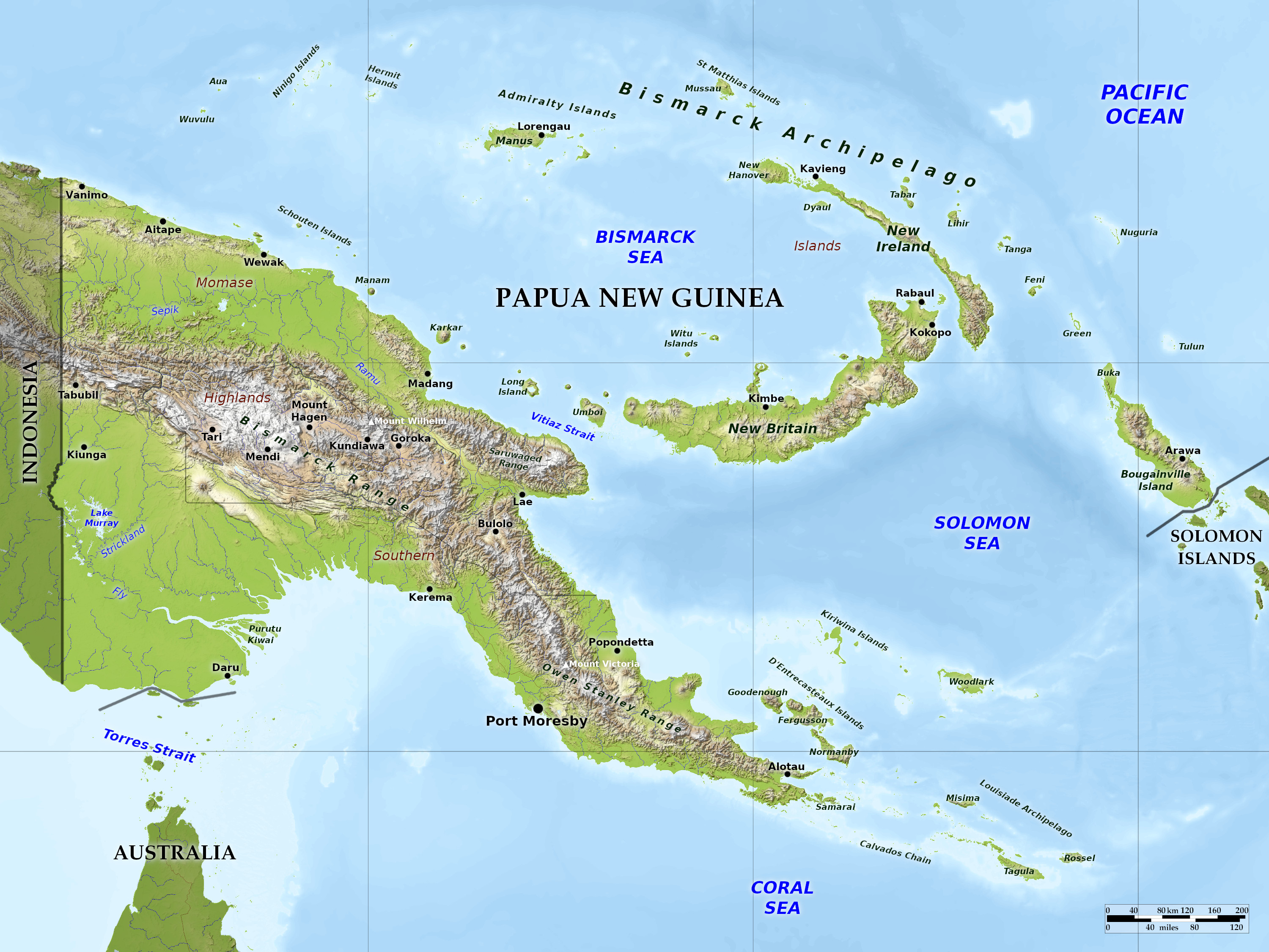 Relief map of Papua New Guinea
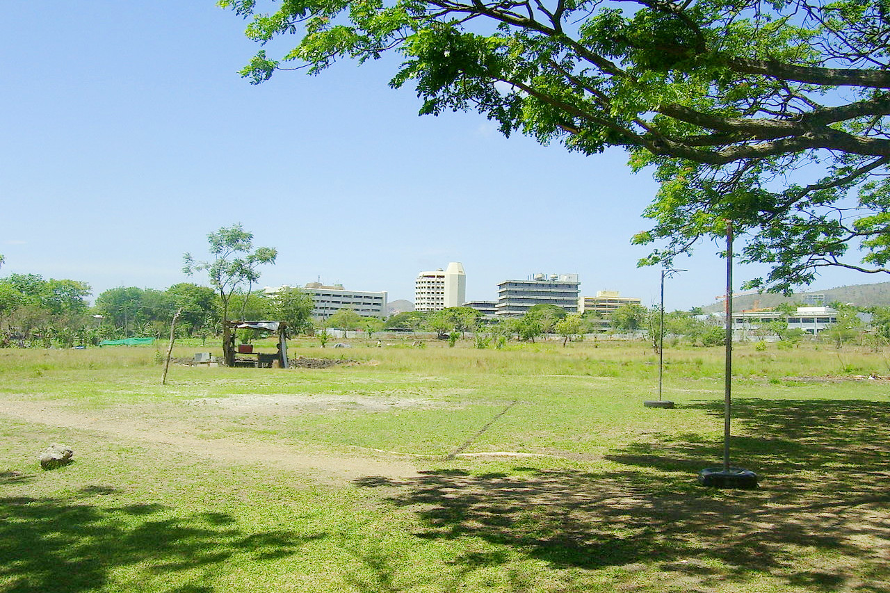
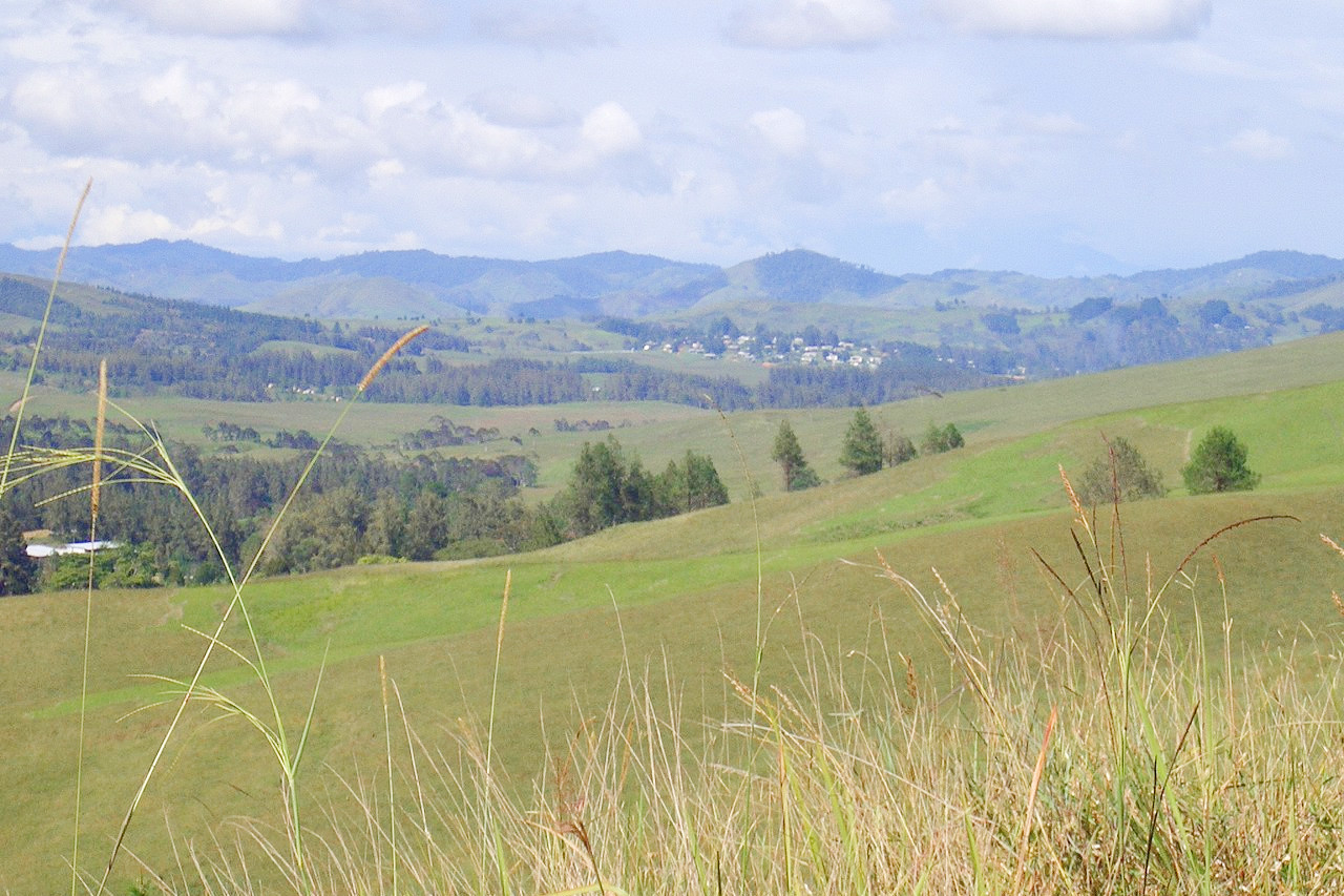
What is the landscape of Papua New Guinea like?
Mainland
Papua New Guinea is situated between Australia and the deep ocean basin of the Pacific. The largest section is the eastern half of the island of New Guinea, which is dominated by the central mountains, or system of mountain ranges, extending from Indonesia's Irian Jaya to East Cape in Papua New Guinea, and including the nation’s highest peak, Mount Wilhelm (4,509 m / 14,793 ft). The second-highest summit, also in the central mountain complex, is Mount Giluwe, an extinct volcano at an elevation of 4,367 meters (14,327 feet).
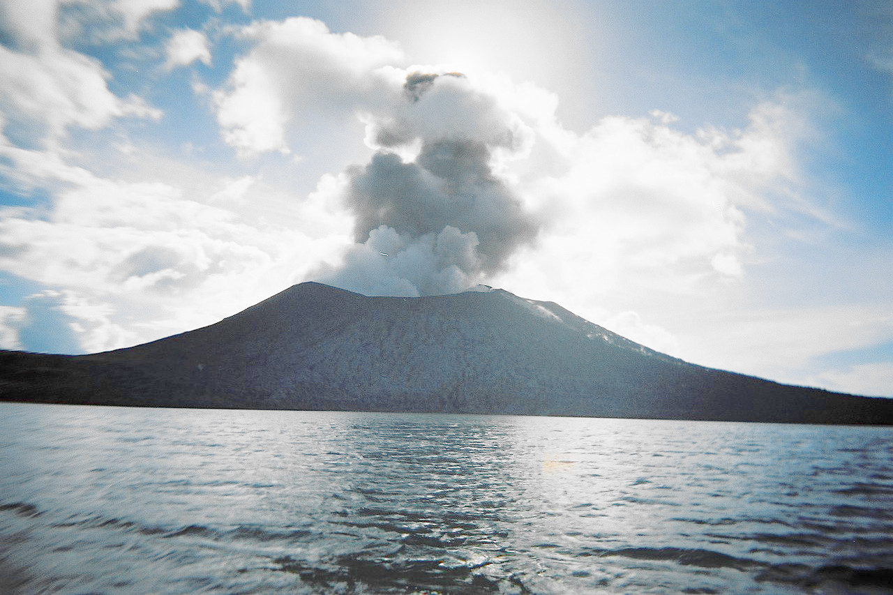
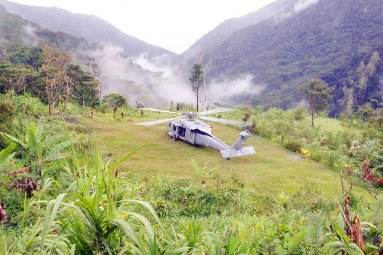
A second mountain chain fringes the north coast and runs parallel to the central cordillera. Active and recently active volcanoes are prominent features of New Guinea landscapes; there are no glaciers or snowfields. Another major mountain range, the Owen Stanley, is found in the southeast. In the lowlands are many swamps and floodplains.
The steep mountains of the Highlands have very few foothills. The valleys in the central Highlands have grasslands that were produced by burning forests to clear land for agriculture. Alpine grasslands exist at elevations above 3,350 meters (11,000 feet), where there is a moist, cool climate.
Islands
_anchored_off_the_coast_of_Papua_New_Guinea_in_support_of_Pacific_Partnership_2008.jpg&oldid=661070832)
_crew_arrives_in_Manus,_Papua_New_Guinea,_on_Aug._14,_2022.jpg&oldid=683979591)
_21,_based_in_San_Diego,_lands_near_Alola_Village_in_the_Owen_Stanley_Mountain_Range_in_Papua_New_Guinea_to_evacuate_Australian.jpg&oldid=521528981)
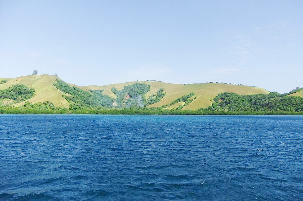
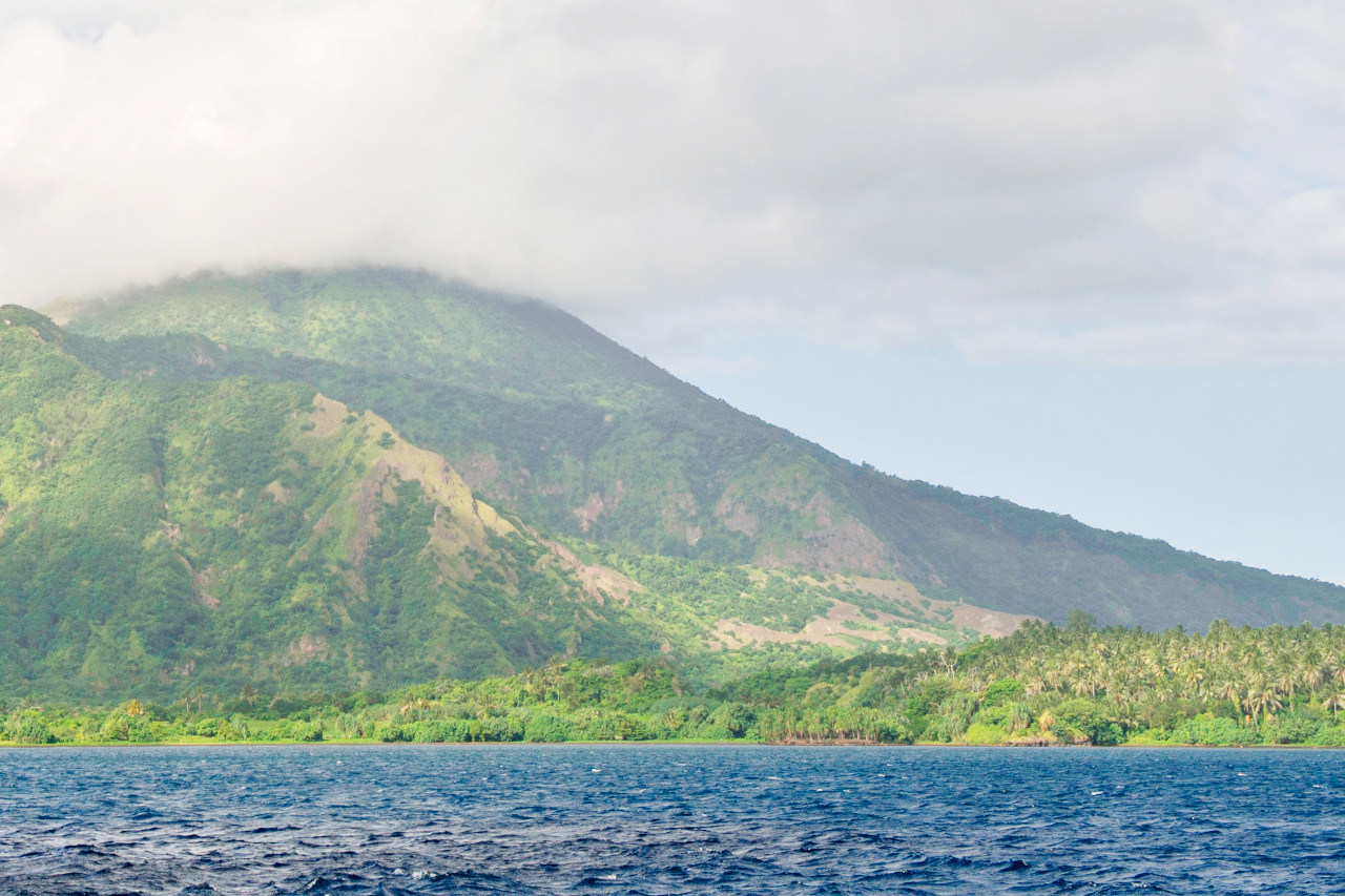
Hundreds of smaller volcanic and coral islands lie off the eastern shore to complete the nation of Papua New Guinea. These smaller islands are also areas of great contrast and generally feature mountain ranges rising directly from the sea or from narrow coastal plains.
To the east of are the islands of the Bismarck Sea and Solomon Sea. A chain of volcanoes formed New Britain Island, in the western Bismarck Archipelago. New Ireland, also in the western Bismarck Archipelago, contains limestone mountains. New Hanover and Mussau are smaller islands in the same area. Further west in the Bismarck Archipelago is Manus. Manus and the surrounding coral atolls form the Admiralty Islands.
Further east are islands belonging to the Solomon chain. The two largest islands here are the mountainous Bougainville and its small neighbour Buka.
What is the nature of Papua New Guinea like?
Most of the foreshores of New Guinea are eucalyptus-dotted grass lands; but in the interior there are dense forests up to a great altitude. Tropical rainforest covers as much as three-quarters of Papua New Guinea. These forests are a wealth of biodiversity. But there are many other habitats ranging from tidal swamps at sea level to alpine conditions. In low-lying coastal areas, various species of mangroves form the main vegetation, together with the beautiful casuarina, sago, and palm. Orchids, lilies, ferns, and creepers abound in the rain forests. There are large stands of pine at elevations of 900 to 1,200 meters (3,000–4,000 feet). At the highest altitudes, beginning at 1,800 meters (6,000 feet), there are mosses, lichens, and other alpine flora—rhododendrons, pines, and palms.
Birds abound in amazing profusion and variety. About 650 breeding species have been recognized. Papua New Guinea is the major center for a number of bird families, such as the bird of paradise, bower bird, cassowary, kingfisher, and parrot. The birds of paradise are the special fame of the country—many of them are most gorgeously adorned.
There are more than 200 species of mammals, many nocturnal, of which rodents and marsupials predominate. The butterflies of Papua New Guinea are world famous for their size and vivid coloring.
What is the climate of Papua New Guinea like?
See our main article: The Climate of Papua New Guinea
Papua New Guinea has a tropical climate which is hot all the year round. There are two main seasons: the northwest or wet monsoon prevails from December to March, and the southeast or dry trade winds from May to October. Most of the lowland and island areas have daily mean temperatures of about 27°C (81°F) while highland areas are much cooler, and can get rather cold at night.
Annual rainfall varies widely with the monsoon pattern, ranging from as little as 900 mm (35 in) at Port Moresby to an average of 5,800 mm (230 in) in the western river basin.
| Climate data for Port Moresby | |||||||||||||
|---|---|---|---|---|---|---|---|---|---|---|---|---|---|
| Month | Jan | Feb | Mar | Apr | May | Jun | Jul | Aug | Sep | Oct | Nov | Dec | Year |
| Average high °C (°F) | 32.1 (89.8) | 31.6 (88.9) | 31.4 (88.5) | 31.3 (88.3) | 31.0 (87.8) | 30.3 (86.5) | 29.9 (85.8) | 30.3 (86.5) | 31.0 (87.8) | 32.0 (89.6) | 32.5 (90.5) | 32.4 (90.3) | 31.3 (88.3) |
| Daily mean °C (°F) | 27.4 (81.3) | 27.3 (81.1) | 27.1 (80.8) | 27.0 (80.6) | 26.9 (80.4) | 26.1 (79.0) | 25.7 (78.3) | 26.1 (79.0) | 26.5 (79.7) | 27.5 (81.5) | 27.6 (81.7) | 27.8 (82.0) | 26.9 (80.4) |
| Average low °C (°F) | 23.7 (74.7) | 23.5 (74.3) | 23.4 (74.1) | 23.5 (74.3) | 23.5 (74.3) | 23.1 (73.6) | 22.4 (72.3) | 22.6 (72.7) | 23.2 (73.8) | 23.5 (74.3) | 23.6 (74.5) | 23.7 (74.7) | 23.3 (73.9) |
| Average precipitation mm (inches) | 192.2 (7.57) | 140.6 (5.54) | 189.8 (7.47) | 105.2 (4.14) | 56.2 (2.21) | 21.6 (0.85) | 13.8 (0.54) | 12.0 (0.47) | 14.4 (0.57) | 15.2 (0.60) | 40.0 (1.57) | 97.8 (3.85) | 898.8 (35.38) |
| Source: World Meteorological Organization | |||||||||||||
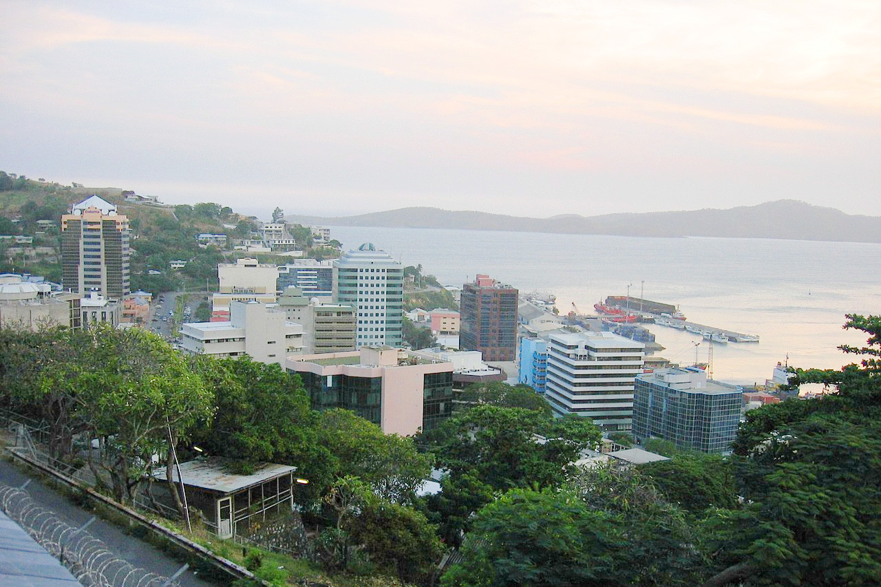 View of Port Moresby Town from a nearby hill
The official websites
Papua New Guinea
A Million Different Journeys
| Location: | In the southwest Pacific, east of Indonesia and north of Australia |
| Coordinates: | 6° 00′ S, 147° 00′ E |
| Size: | • 1150 km N-S; 1700 km E-W • 700 miles N-S; 1050 miles E-W |
| Terrain: | Mostly mountains with coastal lowlands and rolling foothills |
| Climate: | Tropical with slight seasonal temperature variation; wet northwest monsoon (December to March), dry southeast monsoon (May to October) |
| Highest point: | Mount Wilhelm 4,509 m / 14,793 ft |
| Forest: | 93% (2010 est.) (source) |
| Population: | 9,593,498 (2022 est.) |
| Population density: | Low (15/km²) |
| Capital: | Port Moresby |
| Languages: | Tok Pisin (official), English (official) 2%, Hiri Motu (official) 2%, some 839 other languages spoken |
| Human Development Index: | Medium (0.555) |
| Currency: | Kina |