The Geography of
New Zealand
Why visit New Zealand?
The beauty of New Zealand cannot be contained in a few words. The colors of the countryside are vibrant and alive, the landscapes are jaw-droppingly stunning. New Zealand is known for its natural wonders such as Fiordland National Park and Tongariro National Park which are some of the world’s greatest tourist destinations. Whether you're interested in immersing yourself the natural wonders of the North Island or exploring the fiords of South Island, there's always something unforgettable in New Zealand.
Contents
Map
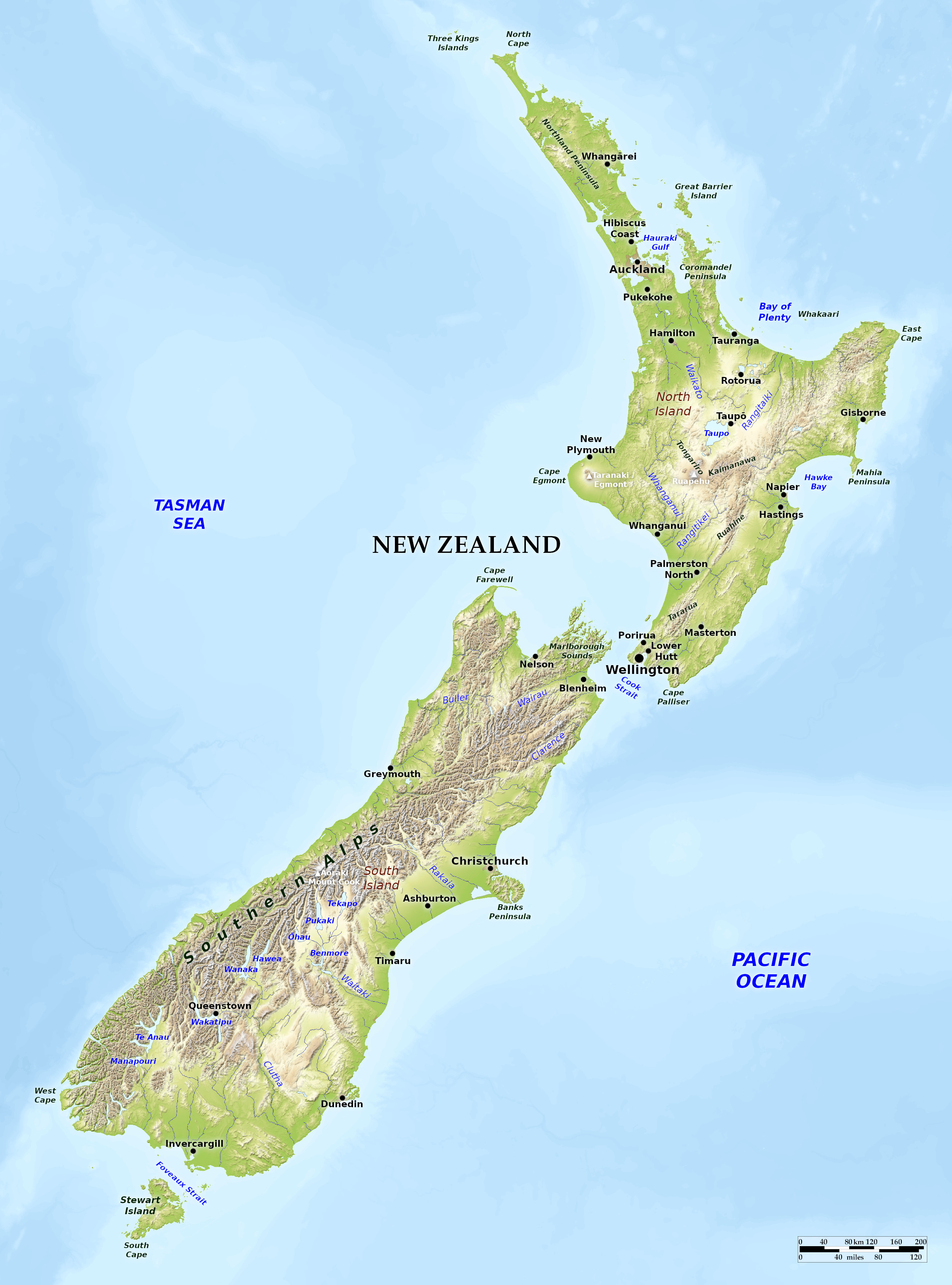 Relief map of New Zealand
What is the landscape of New Zealand like?
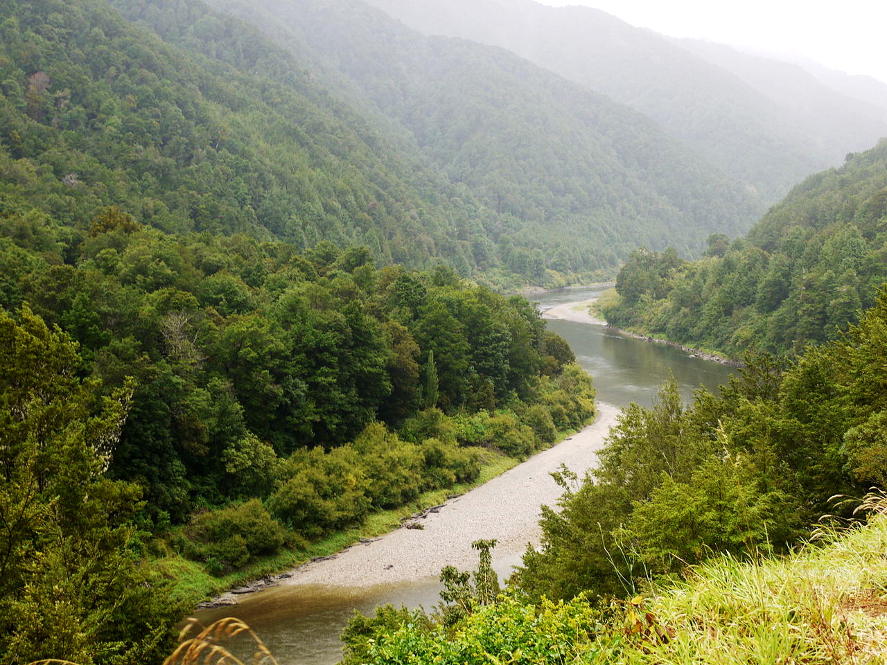
New Zealand lies in the Pacific about 1,200 miles southeast of Australia and is the largest group of islands in the Pacific ocean. There are two main islands, known as North Island and South Island, and a third of much smaller size, Stewart Island, and some small outlying islets. Of volcanic origin, New Zealand has chains of high mountains, hot geyser springs and other volcanic features.
North Island
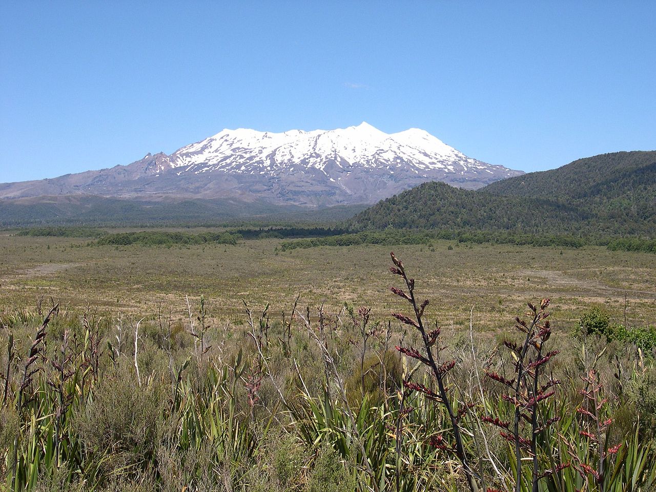
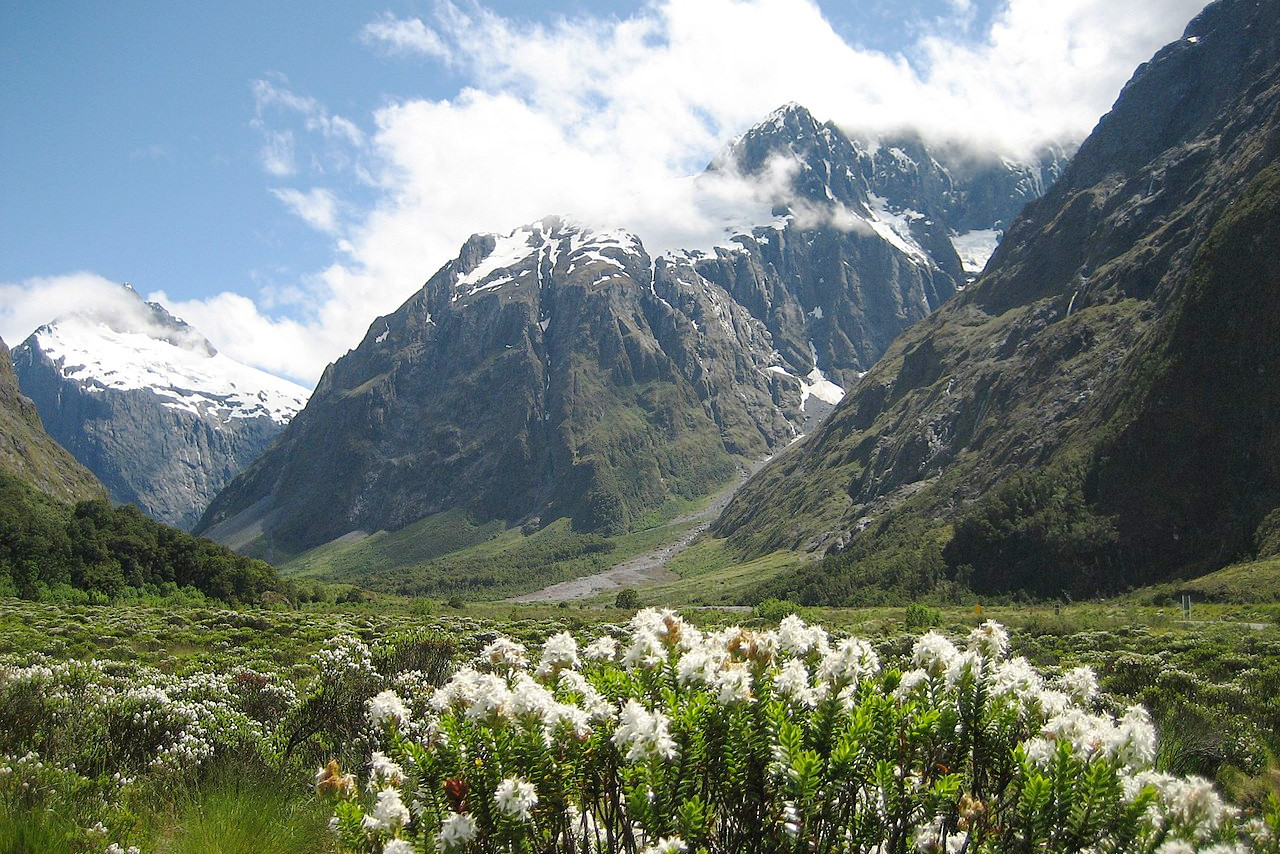
North Island is around 500 miles long and about 200 miles wide. It is much indented by deep bays and projecting headlands. The main body of the island is rugged and mountainous. It traversed from south to north by chains of mountains over 1,000 meters (3,000 feet) in height running northeast from Cook Strait to East Cape on the Bay of Plenty. These lofty mountains are covered from their bases nearly to their summits with primeval forests. The centre of North island is occupied by several isolated volcanic peaks. The highest mountain of the central range is the active volcano Mount Ruapehu, 2,797 meters (9,177 feet), rising into the region of perpetual snow; another of its peaks, Mount Tongariro 1,978 meters (6,490 feet), is also active. Mount Ngauruhoe 2,291 meters (7,516 feet) emits vapour and steam incessantly. West of it, near the coast, is Mount Taranaki (or Mount Egmont) a volcano, 2,518 meters (8,261 feet) high; it is a perfect cone, and always capped with snow—its symmetrical form and dense clothing of forest makes it the most beautiful of these volcanos.
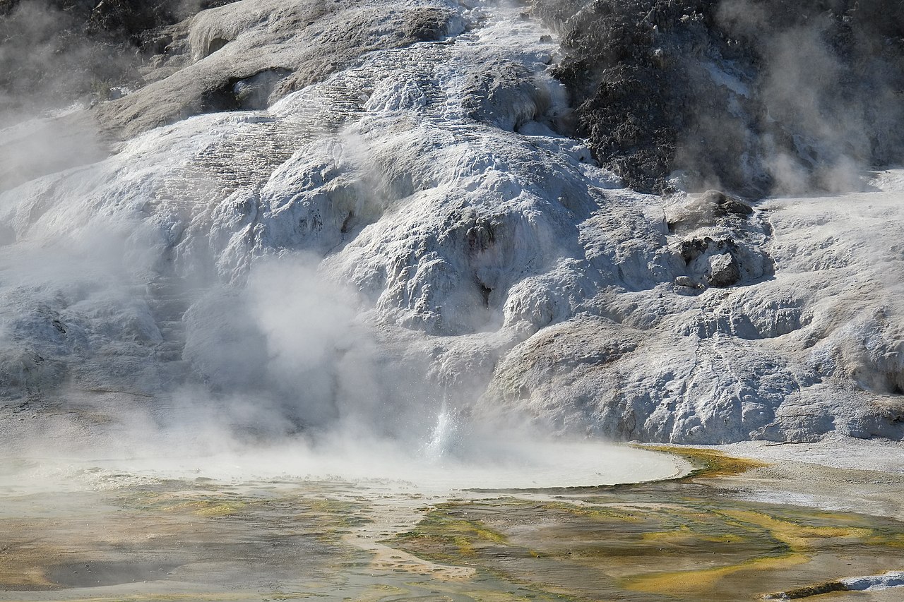
In the centre of the island is Lake Taupo, about 30 miles long by 20 miles broad. It lies in the midst of a pumice-covered plateau from 300 to 600 meters (1,000–2,000 feet) above the sea; and round and beyond the great lake the region of the thermal springs covers 5,000 square miles and stretches from Mount Ruapehu to the Bay of Plenty. Fine lakes and waterfalls, innumerable pools, in temperature from cold to boiling-point, geysers, fumaroles and mud volcanoes attract tourists in large numbers. In the centre of the Bay of Plenty is another active volcano called Whakaari or White island, 3 miles in circumference and 321 meters (1,053 feet) high.
North island abounds in rivers and inlets of the sea, which give easy access to the most inland districts. The largest river, the Waikato, rises in the Taupo lake, near the centre, and running north 425 kilometres (264 miles) reaches the sea on the west coast. The Waikato and Waihou flow north, the Rangitaiki northeast, and Mokau, Wanganui and Rangitikei west or southwest. The Mokau and Wanganui run between fern-clad and forested hills and precipices, often of almost incomparable beauty.

The coast line of North Island contains many natural harbors, especially those of Wellington on Cook's Strait, and of Auckland on the Northland Peninsula. The chief bays are Hauraki Gulf and Bay of Plenty in the northeast; Hawke Bay in the east; South Taranaki Bight in the southwest. The Northland Peninsula is the narrow, irregular peninsula that reaches out northward for some 200 miles.
South Island
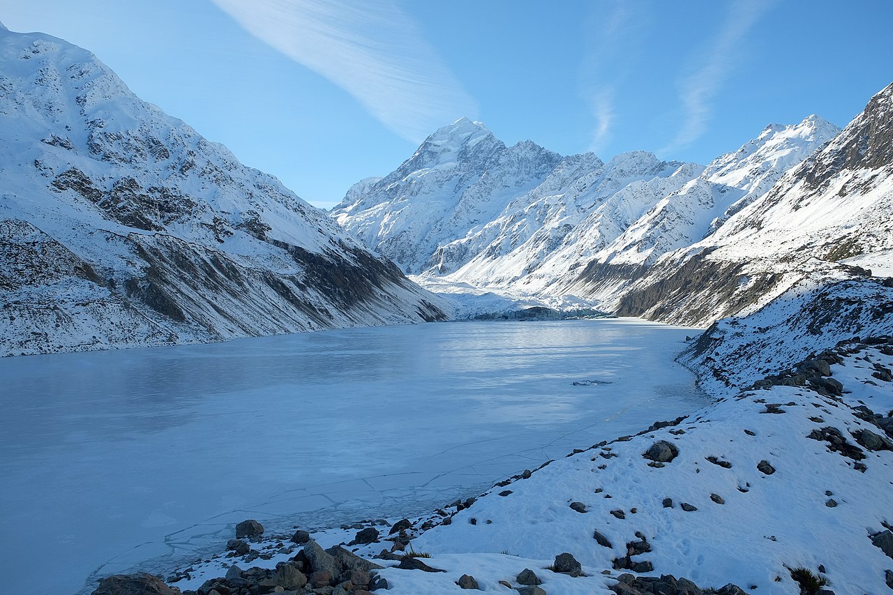
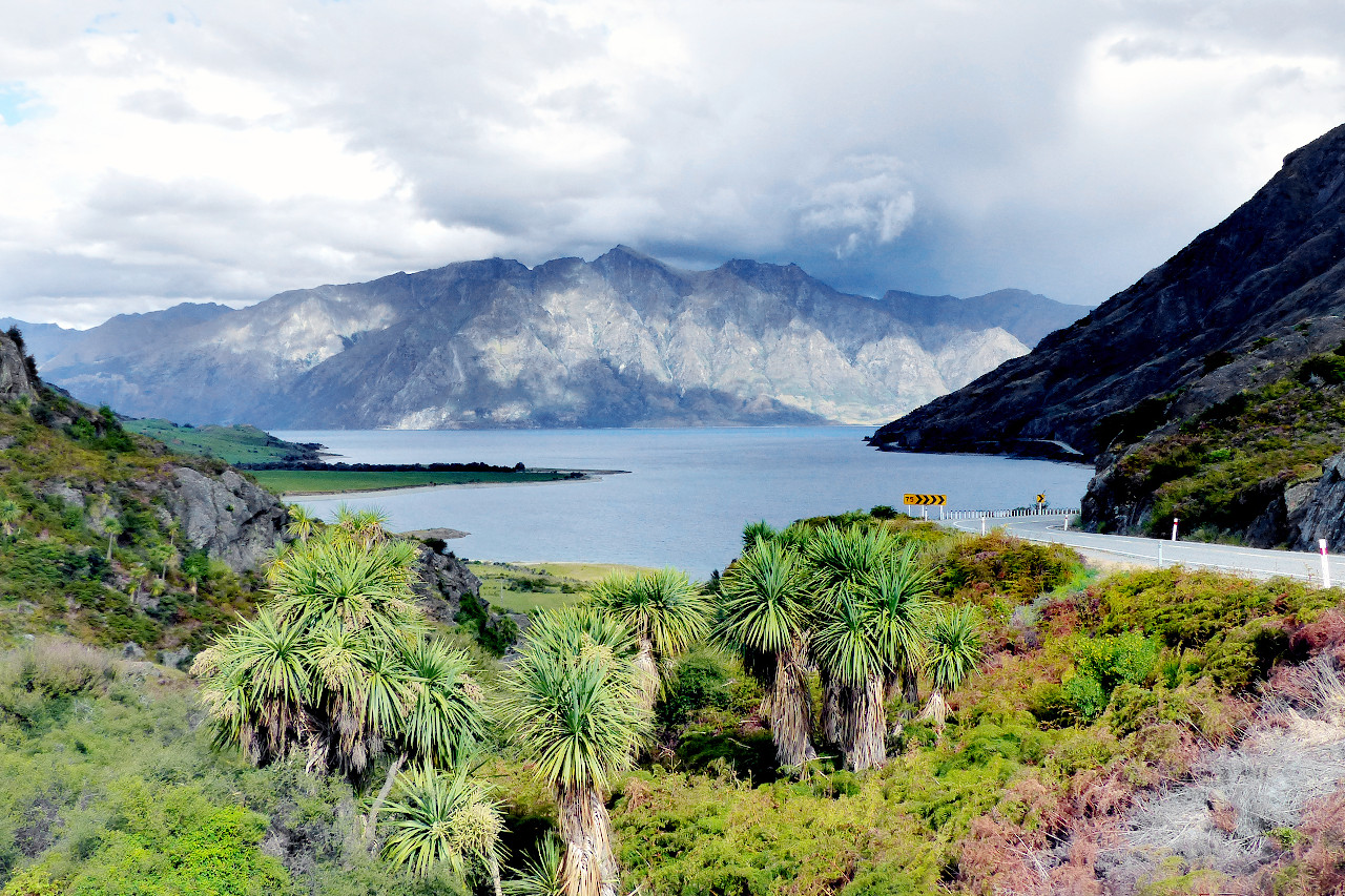
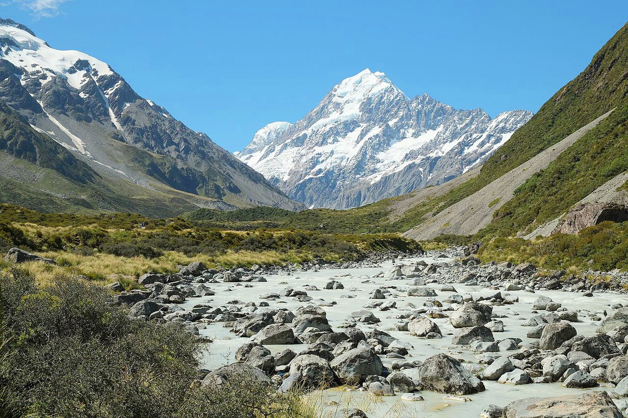
South Island is 530 miles long, with an average breadth of 110 miles. The coast line is very continuous except on the north coast, and the south west coast. On the north coast, from Cape Farewell to Cape Campbell, are numerous harbors; on the south west are a series of narrow fjords. South island is traversed by the Southern Alps running the full length of the island from the north to the south west; in some places it reaches an elevation of 3500 meters (11,500 feet). The highest peak is known as Aoraki (Mount Cook) 3,724 meters (12,218 feet), near the west coast. Among these mountains are glaciers of great size, stretching down on the south west almost to the sea. The Tasman glacier is 18 miles long and the Murchison glacier is 10 miles in length. Toward both the east and west coasts this range is abrupt and precipitous. On the east broad and fertile plains, and on the west a narrow strip of land, lie between it and the sea. In the centre of the island are extensive table lands. There are no active volcanoes in South Island but there are hot springs.
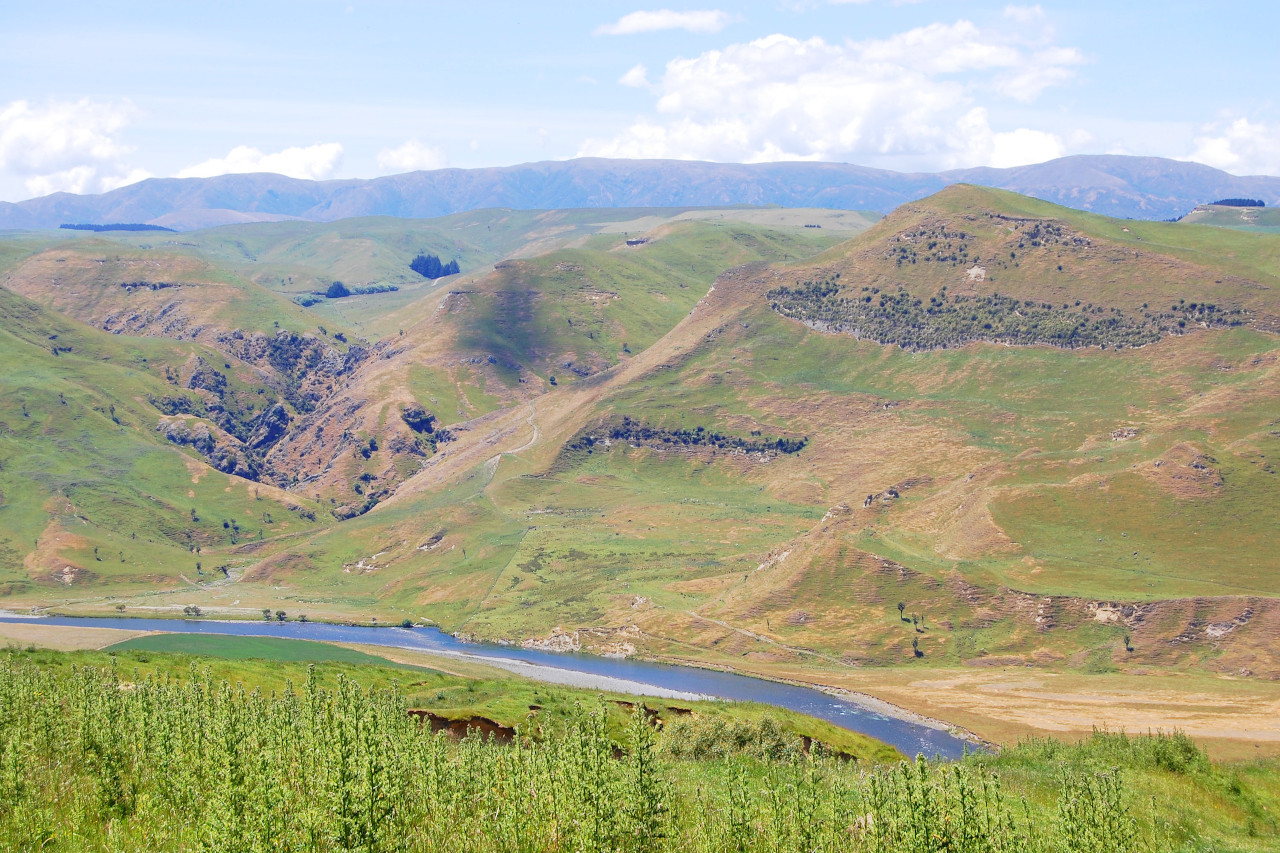
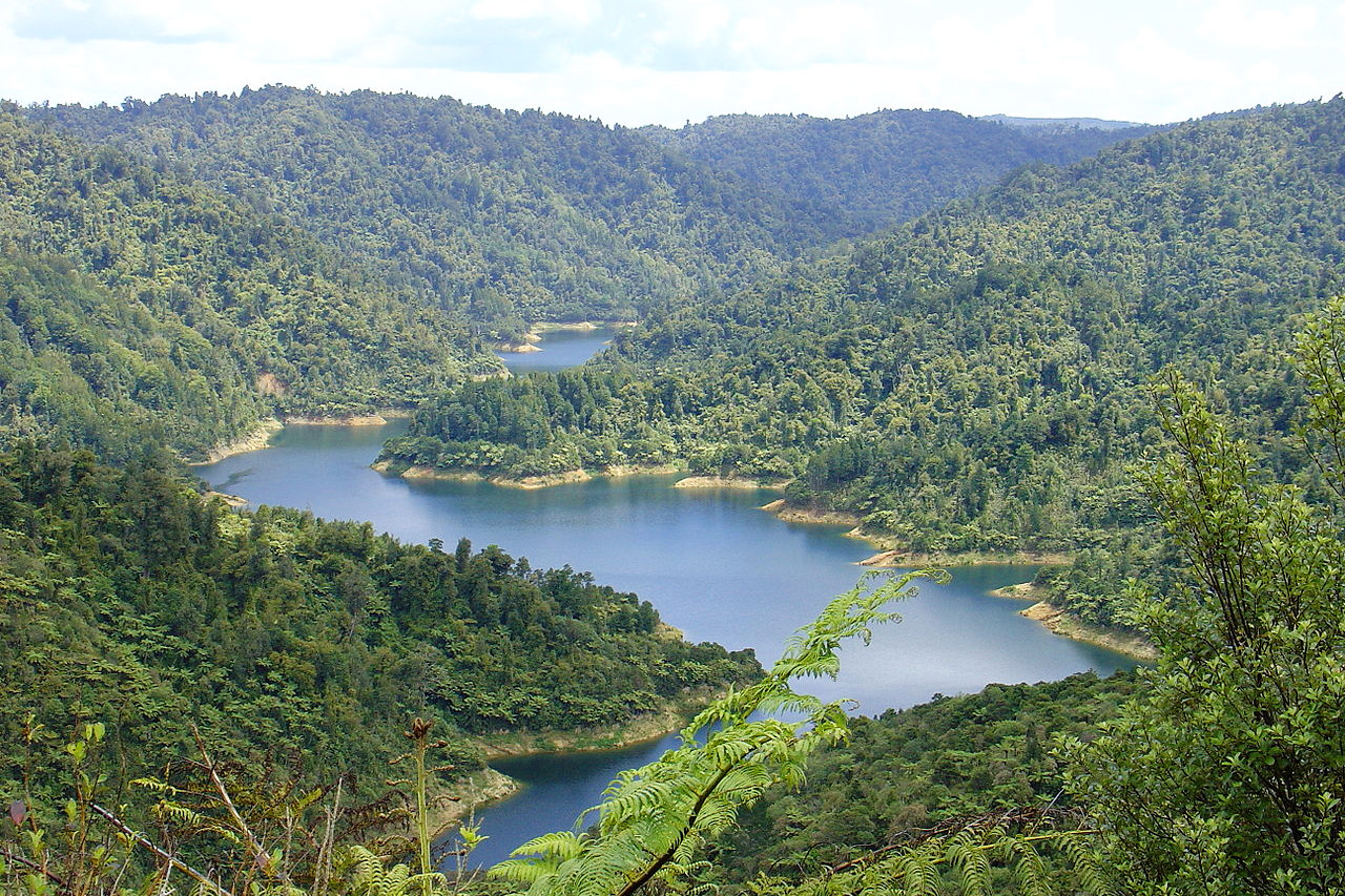
Several rivers of considerable size flow from the central mountains of South island across the great eastern plain to the sea. These are subject to great and sudden floods from the melting of the mountain snows. The largest river is the Clutha, which has a course of 150 miles, and enters the sea near the south east angle of the island. On the northwest side of the island the Buller River is famous for the grandeur of its gorges. There are several extensive lakes in the centre of South island, the largest being Wakatipu and Te Anau, covering 112 and 133 square miles respectively.
Stewart Island (Rakiura) is separated from South Island by Foveaux Strait. It is mountainous and forest-clad, but the highest summits barely exceed 900 meters (3,000 feet). It has an area of 665 square miles.
What is the nature of New Zealand like?
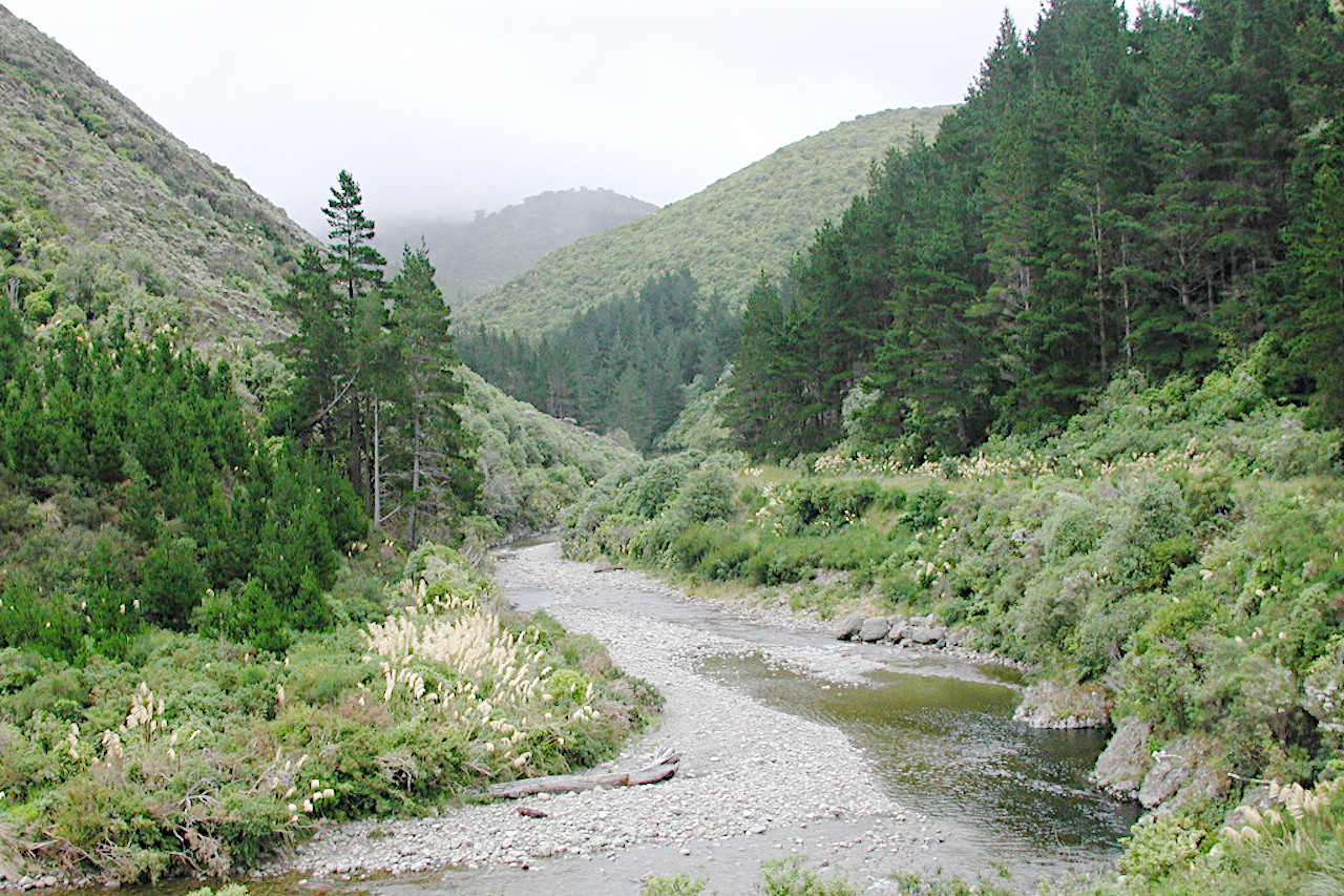
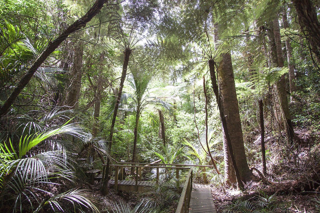
New Zealand is one of the most remarkable botanical regions of the world. The islands are covered with dense, evergreen forest, a luxuriant growth of pines and beeches, tangled and intertwined with palms, ferns of all sizes, wild vines, and a bushy, mossy undergrowth.
Plants
New Zealand has about 120 species of indigenous trees, nearly all of which are evergreen, so the change of seasons consequently makes little difference in the appearance of the forests. In general, New Zealand has two classes of forest, mixed bush and beech. The mixed bush is widespread in both islands; the beech is found chiefly in the South Island. The first contains such a great variety of plants that as many as forty or fifty species of trees and shrubs have been found on one acre. In both classes of forest the average height of trees is from 18 to 24 meters (60–80 feet); the maximum height is 45 meters (150 feet), in the mixed bush.
The most remarkable tree is the Kauri pine (Agathis australis), native to the north part of North island. It grows to great size, often to a circumference of 12 meters (40 feet), rising to the height of 27 meters (90 feet) without a branch. It produces abundantly a gum which becomes very valuable after lying long buried in the earth; it is dug up on the site of ancient forests. The Totara pine equals the Kauri in size; and the Puriri rivals the English oak in hardness, and has a girth of 6 meters (20 feet).
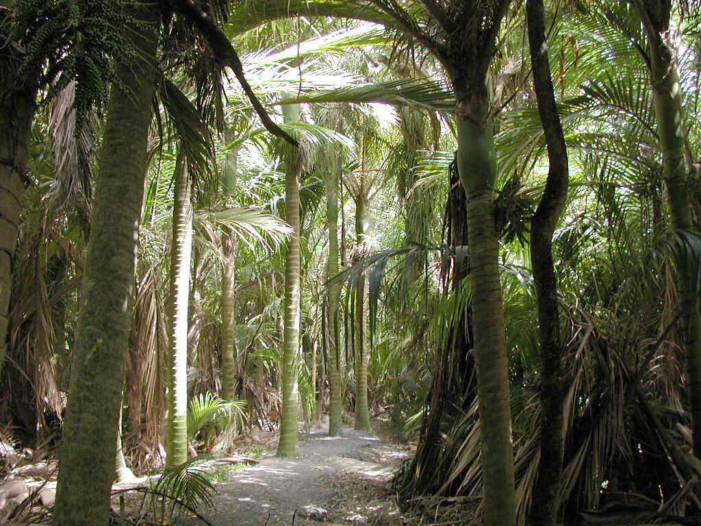
One palm tree, the Nikau palm (Rhopalostylis sapida), grows in New Zealand. In the North Island it is very plentiful. The Nikau is from 6 to 9 meters (20–30 feet) high. When the Kākā, or wild parrot, seeks to gorge itself with the scarlet fruit growing in big clusters just beneath the branches, it has to hang head downward from the leaves. By the Maoris these leaves are woven into kits and baskets, and in woodsmen's camps they were often used as roofing.
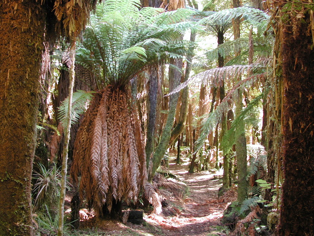
New Zealand has about one hundred and fifty varieties of ferns. Ferns are so common that it has become an emblem of the country. In some areas they form almost the only vegetation over immense districts. In forest depths, where they grows best, tree ferns can attain a height of 6 to 9 meters (20–30 feet), and remarkable for the elegance of their forms. Their slender trunks with widely spreading fronds resembles the cocoanut palm.
Still more numerous than tree fern and palm are the stranglers, creepers, and other parasites. Every tree sustains a climber or a mossy growth. The greatest of them all, the Rātā (Metrosideros robusta), the second largest tree in New Zealand. This strangler grows in the North Island, germinating in canopies of other trees sending out tendrils to encircle the tree. Ultimately the Rātā itself becomes a large tree, and in time it completely incloses its host and absorbs its life.
Flax (Phormium) produces long leaf fibres that played an important role in the culture, history, and economy of the Māori. They used them for building and thatching huts, and for many other purposes including sails, nets, fishing tackle, plates, ropes, baskets, medicine, and clothing.
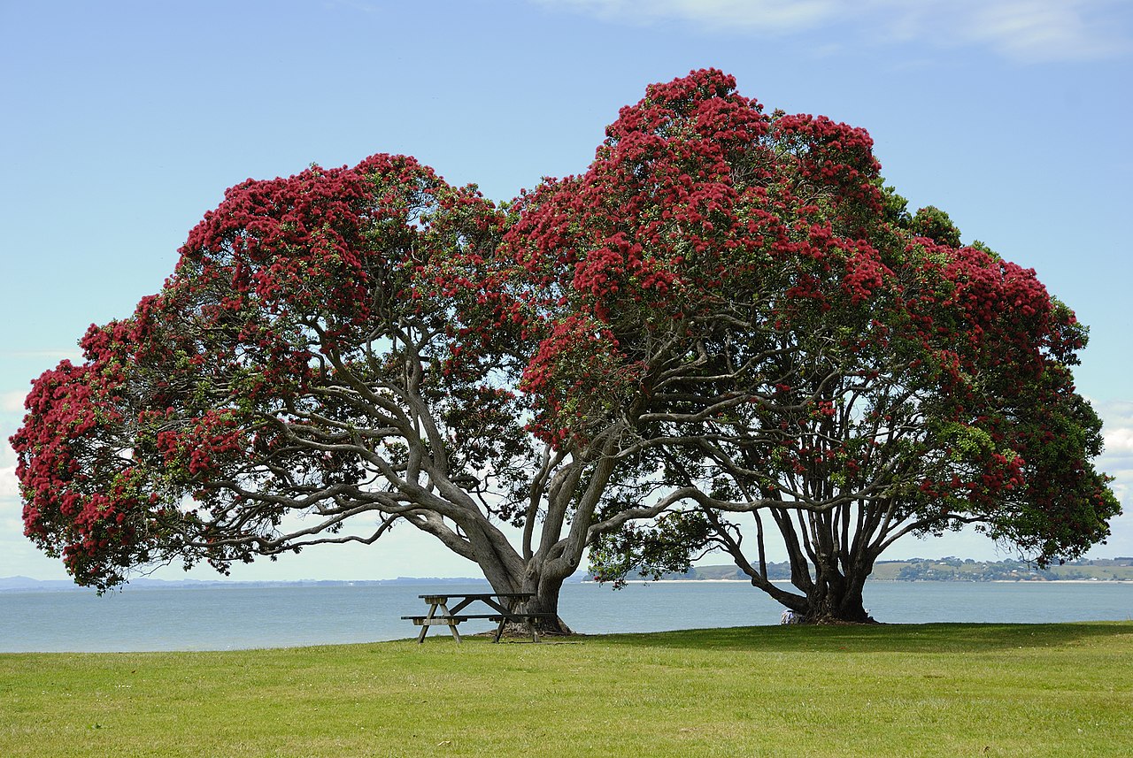
There are about one thousand species of flowering plants, of which about three-quarters are endemic to the country. When the forests are in flower the vast expanses of green are brightened with red, pink, yellow, and white.
Animals
New Zealand has no native land mammals except for two bat species, and seals along the coasts. The Māori introduced the Polynesian dog (now extinct) and the Polynesian rat (now rare). Many European species have since been introduced including deer, pigs, cats, rabbits, and rats, which are often regarded as pests.
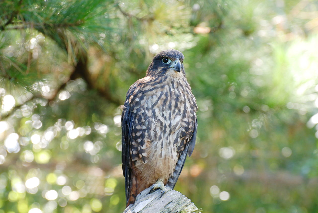
New Zealand has over 100 species of birds. Of birds of prey there are the Kāhu, (or Swamp harrier), and the Kārearea, (or New Zealand falcon). New Zealand's one species of true owl is the Ruru, but called by the Europeans the "Morepork", because its cry resembles these words.
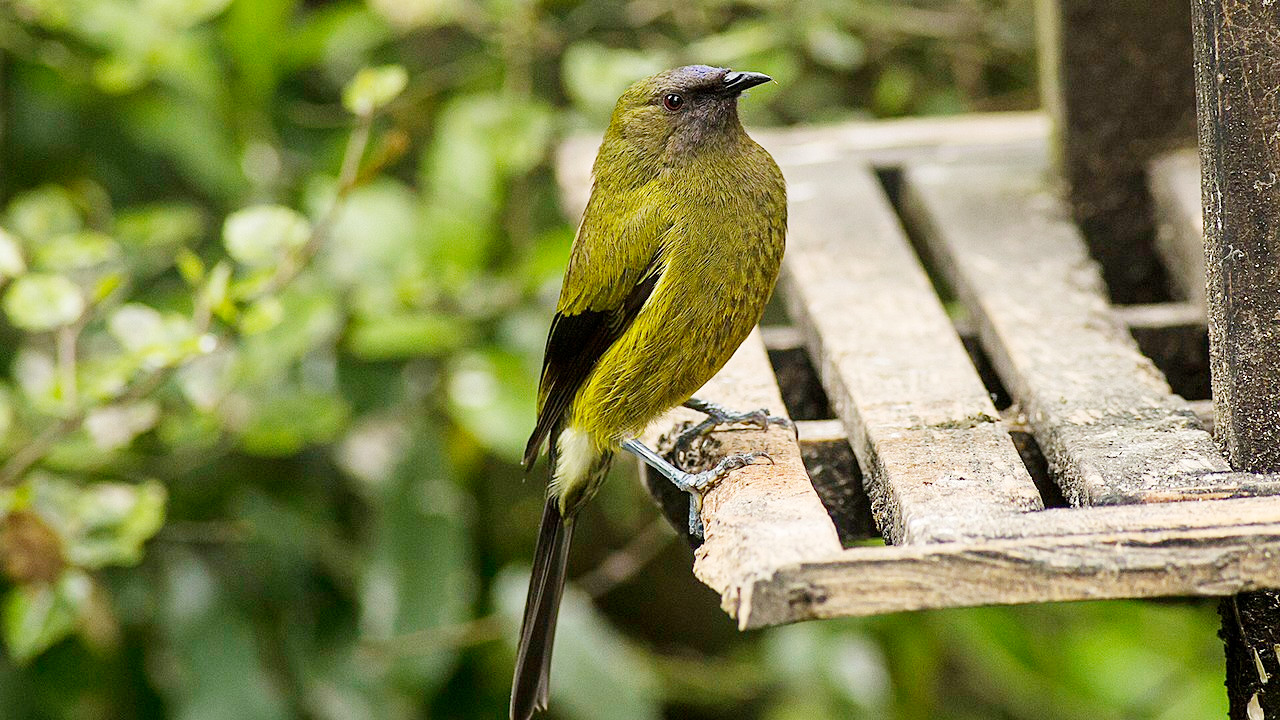
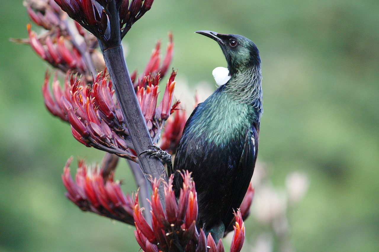
There are six mainland species of parrot, three of which are small green parakeets, or Kākāriki, with different colored heads. The Kākā is a large brown parrot, great numbers of which assemble at sunrise and sunset on berry-bearing trees uttering discordant screams. The Kea is an olive-green parrot with an orange underwing—it is the world's only alpine parrot. The Kakapo, or night parrot, is remarkable for being a species of large, flightless, nocturnal, ground-dwelling parrot. Two other flightless birds include the Kiwi and the Weka, whereas the Fernbird flies weakly. The Tūī, a dark-colored bird of the honeyeater family, is one of the most common birds in the country. Another honeyeater, called Korimako (or bellbird), is about the size of a sparrow, with a long beak, and is a famous songster.
.jpg&oldid=459756733)
.jpg)
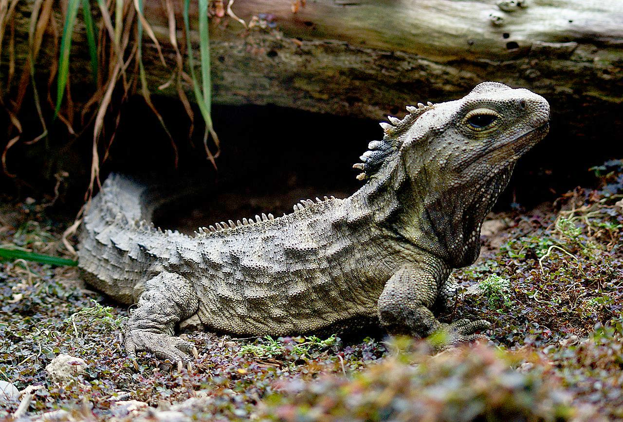
New Zealand has four native species of frog (and a few more introduced species). The reptiles include many species of gecko, and skink (Oligosoma), and the remarkable Tuatara the only surviving member of its order, which flourished around 200 million years ago.
Of the 100 or more species of insects around half are beetles. Mosquitoes and sand flies are plentiful and troublesome in North island in summer. Spiders are numerous, but only a very few are poisonous.
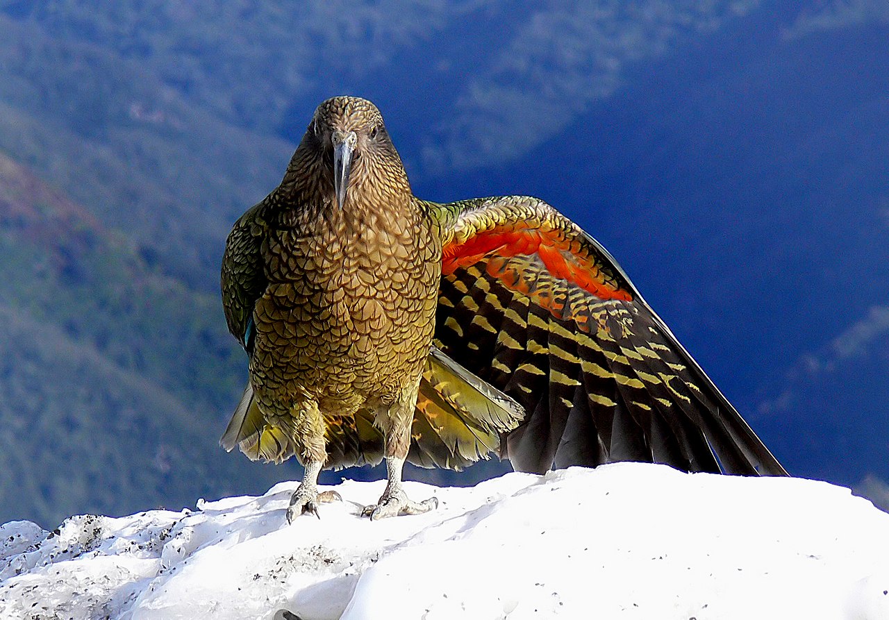 Kea, the New Zealand Alpine Parrot
_(9112326315).jpg&oldid=455794578)
What is the climate of New Zealand like?
See our main article: The Climate of New Zealand
The climate of New Zealand is warm and temperate. January and February are the warmest months, June and July the coldest. The mean annual temperature of North island is 14°C (57°F), and that of South island 11°C (52°F). The coast climate is quite changeable; the heat varying from 5°C (40°F) to 20°C (70°F), and occasionally reaching both extremes in 24 hours.
There are neither wet nor dry seasons. The west coast is receives much of the rain with wet gales from a western ocean, the same clouds gathering on the dripping sides of the mountains. The east is much drier; Christchurch has just 660 millimeters (26 inches) of annual rainfall, less than a quarter of that along the western coast, and droughts can occur in some years. Snow rarely lies on the ground at sea level, and ice is seldom seen. The atmosphere is moist, and fogs are frequent in the southern part of the country.
| Climate data for Wellington | |||||||||||||
|---|---|---|---|---|---|---|---|---|---|---|---|---|---|
| Month | Jan | Feb | Mar | Apr | May | Jun | Jul | Aug | Sep | Oct | Nov | Dec | Year |
| Average high °C (°F) | 20.2 (68.4) | 20.4 (68.7) | 19.0 (66.2) | 16.6 (61.9) | 14.0 (57.2) | 11.9 (53.4) | 11.2 (52.2) | 11.9 (53.4) | 13.4 (56.1) | 15.0 (59.0) | 16.7 (62.1) | 18.7 (65.7) | 15.8 (60.4) |
| Daily mean °C (°F) | 16.7 (62.1) | 16.9 (62.4) | 15.7 (60.3) | 13.7 (56.7) | 11.4 (52.5) | 9.3 (48.7) | 8.6 (47.5) | 9.2 (48.6) | 10.5 (50.9) | 11.9 (53.4) | 13.4 (56.1) | 15.3 (59.5) | 12.7 (54.9) |
| Average low °C (°F) | 13.2 (55.8) | 13.4 (56.1) | 12.4 (54.3) | 10.7 (51.3) | 8.6 (47.5) | 6.7 (44.1) | 5.9 (42.6) | 6.4 (43.5) | 7.5 (45.5) | 8.8 (47.8) | 10.2 (50.4) | 12.0 (53.6) | 9.7 (49.5) |
| Average rainfall mm (inches) | 77.5 (3.05) | 77.0 (3.03) | 85.8 (3.38) | 100.9 (3.97) | 120.7 (4.75) | 132.4 (5.21) | 136.0 (5.35) | 125.5 (4.94) | 100.8 (3.97) | 110.3 (4.34) | 91.5 (3.60) | 92.0 (3.62) | 1,250.4 (49.23) |
| Source: NIWA Climate Data | |||||||||||||
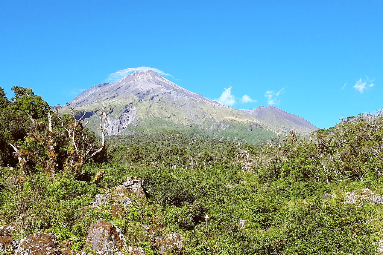 Mount Taranaki
..jpg&oldid=453961249)
The official websites
New Zealand
100% Pure new Zealand!
| Location: | Oceania, islands in the South Pacific Ocean, southeast of Australia |
| Coordinates: | 41° 00′ S, 174° 00′ E |
| Size: | • 1500 km N-S; 1050 km E-W • 925 miles N-S; 650 miles E-W |
| Climate: | Temperate with sharp regional contrasts |
| Highest point: | Aoraki/Mount Cook 3,724 m / 12,218 ft |
| Forest: | 31.4% (2011 est.) |
| Population: | 4,925,477 (July 2020 est.) |
| Population density: | Low (19/km²) |
| Capital: | Wellington |
| Languages: | English (official) 95.4%, Maori (official) 4%, Samoan 2.2% |
| Human Development Index: | Very High (0.931) |
| Currency: | New Zealand dollar |