The Geography of
Sweden
Why visit Sweden?
Sweden's natural beauty draws tourists from around the globe. Sweden is a land of lakes, forests, and islands, with a glorious summer and the space to enjoy it. Its dense forests are home to large numbers of wild animals, and the country's many rivers not only form dramatic waterfalls, but fill thousands of beautiful lakes. The scenic countryside and lakeside towns are a photographer's dream, while its capital city Stockholm offers an eclectic mix of architecture from Gothic to Modernist styles. The greenery, the lakes and rivers, the mountains and the forests, the lovely villages and cities—all combine to make Sweden one of the most beautiful places on earth. If you're looking for a beautiful, peaceful and culturally rich country to visit, Sweden is an excellent choice.
Contents
Map
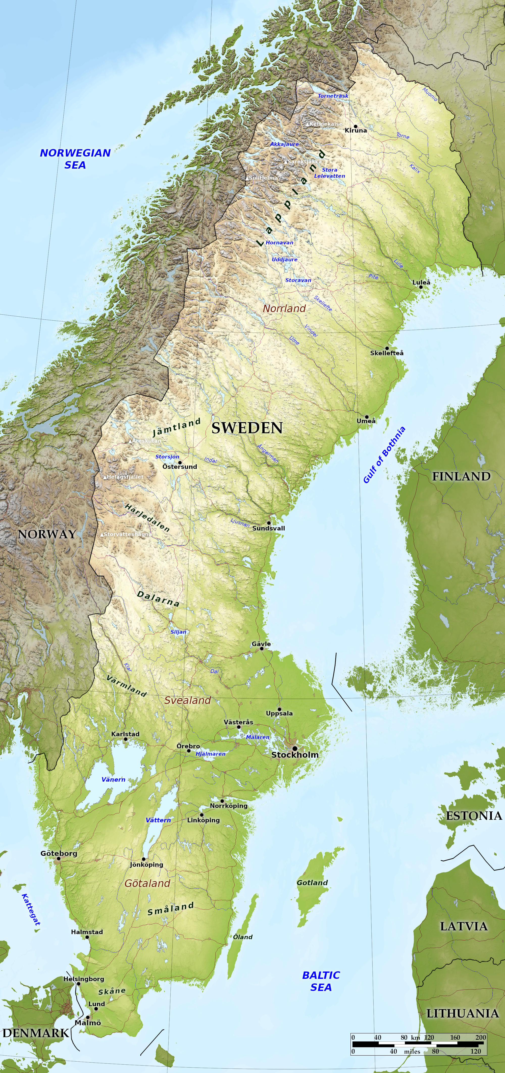 Relief map of Sweden
What is the landscape of Sweden like?
The north of Sweden is a wide and wild tract of mountainous country, thickly forested; the center, Svealand, is the region of the great lakes; Götaland, the southern portion, embraces the fertile plains sloping to the sea.
Northern Sweden (Norrland)
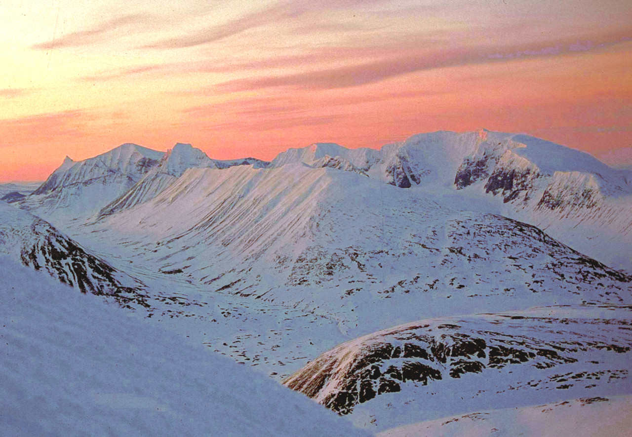
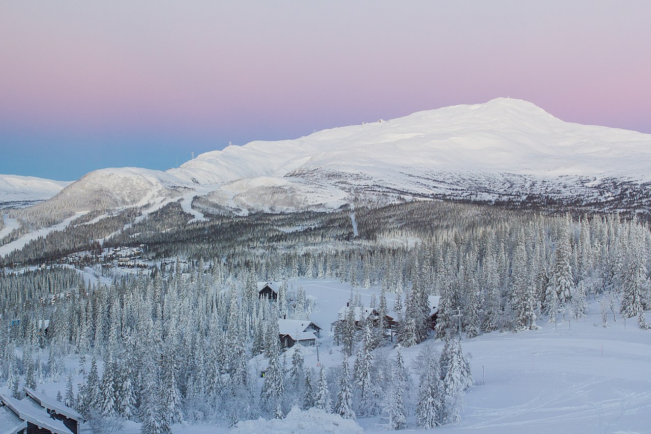
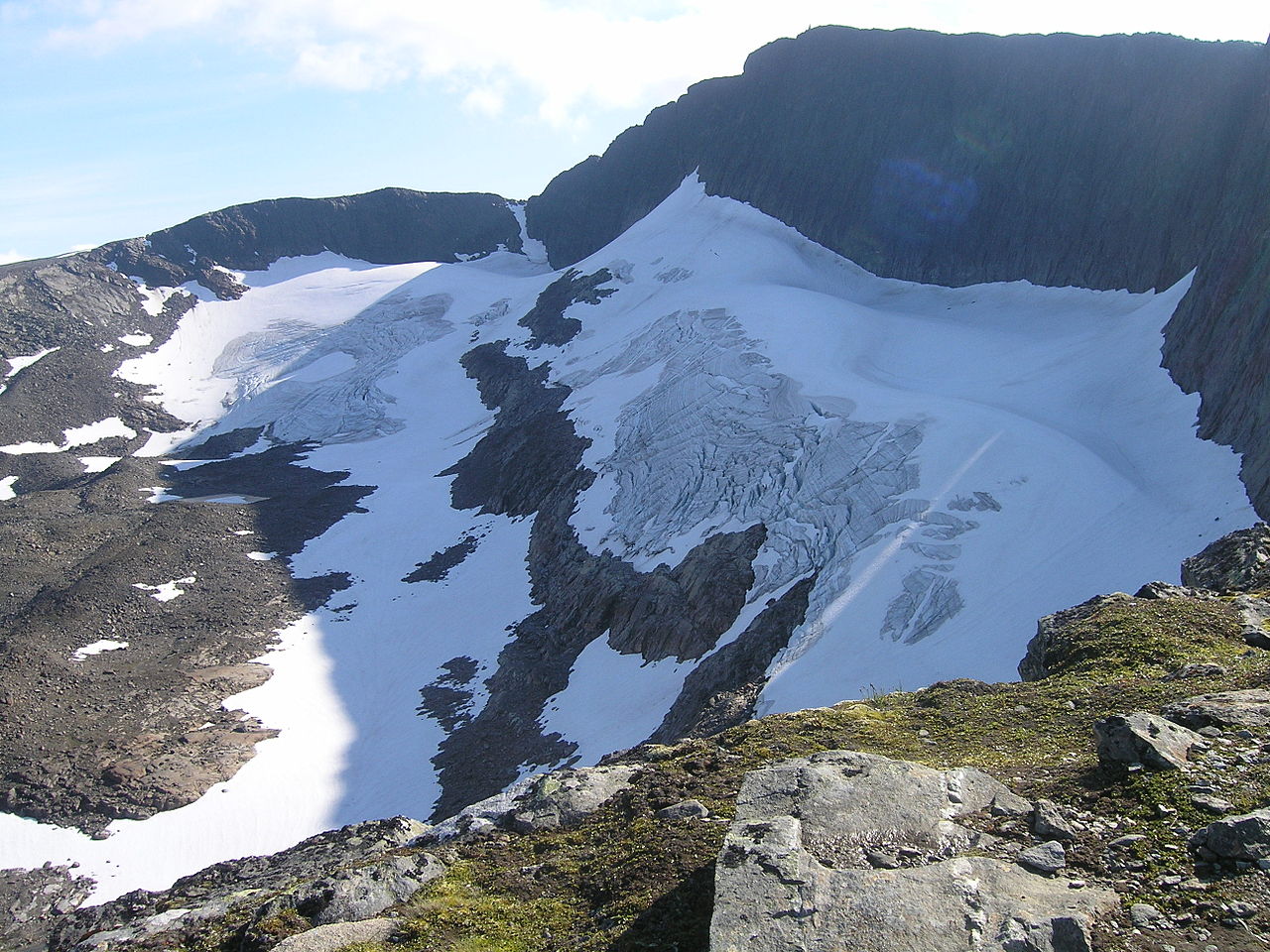
The northwest of Sweden includes the greatest altitudes in the country and the finest scenery. All the higher mountains are snow-covered, and glaciers are numerous in the north. The highest mountain is in the far north, the bold peak of Kebnekaise reaching 2,097 meters (6,880 feet). To the south of that is the remote Sarektjåkkå, 2,089 meters (6,854 feet), the loftiest point of a magnificent group. Southwest of there is the Sulitjelma massif on the Norwegian border peaking at 1,908 meters (6,260 feet); here lies Stuorrajekna—the largest glacier in Sweden.
The mountains decrease in height as you venture south, but the frontier provinces of Jämtland and Härjedalen abound in hills, glaciers, and waterfalls. The mountain of Åreskutan at 1,420 meters (4,660 ft) is easily accessible by the railway line which cross from Sweden into Norway, and the village of Åre has the largest ski resort area in Sweden. Helagsfjället at 1,796 m (5,892 ft) is the highest mountain in Sweden south of the Arctic Circle, and its glacier is the country's southernmost. The final group of high mountains is found in the northern part of Dalarna province where Storvätteshågna reaches 1,204 metres (3,950 feet).
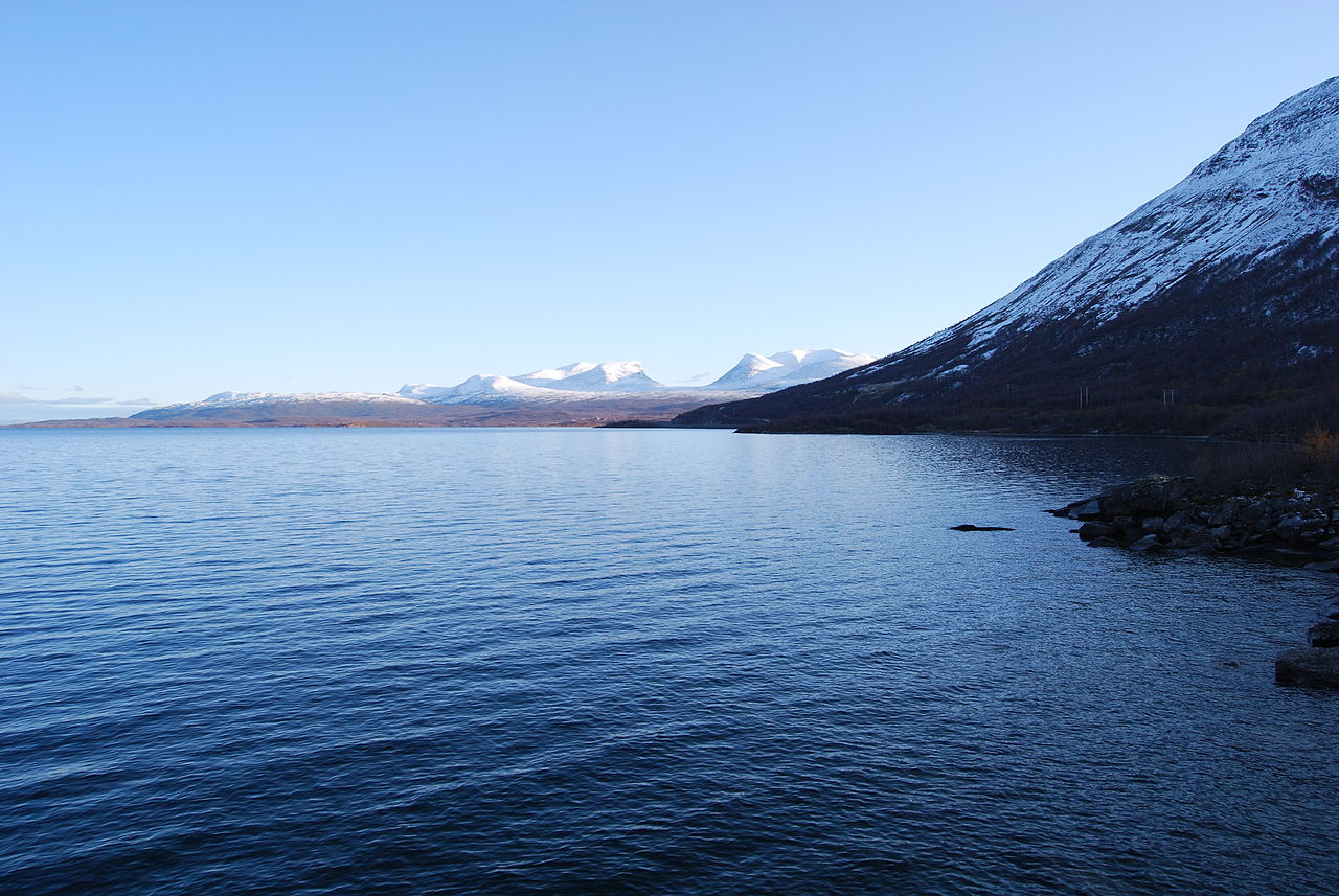
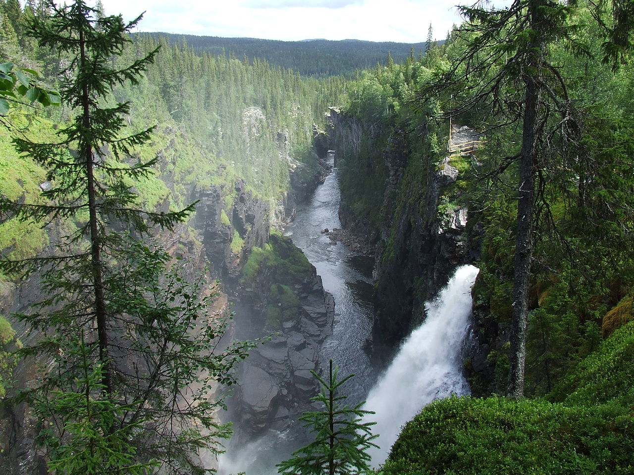
The entire region has dense forests intersected by lakes and waterfalls formed by the accumulated mountain streams hurrying to reach the sea. Eastward from the mountains a series of large rivers flow in a southeasterly direction through a gently undulating landscape of boundless forests resembling a dark green sea. In their upper parts they drain great lakes, most of which are narrow in comparison with their length. In the extreme north of Sweden the land is almost flat, a few low hills standing isolated and conspicuous, and the rivers have serpentine courses, while steep banks are absent. Here the Muonio flows into the Torne river which drains lake Torneträsk. These two rivers form the border with Finland.
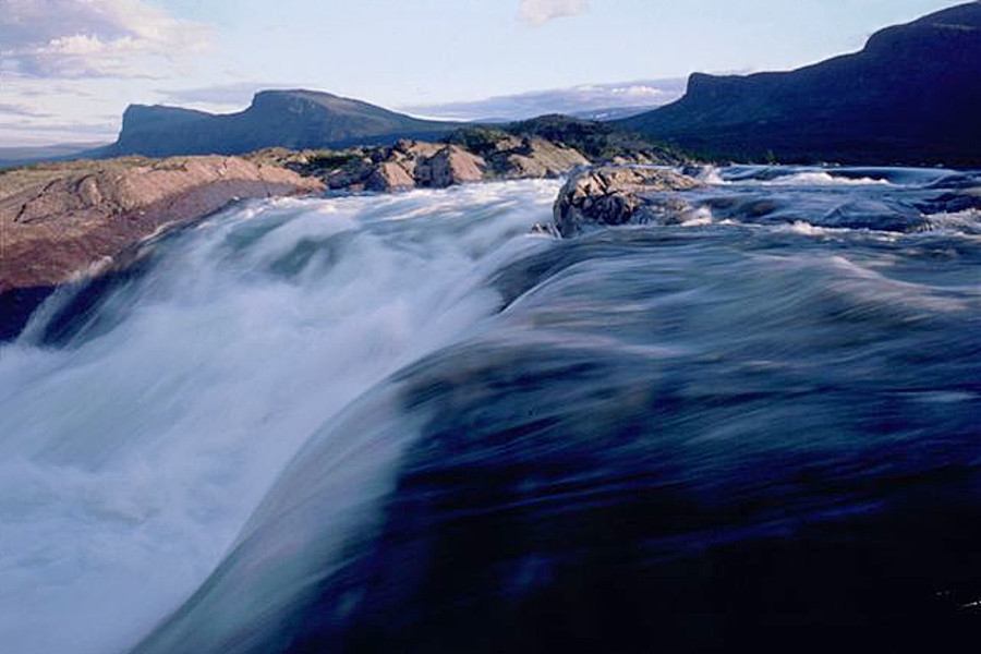
Further south, the Lule river flows from the Stora Lulevatten and Akkajaure lakes, which together have a length exceeding 50 miles. At the end of the Akkajaure lake is Stora Sjöfallet, one of the best known waterfalls in Sweden where the water falls nearly 40 meters (130 feet).
The Skellefte river drains the collective lakes of Hornavan, Uddjaure, and Storavan. Hornavan is a straight lake flanked by big hills, but Uddjaure and Storavan are broad, throwing off deep irregular inlets, and studded with numerous islets. Near the border with Norway, one of the tributaries of the Ångerman river forms the magnificent Hällingsåfallet waterfalls, 43 meters (141 feet) high. Further to the south, the Indal river, which drains the large Storsjön lake, changed its course in 1796, and left bare the remarkable bed of the river rapids called Döda fallet in which many "giant's caldrons" (eddy potholes) are exposed.
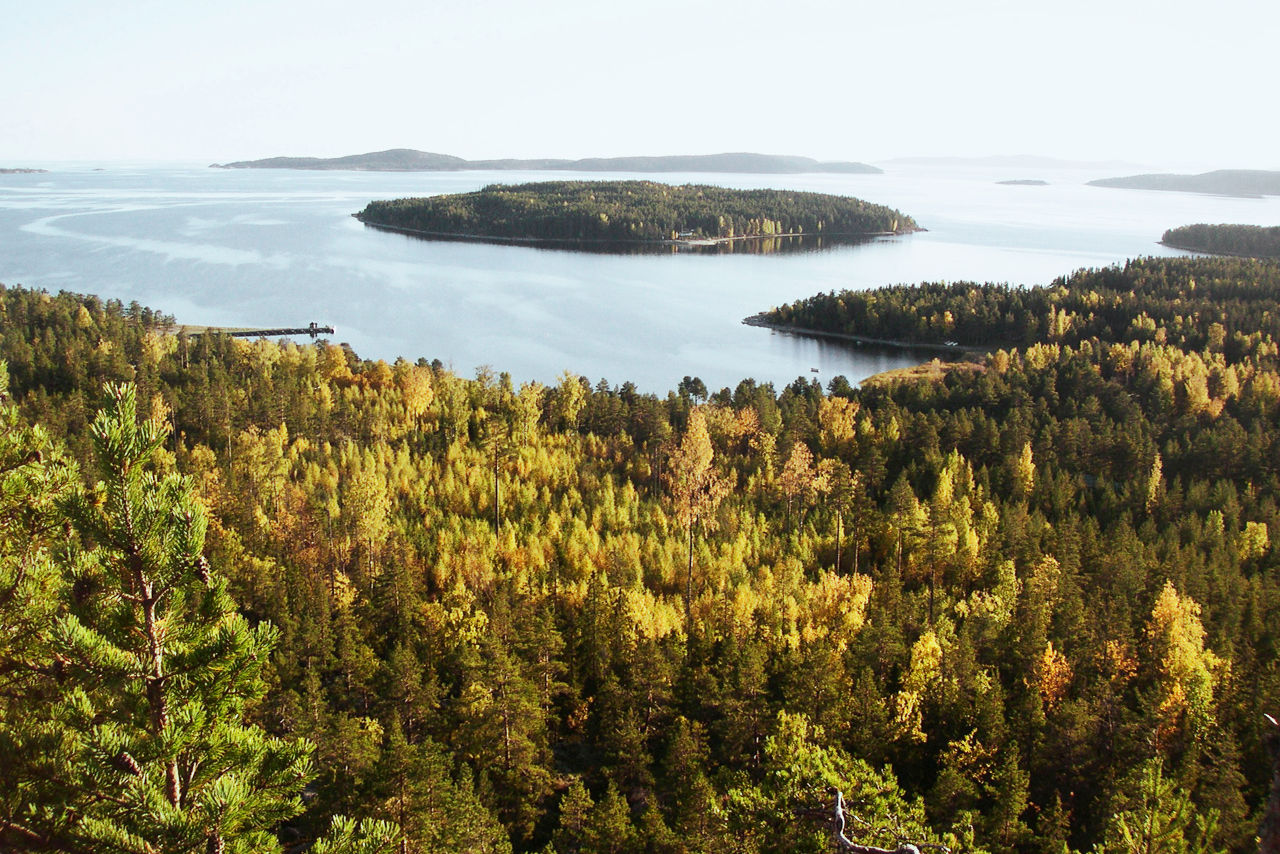
Finally, the coastal belt of northern Sweden is a series of fertile plains extending inland some 50 miles or so. Here the rivers have cut deep into the soft sand and clay, leaving lofty and picturesque bluffs. Situated between the seaboard cities of Sundsvall and Umeå is the High Coast, a landscape of high islands, steep shores, smooth cliffs, and deep inlets.
Central Sweden (Svealand)
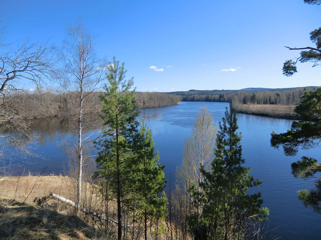
Central Sweden is where you descend to the lowlands. The northwest contains the hills and plateaus of Dalarna and Värmland. This area is a region of beautiful lakes and deep forests, and there is much mountain scenery close to the border with Norway. Through this region flow the two longest rivers in Sweden. The Dal river, which drains various small lakes on the Norwegian frontier, passes through the beautiful Siljan lake. The Klar river is the longest river in Scandinavia; it rises in Femund, a large lake in Norway, and flows south into Vänern lake.
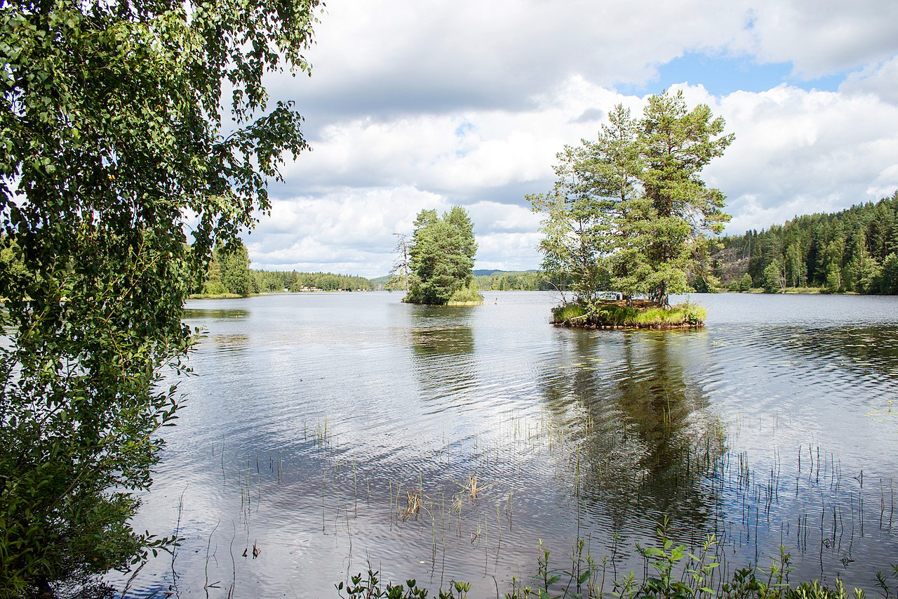
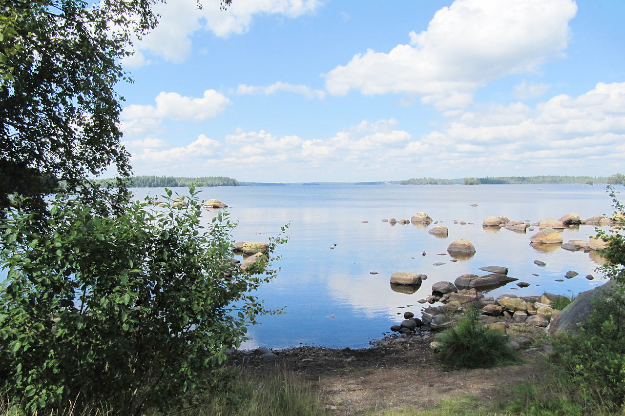
The remainder of the province is made up of flat fertile plains which seldom exceed 100 meters (330 feet). The area is heavily wooded with innumerable lakes, including the four great lakes, Vänern, Vättern, Mälaren and Hjälmaren. These, except the last, far exceed in area any of the northern lakes. The scenery of these lakes, though never grand, is always quietly beautiful.
Vänern is the largest lake in Sweden and the third largest in Europe (the other two are in Russia). It is divided into two parts by two peninsulas and some small islands, the western half being known as the Dalbosjön and the eastern body as Värmlandsjön. The northern shores are high, rocky and in part wooded, the southern open and low, though isolated hills occur, such as the Kinnekulle an abrupt hill 306 meters (1,004 feet) above sea level. Several islands fringe the shore.
Vättern is probably the most beautiful of the great lakes, and it is renowned for the remarkable transparency and blueness of its waters. Its shores are picturesque and steep on the east side, where the Omburg, a forested mountain 263 meters (862 feet) high, rises abruptly with furrowed flanks pierced by caves. Vättern has few islands with the exception of Visingsö in the south which has two ruined castles on its shores.
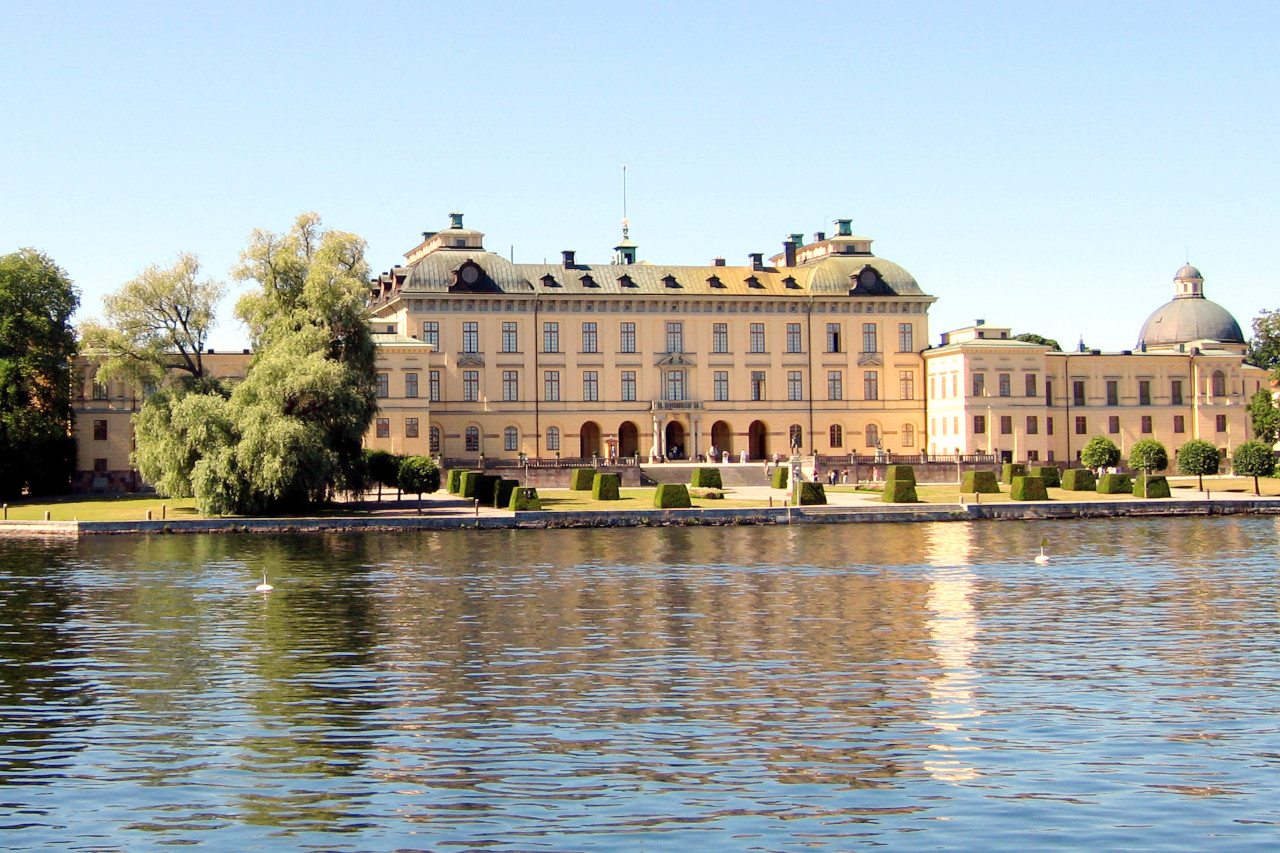
Mälaren is a lake with a very irregular shape. The wooded shores and islands form a notable feature in the pleasant outskirts of the capital city of Stockholm. On the islands of Björkö and Adelsö are ancient Viking remains which form part of a World Heritage Site. Other islands have castles and palaces, including Drottningholm Palace on the island of Lovön which is the residence of the Swedish Royal Family.
Southern Sweden (Götaland)
South of the central lowlands the so-called Småland highlands which extend over the old province of Götaland. Gentle forest-clad hills, many small lakes and peat-mosses, are characteristic of the region. The highest point is Tomtabacken 377 meters (1,237 ft) about 25 miles southeast of the city of Jönköping.
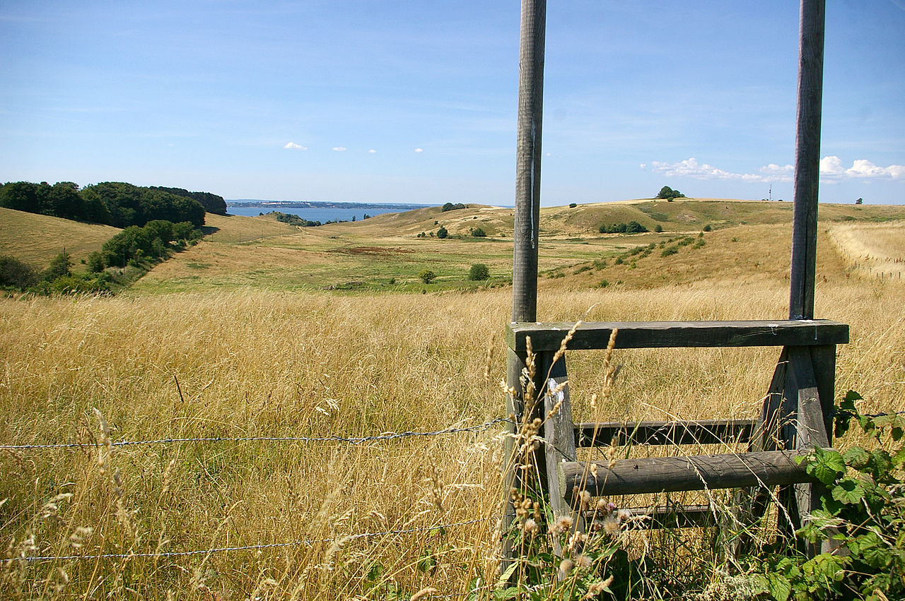
The southernmost part of Sweden is made up of the plains of Skåne. This is an ancient province which was long under Danish control, and where the word Scandinavia derives from. The region consists of level plains with rich open meadows and farmland. Northern Skåne, as well as possessing many stately castles and parks, is thickly wooded with birch and oak forests.
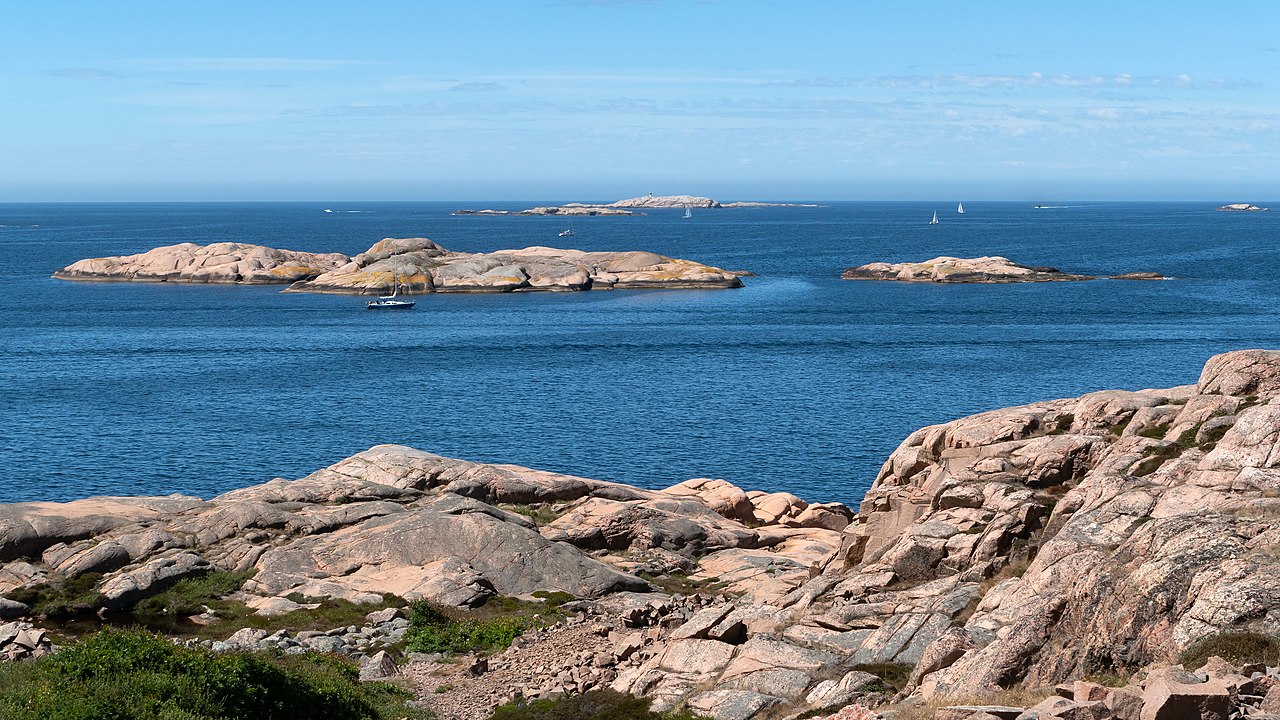
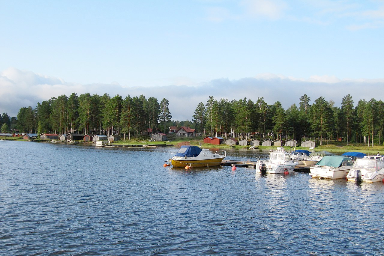
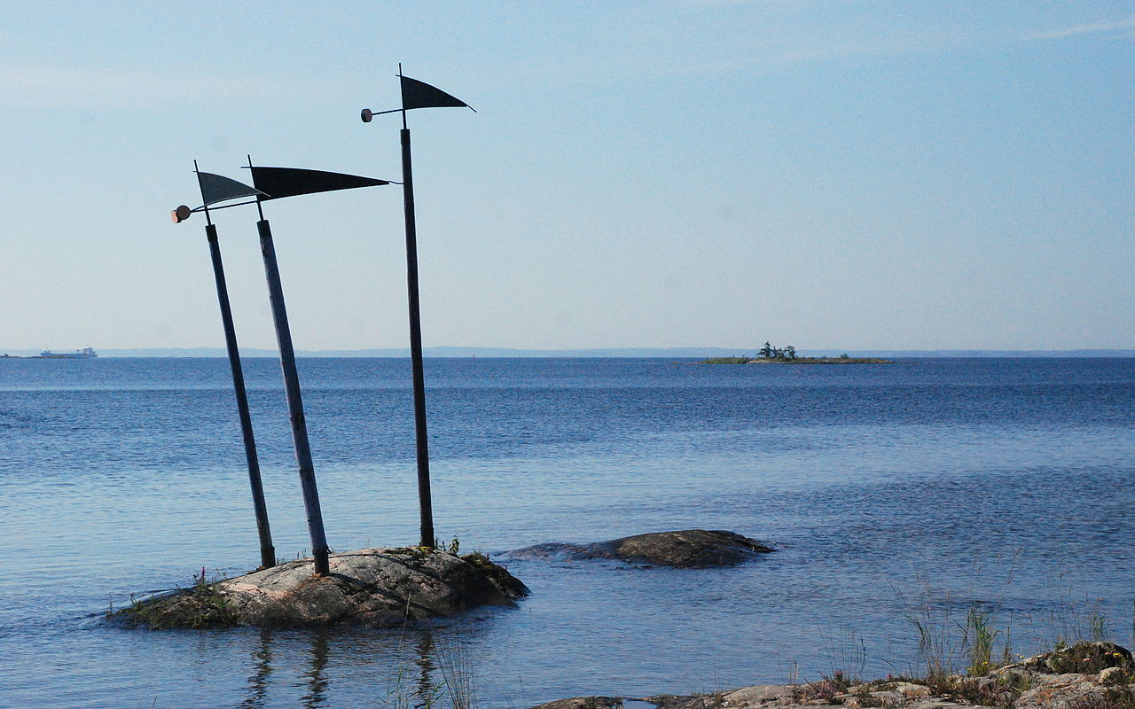
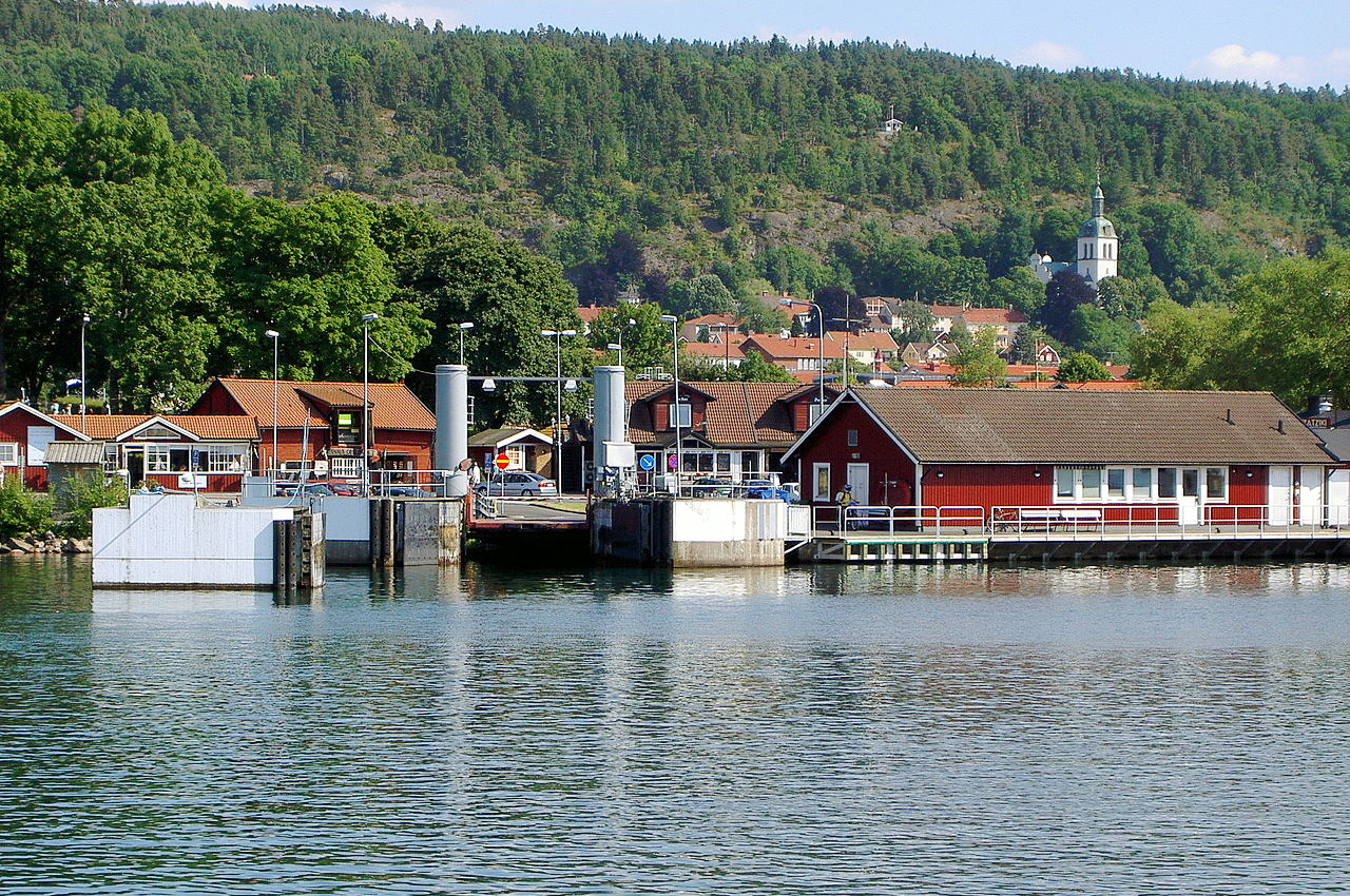
The coasts of Sweden are fringed with countless tiny islands collectively known as the "skerry-fence" (in Swedish: skärgård). Excellent examples of this can be seen off the coasts of Göteborg (Gothenburg) and Stockholm. The island belt is widest (some 45 miles) off Stockholm, the approach to which from the sea is famous for its beauty. Two large islands belong to Sweden, Öland and Gotland.
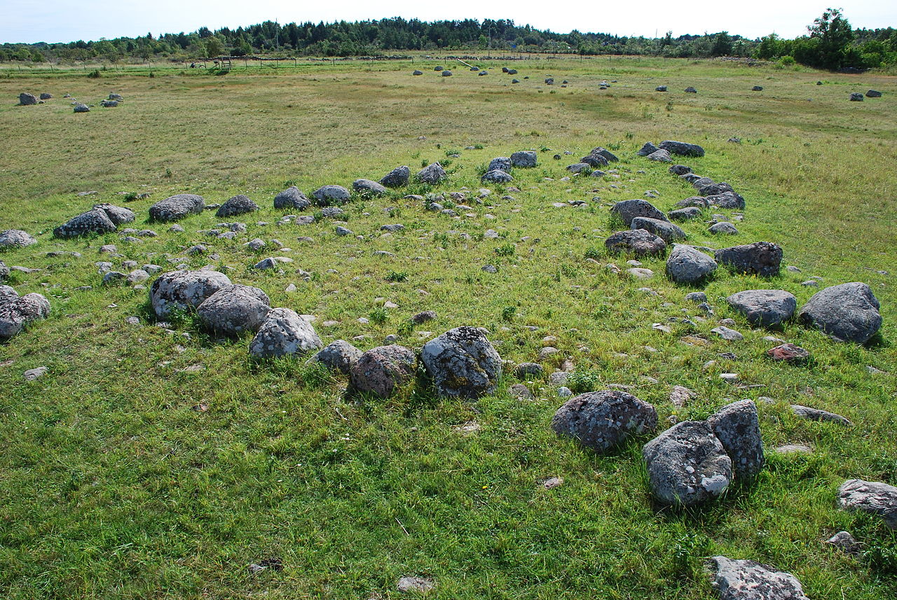
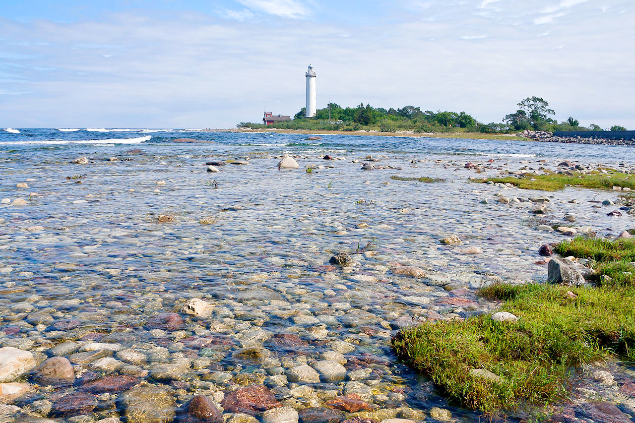
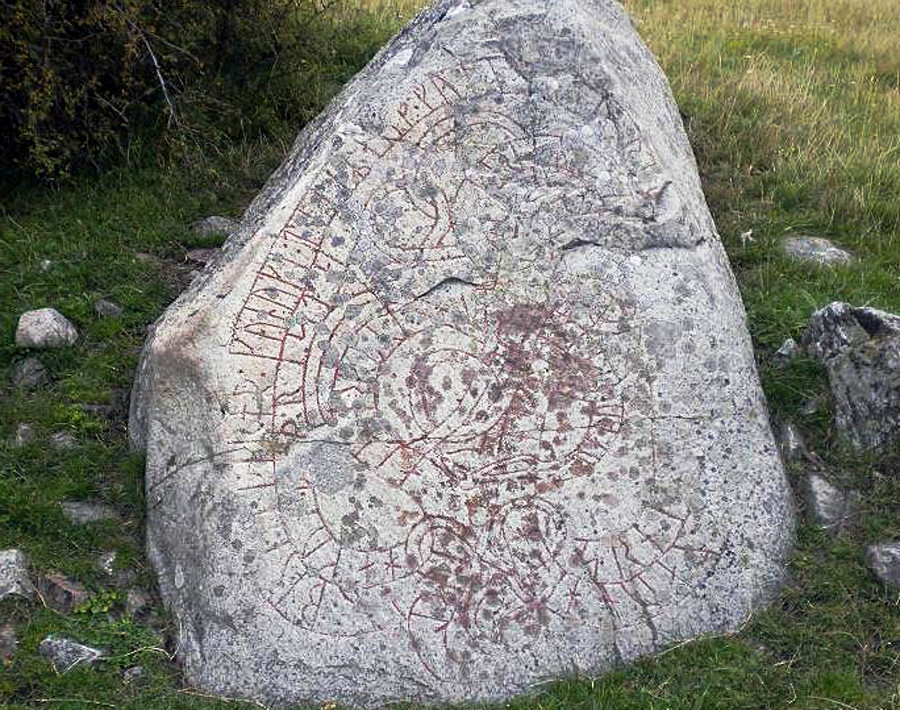
The long narrow island of Öland is 80 miles in length and 4 to 10 miles wide. It is connected to the mainland by a 6 kilometer (4 mile) bridge. Down the west side of the island for a considerable distance runs a limestone ridge, rising in terraces but sometimes in steep cliffs, to an extreme height of 60 meters (200 feet). Otherwise the island is clothed with clumps of trees between fields, windmills, villages and church towers. There are burial grounds from the Iron Age through the Viking Age including standing stones arranged in groups to represent ships.
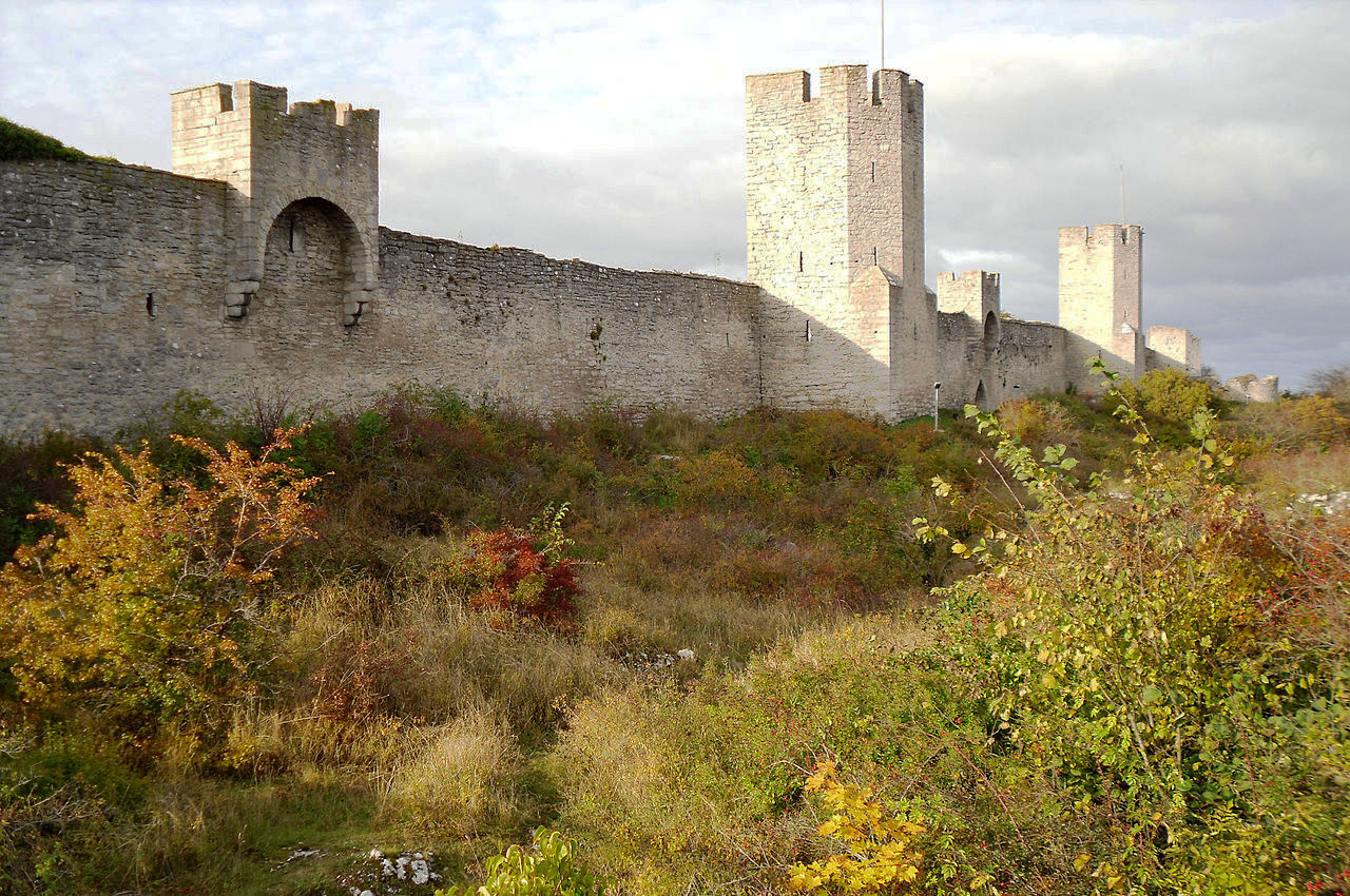
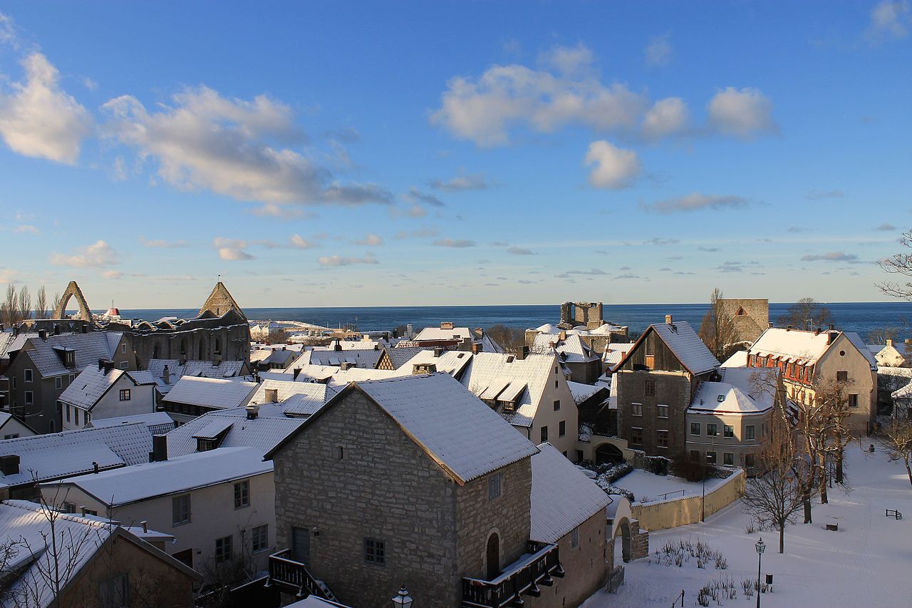
Gotland, 80 miles long and 30 miles wide, is the largest island of Sweden. The island is a level plateau with steep coasts. Its capital, the walled town of Visby, was a rich commercial centre from the 11th to the 14th century, and the most important Hanseatic city in the Baltic Sea. The island is now something of a tourist hotspot.
What is the nature of Sweden like?
.jpg&oldid=334590211)
.jpg&oldid=358954093)
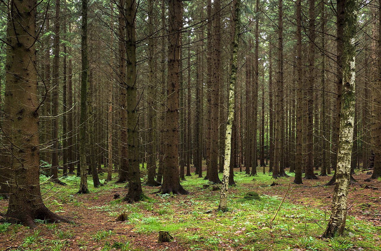
Sweden is renowned for the vast extent of its forests. The country is full of conifer forests, especially the Scots pine (Pinus sylvestris) and Norway spruce (Picea abies). In southern provinces oak trees appear as well as pine and spruce, and there are many other introduced trees, such as the ash, maple, lime, and beech. Besides these, two species of birch (silver birch and downy birch) form considerable forests and are some of the most beautiful of northern forest trees. They are often the dominant tree at alpine altitudes where they form belts of woodland with occasional rowan and aspen. The upper flanks of the high mountains are treeless; here instead are the alpine plants mostly confined to the northern part of Sweden.
What is the climate of Sweden like?
See our main article: The Climate of Sweden
Sweden has a temperate climate in the south with cold winters and warm summers; the north is subarctic with a short, sharp summer. In summer the days are not only long and bright, but also very warm. July is generally the hottest month, the temperature is almost the same all over the country. In the south, spring begins in March and autumn in October, and Stockholm enjoys nearly five months free from frost. In the north, however, summer is a short season from mid-June to the end of August.
Winter is a complete contrast to this: for months the land is covered with heavy snow. Ice covers the lakes for around 100 days in the south, and around 200 in the north. The formation of sea-ice on the west and south coasts is rare, but a fringe of solid ice forms on the east coast every winter, and the northern reaches of the Gulf of Bothnia are covered with ice from November to May.
In the far north of Sweden the sun is seen continuously above the horizon from the end of May to the middle of July. Further south, Stockholm experiences 18½ hours of sunshine and Göteborg for 17½ hours. With the long twilight comes a succession of beautiful skies.
| Climate data for Stockholm (1991-2020) | |||||||||||||
|---|---|---|---|---|---|---|---|---|---|---|---|---|---|
| Month | Jan | Feb | Mar | Apr | May | Jun | Jul | Aug | Sep | Oct | Nov | Dec | Year |
| Average high °C (°F) | 1.0 (33.8) | 1.2 (34.2) | 4.7 (40.5) | 10.7 (51.3) | 16.5 (61.7) | 20.8 (69.4) | 23.6 (74.5) | 22.1 (71.8) | 16.6 (61.9) | 10.1 (50.2) | 5.4 (41.7) | 2.5 (36.5) | 11.3 (52.3) |
| Daily mean °C (°F) | −1.0 (30.2) | −1.0 (30.2) | 1.6 (34.9) | 6.3 (43.3) | 11.4 (52.5) | 15.7 (60.3) | 18.7 (65.7) | 17.7 (63.9) | 13.1 (55.6) | 7.7 (45.9) | 3.6 (38.5) | 0.6 (33.1) | 7.9 (46.2) |
| Average low °C (°F) | −2.9 (26.8) | −3.2 (26.2) | −1.1 (30.0) | 2.6 (36.7) | 7.1 (44.8) | 11.6 (52.9) | 14.8 (58.6) | 14.2 (57.6) | 10.2 (50.4) | 5.5 (41.9) | 1.9 (35.4) | −1.2 (29.8) | 5.0 (41.0) |
| Average precipitation mm (inches) | 37.0 (1.46) | 29.4 (1.16) | 27.3 (1.07) | 29.2 (1.15) | 34.0 (1.34) | 61.7 (2.43) | 61.5 (2.42) | 66.2 (2.61) | 53.3 (2.10) | 51.4 (2.02) | 47.6 (1.87) | 47.8 (1.88) | 546.4 (21.51) |
| Average snowfall cm (inches) | 23.3 (9.2) | 25.6 (10.1) | 18.1 (7.1) | 5.9 (2.3) | 1.1 (0.4) | 0.0 (0.0) | 0.0 (0.0) | 0.0 (0.0) | 0.0 (0.0) | 1.8 (0.7) | 6.6 (2.6) | 20.3 (8.0) | 102.7 (40.4) |
| Source: Swedish Meteorological and Hydrological Institute | |||||||||||||
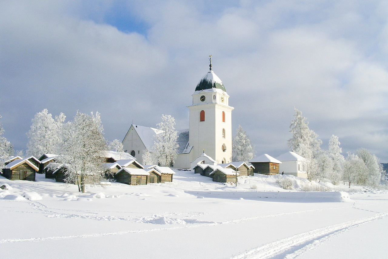 Rättviks kyrka in winter, Dalarna
The official websites
Sweden
The old, free, mountainous North
| Location: | Northern Europe, bordering the Baltic Sea and Gulf of Bothnia, between Finland and Norway |
| Coordinates: | 62° 00′ N, 15° 00′ E |
| Size: | • 1,575 km N-S; 500 km E-W • 980 miles N-S; 310 miles E-W |
| Terrain: | Mostly flat or gently rolling lowlands; mountains in west |
| Climate: | Temperate in south with cold, cloudy winters and warm, partly cloudy summers; subarctic in north |
| Highest point: | Kebnekaise 2,096 m / 6,877 ft |
| Forest: | 68.7% (2011 est.) |
| Population: | 10,202,491 (July 2020 est.) |
| Population density: | Low (25/km²) |
| Capital: | Stockholm |
| Languages: | Swedish (official); Finnish, Sami, Romani, Yiddish, and Meankieli are official minority languages |
| Human Development Index: | Very high (0.945) |
| Currency: | Kronor |