The Geography of
Northeast England
Why visit Northeast England?
The North East of England is a region rich in culture, historic sites, world heritage sites and dramatic landscapes. It is known for its lush green countryside and rolling hills, is one of the most picturesque parts of the country. From sandy beaches to charming villages, this region has something for everyone. The northeast is also home to some amazing attractions like Hadrian's Wall.
Contents
Map
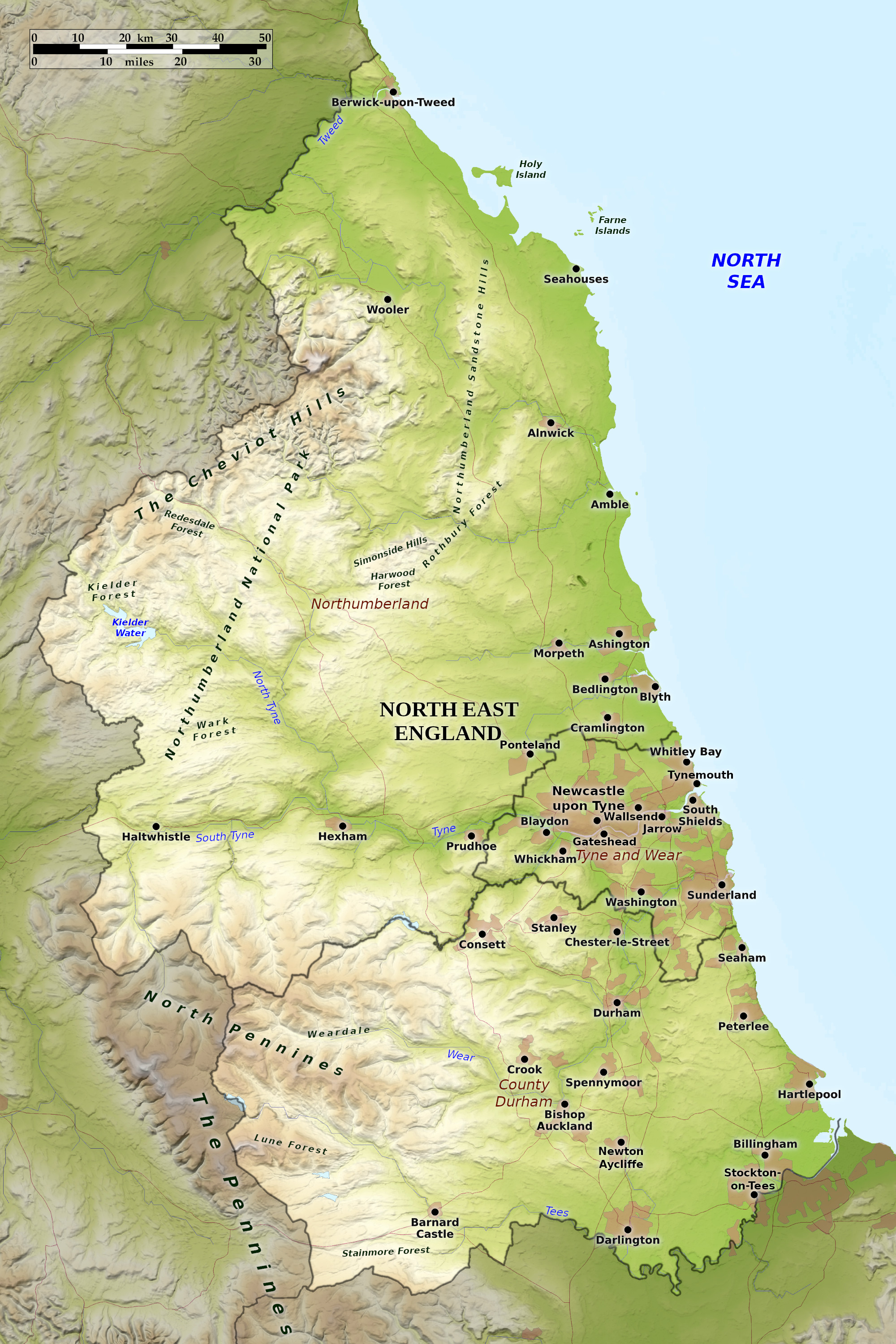 Relief map of Northeast England
What is the landscape of Northeast England like?
In the south of this region lies County Durham, a rather hilly county especially toward the west which is occupied by spurs of the North Pennines, exceeding 700 meters (2,300 feet) in height at some points on the Cumbria border. The dales have wild moors separating beautiful and fertile valleys, often with steep, well-wooded banks.
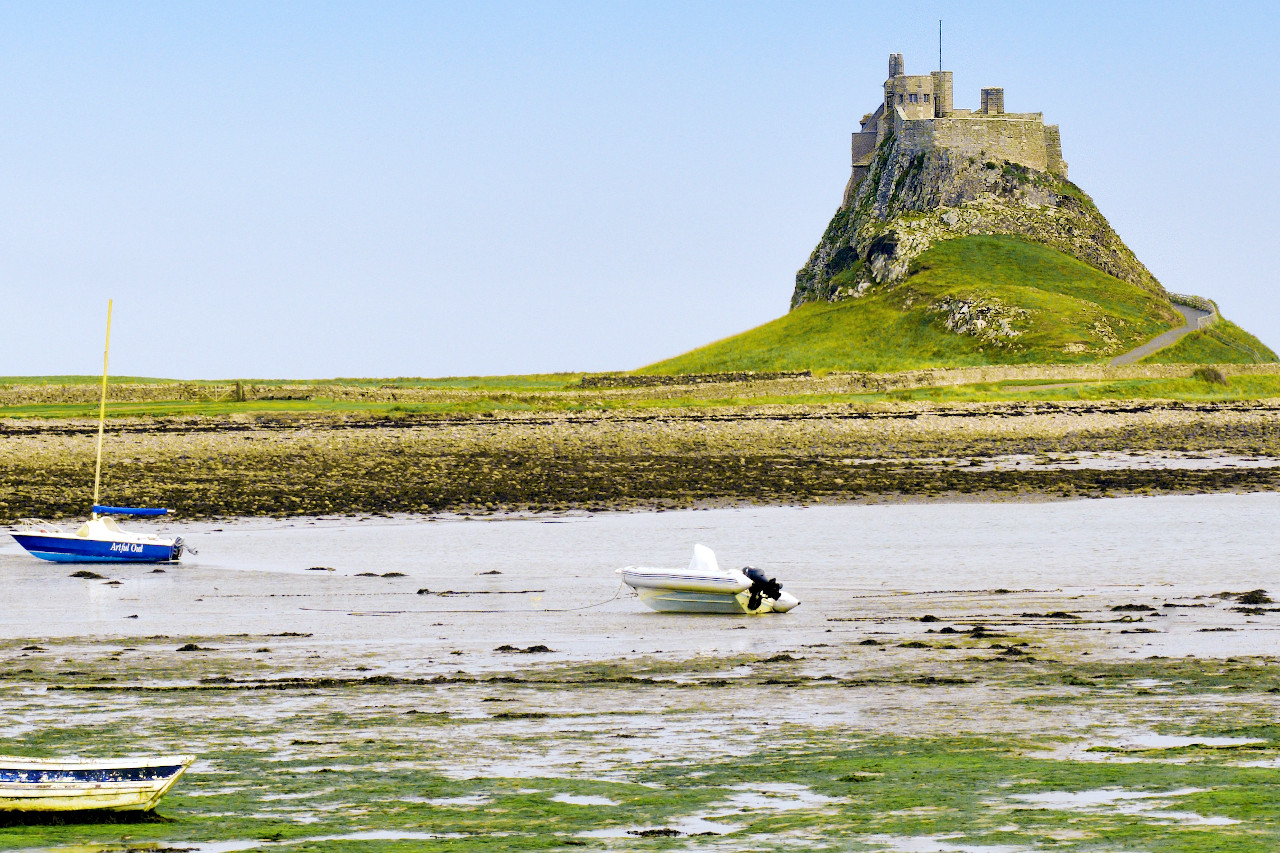
Northumberland is the northernmost county of England. It rises to the northwest to the border with Scotland. Here the Cheviot range partly separates Northumberland from Scotland. The hills are finely grouped, of conical and high-arched forms, and generally grass-covered. The culminating mountain is known as The Cheviot at 815 meters (2,674 feet). In the southwest the high ground merges with the Pennine uplands. The hills and moors sink to a generally low coast, a succession of sands, flat tidal rocks and slight cliffs. Its bays are edged by wind-swept sand-dunes. There are several islands, most notably Holy Island, or Lindisfarne, connected to the mainland at every low tide. The Farne Islands are a group of rocky islets farther south.
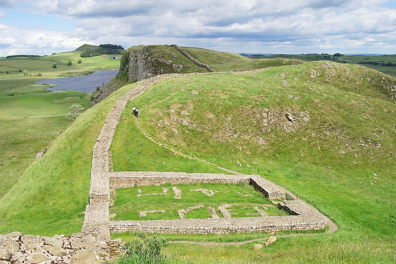
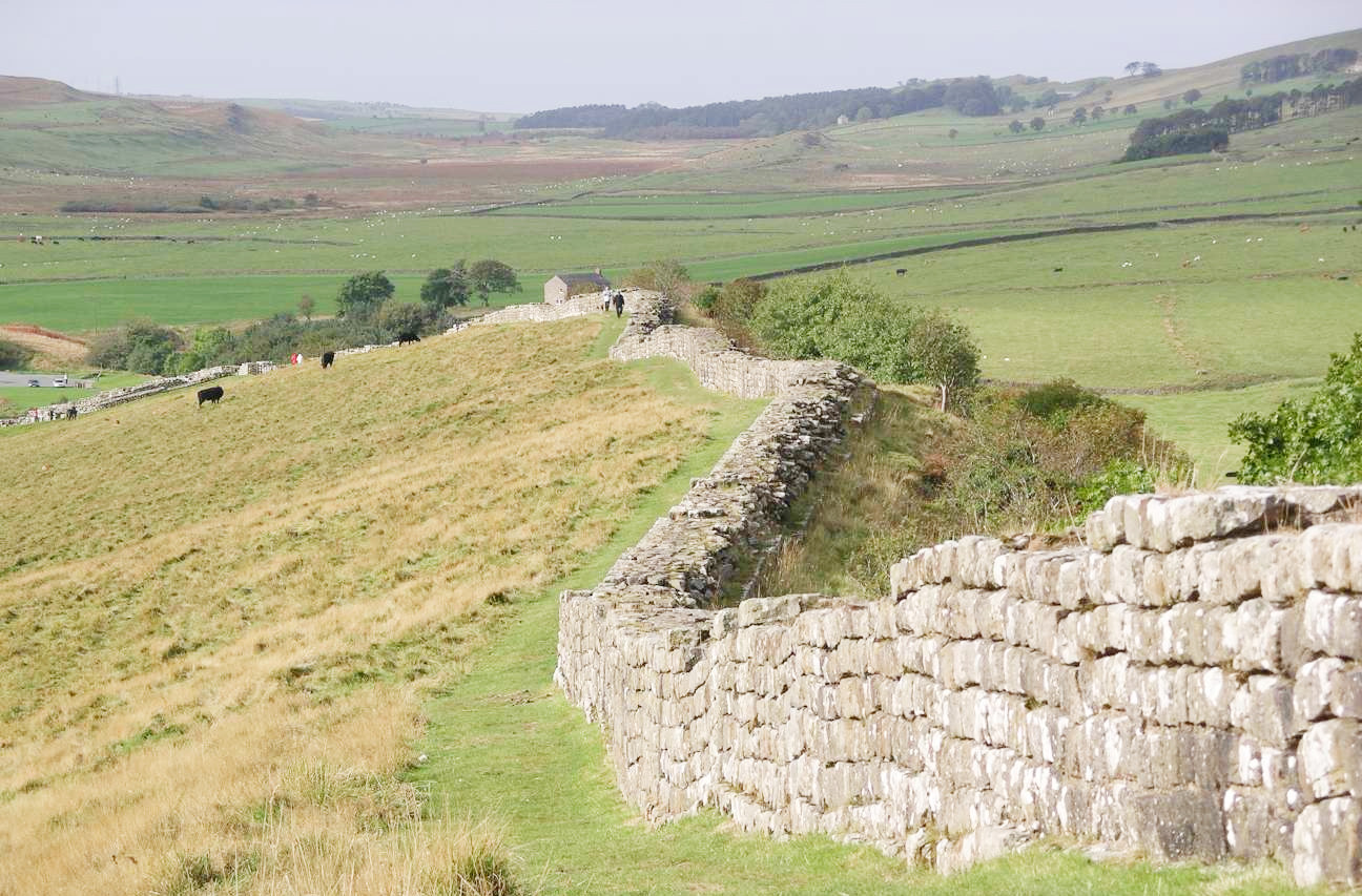
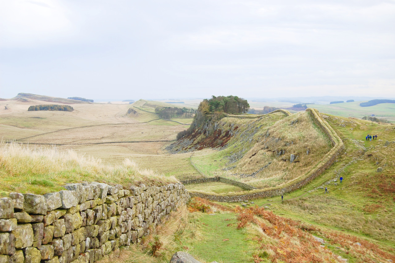 Hadrian's Wall west of Housesteads
What is the climate of Northeast England like?
Northeast England has a maritime climate with both mild summers and winters. Compared with the rest of England, the weather there is relatively stable, and extreme conditions, such as floods, droughts or heatwaves, are rare. Rainfall here is somewhat lower than the west coast although the weather is often cloudy. The warmest areas are in the lowlands of County Durham. The hills have cold winters sometimes with significant snow. Summers are typically warm with long daylight hours.
| Climate data for Durham (1981–2010) | |||||||||||||
|---|---|---|---|---|---|---|---|---|---|---|---|---|---|
| Month | Jan | Feb | Mar | Apr | May | Jun | Jul | Aug | Sep | Oct | Nov | Dec | Year |
| Average high °C (°F) | 6.6 (43.9) | 7.2 (45.0) | 9.5 (49.1) | 11.9 (53.4) | 15.0 (59.0) | 17.6 (63.7) | 20.1 (68.2) | 19.8 (67.6) | 17.2 (63.0) | 13.3 (55.9) | 9.4 (48.9) | 6.7 (44.1) | 12.9 (55.2) |
| Daily mean °C (°F) | 3.8 (38.8) | 4.1 (39.4) | 5.9 (42.6) | 7.8 (46.0) | 10.6 (51.1) | 13.3 (55.9) | 15.6 (60.1) | 15.4 (59.7) | 13.1 (55.6) | 9.8 (49.6) | 6.4 (43.5) | 3.9 (39.0) | 9.2 (48.6) |
| Average low °C (°F) | 0.9 (33.6) | 0.9 (33.6) | 2.3 (36.1) | 3.7 (38.7) | 6.1 (43.0) | 9.0 (48.2) | 11.1 (52.0) | 11.0 (51.8) | 9.0 (48.2) | 6.3 (43.3) | 3.4 (38.1) | 1.1 (34.0) | 5.4 (41.7) |
| Average rainfall mm (inches) | 52.3 (2.06) | 41.8 (1.65) | 44.6 (1.76) | 52.7 (2.07) | 44.2 (1.74) | 55.4 (2.18) | 54.0 (2.13) | 60.8 (2.39) | 55.4 (2.18) | 60.9 (2.40) | 72.0 (2.83) | 57.0 (2.24) | 651.1 (25.63) |
| Source: Met Office | |||||||||||||
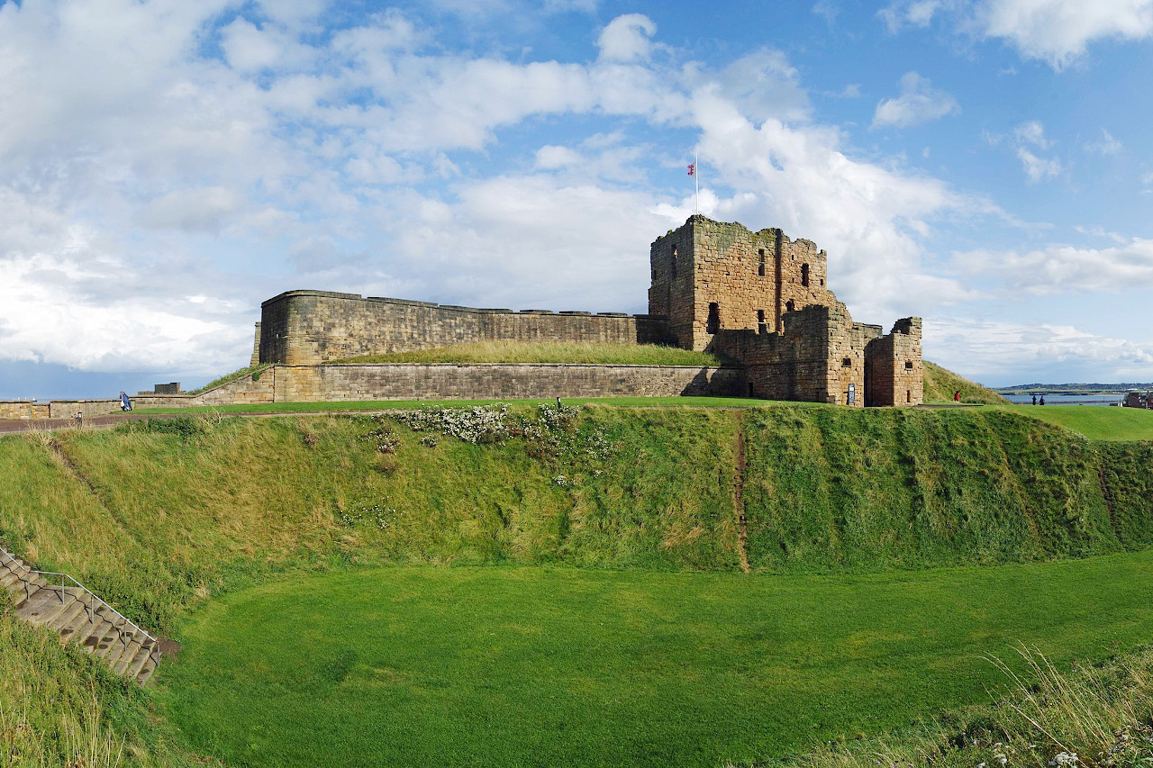
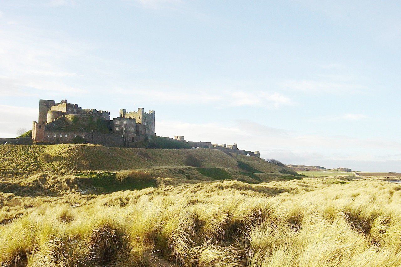
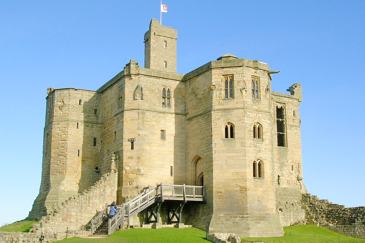 Warkworth Castle in Northumberland
The official websites
North East England
England's wild north
| Location: | Eastern Britain |
| Coordinates: | 55° 00′ N, 2° 00′ W |
| Size: | • 155 km N-S; 100 km E-W • 95 miles N-S; 60 miles E-W |
| Terrain: | Ranges of hills rising to the northwest and southwest |
| Climate: | Maritime climate with cool summers and winters; year-round rainfall |
| Highest point: | The Cheviot 815 m / 2,674 ft |
| Forest: | 24% (2010 est.) (source) |
| Population: | 2,657,909 (2018) |
| Population density: | High (310/km²) |
| Capital: | — |
| Languages: | English |
| Human Development Index: | Very High (0.904) |