.jpeg)
The Geography of
Hawaii
Why visit Hawaii?
Hawaii is one of the loveliest groups of islands in any ocean. The archipelago has a bright, Pacific setting, sunny climate, gentle cool breezes, and world-famous volcanoes. Hawaii’s natural beauty attracts people from all over the globe to explore its hidden treasures. The islands have lush rainforests, white-sand beaches and crystal-clear water. The islands are also home to an abundance of cultural experiences and friendly people. There are plenty of activities available for visitors no matter what their interests may be—hiking, swimming, diving or simply soaking up some sun on a beach!
Contents
Map
 Relief map of Hawaii
What is the landscape of Hawaii like?
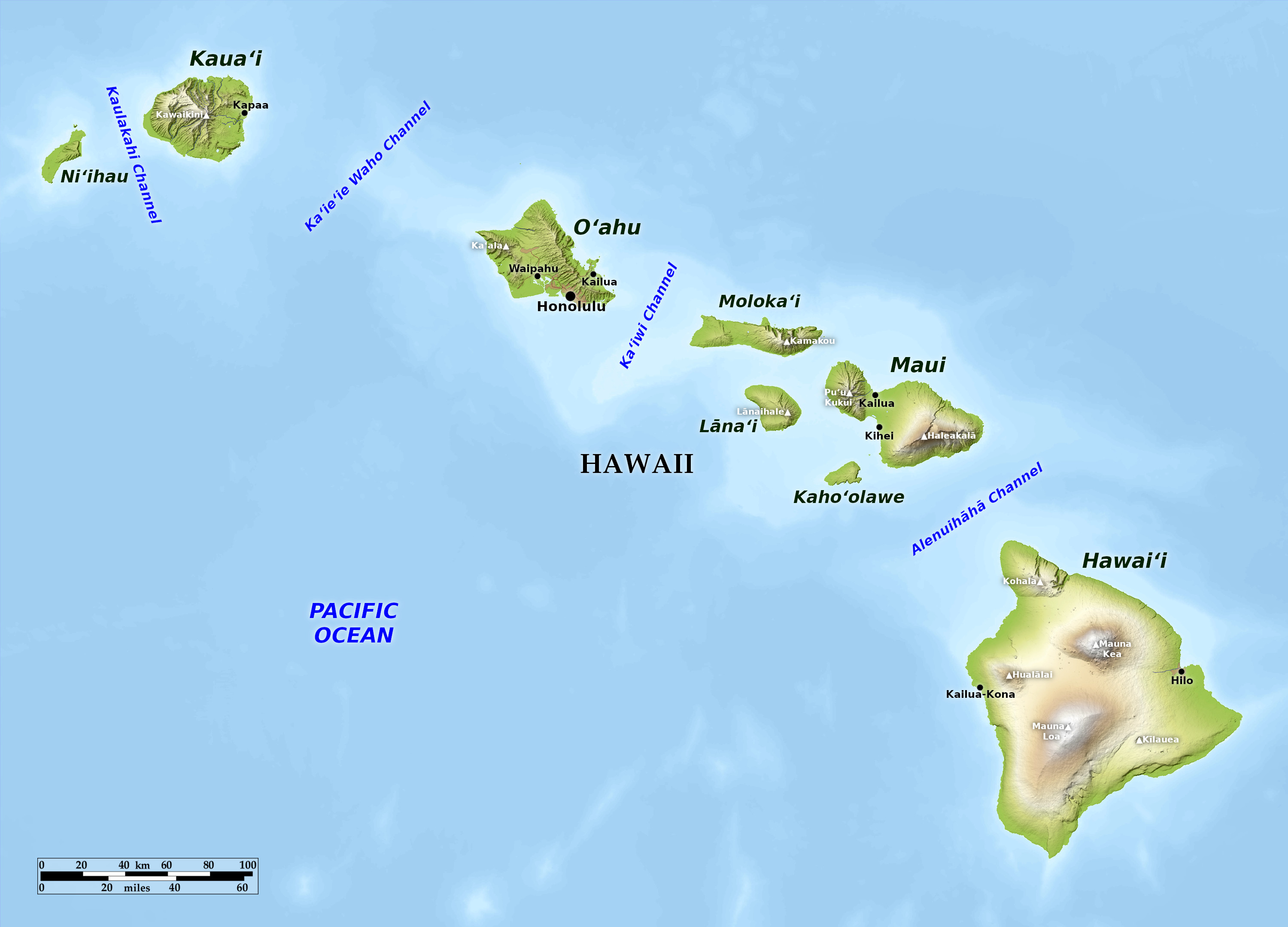
Hawaii is a long chain of more than one-hundred islands extending 1,650 miles (2,650 km) across the Pacific Ocean. The main group—extending across 400 miles (640 km)—is made up of eight large islands.
Hawaiʻi
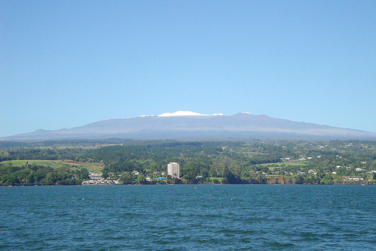
The island of Hawaiʻi has an area nearly double that of all the other islands put together. It is triangular in shape, with sides about 80 miles (130 km) in length. Almost the whole island is occupied by the gentle slopes of five volcanic mountains, Mauna Kea on the northeast, 13,803 feet (4,207 m) (the highest peak in the Pacific Ocean); Mauna Loa on the southwest, 13,679 feet (4,169 m); Hualālai on the west, 8,271 feet (2,521 m); Kohala on the northwest, 5,480 feet (1,670 m); and Kīlauea on the southeast 4,091 feet (1,247 m).
.jpeg)
The name Mauna Kea means "white mountain", so named from the snow on its summit. The peaks of Mauna Kea are truncated cones with craters rising from plains of clinkers and gravel, ashes and sand; but no modern streams of lava are visible, nor is there record of any eruption of this mountain. The slopes are at their most gentle on the west side. The coast running north from Hilo, a distance of 30 miles, is remarkable for the many rivers running at the bottom of ravines 1,800 or 2,000 feet (600 m) in depth which are cut into the side of Mauna Kea.
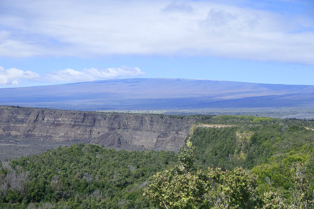
Mauna Loa ("Great Mountain") is by far the largest volcano, at the base measuring about 75 miles from north-to-south and 50 miles from east-to-west. It is still an active volcano. The circular crater, 1.5 miles (2.5 km) in diameter, has nearly vertical walls around 500 feet (150 m) high on the inner side; and the bottom between the numerous cones is usually covered with solid lava, from the fissures of which issue steam and sulphurous vapours. Mauna Loa's most recent eruption occurred in 2022.
.jpeg)
The summit of Hualālai is scattered with many pit craters from 300 to 500 feet (90–150 m) deep and from 700 to 1,000 feet (210–300 m) in diameter, their solid walls being nearly vertical. More than 150 cones have been counted on the sides of Hualālai. The last eruption took place in 1801, when a copious flow of lava reached the coast, where it filled up a deep bay.
Kohala rising abruptly from the north shore of the island, but on the land side it has been partly covered with lava from Mauna Kea, to form broad plains. On the ocean side, wherever this lava has not extended, cliffs 1,000 feet (300 m) in height face the sea and enormous gorges with nearly straight walls as much as 3,000 feet (900 m) high and extending inland 5-6 miles have been formed.
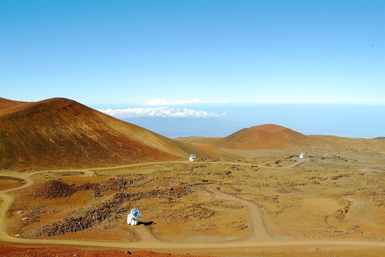
Kīlauea is the largest active crater (8 miles in circumference) and is easily accessible. When most active it affords a grand spectacle, especially at night: across the crust run glowing cracks, the crust is then broken into cakes, the cakes plunge beneath, lakes of liquid lava are formed, over whose surface play fire-fountains, the surface again solidifies and the process is repeated.
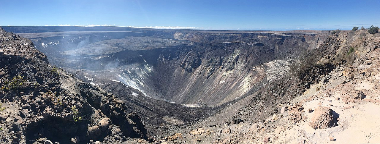 Halema‘uma‘u crater on the rim of Kīlauea
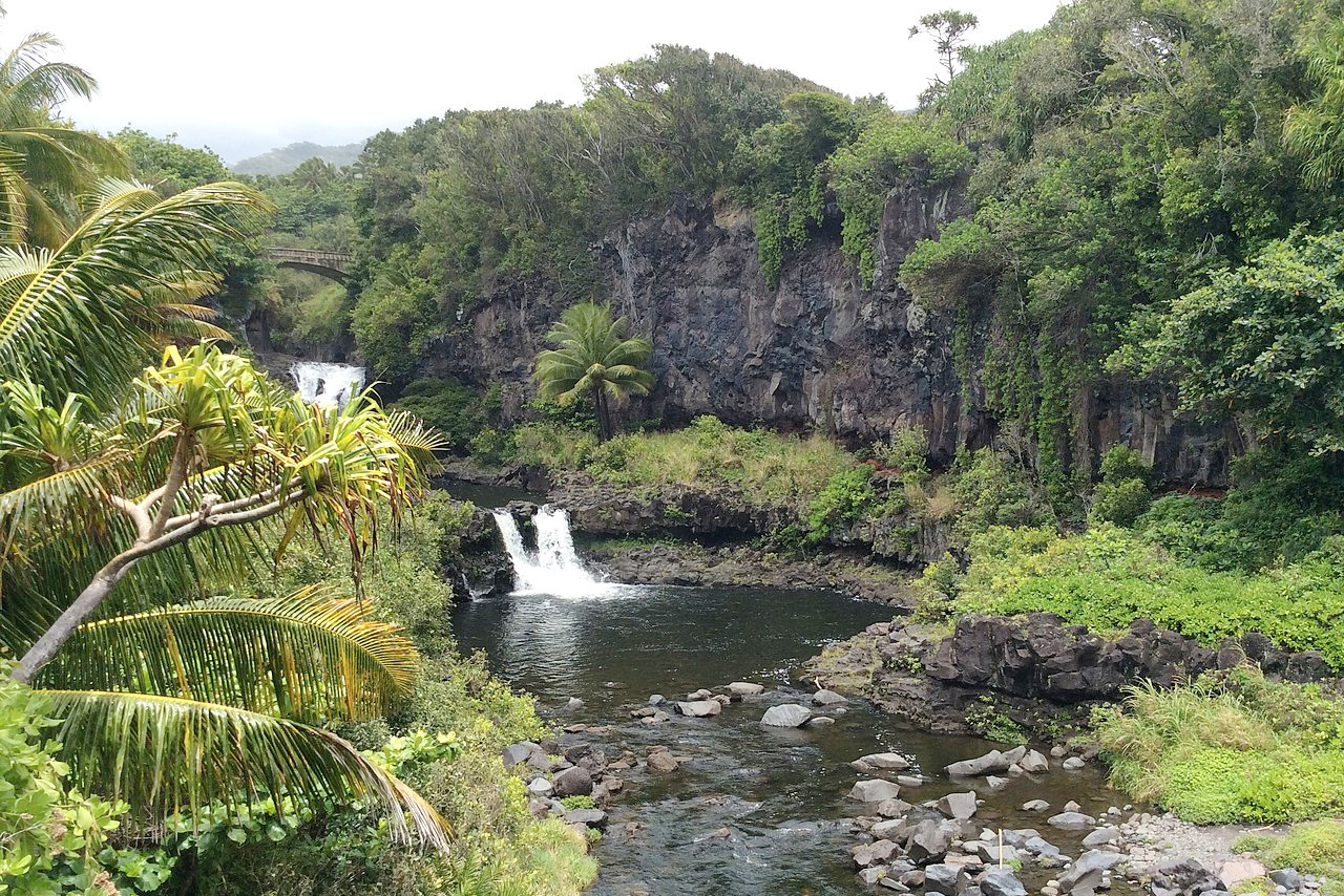
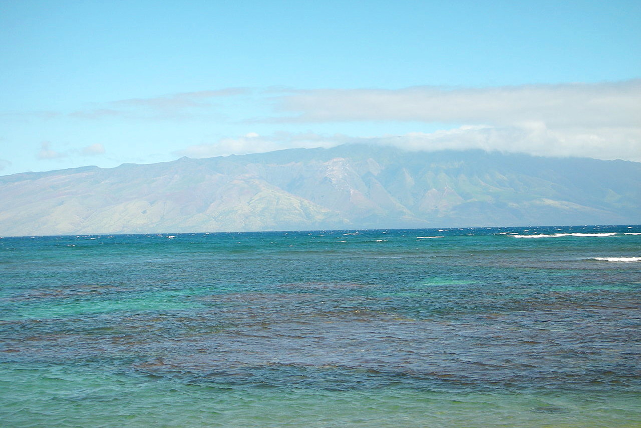
Maui
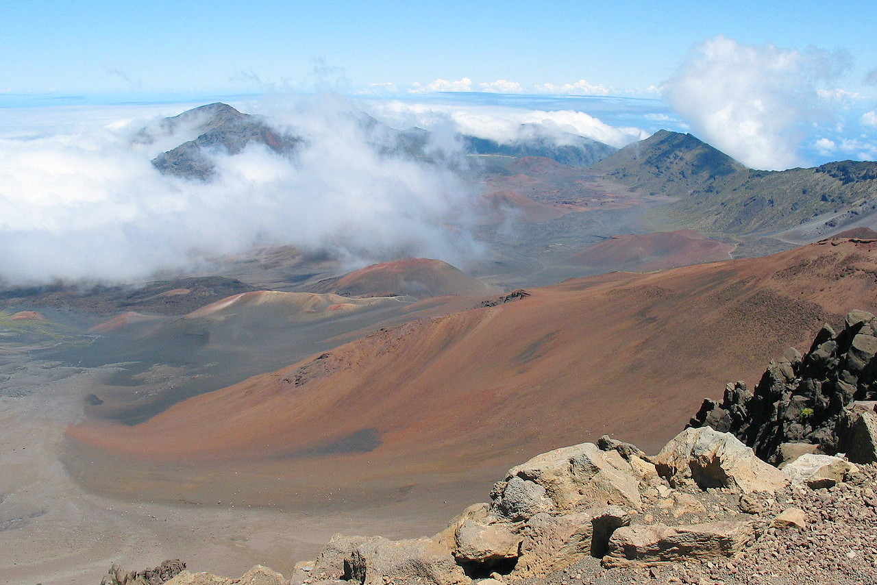
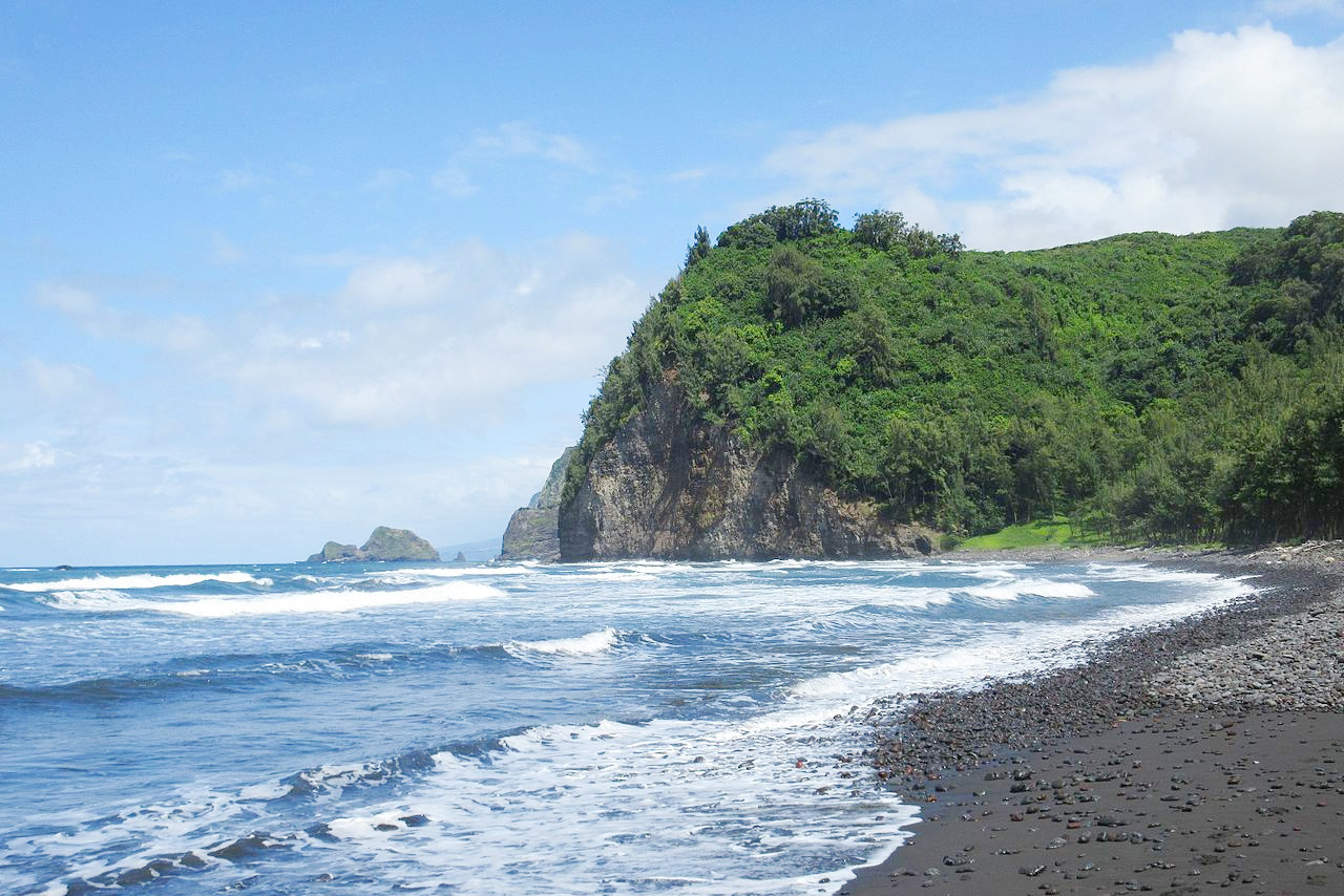
The island of Maui, lying 25 miles northwest of Hawaiʻi, is composed of two mountains connected by a low sandy isthmus 7 or 8 miles long by 6 miles across. Haleakalā, the high mountain on the eastern side, has a height of 10,023 feet (3,055 m), and forms a great dome-like mass with a circumference at the base of 90 miles, and with gentle slopes. The extinct crater on its summit, which is one of the largest in the world, has a length of 7 miles (12 km), and a width of 2 miles (3.5 km). On the east and north are two great gaps in the walls from 1 to 3 miles wide, through each of which has poured a copious flood of lava which nearly reached the sea. Along the north base of the mountain are numerous ravines (several hundred feet deep), to the bottom of which small streams of water fall in long cascades.
.jpeg)
Puʻu Kukui, the highest summit on the west of Maui, is 5,788 feet (1,764 m) high. Volcanic action appears to have ceased here at a much earlier period than on Haleakala, there being no craters on the summit or sides. The slopes have deep valleys separated by narrow sharp ridges. West Maui is noted for the beauty of the tropical scenery.
.jpeg) Wai'anapanapa State Park, Maui
Wai'anapanapa State Park, Maui
Kahoʻolawe
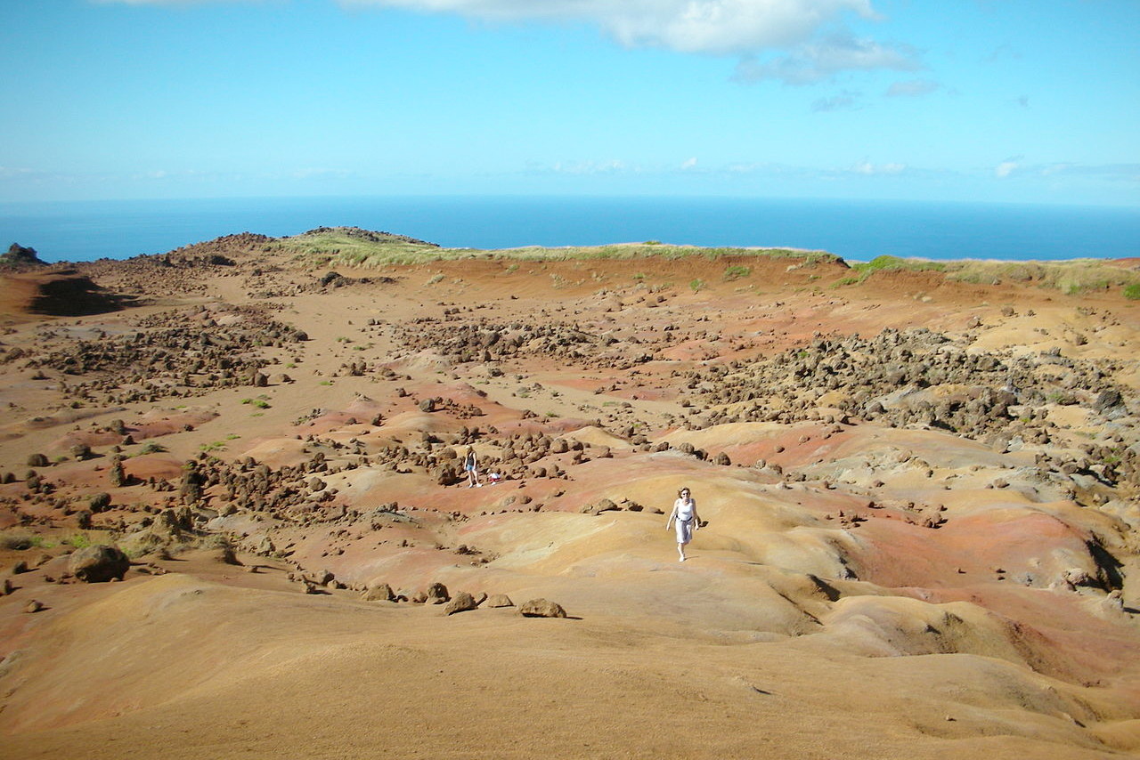
Kahoʻolawe is a small island 6 miles southwest of Maui. It is 14 miles long by 6 miles wide. Its hills, which rise to a height of 1,483 feet (452 m), are rugged, but with no ravines. The vegetation is scanty and there are no rivers. There is no permanent human settlement.
Lānaʻi
Lānaʻi is another small island, 7 miles west of Maui. It is about 18 miles long and 12 miles wide and supports around 3,000 people. It has a mountain range which rises to a maximum height of 3,366 feet (1,026 m). The northeast slope is cut by deep gorges contain a rich growth of trees and shrubs. On the southwest side is a rolling grassy table-land, but over the whole north portion of the island the winds sweep the rocks bare.
 Mountains of Lānaʻi
Molokaʻi
Molokaʻi, 8 miles northwest of Maui, extends 40 miles from east-to-west and has an average width of nearly 7 miles. A range of mountains comprising more than one-half the island and attains a maximum height of 4,961 feet (1,512 m) in the peak of Kamakou. The south slope of this range is gradual but is cut by many straight and narrow ravines, in some instances to a great depth. The north slope is abrupt, with cliffs from 1,000 to 4,000 feet (300–1,200 m) in height. The middle of the island drops to a low and gently rolling plain, but further west it rises again to a round-topped summit at 1,381 feet (421 m).
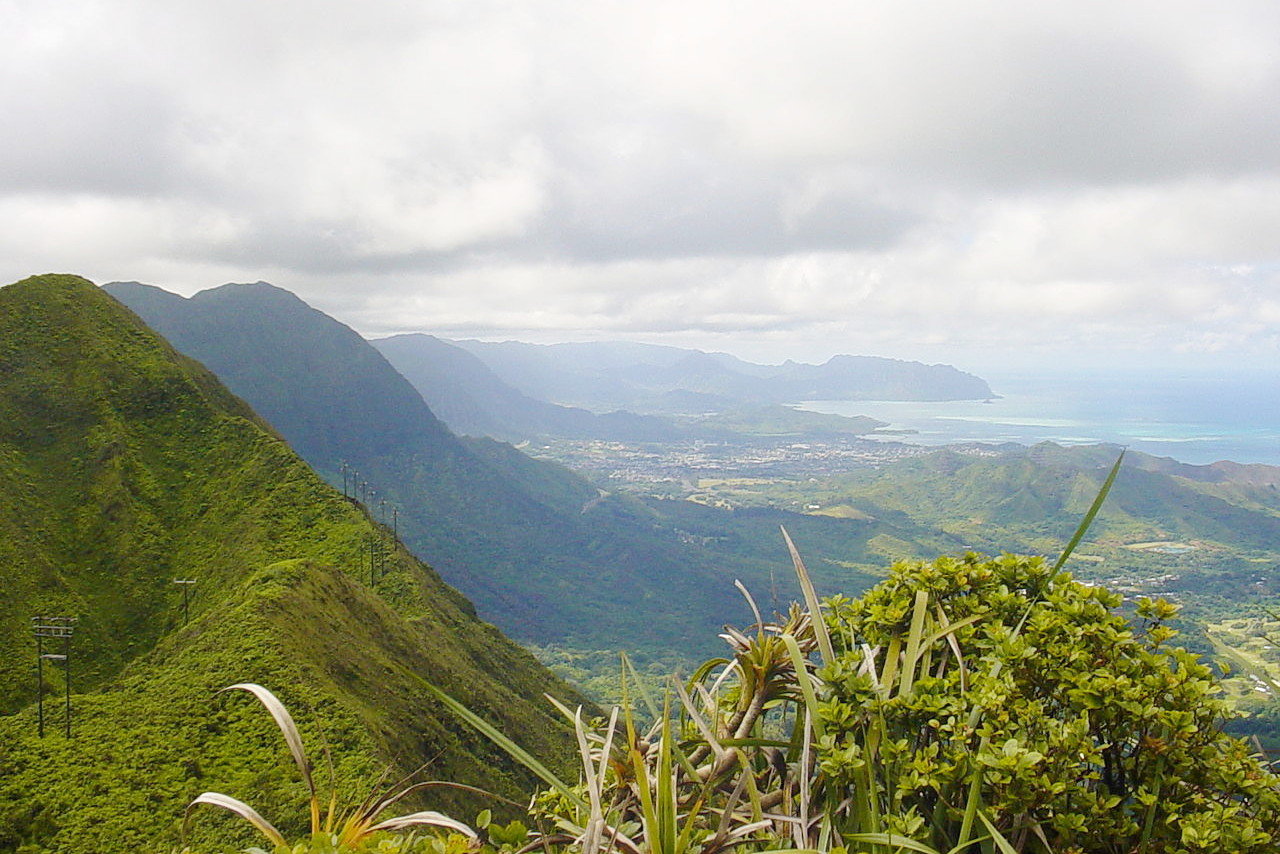
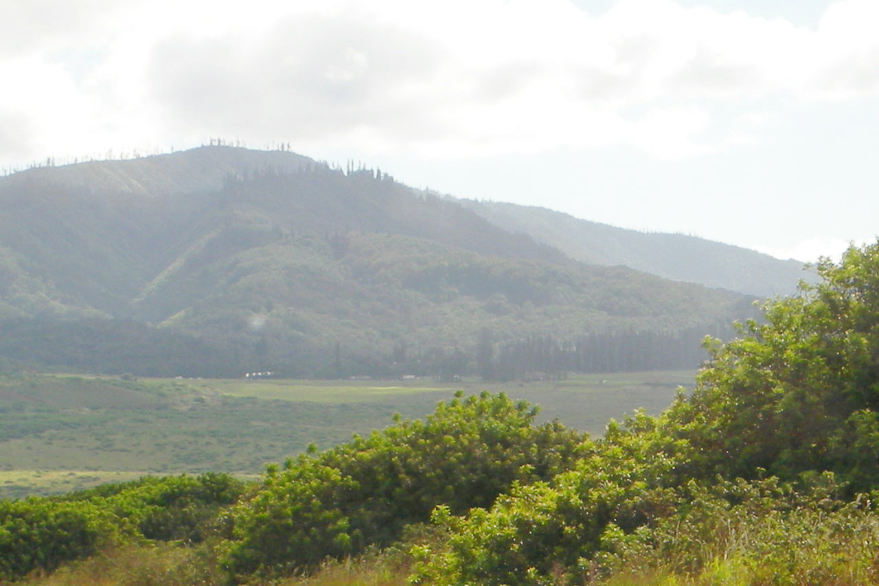
Oʻahu
Oʻahu, 23 miles north of Molokaʻi, has an irregular rectangular shape. It is traversed from southeast to northwest by two parallel ranges of hills separated by a low plain. The western or Waianae Range has the highest point on the island: an eroded shield volcano known as Kaʻala, at 4,025 ft (1,227 m).
The eastern or Koʻolau Range is much longer than the other, and its ridge is very much broken; on the land side there are many ravines formed by lateral spurs, but to the sea for 30 miles it presents a nearly vertical wall without a break. The valleys are remarkable for beautiful scenery,—peaks, cliffs, ravines, cascades and tropical vegetation. There are few craters on the heights, but on the coasts there are several groups of small cones with craters, some of lava, others of tufa.
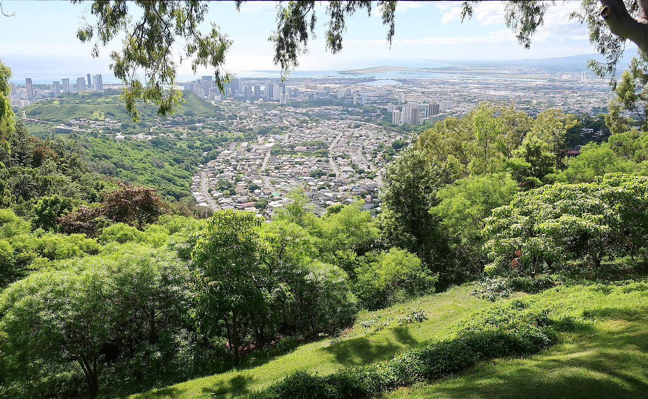
The greater part of the coast is surrounded by a coral reef, often half a mile wide. On a plain on the south side of the island, a mile wide and two miles long, stands Honolulu, the capital city of Hawaii.
.jpeg) Landscape of Oahu
Landscape of Oahu
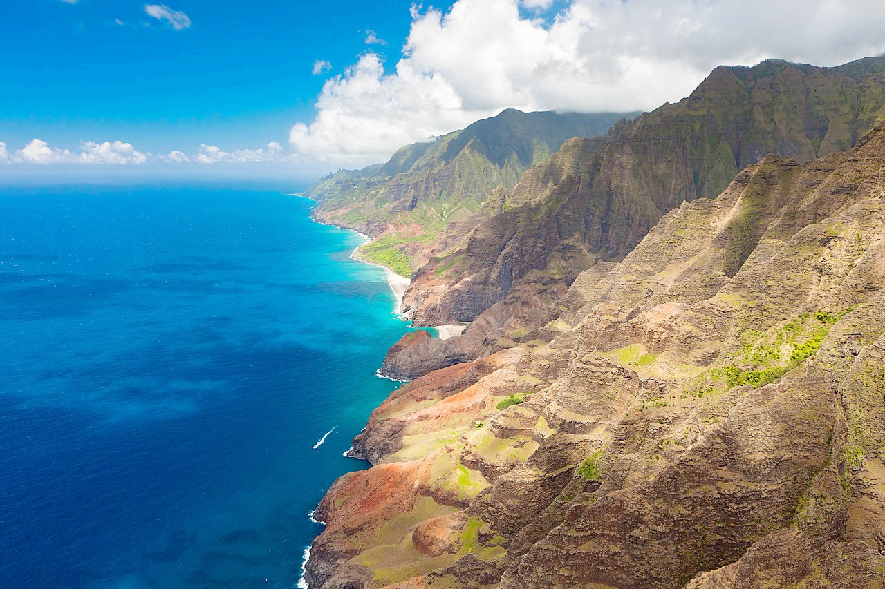
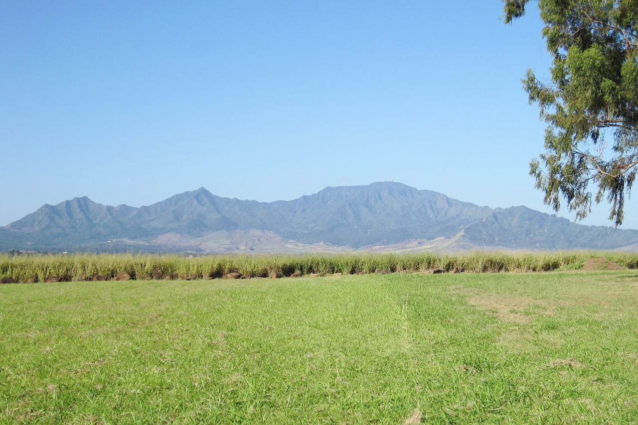
Kauaʻi
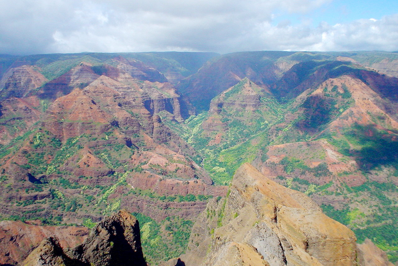
Kauaʻi, 63 miles northwest of Oʻahu, has an irregularly circular shape with a diameter of about 25 miles. At the centre of the island is the basaltic mountain Waiʻaleʻale, 5,148 feet (1,569 m) high, which has a swampy top and sides deeply furrowed by ravines. To the west of the mountain is a high tableland with an area of 40 square miles, terminating at the sea in a precipice of 2,000 feet (600 m).
.jpeg)
The valleys are numerous, deep, and very picturesque with wood and waterfalls. The north side of the island is considered to be the best watered and most fertile part of the Hawaiian islands. In this part the rainy season extends over nine months, watering the island with large mountain streams; and it is called "garden isle".
Niʻihau
Niʻihau, the most westerly of the inhabited islands, is 18 miles west of Kauaʻi. It is 16 miles long and 6 miles wide. The western two-thirds consists of a low plain, composed of an old coral reef and debris washed down from the mountains. The east side the island rises steeply from the sea and attains a maximum height of 1,289 feet (393 meters) at Pānīʻau. Access to the island is restricted.
What is the nature of Hawaii like?
Plants
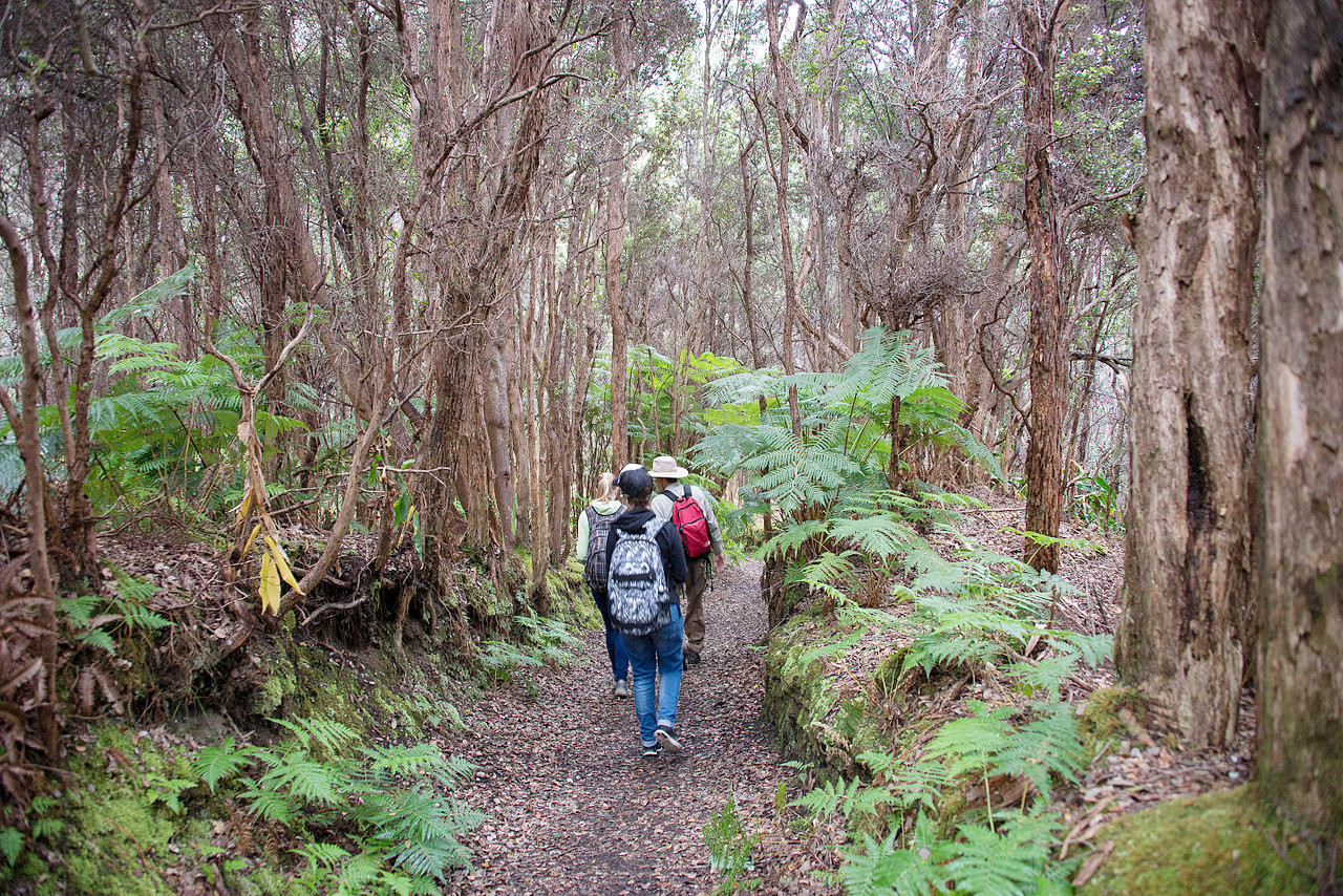
As a result of their isolation, the Hawaiian Islands have their own distinct species, although in many places they have been replaced by trees and fruit plants introduced since the early 19th century. The forests are distinctly tropical, and are composed of trees of medium size. They are most common between altitudes of 2,000 and 8,000 feet (600–2,400 m). In regions of heavy rainfall the ʻōhiʻa lehua (Metrosideros polymorpha), a tree growing from 30 to 100 feet (30 m) in height, is dominant. It produces a brilliant display of flowers, made up of a mass of stamens, which can range from fiery red to yellow. It often forms impenetrable of the forests because of the dense undergrowth of ferns and climbing vines which surround it. The koa (Acacia koa), a flowering tree, forms extensive forests on Hawaii and Maui between elevations of 2,000 and 4,000 feet (600–1,200 m).
.jpeg)
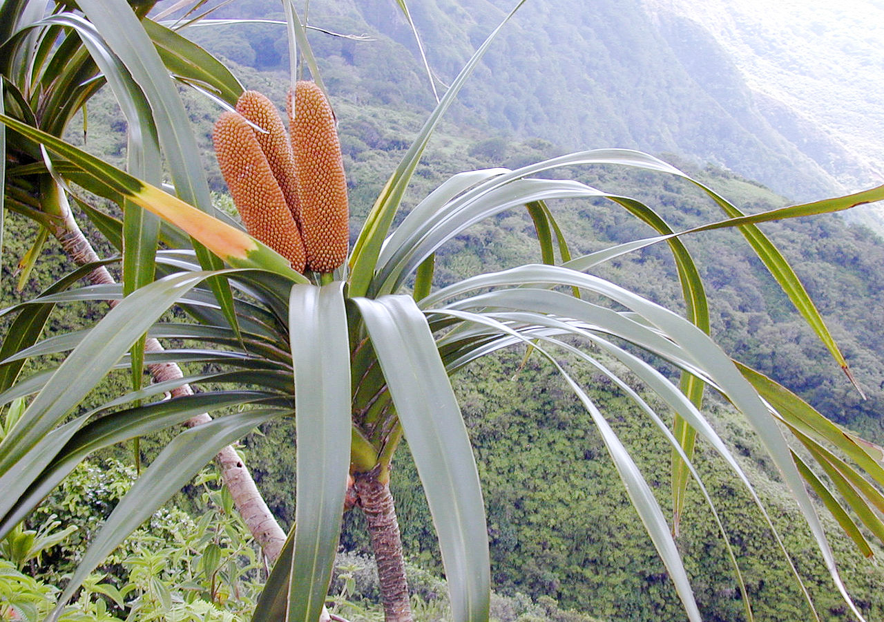
The kukui (Aleurites moluccanus) and the long-thorn kiawe (Prosopis juliflora) are the principal forest trees that occur below 2,000 feet (600 m). The kukui grows along streams and gulches; candles were made from its nuts, which are very oily. The long-thorn kiawe is an introduced species which has formed dense forests.
Native fruit-bearing plants are the Chilean strawberry (Fragaria chiloensis) and the ʻōhelo ʻai (Vaccinium reticulatum), both of which grow at high elevations on Hawaiʻi and Maui. Most of the grasses are coarse, and some of them, particularly the hilo grass (Paspalum conjugatum), form a dense mat over the ground which prevents the spread of forests. Many other grass species were used for thatching, carpets, and clothing. Ferns form a luxuriant undergrowth in the ʻōhiʻa lehua and the koa forests, and the islands are noted for the profusion and beautiful colours of their flowering plants.
Animals
.jpeg)
A day-flying bat, the Hawaiian hoary bat, is the only land mammal native to the islands. The endangered humpback whale migrates to Hawaiian waters in winter, and there are five species of sea turtle. Among reptiles, there are no snakes, but there are local species of skink and gecko. Land-snails are remarkably common and diverse; over 300 varieties exist. Fish in a great variety of colours and shapes abound in the sea along the coasts.
_Hosmer_Grove,_Haleakala_Nat_Park,_Maui_co,_Hawaii_-01_(41106135465).jpeg)
.jpg&oldid=514208318)
.jpg&oldid=474864115)
.jpg&oldid=520943443)
.jpg&oldid=451097290)
.jpg&oldid=458691687)
.jpg&oldid=499919065)
.jpg&oldid=476019630)
.JPG&oldid=510614108)
.jpg&oldid=514207447)
_Hosmer_Grove,_Haleakala_Nat_Park,_Maui_co,_Hawaii_-01_(41106135465).jpg&oldid=476641160)
There are some beautiful species of birds, some now endangered. The most typical family are the Hawaiian honeycreepers, noted for their stout sickle-shaped beaks with which the birds extract insects from tree-bark. The state bird is the Hawaiian goose or nene—once close to extinction, it now numbers a few thousand and is on the increase.
What is the climate of Hawaii like?
"Foliage and fruit of Freycinetia arborea ('Ie'ie) at Waihee Ridge Trail, Maui" by Forest & Kim Starr / USGS
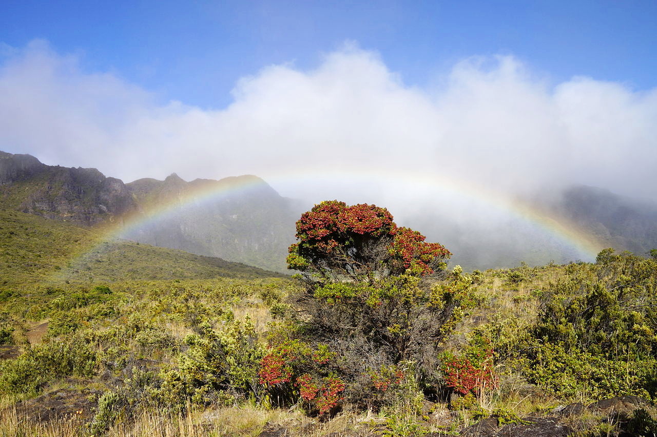
Hawaii has a tropical climate cooled by trade winds. Normal daily temperatures in Honolulu average 74°F (23°C) in February and 82°F (28°C) in August. The sky is usually cloudless or only partly cloudy. The northeast trade winds blow periodically from March to December producing regular land and sea breezes. During January, February and a part of March the wind blows strongly from the south or southwest with a warm, moisture-laden wind.
More rain falls in the winter months; and the amount increases with the altitude also up to about 4,000 feet (1,200 m). The level of rainfall varies greatly across the islands. Some areas are considered quite arid, these include upper mountain slopes and island interiors, as in central Maui. On the other hand, the summit of Mount Waiʻaleʻale on the island of Kauaʻi is considered one of the rainiest spots on Earth. Snow falls at the summits of Mauna Loa, Mauna Kea, and Haleakala—the highest mountains.
| Climate data for Honolulu (1991−2020) | |||||||||||||
|---|---|---|---|---|---|---|---|---|---|---|---|---|---|
| Month | Jan | Feb | Mar | Apr | May | Jun | Jul | Aug | Sep | Oct | Nov | Dec | Year |
| Average high °F (°C) | 80.5 (26.9) | 80.5 (26.9) | 81.2 (27.3) | 83.1 (28.4) | 84.8 (29.3) | 86.9 (30.5) | 88.1 (31.2) | 88.8 (31.6) | 88.4 (31.3) | 86.9 (30.5) | 84.1 (28.9) | 81.8 (27.7) | 84.6 (29.2) |
| Daily mean °F (°C) | 73.6 (23.1) | 73.8 (23.2) | 74.7 (23.7) | 76.6 (24.8) | 78.2 (25.7) | 80.3 (26.8) | 81.6 (27.6) | 82.2 (27.9) | 81.6 (27.6) | 80.4 (26.9) | 78.0 (25.6) | 75.5 (24.2) | 78.0 (25.6) |
| Average low °F (°C) | 66.8 (19.3) | 67.1 (19.5) | 68.1 (20.1) | 70.1 (21.2) | 71.5 (21.9) | 73.8 (23.2) | 75.1 (23.9) | 75.6 (24.2) | 74.8 (23.8) | 73.9 (23.3) | 71.8 (22.1) | 69.2 (20.7) | 71.5 (21.9) |
| Average precipitation inches (mm) | 1.84 (47) | 1.94 (49) | 2.36 (60) | 0.77 (20) | 0.82 (21) | 0.50 (13) | 0.52 (13) | 0.84 (21) | 0.88 (22) | 1.51 (38) | 2.25 (57) | 2.18 (55) | 16.41 (417) |
| Source: NOAA | |||||||||||||
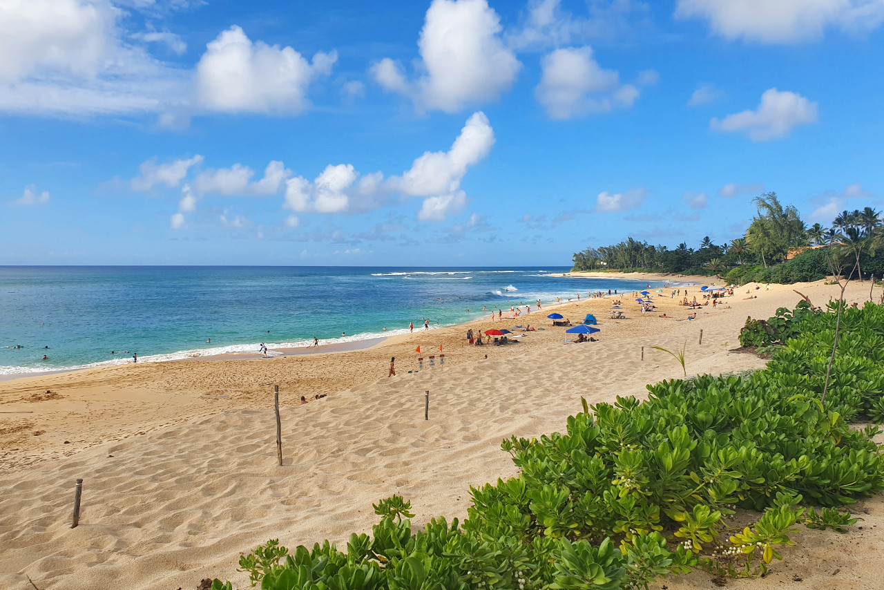 Sunset Beach, Oahu
The official websites
Hawaii
The Aloha State
| Location: | An island group situated in the northern Pacific Ocean |
| Coordinates: | 21° 15′ N, 157° 45′ W |
| Size: | • Main group: 640 km / 400 miles SE–NW; • Complete group: 2,650 km / 1,650 miles SE–NW |
| Terrain: | Eight major islands and 124 minor islands, formed by volcanic activity. |
| Climate: | Tropical climate cooled by trade winds. Warm winters; hot summers |
| Highest point: | Mauna Kea 4,207 m / 13,803 ft |
| Forest: | 43% (2016) (source) |
| Population: | 1,415,872 (2019) |
| Population density: | Low-to-medium (83/km²) |
| Capital: | Honolulu |
| Languages: | English, Hawaiian |
| Human Development Index: | Very High (0.945) |