.jpg)
The Geography of
Angola
Why visit Angola?
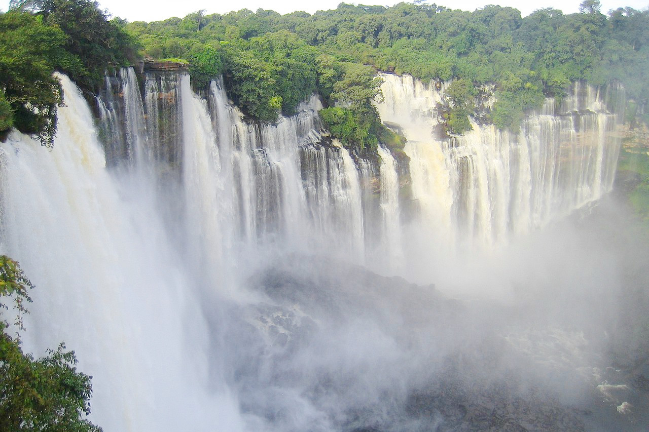
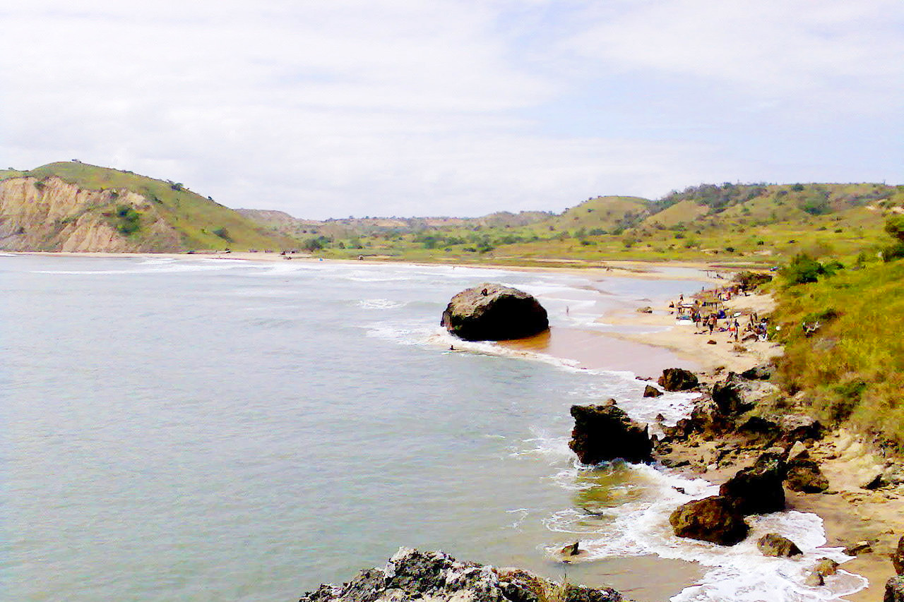
From the central highlands to the desert regions of the south and the long coastline bordering the Atlantic Ocean, Angola's varied landscape has a majestic, breathtaking beauty. The country is naturally endowed with a long summer season and beautiful, sandy beaches.
Contents
Map
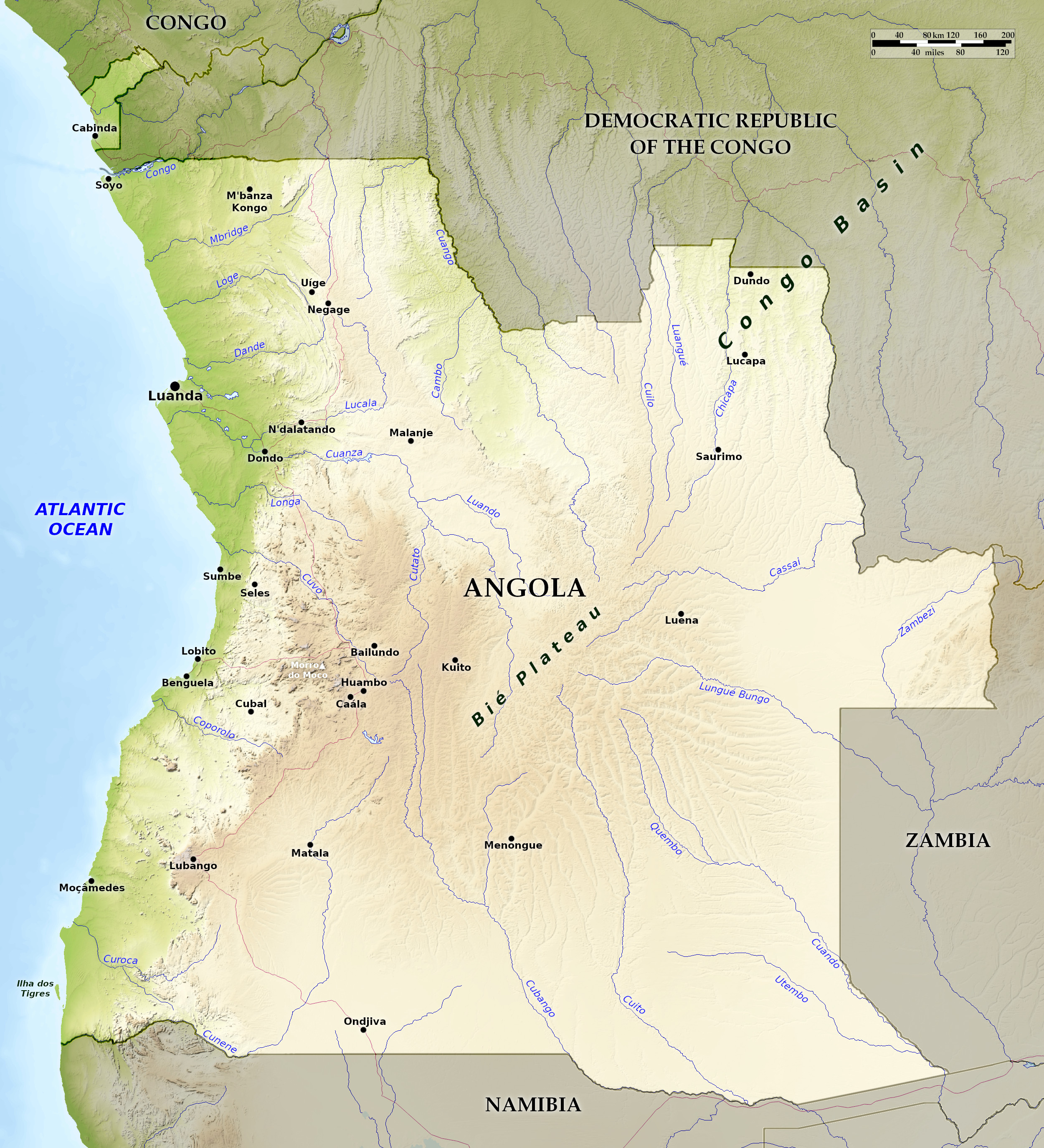 Relief map of Angola
What is the landscape of Angola like?
Angola has three main natural regions: the coastal lowlands, characterized by low plains and terraces; hills and mountains rising inland from the coast to a great escarpment; and an area of plateaux called the high plateau (planalto), extending eastward from the escarpment. The Cabinda exclave, north of Angola, is also part of Angola.
Coastal Lowlands
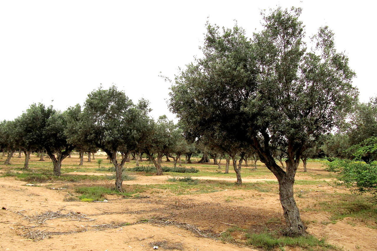
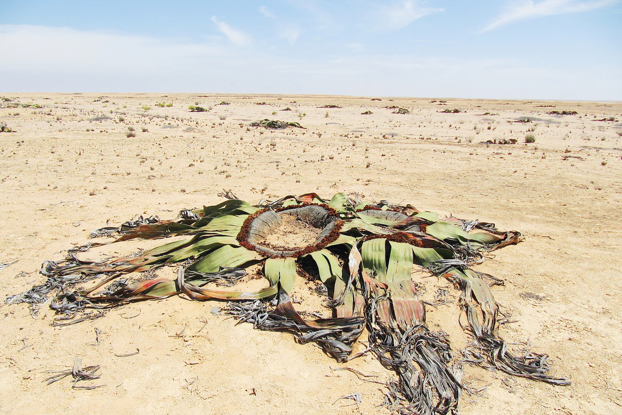
The coastal lowlands rise out of the sea in a series of low terraces. This region varies in width from about 25 kilometers (15 miles) near Benguela to more than 150 kilometers (90 miles) in the Cuanza River valley south of Angola's capital, Luanda, and is distinctly different from Angola's highlands. The Atlantic Ocean's cold, north-flowing Benguela Current significantly reduces rainfall along the coast, making the region relatively arid, or nearly so, south of Benguela (where it forms the northern extension of the Namib Desert), and even in its northern reaches quite becomes dry. Even around Luanda it is not rare for the rain to stay away. Given this rainfall pattern, the extreme south is characterized by sand dunes giving way to dry scrub along the mid-coast. Parts of the northern coastal plain are covered by dense scrub.
The Atlantic coastland is an arid strip that is well irrigated by the west-flowing rivers. The Kwango River, located in the northern region, is a fairly navigable waterway that empties into the Congo River system. The Kwando and Okavango Rivers both drain southeast into the Okavango Swamp. The southernmost rivers in Angola, which flow into the Atlantic, are seasonal and therefore completely dry for much of the year.
Inland Hills
The belt of hills and mountains runs parallel to the coast at distances of 20 to 100 kilometers (12–60 miles) inland. The Cuanza river divides the zone in two. The northern part gradually rises from the coastal zone to an average altitude of 500 meters (1,650 feet), with crests from 1,000 to 1,800 meters (3,300–5,900 feet). South of the Cuanza River, the hills rise steeply from the coastal lowlands, forming a high escarpment that extends from a point east of Luanda and runs south through Namibia. The escarpment reaches 2,400 (7,900 feet) meters at its highest point southeast of Sumbe town and is steepest in the extreme south in the Serra da Chela mountain range.
The High Plateau
The high plateau lies to the east of the hills and mountains and dominates Angola's terrain. The surface of the plateau is typically flat or hilly, but parts of the Benguela Plateau and the Humpata Highland area of the Hufla Plateau to the south reach elevations of 2,500 meters (8,200 feet) and more. The Malanje plateau in the north is rarely higher than 1,000 meters (3,300 feet). The Bié Plateau, also known as the Great Central Plateau, covers most of central Angola. The highest peak in Angola is Mount Moco (Morro de Moco) with an elevation of 2,620 meters (8,596 feet). It is just northwest of Huambo.
The Benguela Plateau and the coastal area in the immediate vicinity of Benguela and Lobito, the Bie Plateau, the Malanje Plateau and a small part of the Hufla Plateau near the city of Lubango have long been among the most densely populated areas in Angola.
What is the nature of Angola like?
.jpg&oldid=660847710)
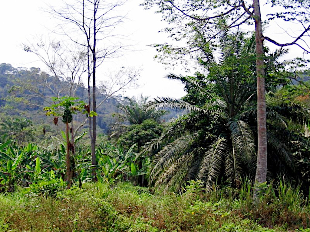
Heavy forests (particularly in Cabinda and the northern districts) cover the humid regions, and the drier areas have thinner savannah-like grass vegetation. The southern desert steppe is sandy and arid with sparse vegetation except along the major rivers. Inconsistent rainfall keeps the far south somewhat dry. The area is characterized by sand dunes giving way to dry scrub (low shrub plants) in the central parts.
Rainfall at the highest points of the central plateau allows deciduous forests to grow, although much of the forest has been cleared for wood and fuel. The climate and soils of these central plateaus support diverse vegetation. Most of the eastern half of Angola is a relatively flat and open plateau characterized by sandy soils.
The fauna includes lions, impalas, hyenas, hippos, rhinos and elephants. There are thousands of bird species and a variety of insects.
What is the climate of Angola like?
See our main article: The Climate of Angola
Angola’s temperatures and climates vary from region to region. The north has a wet, tropical (supports plant growth year round) climate; the east has a moderate tropical climate; and the southern central strip near the border with Namibia has hot, dry desert conditions. There are two seasons in Angola: a dry, cool winter and a hot, rainy summer. Temperatures are hotter along the coast and cooler on the central plateau.
Rainfall varies greatly by region. The annual average rainfall is 50 mm (2 in) near the southern coast (Moçâmedes); 340 mm (13 in) at the northern coast (Luanda); and as high as 1,500 mm (59 in) in the northeast. Some regions of Angola suffer from occasional drought.
| Climate data for Luanda (1961-1990) | |||||||||||||
|---|---|---|---|---|---|---|---|---|---|---|---|---|---|
| Month | Jan | Feb | Mar | Apr | May | Jun | Jul | Aug | Sep | Oct | Nov | Dec | Year |
| Average high °C (°F) | 29.5 (85.1) | 30.5 (86.9) | 30.7 (87.3) | 30.2 (86.4) | 28.8 (83.8) | 25.7 (78.3) | 23.9 (75.0) | 24.0 (75.2) | 25.4 (77.7) | 26.8 (80.2) | 28.4 (83.1) | 28.6 (83.5) | 27.7 (81.9) |
| Daily mean °C (°F) | 26.7 (80.1) | 28.5 (83.3) | 28.6 (83.5) | 28.2 (82.8) | 27.0 (80.6) | 23.9 (75.0) | 22.1 (71.8) | 22.1 (71.8) | 23.5 (74.3) | 25.2 (77.4) | 26.7 (80.1) | 26.9 (80.4) | 25.8 (78.4) |
| Average low °C (°F) | 23.9 (75.0) | 24.7 (76.5) | 24.6 (76.3) | 24.3 (75.7) | 23.3 (73.9) | 20.3 (68.5) | 18.7 (65.7) | 18.8 (65.8) | 20.2 (68.4) | 22.0 (71.6) | 23.3 (73.9) | 23.5 (74.3) | 22.3 (72.1) |
| Average precipitationl mm (inches) | 30 (1.2) | 36 (1.4) | 114 (4.5) | 136 (5.4) | 16 (0.6) | 0 (0) | 0 (0) | 1 (0.0) | 2 (0.1) | 7 (0.3) | 32 (1.3) | 31 (1.2) | 405 (16) |
| Source: Deutscher Wetterdienst | |||||||||||||
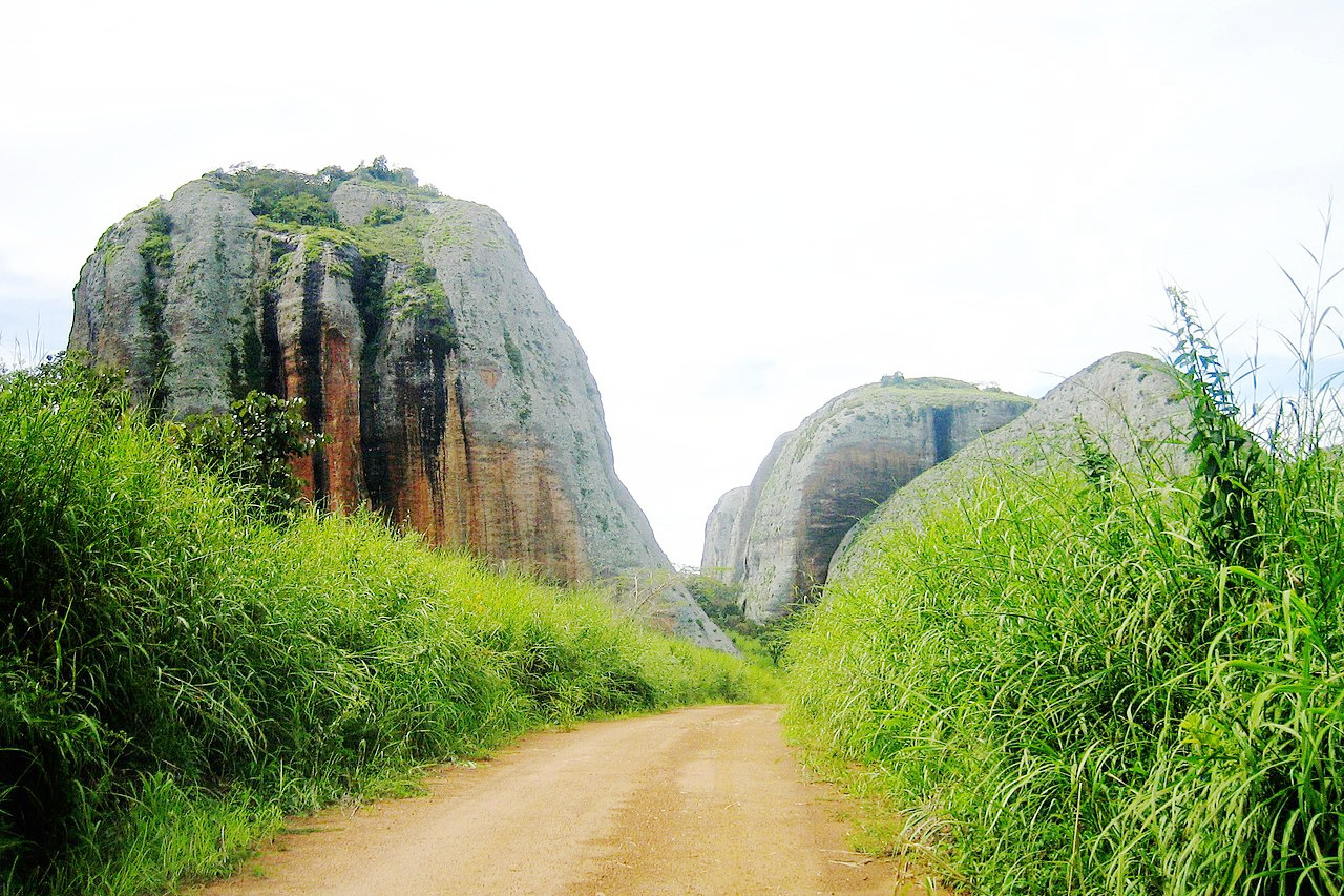
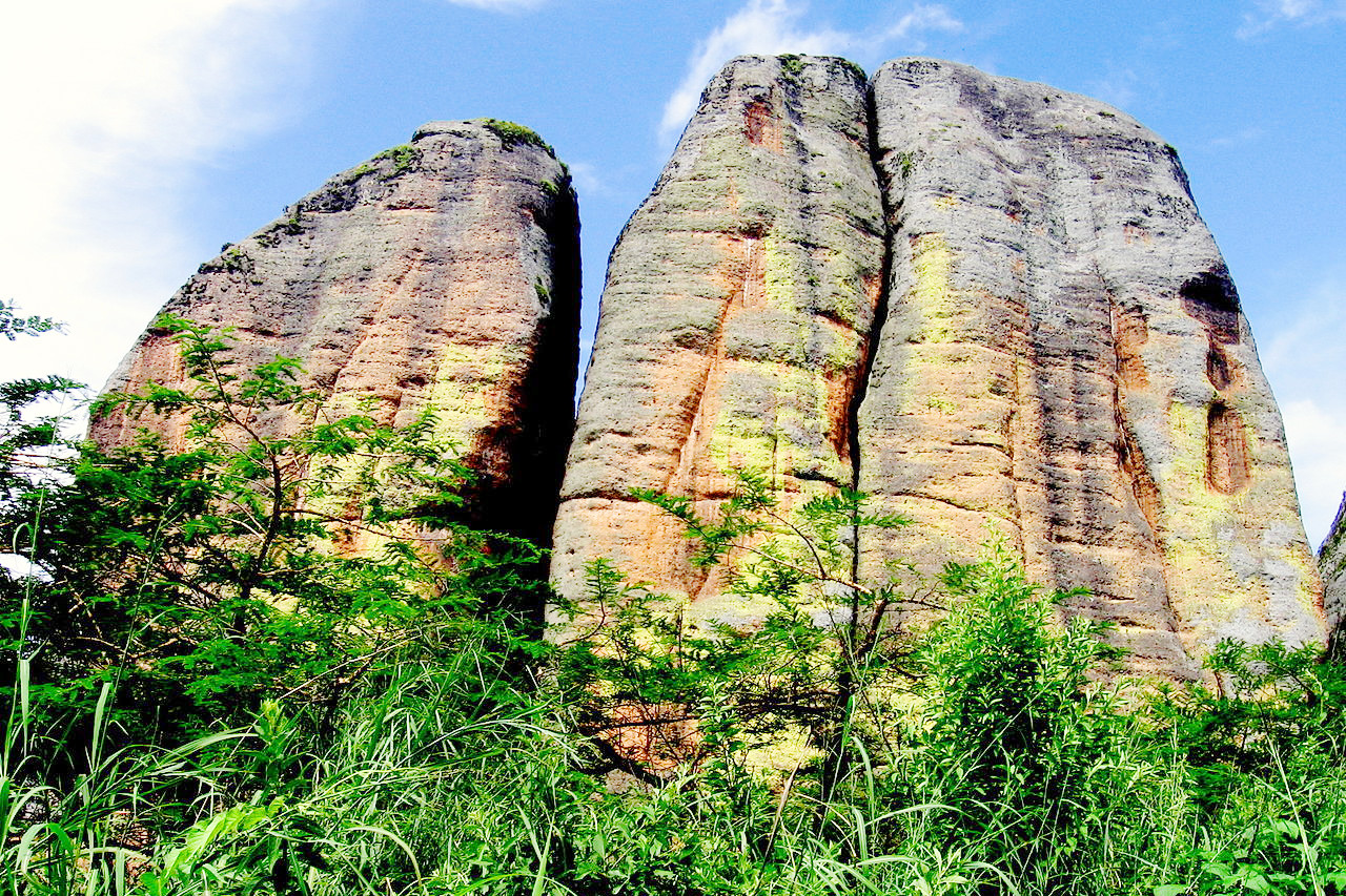
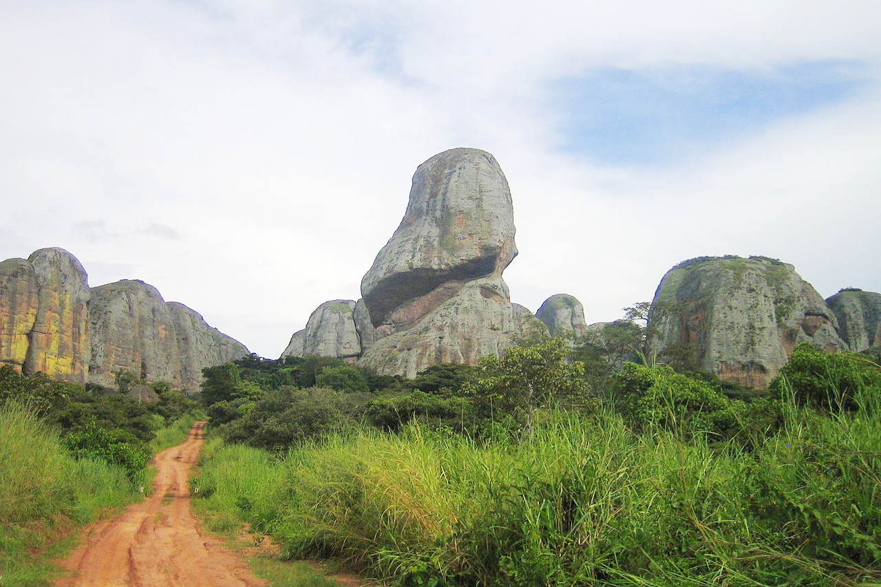 Pungo Andongo, Malange
Angola
A young and fun country
| Location: | Southern Africa, bordering the South Atlantic Ocean, between Namibia and Democratic Republic of the Congo |
| Coordinates: | 12° 30′ S, 18° 30′ E |
| Size: | • 1520 km N-S; 1350 km E-W • 940 miles N-S; 840 miles E-W |
| Terrain: | Narrow coastal plain rises abruptly to vast interior plateau |
| Climate: | Semiarid in south and along coast to Luanda; north has cool, dry season (May to October) and hot, rainy season (November to April) |
| Highest point: | Morro do Moco 2,620 m / 8,600 ft |
| Forest: | 54% (2018 est.) |
| Population: | 34,795,287 (2022 est.) |
| Population density: | Low (25/km²) |
| Capital: | Luanda |
| Languages: | Portuguese 71.2% (official), Umbundu 23%, Kikongo 8.2%, Kimbundu 7.8%, Chokwe 6.5%, Nhaneca 3.4%, Nganguela 3.1%, Fiote 2.4%, Kwanhama 2.3%, Muhumbi 2.1%, Luvale 1%, other 3.6% |
| Human Development Index: | Medium (0.586) |
Related entries
-
Namibia
• Endless Horizons -
Zambia
• The Real Africa -
Democratic Republic of the Congo
• Justice, Paix, Travail -
South Africa
• Alive with Possibility