The Geography of
Zambia
Why visit Zambia?
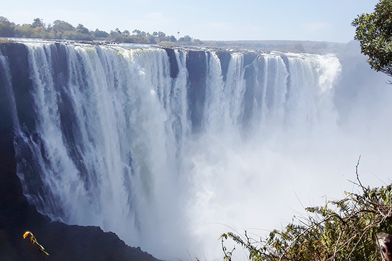
Zambia is a very beautiful country. Located in the heart of Africa, it is a fertile land, with green hills, tropical-like forests, and a lovely climate. Diverse and beautiful landscapes captivate visitors at every turn. A large number of tourists from all over the world visit Zambia annually to witness the magnificent beauty of the Victoria Falls. Zambia also appeals to those who love wildlife and truly wild areas.
Contents
Map
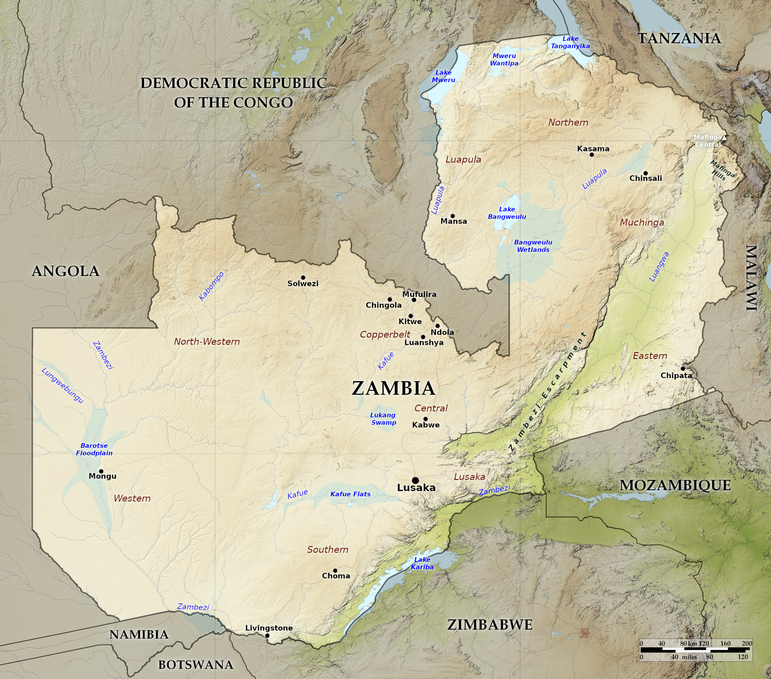 Relief map of Zambia
What is the landscape of Zambia like?
Most of Zambia lies on a portion of the great plateau that dominates central and southern Africa's landmass. Some of that plateau is undulating, some relatively flat, but most of it ranges between 900 and 1,500 meters (3,000–5,000 feet), the higher sections (above 1,200 m / 4,000 ft) occurring, for the most part, in the north. The few areas of still higher land (some of it above 2,000 m / 6,500 ft) are found in the northeast, chiefly along the borders with Tanzania (the Mbala Highlands) and Malawi (the Mafingi Mountains). The significant areas of lower land are rift valleys in the east (the Luangwa River valley) and in the south (the middle Zambezi River valley), both bounded by escarpments.
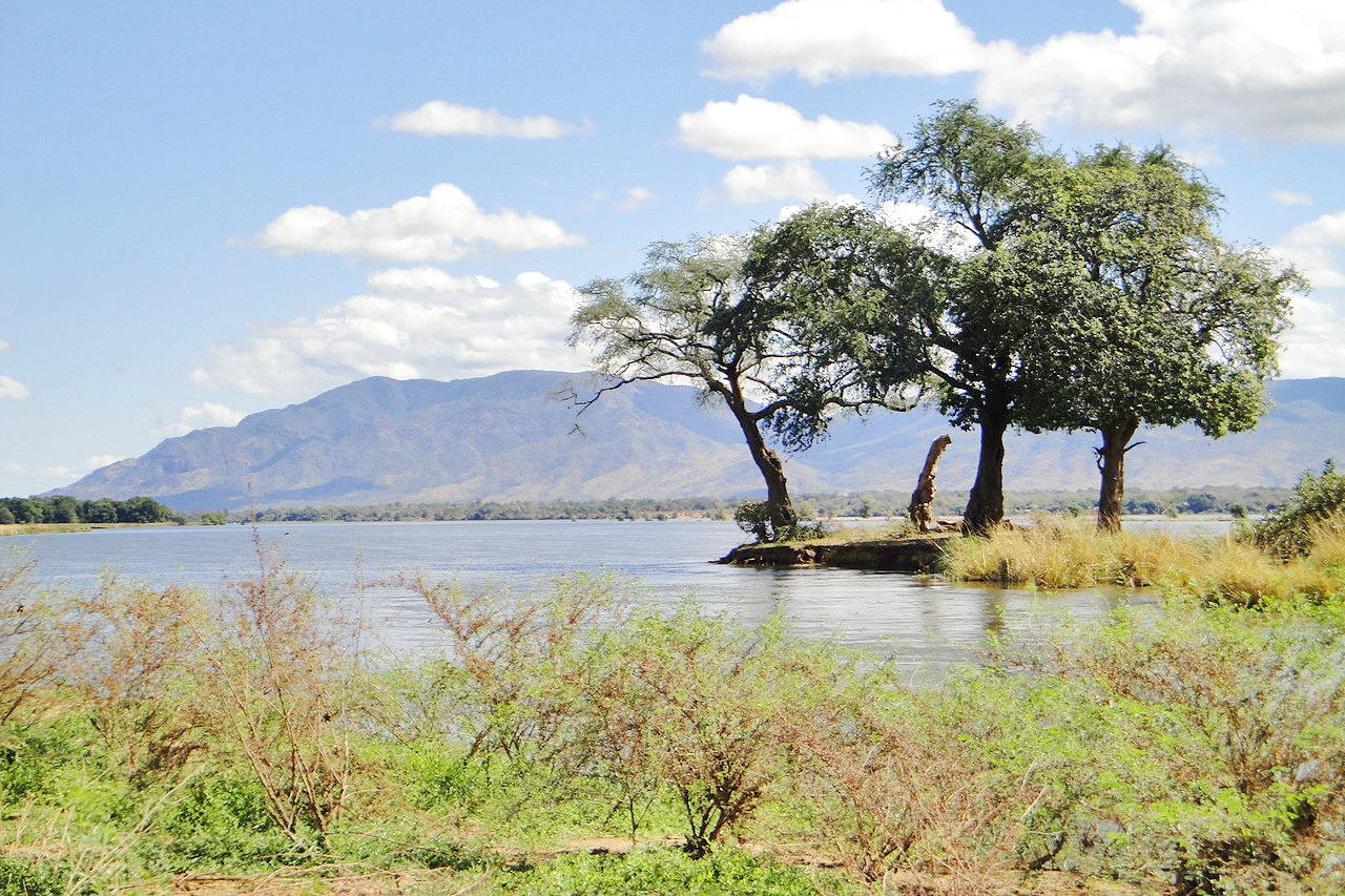
The mountains and plateaus recede as the land is cut by the Luangwa River in the east and the Kafue River in the west, both of which are tributaries of the Zambezi, which flows to the south of the country through the wondrous Victoria Falls and the artificial Lake Kariba. The rivers of Zambia contribute hugely to the country's biodiversity and complex ecosystems. The upper Zambezi, running roughly from north to south, has a low gradient, and the area through which it passes is marked by floodplains and swamps. After turning eastward, the Zambezi flows over Victoria Falls and through the middle Zambezi valley, much of it occupied by the great man-made Lake Kariba.
Plateau land in the northeastern and eastern parts of the country is broken by the low-lying Luangwa River, and in the western half by the Kafue River. Much of the upper Kafue River is also characterized by a low gradient , with extensive swamps. The Kafue River is the longest river wholly within Zambia, the river flows south and then east from the Copperbelt, passing through the Kafue, Lochinvar, and Blue Lagoon National Parks. The Lukanga, Busanga, and the Kafue Flats are wetlands of international importance.
The second tributary of the Zambezi, the Luangwa, occupies the western section of the Great Rift Valley,. The river flows for about 800 kilometers (500 miles) southwestward, with the Muchinga Escarpment on its western side. With its floodplain, oxbow lakes, and pronounced meanders with sand banks, the Luangwa Valley has a rich diversity of animals.
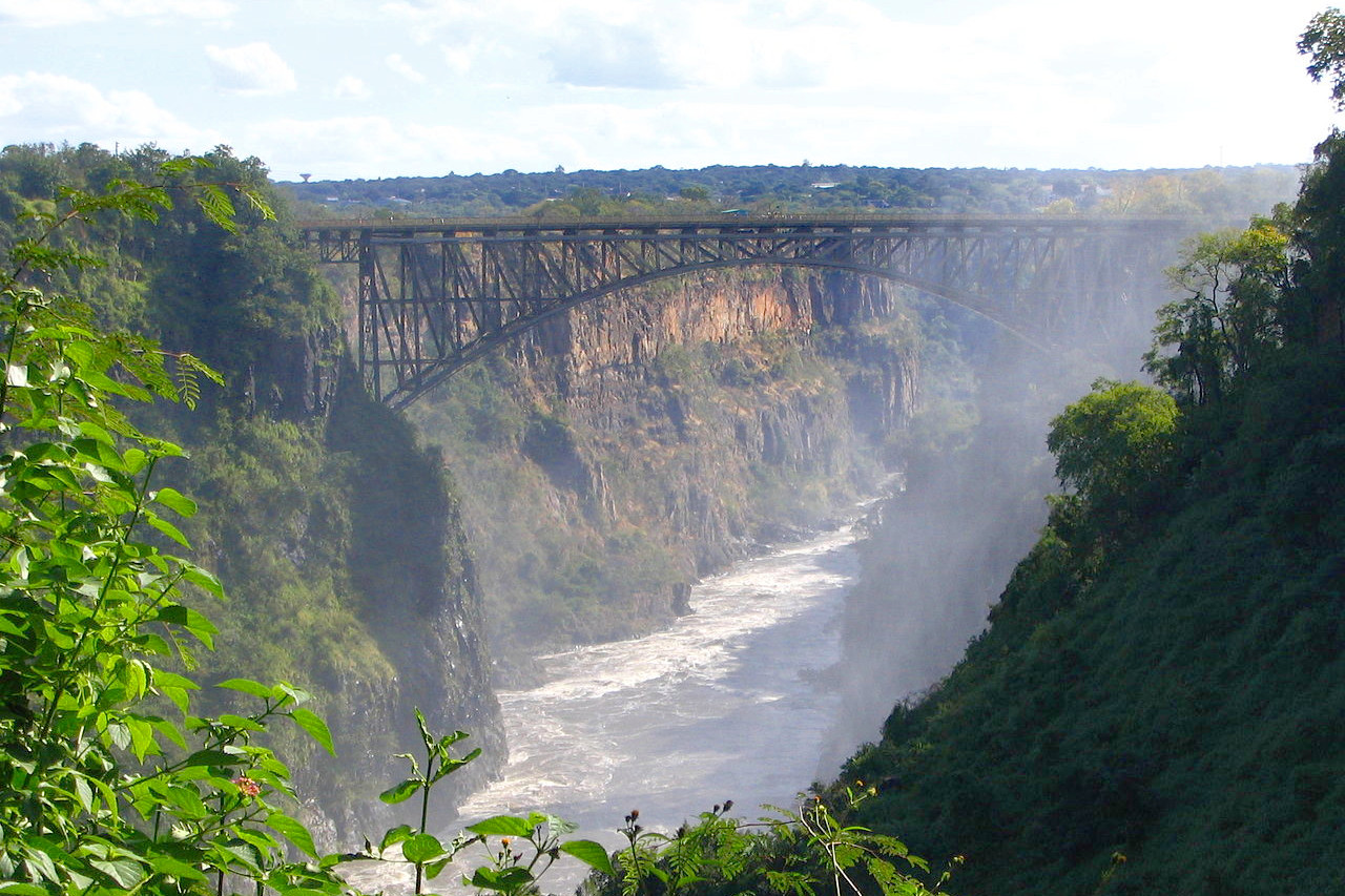
The world-famous, majestic Victoria Falls, straddling the border between Zimbabwe and Zambia, cascade from a height of 108 meters (355 feet) at their maximum and span a width of nearly 1.5 kilometers (1 mile). Two other significant waterfalls are found in Zambia. Just 300 kilometers (185 miles) from Victoria Falls, Ngonye, or Sioma, Falls, features horseshoe-shaped drops. East of the Nsumbu National Park are the Kalambo Falls, which flow from the Kalambo River into Lake Tanganyika. These falls are the second-highest continuous waterfalls on the continent, plunging 220 meters (725 feet).
Passing through a series of gorges with rapids and smaller falls, the Zambezi flows into the man-made Lake Kariba, more than 124 miles (200 km) from the Victoria Falls. Lake Kariba is one of the world’s largest manmade lakes ; it was formed on the Zambezi by the construction of the Kariba Dam. The Zambezi continues to flow eastward before being joined y its tributary, the Kafue River, near Chirundu. Bisecting the Lower Zambezi National Park in Zambia and the Mana Pools National Park in Zimbabwe, the Zambezi is joined by the Luangwa River at the town of Luangwa.
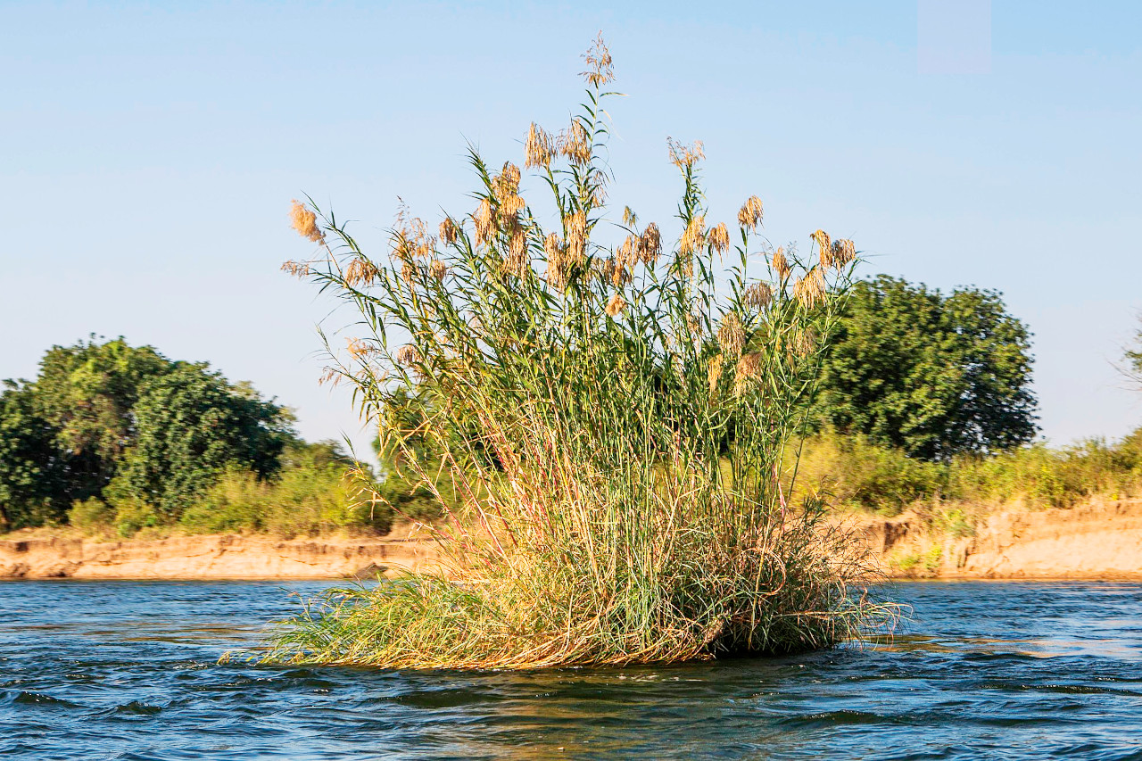
There are three large natural lakes—Bangweulu, Mweru, and Tanganyika—all in the northern area. Lake Tanganykia is the largest lake, although only the southern tip extends into Zambia. Lake Bangweulu and several smaller bodies of water are part of the Bangweulu swamp complex, and are drained by the Luapula River. The main swamp is permanently flooded; the periphery (a belt about forty kilometers wide) is flooded during and immediately after the rainy season. This is a beautiful, undisturbed corner of Zambia, and is home to the extraordinary-looking shoebill stork, and is the only place in the world where the black lechwe antelope are found. In the Western Province the Zambezi also creates the huge Barotse Floodplain, where, at the end of the rainy season, the river can reach a width of about 25 kilometers (16 miles).
What is the nature of Zambia like?
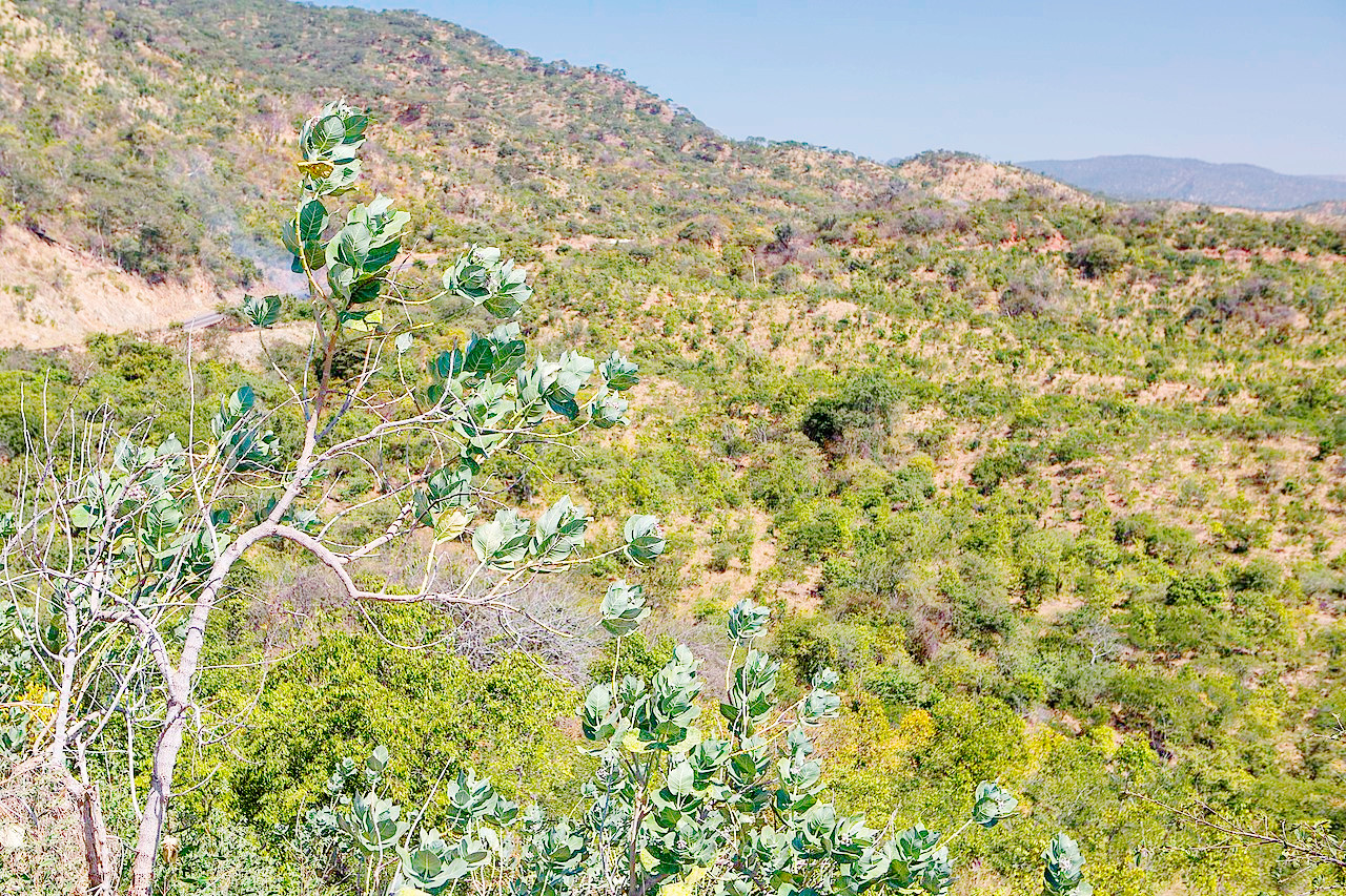
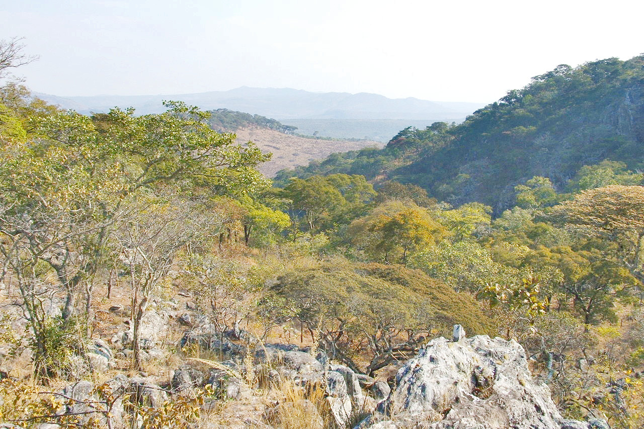
The high plains of Zambia are covered by open to moderately dense deciduous forests that have numerous grassy areas. Acacia and baobab trees, thorn trees and bushes, and tall perennial grasses are widespread, becoming coarser and sparser in the arid regions. The drier areas in the west are more desert-like, but the tropical Zambezi valley supports a wider variety of flora. A narrow belt of low hills covered by savanna and forest extends across the eastern part of the country. Hill areas are also found along most of the Tanzania, Malawi, and Mozambique borders. Marshes occur in a northern lake region east of Zaire and along the Kafue River in central Zambia.
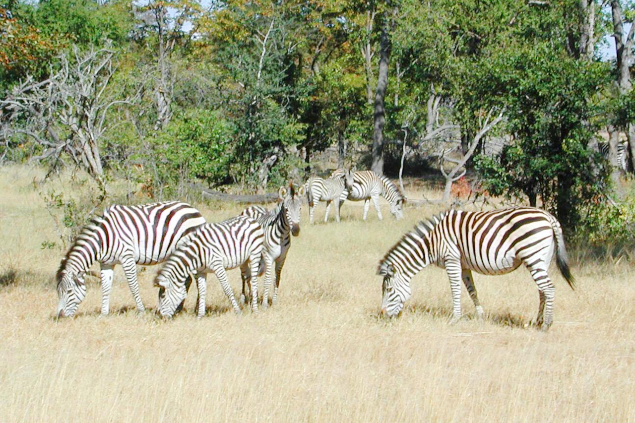
Zambia is spectacularly endowed with wildlife, having more than a hundred species of mammals and more than seven hundred species of birds. The national parks, such as the Kafue National Park, conserve the wildlife. The many varieties of antelope include kudu, puku, lechwe, impala, duiker, and steenbok. In Luangwa Valley can be found giraffe, zebra, rhinoceros, elephant, baboon, monkey, hyena, wolf, and lion. Two rare subspecies, unique to Zambia, include Cookson’s wildebeest and Thornicroft's giraffe.
What is the climate of Zambia like?
See our main article: The Climate of Zambia
Although Zambia lies within the tropics, much of it has a warm temperate climate because of the altitude. The hottest months of the year are August through October, when daily temperatures often reach a high of 30°C to 32°C (86°F to 89°F). The months of May through July are only slightly cooler, with temperatures ranging from 17°C to 26°C (63°F to 79°F). At night, however, temperatures may drop as low as 5°C (41°F).
The rainy season begins in November and lasts until April; heavy tropical storms occur often. Rainfall decreases from north to south. Average annual rainfall is about 1,250 mm (50 inches) in the north and 750 mm (30 inches) in the south.
| Climate data for Lusaka | |||||||||||||
|---|---|---|---|---|---|---|---|---|---|---|---|---|---|
| Month | Jan | Feb | Mar | Apr | May | Jun | Jul | Aug | Sep | Oct | Nov | Dec | Year |
| Average high °C (°F) | 27.4 (81.3) | 27.4 (81.3) | 27.5 (81.5) | 27.1 (80.8) | 25.8 (78.4) | 23.8 (74.8) | 24.0 (75.2) | 26.5 (79.7) | 30.3 (86.5) | 31.7 (89.1) | 30.4 (86.7) | 27.7 (81.9) | 27.5 (81.5) |
| Daily mean °C (°F) | 21.5 (70.7) | 21.5 (70.7) | 21.1 (70.0) | 19.9 (67.8) | 17.4 (63.3) | 15.2 (59.4) | 14.9 (58.8) | 17.3 (63.1) | 21.3 (70.3) | 23.5 (74.3) | 23.4 (74.1) | 21.7 (71.1) | 19.9 (67.8) |
| Average low °C (°F) | 17.6 (63.7) | 17.4 (63.3) | 16.4 (61.5) | 14.0 (57.2) | 10.7 (51.3) | 7.8 (46.0) | 7.2 (45.0) | 9.2 (48.6) | 12.9 (55.2) | 16.2 (61.2) | 17.4 (63.3) | 17.8 (64.0) | 13.7 (56.7) |
| Average precipitation mm (inches) | 245.4 (9.66) | 185.9 (7.32) | 95.0 (3.74) | 34.7 (1.37) | 3.1 (0.12) | 0.0 (0.0) | 0.1 (0.00) | 0.4 (0.02) | 1.7 (0.07) | 18.4 (0.72) | 89.3 (3.52) | 208.1 (8.19) | 882.1 (34.73) |
| Source: NOAA | |||||||||||||
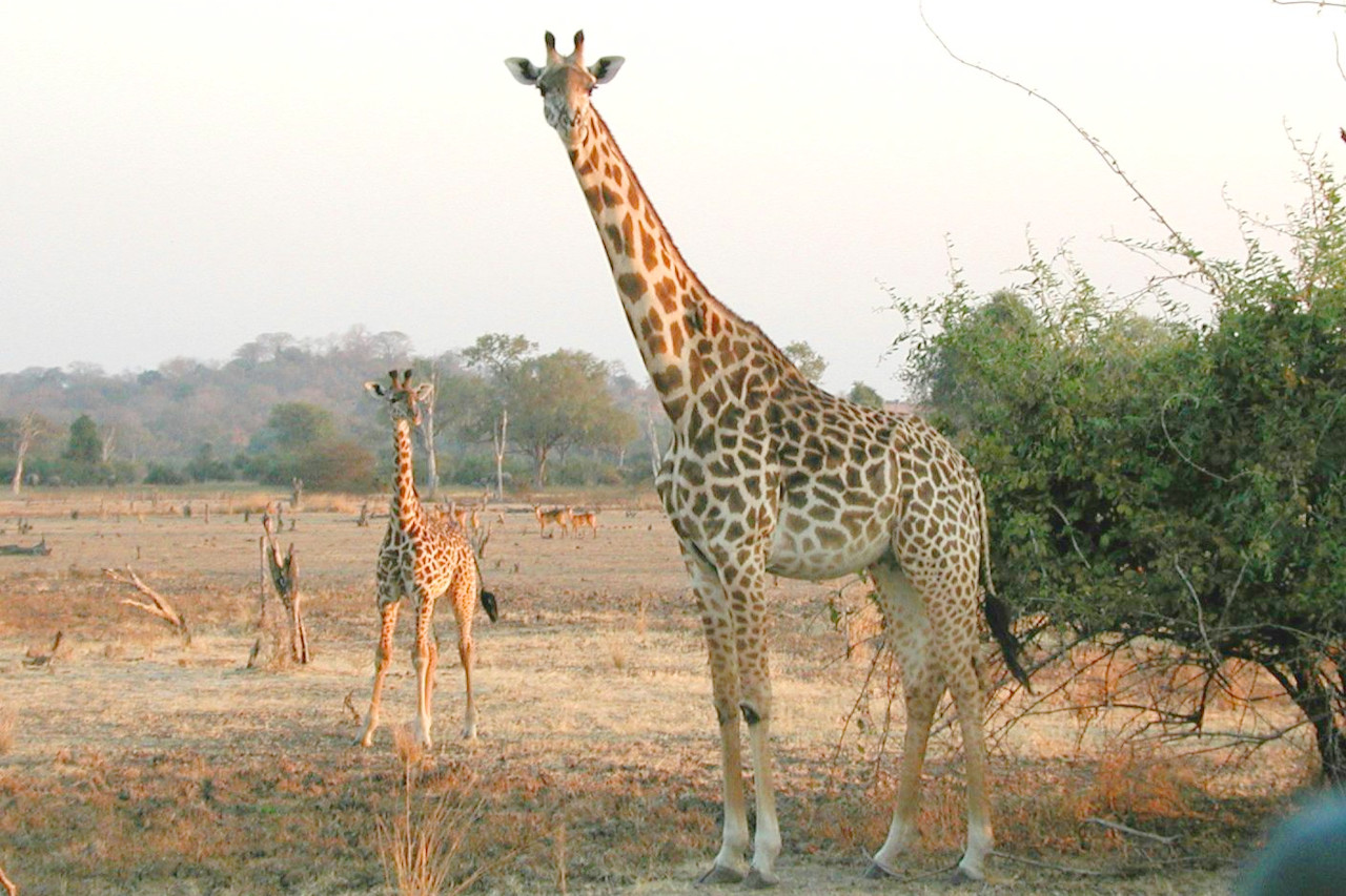 A Giraffe mother and her calf in the South Luangwa National Park
The official websites
Zambia
The Real Africa
| Location: | Southern Africa, east of Angola, south of the Democratic Republic of the Congo |
| Coordinates: | 15° 00′ S, 30° 00′ E |
| Size: | • 1130 km N-S; 1310 km E-W • 700 miles N-S; 810 miles E-W |
| Terrain: | Mostly high plateau with some hills and mountains |
| Climate: | Tropical, but modified by altitude; rainy season (October to April) |
| Highest point: | Mafinga Central 2,339 m / 7,674 ft |
| Forest: | 66.3% (2018 est.) |
| Population: | 19,642,123 (2022 est.) |
| Population density: | Low (26/km²) |
| Capital: | Lusaka |
| Languages: | Bemba 33.4%, Nyanja 14.7%, Tonga 11.4%, Lozi 5.5%, Chewa 4.5%, Nsenga 2.9%, Tumbuka 2.5%, Lunda (North Western) 1.9%, Kaonde 1.8%, Lala 1.8%, Lamba 1.8%, English (official) 1.7%, Luvale 1.5%, Mambwe 1.3%, Namwanga 1.2%, Lenje 1.1%, Bisa 1%, other 9.7% |
| Human Development Index: | Medium (0.565) |