The Geography of
South Africa
Why visit South Africa?
South Africa is full of colour and contrasts, and it's one of the most beautiful places on the planet to visit, with its stunning landscapes. The scenery of South Africa is varied and picturesque, from rolling hills to extensive plains. There are also many interesting historical sites to explor, including Cape Town’s waterfront and Table Mountain’s cable cars. The people are friendly and welcoming—no matter where you go in South Africa. You will feel at home almost immediately!
Contents
Map
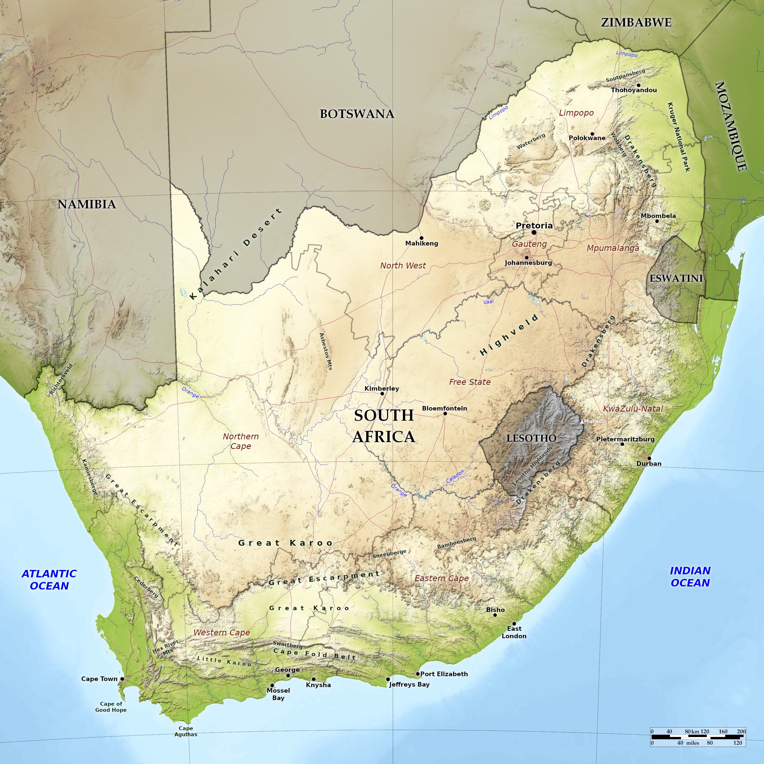 Relief map of South Africa
What is the landscape of South Africa like?
Western and Eastern Cape
All along the coast of Western and Eastern Cape there is a low coastal strip bordering the ocean which varies in width from a few miles to as many as fifty. Behind this low strip the country rises, sometimes up steep slopes, sometimes in successive terraces. The western coastline runs in a general southeast direction with only a few natural harbours; the shores consist of stretches of white sand or thin soil sparsely covered with shrubs.
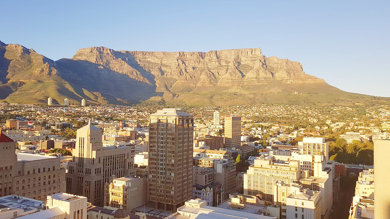
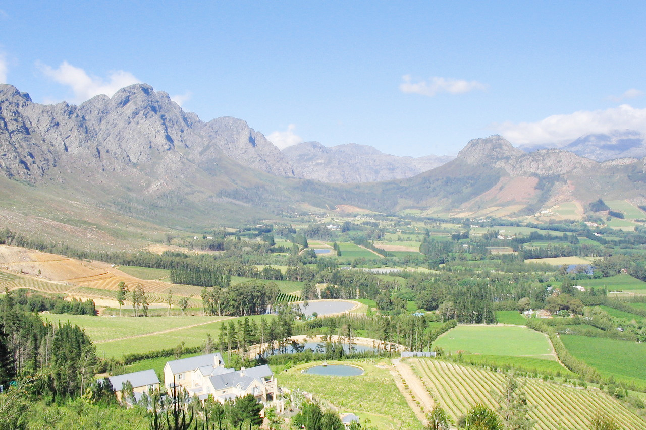
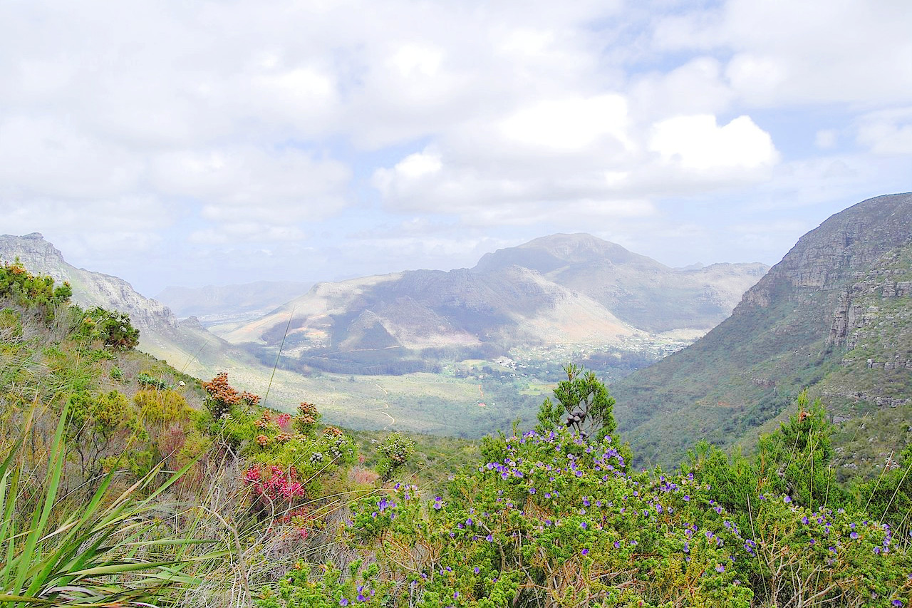
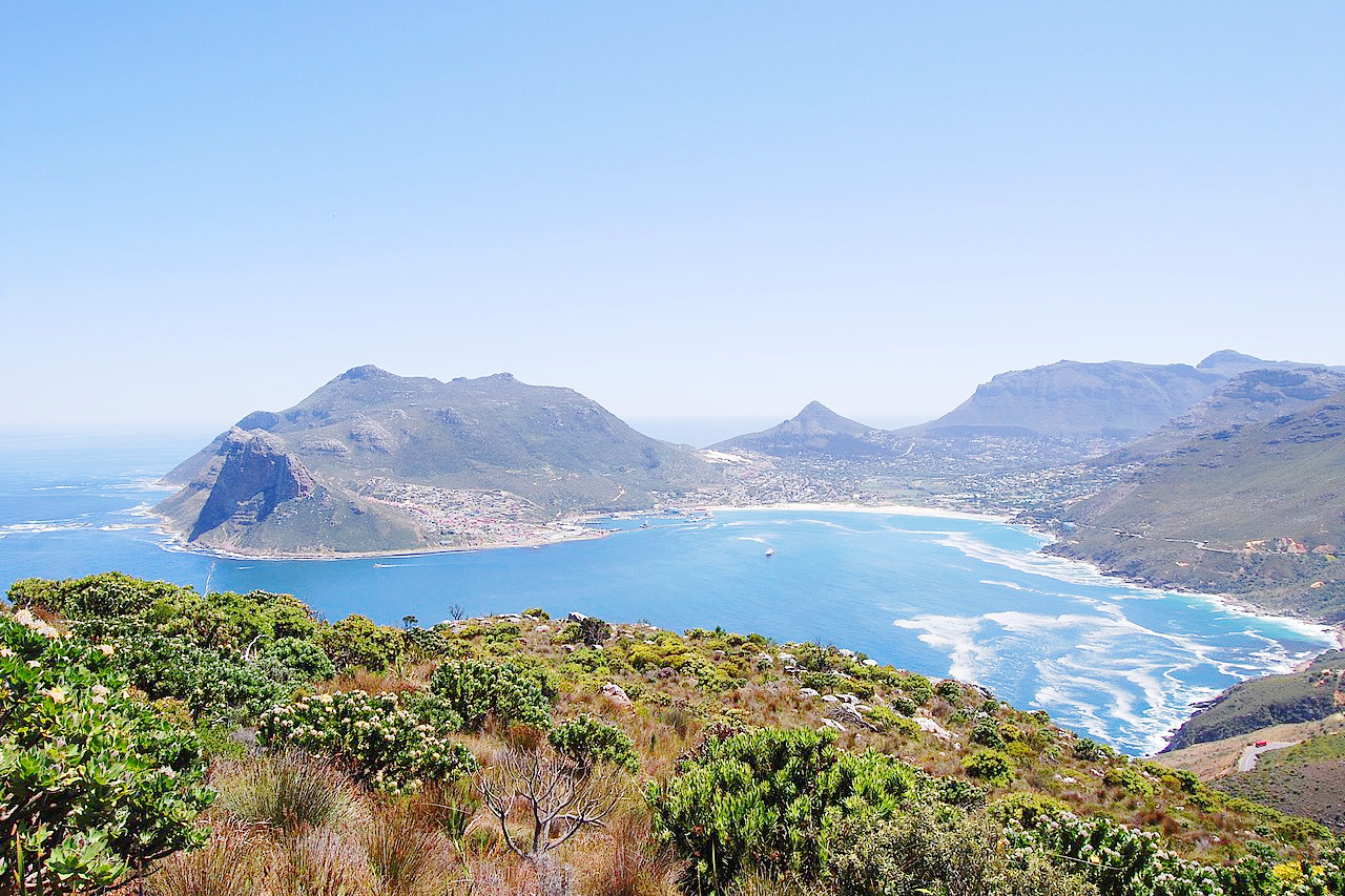
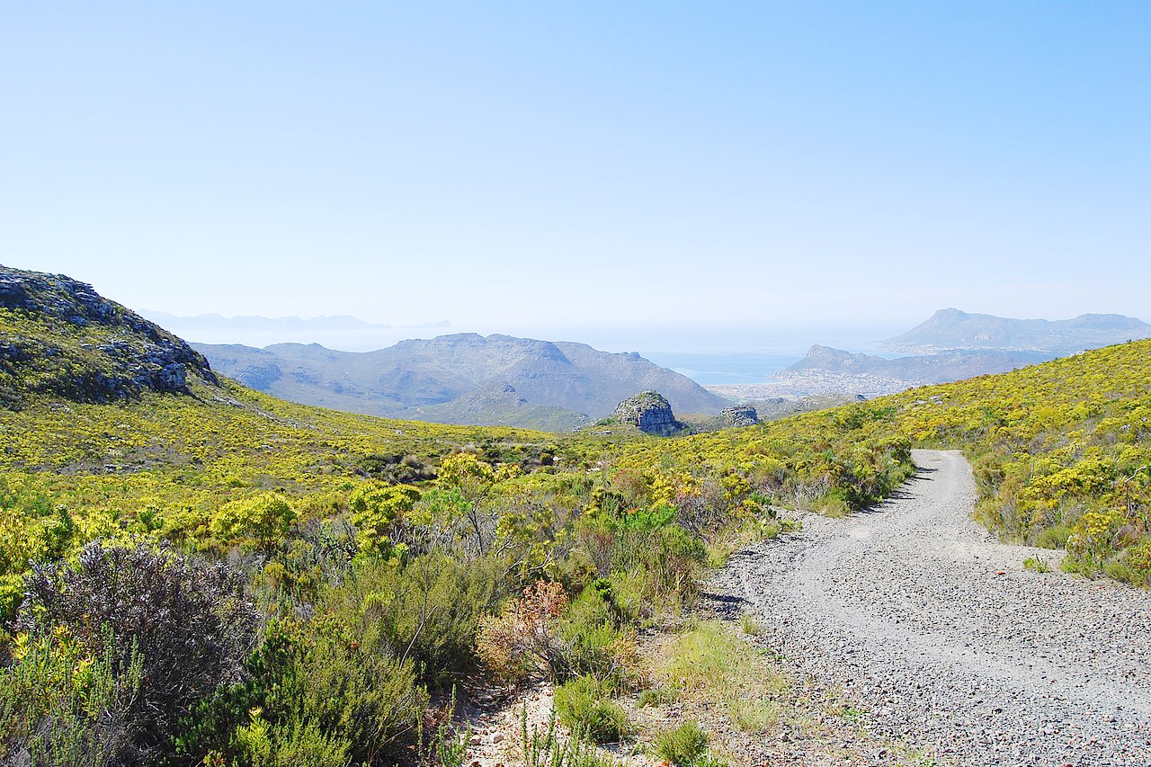
The southwestern corner is distinguished from the rest of South Africa by its Mediterranean climate. The whole region experiences hot dry summmers and cool rainy winters. The Cape Peninsula juts out beyond the normal coast line and consists of an isolated range of hills. Few cities in the world are more magnificently situated than Cape Town. Behind the bay the massive wall of Table Mountain, 2 miles in length, rises to a height of over 1,000 meters (3,300 feet), while on the east and west projecting mountains enclose the plain in which the city lies. The mountain to the east is the Devil's Peak (1,000 m / 3,300 ft), that to the west the Lion's Head (over 600 m / 2000 ft high), with a lesser height in front called the Lion's Rump or Signal Hill. The greater part of the Cape Peninsula is wild and rugged with magnificent coastal and mountain scenery.
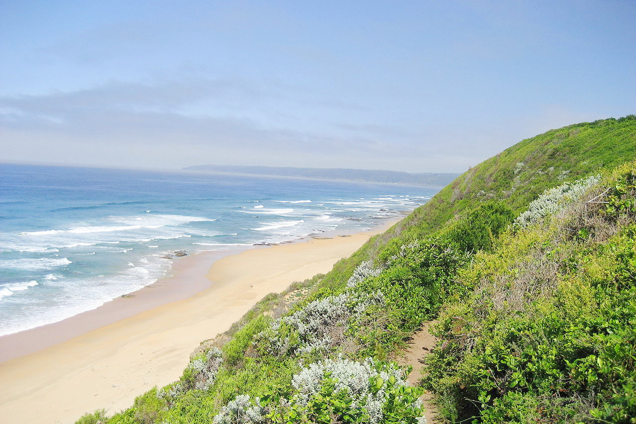
Rounding the storm-vexed Cape of Good Hope the coast heads southeast in a series of shallow bays, until at the saw-edged reefs of Cape Agulhas, the southernmost point of the African continent is reached. The Cape Flats lying to the east of the Cape peninsula comprise a sandy lowland, crossed by slow moving rivers and coastal dunes. To the east begins the Garden Route, a 190-mile stretch of the coast of South Africa which extends into Eastern Cape. From here the green-clad sides of the forested mountains are seen and many mountain streams carrying their waters to the ocean.
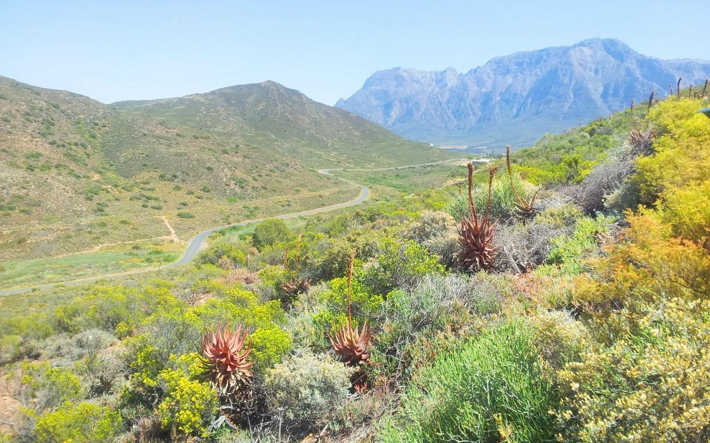
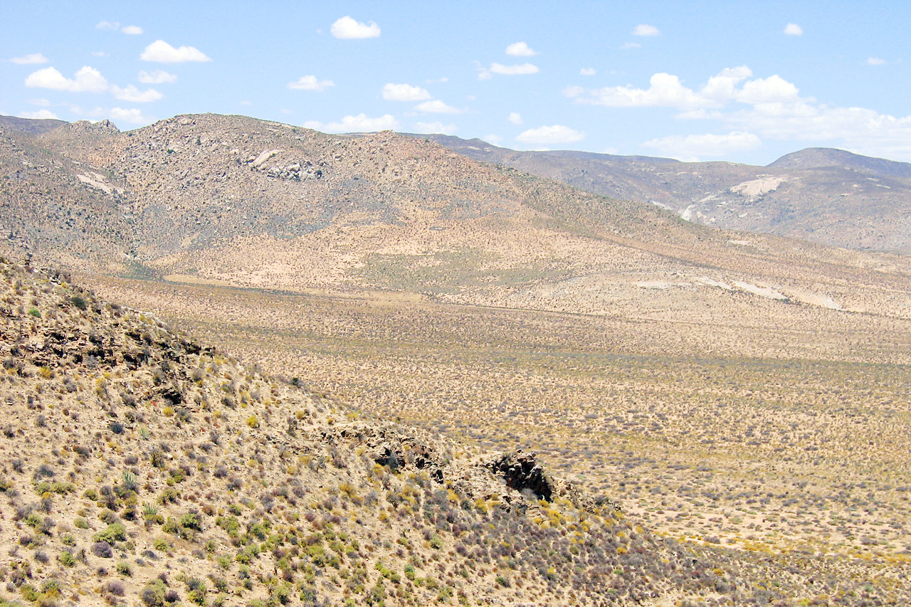
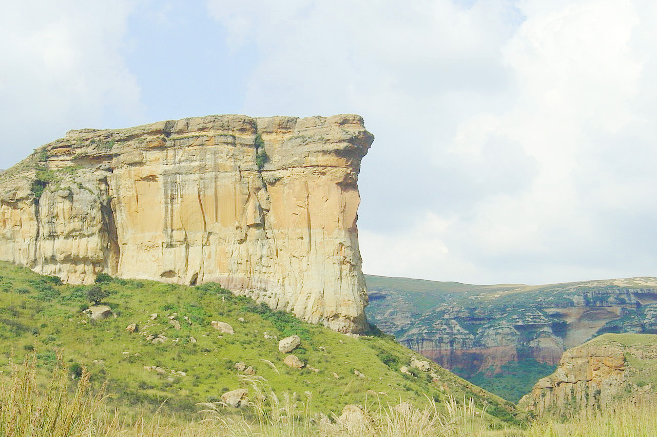
Beyond the coast plain are mountain ranges running parallel to the shore and the land rises by well-marked steps. Behind the first set of ranges is a narrow plateau rarely more than 40 miles wide. This plateau is called the Southern or Little Karoo, Karoo being a corruption of a Khoekhoe word meaning dry, arid. Beyond the second range of hills there is another tableland—the Great Karoo.
The Great Karoo is an excessively dry region, with no such thing as a running stream during a great part of the year, nor, indeed, any moisture, save in a few places shallow pools which almost disappear in the dry season. It is virtually a desert, bearing no trees, though there are plenty of prickly shrubs and small bushes, such as the mimosa which generally marks the river beds. After the early rains the bush bursts into gorgeous purple and yellow blossoms and vivid greens. The brilliancy of the air, the warmth of the days, and the coldness of the nights remind one who traverses it of the deserts of Western America.
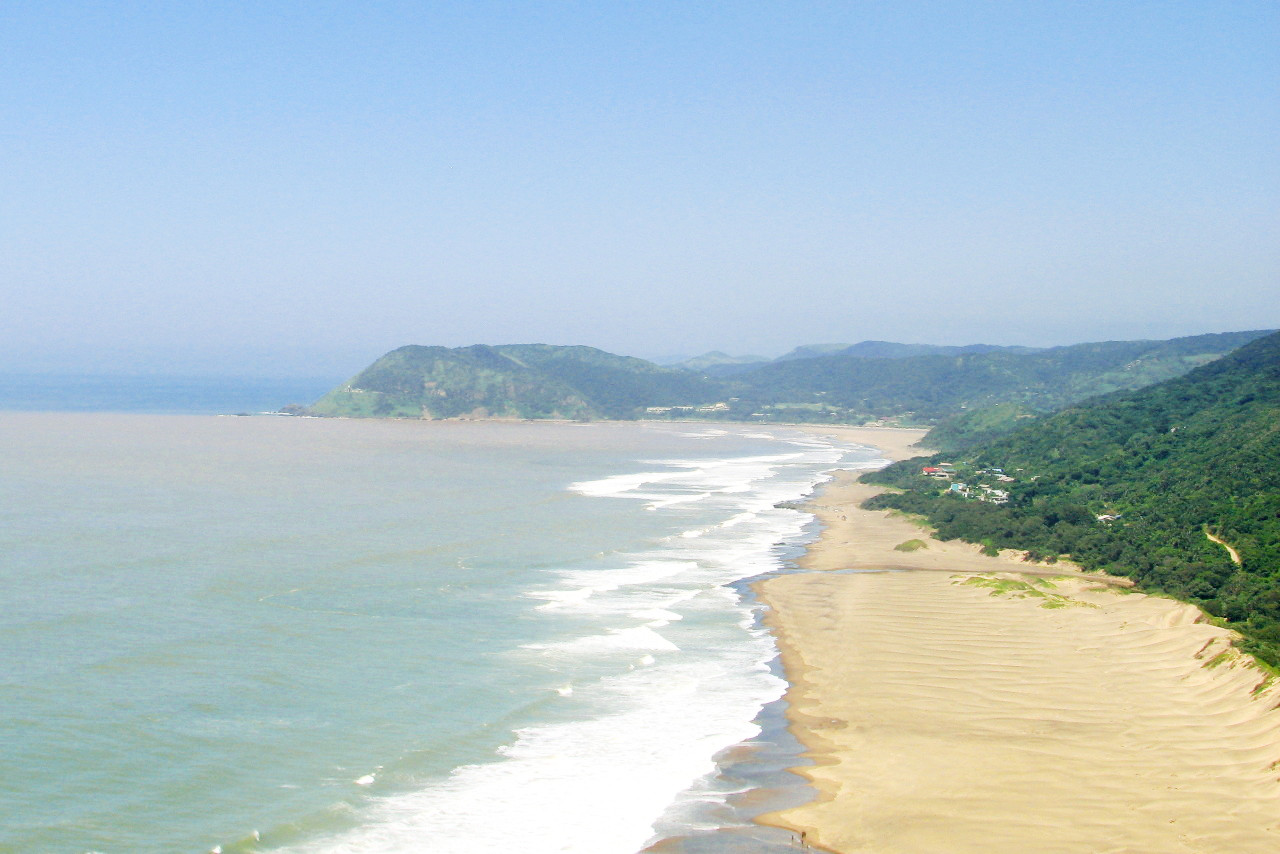
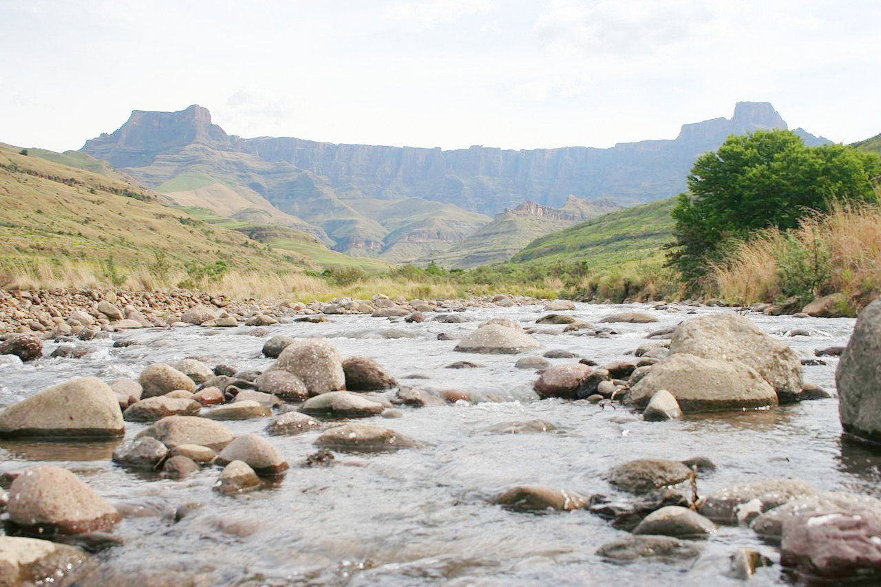
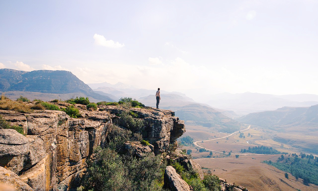
The innermost chain of mountains, the Great Escarpment, follows the curve of the coast from west to east through the Cape regions, and then continues further east under the name of the Drakensberg. In the Sneeuberge range is Compassberg (2,502 meters / 8,209 feet), the highest peak in western half of the country. The southeastern part of the Great Escarpment, including the hilly country descending to the sea, has a heavier rainfall and is in some places covered with forest. Here the grass is richer and the valleys fertile. The southeast stretch of the coast from East London to the border of KwaZulu-Natal is known as the Wild Coast, and is a famous attraction for those seeking beautiful scenery.
Northern Cape and North West
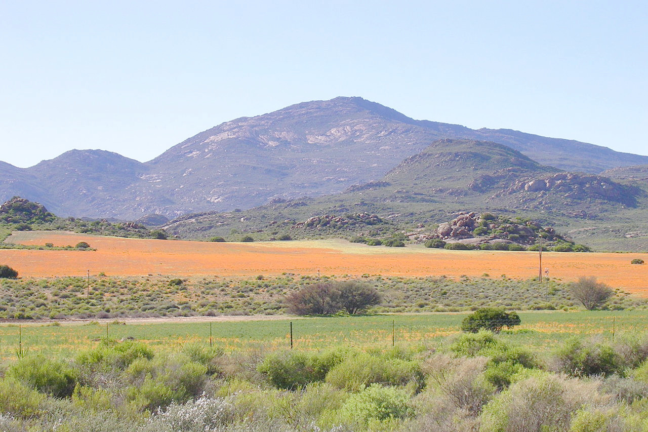
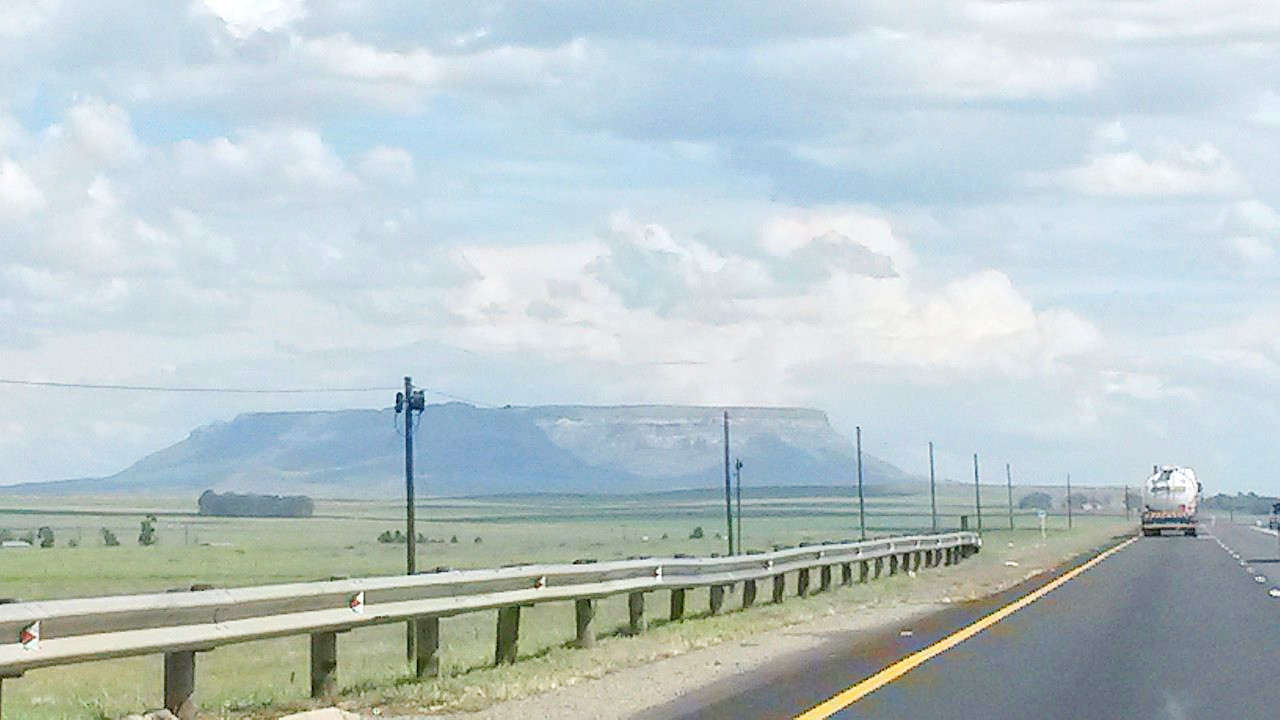
The vast northern plains of Northern Cape are part of the inner tableland of the continent and also go by the name of Karoo. It is equally arid with wide rolling treeless plains crossed by the beds of many rivers, which are dry for a great part of the year. It has an average elevation of 1,000 meters (3,300 feet), being a little higher in the eastern than in the western districts. It is a vast region in which every hill looks alike, but the bare patches of brilliant red soil between the scattered gray-green shrubs lend color to the scene.
The tableland is broken by the Orange River, which traverses its whole length. North of the river the plateau slopes northward to a level sometimes as low as 600 meters (2,000 feet). The country here is even more wild than south of the Orange. Rising from the plains are chains of isolated flat-topped hills such as the Asbestos mountains.
The eastern part is more generally elevated than the western. From Kimberley to Mahikeng, the country rises to 1,200 meters (4,000 feet) or more above sea-level; much of it is nearly level, and almost all of it bare of trees. It is better watered than the western districts, and it therefore becomes grassland after the rains.
KwaZulu Natal
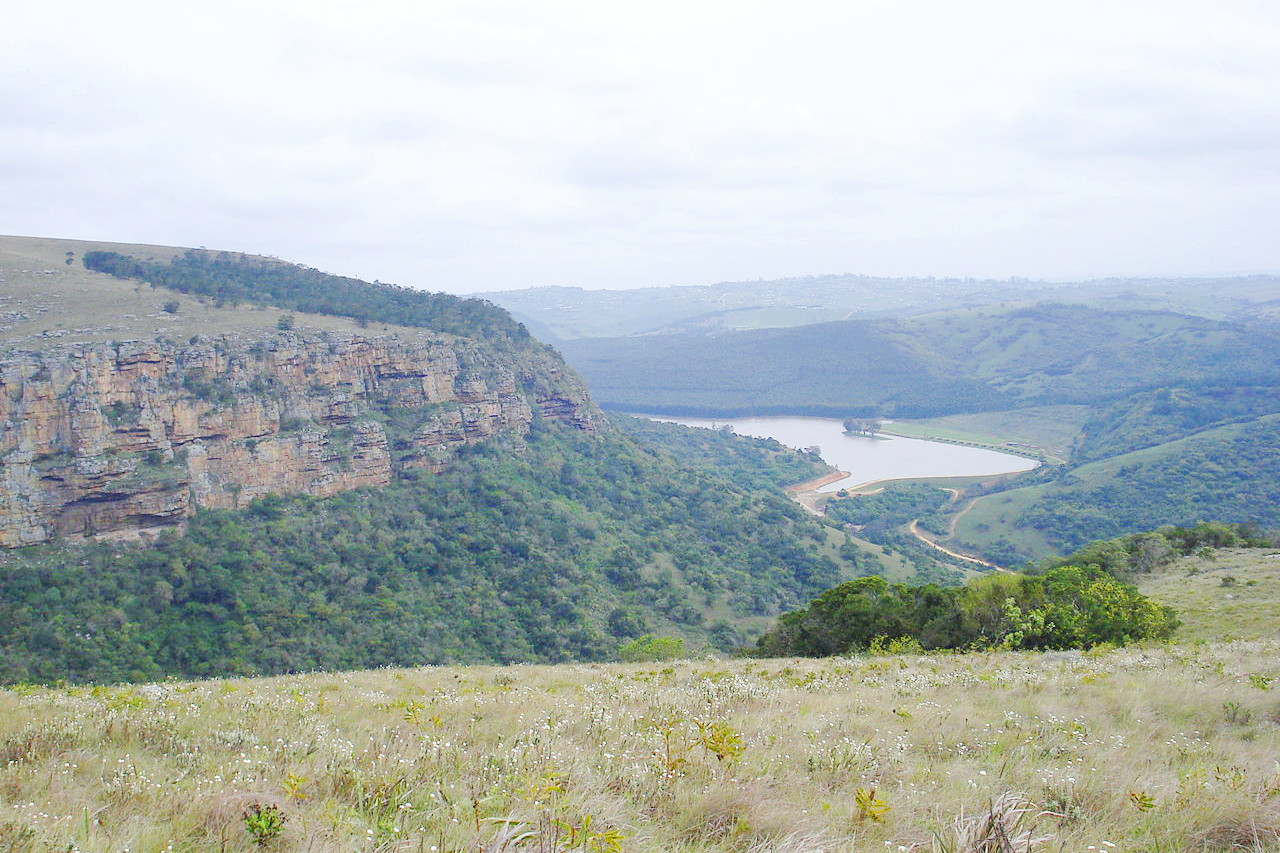
The easternmost province of South Afruca is KwaZulu Natal. It lies on the sea slope of the hills descending from the Drakensberg Range. It is hilly or undulating, with a great variety of surface; and it is also comparatively well watered, with a perennial river in every valley. Hence there is plenty of grass, and towards the coast plenty of trees also, while the loftier interior is bare. The climate is much warmer than that of Cape Colony, and in the narrow strip which borders the sea becomes almost tropical.
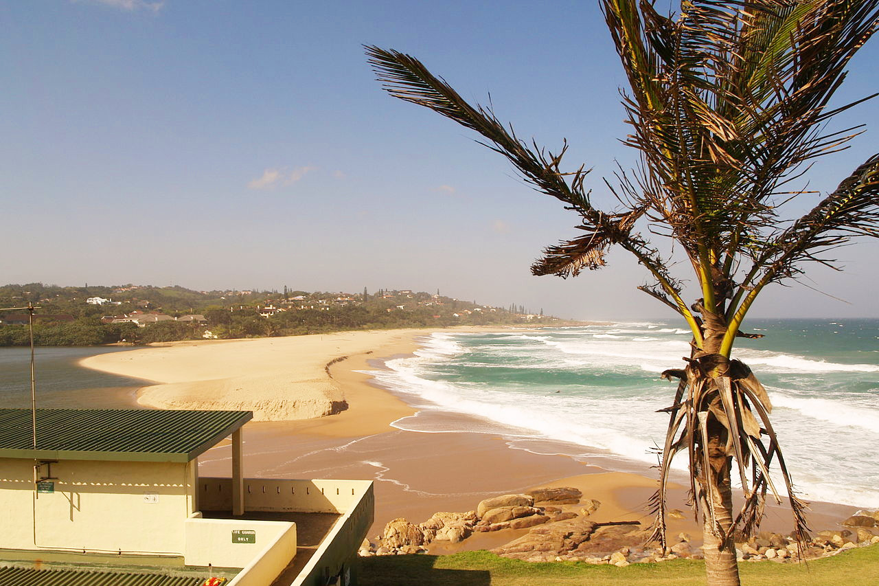
It is one of the ecologically richest as well as one of the fairest parts of South Africa. The sub-tropical climate, attractive coastal scenery, and sandy beaches bring tourists to the coast throughout the year but particularly in winter. The most popular section extends for some 100 miles around Durban. Here there are numerous resorts, the sandy beaches being attractive to holiday makers.
Inland the country may be likened to a steep and gigantic staircase leading to a broad and level land lying beyond its borders. To the north the land loses its semi-tropical character and the land resembles more the plains of the Free State, undulating, grass-covered, but for the most part without trees or bush. The rocky barrier which shuts off this land is part of the Drakensberg range. From the mountain sides flow many rivers which dash in magnificent waterfalls and through deep gorges to the sea. The south-eastern sides of the mountains are in part covered with magnificent trees.
The Drakensberg mountains form the frontier of the province. On the border with Lesotho, the mountains attain a height of 3,000 to 3,350 meters (10,000–11,000 feet), with few breaks in their face. The highest peak in South Africa is Mafadi at 3,450 meters (11,320 feet). North of here the mountain ridge sinks below 2,400 meters (8,000 feet), and here are several passes leading into Free State. Spurs from the Drakensberg, at right angles to the main range, cross the plateaus. The most northern coincides roughly with the northern frontier of Mpumalanga province.
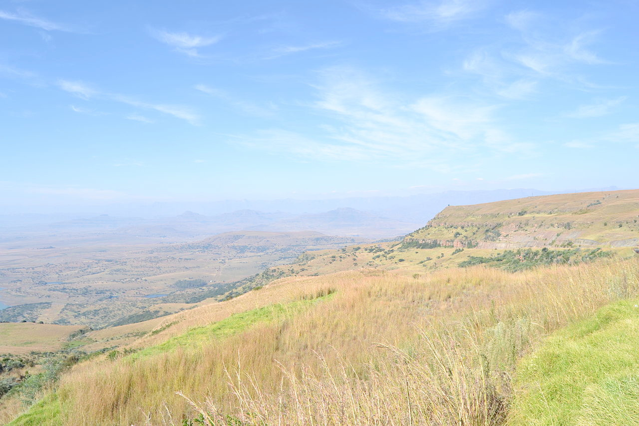
Free State
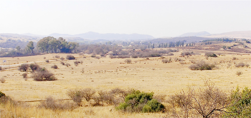
Free State lies entirely on the great plateau, between 1,200 and 1,500 meters (4,000–5,000 feet) above sea-level. It is in the main a level country, though hills are scattered over it, sometimes reaching a height of nearly 1,800 meters (6,000 feet). A remarkable feature of most of these hills, as of many all over the plateau, is that they are flat-topped, and have often steep, even craggy sides. On the east or Natal border the crest of the Drakensberg forms the frontier. Though rugged in places, with outlying spurs and secondary chains, the westward slopes of the Drakensberg are much gentler than the eastern slopes of the chain, and several passes exist through the mountains. Away from the mountains, we reach the plains lying at an altitude of 1,200 to 1,800 meters (4,000–6,000 ft)—this is the Highveld. Over the whole region there is low rainfall, many days of cloudless skies and considerable changes of temperature thoughout the day. The seasons are highly contrasted, the summer being warm and rainy, the winter cool and dry.
It is a bare land with only small trees, but it is well-covered with plants. After the first rains, when these wide stretches of gently undulating land become a brilliant green, nothing can be imagined more exhilarating than to travel across the wide expanse; for the air is pure, keen, and bracing. Dry as the land appears to the eye during the winter, the larger rivers rarely fail, and the southeastern part of Free State is very fertile.
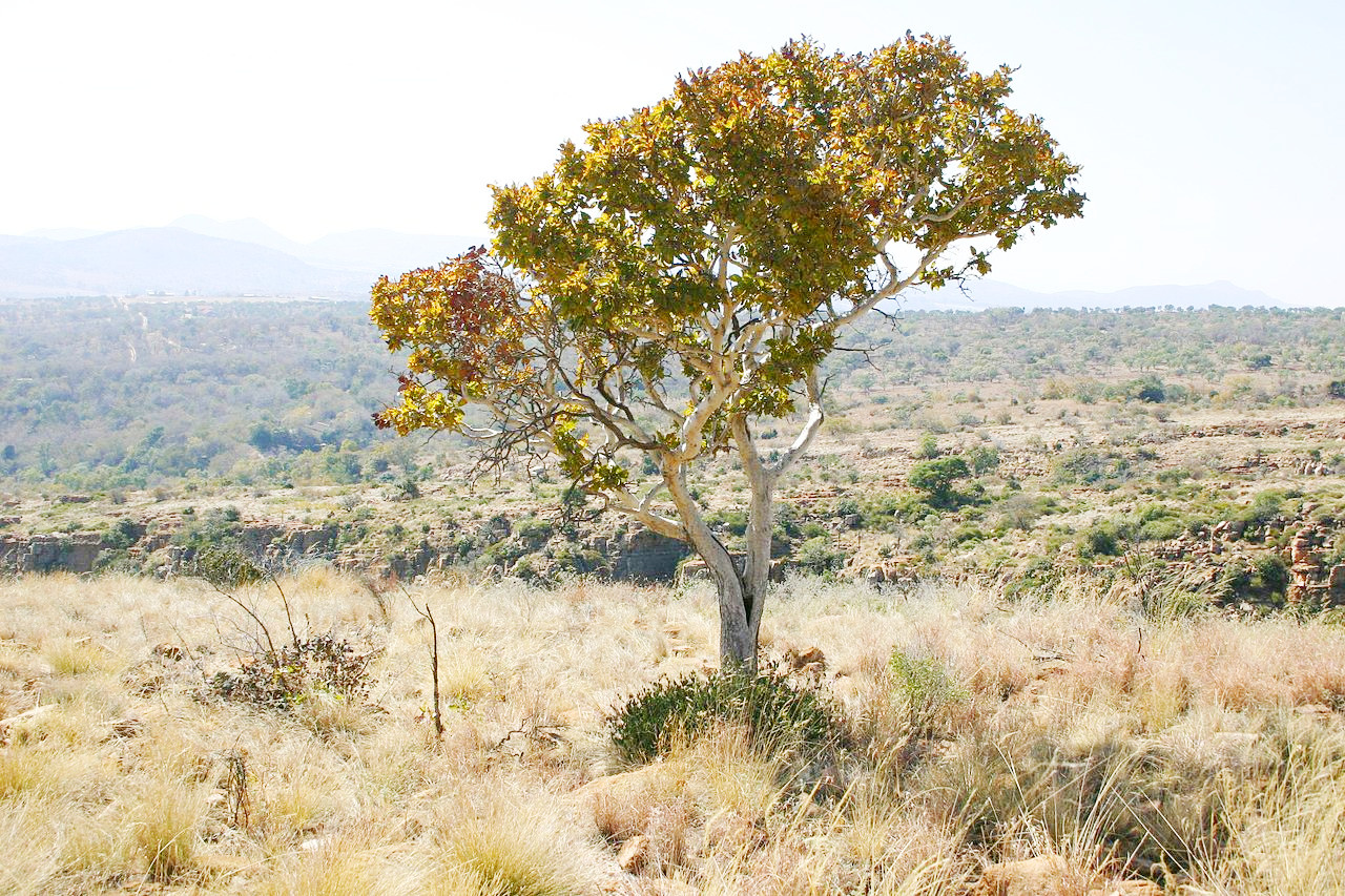
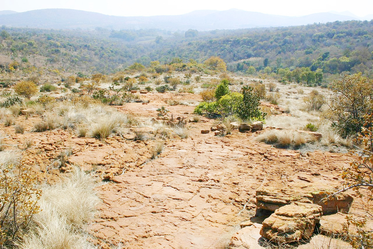
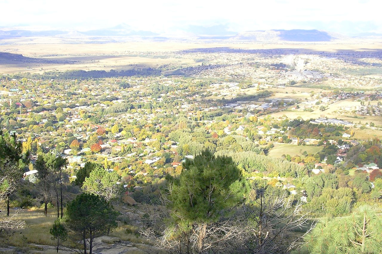 Ficksburg viewed from Imperani Mountain
Northeast
The northeastern part of South Africa, commonly known as the Transvaal, is made up of the provinces of Gauteng, Mpumalanga and Limpopo. The country west of the Drakensberg mountains, though part of the great plateau, is not uniform, consisting of elevated downs, their slopes, and flat basins. The entire region is primarily grassland and strong winds sweep over the vast stretches of open upland, checked by no belts of forest.

The south is a continuation of the Highveld—rolling grass covered downs, treeless, but occasionally interrupted by little hills—either table-shaped or pointed—rising above the general level. Small springs of fresh water are common and there are several shallow lakes or pans—flat bottomed depressions with no outlet. Long low stony ridges are often covered with scrub, while acacia trees are found in the river valleys.
North of Pretoria, the land descends either as a gradual slope, or with abrupt, terrace-like steps with outlying hills and deep, wooded valleys. In the basin following, the land is very level and covered with a growth of tall grasses and low acacia trees and bushes. Farther north, beyond the intervening slopes and low bush, are two mountainous regions: the Waterberg, and more to the northeast, the Soutpansberg. The Soutpansberg has steep slopes and is the northern end of the Drakensberg. The Waterberg constitutes a plateau declining gradually northwestwards and overlooking both the basin to the south and the Limpopo river on the north by steep scarps. Standing at an altitude of 1,200 meters (4,000 feet), the surface is characterised by rocky outcrops and a cover of low bushes.
The low veld is a strip on the eastern and another strip on the northern border along the river Limpopo. North of the Soutpansberg the ground falls rapidly to the Limpopo flats which are little over 360 meters (1,200 feet) above sea-level. The low veld east of the Drakensberg begins at about 900 meters (3,000 feet) and slopes to below 300 meters (1,000 feet) or less until we reach the Mozambique border. The low veld is everywhere covered with scrub, and water is scarce, the rivers being often dry in the winter season.
What is the nature of South Africa like?
Plants
The plant life of South Africa is very rich in the coast districts. No part of the country is richer in beautiful flowers than the immediate neighbourhood of Cape Town, This extreme south-western corner of Africa has a temperate climate with a real summer and a real winter, and gets most of its rain in winter. Heathland plants are common in this small district, some of extraordinary beauty and brilliance, but are scarcely found outside of it. Oak trees, first planted in the eighteenth century, also contribute to the scenery in the south-west corner of the country.
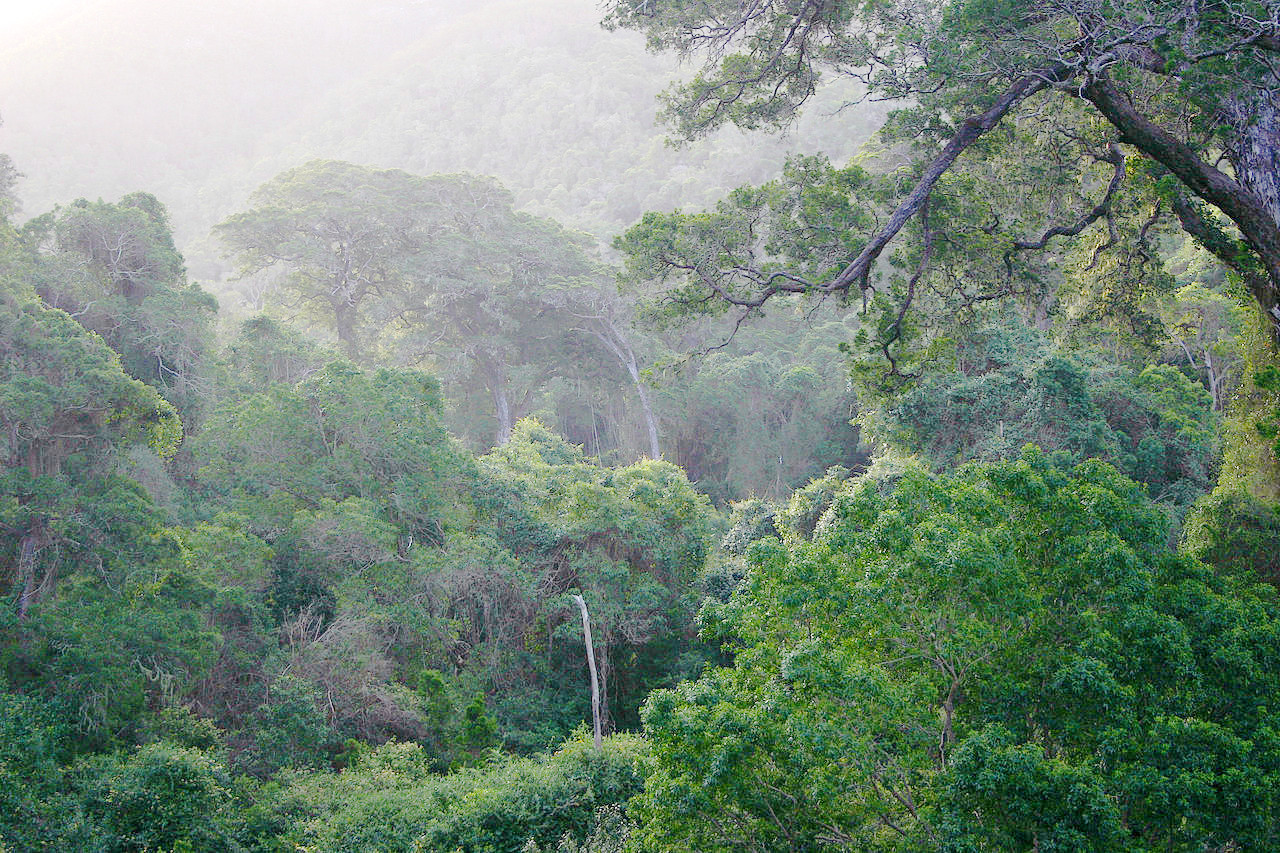
There are ancient forests along the south coast of Cape and KwaZulu Natal provinces, the best of which are now carefully preserved. Such is the great Knysna forest, home to a small population of African elephants. On the slopes of the hilly slopes of Western and Eastern Cape one also finds immense masses of dense scrub, or "bush," usually from four to eight feet in height, sometimes with patches of the prickly-pear cacti, an invader from America, and a formidable one. Hooks, thorns and prickles are characteristic of many South African plants. The scrub is mostly dry, while the larger forests are comparatively damp, and often beautiful with flowering trees, small tree-ferns, and climbers.
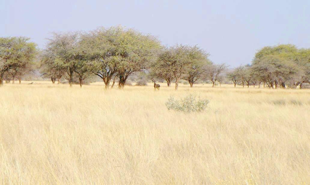
In the desert region, that is to say, the Karoo, there are hardly any trees, except small, thorny acacias, with a scanty, light-green foliage. After the spring rains these bloom in gorgeous colors—purple and yellow blossoms and vivid greens. Over the greater part of the inland plains little grows save veld, the coarse long grass of South Africa. Thorny acacias, euphorbias and aloes are still found in patches on the plains. Further east, where the rainfall is heavier, the trees, though still small, are more frequent and less thorny. In drier regions Australian gum trees now thrive.
In the far north valley levels are well wooded, scattered trees clothing their sides and the hills are covered with aloe, euphorbia, and other scrub growths. The scrub which covers the low veld consists mainly of gnarled thorns with umbrella shaped crowns.
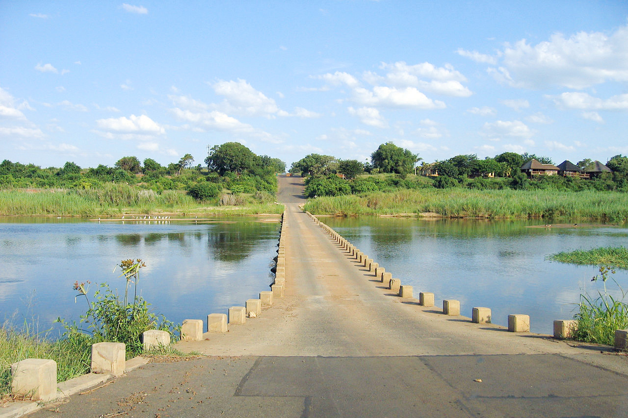
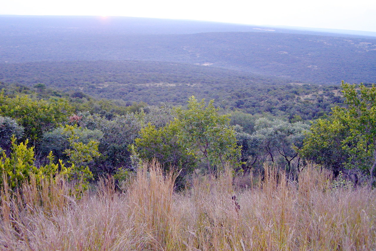
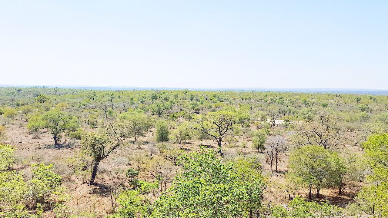 Landscape, Kruger National Park
Animals
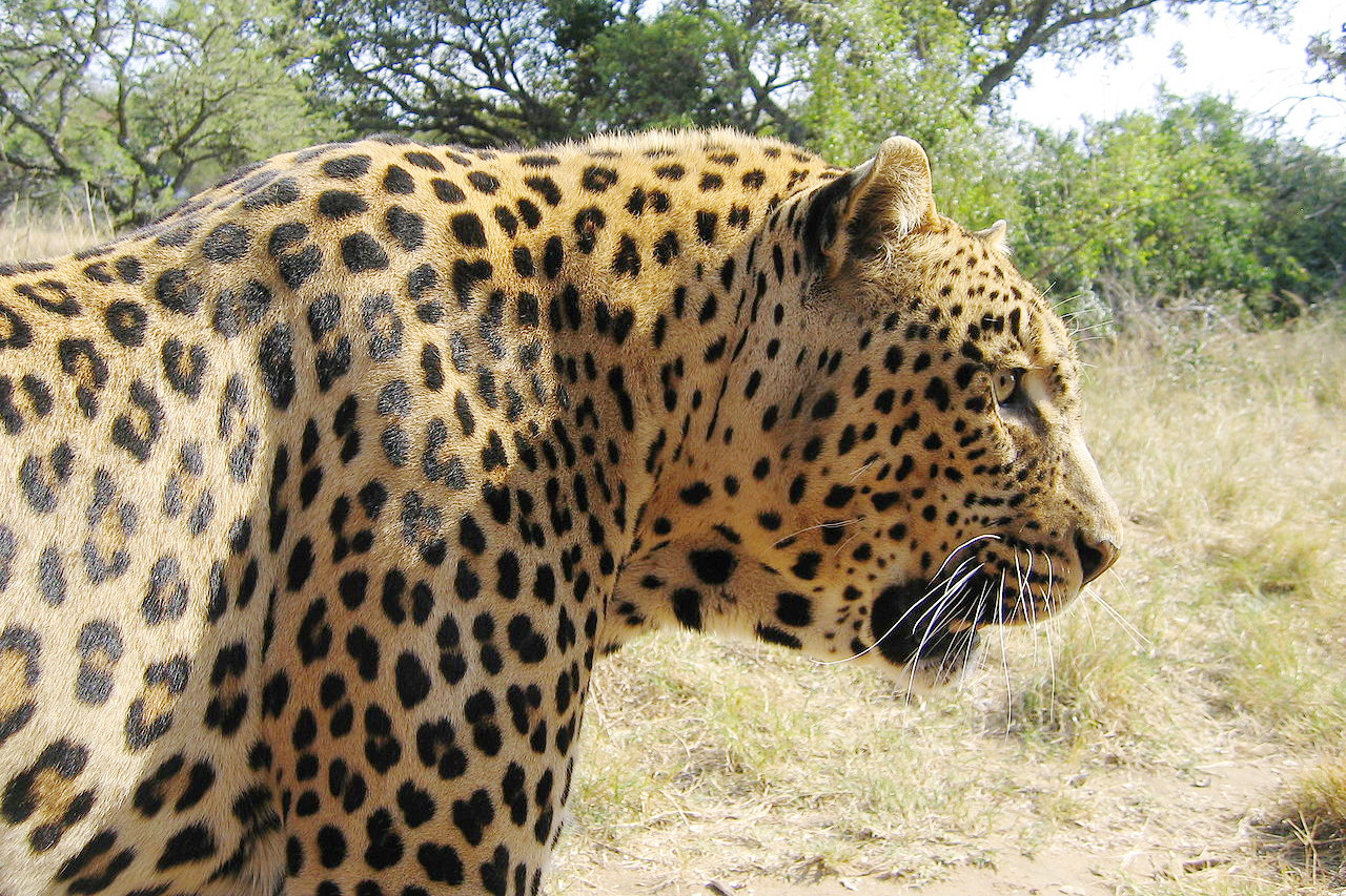
South Africa has a great variety of beautiful animals. Of the big cats, the leopard lingers in the mountainous districts, wheras the lion and the cheetah are mostly confined to protected reserves. Other carnivora in the country are the spotted hyena, aardwolf, Cape fox, bat-eared fox, the Cape wild dog, and various kinds of wild cats including the caracal.
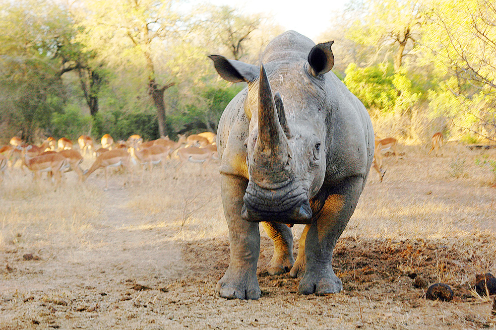
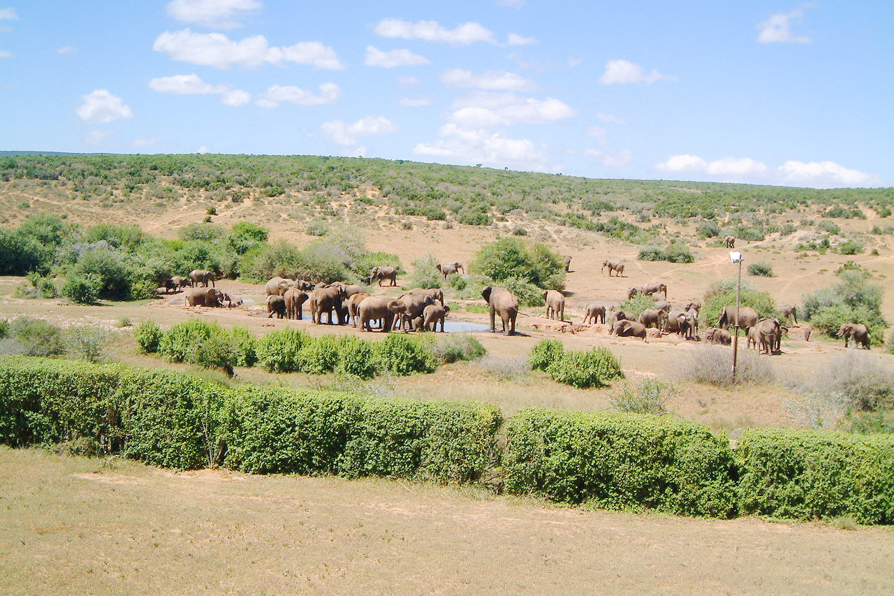
Elephants, giraffes and zebras are still found in the north and north-eastern districts. South Africa has a large population of the southern white rhinoceros—the most common and widespread subspecies of rhinoceros. South Africa is also a stronghold for the black rhinoceros and is at the center of conservation efforts for this critically endangered species. The hippopotamus may still be seen plunging and splashing in the waters of the Kruger National Park.
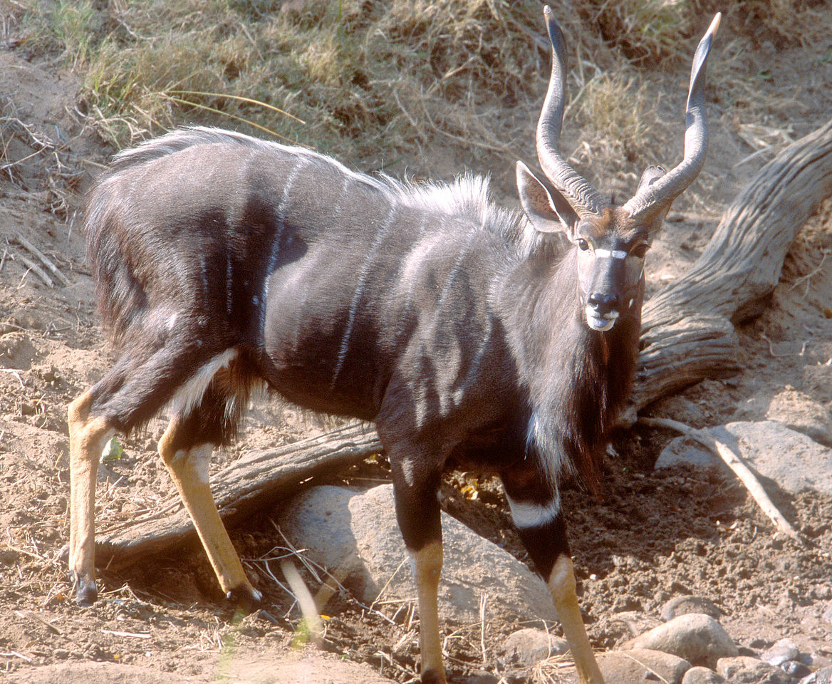
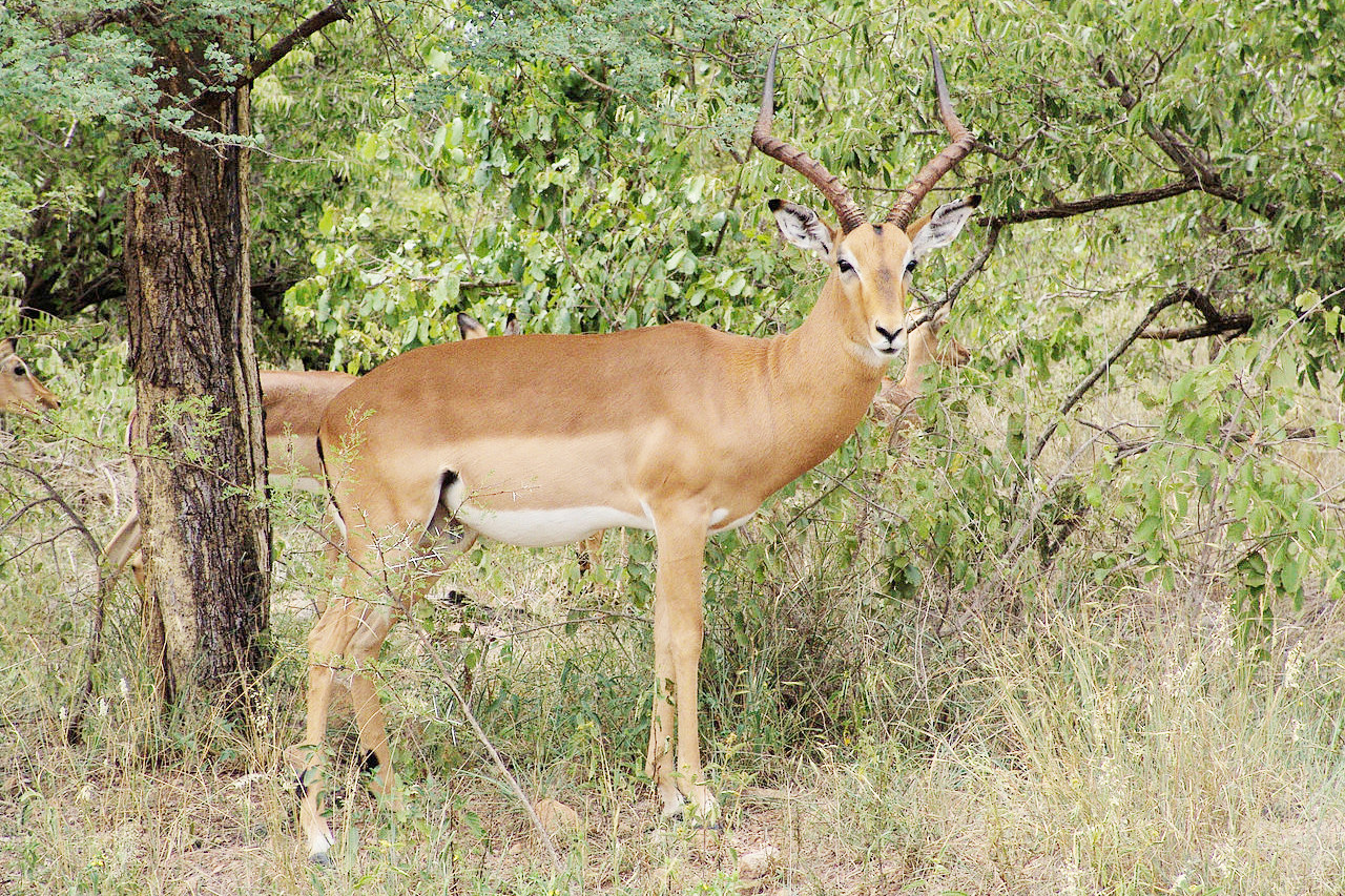
South Africa is famous for its wonderful profusion of antelopes: there are the springbok, of which great herds still wander on the open veld; the steenbok, a small and beautiful animal; the klipspringer, common in the mountains; common eland, seen on the savannah and open plains; the greater kudu, a woodland antelope; as well as the gemsbok, Cape grysbok, blesbok, grey rhebok, hartebeest, and species of reedbuck, impala, and duiker. South Africa has both species of wildebeest: the blue wildebeest and the black wildebeest.
What is the climate of South Africa like?
See our main article: The Climate of South Africa
.jpeg&oldid=339016537)
.jpg&oldid=341838153)
.JPG&oldid=302282812)
.jpeg&oldid=339016737)
.jpg&oldid=346187839)
.jpg&oldid=333978076)
.jpeg&oldid=339016663)
The climate of South Africa is hot and dry. Except in the district round Cape Town, at the southern extremity of the continent, there is no proper summer and winter, but only a dry season, the seven or eight months when the weather is colder, and a wet season, the four or five months when the sun is highest. The heat usual in subtropical countries is tempered by cool breezes, and the atmosphere is dry and bracing. Even in summer, when the heat is great during the day, the temperature falls sharply at sunset, and the nights are cool.
Summer, which begins in October and ends in March, is the rainy season, and there is a fair supply of rain to the coastal strip. Farther inland, rain impinges upon the hills which run down from the Great Escarpment, waters them, and sometimes falls in snow on the highest peaks. Showers scatter rain over the Transvaal and Free State, but the rain only rarely reaches the tracts farther to the west. The Northern Cape as far as the Orange River has low rainfall; under the intense heat of the sun this moisture soon vanishes, the surface bakes hard, and the region becomes parched and arid. During the dry season the smaller rivers become either a waterless bed, a mere line of green, or a chain of pools.
| Climate data for Pretoria (1961–1990) | |||||||||||||
|---|---|---|---|---|---|---|---|---|---|---|---|---|---|
| Month | Jan | Feb | Mar | Apr | May | Jun | Jul | Aug | Sep | Oct | Nov | Dec | Year |
| Average high °C (°F) | 28.5 (83.3) | 28.0 (82.4) | 26.9 (80.4) | 24.1 (75.4) | 21.8 (71.2) | 18.9 (66.0) | 19.5 (67.1) | 22.1 (71.8) | 25.5 (77.9) | 26.6 (79.9) | 27.0 (80.6) | 28.0 (82.4) | 24.7 (76.5) |
| Daily mean °C (°F) | 22.6 (72.7) | 22.1 (71.8) | 21.0 (69.8) | 17.9 (64.2) | 14.7 (58.5) | 11.5 (52.7) | 11.9 (53.4) | 14.7 (58.5) | 18.6 (65.5) | 20.1 (68.2) | 21.0 (69.8) | 21.9 (71.4) | 18.2 (64.8) |
| Average low °C (°F) | 17.8 (64.0) | 17.3 (63.1) | 16.1 (61.0) | 12.6 (54.7) | 8.2 (46.8) | 4.8 (40.6) | 4.8 (40.6) | 7.6 (45.7) | 11.9 (53.4) | 14.4 (57.9) | 15.8 (60.4) | 16.8 (62.2) | 12.3 (54.1) |
| Average precipitation mm (inches) | 135 (5.3) | 76 (3.0) | 79 (3.1) | 54 (2.1) | 13 (0.5) | 7 (0.3) | 3 (0.1) | 5 (0.2) | 20 (0.8) | 73 (2.9) | 100 (3.9) | 108 (4.3) | 673 (26.5) |
| Source: NOAA | |||||||||||||
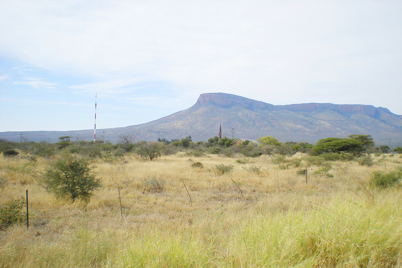
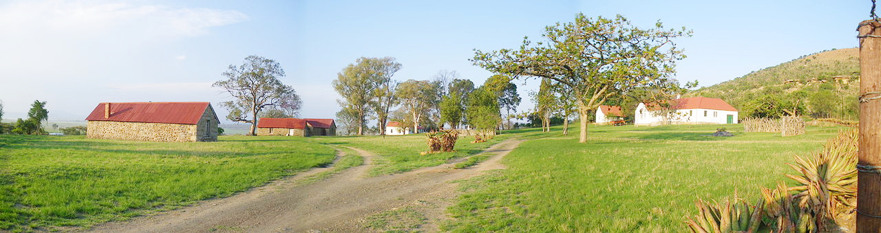 Rorke's Drift, KwaZulu Natal
The official websites
South Africa
Alive with Possibility
| Location: | Southern Africa, at the southern tip of the continent of Africa |
| Coordinates: | 29° 00′ N, 24° 00′ E |
| Size: | • 1,050 km N-S; 1,800 km E-W • 660 miles N-S; 1,130 miles E-W |
| Terrain: | Vast interior plateau rimmed by rugged hills and narrow coastal plain |
| Climate: | Mostly semiarid; subtropical along east coast; sunny days, cool nights |
| Highest point: | Mafadi 3,446 m / 11,306 ft |
| Forest: | 7.6% (2011 est.) |
| Population: | 56,463,617 (July 2020 est.) |
| Population density: | Low (42.4/km²) |
| Capital: | Pretoria / Cape Town / Bloemfontein |
| Languages: | Official languages: Zulu 24.7%, Xhosa 15.6%, Afrikaans 12.1%, Sepedi 9.8%, Setswana 8.9%, English 8.4%, Sesotho 8%, Xitsonga 4%, Swati 2.6%, Tshivenda 2.5%, Ndebele 1.6%; Other (includes Khoi, Nama, and San languages) 1.9% |
| Human Development Index: | High (0.709) |
| Currency: | Rand |