_azerbaijan_8-18centuries12.jpg) Shirvanshakh palace, Old city, Baku
Shirvanshakh palace, Old city, Baku
The Geography of
Azerbaijan
Why visit Azerbaijan?
Azerbaijan is a country of serene landscapes and majestic mountains. Shrouded in myth and legend and populated by a myriad of multicultural peoples, the spectacular Caucasus Mountains have attracted intrepid travellers and explorers for centuries. Azerbaijan is a country of contrasts where past and future cross at each step. It’s a place where tea is drunk with jam, and carpets are woven into the cultural fabric. From ancient landmarks to stunning mountains there is much to explore in Azerbaijan.
Contents
Map
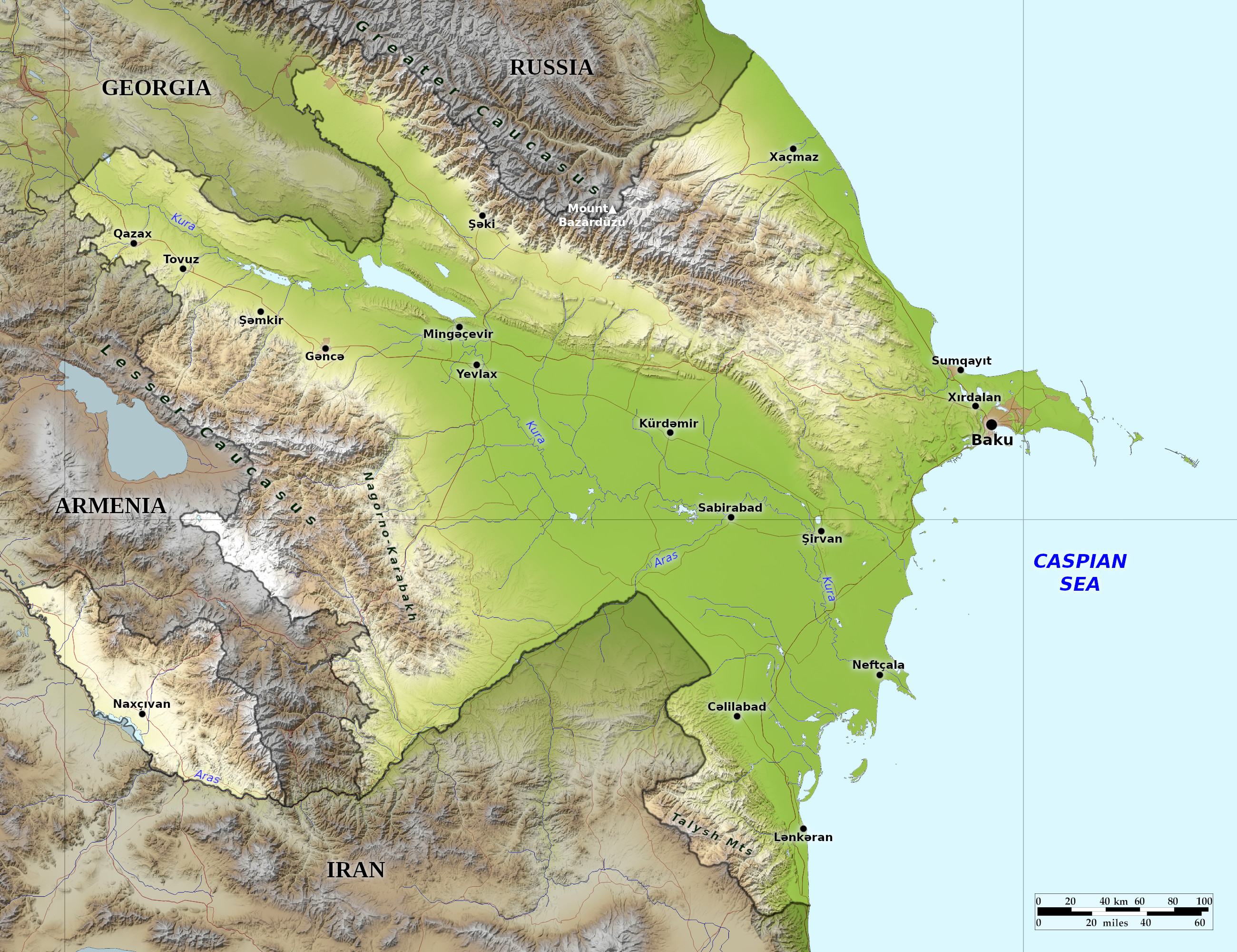 Relief map of Azerbaijan
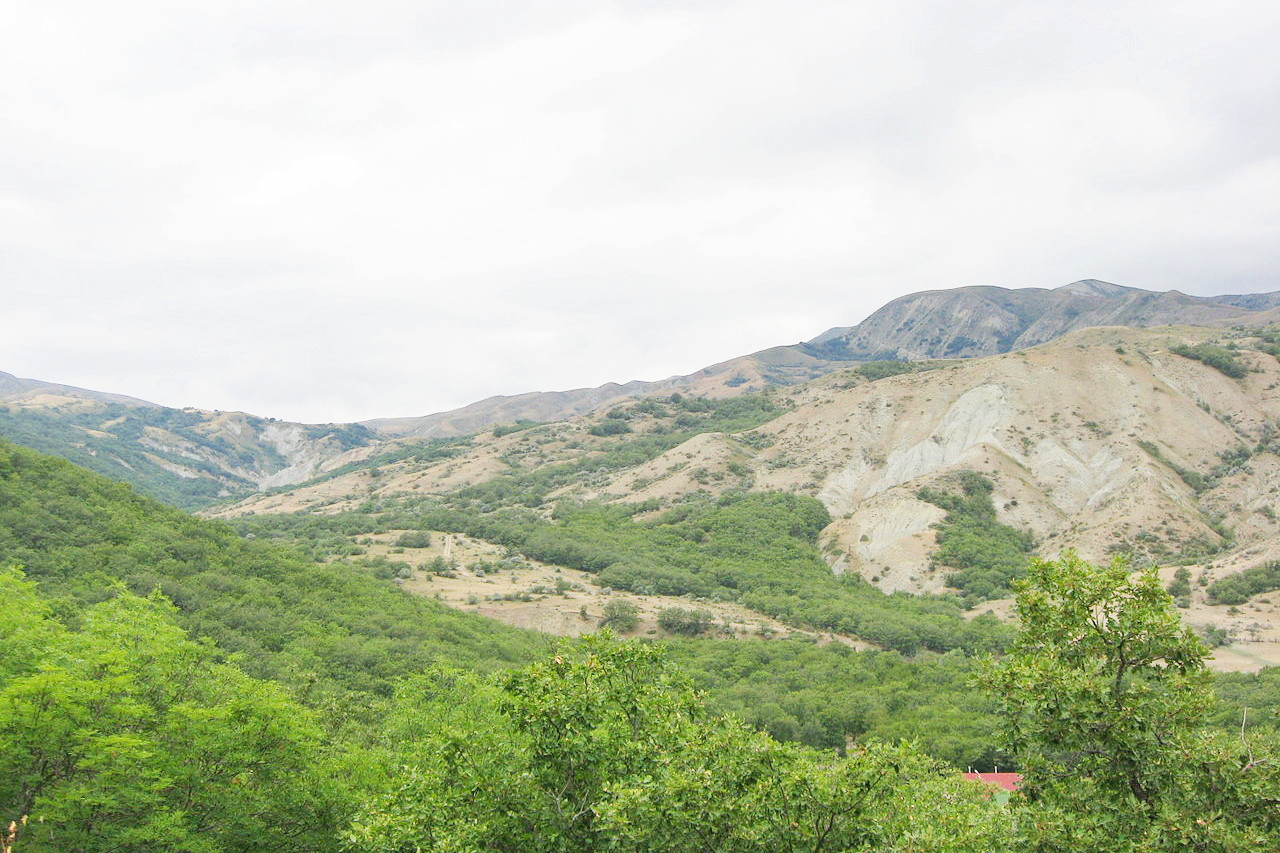
What is the landscape of Azerbaijan like?
_azerbaijan_8-18centuries12.jpg&oldid=509835974)
Azerbaijan is the easternmost country of Transcaucasia (the southern portion of the Caucasus region between the Black and Caspian Seas). Azerbaijan features the large, flat Kura-Aras Lowland (much of it below sea level) surrounded on three sides by mountains. The Great Caucasus Mountains are to the north, the Lesser Caucasus Mountains are to the southwest, and the Talish Mountains are in the south along the border with Iran. The Karabakh Upland lies in the west. The Nakhichevan exclave lies to the west, separated from the rest of Azerbaijan by Armenia.
Three physical features dominate Azerbaijan: the Caspian Sea, whose shoreline forms a natural boundary to the east; the Greater Caucasus mountain range to the north; and the extensive flatlands at the country's center.
Azerbaijan has an 800-kilometer-long (500-mile-long) shoreline along the Caspian Sea. The Caspian Sea is a saltwater lake and the largest inland body of water in the world. The shoreline along the Caspian Sea is essentially flat. The rise in elevation, from lowlands to highlands, occurs over a relatively small area. Notable physical features are the gently undulating hills of the subtropical southeastern coast, which are covered with tea plantations, orange groves, and lemon groves; numerous mud volcanoes and mineral springs in the ravines of Kobustan Mountain near Baku; and coastal terrain that lies as much as 28 meters below sea level.
About half of Azerbaijan is covered by mountain ranges, primarily the Great Caucasus Mountains. These mountains surround the central Kura-Aras Lowlands on three sides. To the northeast, bordering Russia's Dagestan Autonomous Republic, is the Greater Caucasus range; to the west, bordering Armenia, is the Lesser Caucasus range. The Talish Mountains form part of the border with Iranat the southeast tip of the country. The highest elevations occur in the Greater Caucasus, where Mount Bazardüzü rises 4,466 metres (14,652 feet) above sea level.
What is the nature of Azerbaijan like?
The country's flora and fauna is rich and varied. The enviroment varies from subtropical and dry in central and eastern Azerbaijan to subtropical and humid in the southeast. Due to this unique climat, flora is much richer—based on the number of species—than that of other republics of the South Caucasus. About two thirds of all of the species present in the entire Caucasus region can be found in Azerbaijan
What is the climate of Azerbaijan like?
See our main article: The Climate of Azerbaijan
Azerbaijan's climate varies from subtropical to alpine-like. In the central and eastern regions, the climate is generally dry and semiarid. In the southeast, it is humid and sub tropical. Along the shores of the Caspian Sea it is temperate, while the higher mountain elevations are generally cold.
The average rainfall for most of the country is low—only about 150 to 250 millimeters (6 to 10 inches). However, at the highest elevations of the Caucasus and in the southeast lowlands, it can exceed 1,000 millimeters (40 inches).
| Climate data for Baku | |||||||||||||
|---|---|---|---|---|---|---|---|---|---|---|---|---|---|
| Month | Jan | Feb | Mar | Apr | May | Jun | Jul | Aug | Sep | Oct | Nov | Dec | Year |
| Average high °C (°F) | 6.6 (43.9) | 6.3 (43.3) | 9.8 (49.6) | 16.4 (61.5) | 22.1 (71.8) | 27.3 (81.1) | 30.6 (87.1) | 29.7 (85.5) | 25.6 (78.1) | 19.6 (67.3) | 13.5 (56.3) | 9.7 (49.5) | 18.1 (64.6) |
| Daily mean °C (°F) | 4.4 (39.9) | 4.2 (39.6) | 7.0 (44.6) | 12.9 (55.2) | 18.5 (65.3) | 23.5 (74.3) | 26.4 (79.5) | 26.3 (79.3) | 22.5 (72.5) | 16.6 (61.9) | 11.2 (52.2) | 7.3 (45.1) | 15.1 (59.2) |
| Average low °C (°F) | 2.1 (35.8) | 2.0 (35.6) | 4.2 (39.6) | 9.4 (48.9) | 14.9 (58.8) | 19.7 (67.5) | 22.2 (72.0) | 22.9 (73.2) | 19.4 (66.9) | 13.6 (56.5) | 8.8 (47.8) | 4.8 (40.6) | 12.0 (53.6) |
| Average precipitation mm (inches) | 21 (0.8) | 20 (0.8) | 21 (0.8) | 18 (0.7) | 18 (0.7) | 8 (0.3) | 2 (0.1) | 6 (0.2) | 15 (0.6) | 25 (1.0) | 30 (1.2) | 26 (1.0) | 210 (8.3) |
| Source: World Meteorological Organization | |||||||||||||
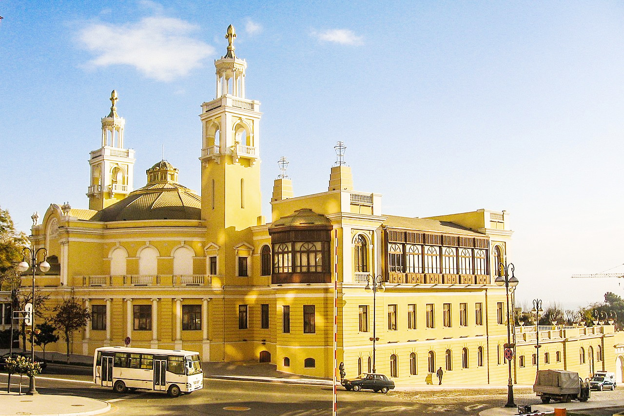 Azerbaijan Philharmonic Hall, Baku
The official websites
Azerbaijan
Land of Fire
| Location: | Southwestern Asia, bordering the Caspian Sea, between Iran and Russia |
| Coordinates: | 40° 15′ N, 47° 30′ E |
| Size: | • 510 km N-S; 685 km E-W • 315 miles N-S; 425 miles E-W |
| Terrain: | A large, flat lowland, with Great Caucasus Mountains to the north, and the Karabakh Upland to the west |
| Climate: | A dry, semiarid steppe climate |
| Highest point: | Mount Bazardüzü 4,466 m / 14,652 ft |
| Forest: | 11% (2018 est.) |
| Population: | 10,420,515 (2023 est.) |
| Population density: | Medium (117/km²) |
| Capital: | Baku |
| Languages: | Azerbaijani (Azeri) (official) 92.5%, Russian 1.4%, Armenian 1.4%, other 4.7% |
| Human Development Index: | High (0.745) |