.jpg)
.JPG)
.jpg)
.JPG)
.JPG)
The Geography of
Belgium
Why visit Belgium?
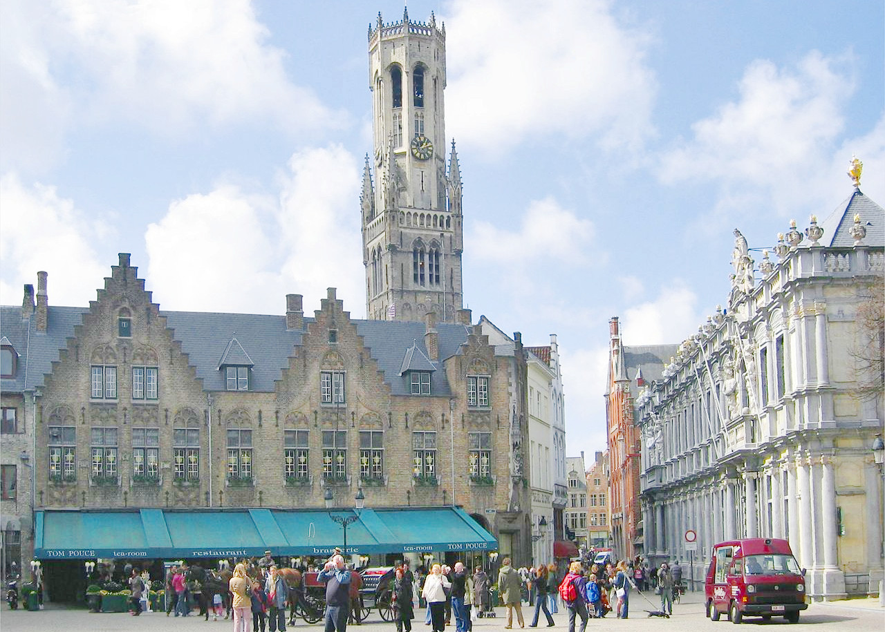
Belgium has a rich history and diverse landscape. It has always been known for its picturesque villages, rolling hills and crystal-clear waterways. Castles and churches dot the landscape and small villages are everywhere. Some of the best places to visit in Belgium include Antwerp, Ghent, and Bruges. Each of these cities has its own unique attractions and offers something unique for those seeking to explore Belgium. Antwerp is known for its Medieval architecture, including the impressive belfry of Antwerp Cathedral. Ghent is home to a magnificent Gothic cathedral. Bruges is one of the few places in the world where a medieval city remains intact and unspoiled. The Ardennes region is still a beautifully forested and romantic rural area. The two contrasting cultures of the Flemish and the French sections of Belgium provide a variety of architecture, language, and cuisine, and they come together in Brussels, the bilingual capital.
Contents
Map
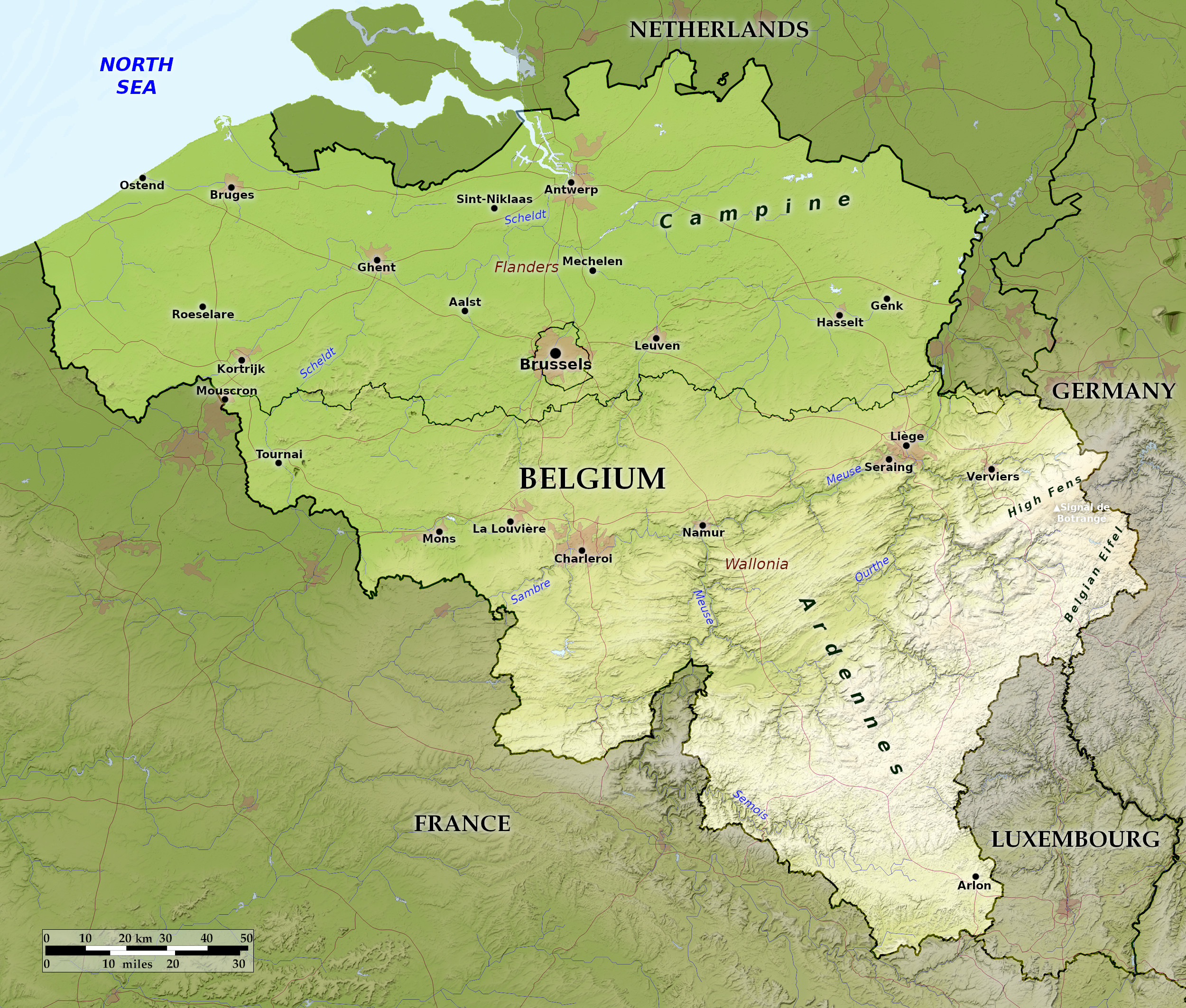 Relief map of Belgium
What is the landscape of Belgium like?
Belgium falls into three regional units: (1) the coastal lands; (2) the central plains; and (3) the southern highlands.
The Coastal Lands
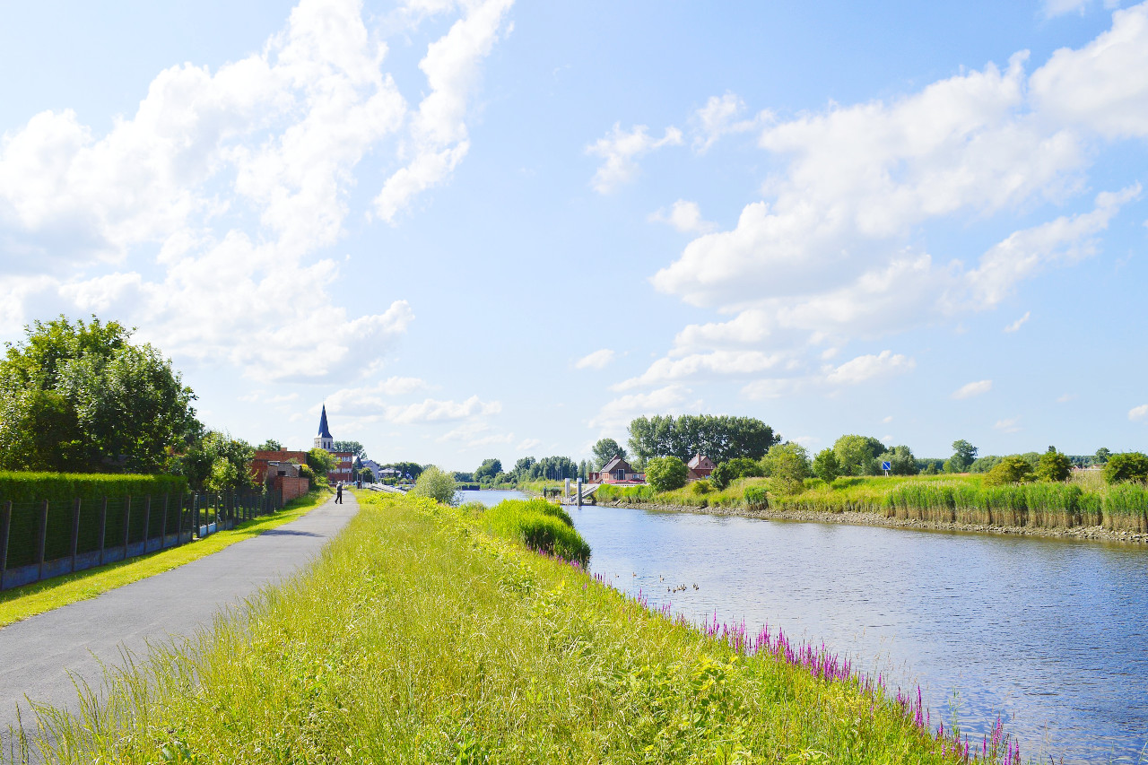
The coast of Belgium is about 40 miles long and is very straight, consisting of a ridge of sand dunes about ten meters above the level of the plains behind. The sandy shores have caused the growth of a number of busy seaside resorts, such as Blankenberge and Ostend.
Immediately behind the dunes is a region of low-lying reclaimed marshland, usually referred to as "polder" land. It is about ten miles wide, and is crossed by a network of drainage canals, the scenery being reminiscent of Holland. The polders are a rich agricultural region.
The Central Plains
This region includes the Basin of the River Scheldt and the region known as the Campine near the Dutch frontier. The Campine is a region of sandy soil which once consisted mainly of extensive moors, tracts of sandy heath, and wetlands.
The Scheldt Basin occupies Central Belgium. The River Scheldt itself rises in France, and its tributaries flow to it fanwise, so that their valley routes converge on Antwerp at the mouth of the main river. This is the great agricultural region of Belgium. Brussels, the capital, occupies a central position in Belgium, and is nearly the geometric centre of the Scheldt Basin. Antwerp, at the mouth of the Scheldt, is the great port of Belgium, and one of the great ports of Europe. Ypres, Bruges, and Ghent are old towns famous for their woollen manufactures since the Middle Ages.
The Southern Highlands
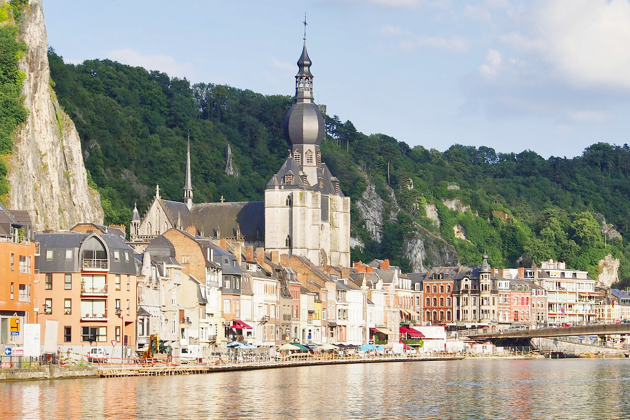
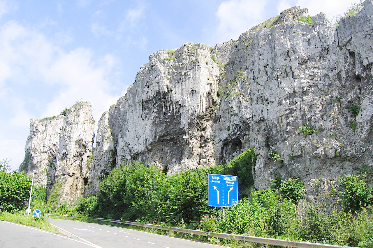
South of the basin of the Scheldt is the valley of the Meuse and its tributary the Sambre. South of the Sambre-Meuse valley rises the highland area of Belgium. This is the Ardennes, a region of old rock rising to over 600 meters (2,000 feet) and part of an ancient mountain system. The higher districts to the south are partly forested and partly open moorland, but the northern half of the upland region is a flourishing agricultural area. The Meuse valley is very picturesque and contains a number of well-known tourist centres, e.g. Dinant. The principal charm of this region is derived from its fine and extensive woodlands
What is the nature of Belgium like?
.jpg&oldid=545540287)
.JPG&oldid=576114535)
.jpg&oldid=551597900)
.JPG&oldid=578763411)
.JPG&oldid=511587676)
The Ardennes is beautifully wooded with a really delightful out-of-the-world district of great charm, especially for those who like walking excursions. Here are valleys, rivers, gorges, forests, moorlands, ancient castles, caves and wonderful scenery. It is in these uplands that the larger forests are found, and these contain conifers together with oaks, beeches, and other deciduous trees.
Over time, half of the country has been cleared for agriculture or pastureland. Besides the forests of the Ardennes, there is also heathland, and this is found especially in eastern areas such as the province of Liège. There are beautiful public parks in most cities, and a fine botanical garden at Bokrijk, the living museum village of ancient Belgian buildings, that is about 55 miles from Brussels.
What is the climate of Belgium like?
See our main article: The Climate of Belgium
Belgium has a temperate climate that is kept mild through the influence of the North Atlantic. The weather is very similar to southern England, but it is somewhat hotter in summer and a little colder in winter. Westerly winds bring changeable weather in from the sea, and rainfall can be frequent and sometimes heavy. Winters are usually mild and wet. Summers are generally quite cool and pleasant. Greater extremes of both cold and heat occur when continental weather moves in from the east. In the part of the Ardennes located farthest inland from the coast, more rain and snow falls—due principally to the higher elevation of the land.
| Climate data for Brussels (1991–2020) | |||||||||||||
|---|---|---|---|---|---|---|---|---|---|---|---|---|---|
| Month | Jan | Feb | Mar | Apr | May | Jun | Jul | Aug | Sep | Oct | Nov | Dec | Year |
| Average high °C (°F) | 6.1 (43.0) | 7.1 (44.8) | 10.9 (51.6) | 15.0 (59.0) | 18.4 (65.1) | 21.2 (70.2) | 23.2 (73.8) | 23.0 (73.4) | 19.5 (67.1) | 14.9 (58.8) | 9.9 (49.8) | 6.6 (43.9) | 14.7 (58.4) |
| Daily mean °C (°F) | 3.7 (38.7) | 4.2 (39.6) | 7.1 (44.8) | 10.4 (50.7) | 13.9 (57.0) | 16.7 (62.1) | 18.7 (65.7) | 18.4 (65.1) | 15.2 (59.4) | 11.3 (52.3) | 7.2 (45.0) | 4.3 (39.7) | 10.9 (51.7) |
| Average low °C (°F) | 1.4 (34.5) | 1.5 (34.7) | 3.5 (38.3) | 6.0 (42.8) | 9.2 (48.6) | 12.0 (53.6) | 14.1 (57.4) | 13.9 (57.0) | 11.3 (52.3) | 8.1 (46.6) | 4.6 (40.3) | 2.1 (35.8) | 7.3 (45.2) |
| Average precipitation mm (inches) | 75.5 (2.97) | 65.1 (2.56) | 59.3 (2.33) | 46.7 (1.84) | 59.7 (2.35) | 70.8 (2.79) | 76.9 (3.03) | 86.5 (3.41) | 65.3 (2.57) | 67.8 (2.67) | 76.2 (3.00) | 87.4 (3.44) | 837.2 (32.96) |
| Source: Royal Meteorological Institute | |||||||||||||
.jpg) Kasteel De Mot, Ternat
Kasteel De Mot, Ternat
.jpg&oldid=479027086)
The official websites
Belgium
The place to Be
| Location: | Western Europe, between France and the Netherlands |
| Coordinates: | 50° 45′ N, 4° 45′ E |
| Size: | • 215 km N-S; 265 km E-W • 135 miles N-S; 165 miles E-W |
| Terrain: | Coastal plains to the northwest, a low central plateau region, and highlands to the southeast |
| Climate: | A temperate maritime climate with moderate temperatures in both summer and winter |
| Highest point: | Signal de Botrange 694 m / 2,277 ft |
| Forest: | 29% (2010 est.) (source) |
| Population: | 11,492,641 |
| Population density: | High (376/km²) |
| Capital: | Brussels |
| Languages: | Dutch, French, German |
| Human Development Index: | Very high (0.931) |
| Currency: | Euro |