The Geography of
The Netherlands
Why visit the Netherlands?
The Netherlands is a very beautiful country with a rich history. Nearly every corner of it contains a beautiful sight that is worth seeing. The main attractions in the Netherlands are its medieval towns and its beautiful countryside with its picturesque canals and bridges, with tulips blooming in springtime, and windmills turning throughout the year. It is home, too, to some of the most famous cultural venues in the world, including the Amsterdam Concert Hall and the Rijksmuseum. Whether you prefer culture, history, or stunning nature, the Netherlands has something to offer everyone who visits it.
Contents
Map
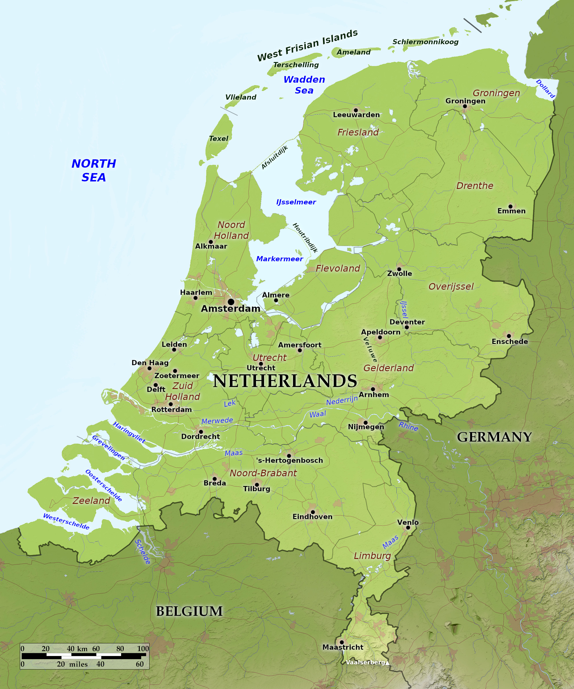 Relief map of The Netherlands
What is the landscape of Netherlands like?
The Netherlands or "Holland" can be divided into three well-defined regions: (1) The coastal belt; (2) Central Holland, i.e. the polder land which is mostly below sea-level; (3) Eastern Holland, i.e. three separate areas of land above sea-level lying generally to the east of the polders.
The Coastal Belt
The coast of the Netherlands is composed of sand dunes, which also border the seaward edges of the islands of Zeeland and the west Frisian Islands. Between these two groups of islands is a smooth unbroken coastline extending from the Hook to Helder. The dunes are strengthened and reinforced to prevent the sea encroaching on the low-lying polders behind the dunes.
At the north end of the coast sit the West Frisian Islands. Once part of the Dutch mainland, the power of the North Sea long ago divided the sandy shore into these low-lying islands. Vacationers come by the thousands each year to visit the nature preserves and ecological habitats.
The "Polder" Country or Central Netherlands
About forty per cent of the Netherlands consists of polder land and two-thirds of this area is below the level of high tide, often by as much as 7 meters (25 feet). Polder land is reclaimed land surrounded by dykes. In ancient times large areas of the Netherlands were inundated. The lagoons (e.g. Haarlem Meer) and salt marshes thus formed have been drained and converted into agricultural land. Dykes were constructed around these low-lying areas, and the water pumped into high-level canals and so drained to the sea.
The greatest of these schemes in modern times has been the reclamation of part of the Zuiderzee. Work was begun in 1920, and with this scheme a dam was built across the northern end of the Zuiderzee and the eastern parts of the polders drained.
In the south is the "island" region of Zeeland. Here cattle and horses are reared on rich pasture lands and a variety of crops is grown; a second large area of polder lies in the northeast of the Netherlands, in the province of Groningen. Between these two regions lie the central polders. Agriculturally this is the richest region of all, and noted for the flowers that are intensively cultivated and the market vegetables which are grown here.
The principal cities of the Netherlands lie in the polder zone. Amsterdam, on the west side of the Zuiderzee, is the capital. The ships of olden days could navigate the shallow Zuiderzee. During the "Period of Discovery" it was the great entrepot for Northern Europe. Rotterdam is today the greater port and handles trade not just for Holland but for shipments across Europe. The Hague on the western edge of the polders, is the seat of the government.
Eastern Netherlands
That part of the Netherlands which lies mainly to the east of the polders is the least densely populated part of the country. The soils are often sandy and pebbly, and there are also large areas of peat bog. The scenery is one of ridges and a rolling landscape. The whole district is often called the Geest and similar regions are to be found in North Germany and in Western Denmark. In the extreme southeast is the Limburg "pan-handle" region where hills are to found as is the highest point in the Netherlands at 323 meters (1,059 feet) above sea-level.
Because of the general flatness of the Netherlands transport is easy in all directions, and the network of river contributed to the ease of canal construction. Holland has thousands of miles of canals and navigable waterways.
What is the nature of Netherlands like?
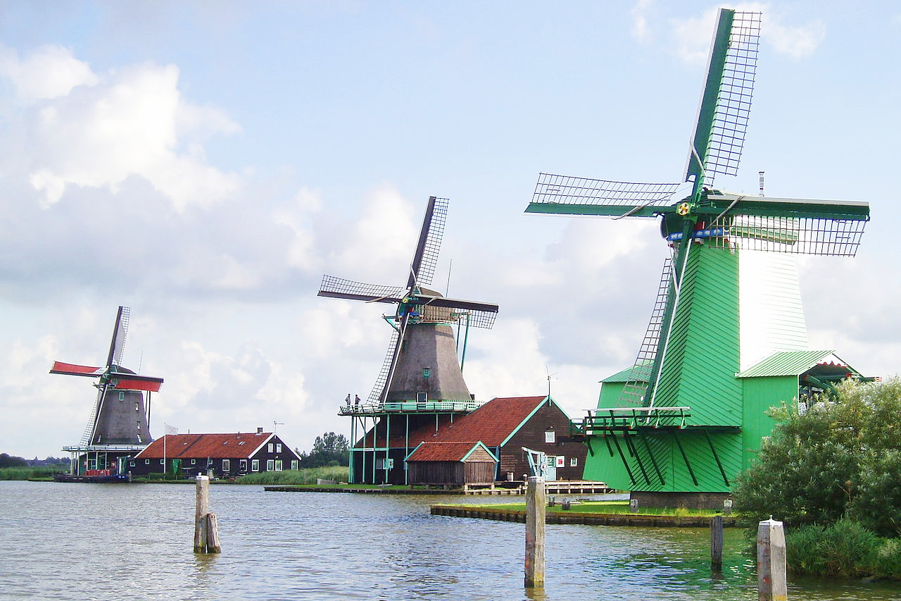
Low and flat as the Netherlands is, the landscape is not monotonous. Instead, it is quite varied and supports many diverse activities. The Dutch countryside is famous for its placid calm scenery dotted with windmills, and its richly cultivated fields, but it also has some magnificent forests. Heath covers the sandy regions in the east of the country. Furze and the common juniper are regular plants on the coastal dunes, and may also be found on many of the heaths. In the woodland areas copses of birch and alder are very common.
What is the climate of Netherlands like?
See our main article: The Climate of the Netherlands
The climate of the Netherlands is very moderate, with mild winters, cool summers, much the same as in England. The average temperature is 2°C (36°F ) in January and 19°C (66°F) in July. Because the Netherlands has few natural barriers, such as high mountains, the climate varies little from region to region. Average annual rainfall is about 760 mm (30 in). The weather is very changeable, and may alter completely within a single day. April to October is the ideal time to visit.
| Climate data for Amsterdam | |||||||||||||
|---|---|---|---|---|---|---|---|---|---|---|---|---|---|
| Month | Jan | Feb | Mar | Apr | May | Jun | Jul | Aug | Sep | Oct | Nov | Dec | Year |
| Average high °C (°F) | 6.2 (43.2) | 6.9 (44.4) | 10.1 (50.2) | 14.3 (57.7) | 17.8 (64.0) | 20.3 (68.5) | 22.5 (72.5) | 22.4 (72.3) | 19.2 (66.6) | 14.7 (58.5) | 10.0 (50.0) | 6.9 (44.4) | 14.3 (57.7) |
| Daily mean °C (°F) | 3.8 (38.8) | 4.1 (39.4) | 6.5 (43.7) | 9.8 (49.6) | 13.3 (55.9) | 16.0 (60.8) | 18.1 (64.6) | 18.0 (64.4) | 15.1 (59.2) | 11.3 (52.3) | 7.4 (45.3) | 4.6 (40.3) | 10.7 (51.2) |
| Average low °C (°F) | 1.2 (34.2) | 1.0 (33.8) | 2.8 (37.0) | 5.2 (41.4) | 8.6 (47.5) | 11.3 (52.3) | 13.5 (56.3) | 13.4 (56.1) | 11.0 (51.8) | 7.7 (45.9) | 4.5 (40.1) | 1.5 (34.7) | 6.8 (44.3) |
| Average precipitation mm (inches) | 66.5 (2.62) | 54.7 (2.15) | 51.8 (2.04) | 39.6 (1.56) | 53.9 (2.12) | 64.8 (2.55) | 82.3 (3.24) | 98.6 (3.88) | 84.4 (3.32) | 86.7 (3.41) | 85.3 (3.36) | 81.7 (3.22) | 850.3 (33.48) |
| Average snowfall cm (inches) | 4.8 (1.9) | 5.3 (2.1) | 2.8 (1.1) | 0.2 (0.1) | 0 (0) | 0 (0) | 0 (0) | 0 (0) | 0 (0) | 0.1 (0.0) | 0.8 (0.3) | 3.9 (1.5) | 17.9 (7.0) |
| Source: Royal Netherlands Meteorological Institute | |||||||||||||
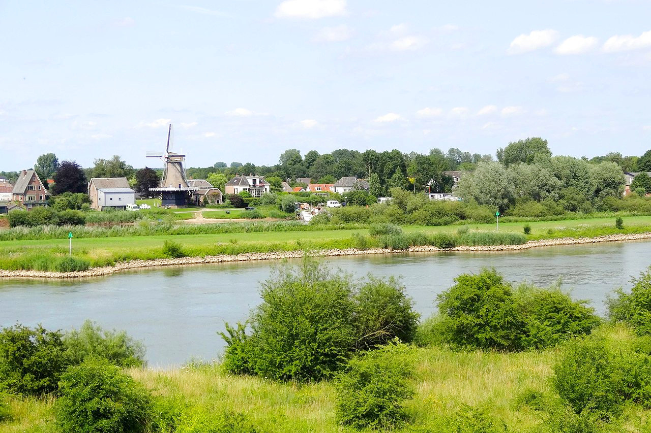
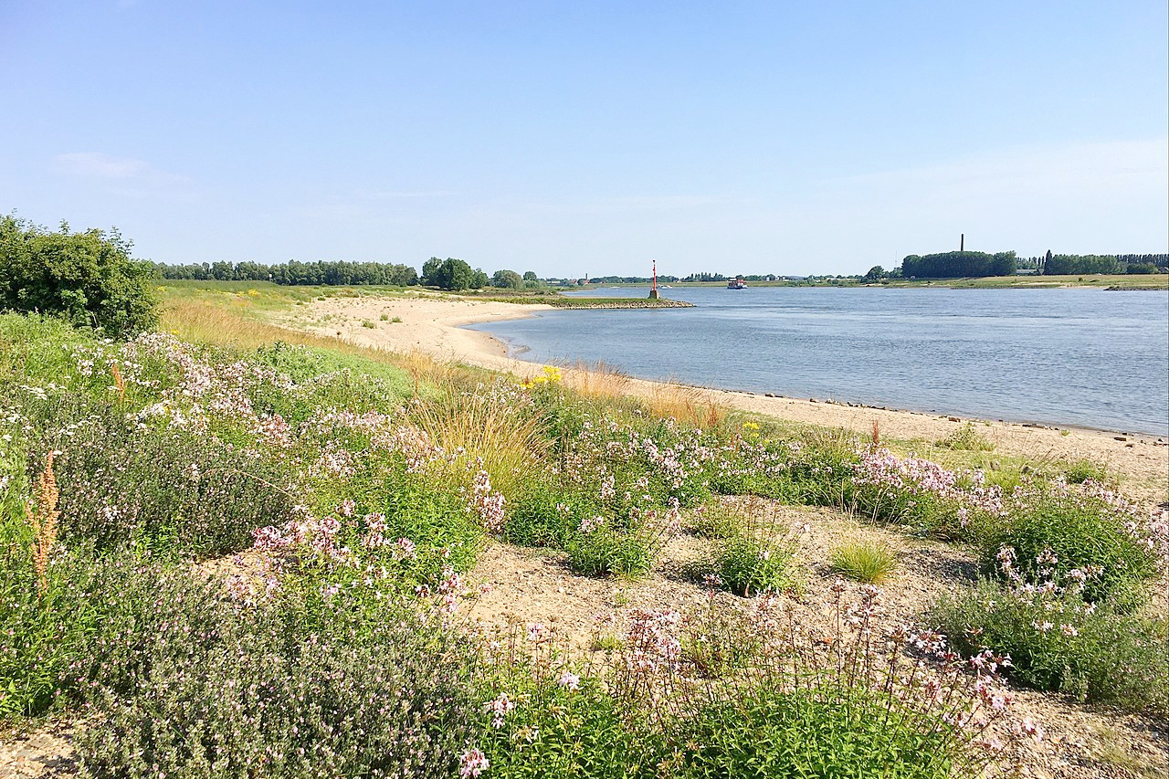
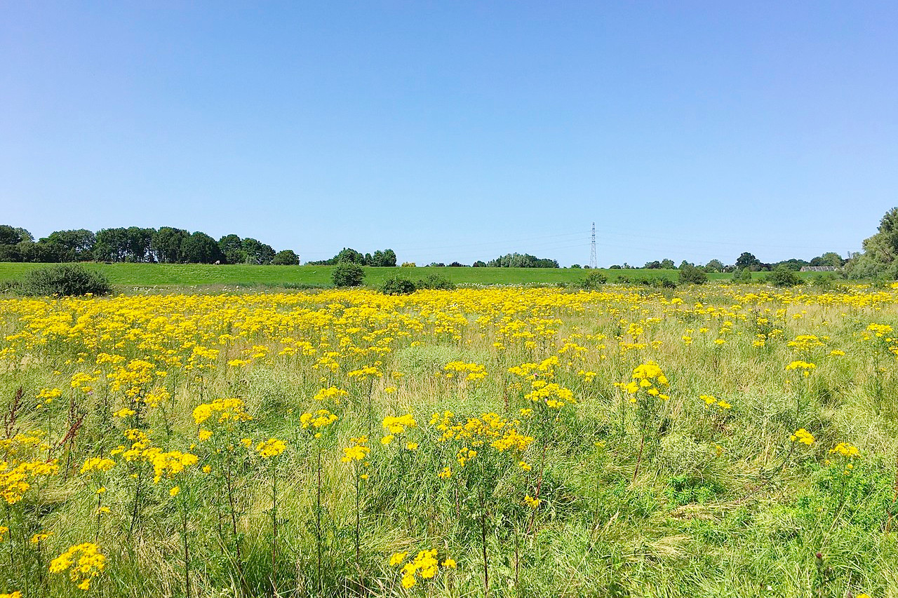 River landscape in the Bemmelse Waard
The official websites
The Netherlands
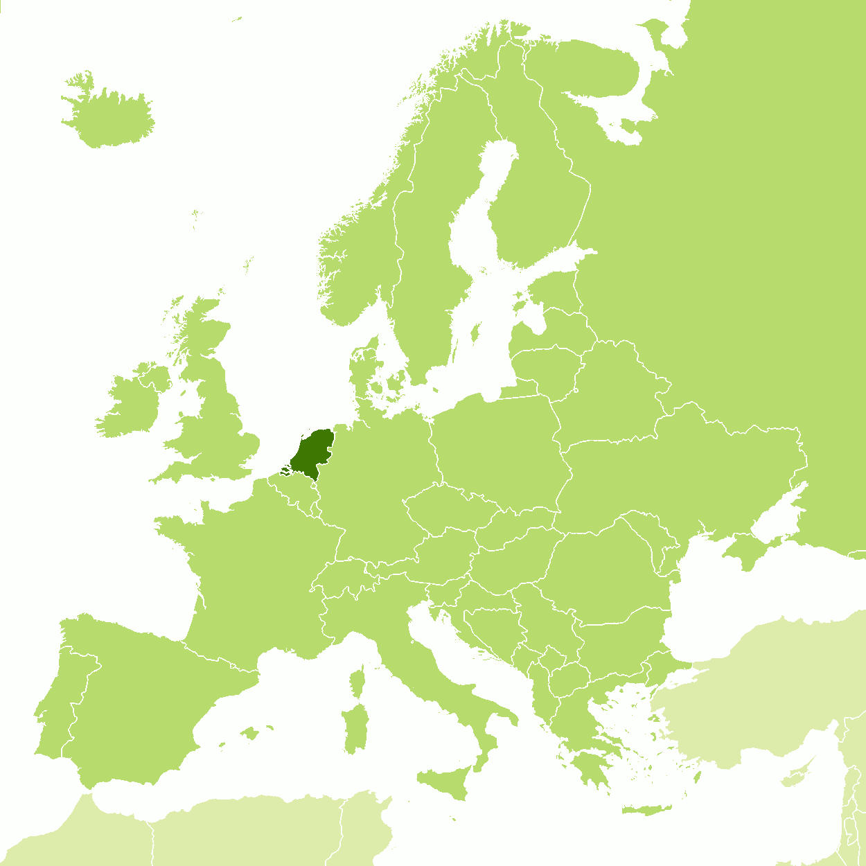
A State of Happiness
| Location: | Western Europe, bordering Belgium and Germany |
| Coordinates: | 52° 15′ N, 5° 30′ E |
| Size: | • 315 km N-S; 265 km E-W • 195 miles N-S; 165 miles E-W |
| Terrain: | Flat in the west and north; becoming undulating and even a little hilly in the east and south |
| Climate: | A temperate maritime climate with moderate temperatures in both summer and winter |
| Highest point: | Vaalserberg 323 m / 1,059 ft |
| Forest: | 19% (2010 est.) (source) |
| Population: | 17,724,700 (2022 est.) |
| Population density: | High (423/km²) |
| Capital: | Amsterdam |
| Languages: | Dutch, West Frisian, English |
| Human Development Index: | Very high (0.944) |
| Currency: | Euro |
beeld_van_het_rivierengebied.jpg)