.jpg)
.jpg)

The Geography of
Alberta
Why visit Alberta?
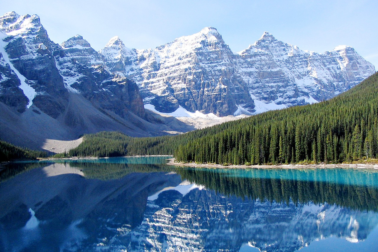
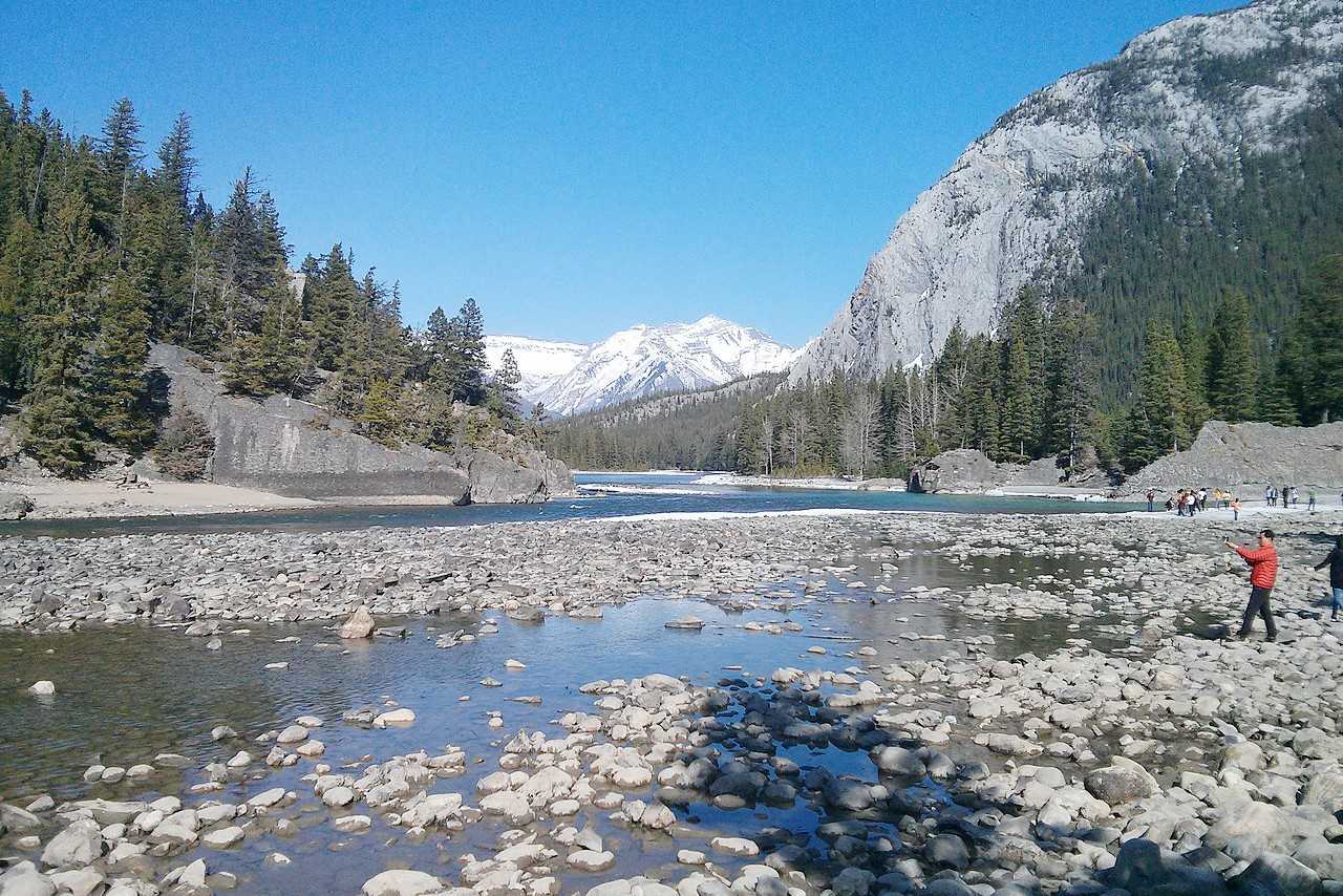
The scenery in Alberta is simply breathtaking. The Rocky Mountains are home to world-famous national parks at Banff, Jasper, and Waterton Lakes. The rivers are a magnet for boating enthusiasts, while others simply enjoy the peaceful walks or bike rides along the lakes. Even the treeless prairies are also a wonderful sight, with splendid green fields and gently rolling hills. The province has a lot to offer if you are willing to explore it.
Contents
Map
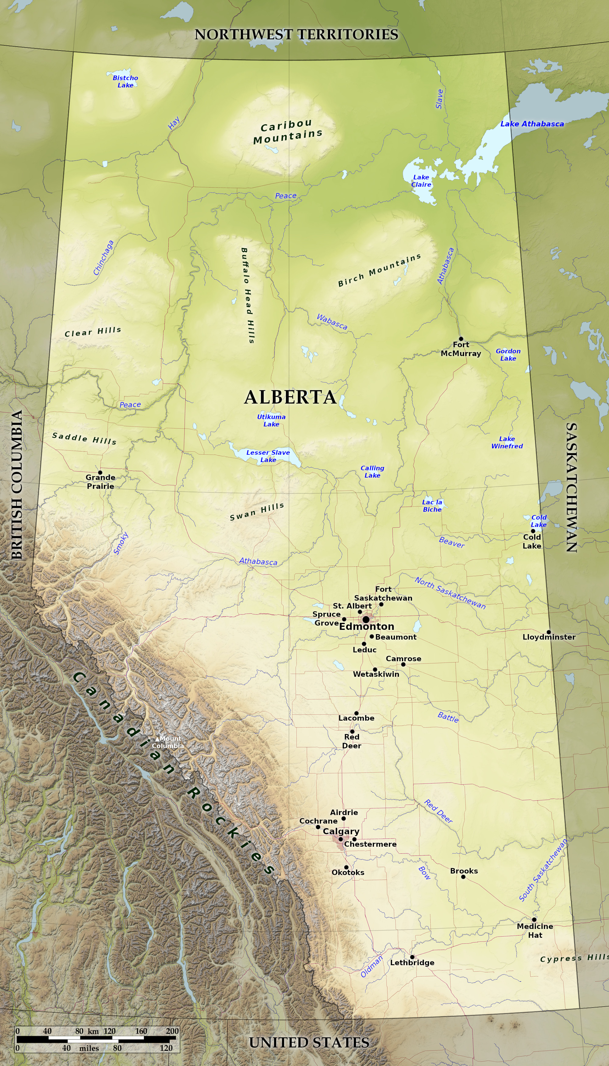 Relief map of Alberta
What is the landscape of Alberta like?
Plains
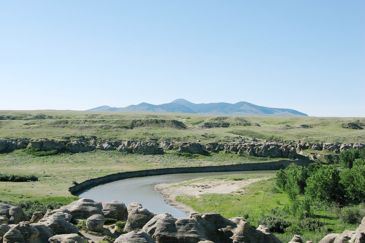
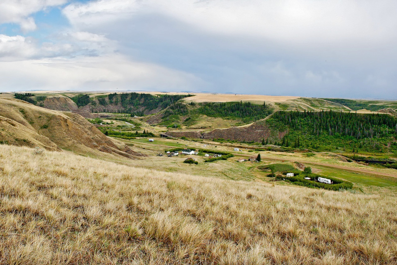
Eastern and southern Alberta is part of the great central plain with wide, open landscapes. As the slopes of the Rocky Mountains to the west are reached more trees are found, until in the foothills of the mountains forests occur. Trees become more common also in the north of the province, until north of the North Saskatchewan River forests are again met with. In the south the prairie is rather arid, but becomes more fertile further north.
The appearance of the prairie section of the province is that of undulating meadows, with rounded sloping ridges covered with shorter grasses. The wooded portions of this landscape are dotted with clumps and belts of trees of moderate size, giving them a parklike appearance. In winter the snowfall is very light, and even this is frequently removed by warm winds from the west. Within a hundred miles of the mountains there is constantly in view, in clear weather, the beautiful line of snowy peaks along the western horizon. This continues for hundreds of miles north-westward.
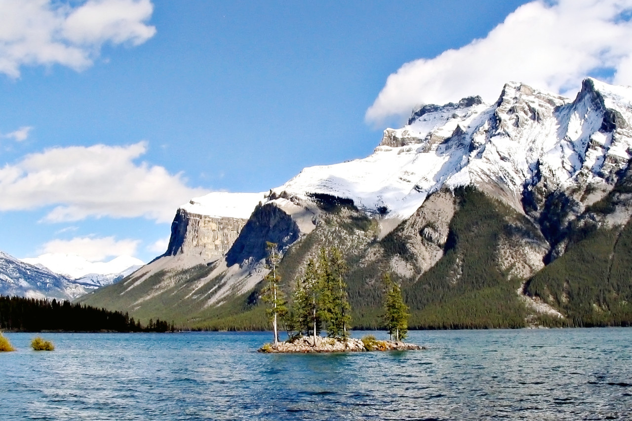
Mountains
The Rocky Mountains, which give the charm to Alberta, run in northwesterly direction, dividing the region from British Columbia. They are reached via gradual foothills from the east, until close-to, the ascent from the plain to the mountain becomes very steep. The peaks of these mountains are majestic, many of them reaching a height of more than two miles above sea-level. In Alberta the highest peak is Mount Columbia at 3,747 m (12,293 feet).
What is the nature of Alberta like?
In central and northern Alberta the opening spring brings in the prairie anemone, other early flowers. The advancing summer introduces many flowers of the sunflower family, until in August the plains are one blaze of yellow and purple. The southern part of Alberta is covered by a short grass which dries up in the middle of summer. The trees in the forested sections of the province are seen in clumps and belts on the hill sides.
On the north side of the Saskatchewan River forests occur for hundreds of miles. They contain aspen, balsam poplar, and paper or canoe birch. The conifers are found northward and in the mountain valleys. Some of these are: Jack pine, Rocky Mountain pine, black pine, white spruce, black spruce, Engelman’s spruce, mountain balsam, Douglas fir, and mountain larch. Alpine plants can be found above the treeline in the mountains; here the scenery is meadow-like and characterized by heaths and saxifrages.
What is the climate of Alberta like?
Alberta has a continental climate and sudden extremes in temperature are common in winter and summer. The winter winds from the northeast are at times very severe, while the western winds—the Chinooks—receive their warmth from the Pacific Ocean and are warm and pleasant. The snow in winter rarely lies longer than four or five days at a time when it is melted by this wind. In the summer the creeks are constantly supplied with water from the melting snow in the mountains.
| Climate data for Edmonton (1981–2010) | |||||||||||||
|---|---|---|---|---|---|---|---|---|---|---|---|---|---|
| Month | Jan | Feb | Mar | Apr | May | Jun | Jul | Aug | Sep | Oct | Nov | Dec | Year |
| Average high °C (°F) | −6.3 (20.7) | −3.8 (25.2) | 1.2 (34.2) | 10.8 (51.4) | 17.4 (63.3) | 20.6 (69.1) | 22.8 (73.0) | 22.2 (72.0) | 17.4 (63.3) | 10.4 (50.7) | −0.1 (31.8) | −5.5 (22.1) | 8.9 (48.1) |
| Daily mean °C (°F) | −12.1 (10.2) | −9.9 (14.2) | −4.4 (24.1) | 4.2 (39.6) | 10.2 (50.4) | 14.1 (57.4) | 16.2 (61.2) | 15.2 (59.4) | 10.2 (50.4) | 3.8 (38.8) | −5.4 (22.3) | −11.0 (12.2) | 2.6 (36.7) |
| Average low °C (°F) | −17.7 (0.1) | −15.9 (3.4) | −10.0 (14.0) | −2.5 (27.5) | 3.0 (37.4) | 7.6 (45.7) | 9.5 (49.1) | 8.1 (46.6) | 3.0 (37.4) | −2.9 (26.8) | −10.6 (12.9) | −16.5 (2.3) | −3.7 (25.3) |
| Average precipitation mm (inches) | 20.8 (0.82) | 11.9 (0.47) | 16.5 (0.65) | 28.7 (1.13) | 49.4 (1.94) | 72.7 (2.86) | 95.6 (3.76) | 54.9 (2.16) | 41.3 (1.63) | 22.6 (0.89) | 17.3 (0.68) | 14.5 (0.57) | 446.2 (17.56) |
| Average snowfall cm (inches) | 21.7 (8.5) | 13.4 (5.3) | 17.5 (6.9) | 14.4 (5.7) | 6.5 (2.6) | 0.0 (0.0) | 0.0 (0.0) | 0.1 (0.0) | 1.1 (0.4) | 10.4 (4.1) | 17.3 (6.8) | 15.9 (6.3) | 118.3 (46.6) |
| Source: Environment and Climate Change Canada | |||||||||||||
.jpg) Heritage Park Historical Village in Calgary
Heritage Park Historical Village in Calgary
.jpg&oldid=506004317)
The official websites
Alberta
Wild Rose Country
| Location: | Western Canada |
| Coordinates: | 55° 00′ N, 114° 30′ W |
| Size: | • 1220 km N-S; 660 km E-W • 760 miles N-S; 410 miles E-W |
| Terrain: | High mountains in the southwest; prairie landscape in the southeast; subarctic landscape in the north |
| Climate: | Continental climate: cold winters with mild to hot summers. High sunshine levels |
| Highest point: | Mount Columbia 3,747 m / 12,293 ft |
| Forest: | 56% (2010) (source) |
| Population: | 4,436,258 (2021) |
| Population density: | Low (16/km²) |
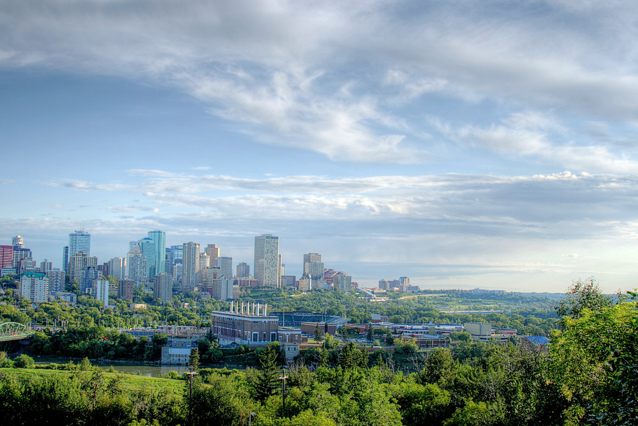
| Capital: | Edmonton |
| Languages: | English |
| Human Development Index: | Very High (0.948) |