The Geography of
British Columbia
Why visit British Columbia?
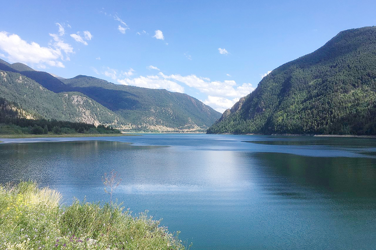
British Columbia is a province full of incredible natural beauty. More than half the land is forested and the scenery includes the Rocky Mountains, the Coast Range, and the deeply indented coast. The people of British Columbia are friendly and welcoming to visitors from all over the world. There are plenty of activities to enjoy, including hiking in the stunning Canadian Rockies or kayaking on some of British Columbia’s most pristine waterways.
Map
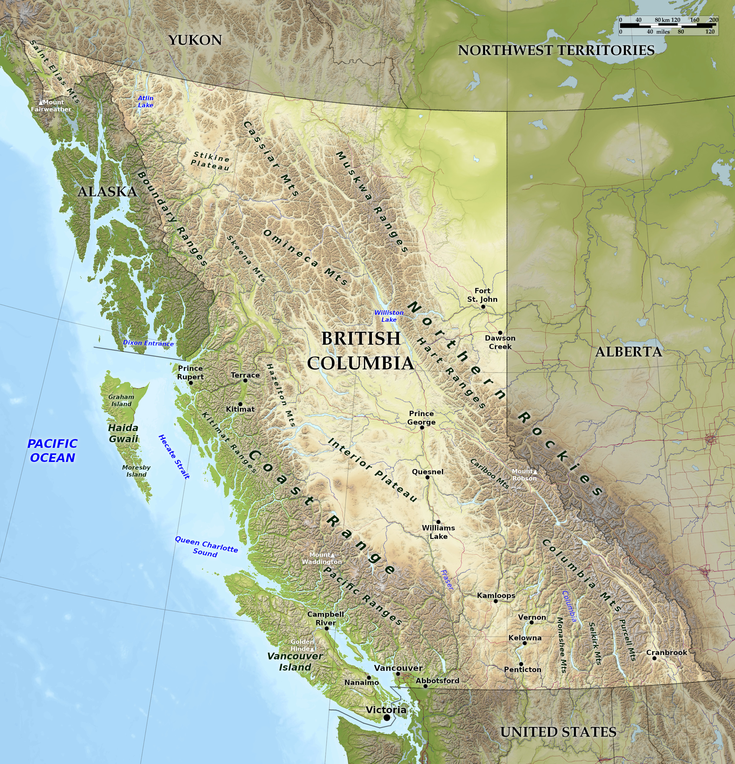 Relief map of British Columbia
What is the landscape of British Columbia like?
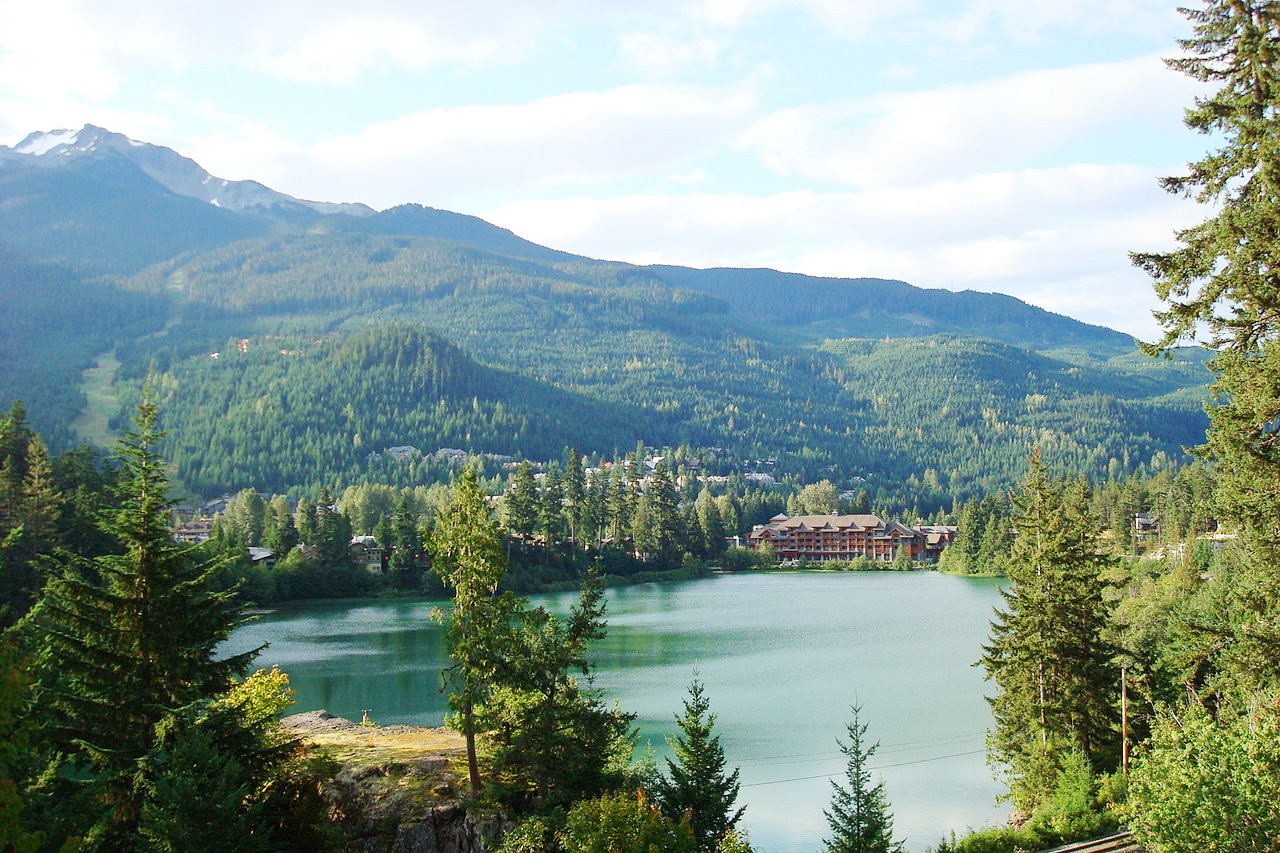
British Columbia is a mountainous region in which the Rocky Mountains approach the Pacific coast ranges. Thus there are two ruling mountain systems—the Rocky Mountains proper on the east side, and the Coast Range on the west or Pacific side. Between these are lesser ranges, as well as the Interior Plateau—an elevated region of hill country. Vancouver Island and Haida Gwaii island are remnants of still another mountain range, which runs parallel to the coast but is now almost entirely submerged beneath the Pacific. The province might be said to consist of a series of parallel mountain ranges with long narrow valleys lying between them.
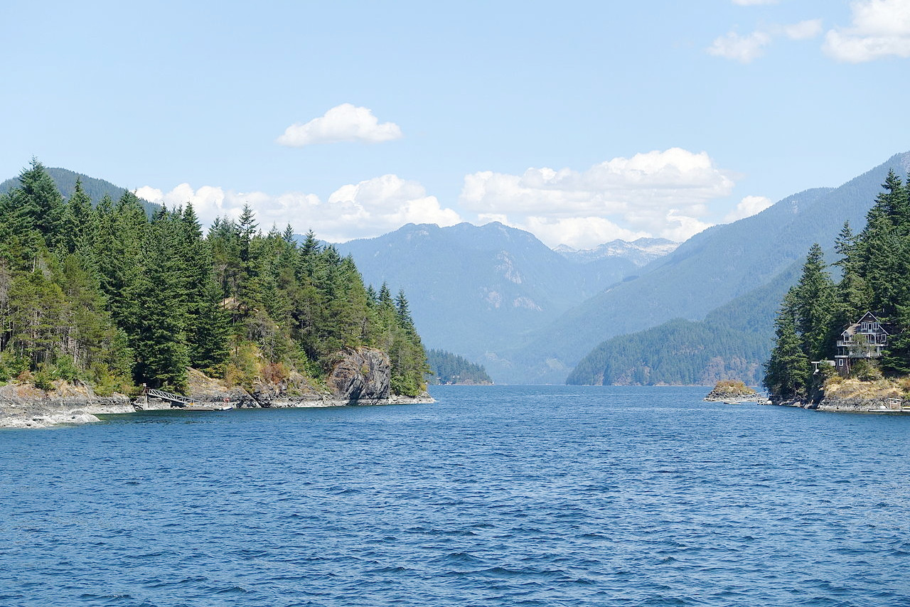
Coast Range
The Coast Range borders the Pacific coast for 900 miles and has a remarkable character. It is around 2,000 meters (6,500 feet) high and averages about 100 miles in width. Its partially submerged valleys create the deep sounds and inlets which penetrate far inland at many points, as well as the profound and gloomy fjords and the stupendous precipices which make the coast line resemble Norway. The coast is one of the most remarkable in the world, measuring with all its indentations 7,000 miles, and is fringed with innumerable islands, of which Vancouver Island and Haida Gwaii are the largest. In the far northwest is the highest mountain in British Columbia: Mount Fairweather which rises to 4,671 m (15,325 feet).
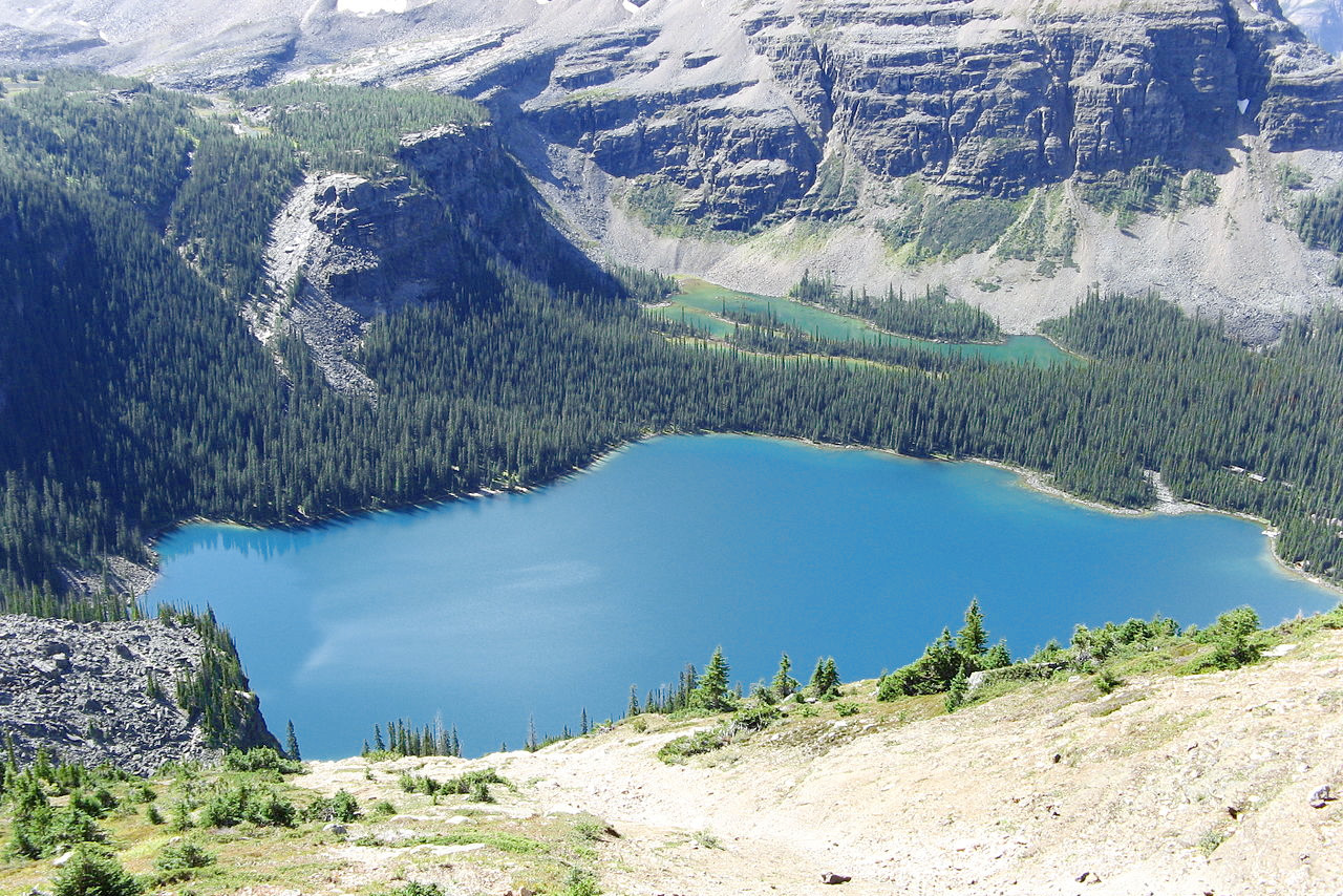
Canadian Rockies
The Canadian Rockies, which lie to the east, are the northern end of the Rocky Mountains which forms the backbone of the continent from Mexico to Alaska. In the southern half of British Columbia the average height of the peaks is around 2,500 meters (8,000 feet), and the highest of the peaks in is Mount Robson which rises to 3,954 m (12,972 feet); northward the mountains become progressively lower. The average width of the range is 60 miles.
Center
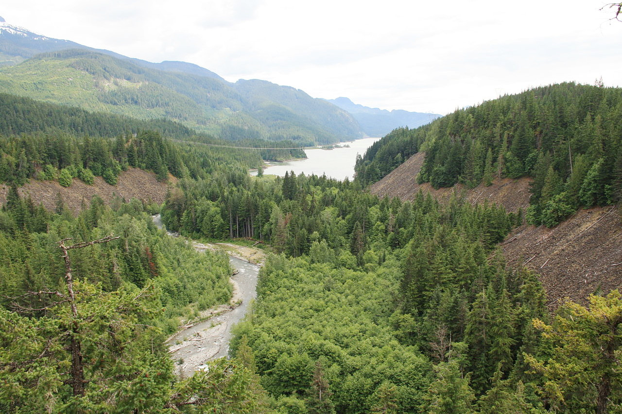
The central regions of British Columbia consist of plateau and low mountains, 200 miles wide, which merge into the Columbia and Rocky Mountain systems on either side. The landscape is of two types: First, the deep-cut U-shaped valleys with heights ranging from 300 to 600 meters (1,000–2,000 feet) above sea-level; second, the rolling upland plateau, 1,000 to 1,500 meters (3,500–5,000 feet) above sea-level, dissected with V-shaped valleys where the rivers erupt from the uplands into the main valleys.
In the south is a valley region in which some of the great rivers of the Pacific slope flow for portions of their upper courses. One of the most important rivers is the Fraser River, which rises in the Rocky Mountains, flows for a long distance to the northwest, and then turning south eventually crosses the Coast Range by a deep canyon-like valley and empties into the Pacific Ocean a few miles south of Vancouver. The Columbia River, which rises farther south in the same range, flows north for about 150 miles, and then bending abruptly, flows south and on through the Arrow Lakes into the United States, emptying into the Pacific in Oregon. These lakes, as well as the other large lakes in southern British Columbia, remain open throughout the winter.
What is the nature of British Columbia like?
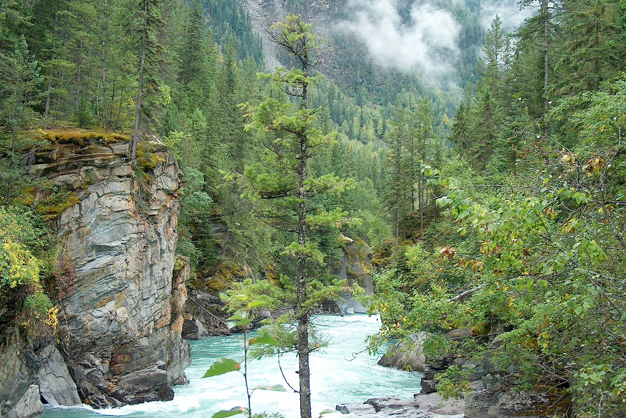
British Columbia is part of the great Pacific forest region of North America and the greatest coniferous forest of the world. The western slopes of the mountains, particularly the Coast ranges, are covered with a dense growth of forest trees which attain remarkable proportions. On the eastern slopes the forests are not so dense nor the trees so large, while much of the interior plateau is well-nigh treeless. The lower Fraser country especially is densely wooded. The rivers and the many inlets and arms all along the coast are bordered with extensive forests. The most abundant species is the Douglas fir which sometimes attains a height of 100 meters (350 feet). There are also dense forests of white cedar; yellow cedar; spruce; and hemlock. Other trees are Menzie's fir, yellow pine, yew, oak, white maple, aspen, cherry, willow, and cottonwood.
The coast forests have such humid atmosphere that a luxuriant growth of ferns often carpet large areas of the forest floor, or clothe the large trunks and branches of the soft maples. The combined effect of these ferns, together with an abundance of mosses and lichens hanging in festoons from the branches, makes the coast forest resemble to a tropical jungle.
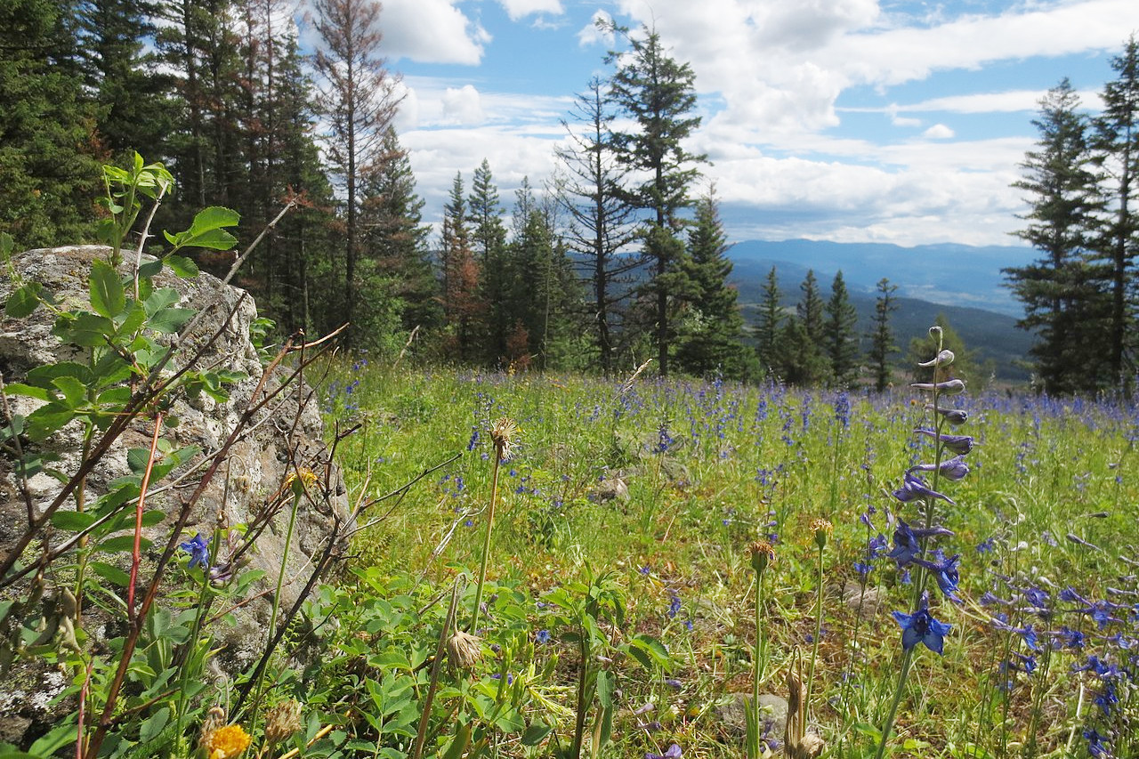
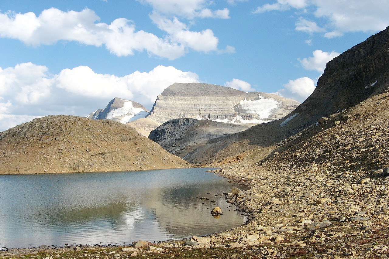
Alpine conditions are to be found on most of the British Columbia mountains above an altitude of 1,700 meters (5,500 feet). At an altitude of 1,400 meters (4,500 feet), is found moist meadow-like land abounding in shrubs such as white rhododendron; red heather; creamy yellow heather; white heather; copper-bush; and blueberries. Much of the moist land is carpeted with the beautiful alpine Spiraea (Eriogynia pectinata); globe flower (Trollius albiflorus); and similar plants. In this zone small subalpine lakes are abundant.
The drier regions of British Columbia are characterized by the scarcity or absence of trees and the predominance of sagebrush; rayless golden rod, balsam root; and similar plants. In the northern parts of the Province are the bog areas—in the spring the bogs are ablaze with the flowers of the laurel and Labrador tea. Later in the year such bogs yield great crops of cranberries, blueberries, and cloudberries.
What is the climate of British Columbia like?
The climate of British Columbia is far warmer than the east coast of Canada. On Vancouver Island the summers are warm with much bright sunshine, and severe frost scarcely ever occurs in winter. On the mainland there are similar conditions except at altitude where the winters are colder.
To the east of the Coast Range the climate is quite different. The summers are warmer, the winters colder and the rainfall is rather light—bright dry weather being the rule. The cold of winter is, however, scarcely ever severe, and the hottest days of summer are made pleasant by the fact that the air is dry and the nights are cool. Further north the winters are more severe.
| Climate data for Vancouver (1981-2010) | |||||||||||||
|---|---|---|---|---|---|---|---|---|---|---|---|---|---|
| Month | Jan | Feb | Mar | Apr | May | Jun | Jul | Aug | Sep | Oct | Nov | Dec | Year |
| Average high °C (°F) | 6.9 (44.4) | 8.2 (46.8) | 10.3 (50.5) | 13.2 (55.8) | 16.7 (62.1) | 19.6 (67.3) | 22.2 (72.0) | 22.2 (72.0) | 18.9 (66.0) | 13.5 (56.3) | 9.2 (48.6) | 6.3 (43.3) | 13.9 (57.0) |
| Daily mean °C (°F) | 4.1 (39.4) | 4.9 (40.8) | 6.9 (44.4) | 9.4 (48.9) | 12.8 (55.0) | 15.7 (60.3) | 18.0 (64.4) | 18.0 (64.4) | 14.9 (58.8) | 10.3 (50.5) | 6.3 (43.3) | 3.6 (38.5) | 10.4 (50.7) |
| Average low °C (°F) | 1.4 (34.5) | 1.6 (34.9) | 3.4 (38.1) | 5.6 (42.1) | 8.8 (47.8) | 11.7 (53.1) | 13.7 (56.7) | 13.8 (56.8) | 10.8 (51.4) | 7.0 (44.6) | 3.5 (38.3) | 0.8 (33.4) | 6.8 (44.2) |
| Average precipitation mm (inches) | 168.4 (6.63) | 104.6 (4.12) | 113.9 (4.48) | 88.5 (3.48) | 65.0 (2.56) | 53.8 (2.12) | 35.6 (1.40) | 36.7 (1.44) | 50.9 (2.00) | 120.8 (4.76) | 188.9 (7.44) | 161.9 (6.37) | 1,189 (46.81) |
| Average snowfall cm (inches) | 11.1 (4.4) | 6.3 (2.5) | 2.3 (0.9) | 0.3 (0.1) | 0.0 (0.0) | 0.0 (0.0) | 0.0 (0.0) | 0.0 (0.0) | 0.0 (0.0) | 0.1 (0.0) | 3.2 (1.3) | 14.8 (5.8) | 38.1 (15.0) |
| Source: Environment and Climate Change Canada | |||||||||||||
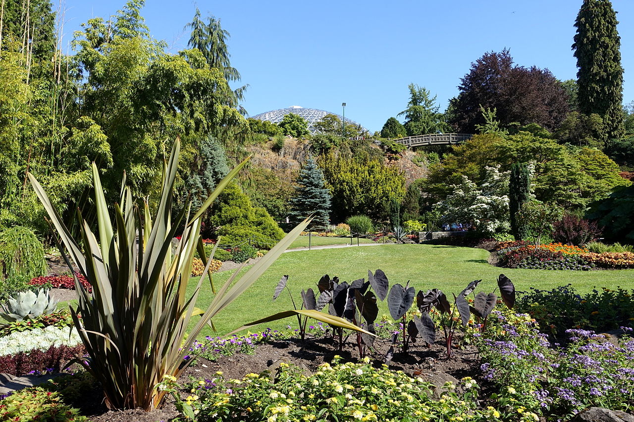 Main Quarry Garden, Queen Elizabeth Park, Vancouver
The official websites
British Columbia
Beautiful British Columbia
| Location: | Western Canada |
| Coordinates: | 54° 00′ N, 125° 00′ W |
| Size: | • 1220 km N-S; 1300 km E-W • 760 miles N-S; 800 miles E-W |
| Terrain: | Mountainous; coastal fjords with chains of islands; some plateaus and plains in the interior |
| Climate: | Moderate on the coasts becoming continental inland with cold winters and mild to hot summers |
| Highest point: | Mount Fairweather 4,671 m / 15,325 ft |
| Forest: | 71% (2010) (source) |
| Population: | 5,153,039 (2021) |
| Population density: | Very low (5/km²) |
| Capital: | Victoria |
| Languages: | English |
| Human Development Index: | Very High (0.938) |