.jpg)
.jpg&oldid=643284334)
The Geography of
Canada
Why visit Canada?
Canada is a country covering more than half the continent of North America, and reaching from the latitude of Italy to the North Pole. It is a country whose circuitous coast-line on the Atlantic measures 10,000 miles, and whose western shore upon the Pacific, studded with islands and indented by and deep inlets, attains almost an equal length; a country where corn and peaches are staple crops, and where vegetation fades out upon the desolate shores of the Arctic Ocean. To look at the eastern region alone, we see the greatest forest region in the world. To consider the central portion, we are regarding the great prairie country: but to cross the passes into the Pacific Province, we enter upon a kingdom of mountains.
Map
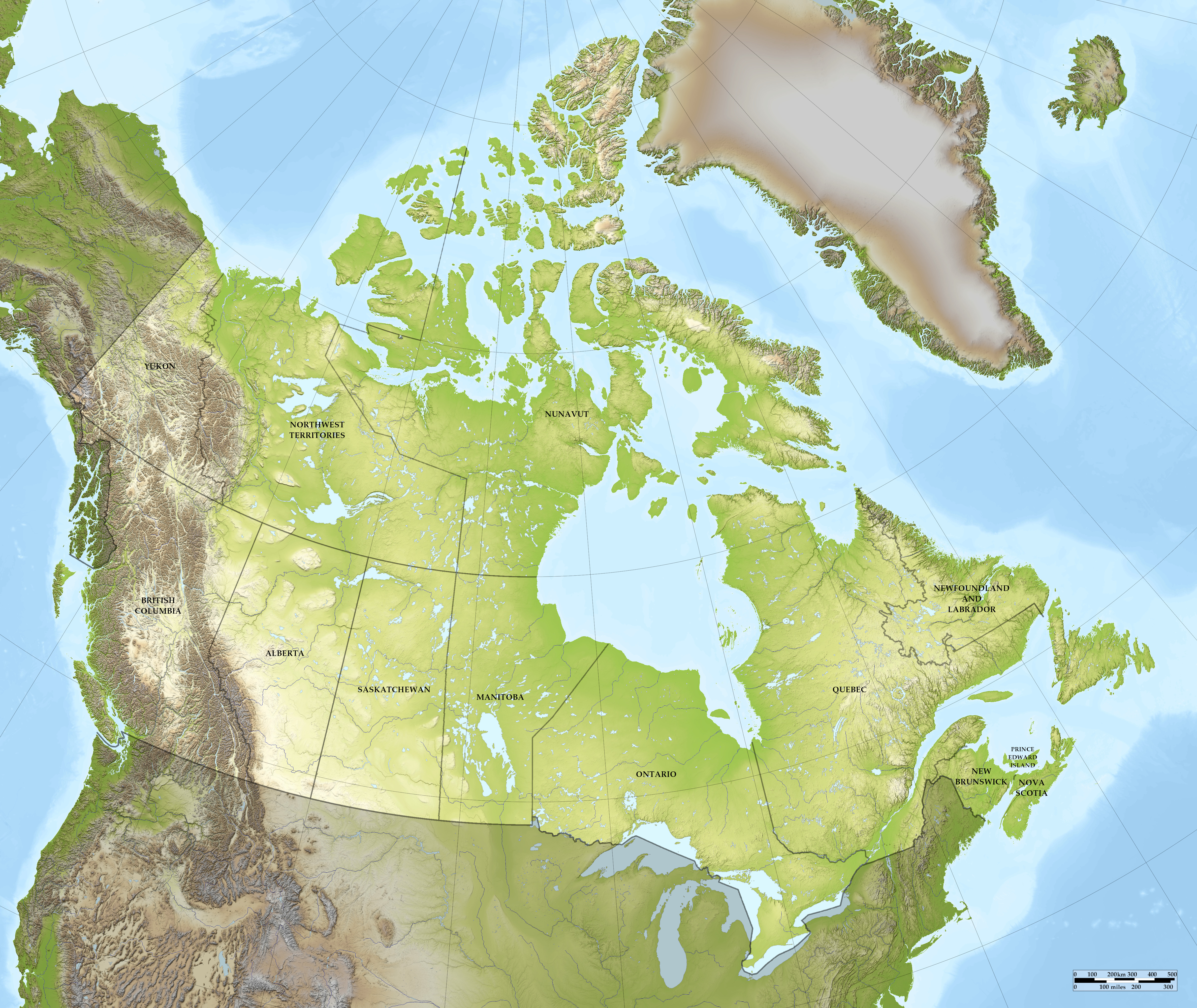 Relief map of Canada
The provinces and territories of Canada
What is the nature of Canada like?
The environment of the northern part of Canada is arctic and subarctic, and this characterizes the scanty plant-life in the East all the way down to the height of land which separates Labrador and the basin of Hudson Hay from the Saint Lawrence Valley. A great space between Hudson Bay and the Arctic shores is almost a desert, and has been known from the earliest times as the Tundra, yielding hardly anything more than mosses, lichens, and a few willows and hardy herbs.
The flora of the Saint Lawrence Valley and of the Maritime Provinces, on the other hand, is similar to that of the northeastern United States, the whole of that space having been originally covered with mixed forests of large trees. The western plains are comparatively treeless as far north as the Saskatchewan River, yet are covered with prairie grasses, which thin out toward the higher and drier steppes westward, where the plains are covered with the bunch-grasses which once supported enormous herds of buffaloes. North of the Saskatchewan a broad belt of rather small and sparse trees extends from Hudson Bay to Great Slave Lake and the Rocky Mountains—chiefly spruce, tamarack, and poplar.
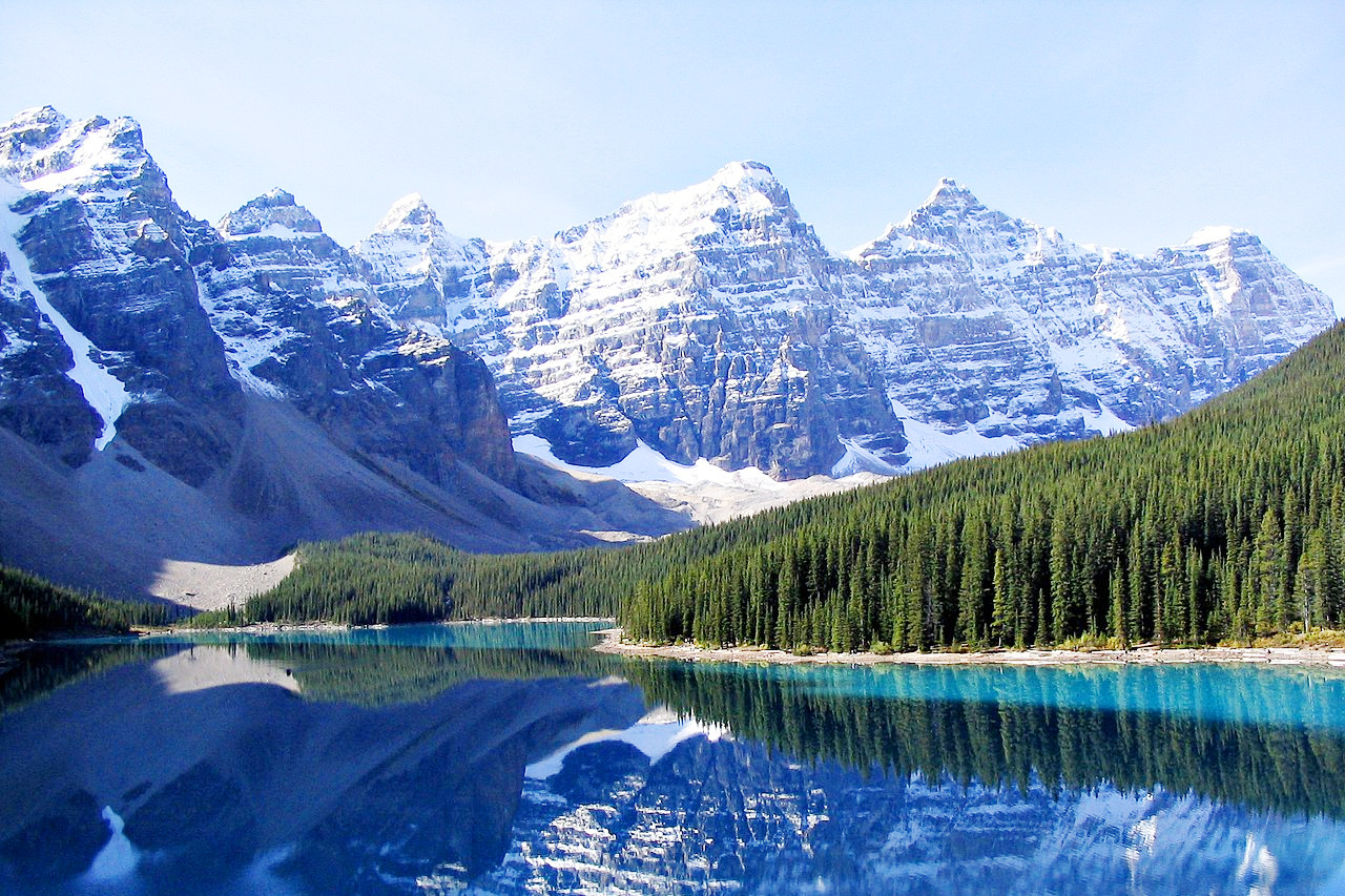
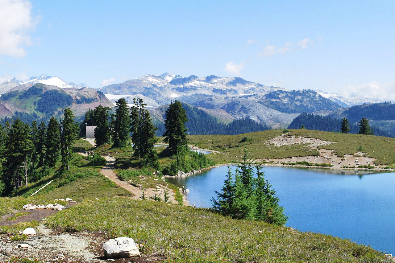
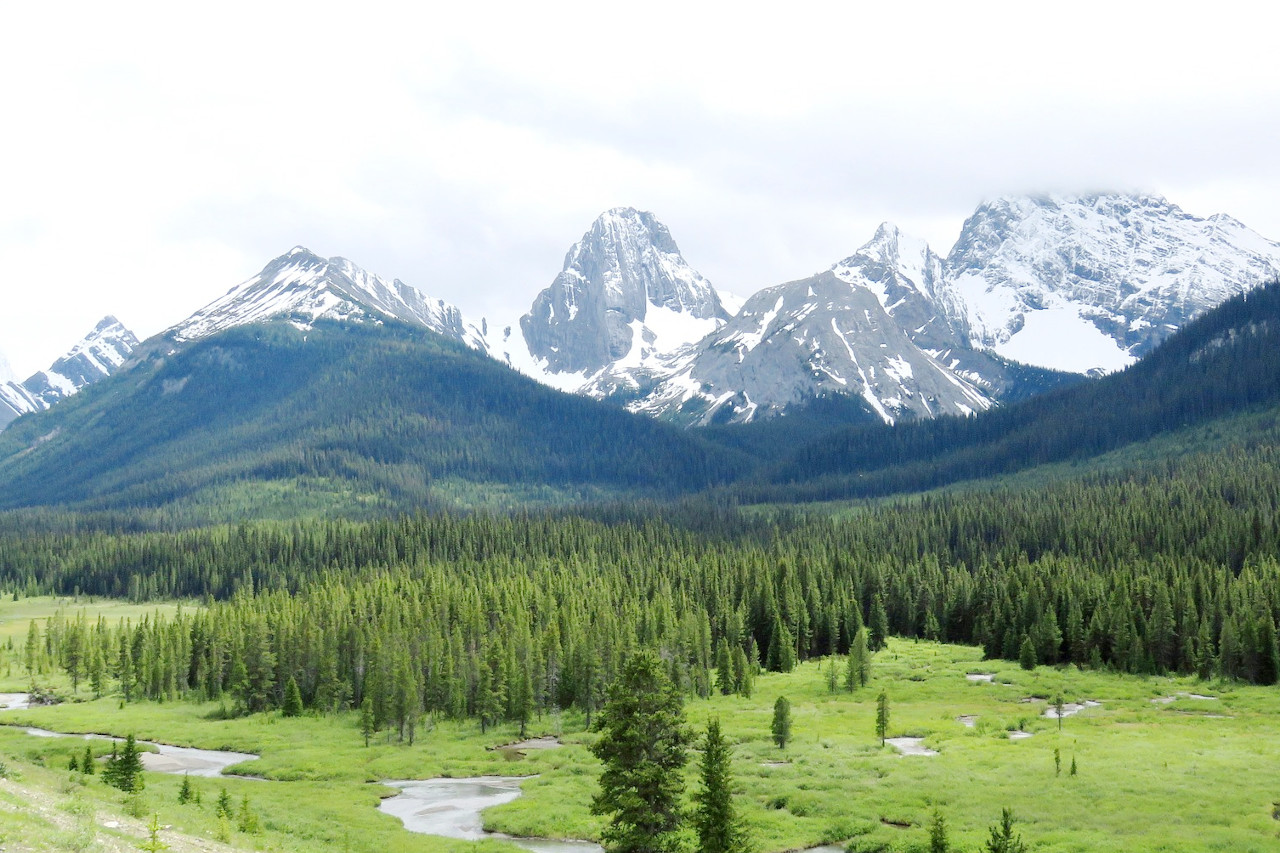
The dry western slopes and valleys of the Rocky Mountains are thinly covered with woods, mainly pine; but the forest increases in density and the trees in size as one proceeds west toward the region of greater rainfall; and the coast ranges, and especially their western slopes, are found covered with the dense forests of mighty evergreen trees that characterize the northwest coast of all North America. These coast forests are inconceivably dense and sombre, and their average height on the lowlands is not less than 200 feet, while the Douglas spruces often exceed 60 meters (300 feet), and the cedars are hardly less tall.
What is the climate of Canada like?
See our main article: The Climate of Canada
In the northeastern region, the 'Hudson Bay Country,' the climate of Canada is arctic or subarctic—a brief, warm summer and a long, cold winter, with much fog on the ice-bound coast. The current of cold water flowing down that coast past Greenland keeps the entrance to Hudson Bay frozen for half of the year, and often packs ice along the coast of Labrador as to make it inaccessible until summer. The region of the Gulf of Newfoundland abounds in fog, and the air of New Brunswick and Nova Scotia is surprisingly cool, with much rain and snow. In the northern interior dry and severe cold prevails ever half of the year, the mercury, even as far south as Manitoba, frequently dropping to -45°C (-50°F).
The climate of the Saint Lawrence Valley, however, is excellent—cold, dry, and bracing, with much snow and occasional severe cold in winter, and in summer heat without much moisture, but usually an abundance of rain. The climate of the more southerly part of the Canadian Northwest is much more favorable to life than one wouid suppose from the latitude. Vancouver Island and the coast of British Columbia have a warm, temperate climate. Flowers bloom in the gardens the year round. The winds that sweep across British Columbia and strike against the Canadian Rocky Mountains deposit snow on the western side. The eastern side of the Rockies has little snow and is sparsely covered with trees, as compared with its western side, and the general temperature is cooler; yet the eastern foothills of the Rockies have a milder climate and earlier spring than the western.
| Climate data for Ottawa (1981–2010) | |||||||||||||
|---|---|---|---|---|---|---|---|---|---|---|---|---|---|
| Month | Jan | Feb | Mar | Apr | May | Jun | Jul | Aug | Sep | Oct | Nov | Dec | Year |
| Average high °C (°F) | −5.8 (21.6) | −3.1 (26.4) | 2.4 (36.3) | 11.4 (52.5) | 19.0 (66.2) | 24.1 (75.4) | 26.6 (79.9) | 25.4 (77.7) | 20.5 (68.9) | 12.8 (55.0) | 5.5 (41.9) | −2.0 (28.4) | 11.4 (52.5) |
| Daily mean °C (°F) | −10.2 (13.6) | −7.9 (17.8) | −2.2 (28.0) | 6.5 (43.7) | 13.5 (56.3) | 18.7 (65.7) | 21.2 (70.2) | 19.9 (67.8) | 15.3 (59.5) | 8.4 (47.1) | 2.0 (35.6) | −5.6 (21.9) | 6.6 (43.9) |
| Average low °C (°F) | −14.4 (6.1) | −12.5 (9.5) | −6.8 (19.8) | 1.5 (34.7) | 8.0 (46.4) | 13.3 (55.9) | 15.7 (60.3) | 14.5 (58.1) | 10.1 (50.2) | 4.0 (39.2) | −1.5 (29.3) | −9.2 (15.4) | 1.9 (35.4) |
| Average precipitation mm (inches) | 62.9 (2.48) | 49.7 (1.96) | 57.5 (2.26) | 71.1 (2.80) | 86.6 (3.41) | 92.7 (3.65) | 84.4 (3.32) | 83.8 (3.30) | 92.7 (3.65) | 85.9 (3.38) | 82.7 (3.26) | 69.5 (2.74) | 919.5 (36.20) |
| Average snowfall cm (inches) | 44.3 (17.4) | 34.7 (13.7) | 29.1 (11.5) | 7.2 (2.8) | 0.0 (0.0) | 0.0 (0.0) | 0.0 (0.0) | 0.0 (0.0) | 0.0 (0.0) | 2.9 (1.1) | 16.0 (6.3) | 41.3 (16.3) | 175.4 (69.1) |
| Source: Environment Canada | |||||||||||||
.jpg) Frontenac County Courthouse, Kingston, Ontario
Frontenac County Courthouse, Kingston, Ontario
.jpg&oldid=600954964)
The official websites
Canada
For Glowing Hearts
| Location: | Western Hemisphere on the continent of North America |
| Coordinates: | 60° 00′ N, 100° 00′ W |
| Size: | • 4600 km N-S; 5200 km E-W • 2900 miles N-S; 3200 miles E-W |
| Terrain: | Mostly a vast plateau with forests and lakes. Low mountain ranges in the east. Northern extension of the Rocky mountains in the west |
| Climate: | Northern Canada has a subarctic or arctic climate, with long cold winters and short sunny summers. The south is warmer with hot summers and cold winters. Maritime climate on the Pacific coast |
| Highest point: | Mount Logan 5,959 m / 19,551 ft |
| Forest: | 43% (2010) (source) |
| Population: | 38,232,593 (2022 est.) |
| Population density: | Very Low (4/km²) |
| Capital: | Ottawa |
| Languages: | English (official) 58.7%, French (official) 22% |
| Human Development Index: | Very High (0.929) |
| Currency: | Canadian Dollar |