The Geography of
Labrador
Why visit Labrador?
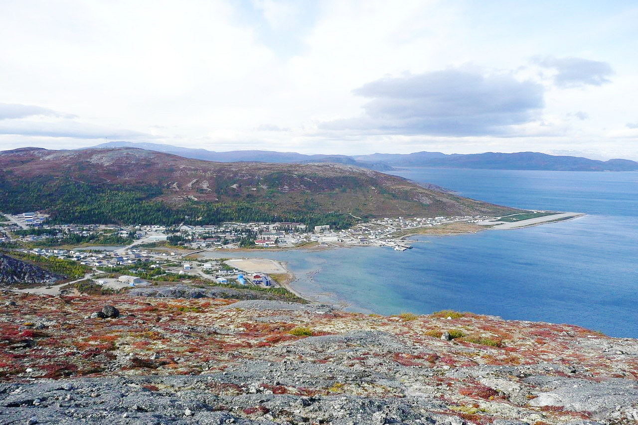
Labrador is a region of Canada that offers a beautiful mix of natural wonders including mountains, forests, lakes and ocean. There is scenery of all types—especially if you prefer to explore the wilderness—from desolate alpine peaks to lush valley forests. The fantastic coastline contains numerous bays, fjords, inlets, and high cliffs. Wandering through these landscapes is truly a unique experience.
Contents
Map
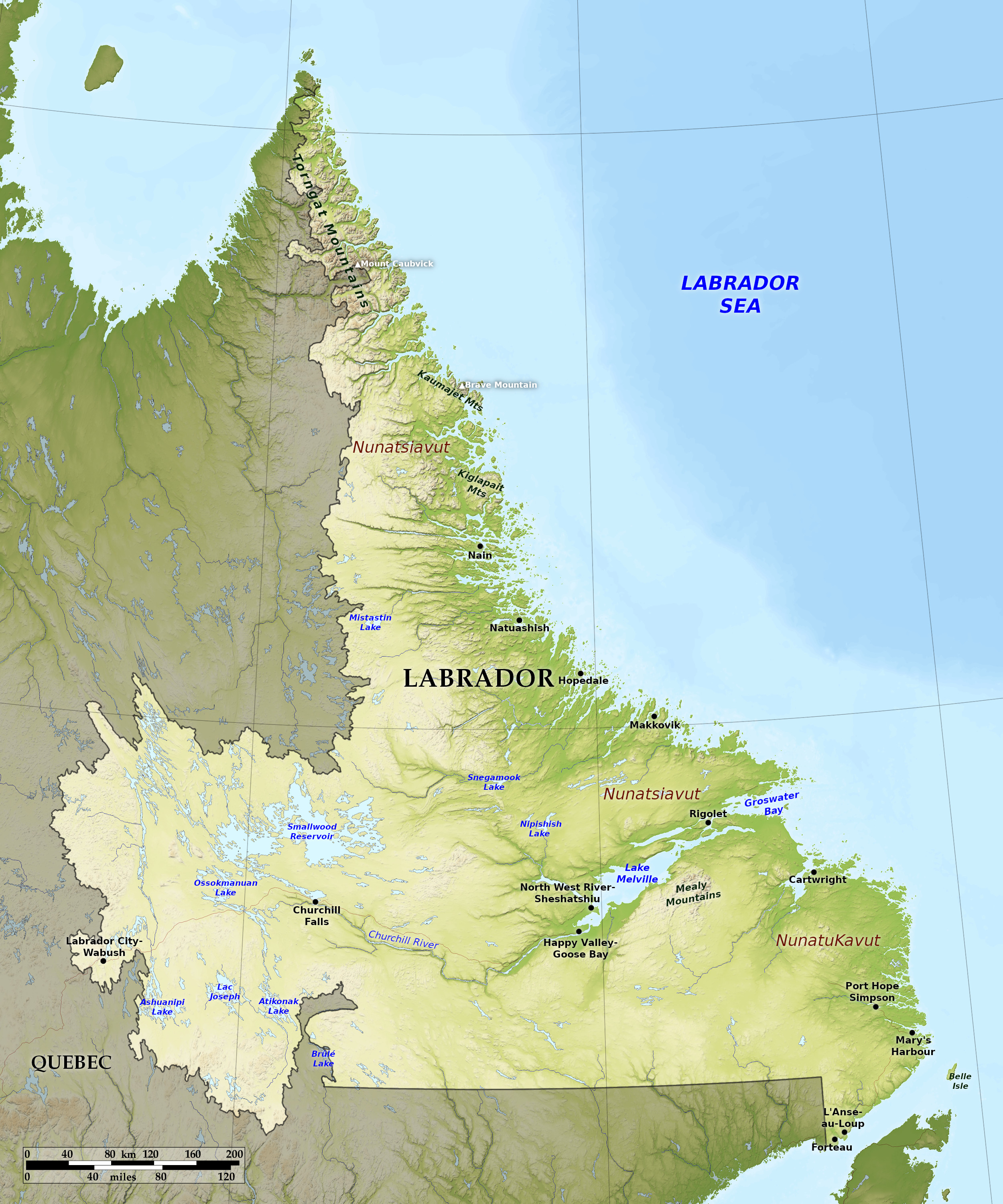 Relief map of Labrador
What is the landscape of Labrador like?
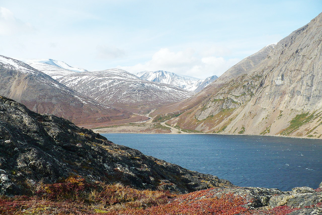
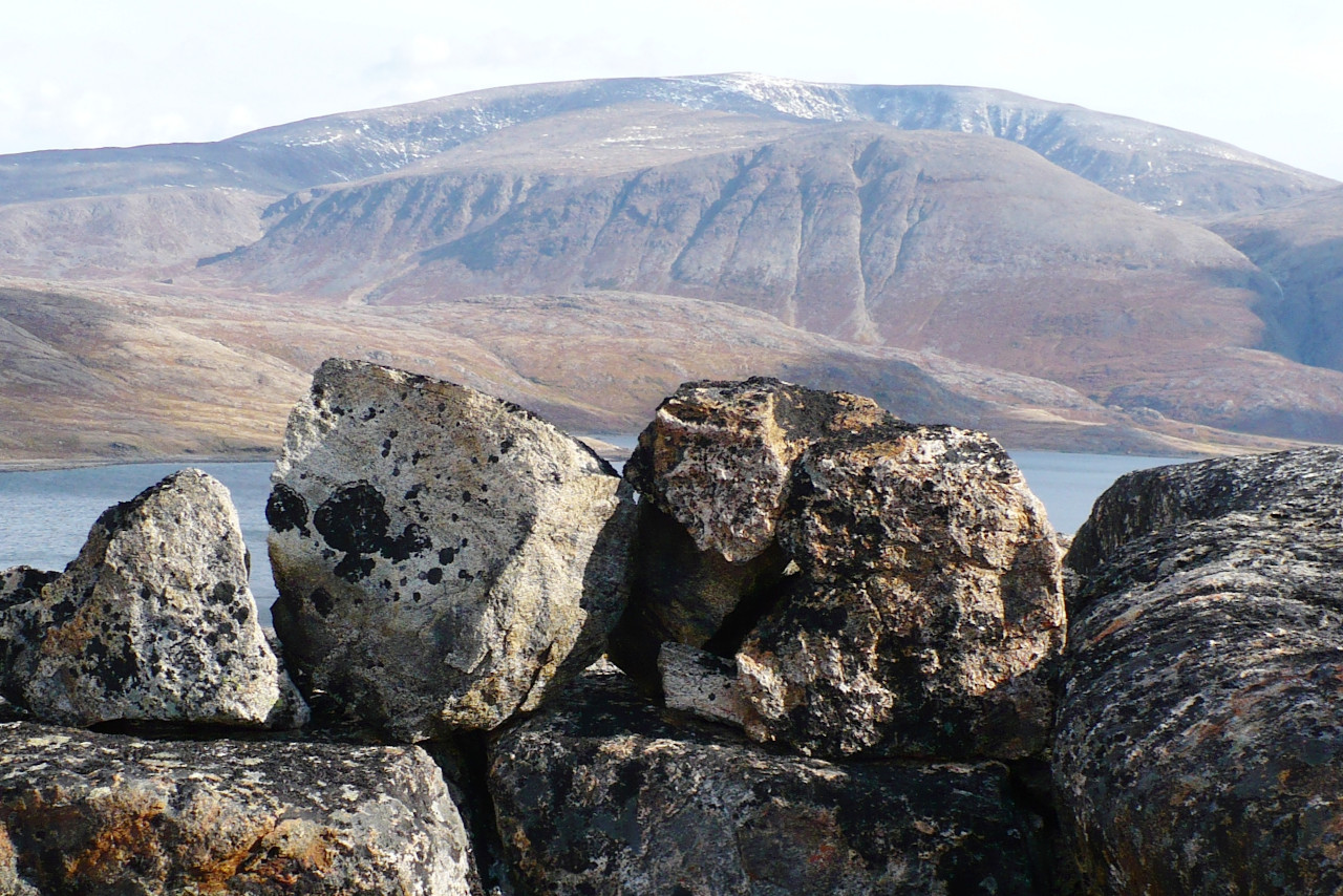
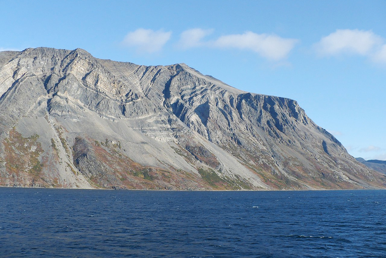
Along some parts of the coast there is a fringe of lowland, but most of Labrador is a plateau. The mountains of Labrador range inland along the Atlantic coast; in southern Labrador they rarely exceed 450 meters (1,500 feet), but increase in the north to a general height of upwards of 600 meters (2,000 feet), with numerous sharp peaks between 1,000 and 1,500 meters (3,000 and 5,000 feet). The coasts are deeply indented by irregular bays and fringed with rocky islands, especially along the high Atlantic coast, where long narrow fiords penetrate inland. The longest of these bays is Groswater Bay combined with Lake Melville, with a length of 150 miles, and a width varying from 2 to 30 miles.
The depressions between the low ridges of the interior are occupied by innumerable lakes, many of great size: up to 100 miles long. The rivers flow on a level with the country and occupy all depressions, so that they frequently spread out into lake-expansions and are often divided into numerous channels by large islands. The descent of the rivers into the valleys is often abrupt, being made by heavy rapids and falls.
What is the nature of Labrador like?
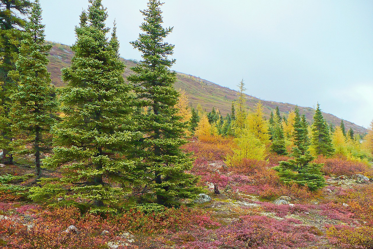
The southern half of Labrador is part of the sub-Arctic forest belt. Forest is continuous over the southern region, with tree species including the white birch, poplar, aspen, cedar, Jack pine, white and black spruce, balsam fir and larch. To the north the size and number of barren areas rapidly increase, so that in the far north the limit of the trees is passed and the landscape is instead covered with low Arctic flowering plants, sedges, and lichens.
What is the climate of Labrador like?
The climate ranges from cold temperate on the southern coasts to arctic conditions in the north. The outer coasts are affected by the floating ice borne southwards on the Arctic current. There are only two seasons in the interior: winter begins early in October, with the freezing of the small lakes, and lasts until the middle of June, when the ice on rivers and lakes melts and summer suddenly bursts forth. On the Atlantic coast the larger bays freeze solid in December, and these coasts often remain ice-bound until June.
| Climate data for Happy Valley–Goose Bay (1981−2010) | |||||||||||||
|---|---|---|---|---|---|---|---|---|---|---|---|---|---|
| Month | Jan | Feb | Mar | Apr | May | Jun | Jul | Aug | Sep | Oct | Nov | Dec | Year |
| Average high °C (°F) | −12.7 (9.1) | −10.1 (13.8) | −3.6 (25.5) | 3.9 (39.0) | 11.0 (51.8) | 17.1 (62.8) | 20.9 (69.6) | 20.4 (68.7) | 14.9 (58.8) | 7.0 (44.6) | −0.3 (31.5) | −8.2 (17.2) | 5.0 (41.0) |
| Daily mean °C (°F) | −17.6 (0.3) | −15.7 (3.7) | −9.5 (14.9) | −1.1 (30.0) | 5.6 (42.1) | 11.4 (52.5) | 15.5 (59.9) | 15.1 (59.2) | 10.0 (50.0) | 3.2 (37.8) | −4.0 (24.8) | −12.5 (9.5) | 0.0 (32.0) |
| Average low °C (°F) | −22.5 (−8.5) | −21.3 (−6.3) | −15.4 (4.3) | −6.1 (21.0) | 0.0 (32.0) | 5.6 (42.1) | 10.0 (50.0) | 9.7 (49.5) | 5.1 (41.2) | −0.6 (30.9) | −7.6 (18.3) | −16.8 (1.8) | −5.0 (23.0) |
| Average precipitation mm (inches) | 64.6 (2.54) | 56.8 (2.24) | 65.3 (2.57) | 63.6 (2.50) | 69.3 (2.73) | 91.4 (3.60) | 121.3 (4.78) | 99.3 (3.91) | 91.0 (3.58) | 81.2 (3.20) | 72.2 (2.84) | 64.4 (2.54) | 940.4 (37.02) |
| Average snowfall cm (inches) | 78.6 (30.9) | 63.2 (24.9) | 71.8 (28.3) | 48.3 (19.0) | 19.1 (7.5) | 1.4 (0.6) | 0.0 (0.0) | 0.0 (0.0) | 0.3 (0.1) | 19.3 (7.6) | 55.6 (21.9) | 70.6 (27.8) | 428.3 (168.6) |
| Source: Environment and Climate Change Canada | |||||||||||||
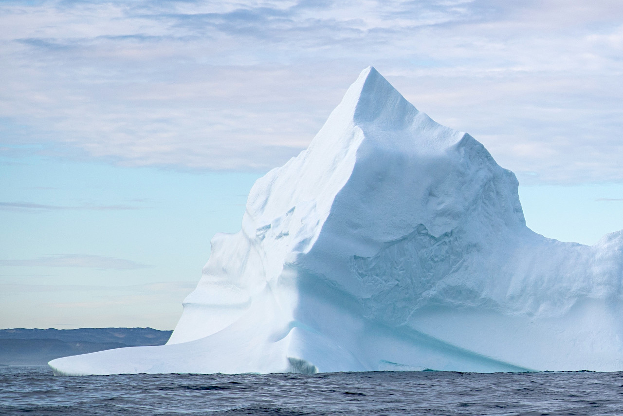 Iceberg in the Labrador Sea
The official websites
Labrador
The Big Land
| Location: | Eastern Canada |
| Coordinates: | 54° 15′ N, 61° 45′ W |
| Size: | • 975 km N-S; 800 km E-W • 600 miles N-S; 500 miles E-W |
| Terrain: | Rolling landscape with a rugged coastline etched with deep fjords. Mountains in the far north. |
| Climate: | Subarctic climate with brief summers and cold winters |
| Highest point: | Caubvick / D'Iberville 1,652 m / 5,420 ft |
| Forest: | 55% (2010) (source) |
| Population: | 27,197 (2016) |
| Population density: | Very Low (0.1/km²) |
| Capital: | St. John's (Newfoundland) |
| Languages: | English |
| Human Development Index: | Very High (0.894) |