_(5455048958).jpg)
_(5455048958).jpg&oldid=532622341)
The Geography of
Newfoundland
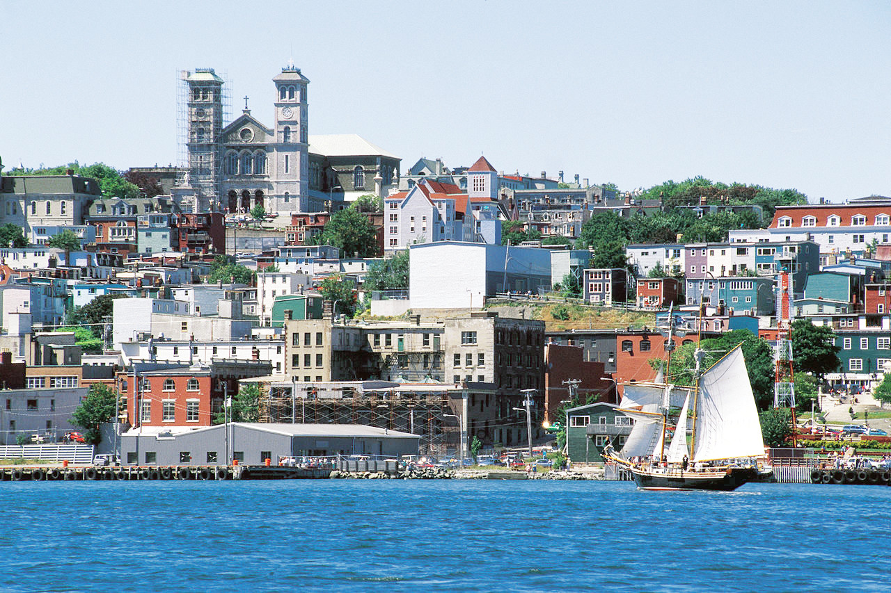
Why visit Newfoundland?
The scenery of Newfoundland is absolutely breathtaking. The climate is temperate, with warm summers and cold winters. The hills and valleys are rocky and serene, and the ocean is always in view. The towns and villages are quaint and there are lots of interesting places to visit. The people are very friendly and welcoming, and the climate is perfect for a walk or a bike ride.
Contents
Map
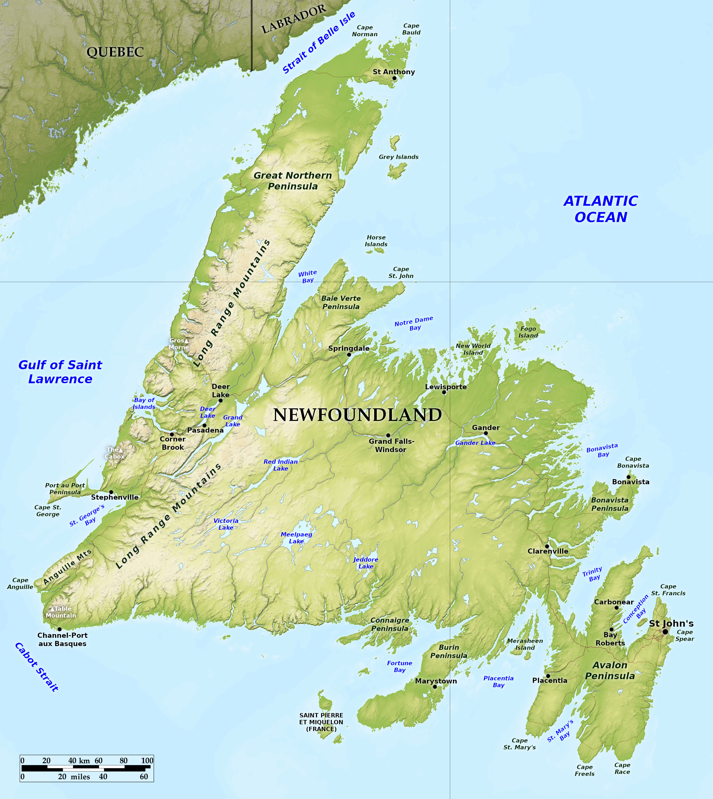 Relief map of Newfoundland
What is the landscape of Newfoundland like?
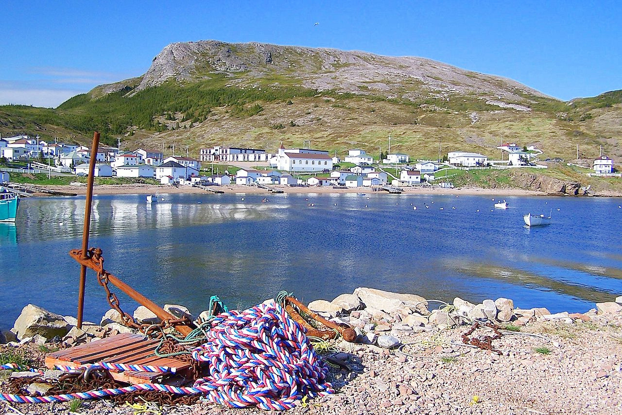
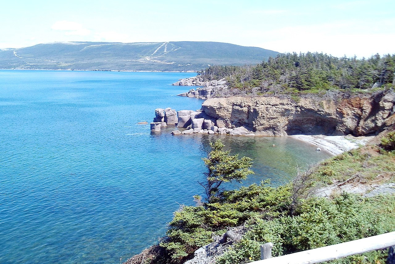
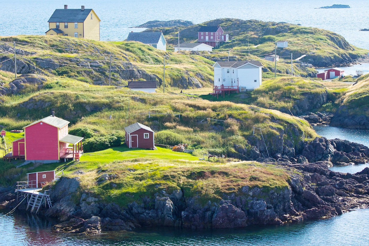
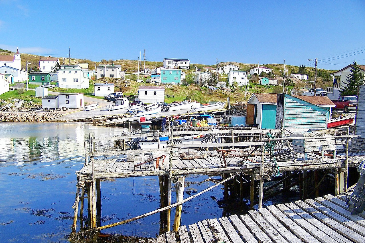
The coast of Newfoundland has deep fjords and large bays running in some instances 80 to 90 miles inland. The fjords resemble those of Norway; islands are numerous, some of them clad with vegetation with beautiful scenery. Near the coasts the landscape is hilly and rugged. In the interior it is undulating plateau with ranges of low hills, valleys, woods, lakes, ponds and marshes.
Over the interior are spread a number of detached sharply-pointed summits, springing abruptly from the great central plateau. The most important range of mountains is the Long Range, extending along the western side of the island for some 200 miles, and having peaks more than 600 meters (2,000 feet) high.
Rivers are few, owing to the uneven character of the country. The immense number of lakes and ponds is perhaps the most striking feature of the island. More than a third of the whole area is occupied by water. These bodies of water, large and small, are found in all places: in the mountain gorges; in the depressions between the low hills; in the valleys and even in the hollows on the tops of the highest hills. The largest is Grand Lake, 56 miles long, 5 in breadth. The next, Red Indian Lake, is 37 miles long. Gander Lake is 33 miles in length, and Deer Lake is 15 miles.
Chief amongst the inlets are Placentia Bay, 55 miles in width at its mouth and 90 miles long; Notre Dame Bay, 50 miles wide and 70 miles long; and Fortune Bay, 25 miles wide and 70 miles long. Opposite Fortune Bay are the two islands of St Pierre and Miquelon, part of the territory of France. In the neighbourhood of St George's Bay on the west coast are situated some of the most fertile lands in the island. Conception Bay, in the east, is one of the most important inlets and is surrounded with settlements.
What is the nature of Newfoundland like?
Parts of Newfoundland are heavily forested, the dominant type of forest being coniferous with interspersed areas of deciduous woods. The forests are often found in belts from two to 10 miles wide along the streams and about the shores of the lakes. From east to west, Newfoundland is a succession of parallel barren ridges, and forested valleys. The coniferous forests contain black spruce, balsam fir, the tamarack, white pine, white spruce and cedar; whereas the tracts of deciduous forest contain balsam, poplar, aspen, white and red maple, birch, elm, mountain ash, alder and a few others.
On the plateaus lie extensive bogs; some of them are forested with black spruce, tamarack, willow, and alder; but many of them are open, grassy, and sedgy moors, with a wealth of flowering plants and ferns. Flowering plants and ferns are in vast varieties, and grow in profusion, except in the driest, windswept portions of the barrens. Grasses, sedges and mosses carpet the wet open places. Reindeer moss (Cladonia) clothes the rockier slopes and crests, particularly in the northwest part.
What is the climate of Newfoundland like?
The climate is more temperate than that of nearby mainland. Winter sets in, as a rule, in the beginning of December and lasts until the middle of April. Generally there is snow during this period. Spring is sometimes late in arriving, but once vegetation sets in it advances with marvellous rapidity. The autumn is usually very fine, and is often prolonged till November. Fogs are confined to the shores and bays of the southeastern and southern coasts.
| Climate data for St. John's (1981–2010) | |||||||||||||
|---|---|---|---|---|---|---|---|---|---|---|---|---|---|
| Month | Jan | Feb | Mar | Apr | May | Jun | Jul | Aug | Sep | Oct | Nov | Dec | Year |
| Average high °C (°F) | −0.8 (30.6) | −1.1 (30.0) | 1.0 (33.8) | 5.6 (42.1) | 11.1 (52.0) | 15.8 (60.4) | 20.7 (69.3) | 20.5 (68.9) | 16.5 (61.7) | 10.8 (51.4) | 6.4 (43.5) | 1.8 (35.2) | 9.0 (48.2) |
| Daily mean °C (°F) | −4.5 (23.9) | −4.9 (23.2) | −2.6 (27.3) | 1.9 (35.4) | 6.4 (43.5) | 10.9 (51.6) | 15.8 (60.4) | 16.1 (61.0) | 12.4 (54.3) | 7.4 (45.3) | 3.0 (37.4) | −1.5 (29.3) | 5.0 (41.0) |
| Average low °C (°F) | −8.2 (17.2) | −8.6 (16.5) | −6.1 (21.0) | −1.9 (28.6) | 1.7 (35.1) | 5.9 (42.6) | 10.9 (51.6) | 11.6 (52.9) | 8.2 (46.8) | 3.9 (39.0) | −0.3 (31.5) | −4.7 (23.5) | 1.0 (33.8) |
| Average precipitation mm (inches) | 149.2 (5.87) | 129.5 (5.10) | 142.2 (5.60) | 122.9 (4.84) | 102.6 (4.04) | 97.6 (3.84) | 91.6 (3.61) | 100.0 (3.94) | 129.6 (5.10) | 156.2 (6.15) | 148.1 (5.83) | 164.8 (6.49) | 1,534.2 (60.40) |
| Average snowfall cm (inches) | 88.7 (34.9) | 71.0 (28.0) | 57.3 (22.6) | 25.3 (10.0) | 4.4 (1.7) | 0.0 (0.0) | 0.0 (0.0) | 0.0 (0.0) | 0.0 (0.0) | 2.4 (0.9) | 22.4 (8.8) | 63.4 (25.0) | 335.0 (131.9) |
| Source: Environment and Climate Change Canada | |||||||||||||
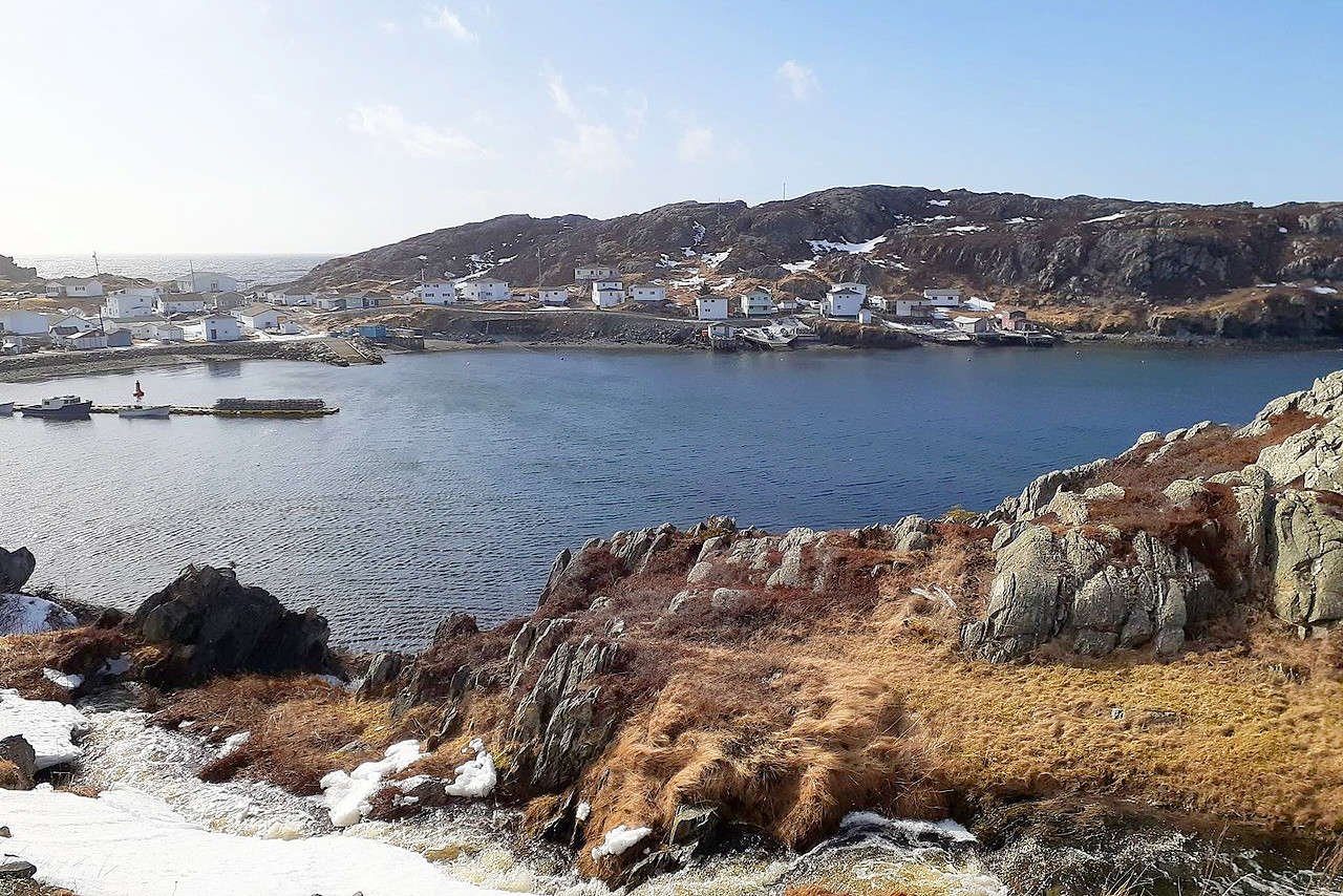 Harbour Mille on the Burin Peninsula
The official websites
Newfoundland
The Rock
| Location: | Eastern Canada |
| Coordinates: | 49° 00′ N, 56° 00′ W |
| Size: | • 500 km N-S; 500 km E-W • 310 miles N-S; 310 miles E-W |
| Terrain: | Rolling, rugged landscape, broken by lakes, bold headlands, and swift-flowing rivers |
| Climate: | Maritime climate with mild summers and winters |
| Highest point: | The Cabox 812 m / 2,664 ft |
| Forest: | 58% (2010) (source) |
| Population: | 479,538 (2016) |
| Population density: | Very Low (4/km²) |
| Capital: | St. John's |
| Languages: | English (98%) |
| Human Development Index: | Very High (0.894) |