The Geography of the
Northwest Territories
Why visit the Northwest Territories?
Situated to the east of the Yukon, the Northwest Territories offer some of the most awe-inspiring scenery in all of North America. The territory stretches for over 1,200 miles from its northernmost tip to its southernmost corner! The various landscapes found within the Northwest Territories are home to vast expanses of tundra, boreal forests, rivers and lakes as well as numerous wildlife habitats. The territory also boasts world-renowned hiking trails that wind their way through pristine wilderness areas.
Contents
Map
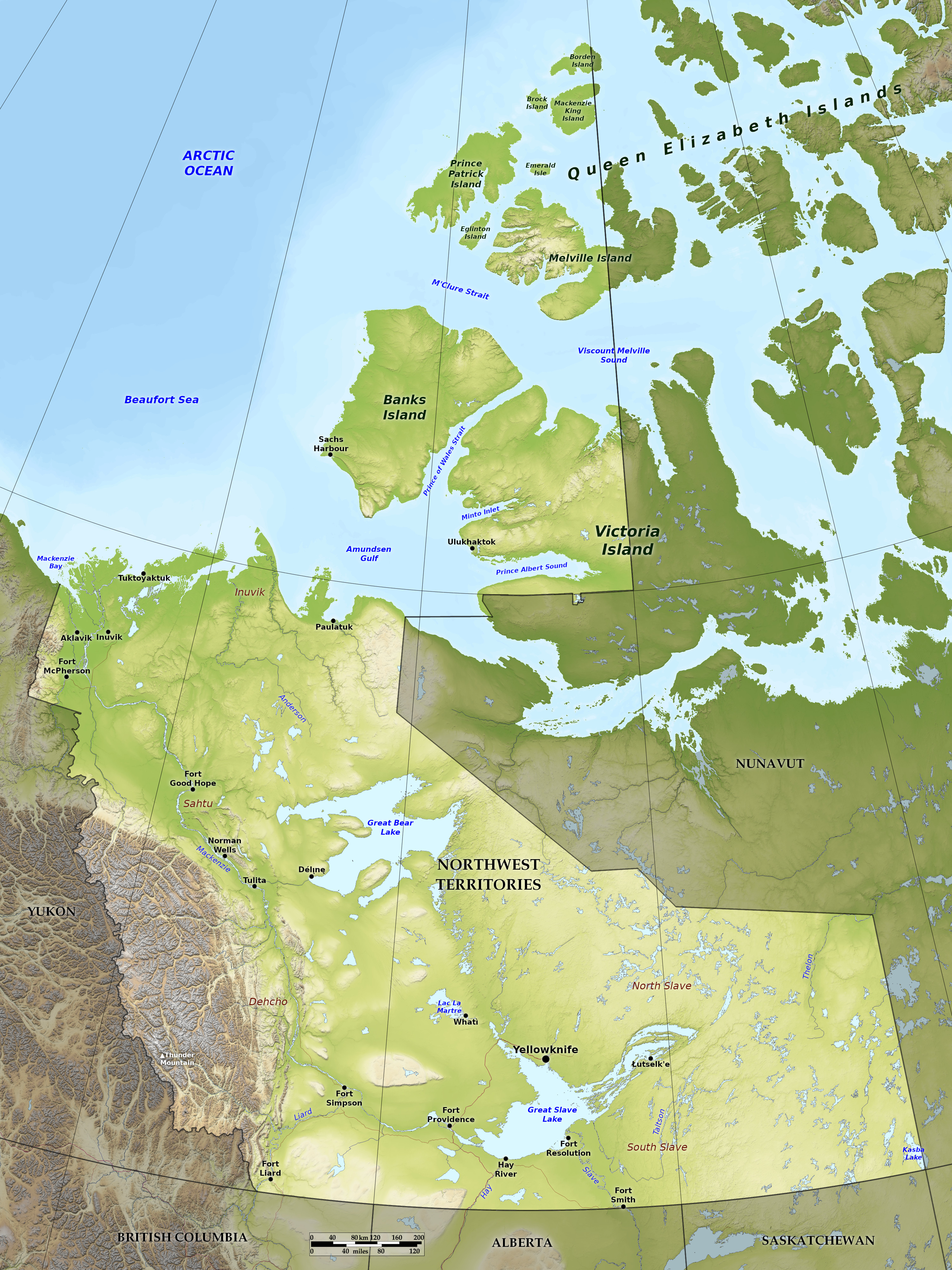 Relief map of the Northwest Territories
What is the landscape of Northwest Territories like?
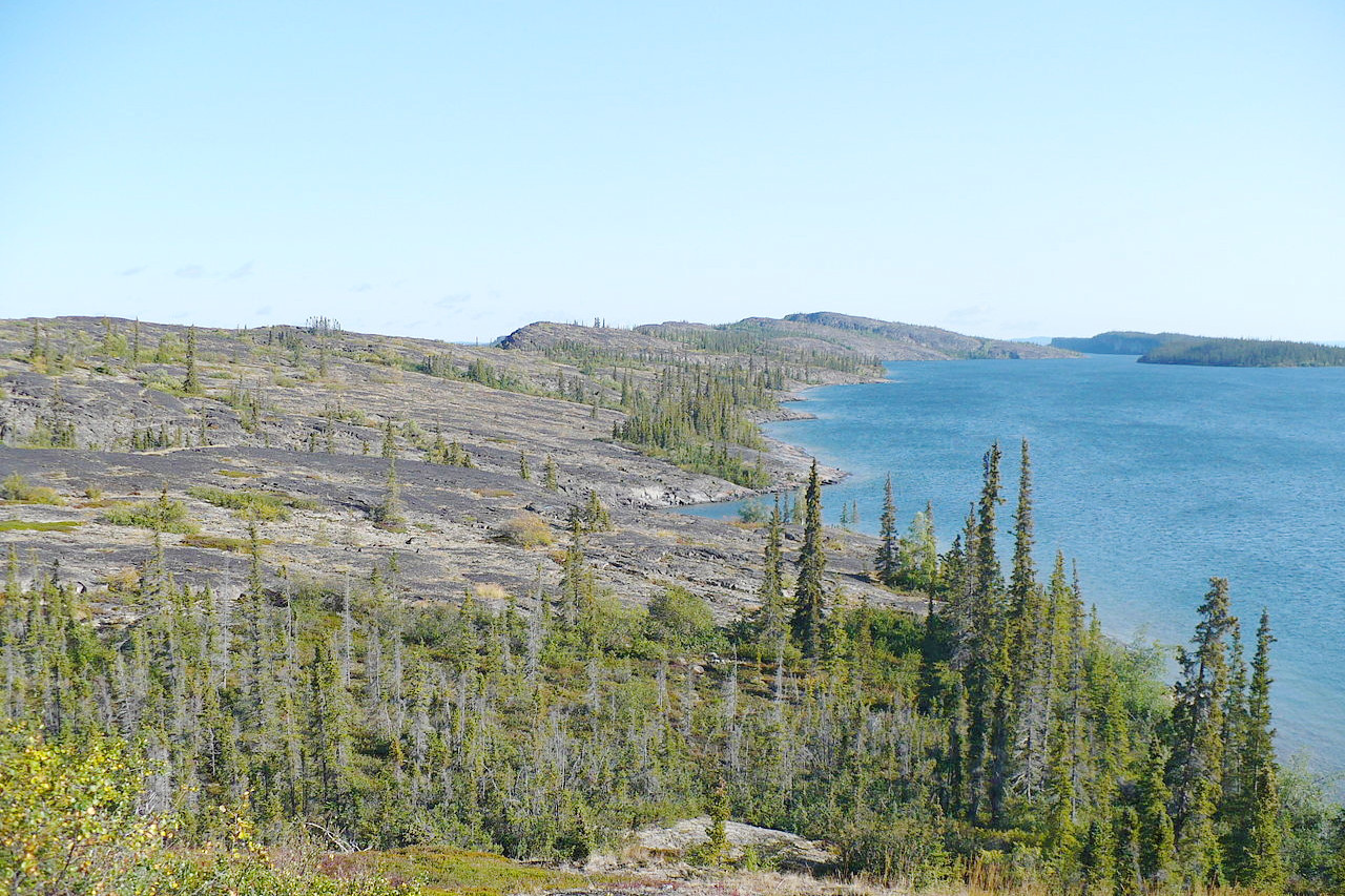
Much of the landscape of Northwest Territories is hummocky and broken, with numerous swamps and lakes. Great Bear Lake in the north and Great Slave Lake in the south are two of the largest lakes in Canada. The Northwest Territories can be divided into two broad geographical regions: the taiga (a boreal forest belt that circles the subarctic zone and is typified by stands of pine, aspen, poplar, and birch trees) and the tundra (a rocky arctic region where the cold climate has stunted vegetation).
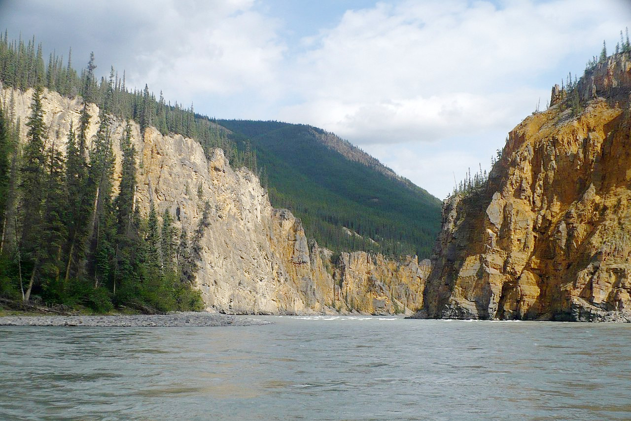
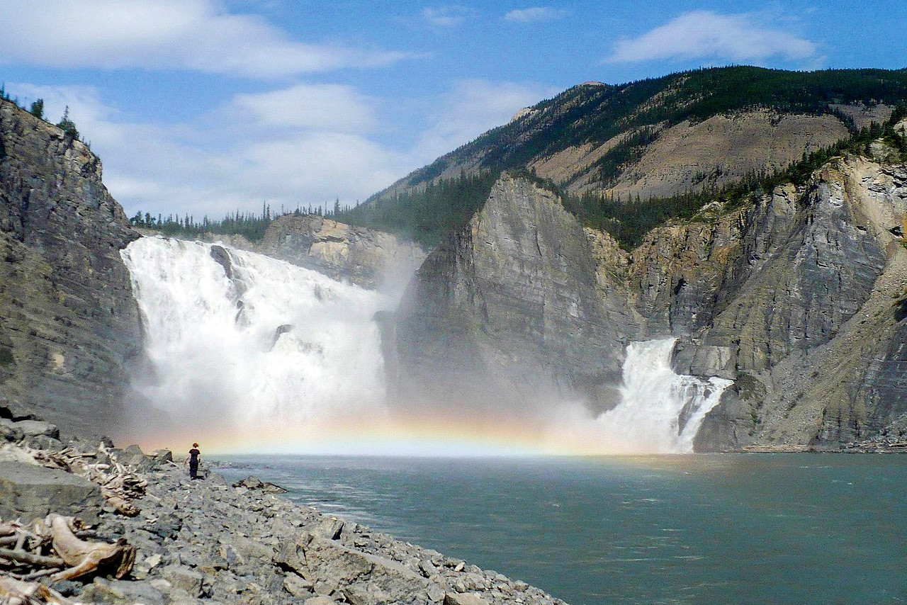
One of the most remarkable features of the Northwest Territories is the Mackenzie River, one of the world's longest at 2,635 miles (4,241 kilometers). In the west are the northernmost limits of the Rocky Mountains reaching a height of 2,773 m (9,098 feet) at Thunder Mountain. The Northern portion of Northwest Territories is mainly a broken plain draining into the Arctic Sea.
What is the nature of Northwest Territories like?
In the south a broad belt of rather small and sparse trees extends from Great Slave Lake to the Canadian Rockies—chiefly pine, aspen, poplar, and birch. The dry eastern slopes and valleys of the Canadian Rockies are thinly covered with forests. As the inhospitable Arctic regions are approached the forest growth becomes very scanty or disappears entirely, so that there is a very considerable area of barren land where the main lifeforms are lichens and mosses. A short but intense summer produces many small but brilliant flowers, including purple mountain saxifrage and fireweed.
What is the climate of Northwest Territories like?
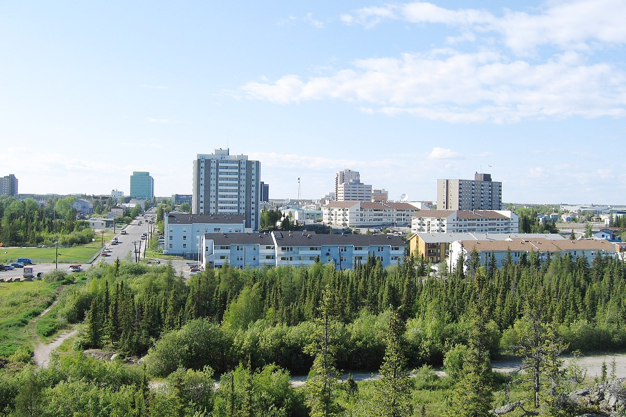
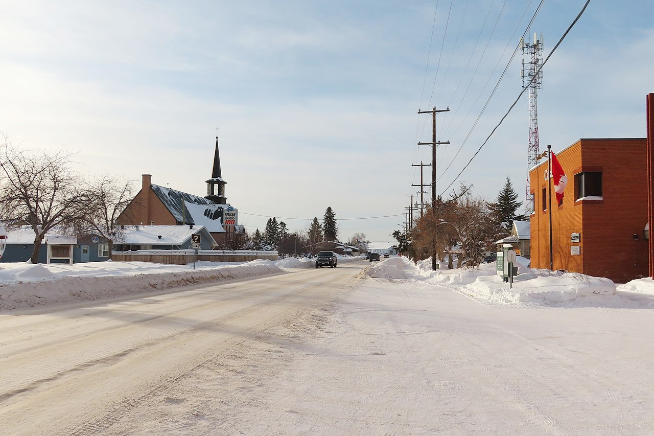
The greater part of the Northwest Territories is characterized by short, warm summers and long and severe winters. There are two major climate zones in the Northwest Territories: subarctic and arctic. In the subarctic zone, average temperatures in January are -23°C (-9°F) and 21°C (70°F) in July, while average temperatures in the arctic zone range from -33°C (-27°F) in January to 10°C (50°F) in July. The average temperatures in Yellowknife are -22°C (8°F) from November to March and 14°C (57°F) from June to August.
| Climate data for Yellowknife (1981–2010) | |||||||||||||
|---|---|---|---|---|---|---|---|---|---|---|---|---|---|
| Month | Jan | Feb | Mar | Apr | May | Jun | Jul | Aug | Sep | Oct | Nov | Dec | Year |
| Average high °C (°F) | −21.6 (−6.9) | −18.1 (−0.6) | −10.8 (12.6) | 0.4 (32.7) | 9.7 (49.5) | 18.1 (64.6) | 21.3 (70.3) | 18.1 (64.6) | 10.4 (50.7) | 0.9 (33.6) | −10.0 (14.0) | −17.8 (0.0) | 0.0 (32.0) |
| Daily mean °C (°F) | −25.6 (−14.1) | −22.9 (−9.2) | −16.8 (1.8) | −5.3 (22.5) | 4.6 (40.3) | 13.3 (55.9) | 17.0 (62.6) | 14.2 (57.6) | 7.2 (45.0) | −1.7 (28.9) | −13.7 (7.3) | −21.8 (−7.2) | −4.3 (24.3) |
| Average low °C (°F) | −29.5 (−21.1) | −27.5 (−17.5) | −22.7 (−8.9) | −11.0 (12.2) | −0.5 (31.1) | 8.5 (47.3) | 12.6 (54.7) | 10.2 (50.4) | 4.0 (39.2) | −4.2 (24.4) | −17.5 (0.5) | −25.7 (−14.3) | −8.6 (16.5) |
| Average precipitation mm (inches) | 14.3 (0.56) | 14.1 (0.56) | 13.9 (0.55) | 11.3 (0.44) | 18.4 (0.72) | 28.9 (1.14) | 40.8 (1.61) | 39.3 (1.55) | 36.3 (1.43) | 30.3 (1.19) | 24.8 (0.98) | 16.2 (0.64) | 288.6 (11.36) |
| Average snowfall cm (inches) | 19.7 (7.8) | 20.0 (7.9) | 18.5 (7.3) | 10.3 (4.1) | 4.7 (1.9) | 0.0 (0.0) | 0.0 (0.0) | 0.1 (0.0) | 3.5 (1.4) | 20.9 (8.2) | 36.5 (14.4) | 23.5 (9.3) | 157.6 (62.0) |
| Source: Environment and Climate Change Canada | |||||||||||||
.jpg) Igloo church in Inuvik
Igloo church in Inuvik
.jpg&oldid=517883698)
The official websites
Northwest Territories
Spectacular Northwest Territories
| Location: | Northwest Canada |
| Coordinates: | 69° 30′ N, 121° 30′ W |
| Size: | • 2000 km N-S; 1400 km E-W • 1250 miles N-S; 875 miles E-W |
| Terrain: | Subarctic forest belts in the south. Mountains in the southwest. Rocky tundra in the north. |
| Climate: | Subarctic climate in the south. Warm, long summer days; dark, icy winters. Arctic conditions in the north. |
| Highest point: | Thunder Mountain 2,773 m / 9,098 ft |
| Forest: | 30% (2010) (source) |
| Population: | 45,136 (2021) |
| Population density: | Very Low (0.04/km²) |
| Capital: | Yellowknife |
| Languages: | English (77%); French (3%); Other (includes Chipewyan, Tłı̨chǫ, North Slavey, South Slavey, Gwich'in) |
| Human Development Index: | Very High (0.924) |