.jpg)
.jpg&oldid=459773731)
.jpg)
.jpg&oldid=475285840)
.jpg)
.jpg&oldid=501704807)
.jpg)
.jpg&oldid=580152218)
The Geography of
Ontario
Why visit Ontario?
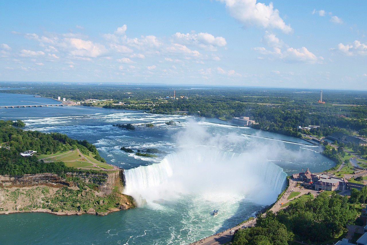
Ontario is a province of central Canada that has always been renowned for its natural beauty. From the stark, rugged uplands to the sprawling green fields and waterways, Ontario offers visitors numerous attractions that can be enjoyed throughout the year including the spectacular Niagara Falls. As the leading cultural province of English-speaking Canada, there is something for everyone in Ontario—whether you're looking for bustling cities full of activity or tranquil lakeside villages where life moves at a slower pace.
Contents
Map
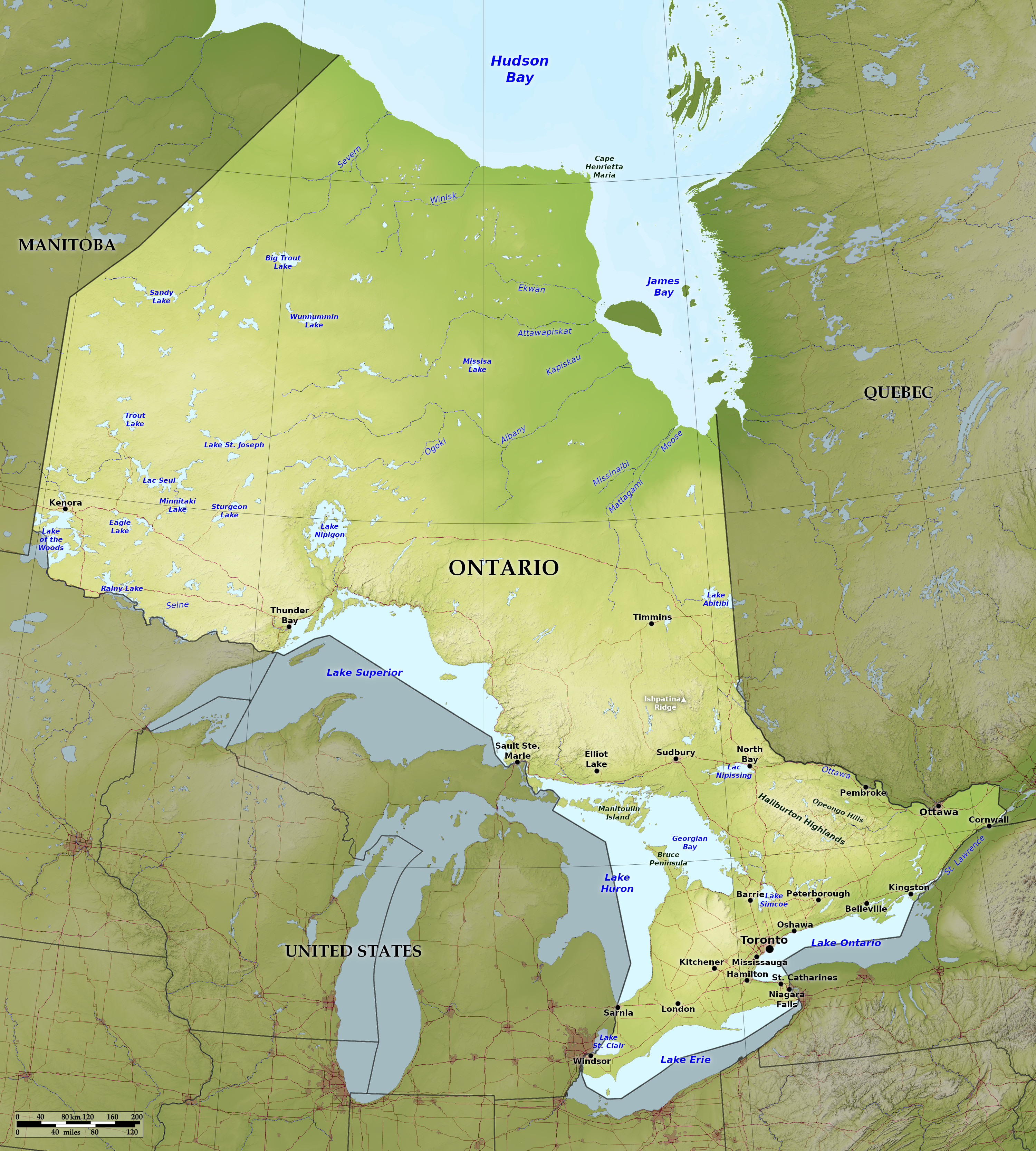 Relief map of Ontario
What is the landscape of Ontario like?
Ontario includes the most southerly point in Canada, and is the most populous of the provinces, nine-tenths of its inhabitants living, however, in one-tenth of its area, between the Great Lakes and the St Lawrence River. This forms part of the plain of the St Lawrence.
Southern Ontario is divided east and west by the Niagara escarpment, a line of cliffs, running from near the Niagara Falls west to the head of Lake Ontario near Hamilton, and then northwest to the Bruce Peninsula on Georgian Bay. The higher parts of this landscape are rolling hills while the lower levels are plains gently sloping toward the nearest of the Great Lakes. The Niagara escarpment is the cause of waterfalls on all the rivers which plunge over it, Niagara Falls being, of course, the most famous; and in many cases these falls have eaten their way back into the tableland, forming deep gorges or canyons like that below Niagara itself, through which the water pours as violent rapids.
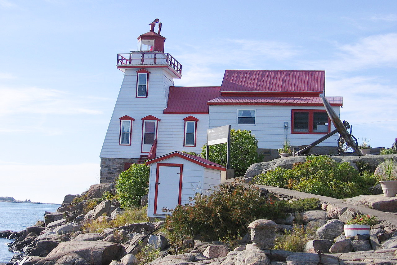
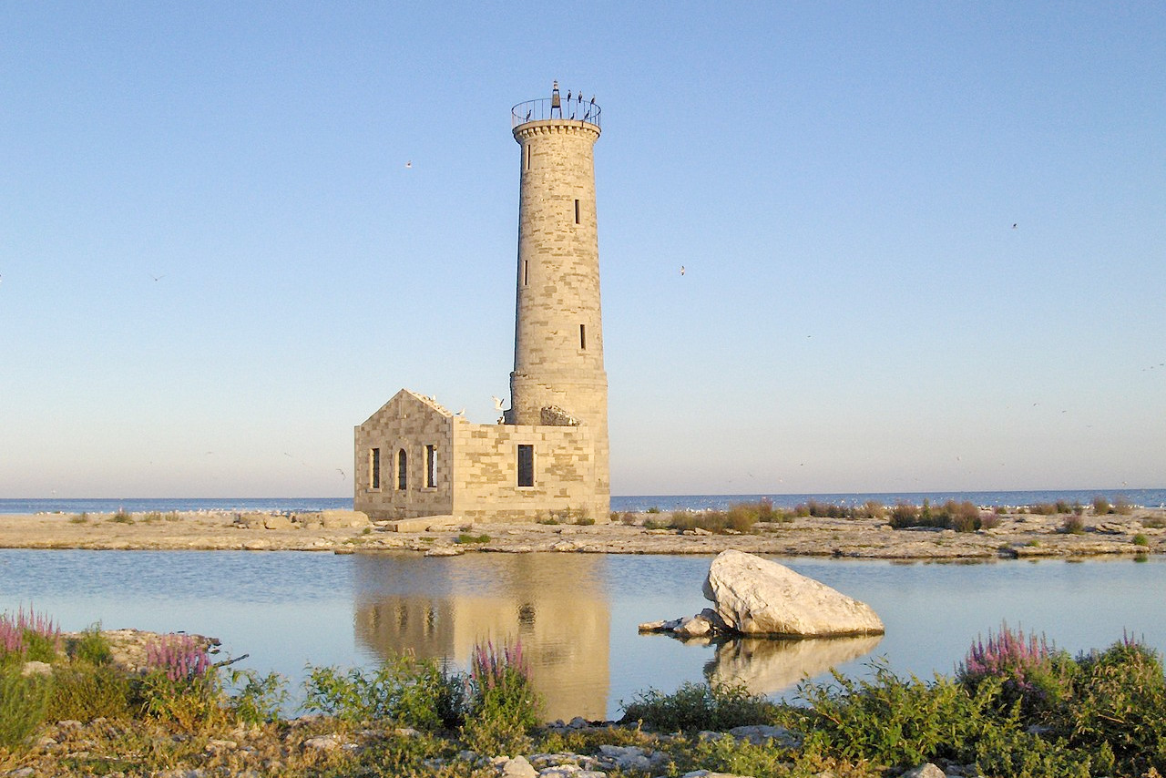
All parts of Ontario are covered with lakes and rivers, the most important chain being that of the St Lawrence River and the Great Lakes. The north shore of Lake Superior is bold and rugged with many islands, but with very few settlements, except fishing villages, owing to its rocky character. The northeast shores of Lake Huron and its large expansion Georgian Bay are fringed with thousands of islands, mostly small, but one them, Manitoulin Island, is 80 miles long. Georgian Bay is cut off from the main lake by Manitoulin Island and the long promontory of Bruce Peninsula. From Lake Ontario into the St Lawrence is the mesh of the Thousand Islands—a famous scenic feature of Ontario.
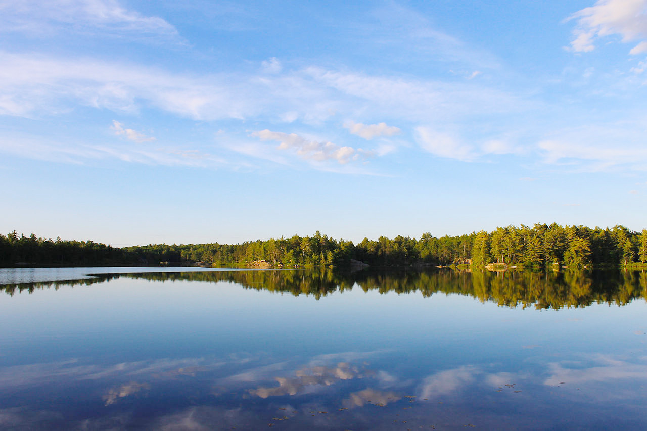
Northern Ontario stretches for hundreds of miles to the north and northwest. The tableland to the north is made up of rocky hills complete with wilderness and forests covering much of the area. In this region the lakes are innumerable, and often very picturesque, forming favourite summer resorts, such as Lake Temagami, the Muskoka Lakes and Lake-of-the-Woods.
What is the nature of Ontario like?
Southern Ontario is known for its mixed forests where white and red pine trees are often found with hardwood trees such as maple, oak, elm, chestnut, and hickory. The vast area north of the Great Lakes is sub-Arctic and the principal forest trees are mostly coniferous: white and red pines, spruce and balsam fir. Broad-leaved species include poplar and paper birch.
Many migratory flying species annually traverse Ontario: Point Pelee is a yearly site for the autumnal exodus of monarch butterflies, and Aylmer is the annual layover location for thousands of migrating tundra swans headed for the Arctic. Woodland caribou, moose, muskrats, beavers, eagles, and wolves inhabit the northern reaches of the province. Polar bears live in the far north along Hudson Bay.
What is the climate of Ontario like?
The climate of Ontario varies greatly from north to south. The northern parts as far south as the north shore of Lake Superior have long and cold but bright winters; while their summers are delightful, with much sunshine and some hot days but pleasantly cool nights. Further south, between Georgian Bay and Ottawa the winters are less cold, but usually with a plentiful snowfall, while the summers are warm and sometimes even hot.
Southern Ontario has its climate greatly modified by the Great Lakes. The summers are often sultry, though the presence of the lakes prevents the intense heat experienced in the states to the west and south. Owing to the mildness of its winters, the southwest peninsula is a famous fruit country with many vineyards and orchards of apples, plums and peaches.
| Climate data for Toronto (1981–2010) | |||||||||||||
|---|---|---|---|---|---|---|---|---|---|---|---|---|---|
| Month | Jan | Feb | Mar | Apr | May | Jun | Jul | Aug | Sep | Oct | Nov | Dec | Year |
| Average high °C (°F) | −0.7 (30.7) | 0.4 (32.7) | 4.7 (40.5) | 11.5 (52.7) | 18.4 (65.1) | 23.8 (74.8) | 26.6 (79.9) | 25.5 (77.9) | 21.0 (69.8) | 14.0 (57.2) | 7.5 (45.5) | 2.1 (35.8) | 12.9 (55.2) |
| Daily mean °C (°F) | −3.7 (25.3) | −2.6 (27.3) | 1.4 (34.5) | 7.9 (46.2) | 14.1 (57.4) | 19.4 (66.9) | 22.3 (72.1) | 21.5 (70.7) | 17.2 (63.0) | 10.7 (51.3) | 4.9 (40.8) | −0.5 (31.1) | 9.4 (48.9) |
| Average low °C (°F) | −6.7 (19.9) | −5.6 (21.9) | −1.9 (28.6) | 4.1 (39.4) | 9.9 (49.8) | 14.9 (58.8) | 18.0 (64.4) | 17.4 (63.3) | 13.4 (56.1) | 7.4 (45.3) | 2.3 (36.1) | −3.1 (26.4) | 5.9 (42.6) |
| Average precipitation mm (inches) | 61.5 (2.42) | 55.4 (2.18) | 53.7 (2.11) | 68.0 (2.68) | 82.0 (3.23) | 70.9 (2.79) | 63.9 (2.52) | 81.1 (3.19) | 84.7 (3.33) | 64.4 (2.54) | 84.1 (3.31) | 61.5 (2.42) | 831.1 (32.72) |
| Average snowfall cm (inches) | 37.2 (14.6) | 27.0 (10.6) | 19.8 (7.8) | 5.0 (2.0) | 0.0 (0.0) | 0.0 (0.0) | 0.0 (0.0) | 0.0 (0.0) | 0.0 (0.0) | 0.1 (0.0) | 8.3 (3.3) | 24.1 (9.5) | 121.5 (47.8) |
| Source: Environment and Climate Change Canada | |||||||||||||
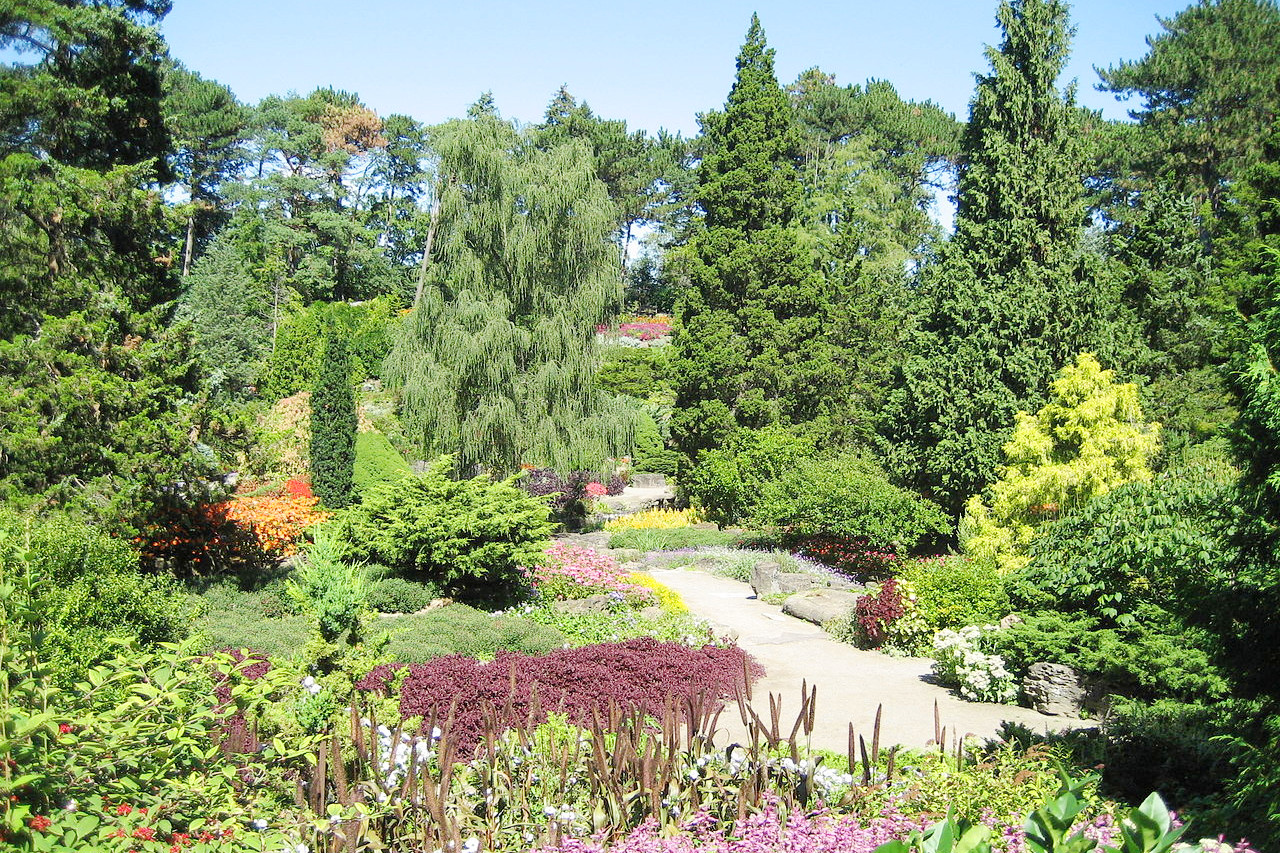 Rock Garden, Royal Botanical Gardens, Hamilton
The official websites
Ontario
The Heartland Province
| Location: | East central Canada |
| Coordinates: | 49° 15′ N, 84° 30′ W |
| Size: | • 1600 km N-S; 1500 km E-W • 1000 miles N-S; 930 miles E-W |
| Terrain: | Subarctic plains in the north; vast rocky plateau in the center; agricultural lands around the Great Lakes in the south |
| Climate: | Relatively temperate in the south with warm summers and cold winters; becoming subarctic in the north |
| Highest point: | Ishpatina Ridge 693 m / 2,274 ft |
| Forest: | 67% (2010) (source) |
| Population: | 14,755,211 (2021) |
| Population density: | Low (15/km²) |
| Capital: | Toronto |
| Languages: | English (76%); French (4%) |
| Human Development Index: | Very High (0.937) |