The Climate of
Pakistan
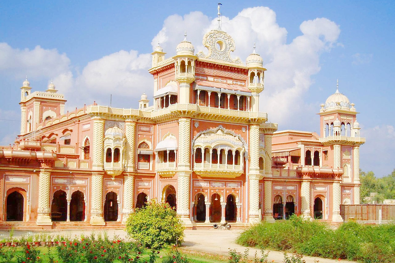
 Faiz Mahal, Khairpur
Climate Map
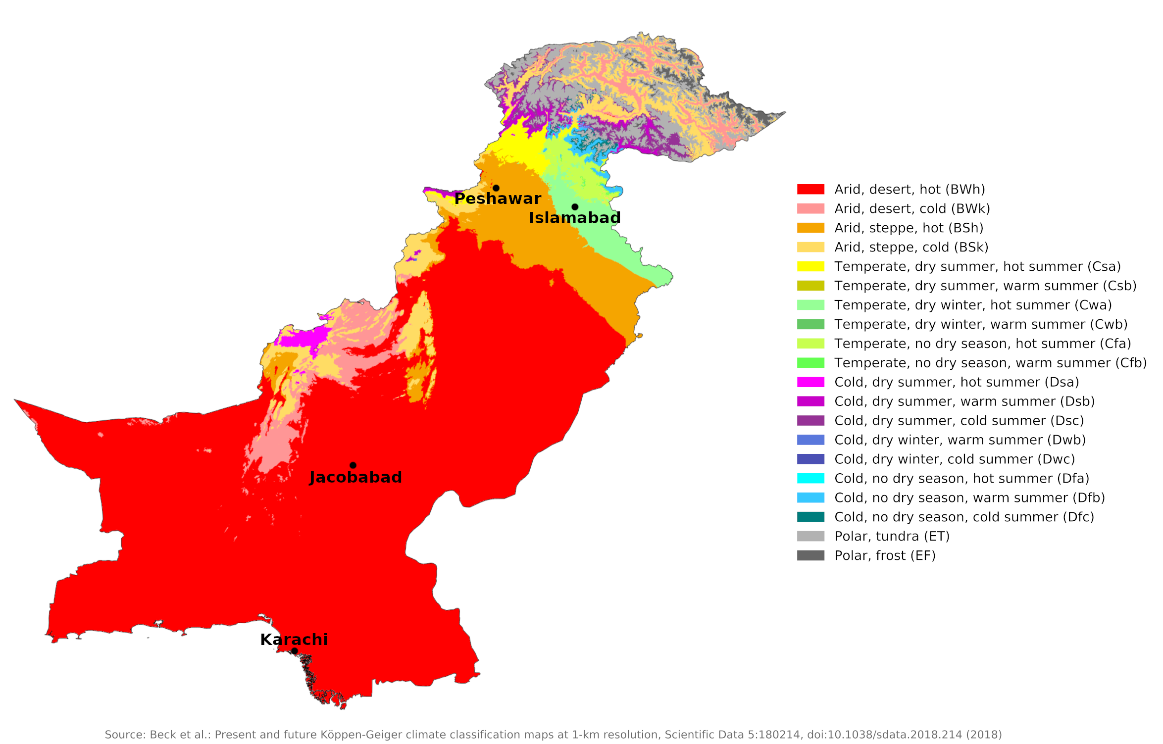
 Climate map of Pakistan
What is the climate of Pakistan like?
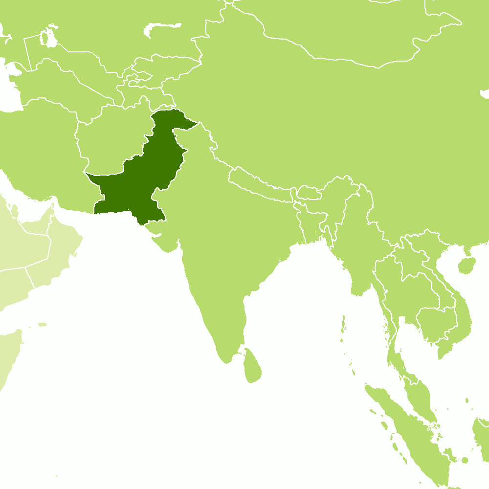
Pakistan is a large country, about one and a half times the size of France. It is located in the northwestern part of the large Indian subcontinent. Its western border with Iran and Afghanistan is mountainous, and its short northern border with China and its northeastern border with India in the Pamir and Karakoram ranges include some of the higher Himalayan peaks. To the south and east it has a long border with India; this is a region of low-lying plains, part of the great Indus Valley.
Most of the country has a climate dominated by the influence of the great seasonal wind reversal, the Asian monsoon. There are four seasons in the country: winter, from December to February; a hot, dry spring from March to May; the arrival of the southwest monsoon from June to September; and the northeast monsoon from October to November. In the north and west, the rainy season occurs in winter.
Mid-October to late February is the cool season, when the weather is generally pleasant, sunny and fairly warm during the day but with cool nights and the occasional frost. The northern and western parts of the country at this time receive some rain brought from the west by depressions. Conditions in the higher mountains are decidedly cold at this time. During this period, midday temperatures rise to very high levels in the south and center of the country. Despite the low humidity, the heat is extremely uncomfortable. There can be occasional rain during this time, usually in the form of showers and thunderstorms. Such brief storms are often preceded or accompanied by dust storms.
The rainy season lasts from late June to early October across most of the country. This is the southwest monsoon season and although temperatures are slightly lower, the higher humidity can cause some discomfort. These monsoon rains are quite strong in nature and can cause significant flooding, even severe flooding when combined with western disturbances in the upper parts of the country.
Not all parts of Pakistan are equally wet during the rainy season. The desert region in the south and south-east receives little rain at this time and is sunny and hot; See the climate of Jacobabad, which has a reputation for being one of the hottest places on earth from April to September. Karachi, on the coast of the Arabian Sea, also has low rainfall and, although cooler than inland, has a very unpleasant climate at this time due to the higher humidity.
| Climate data for Jacobabad (1961–1990) | |||||||||||||
|---|---|---|---|---|---|---|---|---|---|---|---|---|---|
| Month | Jan | Feb | Mar | Apr | May | Jun | Jul | Aug | Sep | Oct | Nov | Dec | Year |
| Average high °C (°F) | 22.6 (72.7) | 25.2 (77.4) | 31.4 (88.5) | 38.0 (100.4) | 43.1 (109.6) | 44.3 (111.7) | 40.6 (105.1) | 38.2 (100.8) | 37.0 (98.6) | 35.3 (95.5) | 30.1 (86.2) | 24.1 (75.4) | 34.2 (93.5) |
| Daily mean °C (°F) | 15.1 (59.2) | 17.9 (64.2) | 24.0 (75.2) | 30.2 (86.4) | 34.9 (94.8) | 36.9 (98.4) | 34.9 (94.8) | 33.2 (91.8) | 31.4 (88.5) | 27.8 (82.0) | 22.1 (71.8) | 16.4 (61.5) | 27.1 (80.7) |
| Average low °C (°F) | 7.7 (45.9) | 10.5 (50.9) | 16.6 (61.9) | 22.3 (72.1) | 26.7 (80.1) | 29.4 (84.9) | 29.2 (84.6) | 28.3 (82.9) | 25.9 (78.6) | 20.3 (68.5) | 14.1 (57.4) | 8.7 (47.7) | 20.0 (68.0) |
| Average precipitation mm (inches) | 3.1 (0.12) | 7.1 (0.28) | 10.3 (0.41) | 2.0 (0.08) | 1.7 (0.07) | 4.7 (0.19) | 36.8 (1.45) | 26.3 (1.04) | 11.2 (0.44) | 2.3 (0.09) | 1.2 (0.05) | 3.7 (0.15) | 110.4 (4.37) |
| Source: NOAA | |||||||||||||
| Climate data for Karachi | |||||||||||||
|---|---|---|---|---|---|---|---|---|---|---|---|---|---|
| Month | Jan | Feb | Mar | Apr | May | Jun | Jul | Aug | Sep | Oct | Nov | Dec | Year |
| Average high °C (°F) | 28.2 (82.8) | 28.4 (83.1) | 32.2 (90.0) | 34.7 (94.5) | 35.5 (95.9) | 35.4 (95.7) | 33.3 (91.9) | 32.1 (89.8) | 33.2 (91.8) | 35.5 (95.9) | 32.5 (90.5) | 28.2 (82.8) | 32.4 (90.4) |
| Daily mean °C (°F) | 20.5 (68.9) | 21.2 (70.2) | 25.4 (77.7) | 28.8 (83.8) | 31.0 (87.8) | 31.8 (89.2) | 30.4 (86.7) | 29.2 (84.6) | 28.7 (83.7) | 27.8 (82.0) | 24.6 (76.3) | 20.4 (68.7) | 26.6 (80.0) |
| Average low °C (°F) | 12.7 (54.9) | 14.0 (57.2) | 18.6 (65.5) | 23.0 (73.4) | 26.6 (79.9) | 28.3 (82.9) | 27.6 (81.7) | 26.3 (79.3) | 25.6 (78.1) | 21.9 (71.4) | 16.8 (62.2) | 12.7 (54.9) | 21.2 (70.1) |
| Average precipitation mm (inches) | 8.4 (0.33) | 7.4 (0.29) | 5.3 (0.21) | 3.0 (0.12) | 0.1 (0.00) | 10.8 (0.43) | 60.0 (2.36) | 60.9 (2.40) | 11.0 (0.43) | 2.6 (0.10) | 0.4 (0.02) | 4.8 (0.19) | 174.7 (6.88) |
| Source: Pakistan Meteorological Department | |||||||||||||
Mountain regions in the north and west of the country get much less rain during the southwest monsoon and can be wetter in the cooler winter season; see the climate of Peshawar which has a year-round weather sequence more similar to that found in Iran to the west. The full effects of the monsoon rains are felt in the eastern and central plains of the country. Here the year-round climate is more similar to that of the northern plains of India. In the northern capital Islamabad, average temperatures range from 2°C (35°F) in January to 40°C (104°F) in June.
| Climate data for Peshawar (1961–1990) | |||||||||||||
|---|---|---|---|---|---|---|---|---|---|---|---|---|---|
| Month | Jan | Feb | Mar | Apr | May | Jun | Jul | Aug | Sep | Oct | Nov | Dec | Year |
| Average high °C (°F) | 18.3 (64.9) | 19.5 (67.1) | 23.7 (74.7) | 30.0 (86.0) | 35.9 (96.6) | 40.4 (104.7) | 37.7 (99.9) | 35.7 (96.3) | 35.0 (95.0) | 31.2 (88.2) | 25.6 (78.1) | 20.1 (68.2) | 29.4 (84.9) |
| Daily mean °C (°F) | 11.2 (52.2) | 12.9 (55.2) | 17.4 (63.3) | 23.2 (73.8) | 28.6 (83.5) | 33.1 (91.6) | 32.2 (90.0) | 30.7 (87.3) | 28.9 (84.0) | 23.7 (74.7) | 17.6 (63.7) | 12.5 (54.5) | 22.7 (72.9) |
| Average low °C (°F) | 4.0 (39.2) | 6.3 (43.3) | 11.2 (52.2) | 16.4 (61.5) | 21.3 (70.3) | 25.7 (78.3) | 26.6 (79.9) | 25.7 (78.3) | 22.7 (72.9) | 16.1 (61.0) | 7.6 (45.7) | 4.9 (40.8) | 15.9 (60.6) |
| Average precipitation mm (inches) | 26.0 (1.02) | 42.7 (1.68) | 78.4 (3.09) | 48.9 (1.93) | 27.0 (1.06) | 7.7 (0.30) | 42.3 (1.67) | 67.7 (2.67) | 17.9 (0.70) | 9.7 (0.38) | 12.3 (0.48) | 23.3 (0.92) | 403.9 (15.9) |
| Source: NOAA | |||||||||||||
| Climate data for Islamabad (1961–1990) | |||||||||||||
|---|---|---|---|---|---|---|---|---|---|---|---|---|---|
| Month | Jan | Feb | Mar | Apr | May | Jun | Jul | Aug | Sep | Oct | Nov | Dec | Year |
| Average high °C (°F) | 17.7 (63.9) | 19.1 (66.4) | 23.9 (75.0) | 30.1 (86.2) | 35.3 (95.5) | 38.7 (101.7) | 35.0 (95.0) | 33.4 (92.1) | 33.5 (92.3) | 30.9 (87.6) | 25.4 (77.7) | 19.7 (67.5) | 28.6 (83.5) |
| Daily mean °C (°F) | 10.1 (50.2) | 12.1 (53.8) | 16.9 (62.4) | 22.6 (72.7) | 27.5 (81.5) | 31.2 (88.2) | 29.7 (85.5) | 28.5 (83.3) | 27.0 (80.6) | 22.4 (72.3) | 16.5 (61.7) | 11.6 (52.9) | 21.3 (70.3) |
| Average low °C (°F) | 2.6 (36.7) | 5.1 (41.2) | 9.9 (49.8) | 15.0 (59.0) | 19.7 (67.5) | 23.7 (74.7) | 24.3 (75.7) | 23.5 (74.3) | 20.6 (69.1) | 13.9 (57.0) | 7.5 (45.5) | 3.4 (38.1) | 14.1 (57.4) |
| Average precipitation mm (inches) | 67.1 (2.64) | 89.5 (3.52) | 129.8 (5.11) | 61.8 (2.43) | 39.2 (1.54) | 148.2 (5.83) | 368.0 (14.49) | 334.5 (13.17) | 151.2 (5.95) | 44.3 (1.74) | 17.8 (0.70) | 24.3 (0.96) | 1,475.7 (58.08) |
| Source: NOAA | |||||||||||||
Sunshine hours are high all year round in most parts of Pakistan, ranging from six to seven hours a day in the cool season to 10 to 12 hours in the hot season. During the rainy season, cloud cover increases over most of the country, although rainfall levels can be light in some areas. For example, in July and August, Karachi averages only four or five hours of sunshine per day, although rainfall is much less than in the north of the country.
Most of Pakistan experiences dry conditions that miss the full force of the monsoon. In the plains of Pakistan, the average annual rainfall is only 130 millimeters (5 inches), while in the highlands it is 900 millimeters (35 inches). Punjab has had great fluctuations in monsoon rainfall, with droughts in some years and floods in others. In the north hailstorms are common and snow falls in winter. The high mountains of the north are permanently shrouded in snow and ice. The melting snows of these mountains, along with the heavy summer monsoon rains, feed the five major rivers of the Punjab plains, which converge to form the Indus. Without the irrigation flow of these rivers, much of the Punjab and Sind lowlands would be a more extensive desert than they are.
In the hottest parts of Pakistan you are at risk of heat exhaustion during the hot season and visitors should allow a few days to acclimatize before engaging in strenuous activities. The heat is often so great that the indoor temperatures are very uncomfortable at night without air conditioning.
References
- E. A. Pearce, Charles Gordon Smith, (1990) The Hutchinson World Weather Guide, John Murray Press. ISBN 1859863426
- Timothy L. Gall, (ed.), (2003), Worldmark Encyclopedia of the Nations, Eleventh Edition, Thomson Gale
- Federal Research Division, Library of Congress, (1995), Pakistan: a country study. Claitor's Pub. Division. ISBN 0844408344
- Hugh Chisholm, (ed.), (1911), Encyclopædia Britannica, Eleventh edition, Cambridge University Press
The Climate of
Pakistan

In summary:
Pakistan's climate ranges from a hot desert conditions in the south to semiarid and subtropical in the north. The climate is generally dry and hot near the coast, becoming progressively cooler toward the northeastern uplands. The hot season begins in March, and by the end of June the temperature may reach 45°C (113°F).
Between June and September, the monsoon provides an average rainfall of about 380 mm (15 in) in the river basins and up to about 1500 mm (60 in) in the northern areas. Rainfall can vary radically from year to year, and successive patterns of flooding and drought are not uncommon.