The Climate of
Zimbabwe
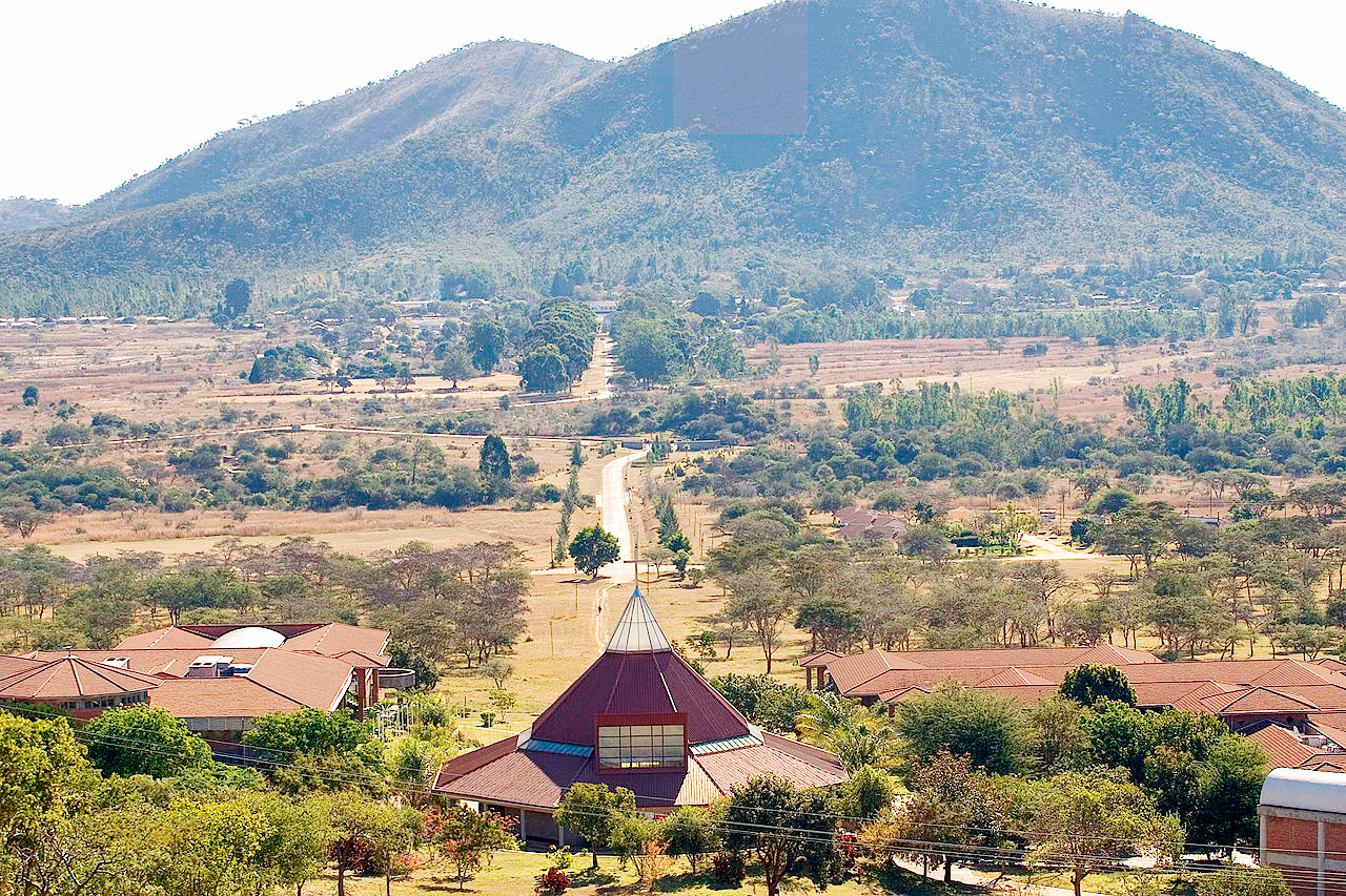
 View to the Great View of Mount Chiremba from Africa University Campus
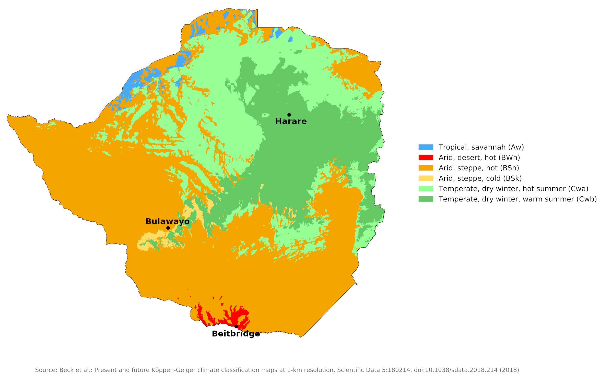
Climate Map
 Climate map of Zimbabwe
What is the climate of Zimbabwe like?
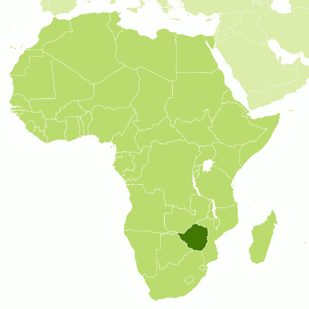
Zimbabwe is a country in south-central Africa. It is almost twice the size of the UK It is bordered on the north by Zambia, east by Mozambique, south by South Africa, and west by Botswana. Most of the country consists of a plateau with an average elevation of over 1,200 meters (4,000 feet). Along On the eastern border with Mozambique there are hills that rise to over 2,400 meters (8,000 feet), while in the north and south of the country, in the Zambezi and Limpopo valleys respectively, elevation falls below 450 meters (1,500 feet).
Altitude greatly affects both temperature and precipitation in Zimbabwe. The higher areas to the east and the Highveld receive more rainfall and are cooler than the lower areas. Temperatures are warm all year round but rarely hot. There is an average of eight to nine hours of sunshine per day in the dry season and six to seven hours of sunshine in the rainy season. Temperatures in the Highveld range from 12 to 13°C (54–55°F) in winter to 24°C (75°F) in summer.
In the lower elevations, temperatures are up to 6°C (11°F) higher than in the higher elevations. Summer temperatures in the Zambezi and Limpopo valleys average between 28° and 32°C (82–90°F).
Zimbabwe's climate includes a warm wet season—the southern hemisphere summer—from November to March; a transitional period with decreasing rainfall well into May; a cool and dry winter season from May to August; and a season that becomes progressively warmer and drier from August to October, until both the progressive rise in daily temperatures and annual drought are interrupted in November by the first rains of the ensuing rainy season.
Mean annual rainfall varies considerably from one part of the country to another, but nowhere receives great quantities of rain, and as much as two-thirds of Zimbabwe receives less than 800 millimeters (32 inches). Precipitation decreases from east to west. The eastern mountains receive more than 1,000 millimeters (40 inches) annually, while Harare has 800 millimeters (32 inches) and Bulawayo 600 millimeters (24 inches). The low-lying parts of the south and southwest have a rather arid climate, with unreliable rainfall ranging from 400 to 600 millimeters (16 to 24 inches). Seasonal water scarcity is common.
There is a high evaporation rate of surface water throughout Zimbabwe. Most of the country receives little rainfall between May and November, and many streams dry up completely during this annual dry season. In half of the country, annual rainfall is often insufficient for agriculture, and rainfall can vary widely from year to year. In general, the lower the average rainfall, the lower the reliability. As a result, the Lowveld areas—subarid in the best years—suffer greatly from large fluctuations in total precipitation, occurring at frequent but irregular intervals.
Most of Zimbabwe has a generally pleasant climate all year round. Harare and Bulawayo typify the highland regions between 1,200 and 1,500 meters (4,000–5,000 feet). Beitbridge in the Limpopo Valley is typical of conditions in the lower parts of northern Zimbabwe.
| Climate data for Harare (1961–1990) | |||||||||||||
|---|---|---|---|---|---|---|---|---|---|---|---|---|---|
| Month | Jan | Feb | Mar | Apr | May | Jun | Jul | Aug | Sep | Oct | Nov | Dec | Year |
| Average high °C (°F) | 26.2 (79.2) | 26.0 (78.8) | 26.2 (79.2) | 25.6 (78.1) | 23.8 (74.8) | 21.8 (71.2) | 21.6 (70.9) | 24.1 (75.4) | 28.4 (83.1) | 28.8 (83.8) | 27.6 (81.7) | 26.3 (79.3) | 25.5 (77.9) |
| Daily mean °C (°F) | 21.0 (69.8) | 20.7 (69.3) | 20.3 (68.5) | 18.8 (65.8) | 16.1 (61.0) | 13.7 (56.7) | 13.4 (56.1) | 15.5 (59.9) | 18.6 (65.5) | 20.8 (69.4) | 21.2 (70.2) | 20.9 (69.6) | 18.4 (65.1) |
| Average low °C (°F) | 15.8 (60.4) | 15.7 (60.3) | 14.5 (58.1) | 12.5 (54.5) | 9.3 (48.7) | 6.8 (44.2) | 6.5 (43.7) | 8.5 (47.3) | 11.7 (53.1) | 14.5 (58.1) | 15.5 (59.9) | 15.8 (60.4) | 12.3 (54.1) |
| Average precipitation mm (inches) | 190.8 (7.51) | 176.3 (6.94) | 99.1 (3.90) | 37.2 (1.46) | 7.4 (0.29) | 1.8 (0.07) | 2.3 (0.09) | 2.9 (0.11) | 6.5 (0.26) | 40.4 (1.59) | 93.2 (3.67) | 182.7 (7.19) | 840.6 (33.09) |
| Source: World Meteorological Organization | |||||||||||||
| Climate data for Bulawayo | |||||||||||||
|---|---|---|---|---|---|---|---|---|---|---|---|---|---|
| Month | Jan | Feb | Mar | Apr | May | Jun | Jul | Aug | Sep | Oct | Nov | Dec | Year |
| Average high °C (°F) | 27.7 (81.9) | 27.2 (81.0) | 27.1 (80.8) | 25.9 (78.6) | 24.1 (75.4) | 21.6 (70.9) | 21.5 (70.7) | 24.4 (75.9) | 27.9 (82.2) | 29.4 (84.9) | 28.7 (83.7) | 27.7 (81.9) | 26.1 (79.0) |
| Daily mean °C (°F) | 21.8 (71.2) | 21.2 (70.2) | 20.6 (69.1) | 18.7 (65.7) | 16.0 (60.8) | 13.7 (56.7) | 13.8 (56.8) | 16.4 (61.5) | 19.9 (67.8) | 21.6 (70.9) | 21.7 (71.1) | 21.4 (70.5) | 18.9 (66.0) |
| Average low °C (°F) | 16.5 (61.7) | 16.2 (61.2) | 15.3 (59.5) | 13.0 (55.4) | 9.9 (49.8) | 7.4 (45.3) | 7.2 (45.0) | 9.1 (48.4) | 12.4 (54.3) | 15.0 (59.0) | 16.0 (60.8) | 16.3 (61.3) | 12.9 (55.2) |
| Average precipitation mm (inches) | 117.8 (4.64) | 104.6 (4.12) | 51.4 (2.02) | 33.3 (1.31) | 7.0 (0.28) | 2.2 (0.09) | 1.0 (0.04) | 1.4 (0.06) | 7.0 (0.28) | 38.4 (1.51) | 91.1 (3.59) | 120.3 (4.74) | 575.5 (22.66) |
| Source: World Meteorological Organization | |||||||||||||
| Climate data for Beitbridge (1961–1990) | |||||||||||||
|---|---|---|---|---|---|---|---|---|---|---|---|---|---|
| Month | Jan | Feb | Mar | Apr | May | Jun | Jul | Aug | Sep | Oct | Nov | Dec | Year |
| Average high °C (°F) | 33.5 (92.3) | 32.8 (91.0) | 32.0 (89.6) | 30.4 (86.7) | 28.2 (82.8) | 25.4 (77.7) | 25.4 (77.7) | 27.6 (81.7) | 30.2 (86.4) | 31.8 (89.2) | 31.8 (89.2) | 33.1 (91.6) | 30.2 (86.4) |
| Daily mean °C (°F) | 27.7 (81.9) | 27.2 (81.0) | 26.1 (79.0) | 23.7 (74.7) | 20.1 (68.2) | 16.8 (62.2) | 16.7 (62.1) | 19.2 (66.6) | 22.7 (72.9) | 25.2 (77.4) | 26.1 (79.0) | 27.2 (81.0) | 23.2 (73.8) |
| Average low °C (°F) | 21.9 (71.4) | 21.5 (70.7) | 20.1 (68.2) | 17.0 (62.6) | 11.9 (53.4) | 8.2 (46.8) | 7.9 (46.2) | 10.7 (51.3) | 15.2 (59.4) | 18.6 (65.5) | 20.3 (68.5) | 21.2 (70.2) | 16.2 (61.2) |
| Average precipitation mm (inches) | 56.8 (2.24) | 54.8 (2.16) | 34.1 (1.34) | 25.6 (1.01) | 10.0 (0.39) | 3.1 (0.12) | 0.4 (0.02) | 1.5 (0.06) | 14.9 (0.59) | 28.4 (1.12) | 48.7 (1.92) | 53.7 (2.11) | 332.0 (13.07) |
| Source: World Meteorological Organization | |||||||||||||
References
- E. A. Pearce, Charles Gordon Smith, (1990) The Hutchinson World Weather Guide, John Murray Press. ISBN 1859863426
- Timothy L. Gall, (ed.), (2003), Worldmark Encyclopedia of the Nations, Eleventh Edition, Thomson Gale
- Federal Research Division, Library of Congress, (1982), Zimbabwe: a country study. Claitor's Pub. Division.
- Hugh Chisholm, (ed.), (1911), Encyclopædia Britannica, Eleventh edition, Cambridge University Press
The Climate of
Zimbabwe

In summary:
The climate of Zimbabwe is greatly affected by altitude and time of year. Average temperatures in the high plateau are about 13°C (56°F) in the winter and about 24°C (75°F) in the summer. In the lower altitudes of the far north and south, temperatures are up to 6°C (11°F) higher than those measured in the highveld.
The summer rainy season lasts from November to March. The cool, dry season follows, lasting from mid-May to mid-August. The low-lying parts of the country have a rather dry climate with an unreliable rainfall of between 300 mm (12 in) and 600 mm (24 in). Over most of the country annual rainfall is between 600 mm (24 in) and 1,000 mm (40 in).