The Geography of
Latvia
Why visit Latvia?
Latvia is the middle Baltic republic—in land size, population, and in other ways as well. Linguistically and culturally, it is close to Lithuania. Historically, it has closer ties to Estonia—for hundreds of years, the two countries were joined together as Livonia. Latvia is a wide, flat country, almost divided in two by a deep inlet called the Gulf of Rı̄ga. Latvia contains some of the calmest and most beautiful beaches in the Baltics, many of them protected from the Baltic Sea’s rough waters by the deep Gulf of Rı̄ga.
Contents
Map
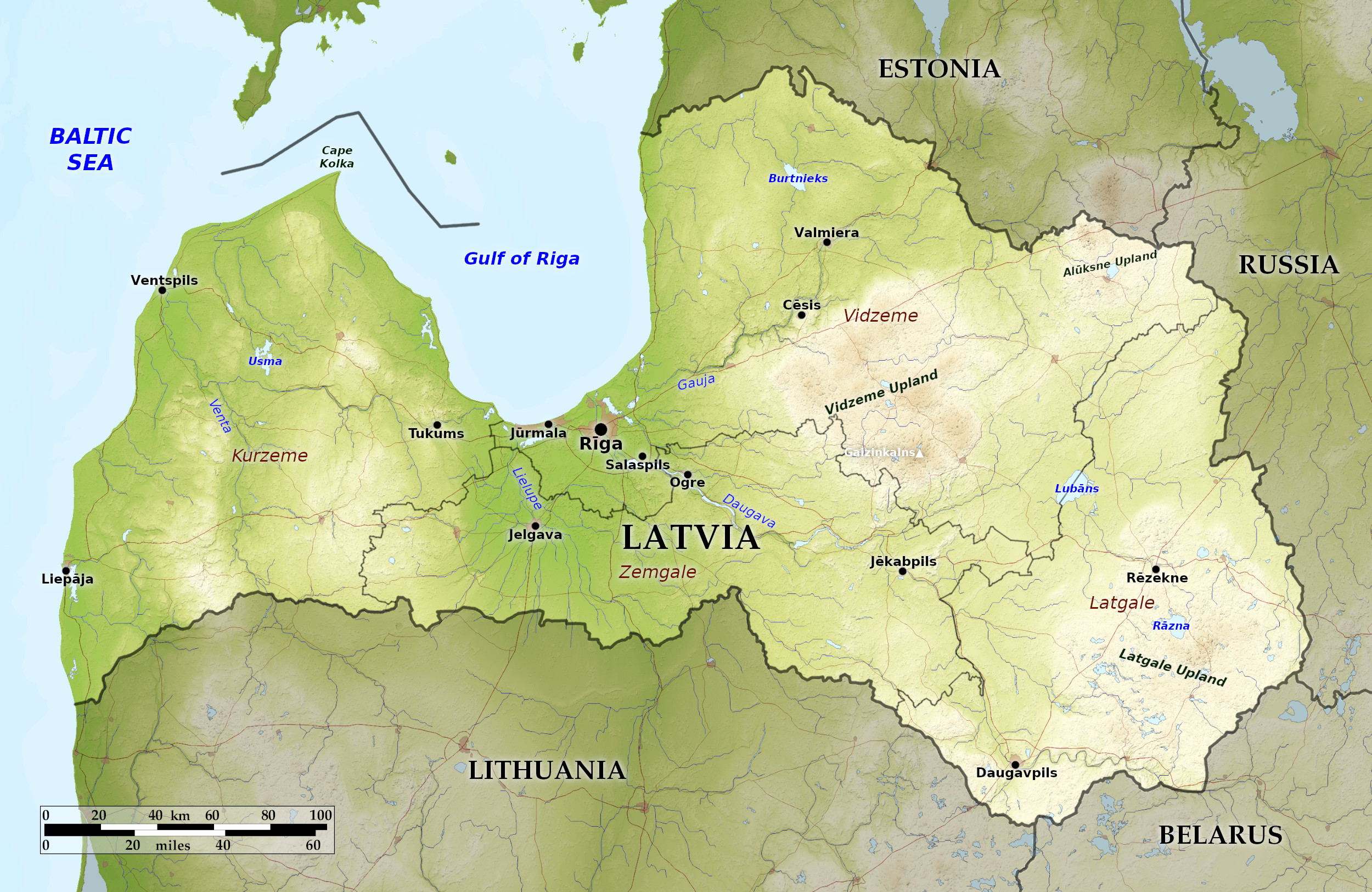 Relief map of Latvia
What is the landscape of Latvia like?
Latvia is divided into four regions. In the west is the Kurzeme, a largely rural region whose northernmost tip at the Kolka cape faces the Baltic Sea in the west and the Gulf of Riga in the east. The Latvian coast runs 531 kilometers (329 miles). It is known as a beautiful coastline, with many sandy beaches. The most charming town is Kuldı̄ga, whose castle is long gone but whose lovely waterfall, the Venta Rapid, is Europe’s widest.
Zemgale, Latvia’s low-lying central region, is the seat of the country’s capital, Riga, the indisputable center of Latvia’s cultural, political, and economic life. Riga also has its old town, with gabled roofs and spires of ancient churches. The Cathedral is the principal landmark; but it is the city’s stunning Art Nouveau architecture that sets it apart from the other Baltic capitals.
Vidzeme region has an average elevation of more than 660 feet (201 m), the largest expanse of highland in the Baltics. The highest point is the Gaiziņkalns, a large hill that peaks at 312 m (1,024 feet). Vidzeme contains many of the country’s historic castles (most notably those in Sigulda and Cēsis) as well as Gauja National Park.
The southeastern part of Latvia is called Latgale. Latgale is the most rural region of Latvia. It is known as the lake district since it contains so many of Latvia's lakes.
What is the nature of Latvia like?
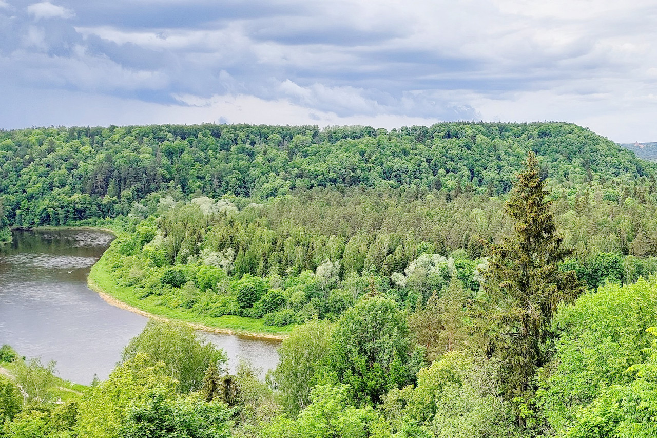
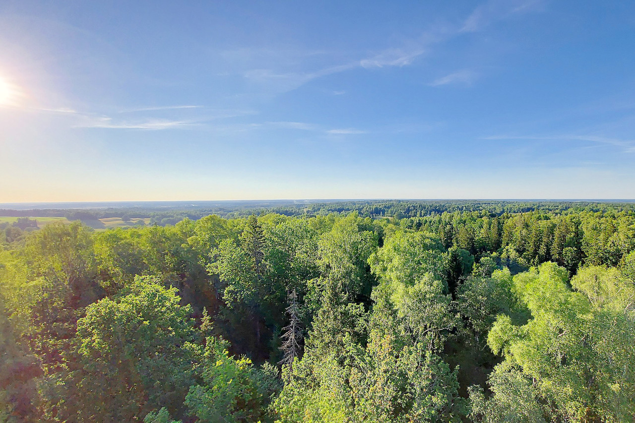
About half of Latvia is forested. The most prevalent forest trees are pine, birch, spruce, and aspen. Aspen, maple, and silver birch border parts of the coastline. Blueberries, mushrooms, and cranberries grow in abundance on the forest floors. Like Estonia, Latvia’s flatlands are dotted with marshes, peat bogs, and lakes. There are about 4,000 lakes in Latvia, many of them in the eastern Latgale region, which is known as the lake district.
Large mammals such as wild boar, Eurasian beaver, and brown bear, lynx, red deer, and elk roam the forests as well as fox, marten, beavers, and squirrels. The routes of migratory birds pass along the Black Sea and over the country. The coast has a significant population of seals.
What is the climate of Latvia like?
See our main article: The Climate of Latvia
Like its Baltic neighbors, Latvia has a mild climate thanks to the warm winds brought in from the North Atlantic. Winters in the west are generally mild, the summers cool. In the more elevated east, winters are somewhat colder, and the summers are warmer and wetter. The average temperature in July is between 17°C and 18°C (62–64°F). In January the average temperature ranges between –3°C and 7°C (31–44°F). Rainfall is common throughout the year with the heaviest rainfall falling in August or September. The Gulf of Rı̄ga freezes over in the winter. The western ports on the Baltic’s warmer waters, however, are open all year.
| Climate data for Riga | |||||||||||||
|---|---|---|---|---|---|---|---|---|---|---|---|---|---|
| Month | Jan | Feb | Mar | Apr | May | Jun | Jul | Aug | Sep | Oct | Nov | Dec | Year |
| Average high °C (°F) | −2.3 (27.9) | −1.7 (28.9) | 2.7 (36.9) | 9.8 (49.6) | 16.2 (61.2) | 20.1 (68.2) | 21.7 (71.1) | 21.0 (69.8) | 16.3 (61.3) | 10.4 (50.7) | 3.9 (39.0) | 0.3 (32.5) | 9.9 (49.8) |
| Daily mean °C (°F) | −5.1 (22.8) | −4.7 (23.5) | −1.0 (30.2) | 5.4 (41.7) | 11.1 (52.0) | 15.1 (59.2) | 17.0 (62.6) | 16.4 (61.5) | 12.2 (54.0) | 7.2 (45.0) | 1.7 (35.1) | −2.1 (28.2) | 6.1 (43.0) |
| Average low °C (°F) | −7.8 (18.0) | −7.6 (18.3) | −4.7 (23.5) | 1.0 (33.8) | 5.9 (42.6) | 10.0 (50.0) | 12.3 (54.1) | 11.8 (53.2) | 8.0 (46.4) | 4.0 (39.2) | −0.5 (31.1) | −4.4 (24.1) | 2.3 (36.2) |
| Average precipitation mm (inches) | 33.7 (1.33) | 27.0 (1.06) | 27.9 (1.10) | 41.1 (1.62) | 42.5 (1.67) | 59.9 (2.36) | 74.3 (2.93) | 73.1 (2.88) | 78.9 (3.11) | 60.2 (2.37) | 57.3 (2.26) | 46.0 (1.81) | 620.9 (24.44) |
| Average snowfall cm (inches) | 8.4 (3.3) | 7.3 (2.9) | 6.1 (2.4) | 1.0 (0.4) | 0.0 (0.0) | 0.0 (0.0) | 0.0 (0.0) | 0.0 (0.0) | 0.0 (0.0) | 0.7 (0.3) | 2.2 (0.9) | 7.0 (2.8) | 32.7 (12.9) |
| Source: Latvian Environment, Geology and Meteorology Centre | |||||||||||||
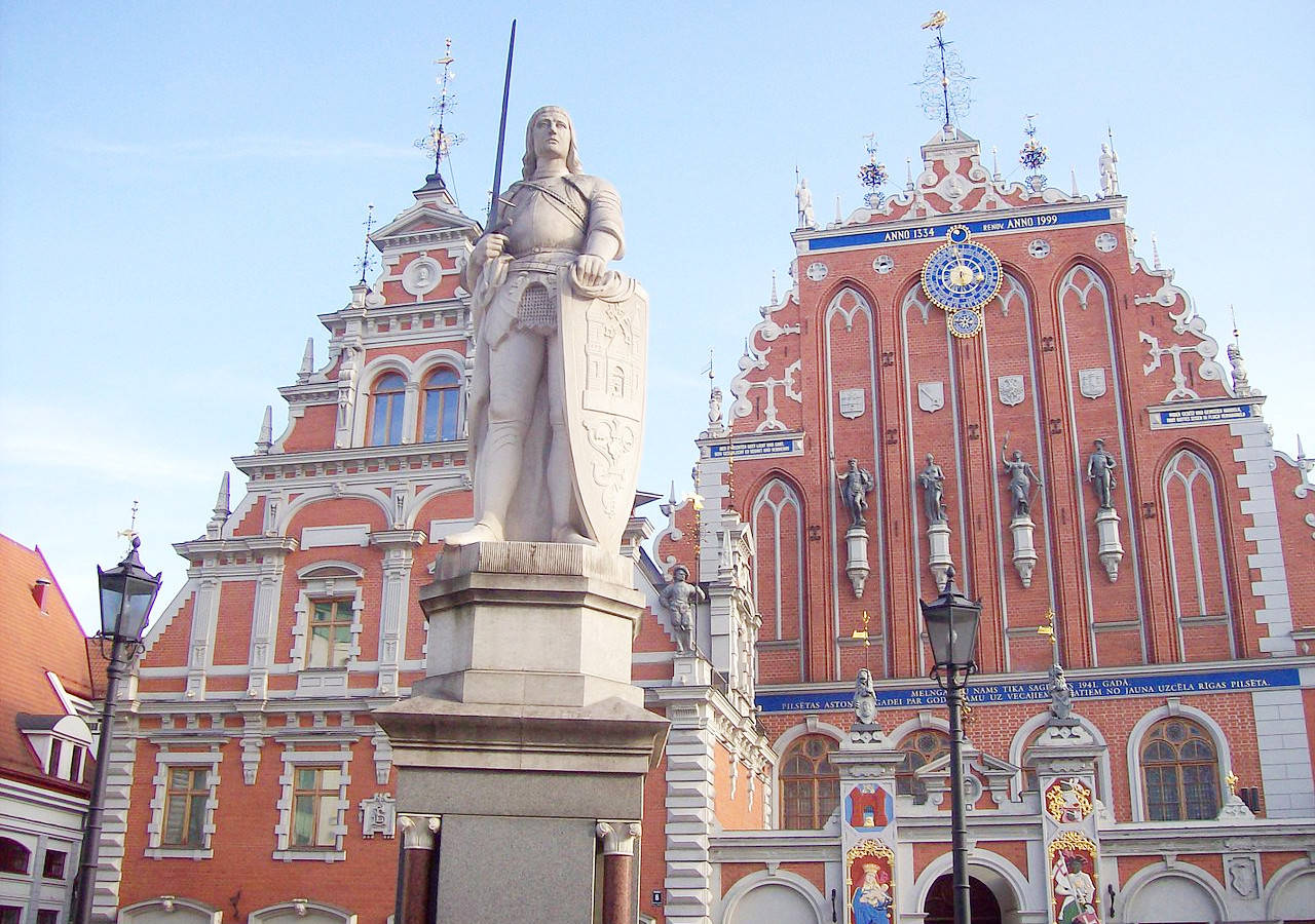 Town Hall and House of Black Heads, Riga
The official websites
Latvia

Best Enjoyed Slowly
| Location: | Northeastern Europe, bordering the Baltic Sea, between Estonia and Lithuania |
| Coordinates: | 57° 00′ N, 24° 45′ E |
| Size: | • 270 km N-S; 445 km E-W • 165 miles N-S; 275 miles E-W |
| Terrain: | Mainly a lowland plain with areas of uplands consisting of moderate-sized hills. |
| Climate: | A cool maritime climate with cool, dry winters and warm, humid summers |
| Highest point: | Gaiziņkalns 312 m / 1,024 ft |
| Forest: | 57% (2010 est.) (source) |
| Population: | 1,842,226 (2022 est.) |
| Population density: | Low (30/km²) |
| Capital: | Riga |
| Languages: | Latvian (official) 56.3%, Russian 33.8%, other 0.6% |
| Human Development Index: | Very high (0.866) |
