The Geography of
Nicaragua
Why visit Nicaragua?
Nicaragua has vast natural beauty in its mountains, volcanoes, and lakes. Located in Central America between Honduras and Costa Rica, it includes the jungle-covered mountains of the Northwest, the dense forests of the East, and the savannas of the whole Atlantic region. Nicaragua offers every aspect of the tropical.
Contents
Map
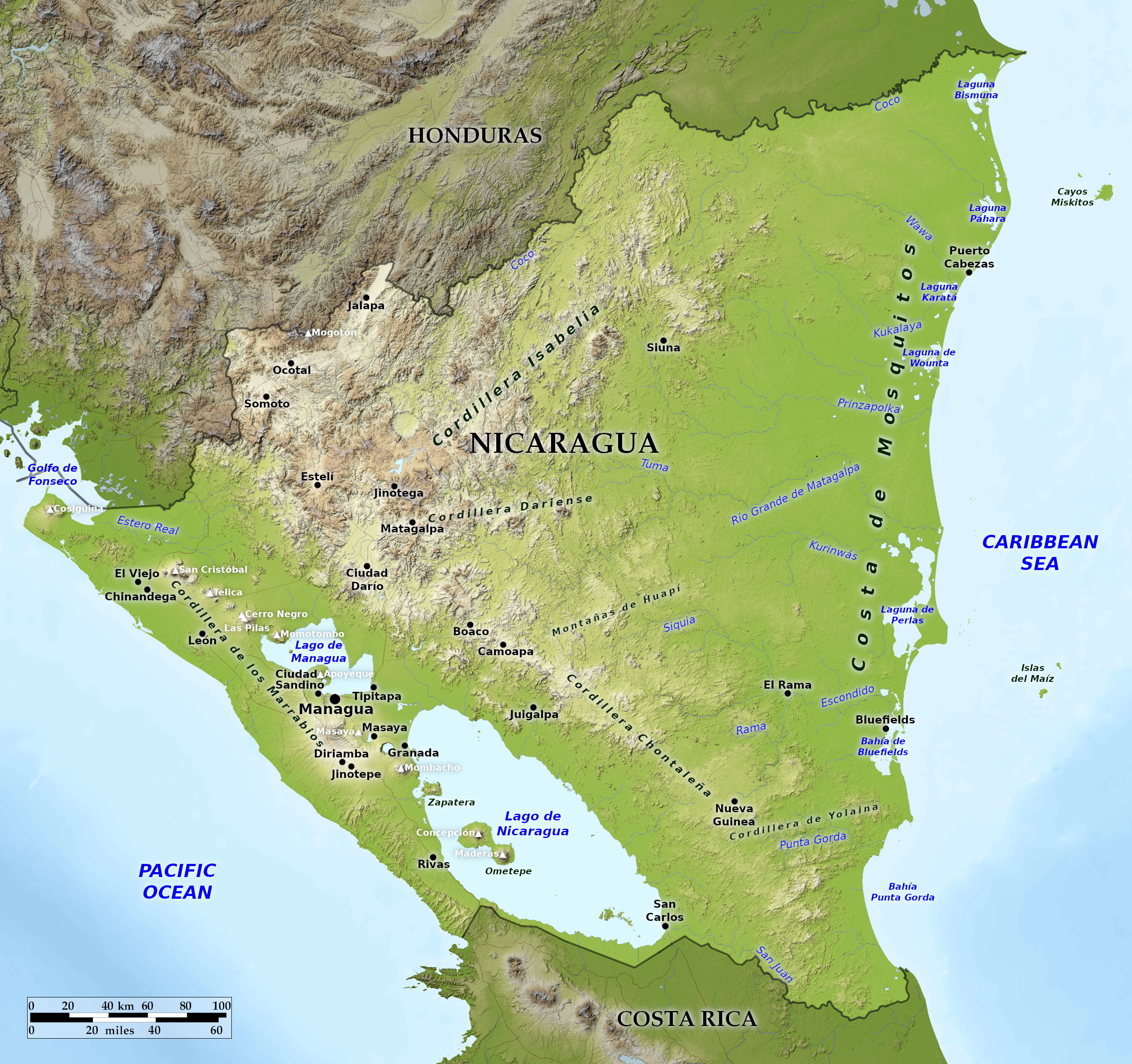 Relief map of Nicaragua
What is the landscape of Nicaragua like?
Nicaragua contains a great diversity of climate and terrain. The country's physical geography divides it into three major zones: the Pacific lowlands, the Central Highlands, and the Caribbean lowlands.
Pacific Lowlands
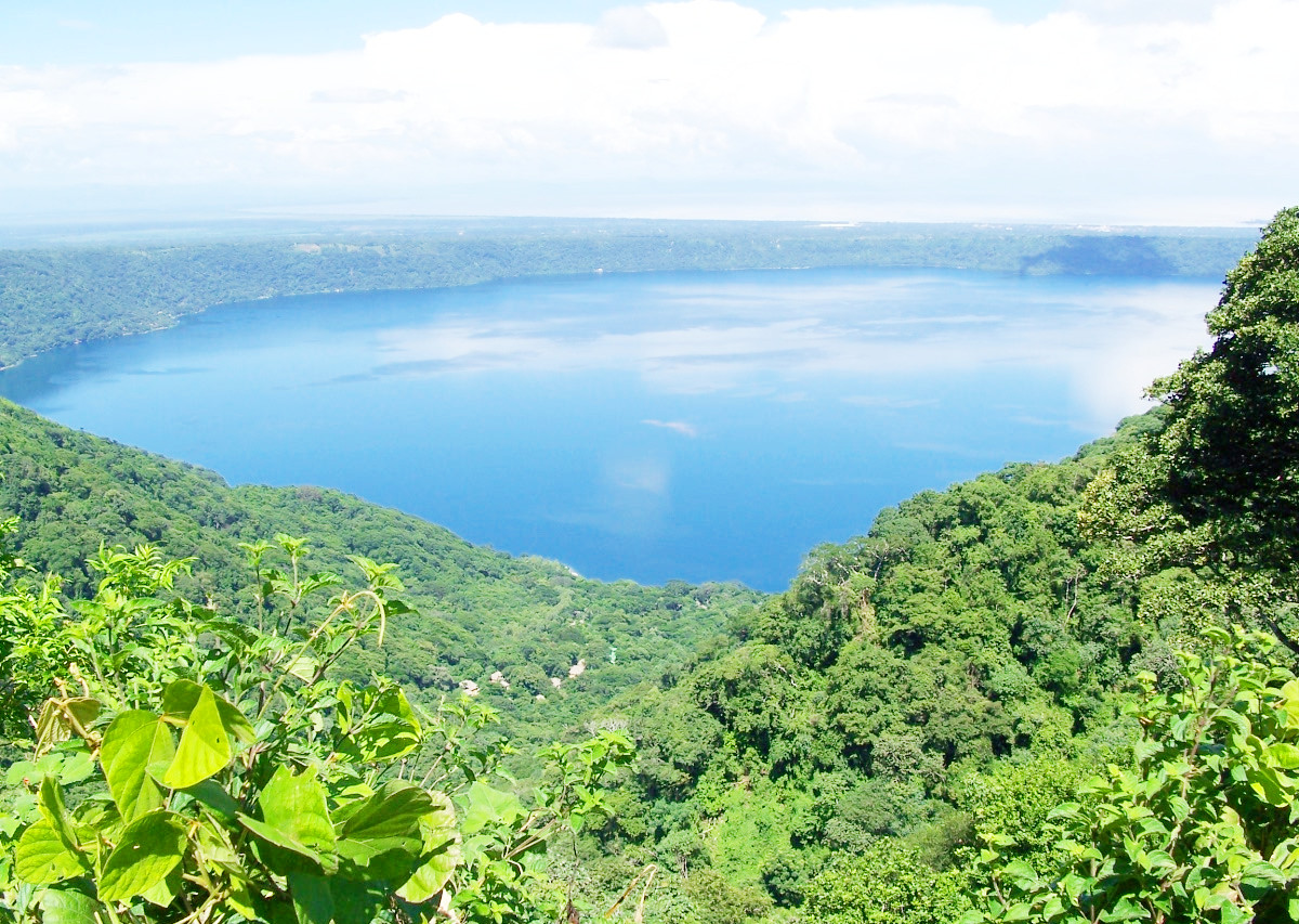
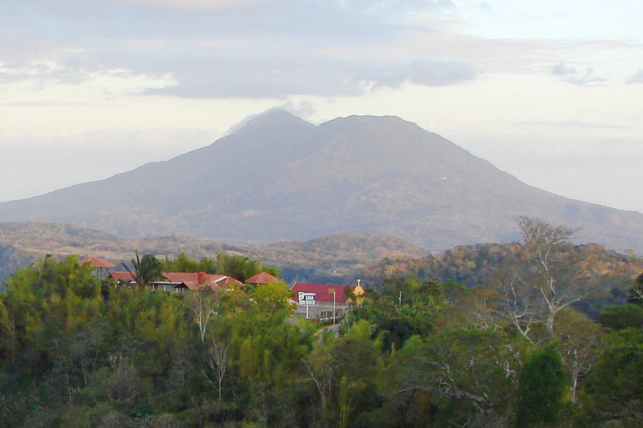
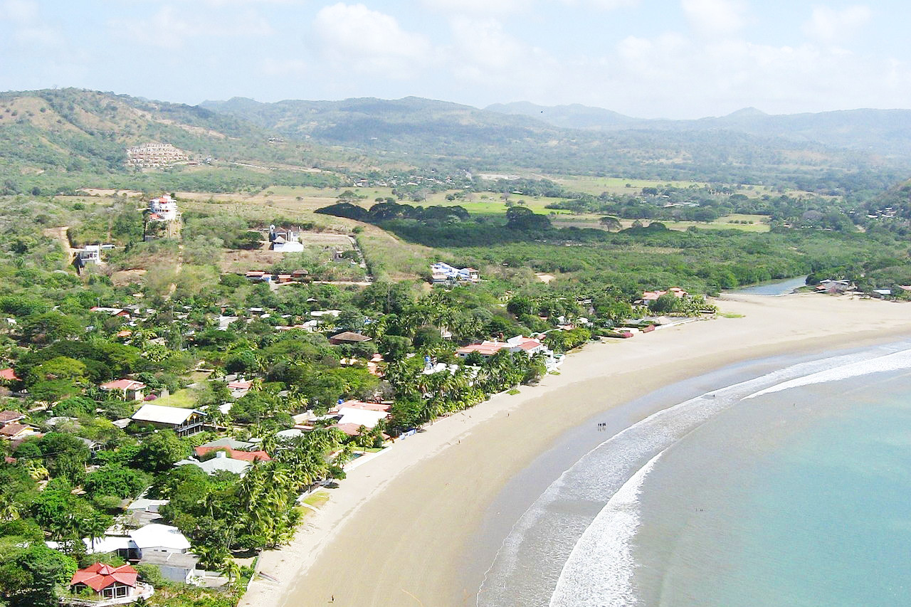
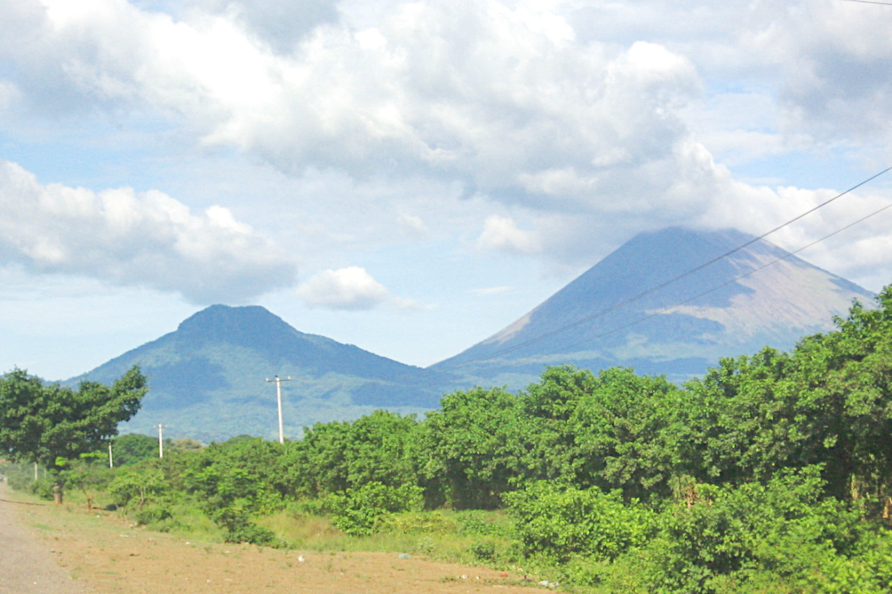
The Pacific lowlands extend about 75 kilometers (45 miles) inland from the Pacific coast. Most of the area is flat, with the exception of a number of young volcanoes, many of which are still active, running between the Golfo de Fonseca and the western shore of Lake Nicaragua. These peaks lie west of a large rift that forms a long, narrow depression that runs southeast across the isthmus from the Golfo de Fonseca to the Rio San Juan. The rift is partially occupied by the largest freshwater lakes in Central America: Lago de Managua (65 kilometers / 45 miles long) and Lago de Nicaragua (about 160 kilometers / 100 miles long). These two lakes are connected by the Rio Tipitapa, which flows south into Lago de Nicaragua. Lago de Nicaragua empties into the Rio San Juan (the border between Nicaragua and Costa Rica), which flows through the southern part of the rift lowlands to the Caribbean Sea. The Rio San Juan valley forms a natural passage near sea level across the Nicaraguan Isthmus from the Caribbean Sea to Lake Nicaragua and the Rift. From the southwestern edge of Lago de Nicaragua it is only 19 kilometers (12 miles) to the Pacific Ocean. This route has been considered several times in the past as a possible alternative to the Panama Canal.
The lakes surrounding and extending northwest of them along the Rift Valley to the Golfo de Fonseca are fertile lowland plains heavily enriched with volcanic ash from nearby volcanoes. These lowlands are densely populated and well cultivated. Directly west of the lakes region is a narrow line of ash-capped hills and volcanoes separating the lakes from the Pacific Ocean. This line is highest in the central part near Leon and Managua.
Being located where two major tectonic plates collide, western Nicaragua is subject to earthquakes and volcanic eruptions. Hundreds of tremors occur each year, some causing severe damage.
Central Highlands
The triangular area known as the Central Highlands lies northeast and east of the Pacific Lowlands. This rugged mountain country consists of 900 to 1,800 meter (3,000–6,000 feet) high ridges and a mixed forest of oak and pine alternating with deep valleys that mainly drain into the Caribbean Sea. Very few major rivers flow west into the Pacific Ocean; those that do are steep, short, and flow only intermittently. The relatively dry western slopes of the central highlands, sheltered from the humid Caribbean winds by the highland ridges, have attracted farmers from the Pacific region since colonial times and are now well settled. The eastern slopes of the highlands are covered with rainforest and sparsely populated with settlers and small communities of indigenous people.
Caribbean Lowlands
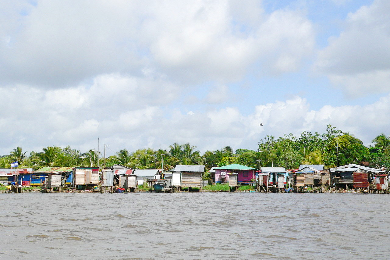
The eastern Caribbean lowlands of Nicaragua make up the sprawling (more than 50 percent of the state's territory) and still sparsely populated lowland area known as the Costa de Mosquitos. This lowland is a hot, humid area that includes coastal plains, the eastern reaches of the central highlands, and the lower portion of the Rio San Juan basin.
Pine and palm savannas dominate as far south as Laguna de Perlas. Tropical rainforests are characteristic from the Laguna de Perlas to the Rio San Juan, inland west of the savanna and along rivers through the savanna. Fertile soils are only found along the natural levees and narrow flood plains of the numerous rivers, including the Escondido, Rio Grande de Matagalpa, Prinzapolka and Coco, and along the many smaller streams that originate in the central highlands and criss-cross the region the way to the complex of shallow bays, lagoons and salt marshes of the Caribbean coast.
What is the nature of Nicaragua like?
Dense tropical rain forest covers much of the eastern (Atlantic) half of Nicaragua. Here, the tallest trees, may tower 60 meters (200 feet) above the forest floor. Nicaragua has numerous rainforests, some of which are protected as reserves. Two exceptional reserves are Reserva Natural Miraflor and Reserva Biológic Indo-Maiz. Miraflor is remarkably pristine and has tropical savannah at lower altitude, pine forest higher up, and cloud forest at its highest elevations. Indo-Maiz protects the largest contiguous extent of primary rainforest in Central America, an area that is called the Bosawás Biosphere Reserve. Here, a habitat exists for a huge number of species of birds, trees, and insects.
The central highlands region has extensive forests of oak and pine on the slopes, but lower valley elevations show damage from fire and agricultural activities. In the uplands there is an elevation where fog is almost constant. This region is called the cloud forest, a landscape of trees, mosses, ferns, orchids, and an abundance of other flora.
The wet and humid Caribbean coastal plain has an abundance of tropical forest. The largest pine savanna in the rainy tropics stands on the lowlands behind the Mosquito Coast. In the drier and heavily populated west, plant life is sparser: scrubland and savanna—a mixture of tall grasses and scattered trees—exist where the land has not been disturbed by farming.
Nicaragua has an abundance of animal life. The wildlife of Nicaragua includes the jaguar, deer, monkey, armadillo, alligator, parrot, macaw, peccary, and several species of snakes (some poisonous). Lake Nicaragua contains the only freshwater sharks in the world, owing to a prehistoric geological movement that separated the lake from the Pacific Ocean, gradually changing the ocean water into fresh water.
What is the climate of Nicaragua like?
See our main article: The Climate of Nicaragua
Nicaragua has a tropical monsoon climate. Except in the central highlands, the climate is warm and humid. Daytime temperatures average 29°C (85°F) and night temperatures drop below 21°C (70°F). In the central highlands temperatures are lower, about 21°C (70°F) in the daytime and about 15°C (60°F) at night.
The rainy season is from May through November and the dry season is from January through April. The east coast gets the greatest amount of yearly rainfall, from 2,300 to 5,000 mm (90 to 200 in). Less rain, about 750 to 2,300 mm (30 to 90 in) per year, falls on the Central Highlands and the west coast.
| Climate data for Managua | |||||||||||||
|---|---|---|---|---|---|---|---|---|---|---|---|---|---|
| Month | Jan | Feb | Mar | Apr | May | Jun | Jul | Aug | Sep | Oct | Nov | Dec | Year |
| Average high °C (°F) | 31.0 (87.8) | 32.1 (89.8) | 33.6 (92.5) | 34.3 (93.7) | 34.0 (93.2) | 31.4 (88.5) | 30.9 (87.6) | 31.4 (88.5) | 30.3 (86.5) | 30.8 (87.4) | 30.6 (87.1) | 30.8 (87.4) | 31.8 (89.2) |
| Daily mean °C (°F) | 26.3 (79.3) | 27.2 (81.0) | 28.5 (83.3) | 29.3 (84.7) | 29.3 (84.7) | 27.2 (81.0) | 26.8 (80.2) | 27.2 (81.0) | 26.8 (80.2) | 26.5 (79.7) | 26.3 (79.3) | 26.2 (79.2) | 27.3 (81.1) |
| Average low °C (°F) | 20.4 (68.7) | 20.6 (69.1) | 21.7 (71.1) | 22.6 (72.7) | 23.4 (74.1) | 23.0 (73.4) | 22.6 (72.7) | 22.4 (72.3) | 22.2 (72.0) | 22.1 (71.8) | 20.9 (69.6) | 20.0 (68.0) | 21.8 (71.2) |
| Average precipitation mm (inches) | 9 (0.4) | 5 (0.2) | 3 (0.1) | 8 (0.3) | 130 (5.1) | 224 (8.8) | 144 (5.7) | 136 (5.4) | 215 (8.5) | 280 (11.0) | 42 (1.7) | 8 (0.3) | 1,204 (47.4) |
| Source: Deutscher Wetterdienst | |||||||||||||
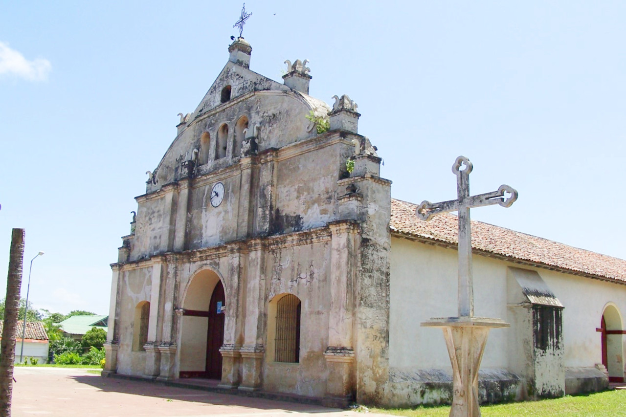
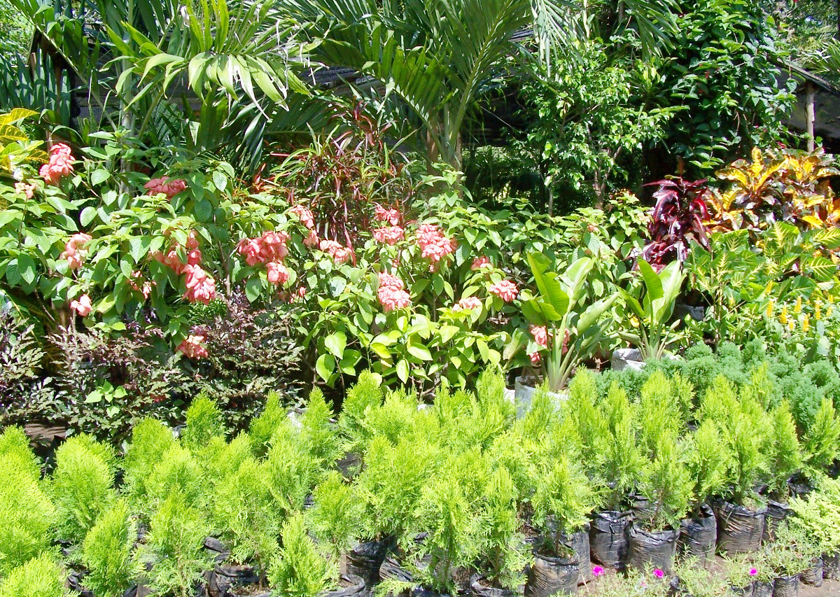 Jardines in Catarina
The official websites
Nicaragua
Land of Lakes and Volcanoes
| Location: | Central America, bordering both the Caribbean Sea and the Pacific Ocean, between Costa Rica and Honduras |
| Coordinates: | 13° 00′ N, 85° 00′ W |
| Size: | • 500 km N-S; 510 km E-W • 310 miles N-S; 320 miles E-W |
| Terrain: | Extensive Atlantic coastal plains rising to central interior mountains; narrow Pacific coastal plain interrupted by volcanoes |
| Climate: | Tropical in lowlands, cooler in highlands |
| Highest point: | Mogotón 2,085 m / 6,841 ft |
| Forest: | 25% (2018 est.) |
| Population: | 6,301,880 (2022 est.) |
| Population density: | Low-to-medium (51/km²) |
| Capital: | Managua |
| Languages: | Spanish (official) 95.3%, Miskito 2.2%, Mestizo of the Caribbean coast 2%, other 0.5% |
| Human Development Index: | Medium (0.667) |