The Geography of
Extremadura
Why visit Extremadura?
Extremadura is a unique region of Spain. Villages are few and far between, but the very silence and solitude of this region is itself tempting. The most characteristic feature of this tableland is the vast heaths, which in spring cover the whole landscape with yellow blossom, but in summer change to a wilderness. The climate in summer is hot, and the rainfall is scanty, but dew is abundant and the nights are cool.
Contents
Map
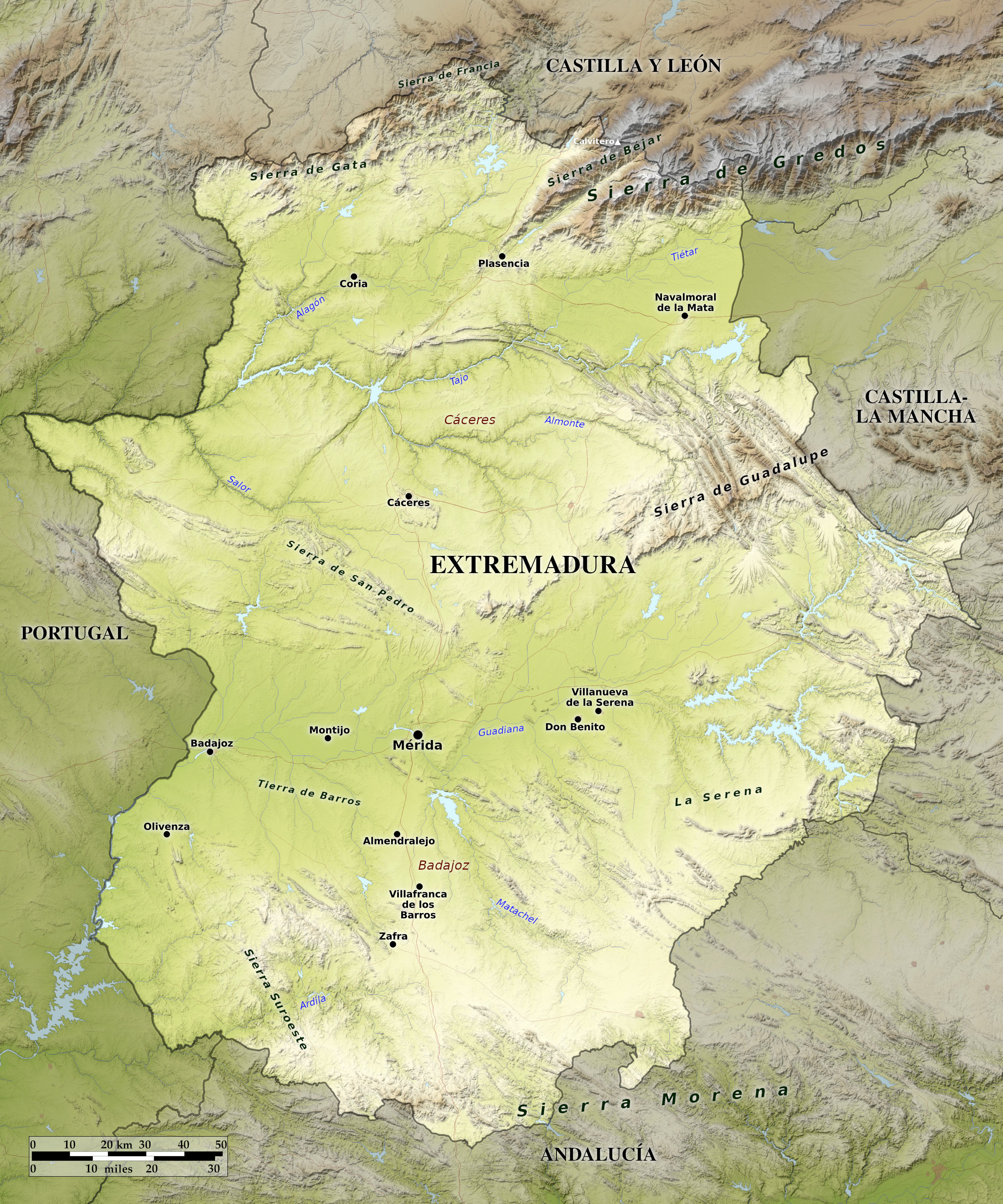 Relief map of Extremadura
What is the landscape of Extremadura like?
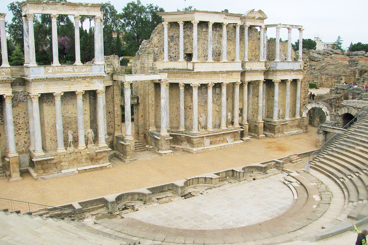
Extremadura is the most rural and remote region of Spain. However, only a small percentage of visitors to Spain ever venture into this part of the country. Small but interesting towns and villages dot the rolling landscape. The capital of the region is Merida, a modest city, and like its neighbor Cáceres, it was an ancient Roman outpost. The ruins of numerous Roman buildings, including a spectacular Roman theater, have been excavated at Merida.
Estremadura consists of a tableland separated from Leon and Castile to the north by the high Sierra de Gredos, Sierra de Béjar, and the Sierra de Gata, which form an almost continuous barrier along the northern frontier. On the south the comparatively low range of the Sierra Morena constitutes the frontier of Andalusia. The tableland of Estremadura is itself divided from east to west by an irregular line of mountains, culminating in the Sierra de Guadalupe in the east. These two halves are respectively known as Alta or Upper Estremadura (Cáceres province), and Baja or Lower Estremadura (Badajoz province).
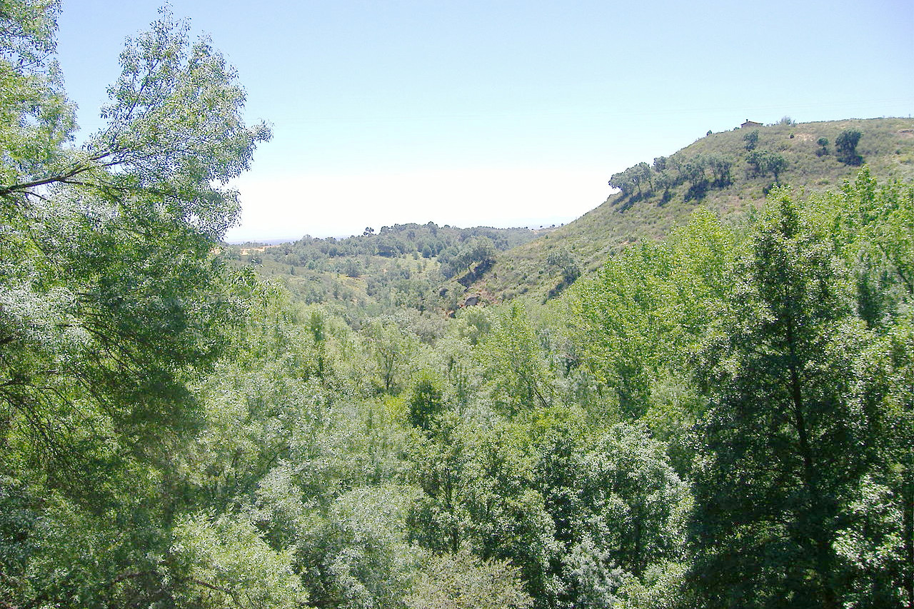
The countryside away from the mountains is typically level or slightly undulating, and often almost uninhabited, with wide tracts of moorland, and a thin growth of shrubs and grass. The Tajo and Guadiana are the two major rivers which flow from east to west through the country.
What is the nature of Extremadura like?
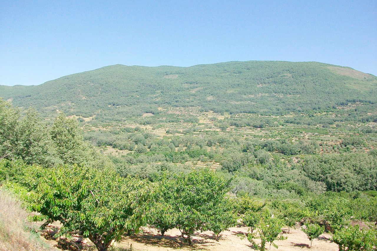
Perhaps the most characteristic feature of this tableland are the vast heaths of rockrose (cistus), which in spring colour the whole landscape with leagues of yellow blossom, and in summer change to an arid wilderness. Otherwise the area is grassland, or covered with thin bush and forest. Much of the region was deforested in earlier times, but there is still beech, oak and chestnut woodland, and there are numerous plantations of olive, cork and fruit trees.
What is the climate of Extremadura like?
The climate shows extremes of heat in summer especially when the hot east winds prevail. Dew, however, is abundant and the nights are cool. Temperatures plunge in winter when the north and northwest winds blow across the plains. Rainfall is scarce in average years. The high mountains are covered with snow by November, although the winters there are not usually severe.
| Climate data for Mérida (1981-2010) | |||||||||||||
|---|---|---|---|---|---|---|---|---|---|---|---|---|---|
| Month | Jan | Feb | Mar | Apr | May | Jun | Jul | Aug | Sep | Oct | Nov | Dec | Year |
| Average high °C (°F) | 14.0 (57.2) | 16.1 (61.0) | 20.1 (68.2) | 21.6 (70.9) | 25.9 (78.6) | 31.6 (88.9) | 34.8 (94.6) | 34.7 (94.5) | 30.6 (87.1) | 24.4 (75.9) | 18.3 (64.9) | 14.5 (58.1) | 23.9 (75.0) |
| Daily mean °C (°F) | 8.9 (48.0) | 10.5 (50.9) | 13.4 (56.1) | 15.2 (59.4) | 18.9 (66.0) | 23.6 (74.5) | 26.3 (79.3) | 26.3 (79.3) | 23.2 (73.8) | 18.3 (64.9) | 13.0 (55.4) | 9.9 (49.8) | 17.3 (63.1) |
| Average low °C (°F) | 3.8 (38.8) | 4.8 (40.6) | 6.8 (44.2) | 8.7 (47.7) | 11.9 (53.4) | 15.7 (60.3) | 17.8 (64.0) | 17.8 (64.0) | 15.9 (60.6) | 12.2 (54.0) | 7.6 (45.7) | 5.3 (41.5) | 10.7 (51.2) |
| Average precipitation mm (inches) | 51.4 (2.02) | 40.7 (1.60) | 33.2 (1.31) | 49.2 (1.94) | 43.0 (1.69) | 15.3 (0.60) | 3.6 (0.14) | 5.7 (0.22) | 25.4 (1.00) | 61.4 (2.42) | 69.3 (2.73) | 69.3 (2.73) | 467.5 (18.4) |
| Source: Agencia Estatal de Meterología | |||||||||||||
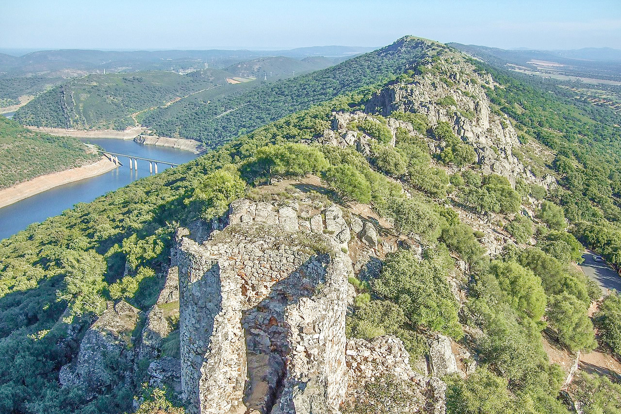
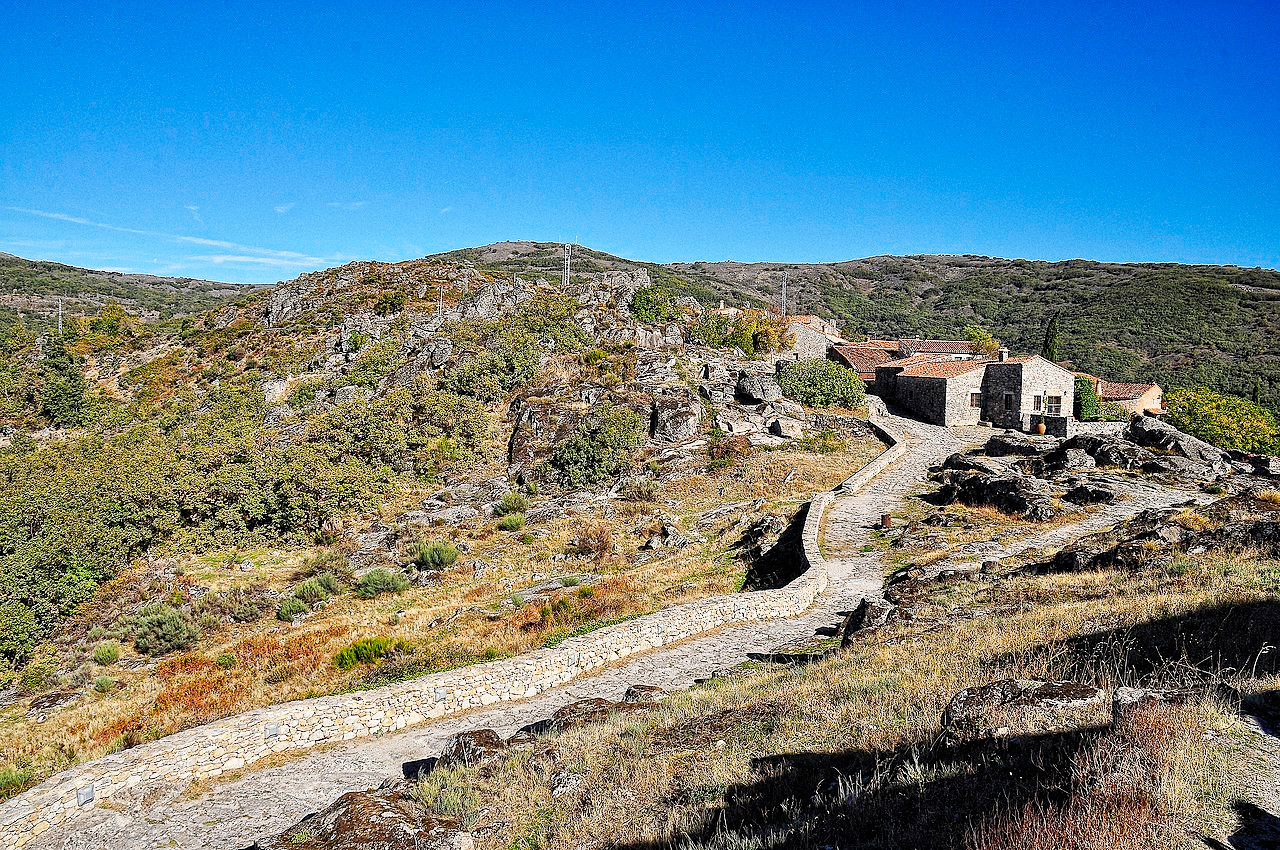 Trevejo in the municipality of Villamiel, Cáceres
The official websites
Extremadura
A Land of Contrasts
| Location: | Western Spain |
| Coordinates: | 39° 15′ N, 06° 00′ W |
| Size: | • 285 km N-S; 250 km E-W • 175 miles N-S; 155 miles E-W |
| Terrain: | Flat or undulating plateau region with low ranges of hills. High mountains in the north |
| Climate: | Hot summers with high levels of sunshine. Winters are mild. Rainfall is low in most of the region except the north |
| Highest point: | Calvitero 2,399 m / 7871 ft |
| Forest: | 14% (2010 est.) (source) |
| Population: | 1 063 987 (2020) |
| Population density: | Low (26/km²) |
| Capital: | Mérida |
| Languages: | Spanish |
| Human Development Index: | Very High (0.866) |