.jpg)
The Geography of
Castile and León
Why visit Castilla y León?
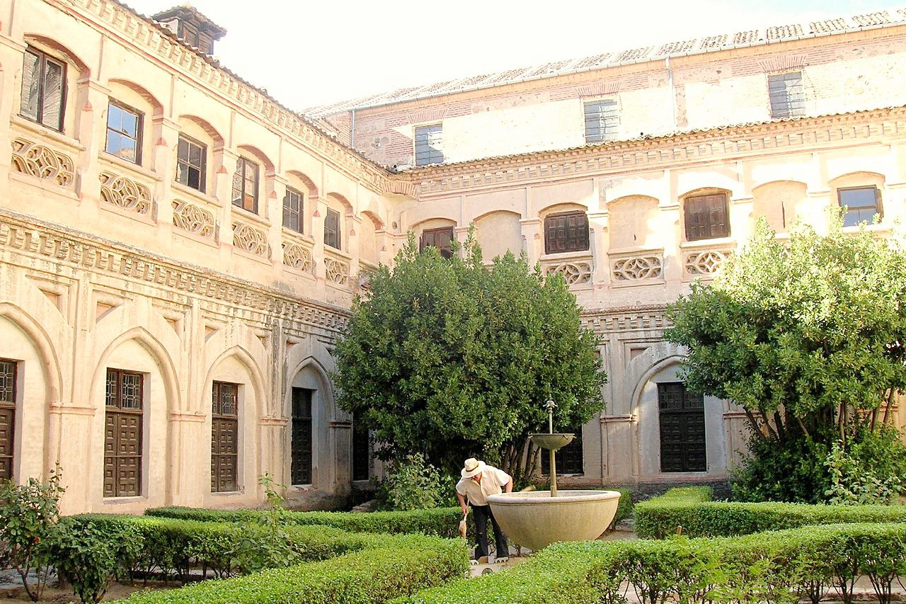
Castile and Leon are the northern half of the vast central plateau of Spain. This plateau has a natural frontier of the Cantabrian Mountains to the north, and to the north-west is the richly wooded pastoral and highland district known as El Bierzo, with fruit and wine in abundance. Castilla and León treasures a large part of the Spanish cultural heritage, with more than 300 castles, and more than 400 museums.
Contents
Map
 Relief map of Castile and León
What is the landscape of Castilla y León like?
.jpg&oldid=598531535)
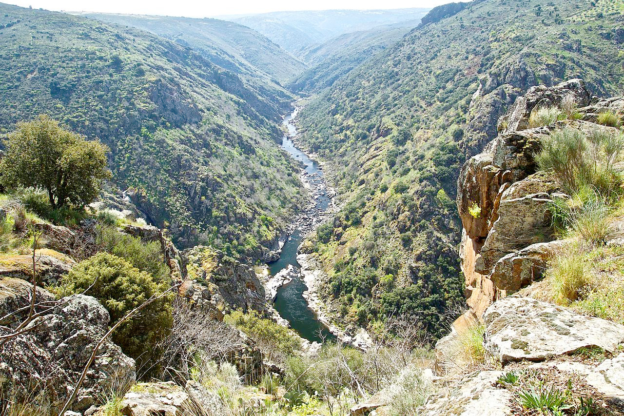
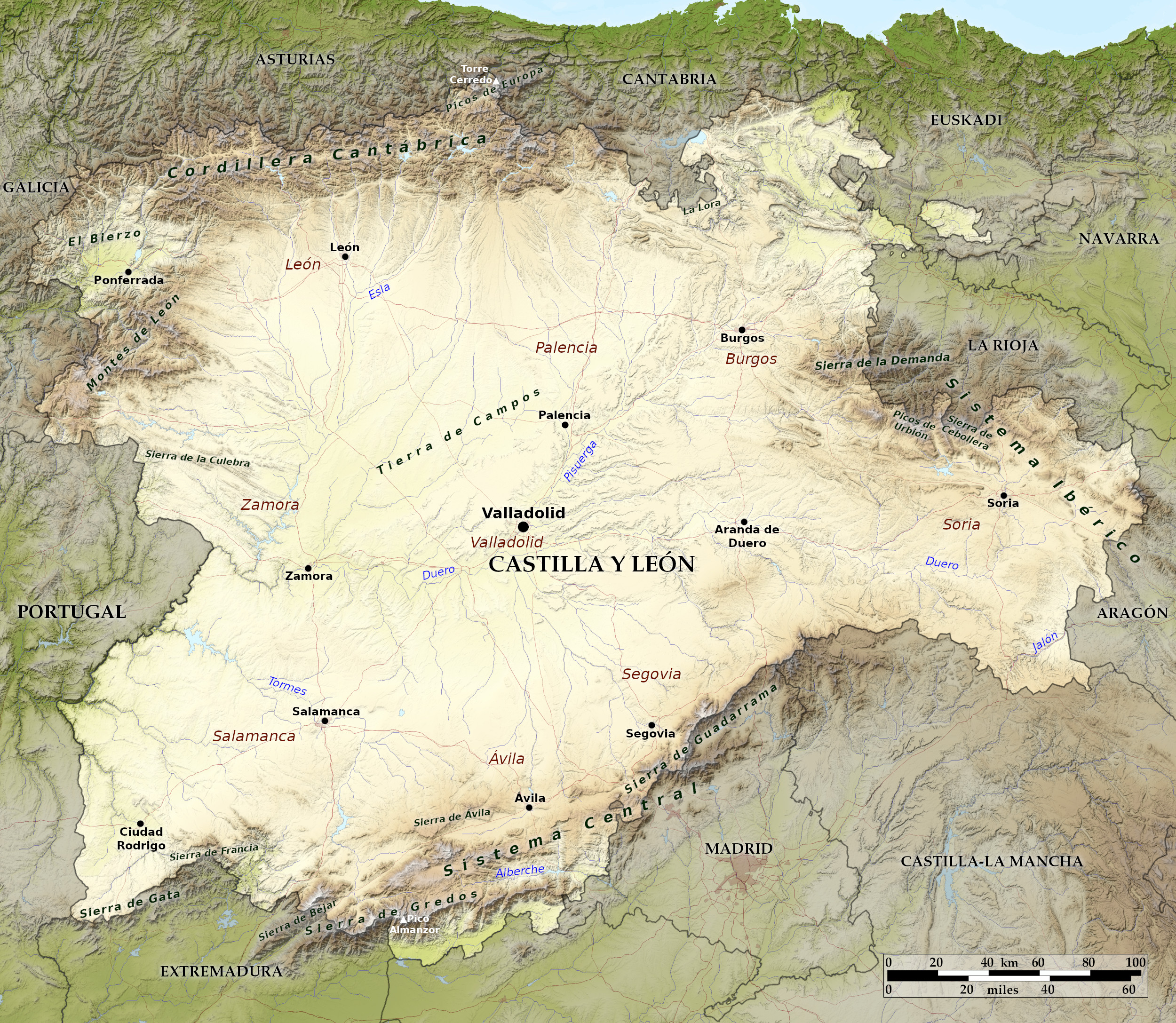
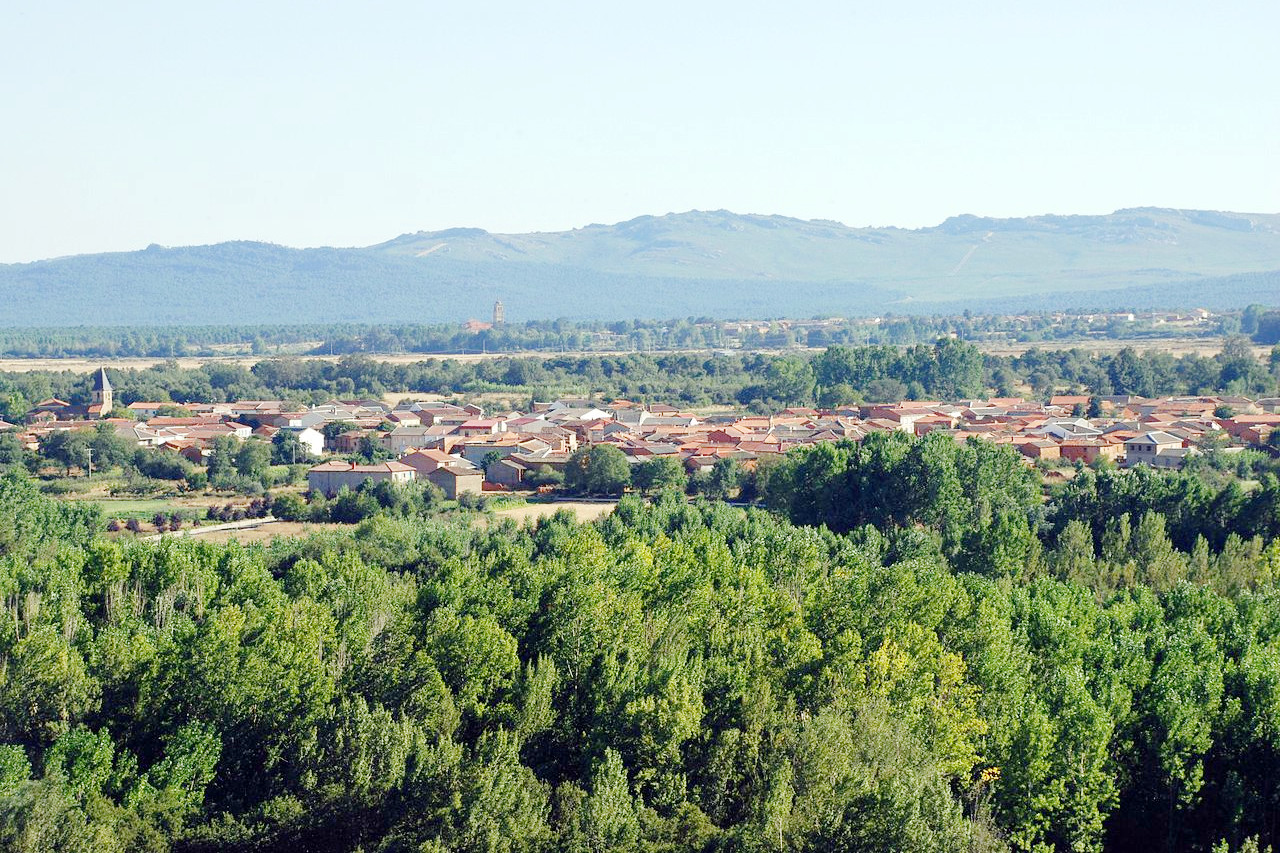
Castile and León (sometimes called "Old Castile") is the largest region of the country, and is at the very heart of Spain. The boundaries of the region, to the north, are formed by the Cantabrian Mountains which reaches a highest point at Torre Cerredo (2,650 m / 8,690 feet). Towards the south the landscape merges imperceptibly into the vast Castilian plateau ("Meseta Central") which is a large, rugged plateau occupying the middle section of Spain. It is, in effect, the basin of the River Duero which traverses the region from east to west.
The country watered by the tributary rivers is for the most part flat and often quite fertile, but becomes more rugged in the highlands of the east. The southern borders of the region are marked by the mountain ranges of Sistema Central—a mass of rugged granitic sierras, interspersed, however, with sheltered and well-watered valleys, abounding with rich vegetation.
The regional capital is the old university city of Valladolid. The ancient city of Salamanca lies in the southwestern corner of the region. It is sometimes referred to as La Ciudad Dorada, or the "Golden City," because of the yellowish sandstone used for many of its ancient buildings. Segovia, another historic city located in the south, features a magnificent 2,000-year-old Roman aqueduct that still carries water. It also has a picturesque alcazar, or castle, where King Ferdinand and Queen Isabella were married in 1469, thus setting the stage for the Age of Discovery and the establishment of the Spanish empire.
What is the nature of Castilla y León like?
The Castilian plains were mostly deforested during the Middle Ages—the remains of the forests are now marked by the solitary holm oaks and junipers which dot the landscape. Sparse forests of these trees are still found in the provinces of León, Soria and Burgos. The southwest (especially Salamanca province) is home to the region's olive groves.
The Cantabrian Mountains of the north have extensive forests populated with beech trees, and sometimes mixed with yew, rowan, whitebeam, holly, and birch. On the sunny slopes there is also oak, ash, lime, chestnut, birch and pine. The southern mountains of the Sistema Central have extensive holm oak forests on the lower slopes, and chestnut, oak, and pine forests on higher ground. The high subalpine zones are home to thickets of broom and juniper.
What is the climate of Castilla y León like?
Castille and León has a continental climate, with cold winters, and hot summers, with the three or four months of summer dryness characteristic of the Mediterranean climate. Intense cold waves are typical of the central winter months, especially from the second half of December to the first half of February. During this period, minimum temperatures will drop below -10°C (-15°F) in many parts.
Rainfall is very uneven across the territory of Castile and León. While in the central basin rainfall is scarce, the surrounding mountains well-watered, and the Sierra de Gredos in the south is the rainiest part of Spain.
| Climate data for Valladolid (1981-2010) | |||||||||||||
|---|---|---|---|---|---|---|---|---|---|---|---|---|---|
| Month | Jan | Feb | Mar | Apr | May | Jun | Jul | Aug | Sep | Oct | Nov | Dec | Year |
| Average high °C (°F) | 8.2 (46.8) | 11.2 (52.2) | 15.2 (59.4) | 16.9 (62.4) | 21.0 (69.8) | 27.0 (80.6) | 30.7 (87.3) | 30.1 (86.2) | 25.6 (78.1) | 18.9 (66.0) | 12.4 (54.3) | 8.6 (47.5) | 18.8 (65.8) |
| Daily mean °C (°F) | 4.2 (39.6) | 5.9 (42.6) | 9.0 (48.2) | 10.7 (51.3) | 14.5 (58.1) | 19.3 (66.7) | 22.3 (72.1) | 22.1 (71.8) | 18.5 (65.3) | 13.2 (55.8) | 7.9 (46.2) | 5.0 (41.0) | 12.7 (54.9) |
| Average low °C (°F) | 0.2 (32.4) | 0.7 (33.3) | 2.8 (37.0) | 4.6 (40.3) | 7.9 (46.2) | 11.6 (52.9) | 14.0 (57.2) | 14.1 (57.4) | 11.3 (52.3) | 7.6 (45.7) | 3.5 (38.3) | 1.3 (34.3) | 6.6 (43.9) |
| Average precipitation mm (inches) | 40 (1.6) | 27 (1.1) | 22 (0.9) | 46 (1.8) | 49 (1.9) | 29 (1.1) | 13 (0.5) | 16 (0.6) | 31 (1.2) | 55 (2.2) | 52 (2.0) | 53 (2.1) | 433 (17.0) |
| Source: Agencia Estatal de Meteorología | |||||||||||||
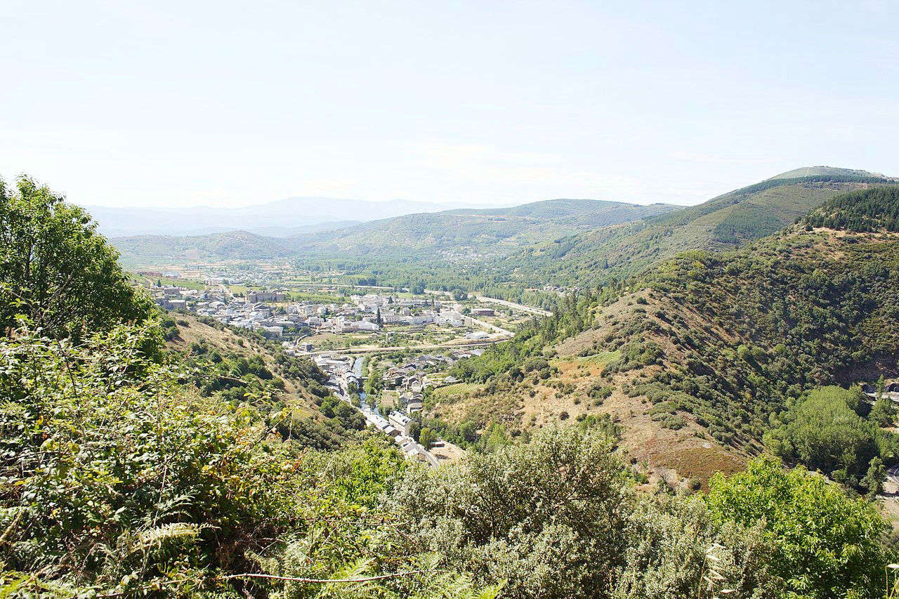 Villafranca del Bierzo, el Bierzo region
The official websites
Castilla y León
Where culture, heritage, and nature meet
| Location: | North-central Spain |
| Coordinates: | 41° 30′ N, 04° 30′ W |
| Size: | • 350 km N-S; 440 km E-W • 220 miles N-S; 275 miles E-W |
| Terrain: | A large elevated plateau framed by mountain ranges |
| Climate: | Hot, dry summers with frequent drought. Long, cold winters; heavy rainfall in the northwest; winter snow in the mountains |
| Highest point: | Torre Cerredo 2,650 m / 8,690 ft |
| Forest: | 12% (2010 est.) (source) |
| Population: | 2,394,918 (2020) |
| Population density: | Low (25/km²) |
| Capital: | None (Valladolid de facto) |
| Languages: | Spanish |
| Human Development Index: | Very High (0.909) |