The Geography of
Castilla–La Mancha
Why visit Castilla-la Mancha?
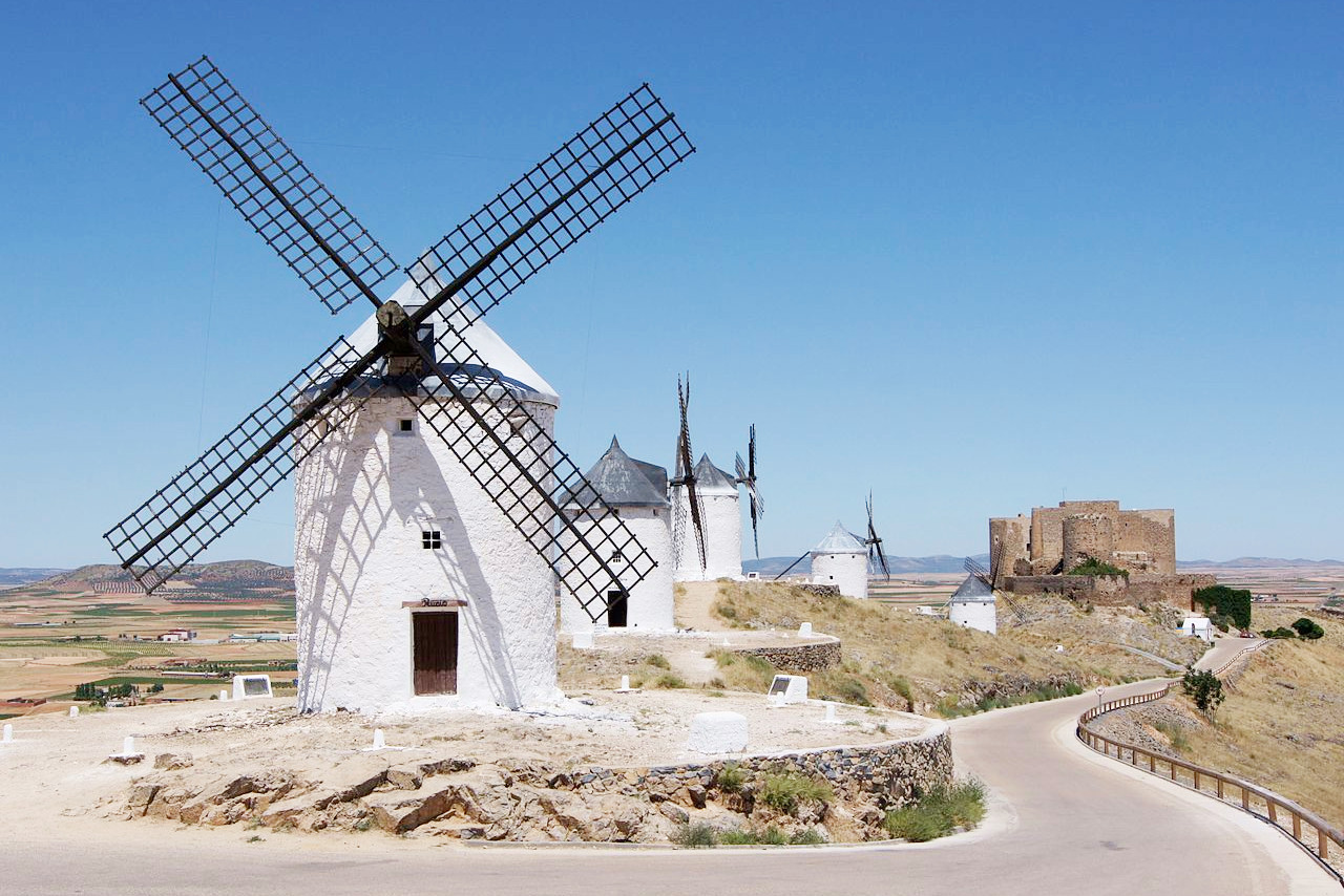
Castilla-La Mancha is a steppe country. La Mancha is famous as the scene of Cervantes' novel Don Quixote; in appearance, with its windwills and vast tracts of dusty land, it remains almost exactly as Cervantes described it. In the west there are extensive tracts of undulating forest-clad hill country which culminate in the Montes de Toledo.
Contents
Map
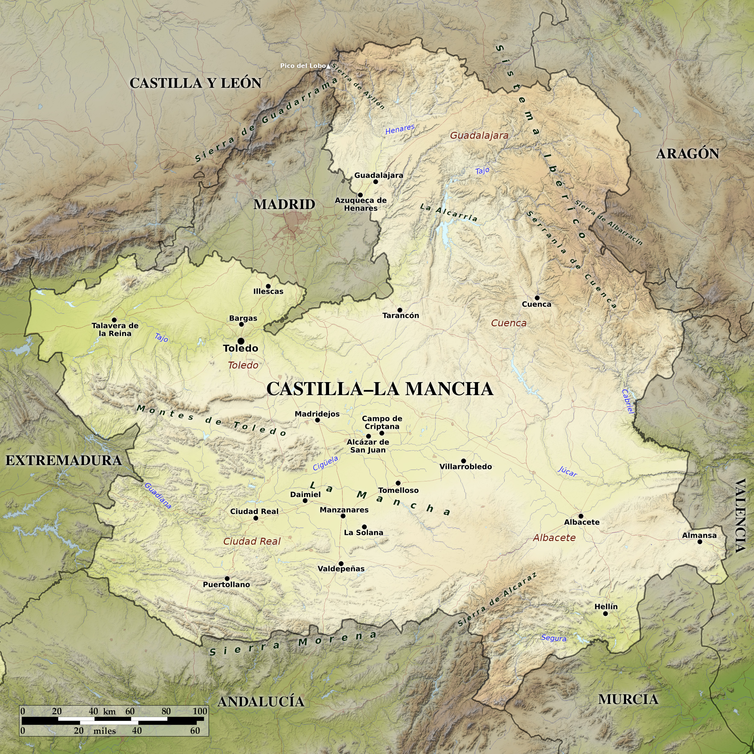 Relief map of Castilla-La Mancha
What is the landscape of Castilla-la Mancha like?
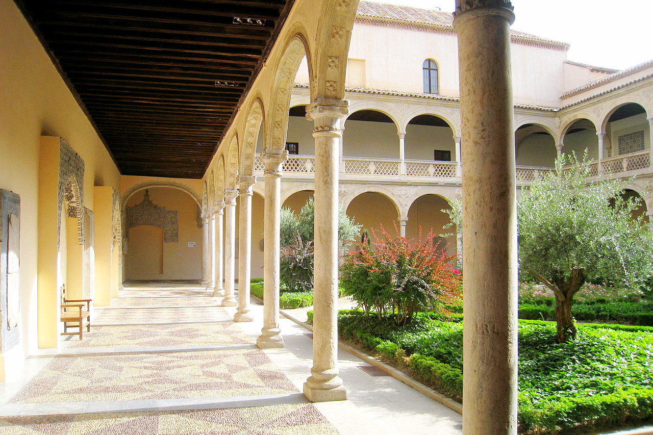
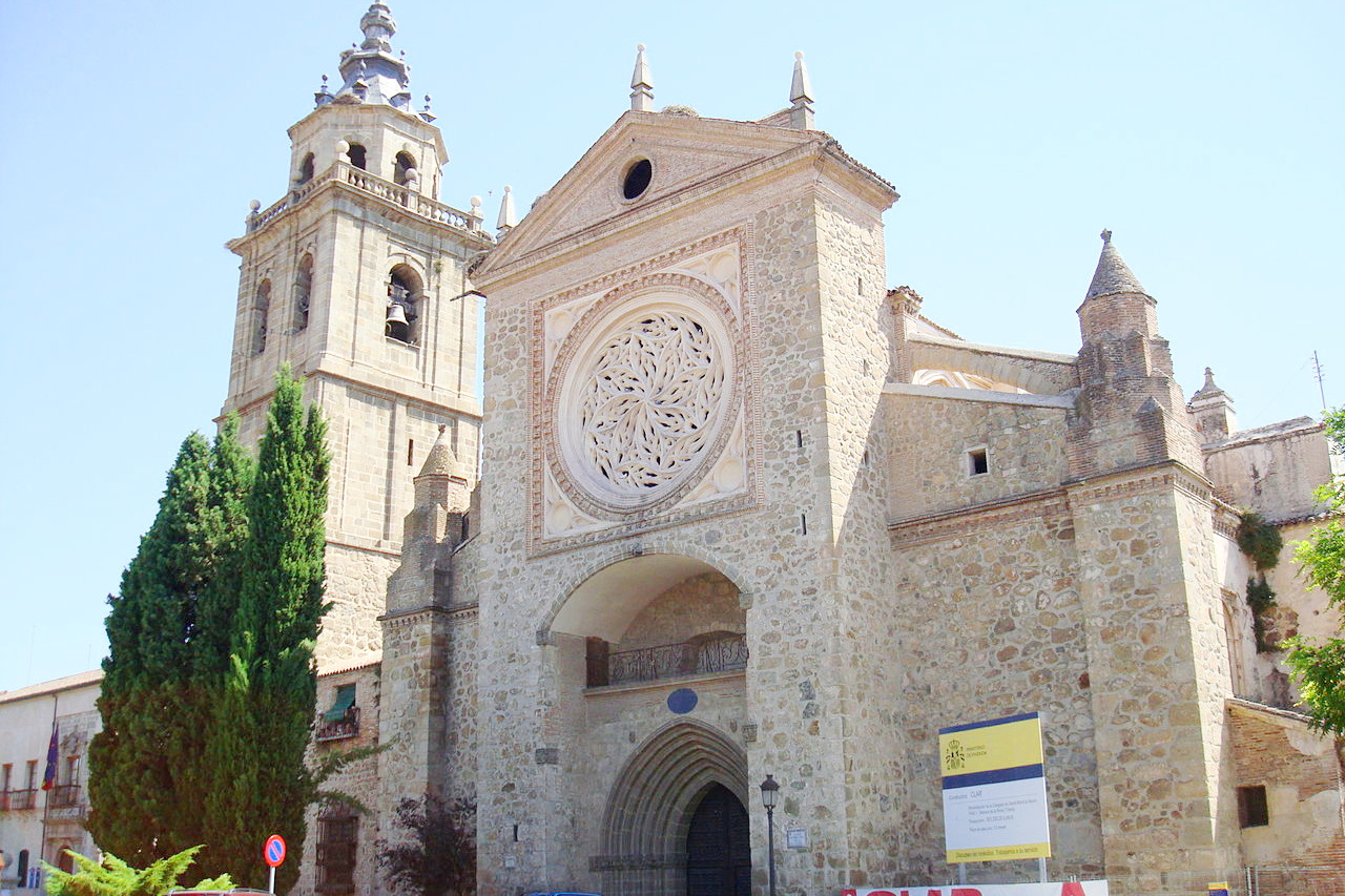
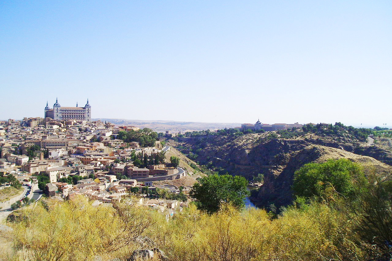
Castilla–La Mancha (sometimes called "New Castile") is Spain's third-largest region in area but contains only 2 million inhabitants. It includes one of the most famous provinces in the country, La Mancha, immortalized by Miguel de Cervantes in his classic satirical novel, Don Quixote. The de facto capital of the region is Toledo, a Roman settlement that later served as the Visigoth capital, as well as the capital of the old province of Castile for several centuries. The city was also the home of one of Spain's most famous artists, El Greco, whose works may be found in many of the city's churches and museums. Guadalajara in the north, and Ciudad Real in the south are two more historic cities.
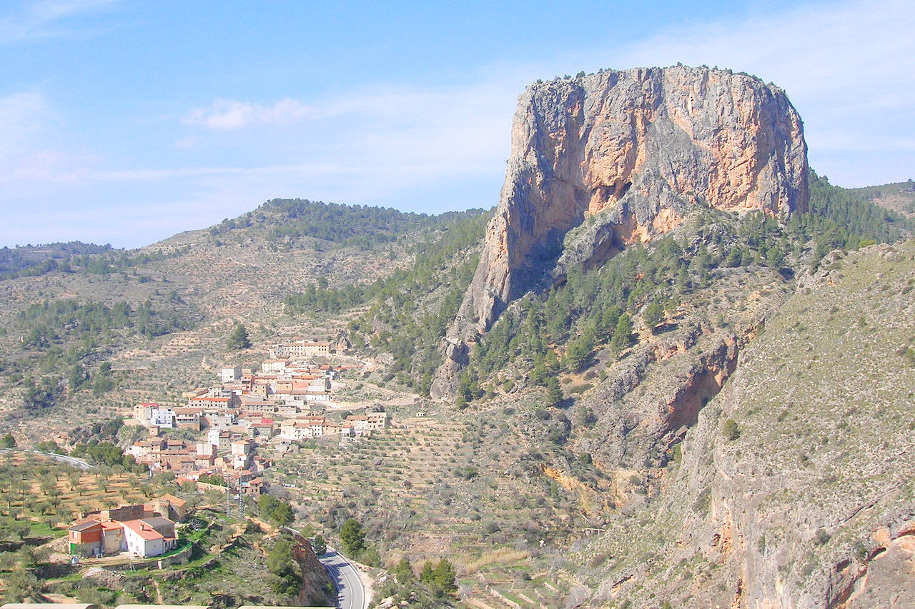
The region is part of the central plateau of Spain, and is in many parts mountainous. Along the northern frontier of Guadalajara rise the lofty Guadarrama mountains, culminating in the Pico del Lobo (2,274 m / 7,461 feet). The south of the region is generally mountainous too, traversed by low ranges or isolated groups of hills, which culminate in the Sierra de Alcaraz on the borders of Granada, where several summits reach 1,500 meters (5,000 feet).
The central parts of Castilla–La Mancha form the region known as La Mancha (Arabic: Al Mansha, "the dry land" or "wilderness"), a name denoting the flat and bare elevated plateau of central Spain that stretches between the mountains of Toledo and the western spurs of the hills of Cuenca. With its multitude of windmills and vast tracts of arid land, it remains much as Cervantes described it.
What is the nature of Castilla-la Mancha like?
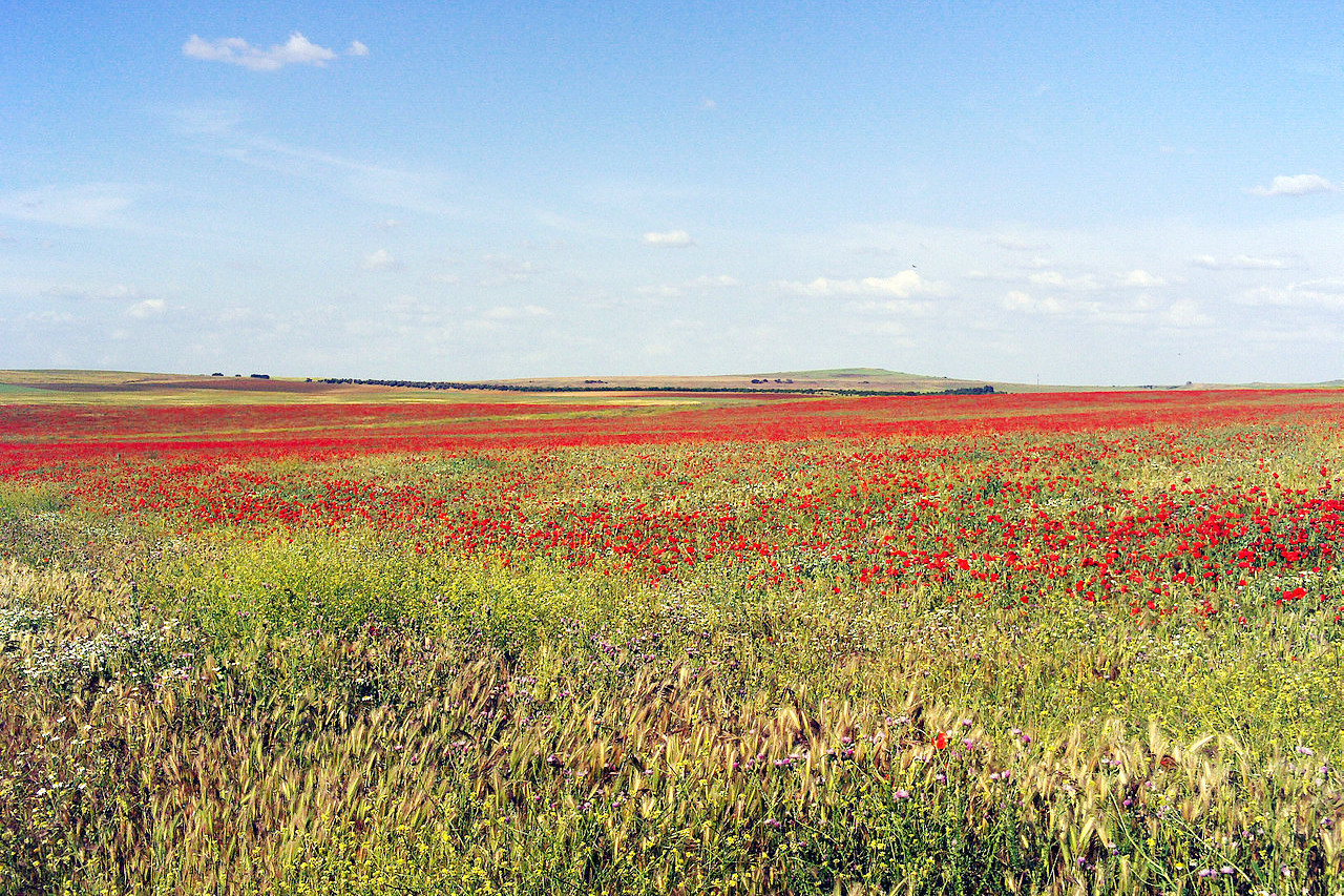
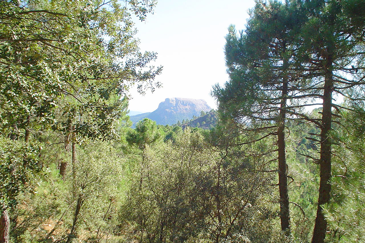
The vegetation of Castilla–La Mancha is very steppe-like, since the scrubland has replaced the typical holm oak forest as a consequence of centuries of human interference. The exception is in the high mountain areas, where the holm oak forests are combined with black oak and cork oak. The most common species of the scrubland are herbaceous plants (thyme, lavender, lavender and rosemary) and rockroses. On the riverbanks there are alder, ash, and birch trees.
What is the climate of Castilla-la Mancha like?
The climate of Castilla–La Mancha, as of Castile generally, is a continental one. It is marked by the extremes of winter cold and summer heat. The weather is often very hot in summer, and severe drought is not uncommon. In winter the plains are exposed to bitterly cold winds and there are frosts on cloudless nights and sporadic snowfalls. Among the higher mountains, the snow lies for several months.
| Climate data for Toledo (1981–2010) | |||||||||||||
|---|---|---|---|---|---|---|---|---|---|---|---|---|---|
| Month | Jan | Feb | Mar | Apr | May | Jun | Jul | Aug | Sep | Oct | Nov | Dec | Year |
| Average high °C (°F) | 11.5 (52.7) | 14.0 (57.2) | 18.1 (64.6) | 19.9 (67.8) | 24.2 (75.6) | 30.5 (86.9) | 34.6 (94.3) | 34.0 (93.2) | 29.0 (84.2) | 22.1 (71.8) | 15.6 (60.1) | 11.6 (52.9) | 22.1 (71.8) |
| Daily mean °C (°F) | 6.4 (43.5) | 8.3 (46.9) | 11.6 (52.9) | 13.5 (56.3) | 17.6 (63.7) | 23.2 (73.8) | 26.8 (80.2) | 26.3 (79.3) | 22.0 (71.6) | 16.1 (61.0) | 10.5 (50.9) | 7.1 (44.8) | 15.8 (60.4) |
| Average low °C (°F) | 1.3 (34.3) | 2.6 (36.7) | 5.0 (41.0) | 7.2 (45.0) | 11.0 (51.8) | 15.9 (60.6) | 18.9 (66.0) | 18.6 (65.5) | 14.9 (58.8) | 10.2 (50.4) | 5.3 (41.5) | 2.5 (36.5) | 9.5 (49.1) |
| Average precipitation mm (inches) | 26 (1.0) | 25 (1.0) | 23 (0.9) | 39 (1.5) | 44 (1.7) | 24 (0.9) | 7 (0.3) | 9 (0.4) | 18 (0.7) | 48 (1.9) | 39 (1.5) | 41 (1.6) | 342 (13.5) |
| Source: Agencia Estatal de Meteorologia | |||||||||||||
The official websites
Castilla–La Mancha
Home of Don Quixote
| Location: | Central Spain |
| Coordinates: | 39° 30′ N, 3° 30′ W |
| Size: | • 370 km N-S; 385 km E-W • 230 miles N-S; 240 miles E-W |
| Terrain: | A plateau region interspersed with ranges of hills rising to low mountains in the north and south |
| Climate: | Very hot and dry summers; cool winters with frosts |
| Highest point: | Pico del Lobo 2,274 m / 7461 ft |
| Forest: | 12% (2010 est.) (source) |
| Population: | 2,045,221 (2020) |
| Population density: | Low (26/km²) |
| Capital: | None (Toledo de facto) |
| Languages: | Spanish |
| Human Development Index: | Very High (0.869) |