.jpg)
The Geography of
Colorado
Why visit Colorado?
Colorado contains some of the most magnificent scenery in North America. Canyons, waterfalls, petrified forests, caverns, and snowy mountain ranges. This scenery, together with the blue skies and clear, dry air of surpassing purity, bring thousands of visitors here annually. The summer weather is perfect for enjoying the outdoors and enjoying the Colorado sunshine. From skiing at Aspen to hiking in the Rocky Mountains, from the prehistoric cliff dwellings of the Mesa Verde National Park; to the natural sandstone sculptures of the Garden of the Gods.
Contents
Map
 Relief map of Colorado
What is the landscape of Colorado like?
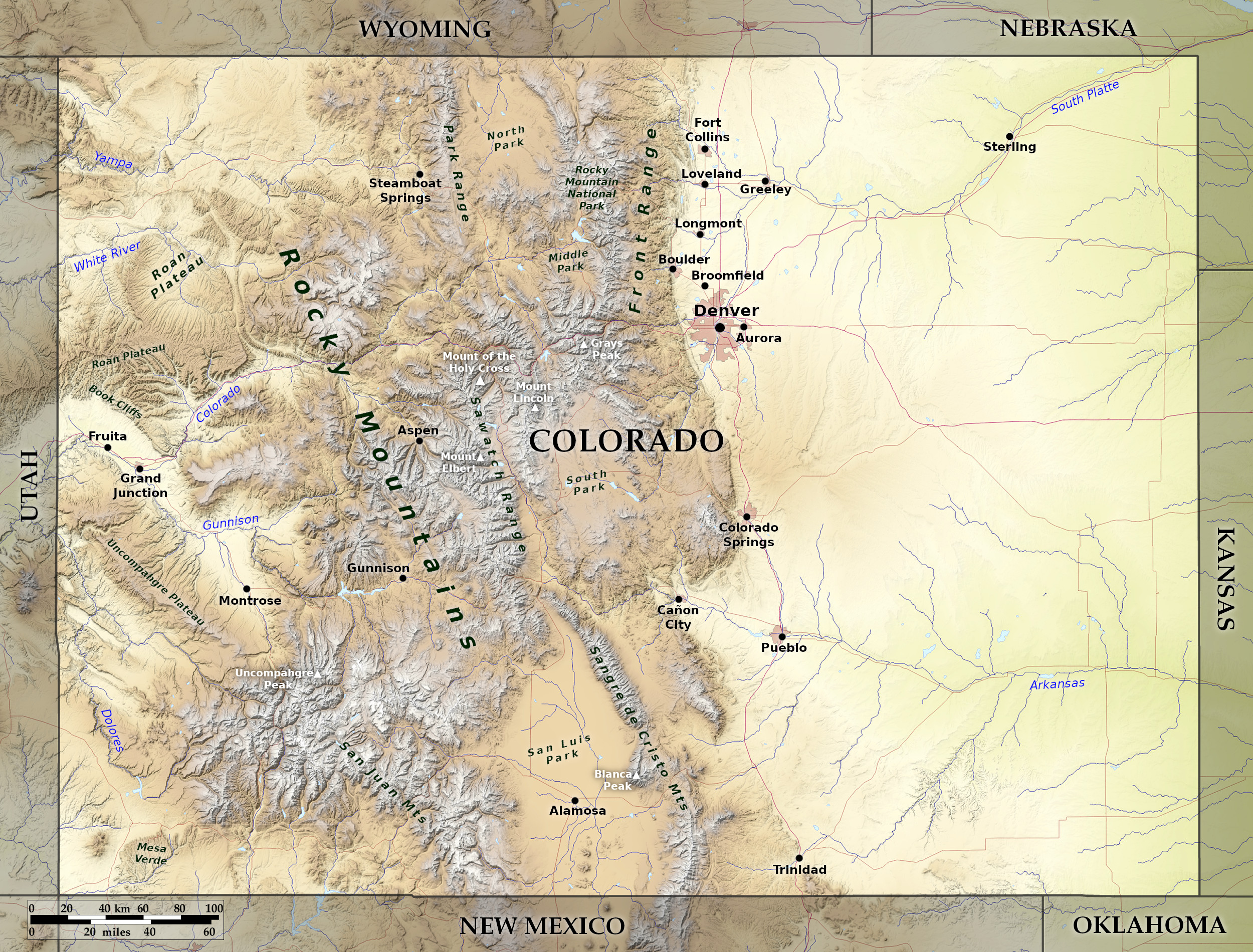
Colorado consists of three main parts: the Eastern Plains, the Rocky Mountains, and the Western Plateau.
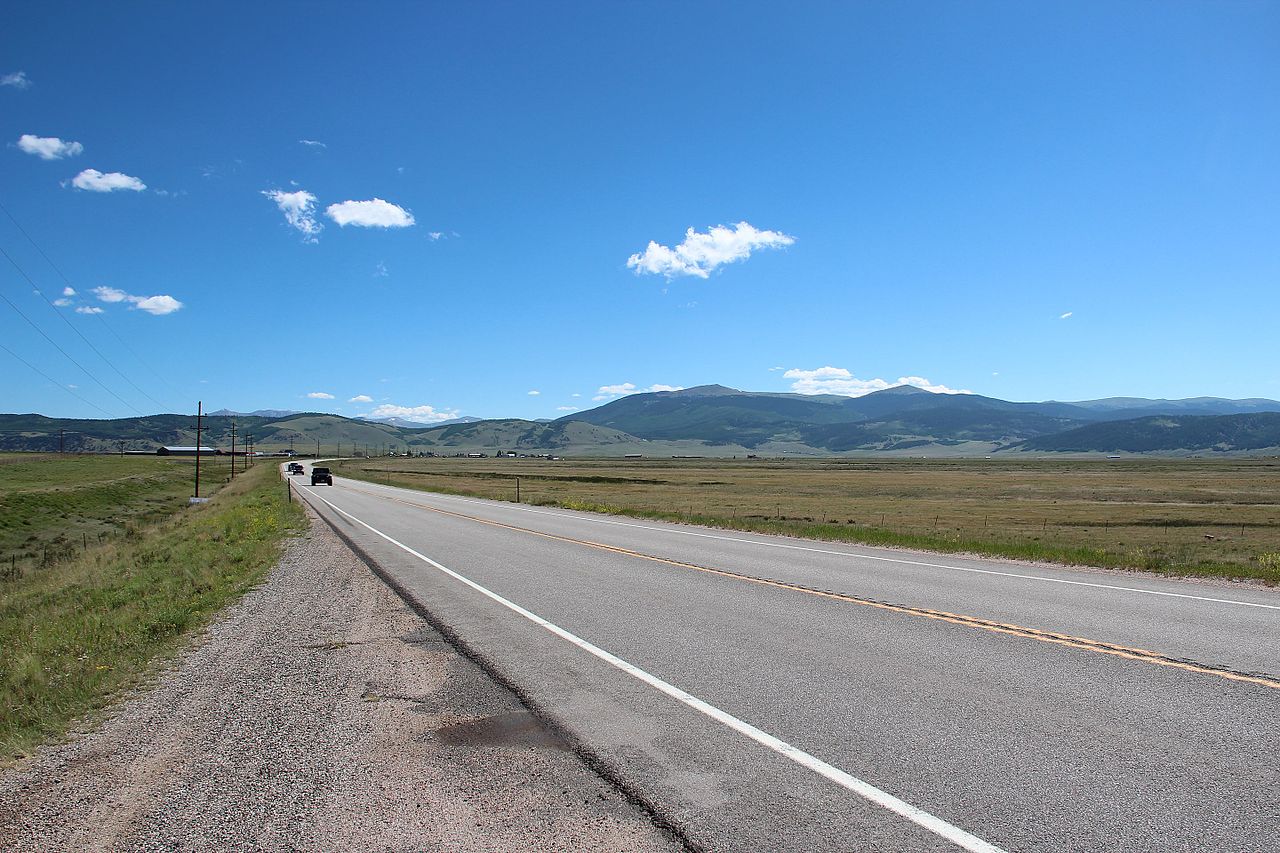
The Eastern Plains
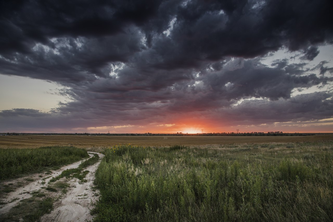
The Eastern Plains of Colorado, comprising two-fifths of the state, is the westernmost portion of the great treeless plains that constitute the Great Plains of America. This region is not one continuous level but rises gradually from east to west. Between the South Platte in the north, and the Arkansas River in the south, the land becomes a series of valleys separated by ridges and traversed by streams and rivers.
_from_W_1.JPG)
The plains are largely treeless, being covered chiefly with short grass, except along the water courses where there are fringes of cottonwoods and willows. Numerous swift streams flow north, south, and east into the general level of the plains.
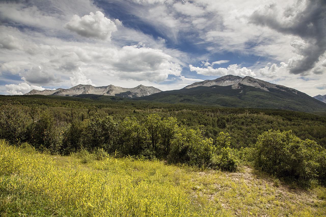
The Rocky Mountains
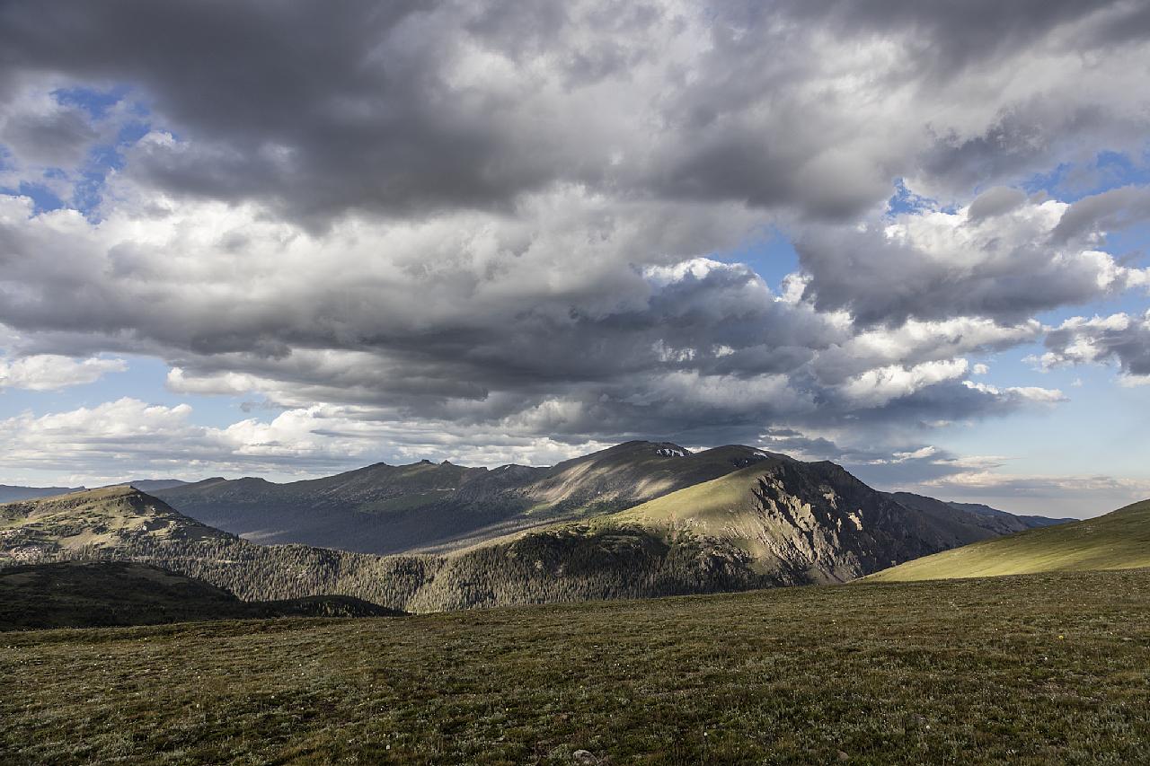
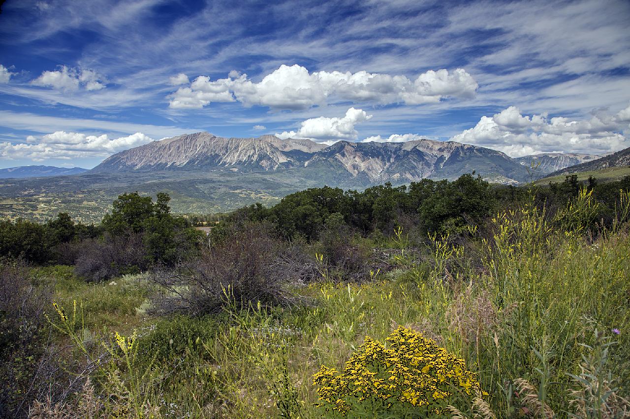
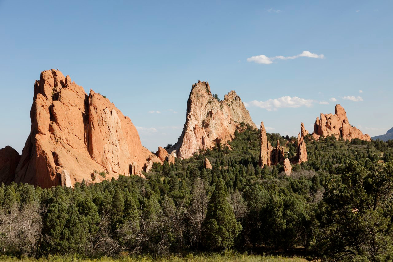
Colorado is crossed from north to south by the great continental chain of the Rocky Mountains, and here are found the highest peaks of these mountains. On their eastern edge lies an abrupt and massive chain of mountains known as the Front Range. The upturning of the rocks at the foot of the Front Range have in places weathered into grotesquely curious forms, as seen in the famous Garden of the Gods in Colorado Springs, approached between two tremendous masses of red rock 330 feet (100 m) high, and strewn with great rocks and ridges of brightly coloured sandstone.
Behind this barrier the whole country is an entanglement of mountains, tier above tier running from north to south, buttressed with splendid spurs, dominated by scores of magnificent peaks, cut by river valleys, and divided by mesas and plateaus. Among the finest of the chains are the Sangre de Cristo, San Juan, and the Sawatch.
"Independence Pass, almost 13,000 feet (4,000 m) high, through the Sawatch Range" by Carol M. Highsmith
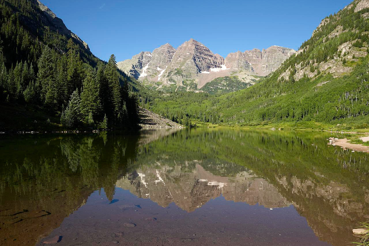
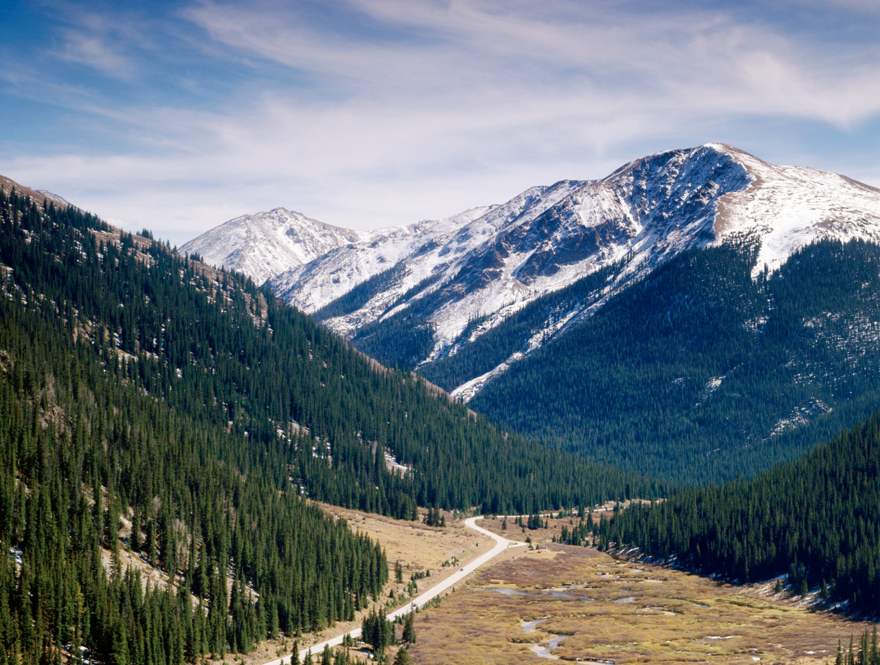
Most magnificent of all the mountain chains of Colorado are the Sawatch and adjoining ranges in the centre of the state. The Sawatch consists of an almost solid mass of granite with an average elevation of around 13,000 feet (4,000 m). It presents a broad and massive outline, and has a mean breadth of fifteen to twenty miles. At the northern end is the splendid Mount of the Holy Cross (14,011 feet / 4,271 m)—so named from the figure of its snow-filled ravines. In the center is Mount Elbert (14,440 ft / 4,401 m) the highest peak in the state.
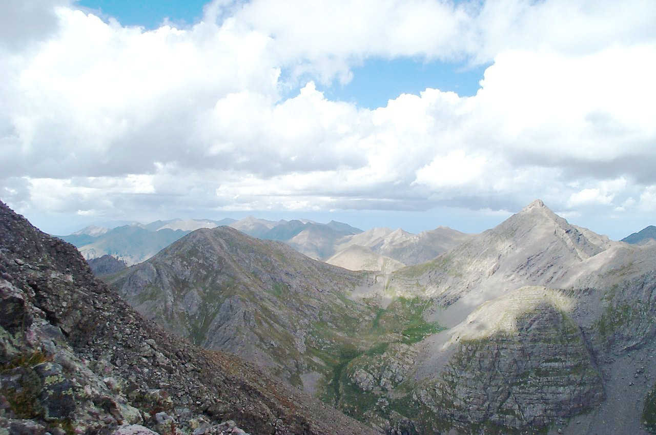
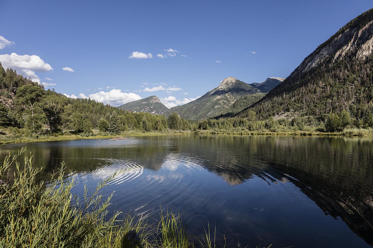
Many fine mountains are scattered in the lesser ranges of the state. The mountains of the south are particularly abrupt and jagged, here the Sangre de Cristo mountains are one of the most beautiful ranges in the Rocky mountains which reaches its highest point at Blanca Peak (14,351 ft / 4,374 m). But everywhere there are cirques, valley troughs, numberless beautiful cascades, sharpened alpine peaks and ridges, and glacial lakes. Much of the grandest scenery is due to glaciation.
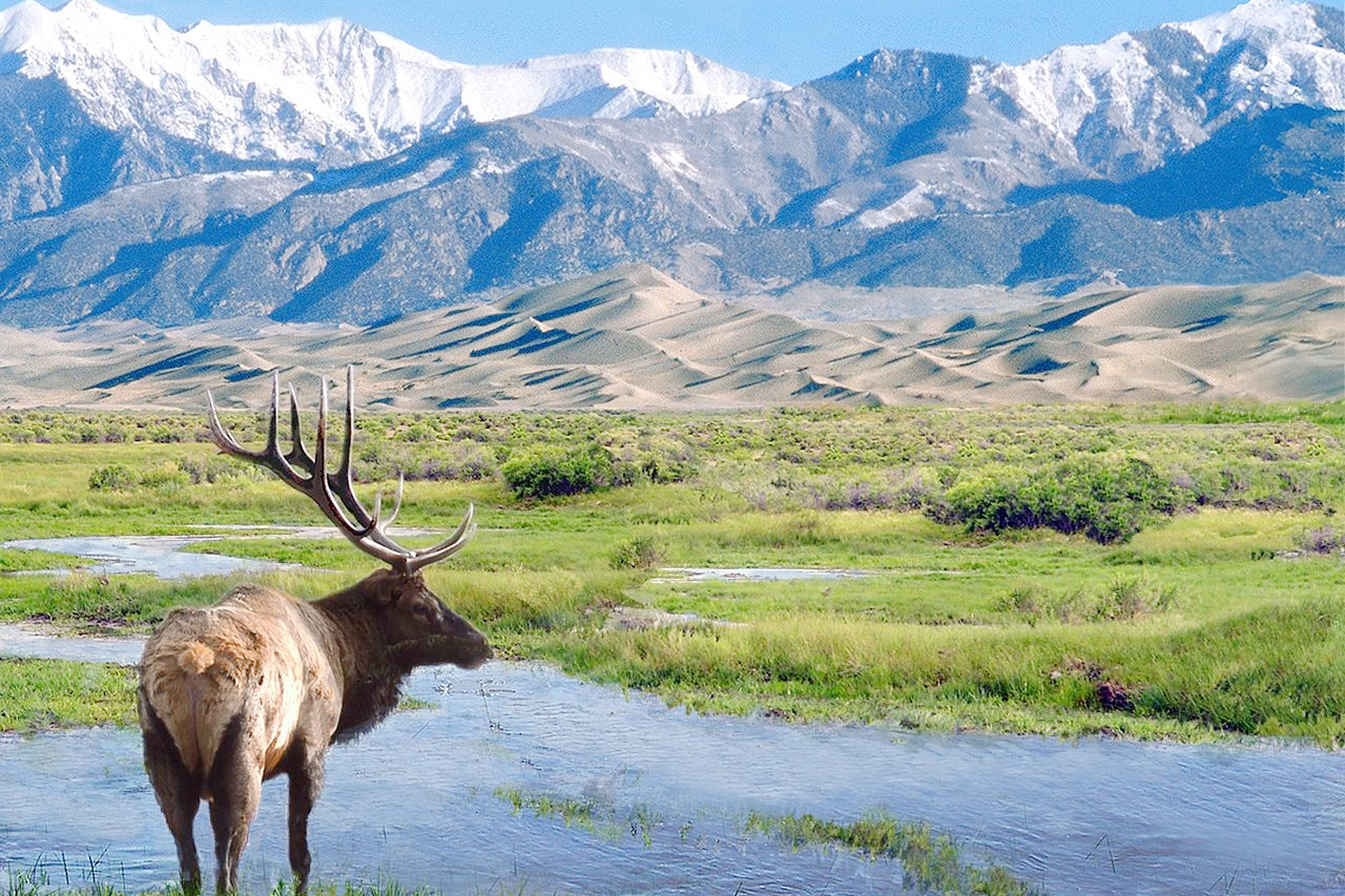
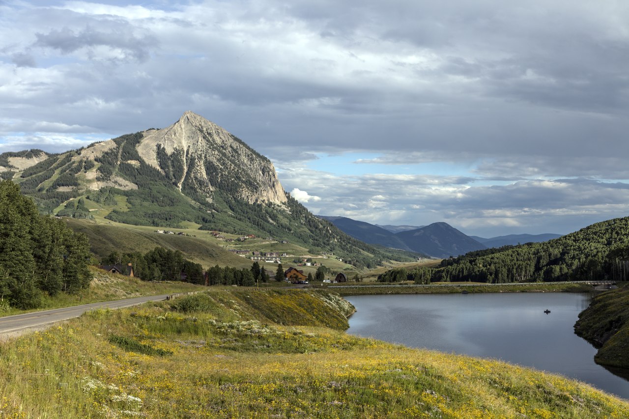
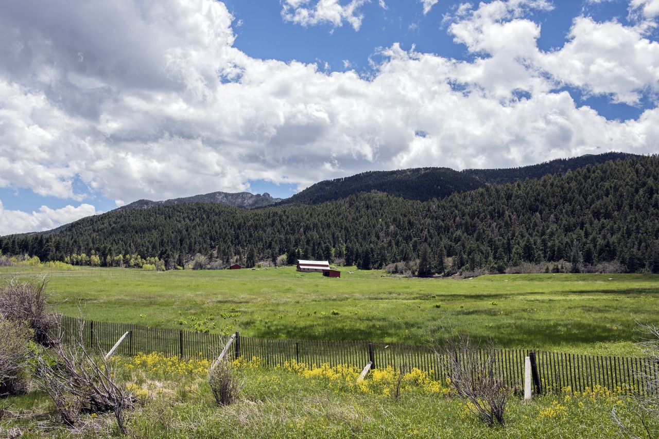
The most remarkable characteristic of the mountains are the four great mountain "parks" extending from the northern to the southern border of the state. These great plateaus consist of extensive irregular plateaus or basins shut in on all sides by lofty mountain ranges. These great plateaus, not all of them level, lie below the surrounding mountain chains. North Park, the highest of all, is a lovely country of meadow and forest. Middle Park is not level, but is traversed thickly by low hills and is surrounded by several of the grandest mountain peaks and some of the most magnificent scenery of the state. On the south side are the lofty summits known as Grays Peak (14,278 feet / 4,352 m) and Mount Lincoln (14,293 feet / 4,357 m), whereupon you reach South Park, a level plain characterized by quiet and charming slopes. Much greater than any of these is San Luis Park which extends into New Mexico. The surface is nearly as flat as a lake, and is traversed by the Rio Grande and more than a dozen of its mountain tributaries.
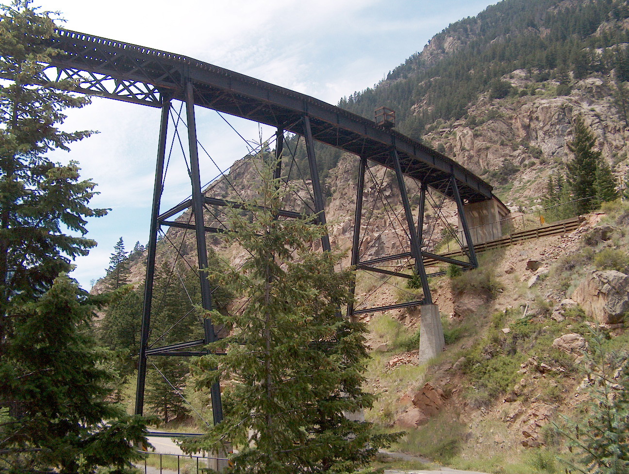
The canyons in the mountains are among the glories of Colorado and of America. There are scores of these such as the Cheyenne Cañons near Colorado Springs where the Seven Falls dashes down 500 feet (150 m) in seven plunges; and Clear Creek Cañon directly west of Denver, with walls at places 1,000 feet (300 m) in height.
Among the grandest is the Royal Gorge above Cañon City, with granite walls towering 2,600 feet (800 m) above the swirling river.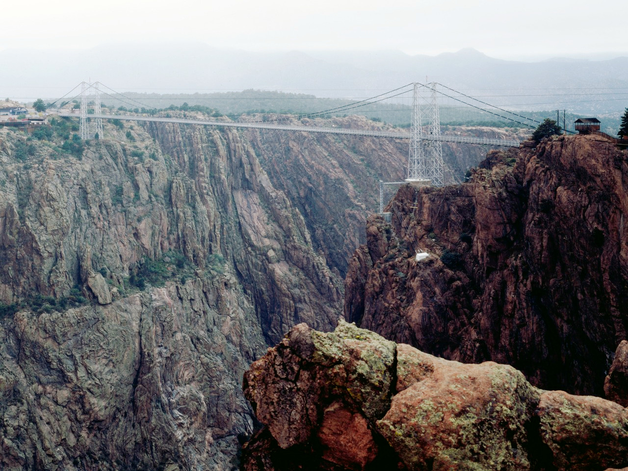 Bridge over the Royal Gorge
The Western plateau
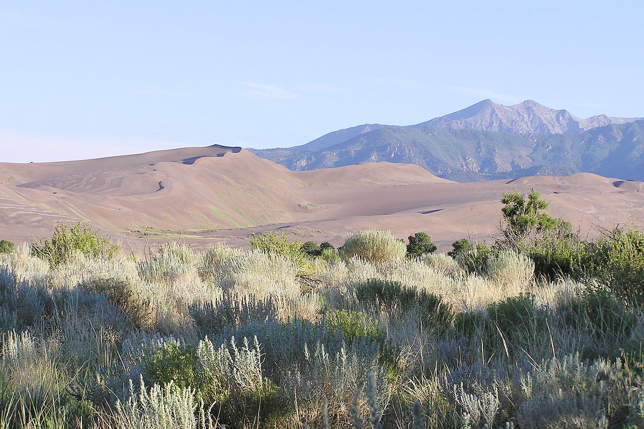
All of western Colorado is a high plateau broken by mountain ranges and cut into deep ravines and canyons with high and dry mesas between. This remarkable region is of equal fame with the giant peaks. There are terraced platforms with rock faces dropping sheer upon other platforms hundreds of feet below, and ending in vertical canyons where the rivers have cut their channels through countless stata of brilliantly rocks. There are barren mesas; cool grassy forested slopes; and rock headlands around curves or junctions of streams or gullies fantastically carved.
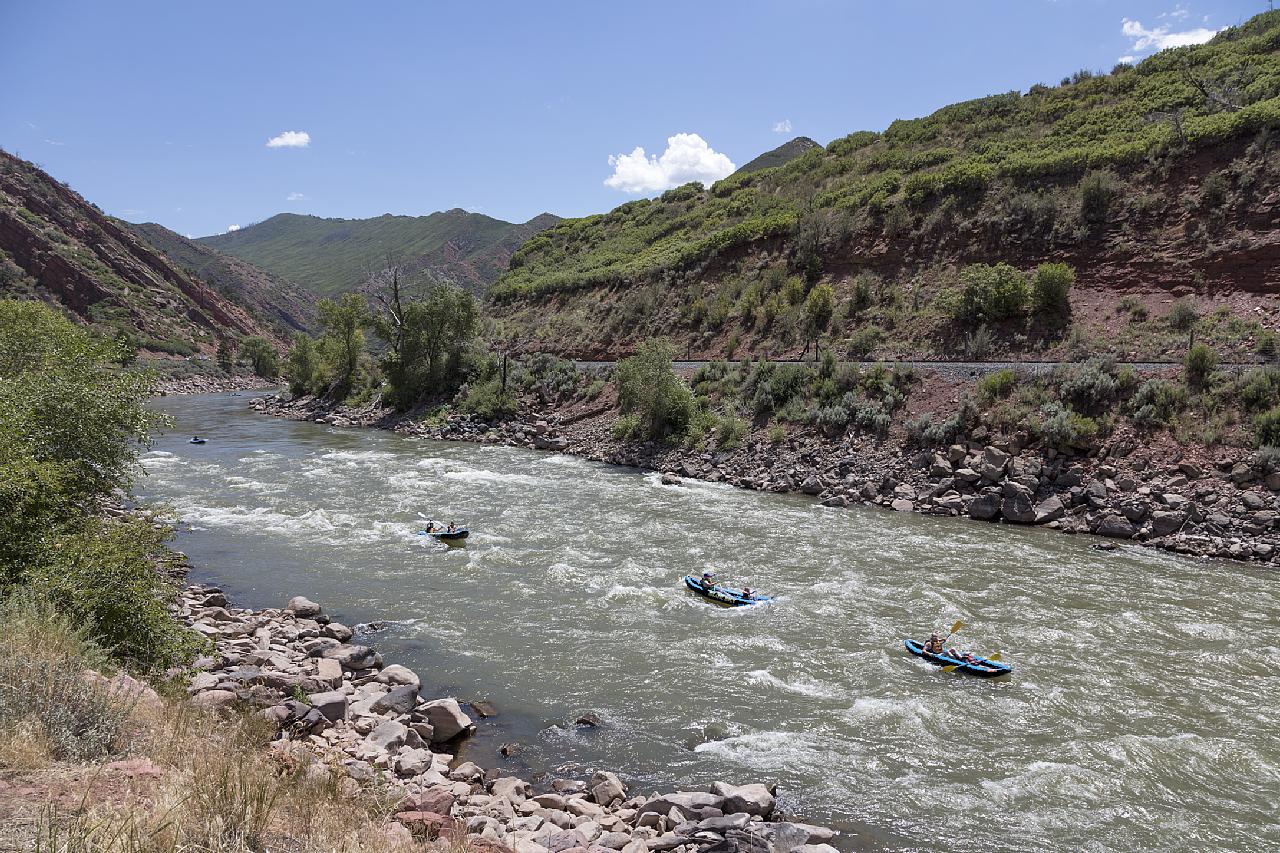
But of even greater beauty are the mountain canyons through which the rivers cut their way. The scenery on the headwaters of the White River, or of the upper tributaries of the Gunnison, and on many of the minor rivers of the southwest is wonderfully beautiful. The Black Canyon of the Gunnison, in particular, is famed for its beauty and grandeur.
What is the nature of Colorado like?
Plants
The plains of Colorado are covered in grass, especially buffalo grass and blue grama grass, but there is also an abundance of flowers. The plains are exceedingly rich; the colour of the landscape in summer is green and flowers, and in the fall yellow and flowers.
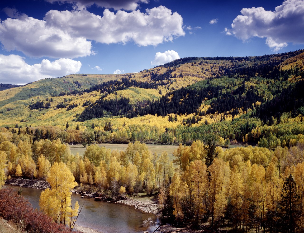
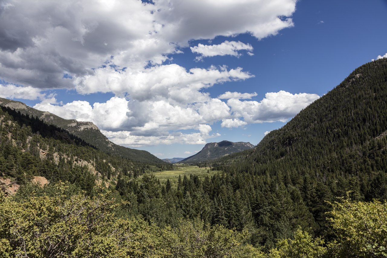
Most of the trees of Colorado are found on the high mountain sides—the mountain valleys and the parks being for the most part bare. The eastern slope of the mountains has a chaparral belt of shrubs, small trees, and scrub oak. The mountains themselves are dominated by forests of pine, spruce, Douglas fir, and aspen. High altitudes, up to the tree line, are dominated by the Engelmann spruce, with the subalpine fir, lodgepole pine, limber pine, and the bristlecone pine as secondary species. All of the higher peaks have extensive alpine meadows and boulder fields with their cushion plants so typical of alpine regions.
.jpg&oldid=366494907)
_from_W_1.JPG&oldid=217237644)
Western Colorado is covered with large areas of sagebrush (Artemisia tridentata), the most typical sagebrush country being in the northwestern counties. In parts of western Colorado one may travel for miles through sagebrush, then through pinyon pine and cedar, then through sagebrush again. Because of the low rainfall trees on south slopes are sparse and there is often a sharp contrast between north-facing and south-facing mountain sides.
The state tree of Colorado is the blue spruce (Picea pungens), occurring locally along streams in the upper foothills. The Rocky Mountain columbine (Aquilegia coerulea) is the state flower. It is commonly found in the mountains, and more sparingly in the foothills.
What is the climate of Colorado like?
Colorado experiences hot summers, and the temperature often rises to 90°F (32°C), but the nights are always cool and dewless. Winters are cold, but not severe: in the southern portion of the plains there is little snow, and the winters are very mild, and even in Denver the snowfall rarely exceeds 10 or 12 inches (25 to 30 cm), and seldom remains longer than 24 hours. Very intense cold prevails of course in winter in the mountains, and snow lies deep in the higher districts.
On the plains the rain generally falls in the spring and early summer, scarcely any falling in autumn or winter, and the late summer is almost rainless. In the mountains, rains are frequent in the summer and autumn, but rain storms of long duration are unknown. Heavy wind storms do occur in all parts of the State, but generally cloudy weather is quite rare. It is essentially a land of sunshine—there being three hundred and forty clear days, in whole or in part, in the average Colorado year.
| Climate data for Denver (1991−2020) | |||||||||||||
|---|---|---|---|---|---|---|---|---|---|---|---|---|---|
| Month | Jan | Feb | Mar | Apr | May | Jun | Jul | Aug | Sep | Oct | Nov | Dec | Year |
| Mean maximum °F (°C) | 65.0 (18.3) | 67.1 (19.5) | 74.7 (23.7) | 80.8 (27.1) | 88.3 (31.3) | 96.5 (35.8) | 99.6 (37.6) | 96.9 (36.1) | 92.9 (33.8) | 84.1 (28.9) | 73.6 (23.1) | 65.3 (18.5) | 100.6 (38.1) |
| Average high °F (°C) | 44.6 (7.0) | 45.7 (7.6) | 55.7 (13.2) | 61.7 (16.5) | 71.2 (21.8) | 83.4 (28.6) | 89.9 (32.2) | 87.5 (30.8) | 79.6 (26.4) | 65.3 (18.5) | 52.9 (11.6) | 44.0 (6.7) | 65.1 (18.4) |
| Average low °F (°C) | 18.7 (−7.4) | 19.7 (−6.8) | 27.5 (−2.5) | 33.9 (1.1) | 43.6 (6.4) | 53.0 (11.7) | 60.2 (15.7) | 58.3 (14.6) | 50.0 (10.0) | 37.0 (2.8) | 26.0 (−3.3) | 18.4 (−7.6) | 37.2 (2.9) |
| Average precipitation inches (mm) | 0.38 (9.7) | 0.41 (10) | 0.86 (22) | 1.68 (43) | 2.16 (55) | 1.94 (49) | 2.14 (54) | 1.58 (40) | 1.35 (34) | 0.99 (25) | 0.64 (16) | 0.35 (8.9) | 14.48 (368) |
| Average snowfall inches (cm) | 6.3 (16) | 9.1 (23) | 8.2 (21) | 4.8 (12) | 1.2 (3.0) | 0 (0) | 0 (0) | 0 (0) | 0 (0) | 4.8 (12) | 4.5 (11) | 10.5 (27) | 49.4 (125) |
| Source: NOAA | |||||||||||||
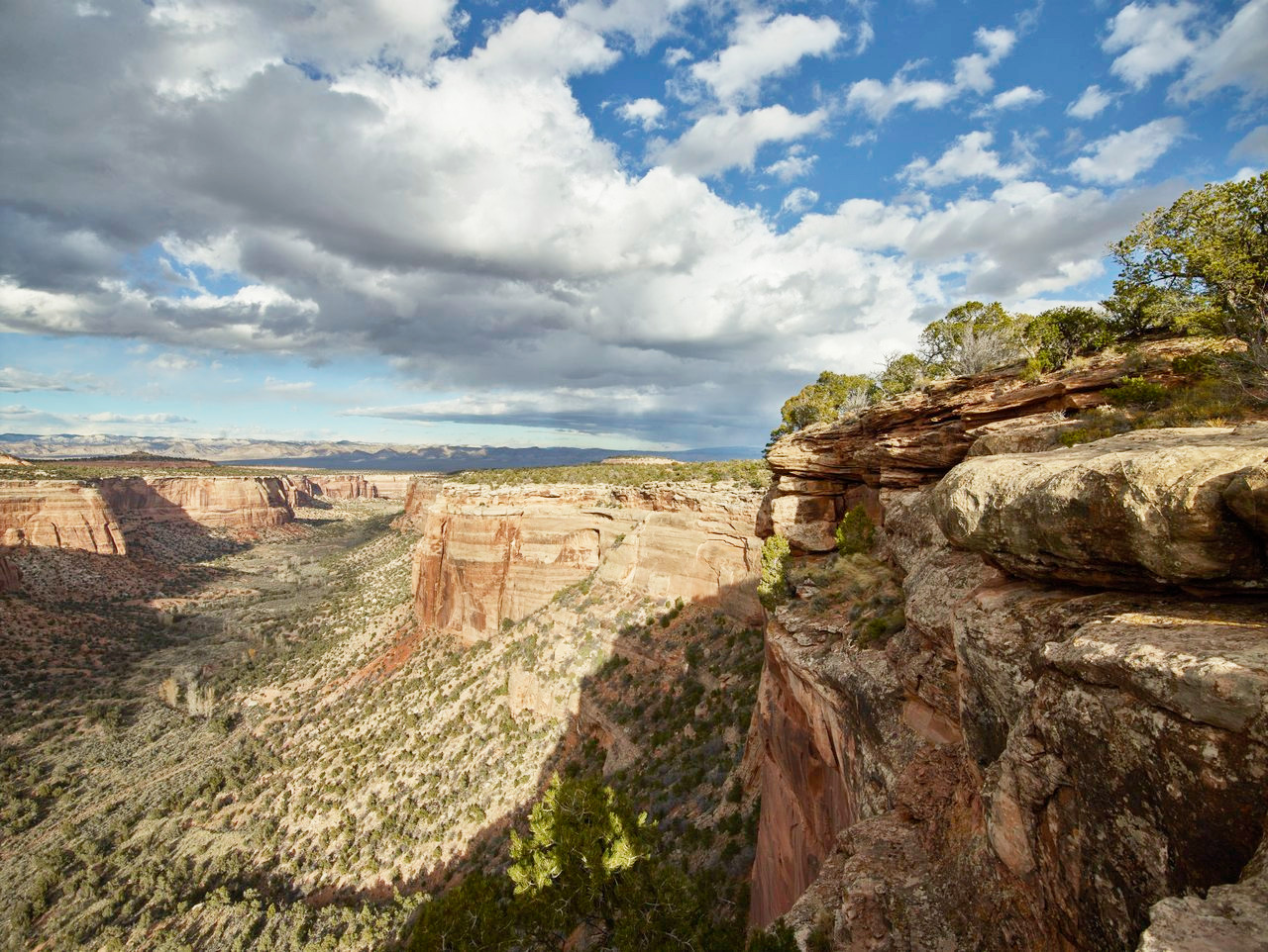 Colorado National Monument, Mesa County
The official websites
Colorado
The Centennial State
| Location: | Rocky Mountain region of the United States, |
| Coordinates: | 39° 00′ N, 105° 30′ W |
| Size: | • 445 km N-S; 625 km E-W • 275 miles N-S; 390 miles E-W |
| Terrain: | The Rocky Mountains dominate Colorado. To the east is a section of the Great Plains; the west is mostly mesa country—broad, flat plateaus with deep ravines. |
| Climate: | A highland continental climate. Winters are generally cold and snowy. Summers are warm and dry with abundant sunshine. |
| Highest point: | Mount Elbert 4401 m / 14,440 ft |
| Forest: | 34% (2016) (source) |
| Population: | 5,758,736 (2019) |
| Population density: | Low (20/km²) |
| Capital: | Denver |
| Languages: | English; Spanish |
| Human Development Index: | Very High (0.948) |