_near_Laramie,_Wyoming_LCCN2015633098.tif.jpg)
The Geography of
Wyoming
Why visit Wyoming?
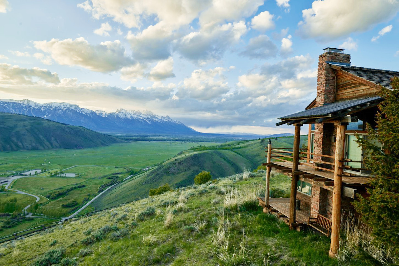
The beauty of Wyoming cannot be put into words. So much of the state is a breathtaking experience—every corner offers something unique and beautiful. Great natural parks encircled by wooded slopes and majestic peaks, with numerous mountain streams, lakes, and waterfalls. It's incredibly vast and incredibly stunning, with mountains, valleys and prairies spread out before you. Here you can experience the Rocky Mountains at their most awe-inspiring: the Teton Range, the Wind River Range, Yellowstone National Park and much more.
Contents
Map
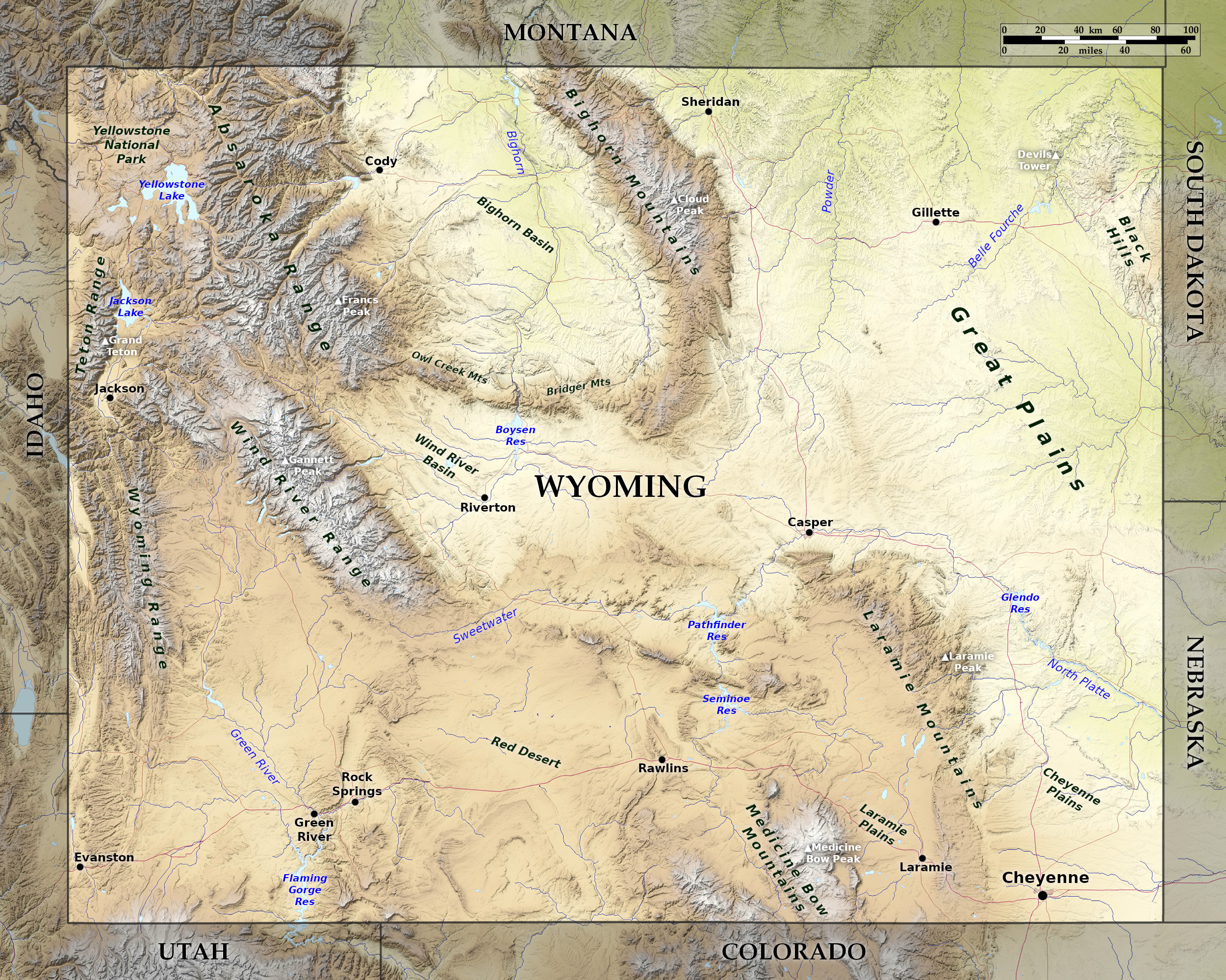 Relief map of Wyoming
What is the landscape of Wyoming like?
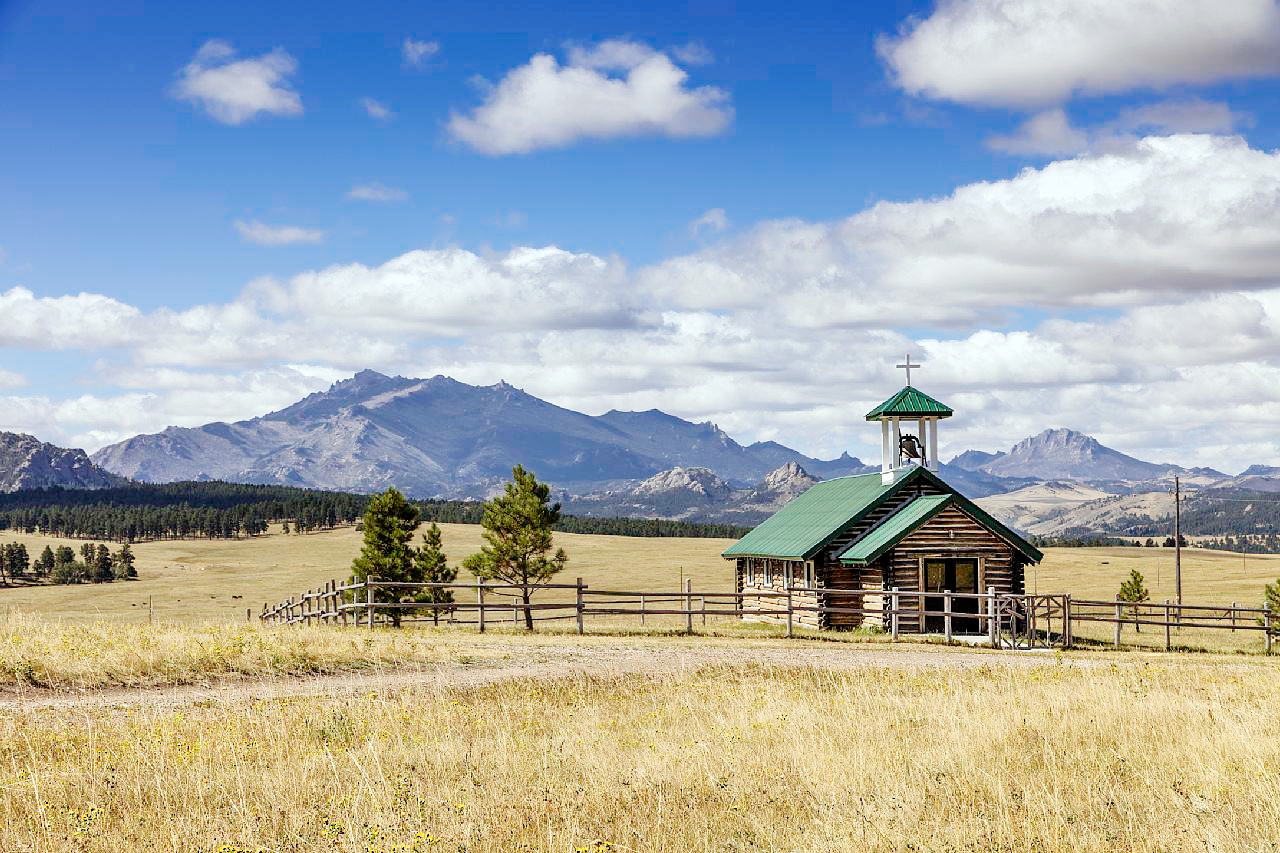
Wyoming is a very rugged State, with plains and plateaus covered with grasses, but by divided spurs or ranges of the Rocky Mountains with mountains, valleys, canyons and geysers.
Great Plains
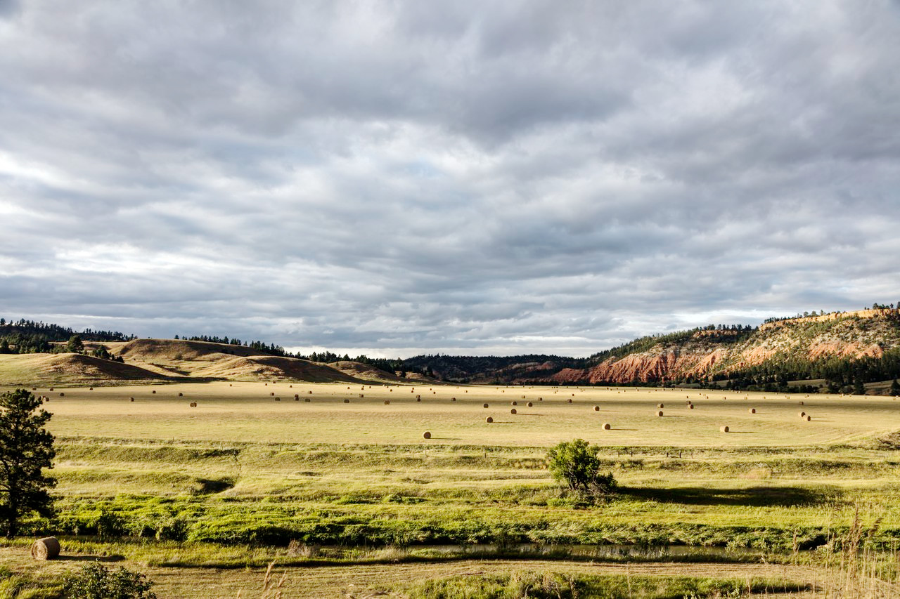
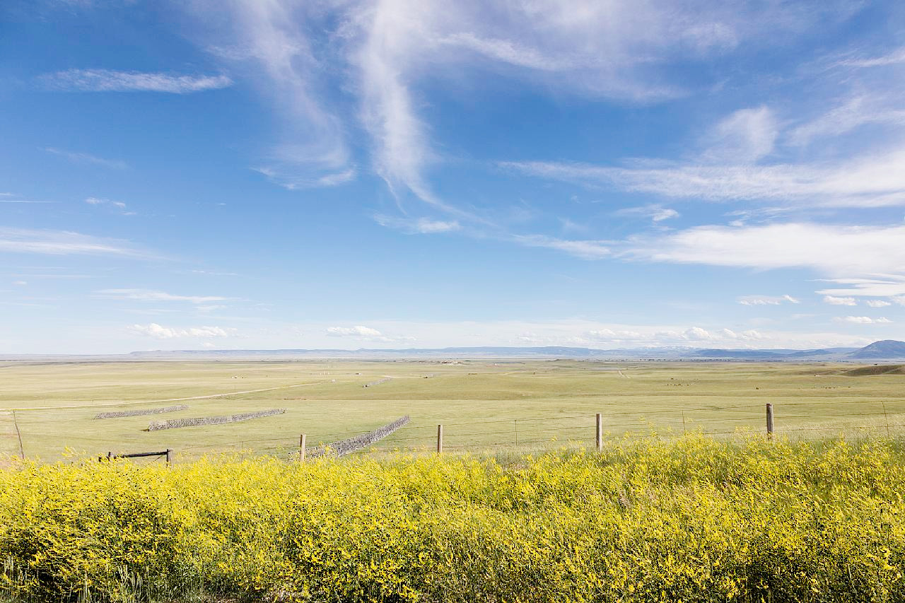
The vast treeless expanse of the Great Plains extend over the southern and in the eastern portions of the state. The Great Plains in Wyoming are around 5,000 to 7,000 feet (1,500–2,100 m) above sea level, and consist of flat or gently rolling country, with little tree growth, but often covered with grasses. In the east the rainfall is sufficient to give the plains the appearance of grassland steppe, but the western and higher plateaus are covered with the characteristic sage brush.
In the southeastern part of the State the Laramie Plains are inclosed by the Laramie Mountains on the northeast and the Medicine Bow Mountains on the southwest. East of the Laramie range are the Cheyenne Plains in the southeast, which to the north open out to the the vast eastern plains stretching for 150 miles in every direction.
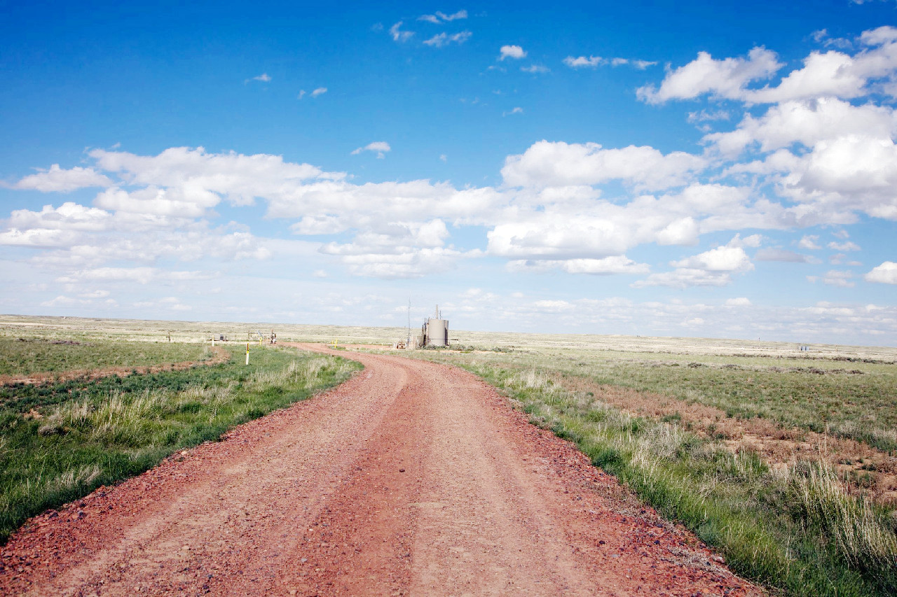
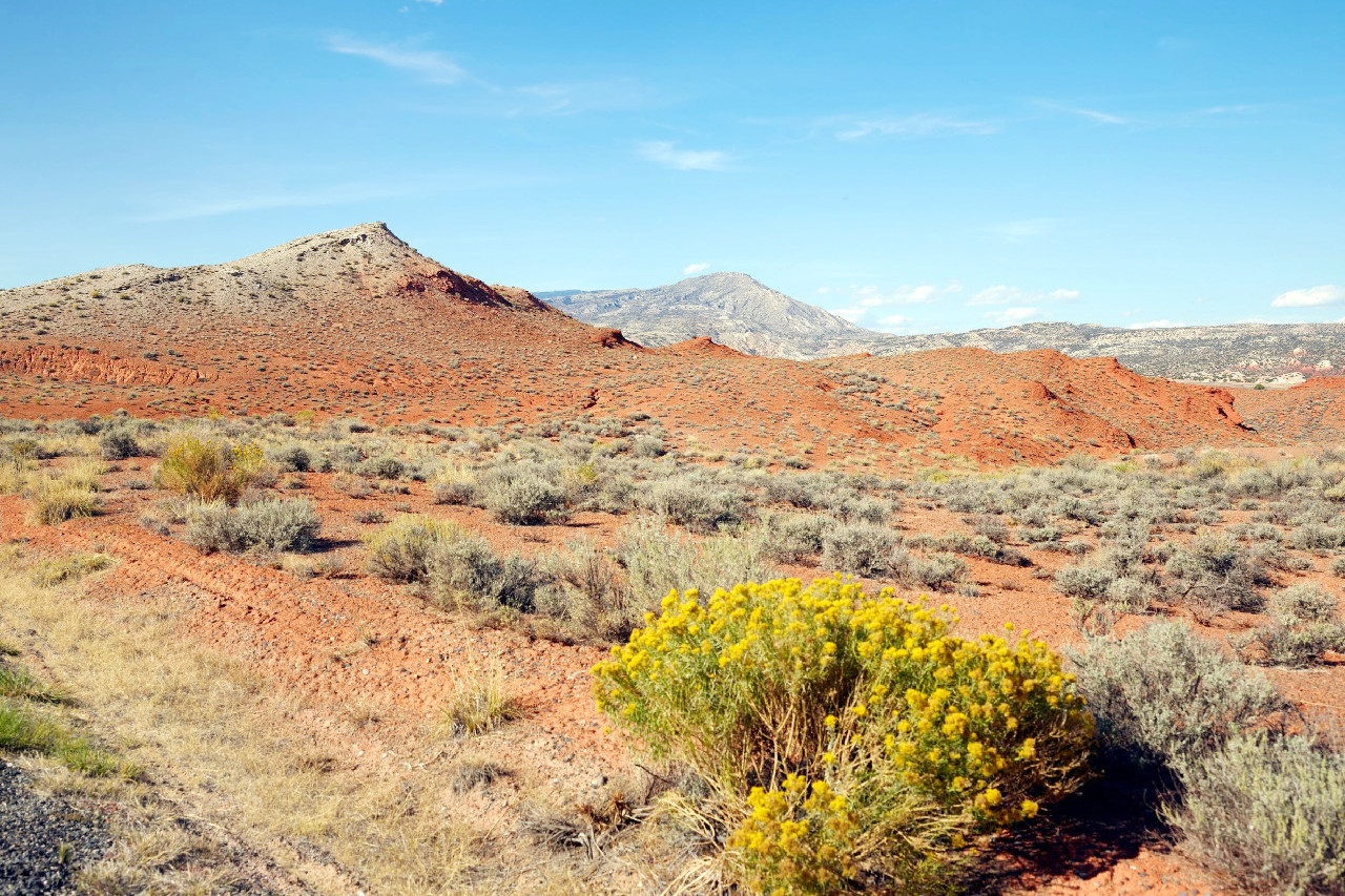
Heading westwards you encounter the lower Wind River Valley in the west central and Bighorn Basin bounded on the east by the Bighorn Mountains. In the southwestern quarter of the State there is another extensive plain-basin known as the Red Desert. Volcanic buttes and mesas occasionally rise as scenic monuments above the general level of the plains, and in the vicinity of the mountains the landscape is often bent sharply upward and carved by erosion into "hogback" ridges. These are well developed near the Bighorn Mountains, an outlying member of the Rockies which interrupts the plains in north-central Wyoming. The foothills and lower mountain slopes give rise to juniper and semidesert coniferous forest.
Black Hills
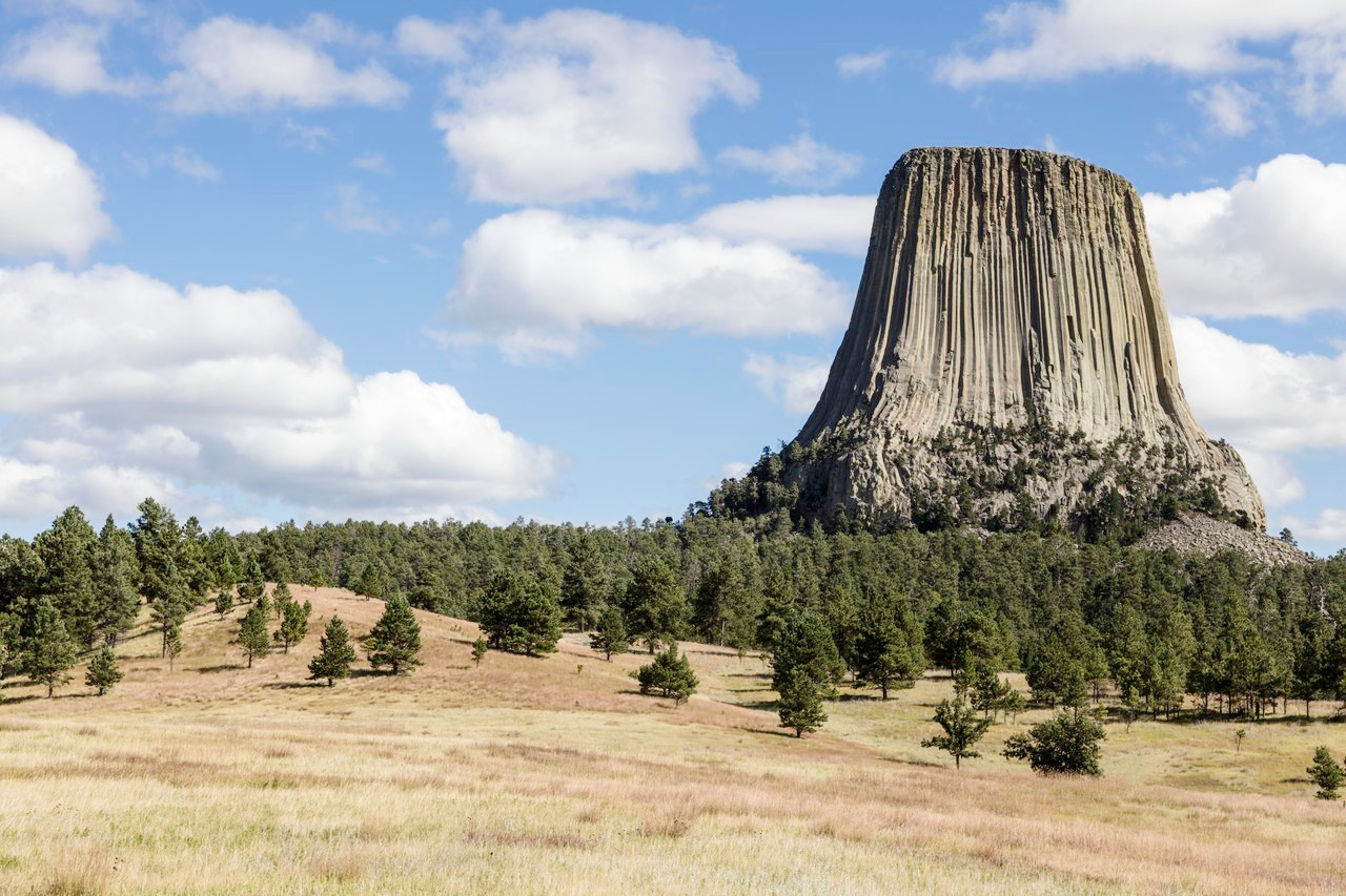
The western slopes of the Black Hills of South Dakota extend across the boundary into northeast Wyoming. These hills are a dome-like elevation of the rocks underlying the Great Plains. Erosion has produced rugged hills, especially towards South Dakota, where granitic rocks are exposed. The northwest outliers of the Black Hills contain the Missouri Buttes and the famous Devil's Tower, prominent erosion remnants of volcanic intrusions.
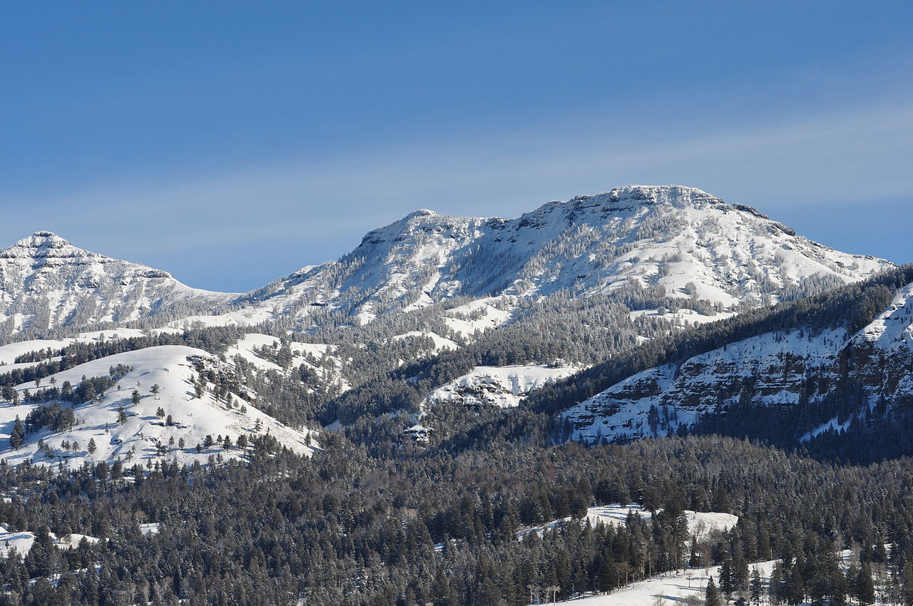
Bighorn Mountains
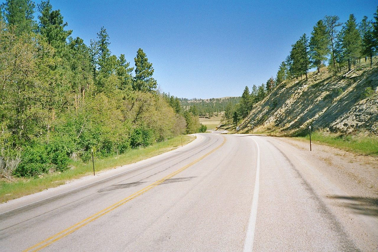
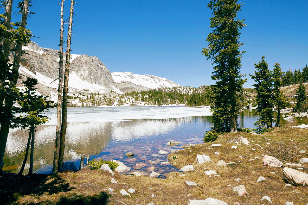
In north central Wyoming are the isolated Bighorn Mountains, culminating in Cloud Peak at 13,171 feet (4,015 meters). These magnificent mountains, which extend 100 miles southward from northern border form one of the longest and most continuous ranges in the State. Local glaciation has modified the higher levels of the Bighorn Mountains, giving glacial cirques, alpine peaks and many mountain lakes and waterfalls. Several small glaciers still remain about the base of Cloud Peak.
Rockies
Much of Wyoming is occupied by the Rocky Mountains, but there is a distinct break between the Northern and Southern Rockies, giving a broad, relatively low pass utilized by the Oregon Trail in early days.
Southern Rockies
The Southern Rockies end in broken ranges with heights of 9,000 feet (2,700 m) and over. The principal mountains in the south are the Laramie Mountains and the Medicine Bow Mountains. The Laramie Mountains, which rise to an average height of 1,000 feet (300 m) above the plain, culminate in Laramie Peak at 10,275 feet (3,132 meters). The Medicine Bow Mountains are a lofty mass on whose western slopes gather the waters of the North Platt River. The highest point in this range is Medicine Bow Peak at 12,018 feet (3,663 meters).
Northern Rockies
The Northern Rockies extending into the northwest of Wyoming has the most magnificent scenery. The extreme northwestern part is a rugged complex of lofty mountains and plateaus cut by numerous canyons which includes the Yellowstone National Park and the Grand Teton National Park.
The Absaroka Range has peaks which rise to heights exceeding 12,000 feet (3,650 m). These mountains, which separate the waters of the Yellowstone from those of the Bighorn, are some of the finest in the United States for grandeur and scenery.
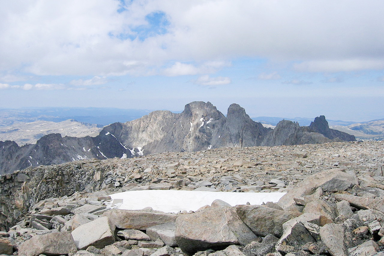
The Wind River Mountains are a massive and snow-clad range, extending southeastward toward the Red Desert. They presents a fine range with a series of rugged peaks along its crest. This range is the highest in the State; it has several peaks over 13,000 feet (4,000 m) high, and Gannett Peak, Wyoming's highest mountain, has an altitude of 13,810 feet (4,210 meters).
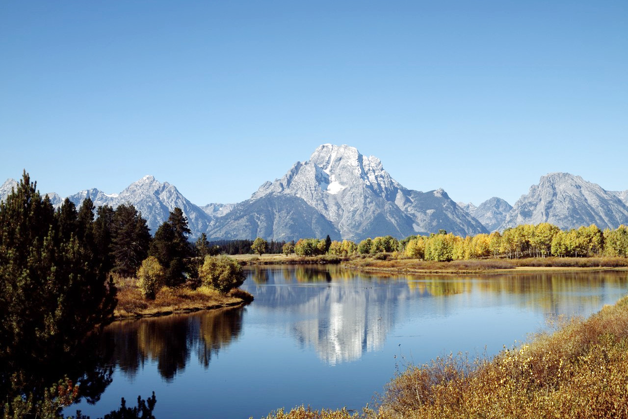
The Teton Mountains, near the northwest border of the State, form a striking feature. They and culminates in the Grand Teton, a spine-like peak, rising 13,775 feet (4,199 meters) above the sea and 7,000 feet (2,100 m) above Jackson Lake, from which it may be seen to the greatest advantage.
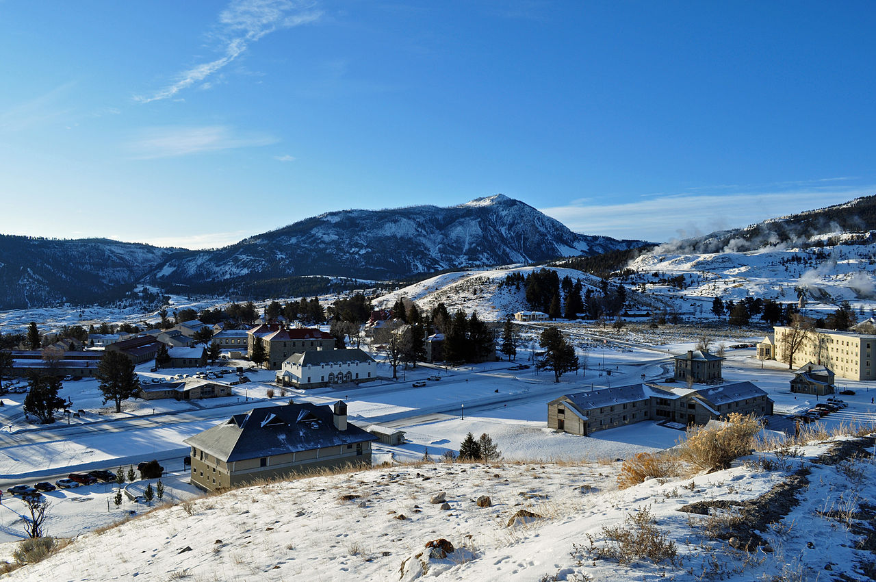
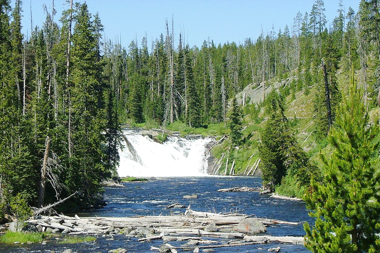
Yellowstone National Park
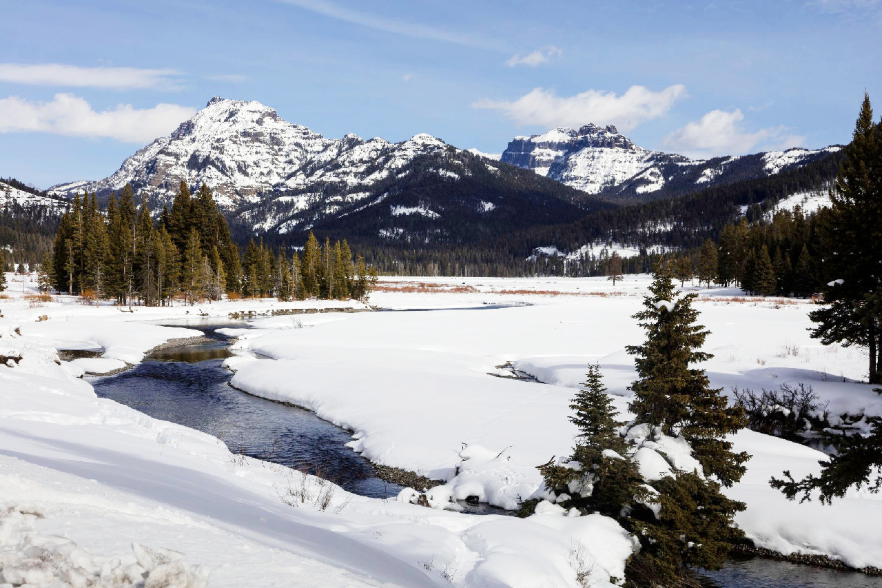
Yellowstone National Park lies mostly within Wyoming with narrow strips projecting into Montana and Idaho. The park is mainly an undulating plateau, around 8,000 feet (2,400 m) above sea-level, upon the surface of which the minor rivers flow, while the larger ones have cut canyons (cañons), several of them being of great depth. The eastern portion, however, is occupied by the rugged Absaroka Mountains.
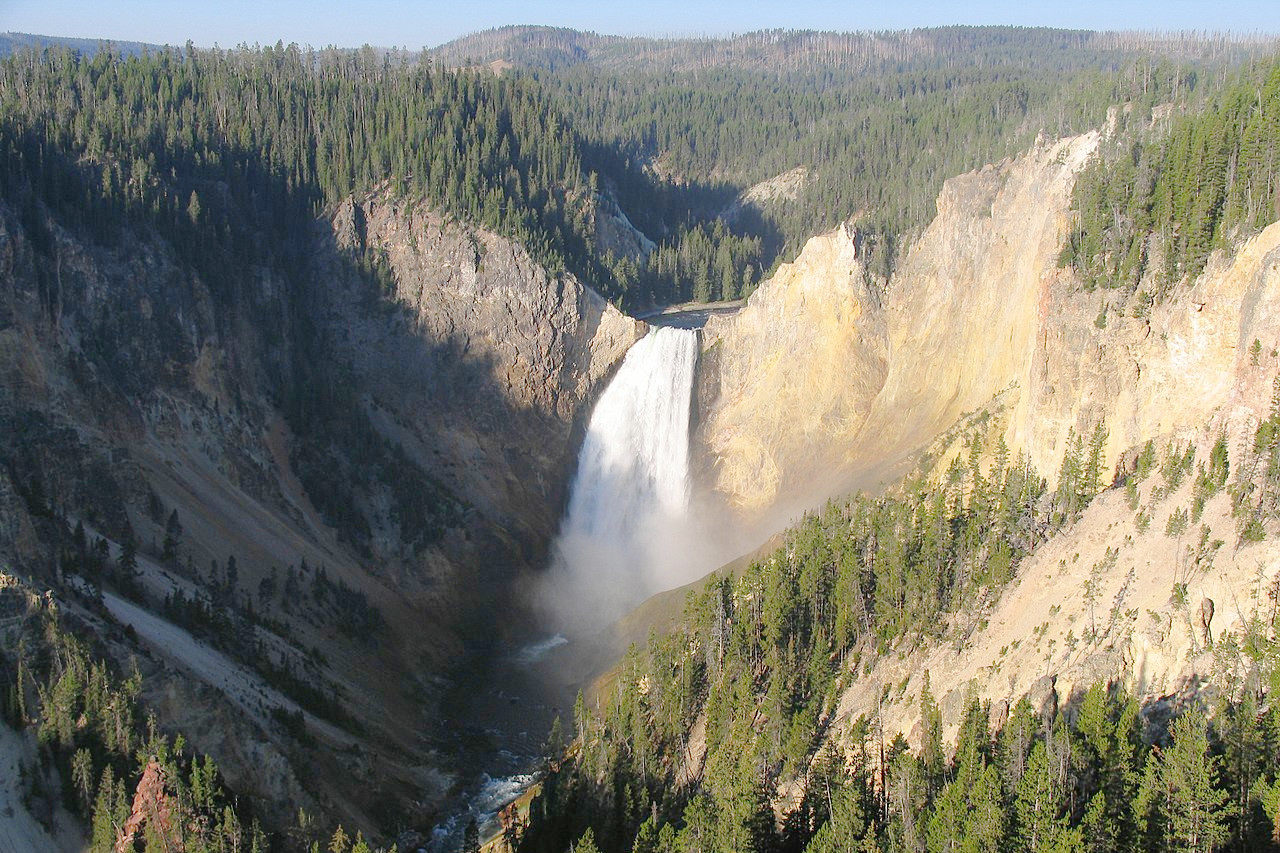
The Park abounds in scenery of unparalleled grandeur. It also contains many beautiful lakes, ponds, mountains, cañons, and waterfalls. About four-fifths of the park is covered with dense coniferous forests. Mention should be made of the Yellowstone Lake which has over 100 miles of shore line; Yellowstone Falls and the vivid coloring of the Grand Canyon of the Yellowstone; and the fossil forests which rise one above the other in the northeast corner of the park.
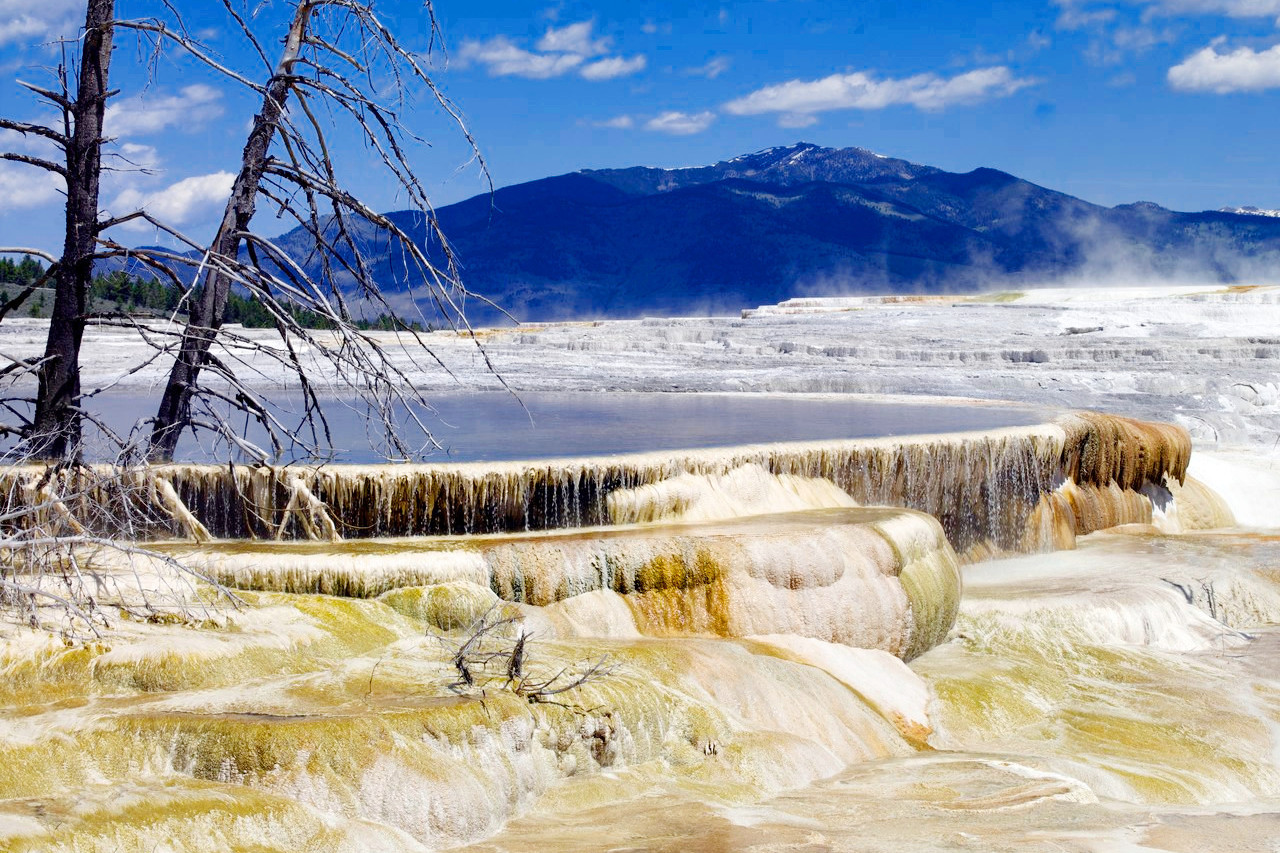
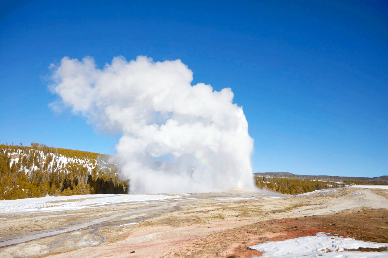
Hot springs and geysers are found in all parts of the plateau, about one-hundred in number. More than half, including the largest and finest, are in the upper and the lower Geyser basins, through which flows the Firehole river, a tributary of the Madison River. The most famous geyser, Old Faithful, throws up a column of hot water to a height of 125–150 feet (45 m), at regular intervals of 65–70 minutes, and the eruption lasts around 4 minutes.
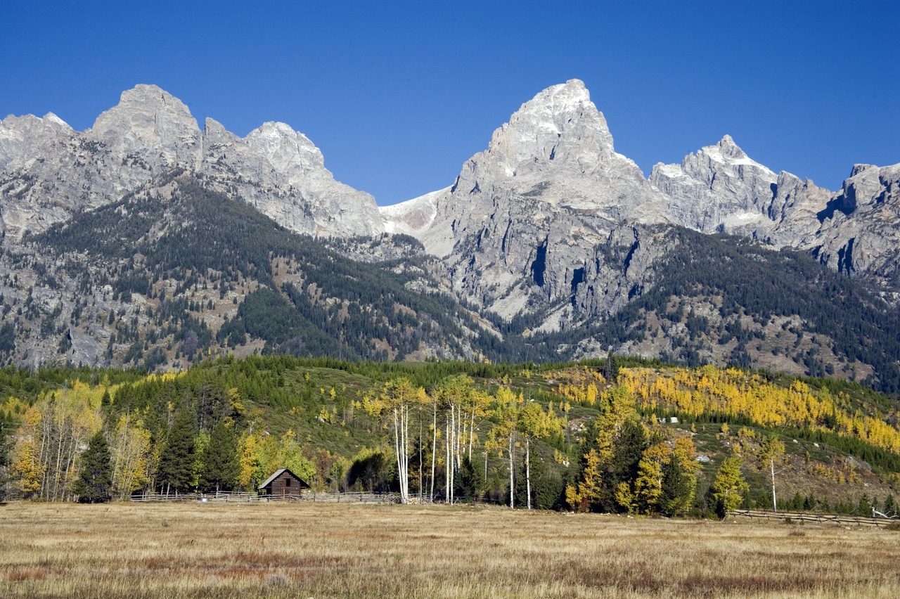 Grand Teton, Grand Teton National Park
What is the nature of Wyoming like?
Wyoming has extensive plains, lofty mountain ranges, and numerous river valleys. The heavy snowfall of the mountains sends plenty of water into the river systems and helps to keep the plains well-irrigated. Fully half of the State is made up of grassy plains and high sagebrush. The lower plains and valleys have yucca, rabbitbrush, juniper, cottonwood and willows. In the arid Red Desert the common sagebrush gives place to the saltbush and greasewood.
.jpg&oldid=375696374)
The mountain slopes are usually covered with coniferous forest. The ponderosa pine is a characteristic tree of the Laramie Mountains, Black Hills and the Bighorn Mountains, whereas the lodgepole pine makes up a large part of the northwest forests. Other notable trees in the mountain regions include the Douglas fir, limber pine (or Rocky Mountain white pine), aspen, and, higher up, Engelmann spruce, whitebark pine, and the subalpine fir (or Rocky Mountain fir). The mountain peaks and crests above the timberline have no trees, but where soil is present, alpine grasses and flowers flourish.
What is the climate of Wyoming like?
The climate of Wyoming is dry and sunny, and, as a rule, very pleasant. In general, the summers are cool and the winters are not severe, but there can be periods of intense heat and intense cold. In most years the maximum rises above 100°F (38°C), and the minimum falls below -30°F (-34°C). In the lower Bighorn Valley, summer temperatures rise to 95°F (35°C), but at heights of 6,000 to 7,000 feet (1,800–2,100 m) on neighbouring ranges, summer temperatures seldom rise above 90°F (32°C), and frosts may occur at any time. The winter climate is remarkably pleasant as a rule, and outdoor activities may usually be carried on without discomfort.
Rainfall is fairly low across the state, though the mountain ranges receive sufficient rain to feed the numerous rivers and support forests. Spring is generally the wettest season—the largest amount of rain falling between March and June. The air is clear and dry, and cyclones and tornadoes are unknown. Winter snowfall is light, and the dry air makes the cold easily endurable.
| Climate data for Cheyenne, Wyoming (1991–2020) | |||||||||||||
|---|---|---|---|---|---|---|---|---|---|---|---|---|---|
| Month | Jan | Feb | Mar | Apr | May | Jun | Jul | Aug | Sep | Oct | Nov | Dec | Year |
| Average high °F (°C) | 40.0 (4.4) | 40.6 (4.8) | 49.1 (9.5) | 54.8 (12.7) | 64.4 (18.0) | 76.7 (24.8) | 84.1 (28.9) | 82.0 (27.8) | 73.3 (22.9) | 59.1 (15.1) | 47.5 (8.6) | 39.3 (4.1) | 59.2 (15.1) |
| Daily mean °F (°C) | 29.2 (−1.6) | 29.5 (−1.4) | 37.1 (2.8) | 42.8 (6.0) | 52.3 (11.3) | 63.1 (17.3) | 70.1 (21.2) | 68.1 (20.1) | 59.6 (15.3) | 46.5 (8.1) | 36.1 (2.3) | 28.7 (−1.8) | 46.9 (8.3) |
| Average low °F (°C) | 18.4 (−7.6) | 18.4 (−7.6) | 25.1 (−3.8) | 30.8 (−0.7) | 40.2 (4.6) | 49.4 (9.7) | 56.1 (13.4) | 54.3 (12.4) | 45.8 (7.7) | 33.9 (1.1) | 24.7 (−4.1) | 18.1 (−7.7) | 34.6 (1.4) |
| Average precipitation inches (mm) | 0.35 (8.9) | 0.52 (13) | 0.96 (24) | 1.79 (45) | 2.44 (62) | 2.16 (55) | 2.11 (54) | 1.52 (39) | 1.47 (37) | 1.00 (25) | 0.61 (15) | 0.48 (12) | 15.41 (391) |
| Average snowfall inches (cm) | 6.3 (16) | 9.0 (23) | 9.7 (25) | 11.3 (29) | 3.4 (8.6) | 0.0 (0.0) | 0.0 (0.0) | 0.0 (0.0) | 1.0 (2.5) | 5.9 (15) | 7.5 (19) | 8.8 (22) | 62.9 (160) |
| Source: NOAA | |||||||||||||
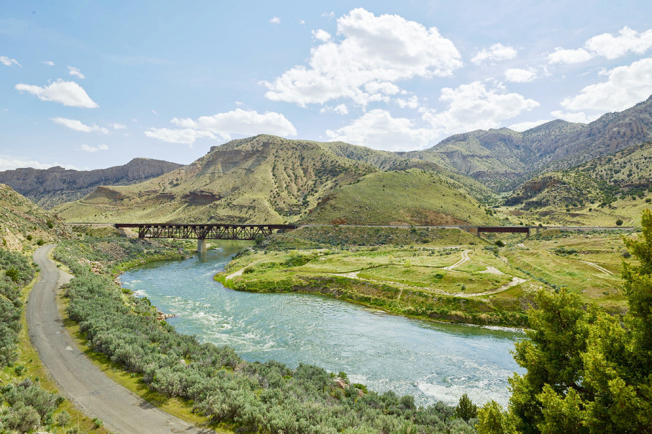 Wind River canyon in north-central Wyoming
The official websites
Wyoming
The Equality State
| Location: | Rocky Mountain region of the northwestern United States |
| Coordinates: | 43° 00′ N, 107° 30′ W |
| Size: | • 425 km N-S; 585 km E-W • 265 miles N-S; 365 miles E-W |
| Terrain: | The eastern third is part of the Great Plains; the remainder belongs to the Rocky Mountains. |
| Climate: | Semiarid with localized desert conditions. |
| Highest point: | Gannett Peak 4,209 m / 13,809 ft |
| Forest: | 18% (2016) (source) |
| Population: | 578,759 (2019) |
| Population density: | Very Low (2/km²) |
| Capital: | Cheyenne |
| Languages: | English; Other (Spanish, German, Native American languages) |
| Human Development Index: | Very High (0.938) |