_Gorge.jpg)
_Gorge.jpg&oldid=589905796)
,_Sunset.jpg)
,_Sunset.jpg&oldid=577381154)
The Geography of the
Northern Territory
Why visit Northern Territory?
Northern Territory is a unique region which showcases a different side of Australia. The landscape ranges from the arid desert landscapes of the south to the tropical forests of the north. The different habitats ensure that there is always something to see. The nights in the regional towns are magical with the quietness interrupted only by the occasional bird or frog. Northern Territory is a place that we would highly recommend for anyone looking for a beautiful, diverse and welcoming region.
Contents
Map
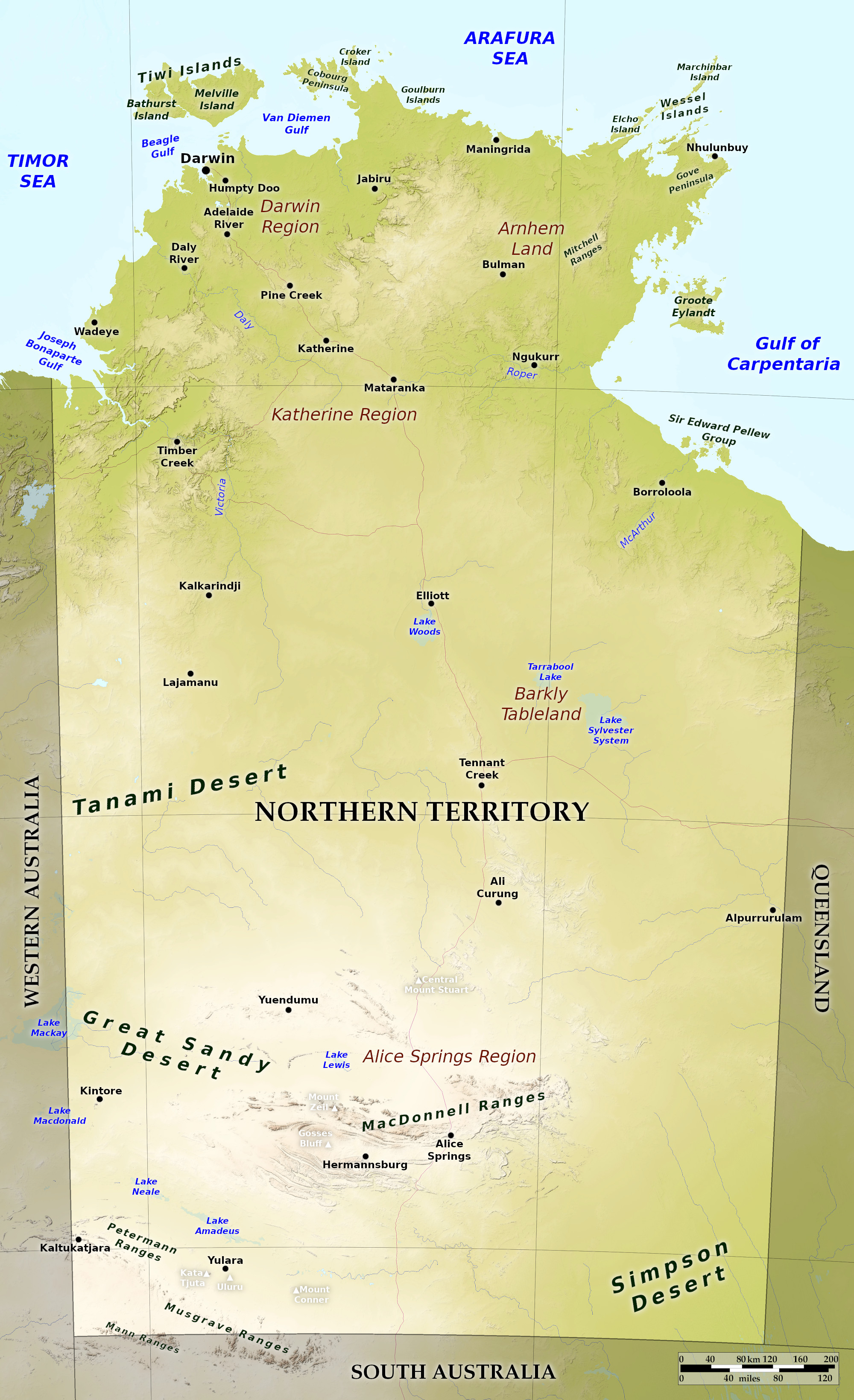 Relief map of the Northern Territory
What is the landscape of Northern Territory like?
Northern Territory, is more than one-sixth of the country of Australia, but also the least populated area. The coast has many large bays and gulfs, including Joseph Bonaparte Gulf, Beagle Gulf, and Van Diemen's Gulf. The much large Gulf of Carpentaria to the east divides the territory from Cape Yorke Peninsula of Queensland. Off the north coast are several large islands, including, Melville and Bathurst Islands, the Wessel group, and Groote Eylandt in the Gulf of Carpentaria.
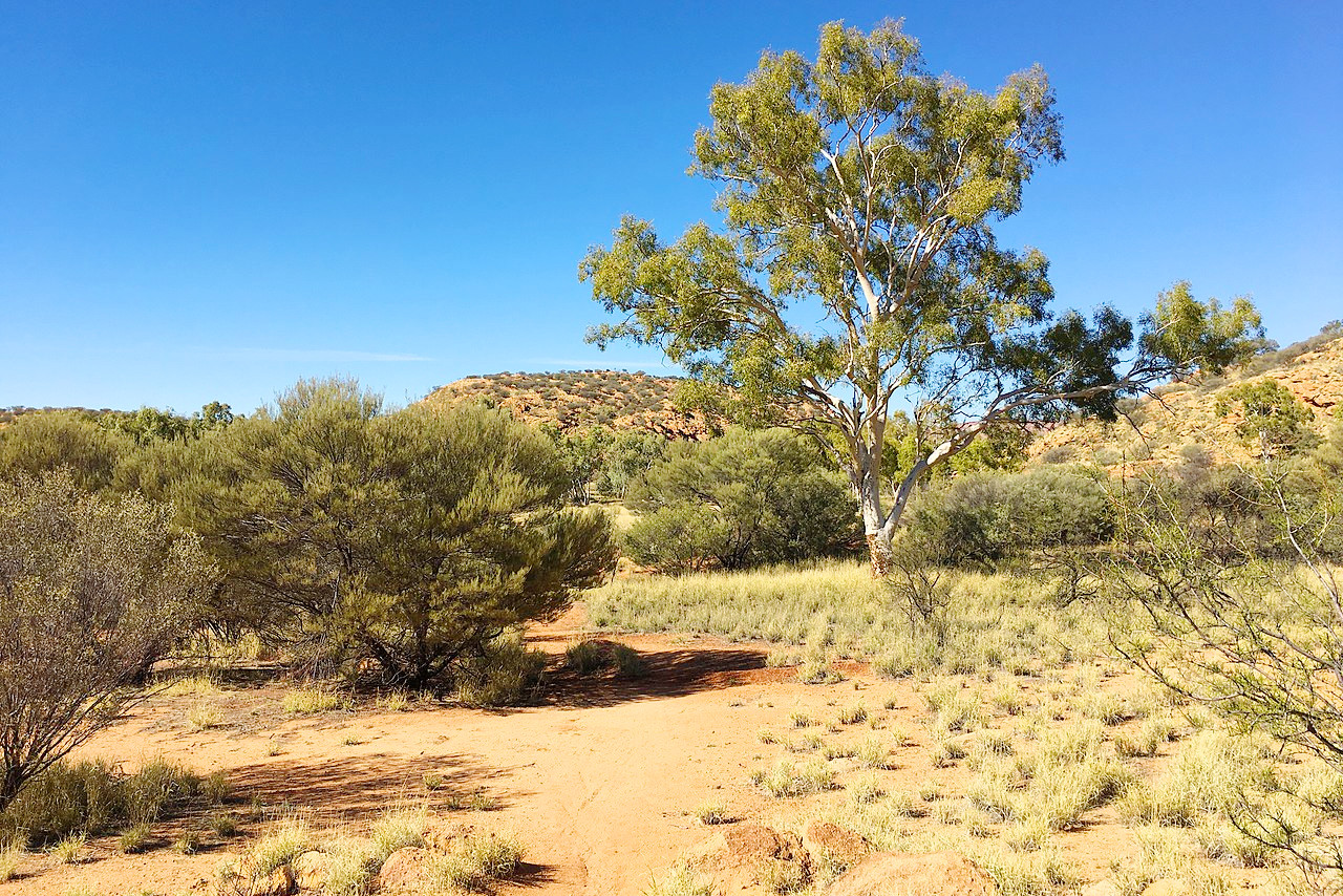
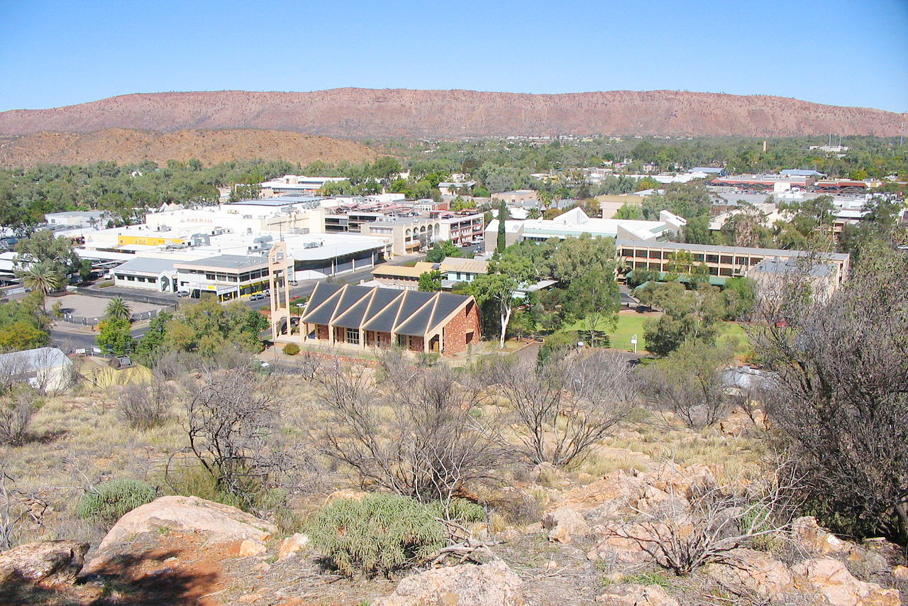
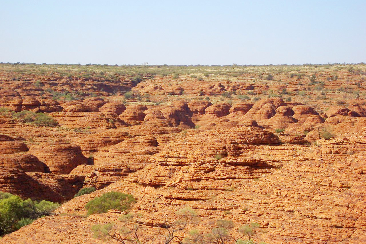
Northern Territory is traversed by small hill and mountain ranges, of which the most important are the mountains of the Macdonnell Chain in the south where Alice Springs lies. The rest of the country to the northern coast is mostly plateau—a high, dissected table-land.
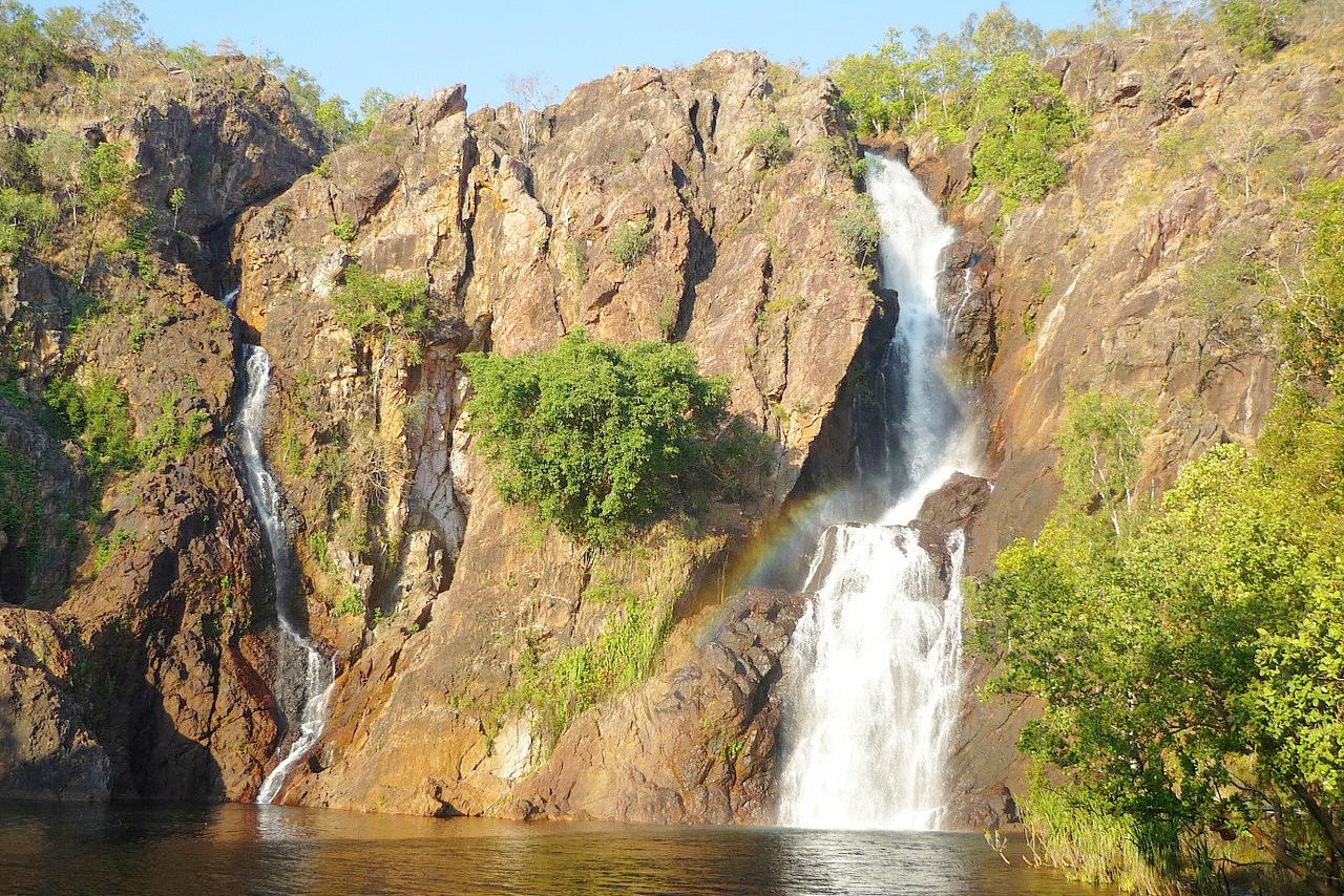
The territory is marked by an absence of water except at the extreme north, where there are several fine rivers, the most noteworthy are, the Roper, flowing into the Gulf of Carpentaria, the Daly and the Victoria, which both flow into the Timor Sea. There are many smaller rivers on the north coast, and these rivers drain country which is subject to regular monsoonal rains, and have the general character of sub-tropical rivers.
What is the nature of Northern Territory like?
The Darwin stringybark (Eucalyptus tetrodonta) is a tree noted for its rough, fibrous or "stringy" bark, and is found in Northern Territory. The boab (Adansonia gregorii) is a baobab, easily recognised by the swollen base of its trunk. Many northern plants are ones common to southeast Asia. The Tamarind occurs in the northeast, with native rice, rattans and wild nutmeg. The red cedar (Toona ciliata) is also Asian. Pines are found to the south, palms in the north; among the most beautiful is the Carpentaria palm. Banksias are very common in sandy districts in the north. Flowering shrubs are common in the south. There are more than one-hundred grasses in Northern Territory.
What is the climate of Northern Territory like?
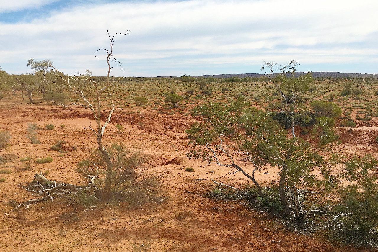
The climate of the Northern Territory is hot; the temperature of this part of the country is very similar to that of northern Queensland. In the north the climate is tropical, and well suited for tropical plants. The rainfall in the extreme north, especially in January and February, is very heavy. This region is backed by a belt of about 100 miles deep in which the rainfall is more moderate, from which inwards the rainfall gradually declines until we reach the south where it is very arid.
| Climate data for Darwin (1991–2020) | |||||||||||||
|---|---|---|---|---|---|---|---|---|---|---|---|---|---|
| Month | Jan | Feb | Mar | Apr | May | Jun | Jul | Aug | Sep | Oct | Nov | Dec | Year |
| Average high °C (°F) | 32.0 (89.6) | 31.7 (89.1) | 32.3 (90.1) | 33.0 (91.4) | 32.3 (90.1) | 31.1 (88.0) | 31.1 (88.0) | 31.9 (89.4) | 33.1 (91.6) | 33.8 (92.8) | 33.7 (92.7) | 33.0 (91.4) | 32.4 (90.4) |
| Daily mean °C (°F) | 28.5 (83.3) | 28.4 (83.1) | 28.6 (83.5) | 28.6 (83.5) | 27.3 (81.1) | 25.5 (77.9) | 25.2 (77.4) | 25.8 (78.4) | 28.0 (82.4) | 29.3 (84.7) | 29.5 (85.1) | 29.2 (84.6) | 27.8 (82.1) |
| Average low °C (°F) | 25.1 (77.2) | 25.1 (77.2) | 24.9 (76.8) | 24.2 (75.6) | 22.3 (72.1) | 20.0 (68.0) | 19.3 (66.7) | 19.8 (67.6) | 22.9 (73.2) | 24.8 (76.6) | 25.4 (77.7) | 25.5 (77.9) | 23.3 (73.9) |
| Average rainfall mm (inches) | 470.7 (18.53) | 412.4 (16.24) | 313.7 (12.35) | 105.1 (4.14) | 20.7 (0.81) | 2.1 (0.08) | 0.9 (0.04) | 0.8 (0.03) | 14.3 (0.56) | 68.9 (2.71) | 143.5 (5.65) | 279.3 (11.00) | 1,832.4 (72.14) |
| Source: Australian Bureau of Meteorology | |||||||||||||
| Climate data for Alice Springs (1991-2020) | |||||||||||||
|---|---|---|---|---|---|---|---|---|---|---|---|---|---|
| Month | Jan | Feb | Mar | Apr | May | Jun | Jul | Aug | Sep | Oct | Nov | Dec | Year |
| Average high °C (°F) | 37.1 (98.8) | 35.8 (96.4) | 33.5 (92.3) | 29.3 (84.7) | 23.6 (74.5) | 20.1 (68.2) | 20.7 (69.3) | 23.5 (74.3) | 28.8 (83.8) | 31.9 (89.4) | 34.4 (93.9) | 35.7 (96.3) | 29.5 (85.2) |
| Daily mean °C (°F) | 29.7 (85.5) | 28.5 (83.3) | 25.7 (78.3) | 21.1 (70.0) | 15.8 (60.4) | 12.4 (54.3) | 12.3 (54.1) | 14.7 (58.5) | 20.0 (68.0) | 23.4 (74.1) | 26.4 (79.5) | 28.2 (82.8) | 21.5 (70.7) |
| Average low °C (°F) | 22.3 (72.1) | 21.1 (70.0) | 17.9 (64.2) | 12.9 (55.2) | 8.0 (46.4) | 4.7 (40.5) | 3.9 (39.0) | 5.8 (42.4) | 11.2 (52.2) | 14.9 (58.8) | 18.3 (64.9) | 20.7 (69.3) | 13.5 (56.2) |
| Average rainfall mm (inches) | 48.9 (1.93) | 40.7 (1.60) | 19.9 (0.78) | 19.9 (0.78) | 17.5 (0.69) | 10.3 (0.41) | 13.0 (0.51) | 3.8 (0.15) | 7.8 (0.31) | 18.7 (0.74) | 33.0 (1.30) | 41.3 (1.63) | 274.8 (10.83) |
| Source: Australian Bureau of Meteorology | |||||||||||||
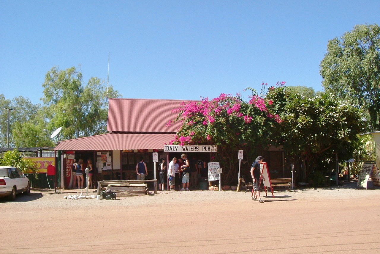 Daly Waters Pub
The official websites
Northern Territory
The Top End
| Location: | North-central Australia |
| Coordinates: | 19° 45′ S, 133° 30′ E |
| Size: | • 1700 km N-S; 960 km E-W • 1060 miles N-S; 600 miles E-W |
| Terrain: | Mostly a desert plateau with occasional ranges of hills and mountains |
| Climate: | Hot, desert, conditions in the south and center. Tropical climate in the north |
| Highest point: | Mount Zeil 1,531 m / 5,023 ft |
| Forest: | 18% (2018) (source) |
| Population: | 247,023 (2021) |
| Population density: | Very low (0.2/km²) |
| Capital: | Darwin |
| Languages: | English |
| Human Development Index: | Very High (0.933) |