The Geography of
Tasmania
Why visit Tasmania?
Tasmania is a stunningly beautiful island southeast of Australia. The island still possesses plenty of untamed wilderness, including wild mountain ranges, pristine beaches, crystal clear lakes and dense forests. The wilderness is seriously beautiful, and marsupials and reptiles run rampant. The island is known for its natural beauty, which is evident from the moment you set eyes on it.
Contents
Map
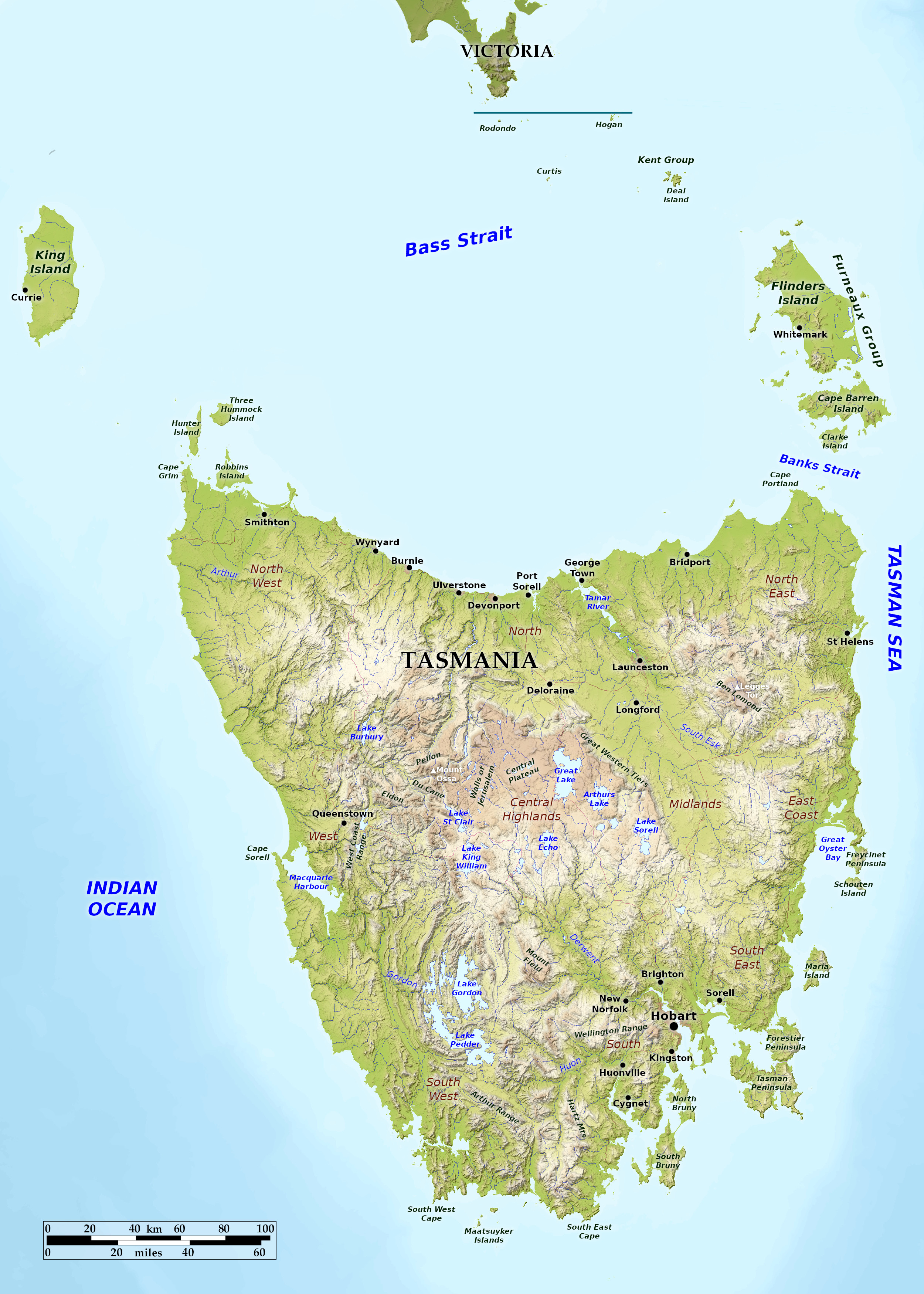 Relief map of Tasmania
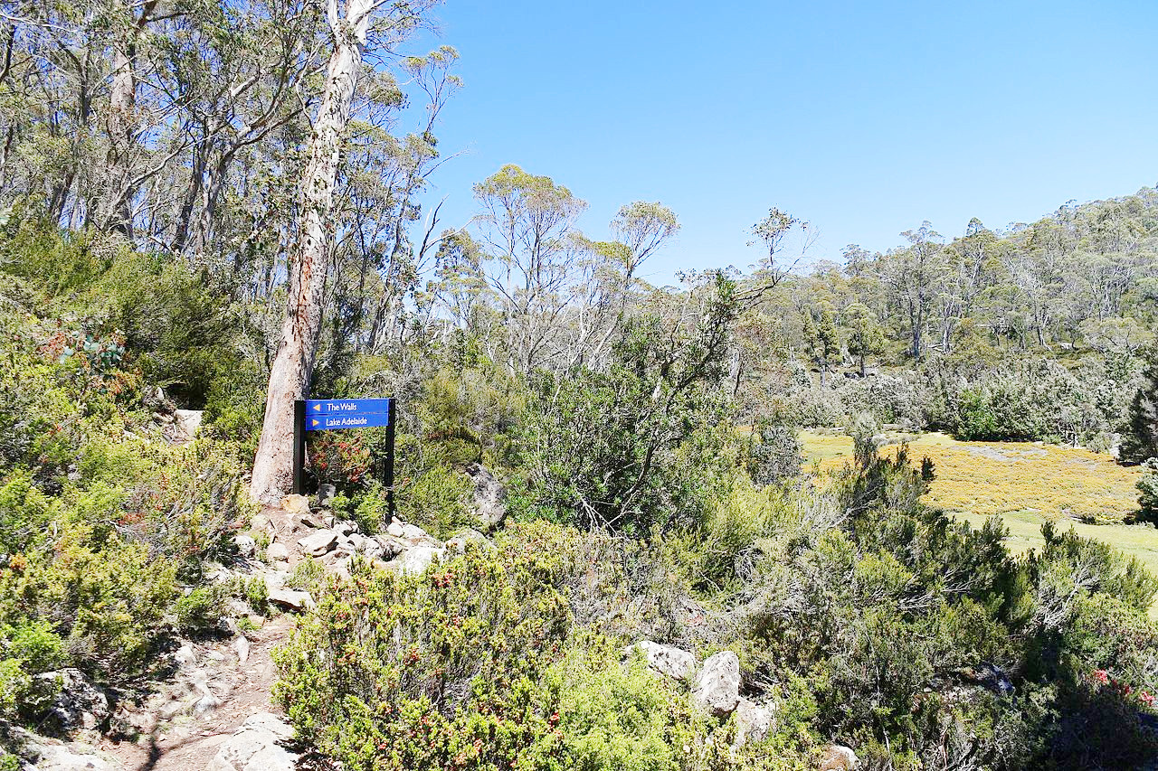
What is the landscape of Tasmania like?
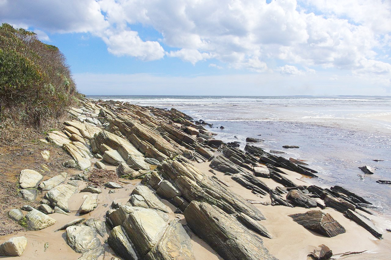
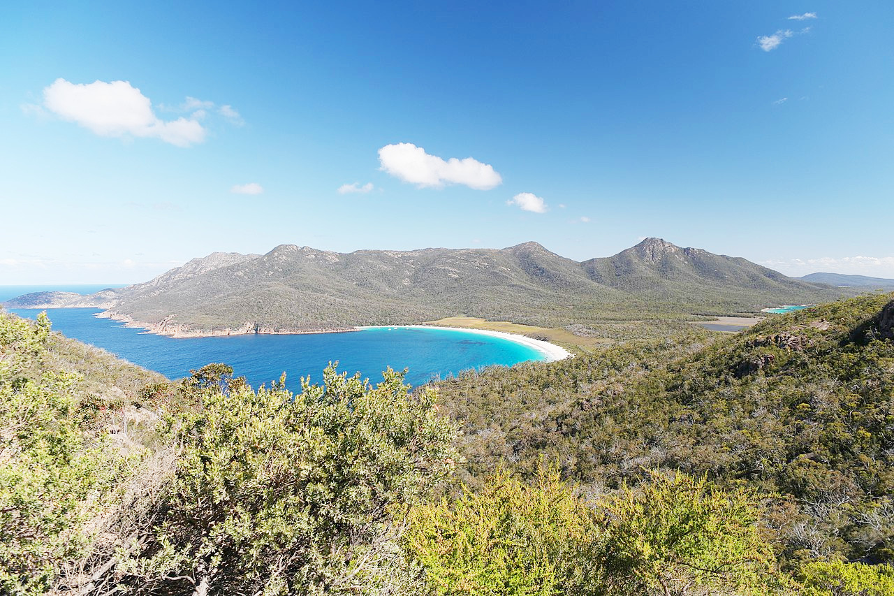
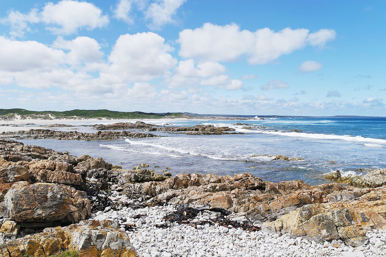
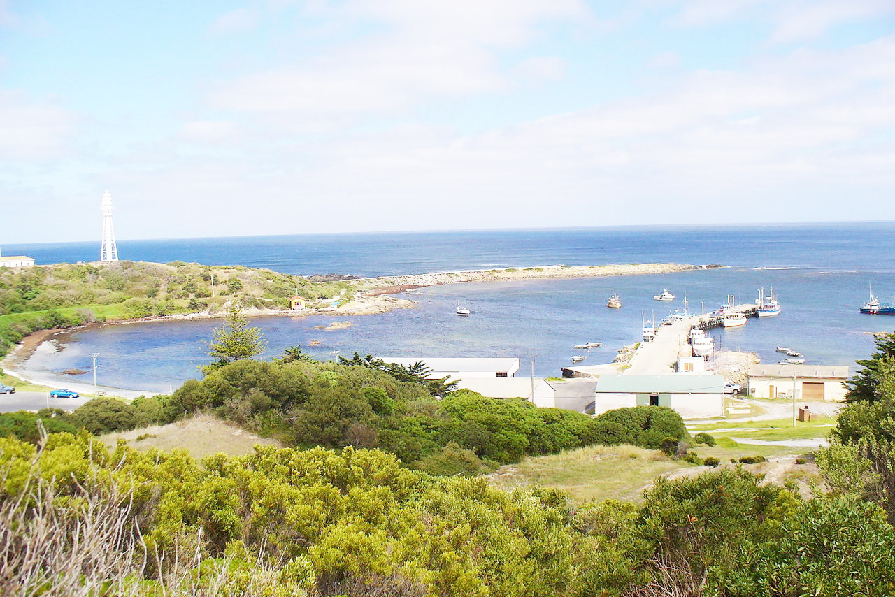
The southeast coast of Tasmania is remarkable for its beautiful inlets and bold headlands. On the main inlet is Hobart, the capital of the island. On the east coast lies Great Oyster Bay, formed by the projection of Freycinet Peninsula. Along the west coast the most conspicuous headland is Cape Sorell, which stands at the entrance of Macquarie Harbour, a deep inlet receiving the waters of the river Gordon. The west coast terminates in the north at Cape Grim, opposite which are the Hunter's Islands group. The north coast of Tasmania has many prominent bays and ports, including the mouth of the Tamar river, on which town of Launceston is situated. In Bass Strait are several large islands belonging to Tasmania; King's, Flinders, Cape Barren and Clarke Islands are the largest.
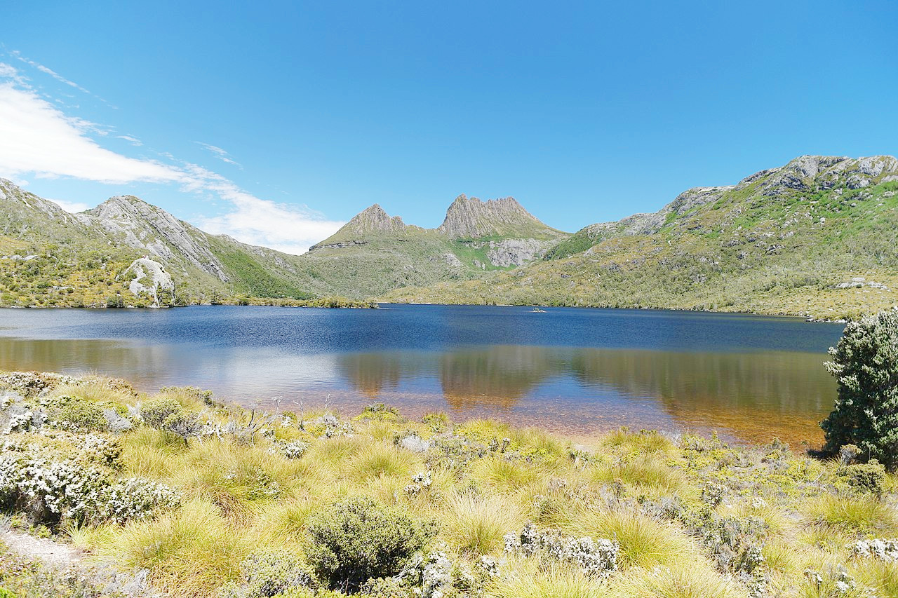
In the central portion of Tasmania is an extensive plateau region with a nearly uniform height of 900 to 1,200 meters (3,000–4,000 feet). At its greatest height it is nearly level, and contains many large freshwater lakes. In the northwest this plateau reaches an altitude of 1,617 m (5,305 feet) at Mount Ossa, the highest point of the island. In the northeastern corner of the island there is a similar plateau remnant, but between the two there is a series of great valleys extending from the mouth of the Tamar in the north to that of the Derwent in the south. The remaining parts of the island are cut up into a maze of deep valleys and high ridges and peaks, often very steep. There are about twenty peaks over 1,200 meters (4,000 feet) high scattered through nearly every part of the island.
The appearance of the island throughout is wonderfully beautiful, with its open plains, bordered by steep mountain ridges, its isolated shaggy peaks and wooded ranges, and its many rivers and lakes. The coasts for the most part, especially towards the south, are bold, with splendid bays and harbours. On the western side the highlands have blue, white, and pinkish crystalline peaks and fantastic outlines of the mountain ranges which rise abruptly to a height of from 600 to 900 meters (2,000–3,000 feet).
What is the nature of Tasmania like?
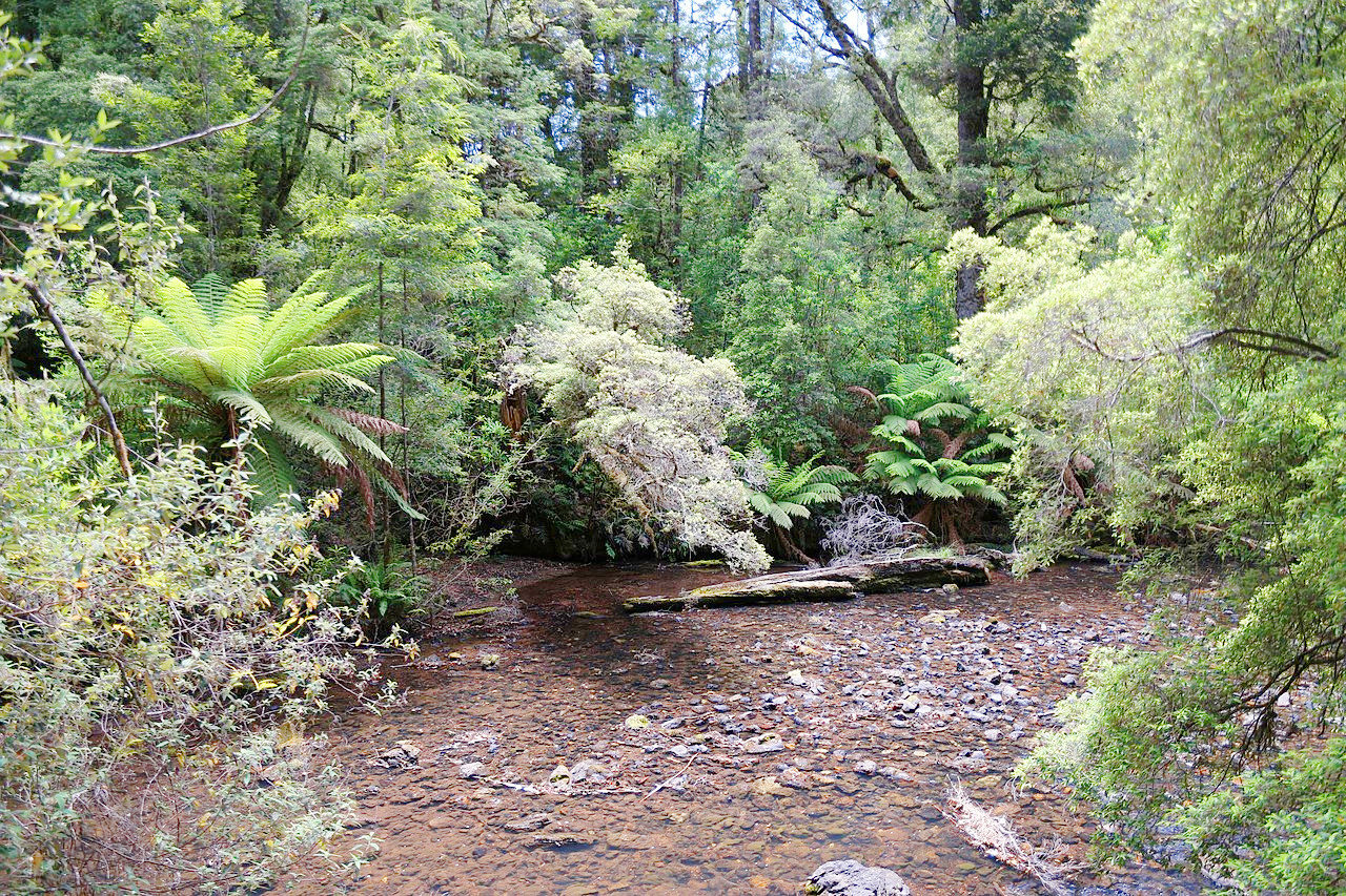
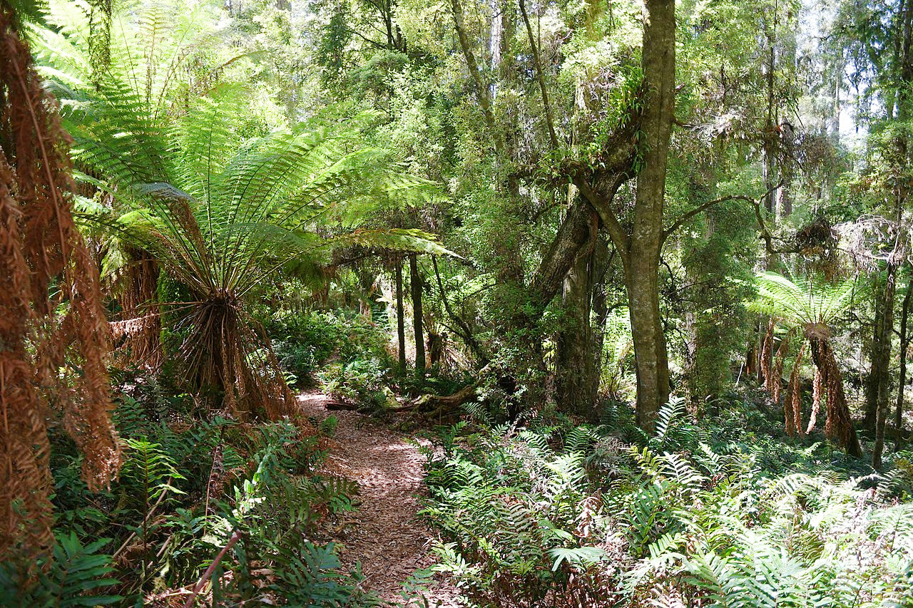
Tasmania has magnificent forests containing acacias and the gigantic eucalyptus, as well as other beautiful trees, such as the Huon pine. The plains and rocky ridges are occupied by quite shaggy forests. The soft tree fern (Dicksonia antarctica) in the mountain ravines is especially remarkable, growing up to 15 m (50 feet) in height. Tasmania is also famous for its small carnivorous marsupial—the Tasmanian devil.
What is the climate of Tasmania like?
The climate of Tasmania is more temperate than the Australian mainland. Summers are warm, sometimes hot, winters are rarely cold, and snow is seldom seen except in the mountains. Rain is brought on the west winds, making the east side of the island rather drier than the west.
| Climate data for Hobart (1991–2020) | |||||||||||||
|---|---|---|---|---|---|---|---|---|---|---|---|---|---|
| Month | Jan | Feb | Mar | Apr | May | Jun | Jul | Aug | Sep | Oct | Nov | Dec | Year |
| Average high °C (°F) | 22.6 (72.7) | 22.5 (72.5) | 20.7 (69.3) | 18.1 (64.6) | 15.6 (60.1) | 13.0 (55.4) | 12.7 (54.9) | 13.8 (56.8) | 15.5 (59.9) | 17.4 (63.3) | 19.5 (67.1) | 20.8 (69.4) | 17.7 (63.9) |
| Daily mean °C (°F) | 17.4 (63.3) | 17.4 (63.3) | 15.8 (60.4) | 13.5 (56.3) | 11.3 (52.3) | 8.9 (48.0) | 8.5 (47.3) | 9.4 (48.9) | 10.9 (51.6) | 12.6 (54.7) | 14.5 (58.1) | 15.9 (60.6) | 13.0 (55.4) |
| Average low °C (°F) | 12.2 (54.0) | 12.2 (54.0) | 10.9 (51.6) | 8.8 (47.8) | 6.9 (44.4) | 4.7 (40.5) | 4.2 (39.6) | 5.0 (41.0) | 6.3 (43.3) | 7.8 (46.0) | 9.5 (49.1) | 10.9 (51.6) | 8.3 (46.9) |
| Average rainfall mm (inches) | 41.1 (1.62) | 32.5 (1.28) | 36.2 (1.43) | 37.4 (1.47) | 27.3 (1.07) | 35.1 (1.38) | 36.5 (1.44) | 46.2 (1.82) | 44.0 (1.73) | 43.2 (1.70) | 39.1 (1.54) | 51.0 (2.01) | 469.6 (18.49) |
| Source: Australian Bureau of Meteorology | |||||||||||||
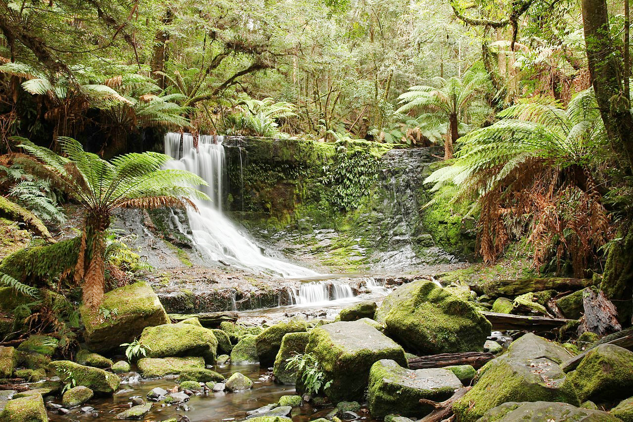 Horseshoe Falls in Mount Field National Park
The official websites
Tasmania
The Apple Isle
| Location: | Southeast Australia |
| Coordinates: | 42° 00′ S, 146° 30′ E |
| Size: | • 470 km N-S; 400 km E-W • 290 miles N-S; 250 miles E-W |
| Terrain: | Very rugged with forested hills, mountains, and valleys |
| Climate: | Temperate climate with year-round rain. Warm summers and mild winters |
| Highest point: | Mount Ossa 1,617 m / 5,305 ft |
| Forest: | 54% (2018) (source) |
| Population: | 541,965 (2021) |
| Population density: | Very low (7.8/km²) |
| Capital: | Hobart |
| Languages: | English |
| Human Development Index: | Very High (0.914) |