.jpg)
.jpg&oldid=470512816)
The Geography of
Victoria
Why visit Victoria?
Victoria is known for its natural beauty, mild climate, and fertile land. To begin with, Victoria has so many different types of scenery. There are rolling hills, snow-capped mountains, untrammelled coastline, and crystal-clear lakes. The wilderness is very accessible here, and spring and summer the Victorian Alps are divine, with historic towns and beautiful valleys.
Map
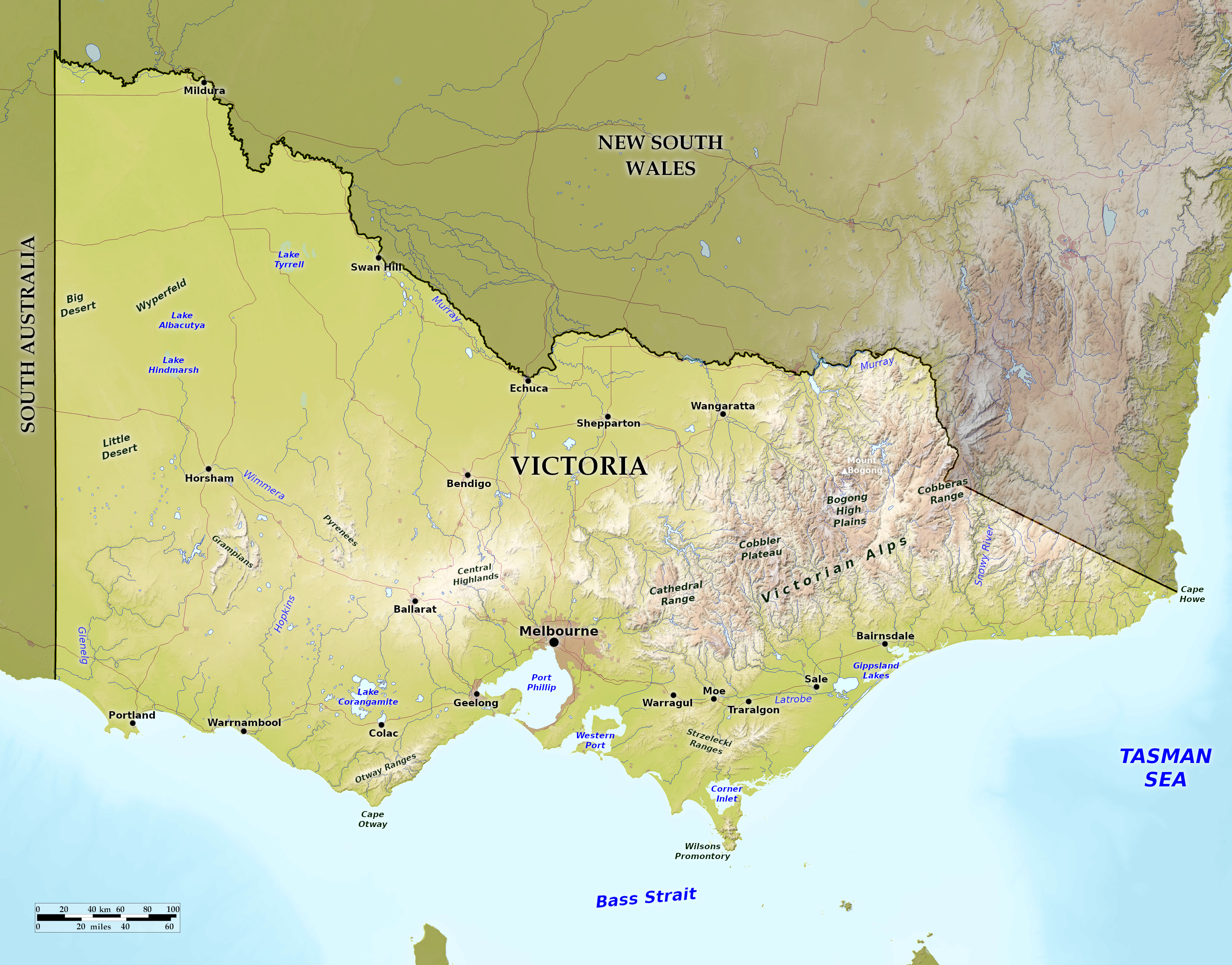 Relief map of Victoria
What is the landscape of Victoria like?
Coast
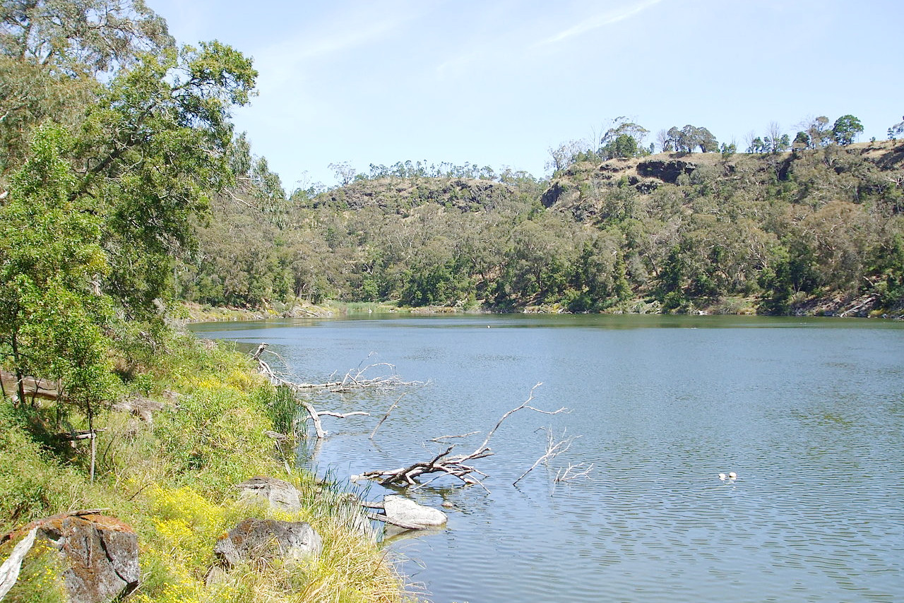
The coastline of Victoria is about 800 miles long. It begins in the west with sandstone cliffs, worn into deep caves and capped by grassy hills, which extend inland to park-like lands. To the east of Cape Nelson lies the inlet of Portland Bay, consisting of a sweep of sandy beach flanked by granite rocks. Then comes a long unbroken stretch of high cliffs, which have been the scene of many calamitous shipwrecks. Cape Otway is the end point of a wild mountain range that here reaches the coast. Its cliffs rise vertically from the water; and the steep slopes above are covered with dense forests of tall trees and tree-ferns. Eastwards from this cape the line of cliffs gradually diminishes in height, until we reach the wide expanse of Port Phillip Bay, at the head of which stands the city of Melbourne. East of Port Phillip Bay lies Western Port, another deep inlet more than half occupied by French Island and Phillip Island; its shores in parts are swampy.
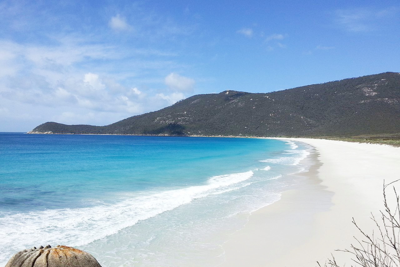
Wilson's Promontory is a great rounded mass of granite hills, with wild and striking scenery, tree-fern gullies and gigantic gum trees, connected with the mainland by a narrow sandy isthmus. East of this cape, lies Corner Inlet, which is dry at low water. From here the coast sweeps round low. There is an unbroken line of sandy shore, backed by low sandhills, behind which comes a succession of lakes, and beyond these rise the soft blue outlines of the mountain ranges of the interior. The shores on the extreme east are somewhat higher, and terminate at Cape Howe at the eastern end of the State.
West
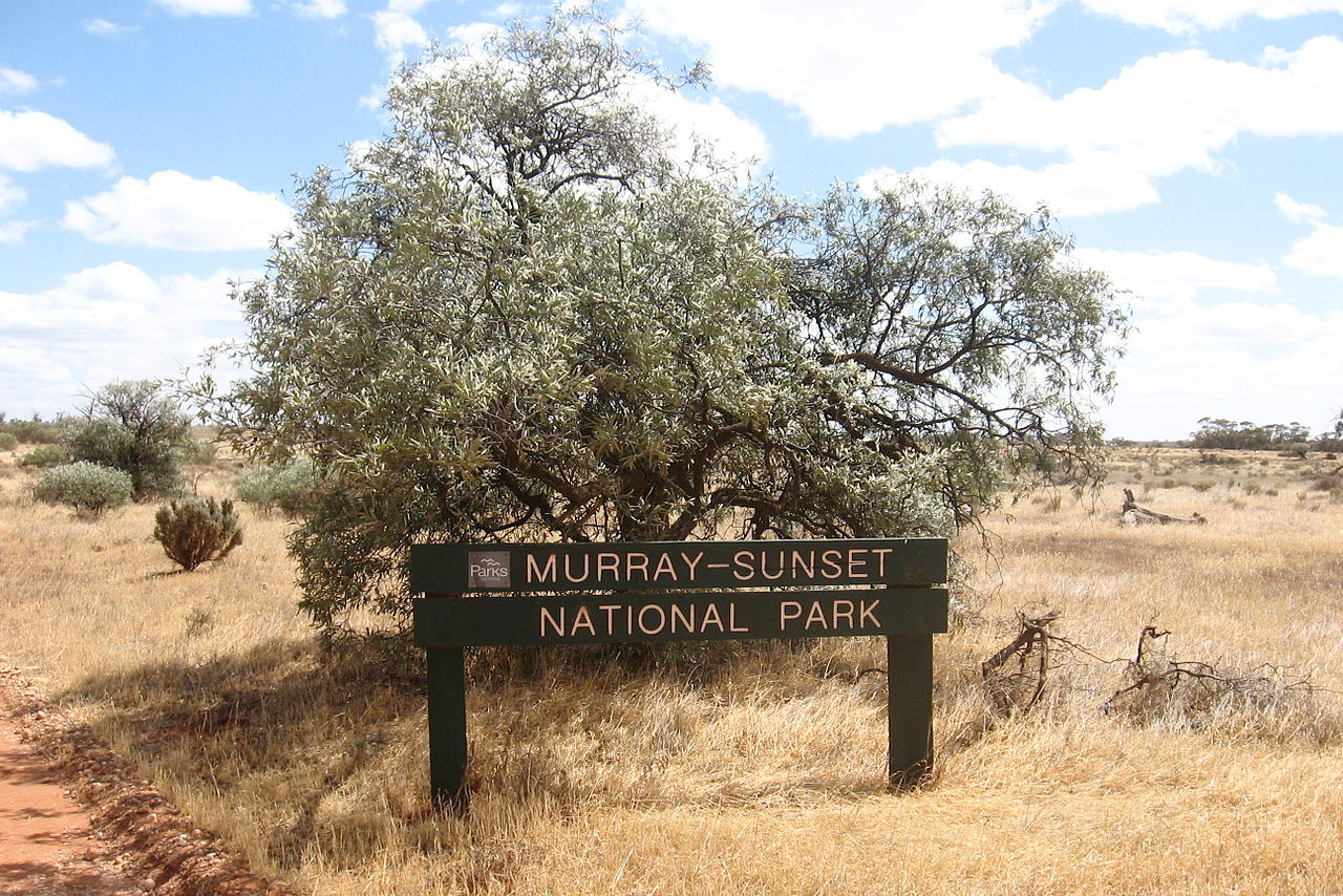
The western half of Victoria is level or slightly hilly, with only thinly wooded grassy lands, with all the appearance of open parks. The northwest corner of the State, equally flat, is dry and sometimes sandy, and often bare of vegetation. This wide western plain is slightly broken in two places. In the south the wild ranges of Cape Otway are covered over a considerable area with richly luxurious but almost impassable forests. This coast forms a favourite holiday resort—the scenery being very attractive. The middle of the plain is crossed by some thin lines of mountains, the chief being the Grampians, the Australian Pyrenees, and the Central Highlands. The high point is Mount William within the Grampians National Park at 1,167 metres (3,829 feet).
East
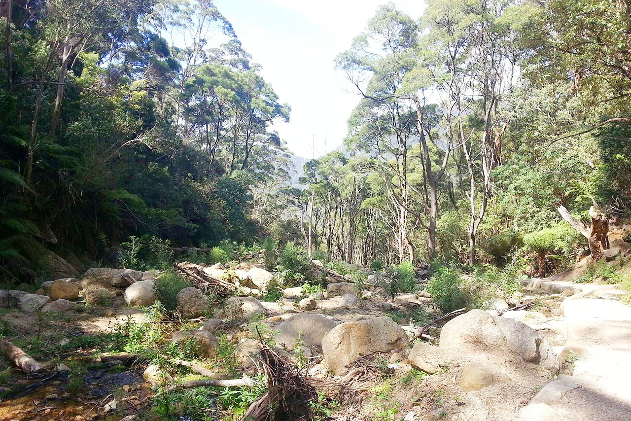
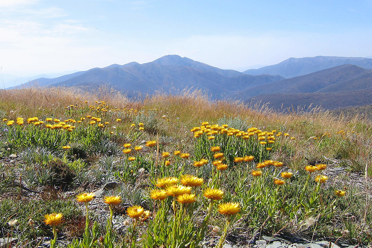
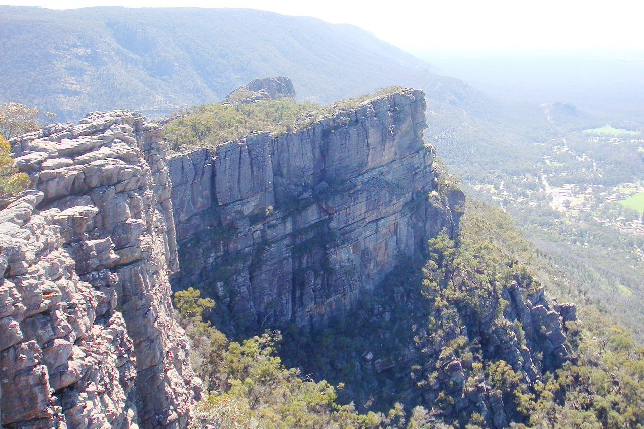
The eastern half of Victoria is wholly different. Though there is plenty of level land, it occurs mainly in small patches in the south. A great part of eastern Victoria is occupied with the complicated mass of ranges known collectively as the Australian Alps. The whole forms a plateau averaging from 300 to 600 meters (1,000–2,000 feet) high, with many smaller tablelands ranging from 900 to 1,500 meters (3,000–5,000 feet) in height, and about fifteen peaks over 1,500 meters (5,000 feet). The highest peak, Mount Bogong 1,986 m (6,516 feet) in altitude. The ranges are densely covered with vegetation. Along the ranges grow the giant trees for which Victoria is famous. The narrow valleys and gullies contain exquisite scenery, the rocky streams being overshadowed by groves of graceful tree-ferns, from amid whose waving fronds rise the tall smooth stems of the white gums. Millions of acres are covered with forest-clad mountains.
What is the nature of Victoria like?
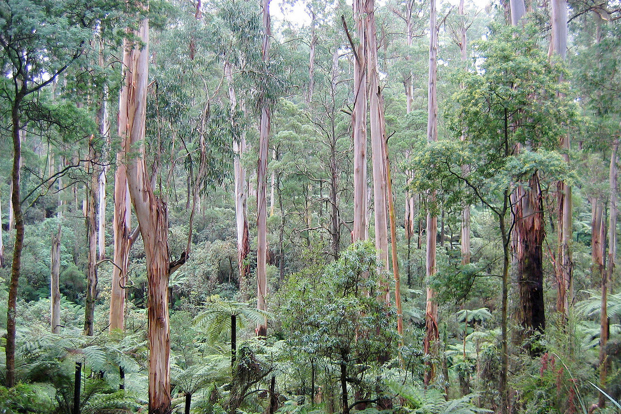
The trees are largely composed of eucalyptus or gum trees with several hundred different species. Some eucalyptus trees reach an extraordinary height—singularly beautiful when seen in groves, having all the appearance of lofty pillared cathedrals. Smaller species of eucalyptus form the common "bush." They are prominent along all the coasts, where they grow densely on the sand-hills. Heaths, grass-trees and magnificent ferns and fern-trees are also notable features in Victorian forests. In other regions there are grassy slopes or open, parklike forests, becoming dense on the mountains. The northwest plains are very dry and often treeless, covered with a scanty scrub vegetation.
What is the climate of Victoria like?
Victoria enjoys a fine climate—cooler and more agreeable than that of the states to the north. About one-half of the days in the year present a bright cloudless sky, with a warm and dry atmosphere. These days are mainly in the autumn and spring. The rainfall is very irregular, but heavier in the east and on the mountains.
The north winds, which blow on an average about sixty days in the year, are cold and dry in winter, but in summer they are hot and dry, and often bring dust with them. In winter the temperature in the lowlands almost never falls below freezing-point, but snow is common enough in the mountains, and the roads in the Australian Alps sometimes lie under heavy snow.
| Climate data for Melbourne (1991–2020) | |||||||||||||
|---|---|---|---|---|---|---|---|---|---|---|---|---|---|
| Month | Jan | Feb | Mar | Apr | May | Jun | Jul | Aug | Sep | Oct | Nov | Dec | Year |
| Average high °C (°F) | 27.0 (80.6) | 26.9 (80.4) | 24.6 (76.3) | 21.1 (70.0) | 17.6 (63.7) | 15.1 (59.2) | 14.5 (58.1) | 15.9 (60.6) | 18.1 (64.6) | 20.5 (68.9) | 22.9 (73.2) | 24.8 (76.6) | 20.8 (69.4) |
| Daily mean °C (°F) | 21.6 (70.9) | 21.7 (71.1) | 19.6 (67.3) | 16.5 (61.7) | 13.7 (56.7) | 11.7 (53.1) | 11.0 (51.8) | 11.9 (53.4) | 13.8 (56.8) | 15.7 (60.3) | 17.9 (64.2) | 19.6 (67.3) | 16.2 (61.2) |
| Average low °C (°F) | 16.1 (61.0) | 16.4 (61.5) | 14.6 (58.3) | 11.8 (53.2) | 9.8 (49.6) | 8.2 (46.8) | 7.5 (45.5) | 7.9 (46.2) | 9.4 (48.9) | 10.9 (51.6) | 12.8 (55.0) | 14.3 (57.7) | 11.6 (52.9) |
| Average rainfall mm (inches) | 44.2 (1.74) | 50.2 (1.98) | 39.0 (1.54) | 53.2 (2.09) | 43.9 (1.73) | 49.5 (1.95) | 39.8 (1.57) | 47.0 (1.85) | 54.5 (2.15) | 55.8 (2.20) | 63.3 (2.49) | 60.9 (2.40) | 600.9 (23.66) |
| Source: Australian Bureau of Meteorology | |||||||||||||
.jpg) London Arch in Port Campbell National Park
London Arch in Port Campbell National Park
.jpg&oldid=502879054)
The official websites
Victoria
The Garden State
| Location: | Southeast Australia |
| Coordinates: | 37° 15′ S, 145° 15′ E |
| Size: | • 580 km N-S; 810 km E-W • 360 miles N-S; 505 miles E-W |
| Terrain: | Mountains in the east; hills in the center; plateau in the west. Coastal plains in many places |
| Climate: | Temperate climate across much of the state, becoming drier to the west. Semi-desert in the northwest |
| Highest point: | Mount Bogong 1,986 m / 6,516 ft |
| Forest: | 36% (2018) (source) |
| Population: | 6,648,564 (2021) |
| Population density: | Low (28/km²) |
| Capital: | Melbourne |
| Languages: | English |
| Human Development Index: | Very High (0.941) |