.jpg)
.jpg&oldid=461298155)
The Geography of
Prince Edward Island
Why visit Prince Edward Island?
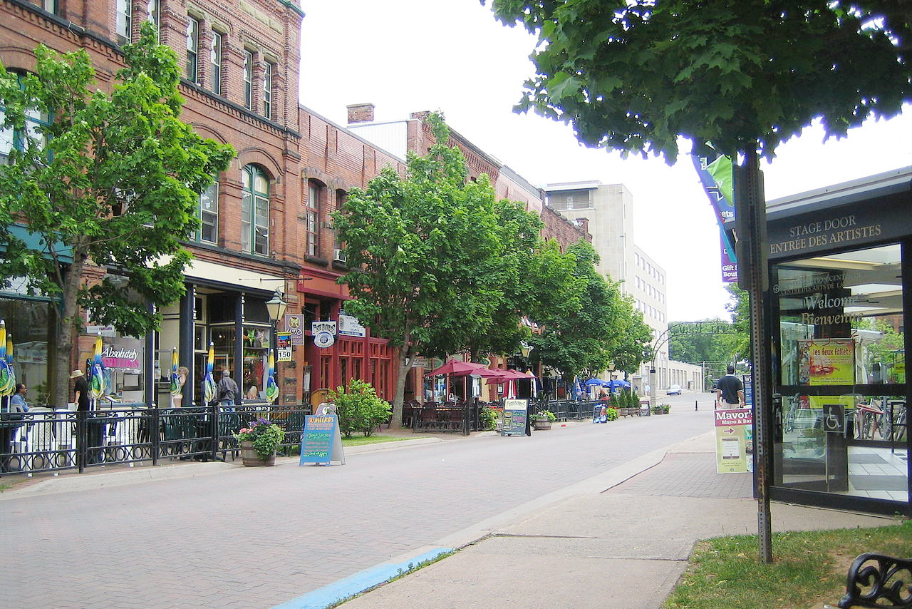
Prince Edward Island is located off the coast of Nova Scotia. The coastline is gentle, with rolling, but often giant dunes. The downtown of the capital city Charlottetown is beautiful with its mix of old and new buildings. The climate is temperate, which means that you can enjoy a variety of outdoor activities all year long.
Contents
Map
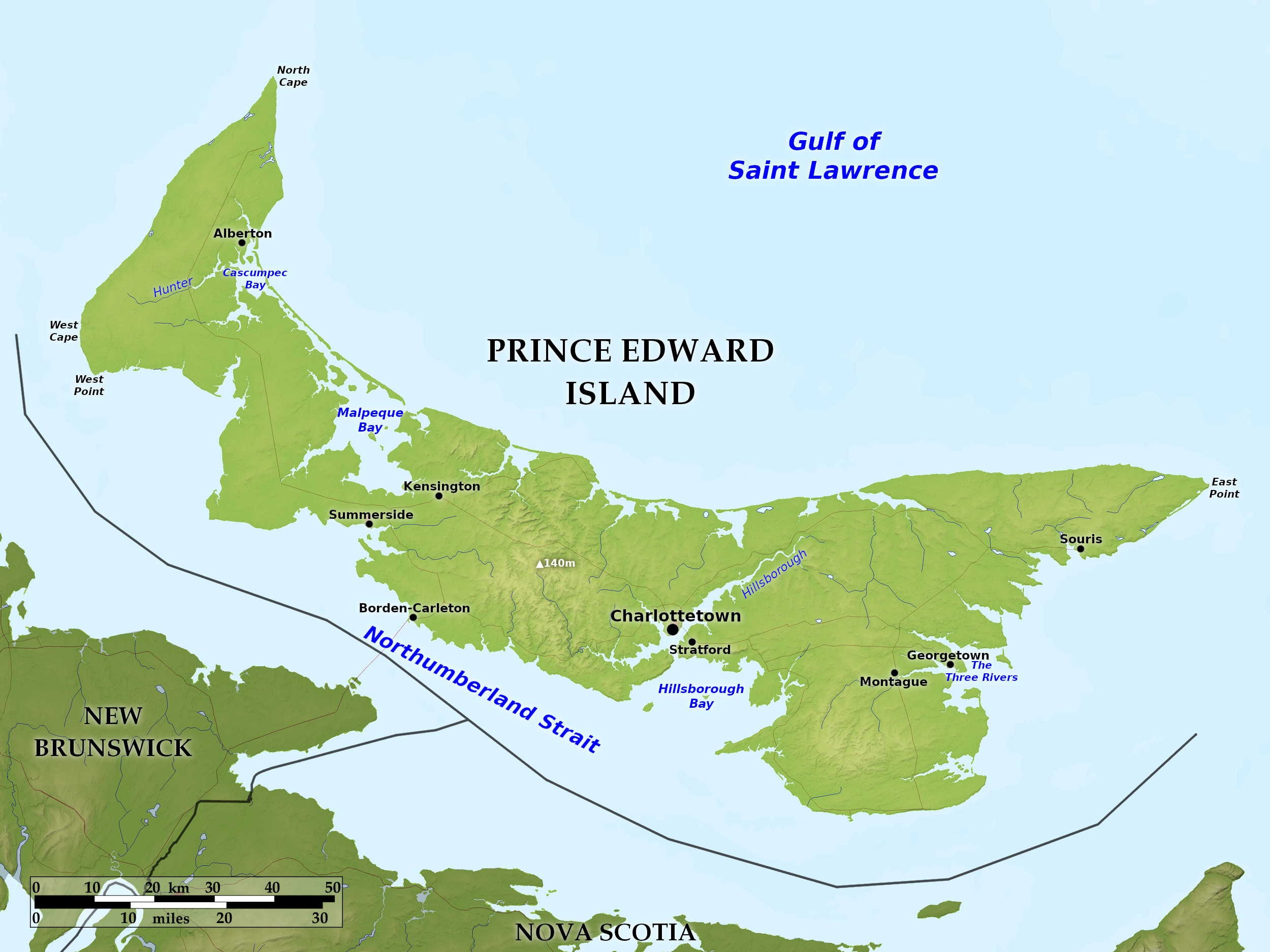 Relief map of Prince Edward Island
What is the landscape of Prince Edward Island like?
Prince Edward Island is the smallest province of Canada. It is situated in the southern part of the Gulf of Saint Lawrence, being separated from New Brunswick and Nova Scotia by the Northumberland Strait. The island is extremely irregular in shape, but is around 130 miles long, and 4 to 30 miles wide.
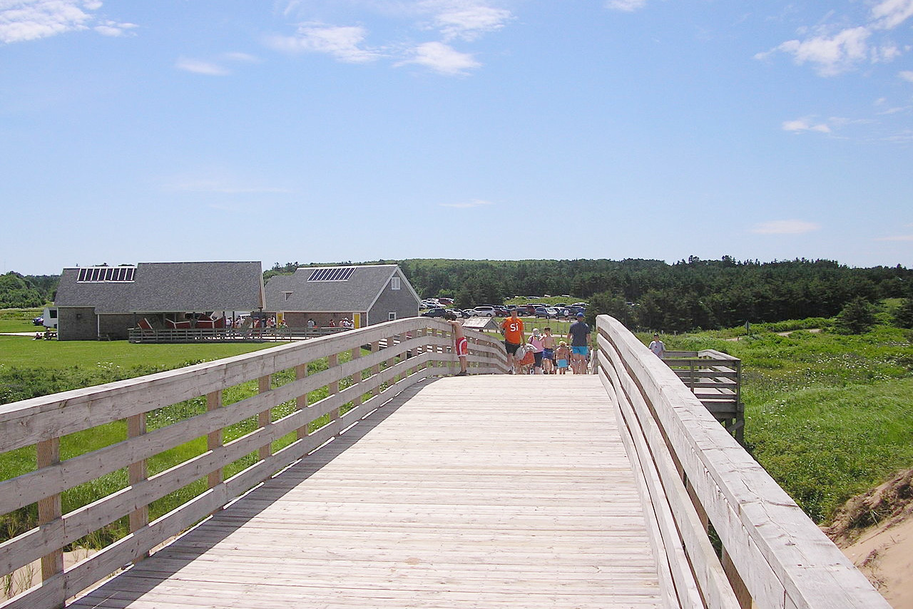
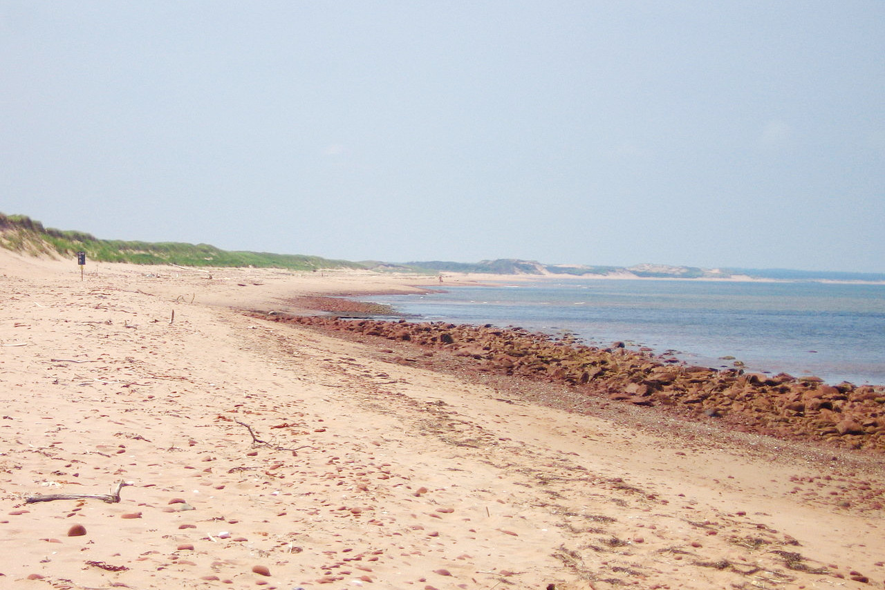
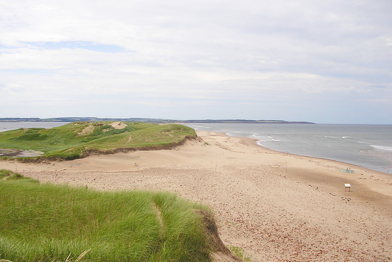
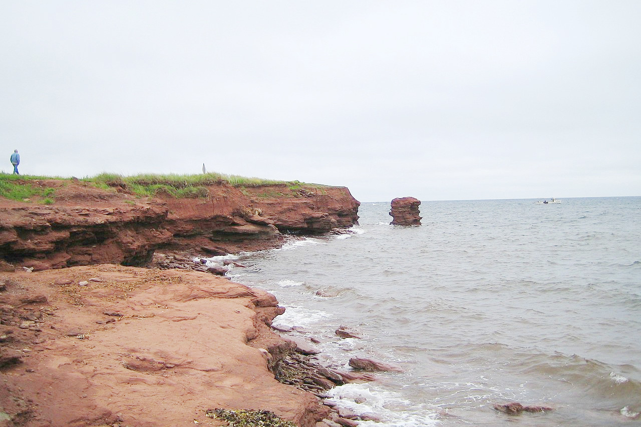
Deep inlets and tidal rivers almost divide it into three approximately equal parts, and no part of the island is far from the sea.. The northwest of the island is very low, and the land nowhere rises more than 50 meters (175 feet) above sea-level; but in the middle of the island is a low ridge of hills, rising to a height of nearly 150 meters (500 feet). The north shore, facing the gulf, is a long series of beaches of fine sand, and is a popular resort in summer. On the south shore, low cliffs of crumbling red sandstone face the strait.
What is the nature of Prince Edward Island like?
Forests originally covered the entire island, and just under half of the island is still forested. Numerous springs and rivers water the island. Salt marshes occur in and near the creeks and bays, as do many dunes of drifted sand, which extend for forty miles along the coast.
What is the climate of Prince Edward Island like?
The climate, though bracing, is milder than that of the neighbouring mainland. The summer climate makes the island a paradise for tourists, and fogs are much less common than in either New Brunswick or Nova Scotia. Average temperatures for Charlottetown are -7°C (19°F) in January and 18°C (64°F) in July. The most rainfall occurs between October and January.
| Climate data for Charlottetown (1981–2010) | |||||||||||||
|---|---|---|---|---|---|---|---|---|---|---|---|---|---|
| Month | Jan | Feb | Mar | Apr | May | Jun | Jul | Aug | Sep | Oct | Nov | Dec | Year |
| Average high °C (°F) | −3.4 (25.9) | −2.9 (26.8) | 0.9 (33.6) | 7.2 (45.0) | 14.3 (57.7) | 19.4 (66.9) | 23.3 (73.9) | 22.8 (73.0) | 18.6 (65.5) | 12.3 (54.1) | 6.3 (43.3) | 0.5 (32.9) | 9.9 (49.8) |
| Daily mean °C (°F) | −7.7 (18.1) | −7.3 (18.9) | −3.1 (26.4) | 3.1 (37.6) | 9.2 (48.6) | 14.5 (58.1) | 18.7 (65.7) | 18.3 (64.9) | 14.1 (57.4) | 8.3 (46.9) | 2.9 (37.2) | −3.3 (26.1) | 5.7 (42.3) |
| Average low °C (°F) | −12.1 (10.2) | −11.7 (10.9) | −7.0 (19.4) | −1.2 (29.8) | 4.1 (39.4) | 9.6 (49.3) | 14.1 (57.4) | 13.7 (56.7) | 9.6 (49.3) | 4.4 (39.9) | −0.5 (31.1) | −7.0 (19.4) | 1.3 (34.3) |
| Average precipitation mm (inches) | 101.0 (3.98) | 83.2 (3.28) | 86.3 (3.40) | 83.7 (3.30) | 91.0 (3.58) | 98.8 (3.89) | 79.9 (3.15) | 95.7 (3.77) | 95.9 (3.78) | 112.2 (4.42) | 112.5 (4.43) | 118.1 (4.65) | 1,158.2 (45.60) |
| Average snowfall cm (inches) | 73.3 (28.9) | 58.3 (23.0) | 44.1 (17.4) | 24.4 (9.6) | 3.7 (1.5) | 0.0 (0.0) | 0.0 (0.0) | 0.0 (0.0) | 0.0 (0.0) | 1.7 (0.7) | 19.2 (7.6) | 65.6 (25.8) | 290.4 (114.3) |
| Source: Environment and Climate Change Canada | |||||||||||||
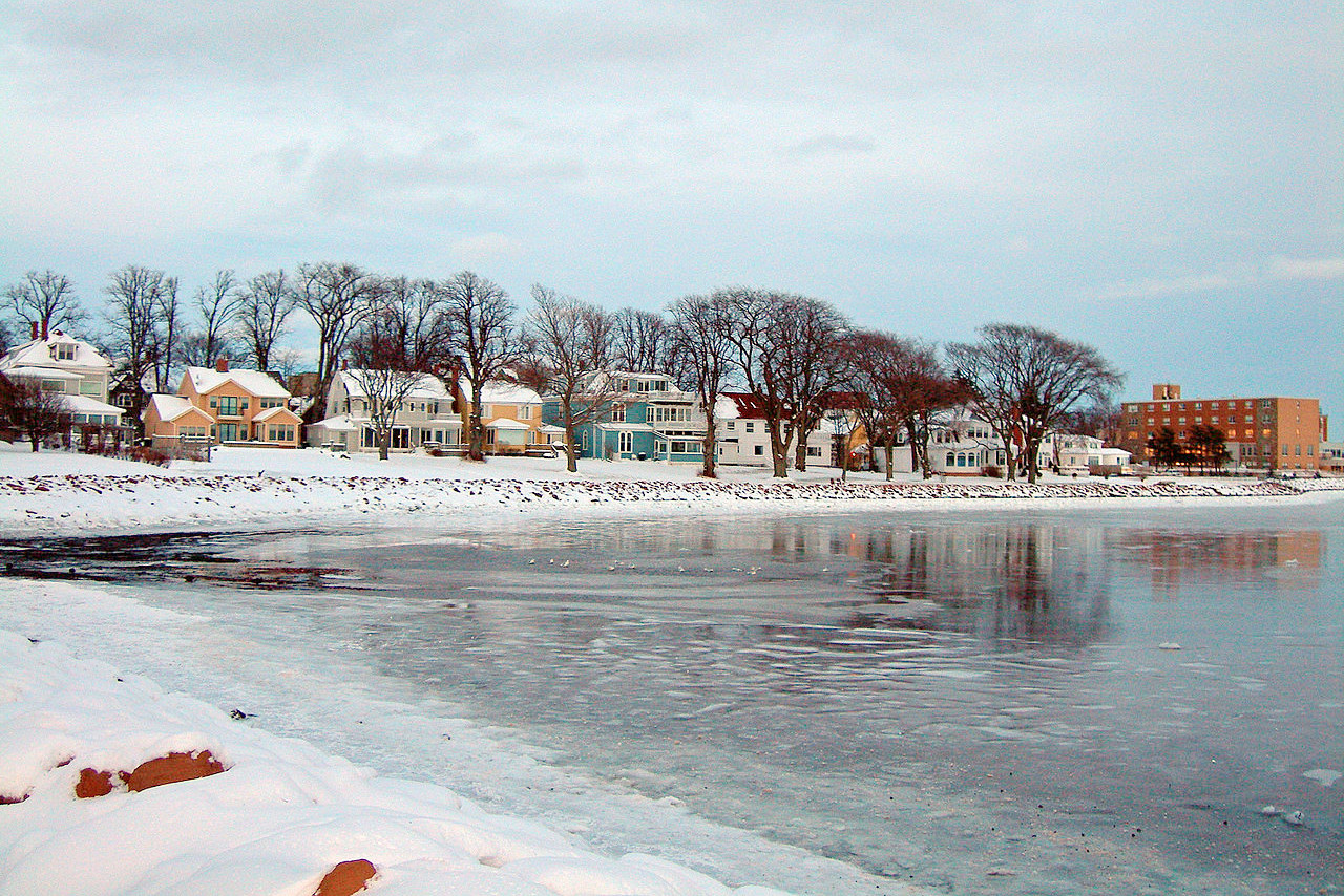 Charlottetown in the winter
The official websites
Prince Edward Island
The Garden of the Gulf
| Location: | Southeastern Canada |
| Coordinates: | 46° 30′ N, 63° 00′ W |
| Size: | • 150 km N-S; 225 km E-W • 90 miles N-S; 140 miles E-W |
| Terrain: | Island province with numerous lakes and rivers, sand dunes and beaches |
| Climate: | Temperate with mild summers and cool winters |
| Highest point: | 142 m / 466 ft |
| Forest: | 47% (2010) (source) |
| Population: | 159,819 (2021) |
| Population density: | Low (25/km²) |
| Capital: | Charlottetown |
| Languages: | English (94%); French (4%) |
| Human Development Index: | Very High (0.924) |