.jpg)
.jpg&oldid=637393085)
The Geography of
La Rioja
Why visit La Rioja?
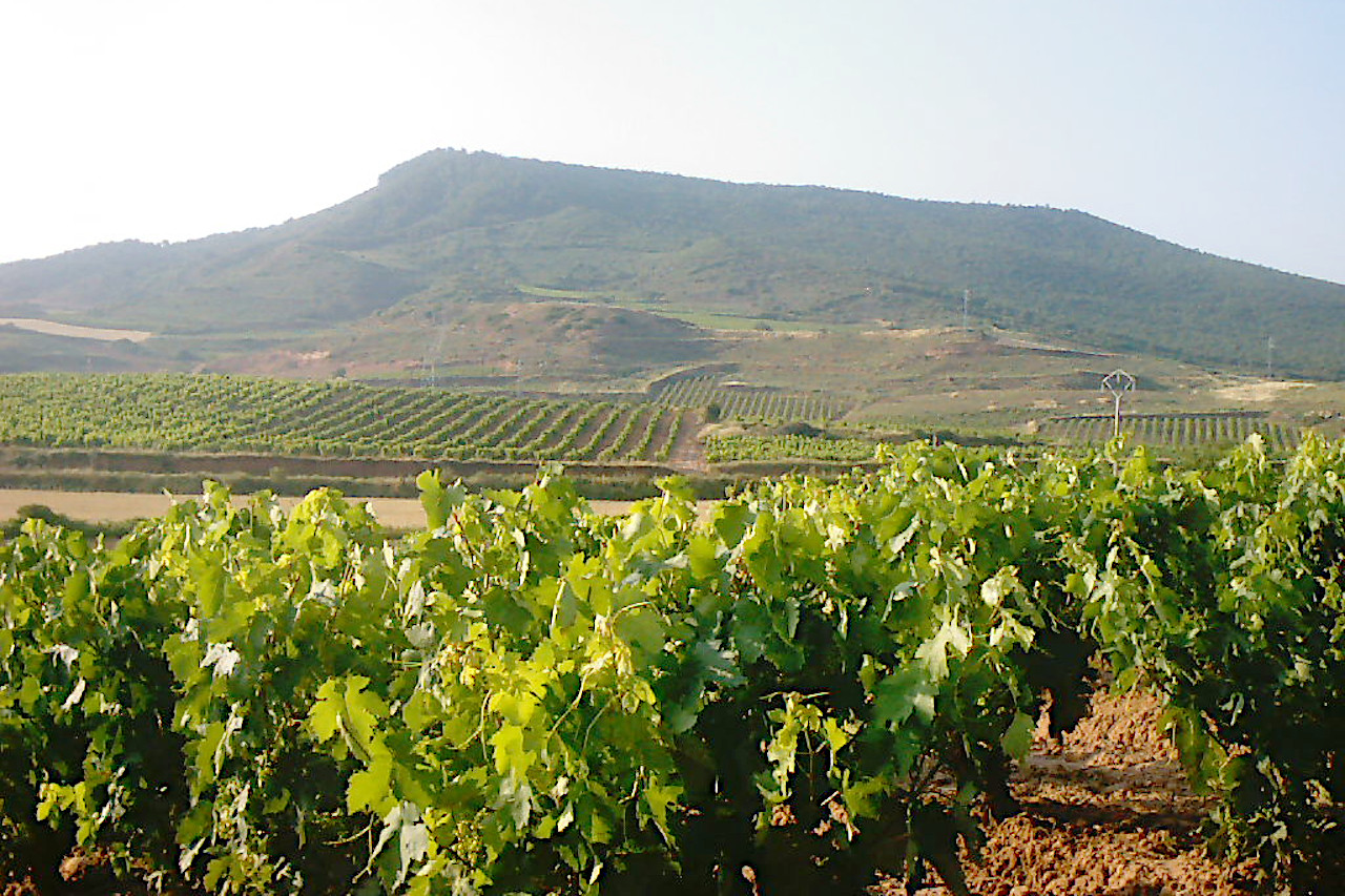
La Rioja is an inland province of northern Spain, skirting the Ebro valley, but in the south broken up by offshoots from high sierra mountains. The mountains have forests of oaks, beech, and pine, whereas the hills are covered with vineyards for the light red and white Rioja wines
Contents
Map
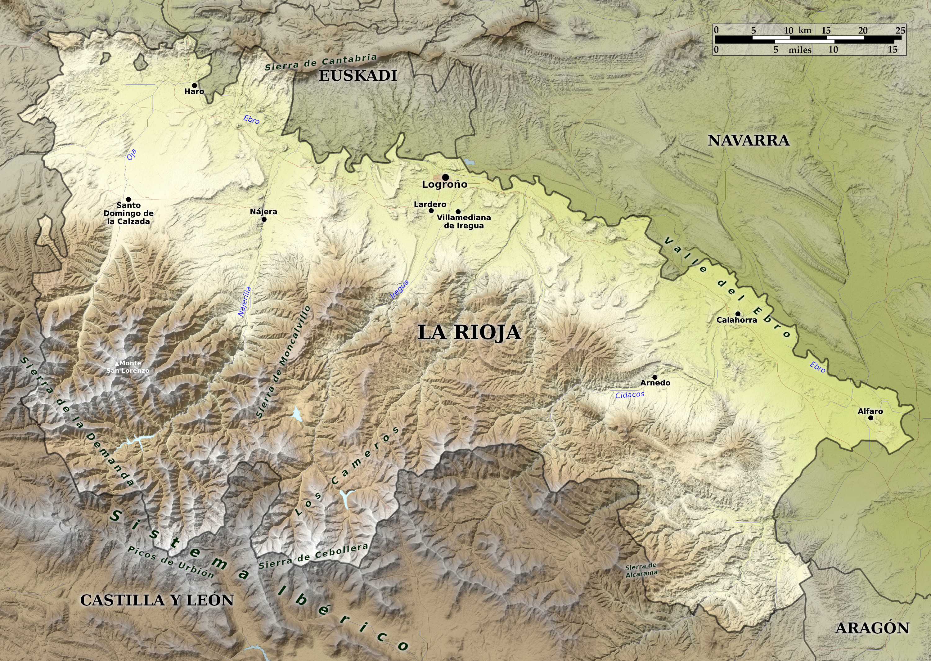 Relief map of La Rioja
What is the landscape of La Rioja like?
La Rioja is an inland region and province of northern Spain. It is bounded to the north by the Basque Country and Navarre, and south by the region of Castille and Leon. The province is in the basin of the river Ebro, which forms its northern boundary except for a short distance in the northwest.
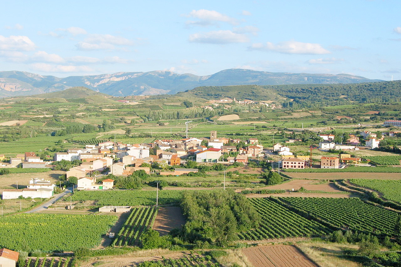
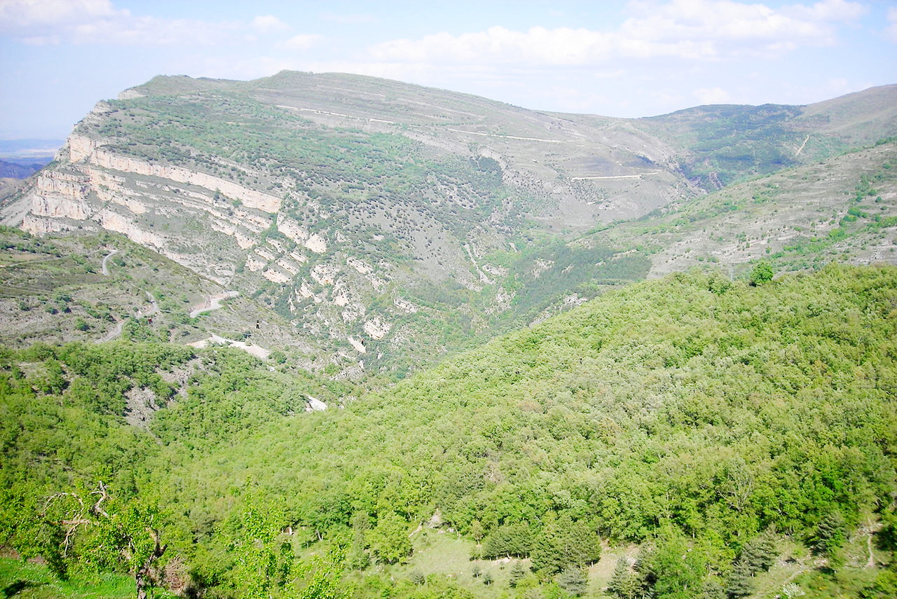
The northern half of the province forms a spacious and for the most part fertile undulating plain, called La Rioja. The southern half of the province is dominated by mountain ranges of the Sistema Iberico, which sends rivers all flowing in a northeasterly direction into the Ebro. In the southwest Monte San Lorenzo, the culminating point of the Sierra de la Demanda, rises 2,271 meters (7,451 feet).
What is the nature of La Rioja like?
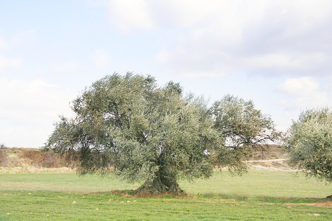
There is a sharp contrast between the Ebro valley to the north, and the mountains to the south. The Ebro Valley has Mediterranean flora—oaks, olive and almond trees, and a farming landscape. The hills are covered with vast vineyards for the wine for which this region is famous for. The mountains have forests of oaks, beech, and pine, often intermixed with thickets of juniper, boxwood, holly, and rockrose (cistus).
What is the climate of La Rioja like?
There is a similar contrast in the climate of La Rioja. The northern, valley area has a Mediterranean climate and the southern, mountains have a more humid, continental climate.
| Climate data for Logroño (1981-2010) | |||||||||||||
|---|---|---|---|---|---|---|---|---|---|---|---|---|---|
| Month | Jan | Feb | Mar | Apr | May | Jun | Jul | Aug | Sep | Oct | Nov | Dec | Year |
| Average high °C (°F) | 9.9 (49.8) | 12.0 (53.6) | 15.9 (60.6) | 17.8 (64.0) | 22.0 (71.6) | 26.9 (80.4) | 30.1 (86.2) | 29.8 (85.6) | 25.8 (78.4) | 20.1 (68.2) | 13.8 (56.8) | 10.2 (50.4) | 19.5 (67.1) |
| Daily mean °C (°F) | 5.9 (42.6) | 7.2 (45.0) | 10.2 (50.4) | 12.0 (53.6) | 15.9 (60.6) | 20.1 (68.2) | 22.8 (73.0) | 22.7 (72.9) | 19.3 (66.7) | 14.7 (58.5) | 9.5 (49.1) | 6.5 (43.7) | 13.9 (57.0) |
| Average low °C (°F) | 2.0 (35.6) | 2.4 (36.3) | 4.6 (40.3) | 6.3 (43.3) | 9.7 (49.5) | 13.3 (55.9) | 15.6 (60.1) | 15.6 (60.1) | 12.9 (55.2) | 9.2 (48.6) | 5.3 (41.5) | 2.8 (37.0) | 8.3 (46.9) |
| Average precipitation mm (inches) | 28 (1.1) | 23 (0.9) | 26 (1.0) | 46 (1.8) | 47 (1.9) | 44 (1.7) | 30 (1.2) | 21 (0.8) | 26 (1.0) | 37 (1.5) | 40 (1.6) | 38 (1.5) | 405 (15.9) |
| Source: Agencia Estatal de Meteorología | |||||||||||||
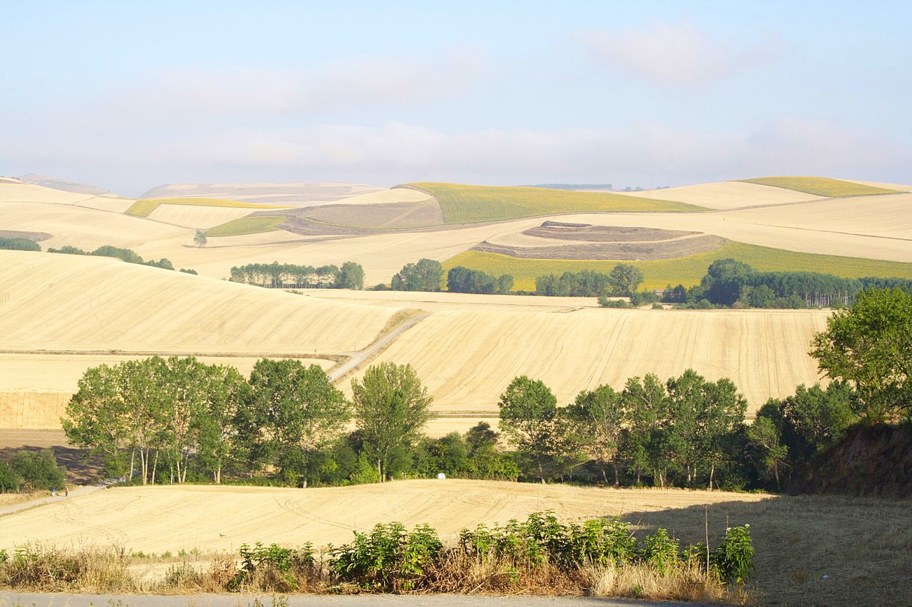
Countryside view from the Way of Saint James, La Rioja
The official websites
La Rioja
The frontier land
| Location: | Northern Spain |
| Coordinates: | 42° 15′ N, 2° 30′ W |
| Size: | • 80 km N-S; 120 km E-W • 50 miles N-S; 75 miles E-W |
| Terrain: | Valley of the Ebro river in the north. Mountain slopes of the Iberian System to the south |
| Climate: | Continental climate with hot summers and mild winters. Cooler in the mountains with more rainfall |
| Highest point: | Monte San Lorenzo 2,271 m / 7,451 ft |
| Forest: | 29% (2010 est.) (source) |
| Population: | 319 914 (2020) |
| Population density: | Low (63/km²) |
| Capital: | Logroño |
| Languages: | Spanish |
| Human Development Index: | Very High (0.913) |