The Geography of
North Dakota
Why visit North Dakota?
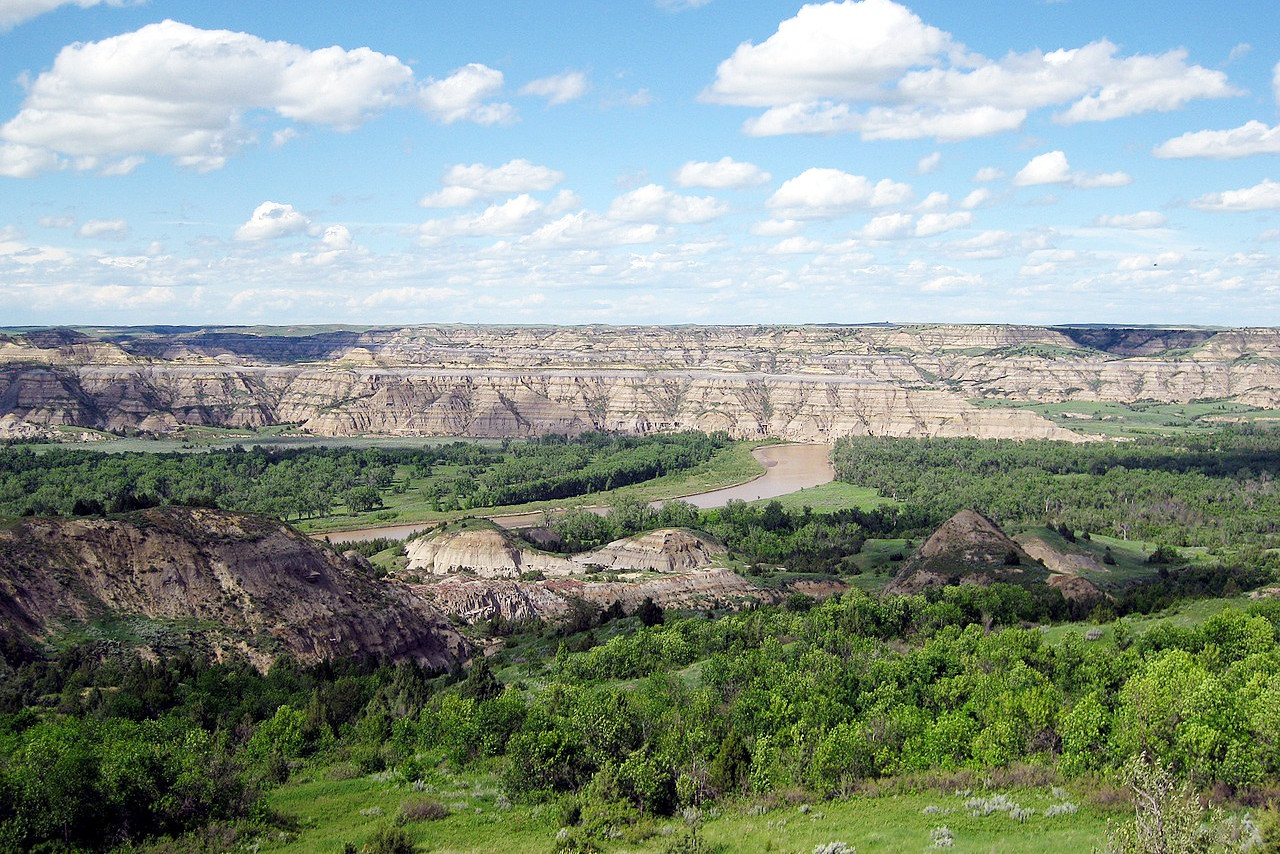
North Dakota is home to a variety of beautiful features. There are the prairie grasslands with their rolling hills, vast open spaces and the soothing sounds of rushing water. In the river valleys are bluffs or high cliffs, lined with trees. The Badlands, so called because the pioneers had great difficulty in crossing them, are a unique geologic formation in the state, and here can be found the Theodore Roosevelt National Park—a beautiful park with sandy hills and wildlife including the elk and the bison.
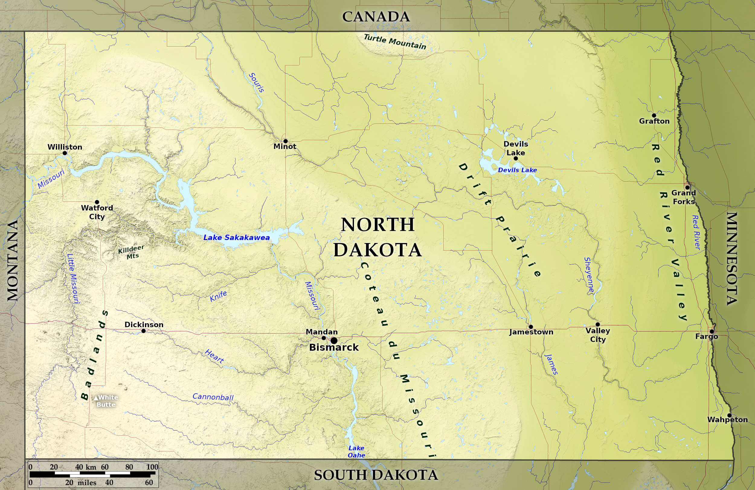
Map
 Relief map of North Dakota
What is the landscape of North Dakota like?
Prairie Plains
North Dakota is divided between the Prairie Plains in the east and Great Plains in the west. The escarpment known as the Coteau du Missouri is the dividing line. The landscape consists of three vast plains or prairie tablelands rising one above the other from east to west, the two easternmost together constituting the Prairie Plains. The lowest of these plains is the Red River Valley, and this valley extends along the eastern edge of the state and varies in width from 25 to 70 miles.
To the west of this valley lies a second plain, ranging in height from 1,200 to 1,600 feet (360–490 m) above sea level, and in width from 75 miles in the south to 200 miles in the north. The prairies in this second plain are not as level as the Red river valley—instead the landscape is gently rolling, and there is one group of hills, the Turtle Mountains rising near the northern border of the State. The entire region is dotted with small lakes, many are strong with salt and alkali.
Great Plains
In the west rises the third and highest plain within the state. It occupies nearly one half of the state, and rises gradually westward until it attains a general height of about 2,700 feet (800 m). This region is noticeably different from the more level lands of the lower plains. East of the Missouri river, glacial action has worn down the hills and filled the valleys until the landscape has a billowy appearance. The region west the Missouri river, however, is almost free from glacial deposits and presents a strong contrast to the rest of the State. The billowy plains still remain in places, but in the vicinity of rivers there are deep ravines. The sands and clays found here are fine and soft, and as there is only light vegetation to protect the hillsides they are easily eroded by the rains. As a result, the surface has been carved into fantastic forms. The early French explorers called the region "les terres mauvaises", and in its English equivalent, "the Bad Lands".
The landscape of the Badlands has been sculpted by water, wind and fire, and is enhanced too by the brilliant colors along the faces of the hills and ravines—grey, yellow, black and every shade of red and brown. Here too are found petrified forests that have long ago disappeared. A few miles from the rivers the country is less broken, and there are deep grassy valleys.
What is the nature of North Dakota like?
North Dakota lies in a dry grassland area, and its plants are typical of a semi-arid country. The prevailing plant-colour is a greyish green, due to a hard dry outer covering which serves as a protection from desiccation. The plants have extensive roots, because of the need of getting moisture from the earth and not from the air.
Trees are mainly found in sheltered spots, such as in the vicinity of rivers. The prairies though are covered with grasses, and with masses of showy native flowers which bloom from spring to autumn. The pasque flower is found on all the prairies and is the earliest to appear. The Bad Lands exhibit a semi-arid vegetation. Cottonwoods flourish along the Little Missouri river, and in sheltered ravines grow stunted junipers and cedars, which seldom rise above the crest of some protecting bluff. Poplars grow in the valleys, and the cactus and sage brush are common.
What is the climate of North Dakota like?
North Dakota has a continental climate in which the seasons are sharply demarked: both winter and summer come suddenly. The summers are short, but as there are sixteen hours of sunlight per day in midsummer, the vegetation grows rapidly. High winds are frequent, and prairie houses are often protected by rows of trees acting as wind breaks. During the growing season the winds are usually light, but in the late summer and autumn there are occasional dry, hot, southerly winds. The winters are long and cold, but on account of the dryness of the climate, is not so harsh. Rainfall is sparse in North Dakota especially towards the west. Much of it occurs in the spring and summer. In the winter rainfall is scarce, hence the snows are usually very light, and are quickly swept from the prairies by the winds.
| Climate data for Bismarck, North Dakota (1991–2020 ) | |||||||||||||
|---|---|---|---|---|---|---|---|---|---|---|---|---|---|
| Month | Jan | Feb | Mar | Apr | May | Jun | Jul | Aug | Sep | Oct | Nov | Dec | Year |
| Average high °F (°C) | 23.2 (−4.9) | 27.8 (−2.3) | 41.0 (5.0) | 56.0 (13.3) | 68.3 (20.2) | 77.9 (25.5) | 84.7 (29.3) | 83.5 (28.6) | 73.4 (23.0) | 57.1 (13.9) | 40.6 (4.8) | 27.7 (−2.4) | 55.1 (12.8) |
| Daily mean °F (°C) | 12.8 (−10.7) | 17.5 (−8.1) | 30.1 (−1.1) | 43.2 (6.2) | 55.3 (12.9) | 65.4 (18.6) | 71.3 (21.8) | 69.6 (20.9) | 59.7 (15.4) | 44.8 (7.1) | 29.9 (−1.2) | 17.9 (−7.8) | 43.1 (6.2) |
| Average low °F (°C) | 2.4 (−16.4) | 7.2 (−13.8) | 19.1 (−7.2) | 30.4 (−0.9) | 42.4 (5.8) | 52.9 (11.6) | 57.9 (14.4) | 55.7 (13.2) | 45.9 (7.7) | 32.6 (0.3) | 19.1 (−7.2) | 8.1 (−13.3) | 31.1 (−0.5) |
| Average precipitation inches (mm) | 0.48 (12) | 0.52 (13) | 0.84 (21) | 1.34 (34) | 2.50 (64) | 3.36 (85) | 3.07 (78) | 2.50 (64) | 1.72 (44) | 1.43 (36) | 0.69 (18) | 0.60 (15) | 19.05 (484) |
| Average snowfall inches (cm) | 8.9 (23) | 7.5 (19) | 8.5 (22) | 4.6 (12) | 0.4 (1.0) | 0.0 (0.0) | 0.0 (0.0) | 0.0 (0.0) | 0.0 (0.0) | 2.5 (6.4) | 8.0 (20) | 10.1 (26) | 50.5 (128) |
| Source: NOAA | |||||||||||||
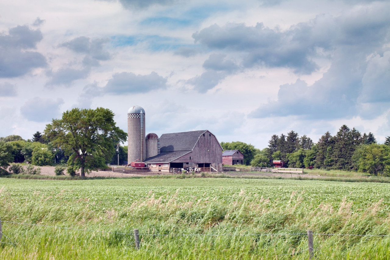
 Barn, rural North Dakota
The official websites
North Dakota

The Peace Garden State
| Location: | North central United States |
| Coordinates: | 47° 30′ N, 100° 30′ W |
| Size: | • 340 km N-S; 580 km E-W • 210 miles N-S; 360 miles E-W |
| Terrain: | Prairie plains rising towards the west |
| Climate: | Continental climate. Hot summers; cold winters; rainfall often sparse. |
| Highest point: | White Butte 1,069 m / 3,508 ft |
| Forest: | 2% (2016) (source) |
| Population: | 762,062 (2019) |
| Population density: | Very low (4/km²) |
| Capital: | Bismarck |
| Languages: | English |
| Human Development Index: | Very High (0.946) |
.jpg)
.jpg)
.jpg)
.jpg)

.jpg)
.jpg)
