.jpg)
.jpg)
.jpg)
.jpg)
.jpg)
The Geography of
Montana
Why visit Montana?
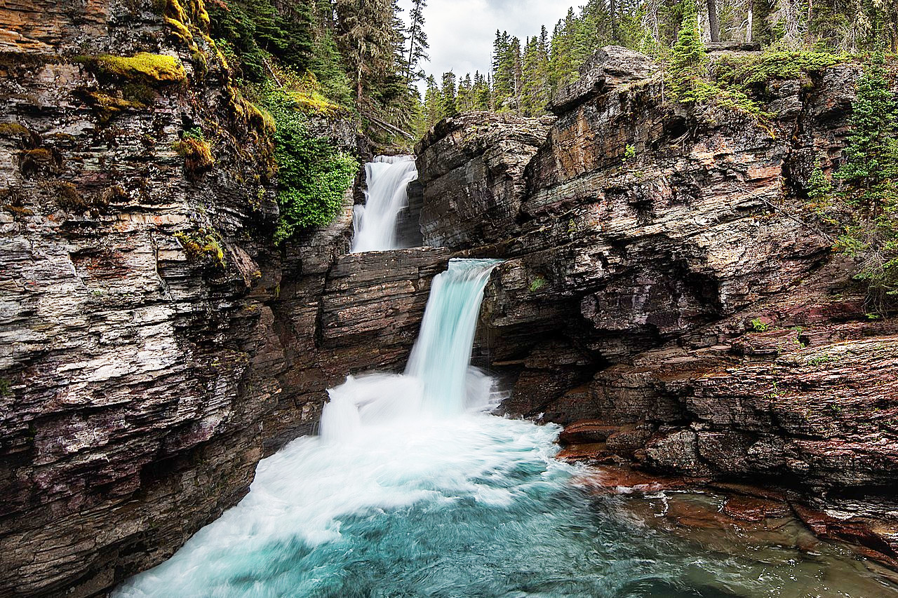
Montana has amazing scenery all throughout the state, from the high mountain ranges in the west to rolling hills and open prairies in central Montana. The Great Falls of the Missouri River are one of Montana's most popular tourist destinations with its dramatic waterfall views. Glacier National Park is another top spot for visitors who love nature and wilderness exploration.
Map
 Relief map of Montana
What is the landscape of Montana like?
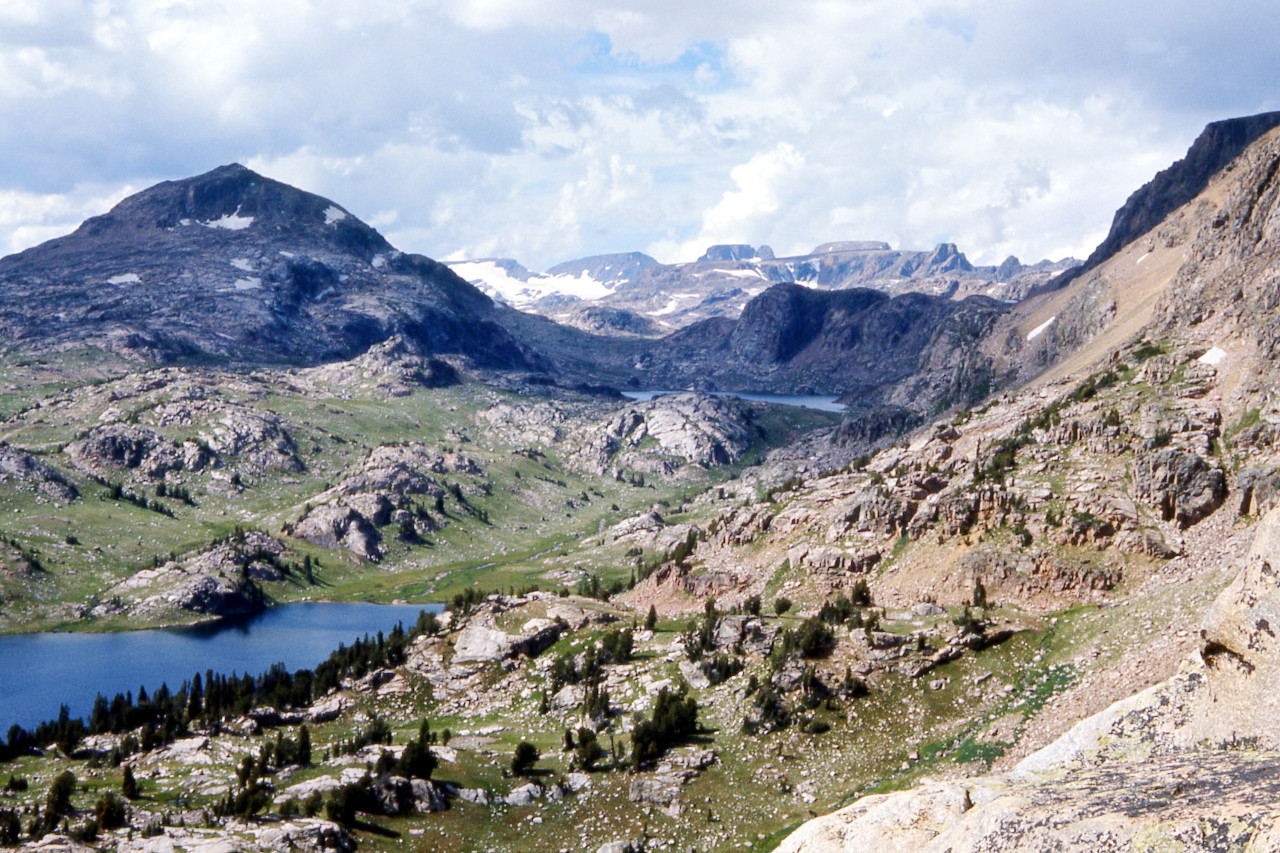
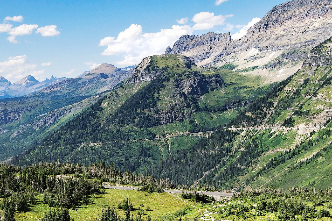
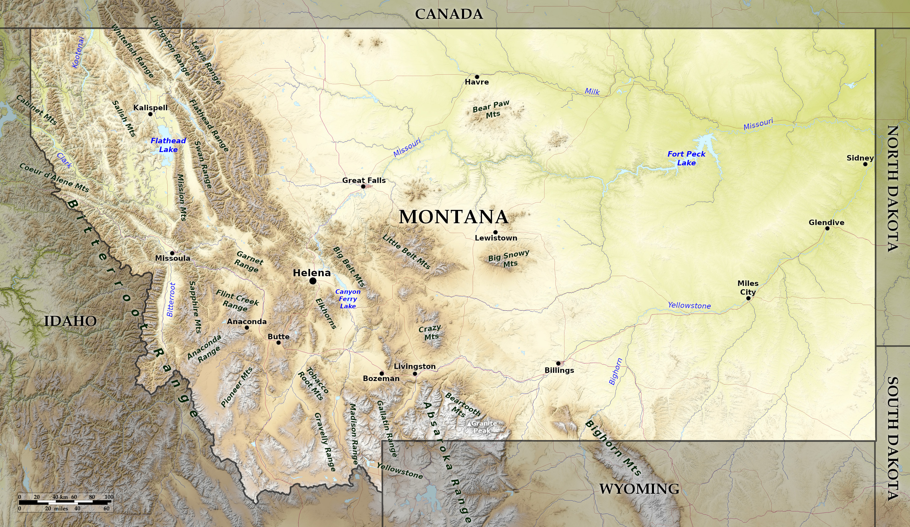
Montana is one of the eight Mountain States that make up the Western United States. It is the fourth-largest state in the United States (after Alaska, Texas, and California). The west is extremely mountainous, with deep and narrow canyons, and, at higher levels, glaciers. Elsewhere the Great Plains slope from the foothills of the mountains to the northeast corner of the state.
Mountains
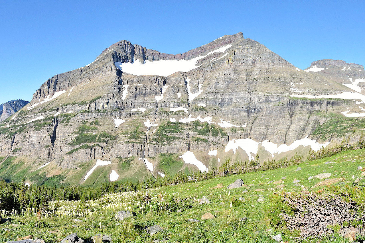
Dominating Montana's landscape are the Rocky Mountains, which run from Alaska to Mexico. The Bitterroot Range, part of the Rocky Mountains follows the boundary line between Montana and Idaho. Deep and narrow canyons are common, and, at higher levels, glaciers carved out amphitheatres, or "cirques" and "U"-shaped troughs. Other major mountain ranges include the Cabinet Mountains, Anaconda Range, Garnet Range, and Sapphire Mountains.
Montana's geology is highly diverse, whether glaciated plain, intermountain basin, mountain foothills, or tableland. Buttes south of Great Falls are major landmarks: Cascade, Crown, Square, Shaw, and Buttes. Montana contains Glacier National Park and parts of Yellowstone National Park. Montana's highest point is Granite Peak, 12,799 feet (3,901 m) above sea level. Between many mountain ranges are several rich river valleys with multiple opportunities for tourism and recreation. The Big Hole Valley, Bitterroot Valley, Gallatin Valley, Flathead Valley, and Paradise Valley are some of the state's most scenic spots.
Great plains
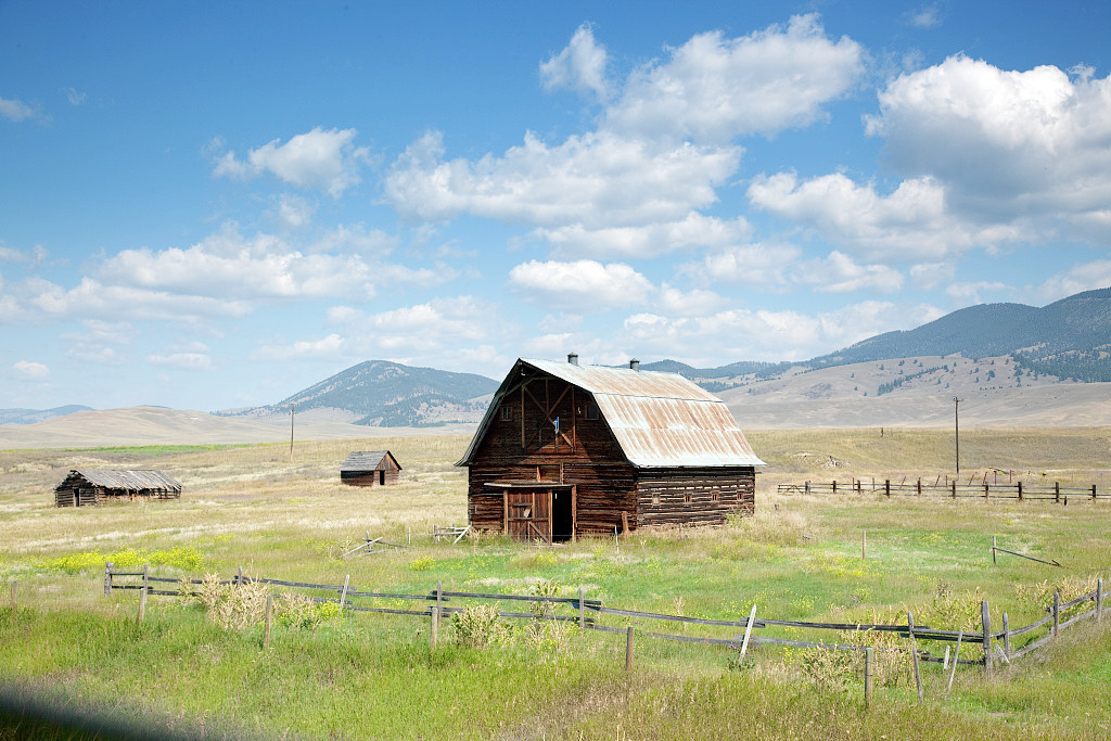
The remainder of the State—about 60 percent—is prairie, part of the northern Great Plains. The eastern plains are dominated by small island mountain ranges and badlands east of the divide. Many of these isolated eastern ranges were created about 120 to 66 million years ago when magma welling up from the interior cracked and bowed the earth's surface here. The Hell Creek Formation in northeast Montana is a major source of dinosaur fossils.
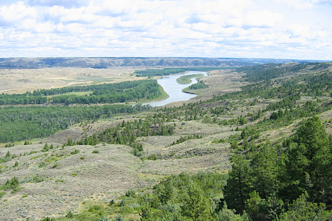
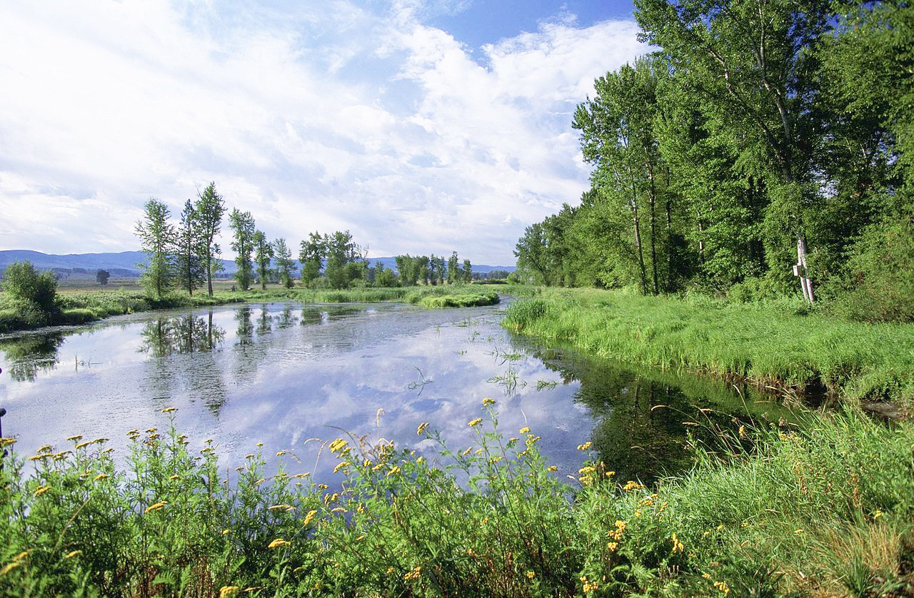
The Missouri river flows 1,300 miles in Montana. Through a great canyon, cut for five miles from 600 to 4,000 feet (180–1,200 m) deep; past Bear Tooth Mountain; by the Long Pool, with its strange, booming noises; over the Great Falls, where, in four separate descents in 15 miles, its waters fall 450 feet (140 m); and through five miles of rapids the Missouri River makes its way. The Yellowstone river, a tributary of the Missouri, rises in the Yellowstone Park in Wyoming, flows northeast across the State through grand canyons and gorges, and enters the Missouri in North Dakota.
What is the nature of Montana like?
Plants
.jpg&oldid=616242527)
.jpg&oldid=503553175)
.jpg&oldid=603797489)
.jpg&oldid=500834672)
.jpg&oldid=610282785)
Forests cover about 25 percent of the state, and trees include ponderosa pine, Douglas fir, larch, spruce, aspen, birch, red cedar, hemlock, ash, alder, rocky mountain maple and cottonwood trees. The Great Plains are covered with bunch grass—which grows in tufts, cacti, and sagebrush species.
Flowers native to Montana include asters, bitterroots, daisies, lupins, poppies, primroses, columbine, lilies, orchids, and dryads. The subalpine region, in the northern Rocky Mountains, is rich in wild flowers during a short midsummer growing season.
What is the climate of Montana like?
Montana has a continental climate, with warm summers and fairly cold winters. Montana is generally dry, although less so on the mountains than on the Great Plains, and subject to sudden changes of temperature.
The west often has a milder climate than the east. In the west the climate is generally delightful, it being greatly affected by the warm, dry "Chinook" wind which blows from the Pacific Ocean. These warm winds may occur in any part of the state, making the air very mild, and melting large quantities of snow in a short time. In the east the winters are often long and very cold, and the summers dry and hot. On the high mountains, snow lies far into the summer.
| Climate data for Helena, Montana (1981–2010) | |||||||||||||
|---|---|---|---|---|---|---|---|---|---|---|---|---|---|
| Month | Jan | Feb | Mar | Apr | May | Jun | Jul | Aug | Sep | Oct | Nov | Dec | Year |
| Average high °F (°C) | 33.3 (0.7) | 38.6 (3.7) | 48.2 (9.0) | 57.8 (14.3) | 67.1 (19.5) | 75.7 (24.3) | 85.7 (29.8) | 84.5 (29.2) | 72.6 (22.6) | 58.7 (14.8) | 43.1 (6.2) | 31.7 (−0.2) | 58.1 (14.5) |
| Daily mean °F (°C) | 23.2 (−4.9) | 27.8 (−2.3) | 36.3 (2.4) | 45.0 (7.2) | 54.0 (12.2) | 62.1 (16.7) | 70.0 (21.1) | 68.4 (20.2) | 57.9 (14.4) | 45.6 (7.6) | 32.6 (0.3) | 21.8 (−5.7) | 45.4 (7.4) |
| Average low °F (°C) | 13.0 (−10.6) | 16.9 (−8.4) | 24.3 (−4.3) | 32.1 (0.1) | 40.8 (4.9) | 48.5 (9.2) | 54.3 (12.4) | 52.2 (11.2) | 43.1 (6.2) | 32.5 (0.3) | 22.0 (−5.6) | 11.9 (−11.2) | 32.6 (0.3) |
| Average precipitation inches (mm) | 0.36 (9.1) | 0.30 (7.6) | 0.59 (15) | 0.98 (25) | 1.87 (47) | 2.06 (52) | 1.19 (30) | 1.20 (30) | 1.10 (28) | 0.68 (17) | 0.49 (12) | 0.40 (10) | 11.22 (285) |
| Average snowfall inches (cm) | 6.2 (16) | 5.0 (13) | 6.2 (16) | 3.7 (9.4) | 0.9 (2.3) | 0.0 (0.0) | 0.0 (0.0) | 0.3 (0.76) | 1.3 (3.3) | 2.4 (6.1) | 4.8 (12) | 7.3 (19) | 38.1 (97) |
| Source: NOAA | |||||||||||||
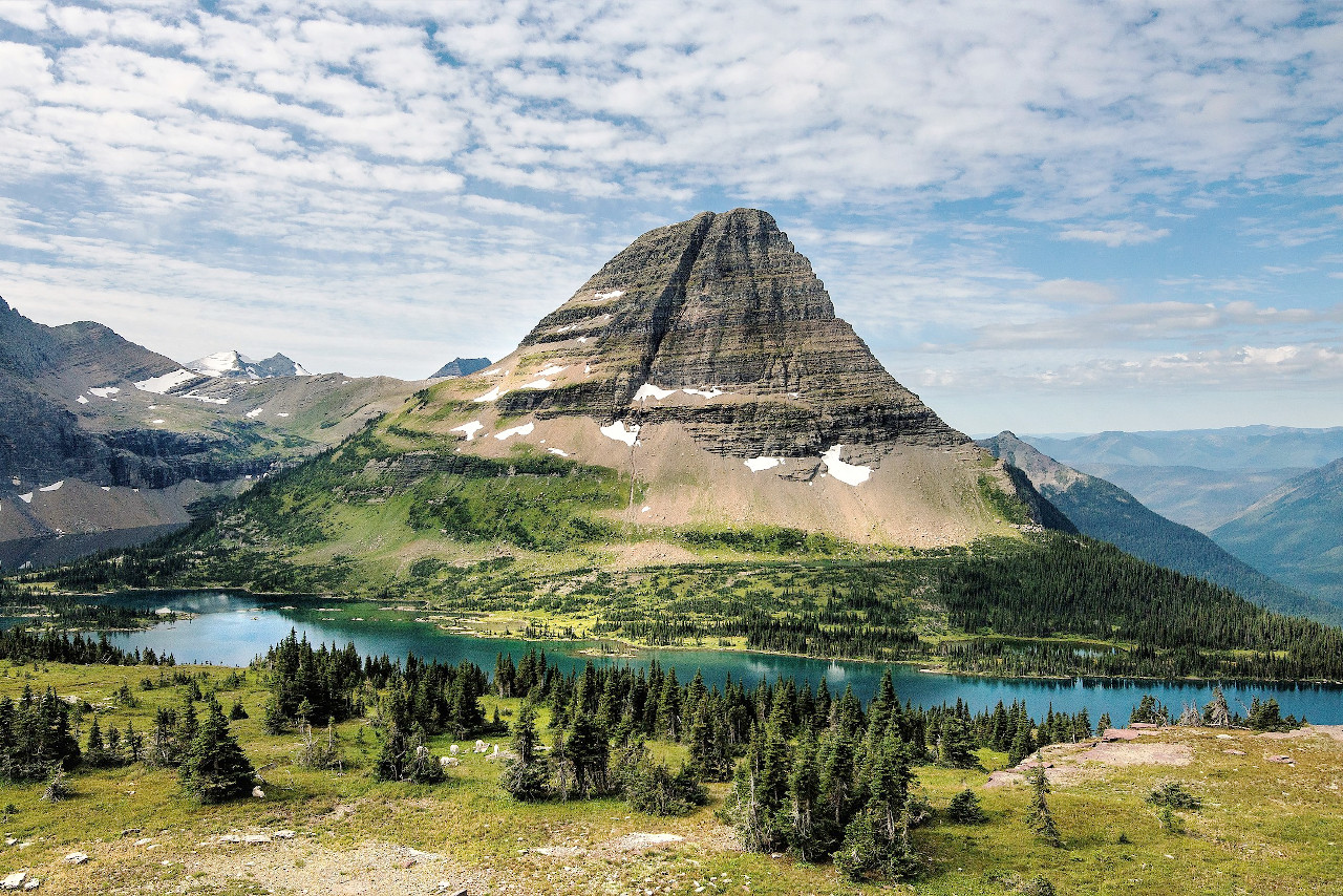 Bearhat Mountain, Glacier National Park
The official websites
Montana
The Treasure State
| Location: | Northwestern United States |
| Coordinates: | 47° 00′ N, 109° 45′ W |
| Size: | • 505 km N-S; 920 km E-W • 315 miles N-S; 570 miles E-W |
| Terrain: | Mountainous in the west. Gently rolling plains occupy the center and east |
| Climate: | Continental climate. Warm summers; cooler in the high mountain areas. Harsh winters especially in the west. |
| Highest point: | Granite Peak 3,904 m / 12,807 ft |
| Forest: | 27% (2016) (source) |
| Population: | 1,068,778 (2019) |
| Population density: | Very Low (3/km²) |
| Capital: | Helena |
| Languages: | English |
| Human Development Index: | Very High (0.921) |