
.jpg)
The Geography of
Oklahoma
Why visit Oklahoma?
Oklahoma has a vast and varied landscape, from rolling hills to high plains and richly fertile land that dips and rises. It also features plenty of rivers and creeks meandering through the land. Oklahoma's diverse topography includes the Ouachita and Ozark mountain ranges, and gives rise to many different ecosystems—grasslands, woodlands, wetlands, forests—that support an abundance of wildlife.
Contents
Map
 Relief map of Oklahoma
What is the landscape of Oklahoma like?
.jpg)
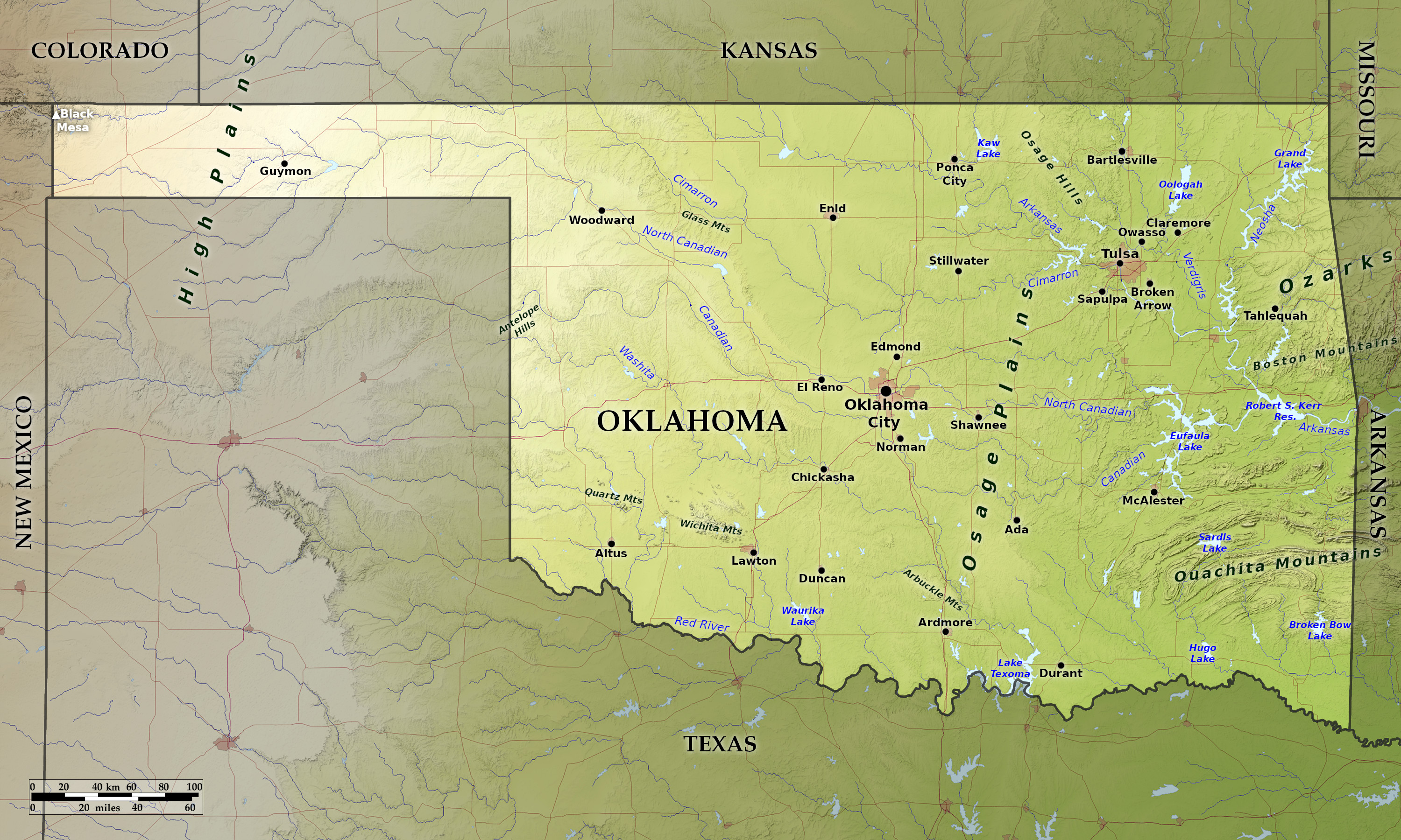
The landscape of Oklahoma varies from wide treeless plains in the west to rugged and heavily wooded mountains in the east. In general, it may be described as a vast rolling plain having a gentle southern and eastern slope. The height above sea-level ranges from 4,700 feet (1,400 m) in the extreme northwest to about 350 feet (100 m) in the southeast.
East
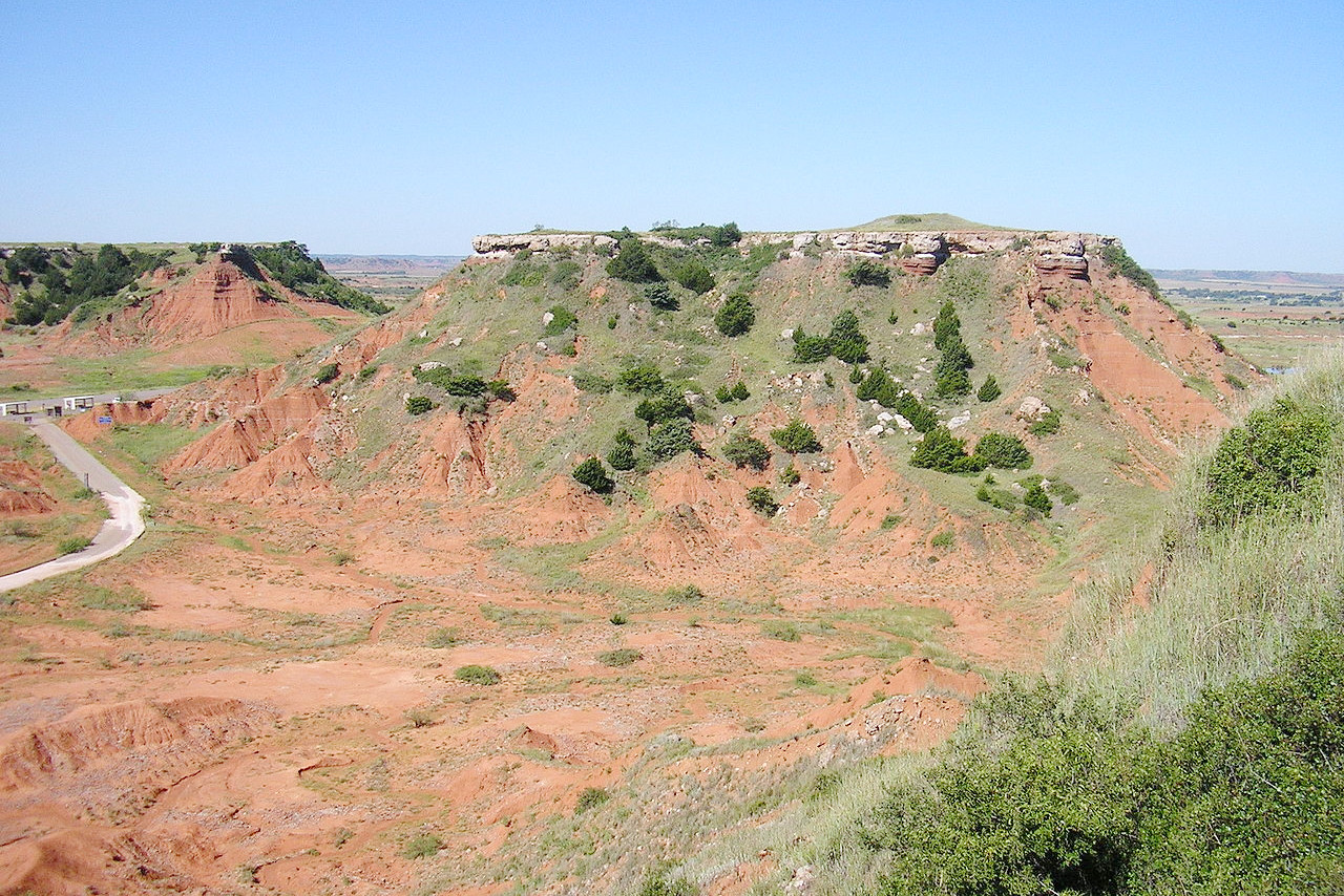
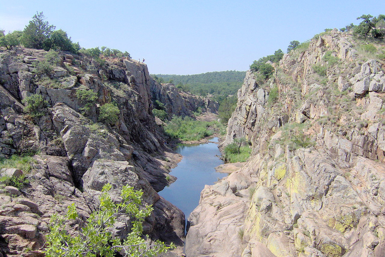
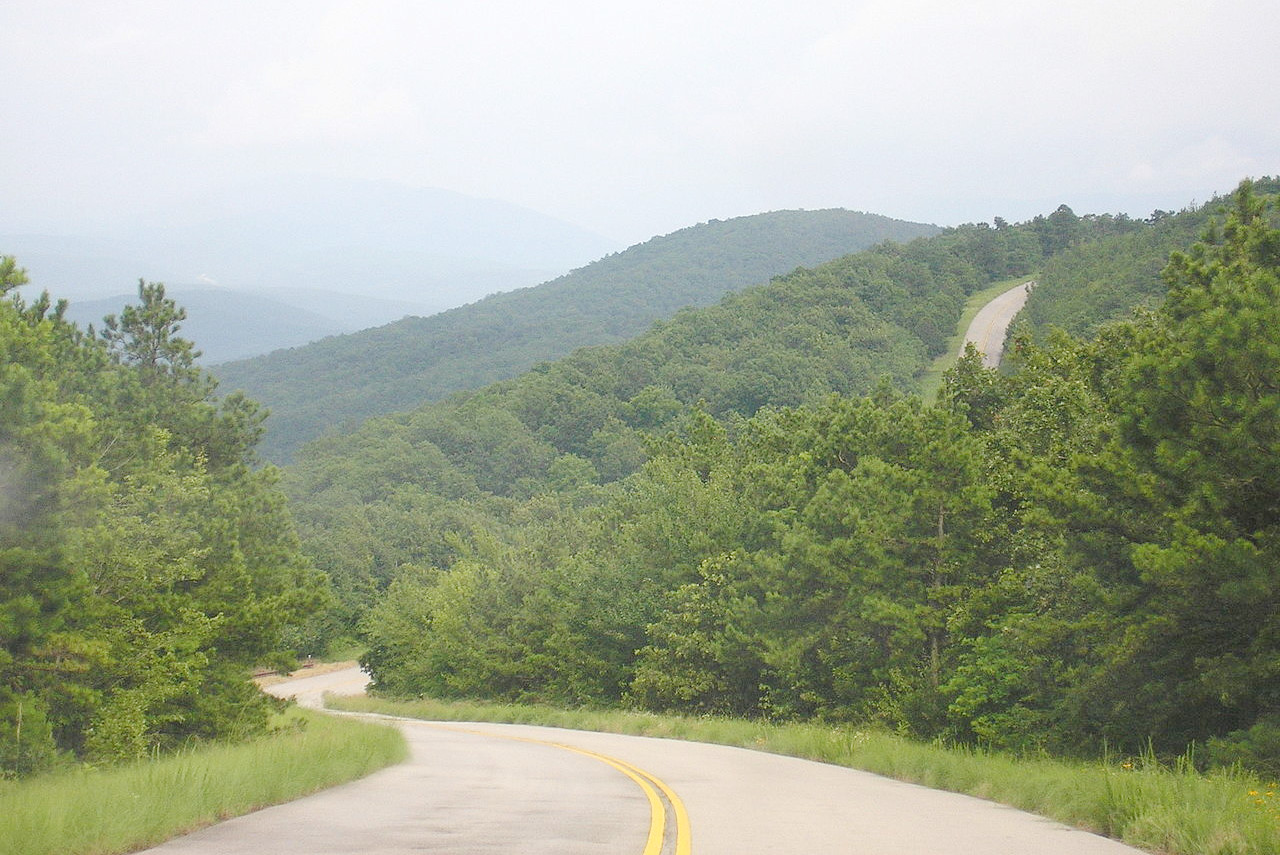
Eastern Oklahoma is hilly woodland. On the eastern border, the western parts of the Ozark Mountains of Arkansas enter the State, and extend westward in a chain of hills gradually decreasing in height. The other major hill range are the the Ouachitas also extending from Arkansas; they have long, low ridges heading generally west-to-east, with wide, flat valleys. Elsewhere, the prairies in northeast Oklahoma are deeply carved by small rivers, and in the western part of this area the rocks have been carved into small canyons, buttes and mesas.
Center
In the south central part of the state is an elevated tableland known as the Arbuckle Mountains. In its western portion this tableland lies about 400 feet (120 m) above the surrounding plains. Sixty miles northwest of this plateau lie the Wichita Mountains, a straggling range of rugged peaks rising abruptly from a level plain. The highest peaks are not more than 1,500 feet (450 m) above the plain, but on account of their steep and rugged slopes they are difficult to ascend. Another group of hills, the Glass Mountains, runs almost parallel with the North Fork of the Canadian river.
West
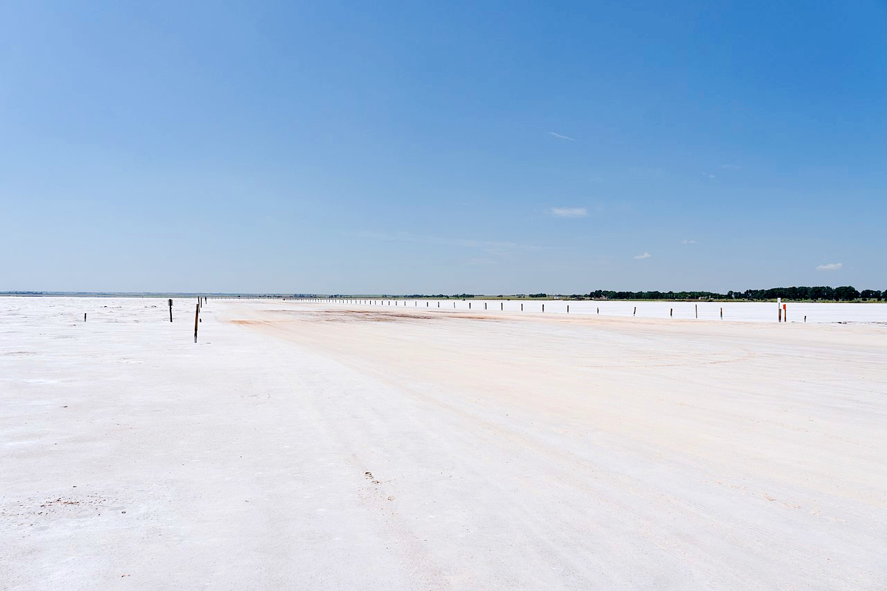
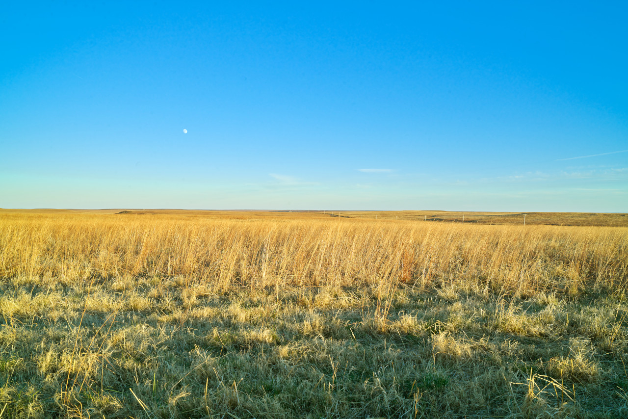
With the exception of these isolated clusters of hills the western portion of the state consists almost entirely of rolling prairie. Large salt flats with snowy-white saline crystals form a striking physical feature on some of the rivers. For example, along the Cimarron river, in Woodward County, the salt flats, around 1 mile wide, extend along the river for 8 miles. The extreme northwestern part of Oklahoma is a lofty tableland forming part of the Great Plains.
What is the nature of Oklahoma like?
.jpg)
.jpg&oldid=567826264)
.jpg&oldid=674968377)
.jpg&oldid=674968730)
The most densely wooded parts of Oklahoma are in the hills of the extreme east; among the prairies of the west, trees are seldom found beyond the banks of rivers. The most common trees are the various species of the oak and cedar. The pine is confined to the more mountainous sections of the east, and the black walnut is found among the river bottom lands. Other varieties widely distributed are the ash, pecan, cottonwood, sycamore, elm, maple, hickory, elder, gum, locust and river birch. The prairies are covered with bunch, grama and dropseed grasses; In the extreme northwest the cactus, sagebrush and yucca, types characteristic of more arid regions, are found.
The flowers of eastern Oklahoma are astonishing in their variety and luxuriance. The violet, columbine, and Dutchman's breeches grow there, and the serviceberry whitens rocky hillsides with its early bloom. The dogwood, linden and redbud expand their dream-like clouds of pink and white from lowland to upland. There are growths of holly a hundred acres in extent, with their perennial green.
The plains country throughout the spring, summer and fall, is a constantly changing panorama of flowering forms. The prairie rose crawls about over the ground; mimosas with their delicate lavender-pink flowers; evening primroses occur everywhere in season: buffalo beans, purple or yellow, are conspicuously attractive plants. The tall spikes of the creamy white bell-like flowers of the yucca stand out here and there in the arid regions, while the rosy blossoms of the prickly pear that sprawls ungracefully over the ground are worthy a far better setting. In the fall the composites in all shades and colors and shapes cover the landscape.
What is the climate of Oklahoma like?
Oklahoma has a continental climate, with great ranges of temperature and a rainfall across the year. The winter however is short and mild, the temperature normally being near freezing-point, though sometimes subject to sudden cold waves. Likewise summers are warm with occasional heat waves. The western and central portions of the state are in general cooler and dryer than the east, on account of their greater height and greater distance from the Gulf Coast.
| Climate data for Oklahoma City (1991−2020) | |||||||||||||
|---|---|---|---|---|---|---|---|---|---|---|---|---|---|
| Month | Jan | Feb | Mar | Apr | May | Jun | Jul | Aug | Sep | Oct | Nov | Dec | Year |
| Average high °F (°C) | 49.3 (9.6) | 53.8 (12.1) | 62.9 (17.2) | 71.1 (21.7) | 78.9 (26.1) | 87.5 (30.8) | 93.1 (33.9) | 92.2 (33.4) | 83.9 (28.8) | 72.8 (22.7) | 60.7 (15.9) | 50.4 (10.2) | 71.4 (21.9) |
| Daily mean °F (°C) | 38.2 (3.4) | 42.3 (5.7) | 51.2 (10.7) | 59.3 (15.1) | 68.2 (20.1) | 76.9 (24.9) | 81.7 (27.6) | 80.7 (27.0) | 72.7 (22.6) | 61.1 (16.2) | 49.2 (9.6) | 40.0 (4.4) | 60.1 (15.6) |
| Average low °F (°C) | 27.0 (−2.8) | 30.8 (−0.7) | 39.5 (4.2) | 47.5 (8.6) | 57.6 (14.2) | 66.2 (19.0) | 70.3 (21.3) | 69.1 (20.6) | 61.5 (16.4) | 49.4 (9.7) | 37.7 (3.2) | 29.5 (−1.4) | 48.8 (9.3) |
| Average precipitation inches (mm) | 1.32 (34) | 1.42 (36) | 2.55 (65) | 3.60 (91) | 5.31 (135) | 4.49 (114) | 3.59 (91) | 3.60 (91) | 3.72 (94) | 3.32 (84) | 1.68 (43) | 1.79 (45) | 36.39 (924) |
| Average snowfall inches (cm) | 1.8 (4.6) | 1.8 (4.6) | 0.8 (2.0) | 0 (0) | 0 (0) | 0 (0) | 0 (0) | 0 (0) | 0 (0) | 0 (0) | 0.5 (1.3) | 1.8 (4.6) | 6.7 (17) |
| Source: NOAA | |||||||||||||
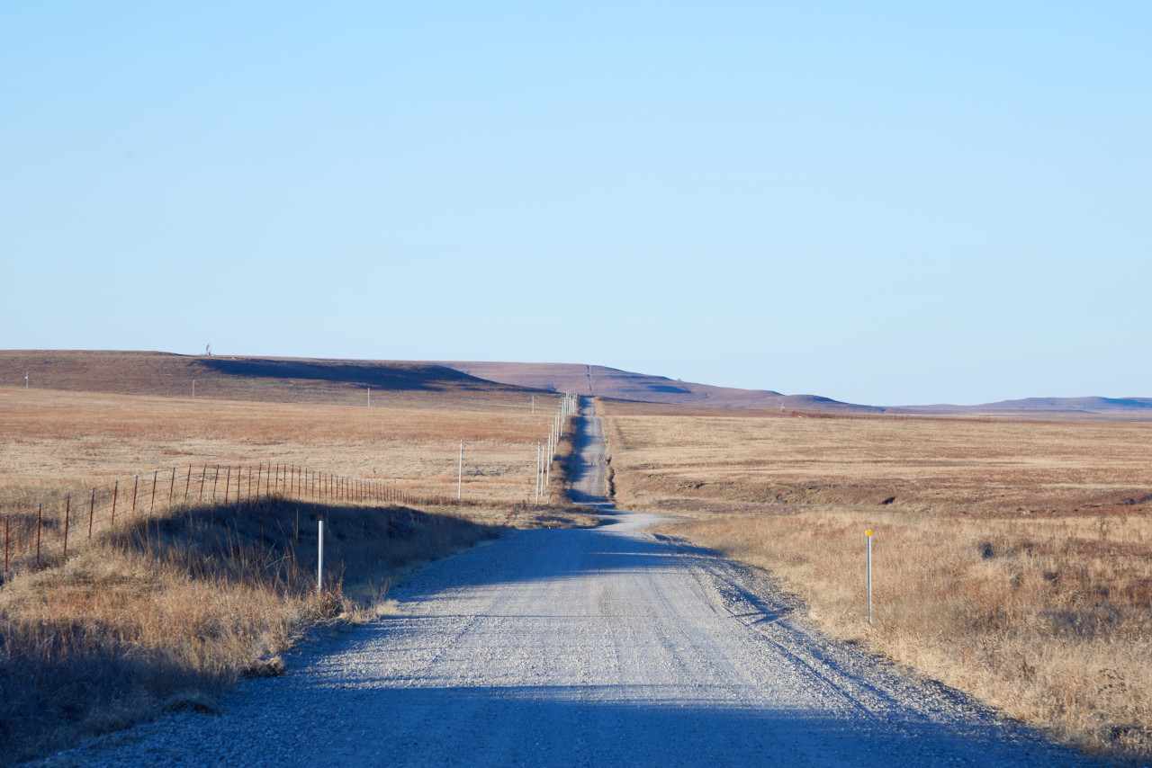 Gravel road through the Joseph H. Williams Tallgrass Prairie Preserve
The official websites
Oklahoma
The Sooner State
| Location: | South-central United States |
| Coordinates: | 35° 30′ N, 98° 15′ W |
| Size: | • 370 km N-S; 745 km E-W • 230 miles N-S; 465 miles E-W |
| Terrain: | High Plains in the west and center. Hills and mountains in the east |
| Climate: | Continental climate. Dry and sunny with hot summers and cold winters |
| Highest point: | Black Mesa 1,516 m / 4,973 ft |
| Forest: | 29% (2016) (source) |
| Population: | 3,963,516 (2020) |
| Population density: | Low (21/km²) |
| Capital: | Oklahoma City |
| Languages: | English |
| Human Development Index: | Very High (0.901) |