The Geography of
Oregon
Why visit Oregon?
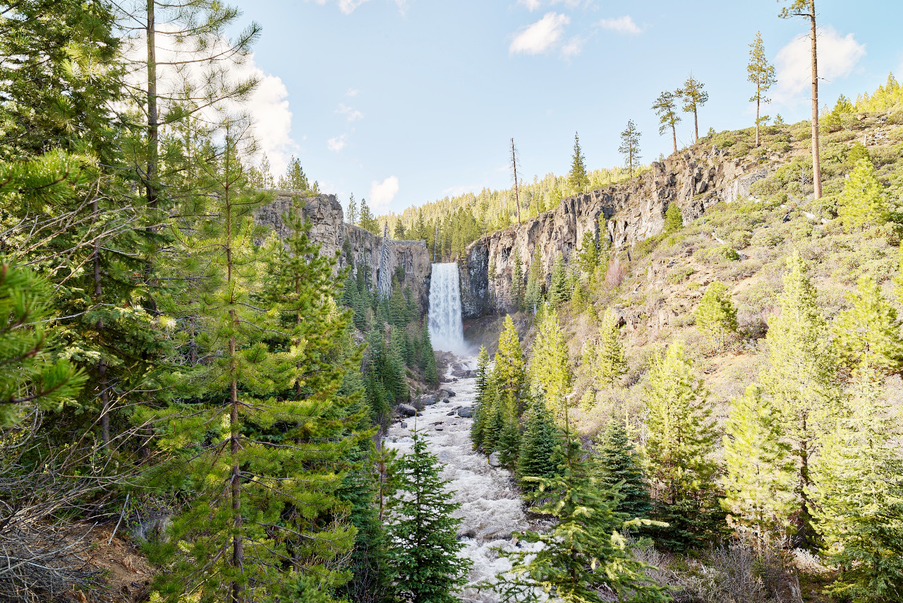
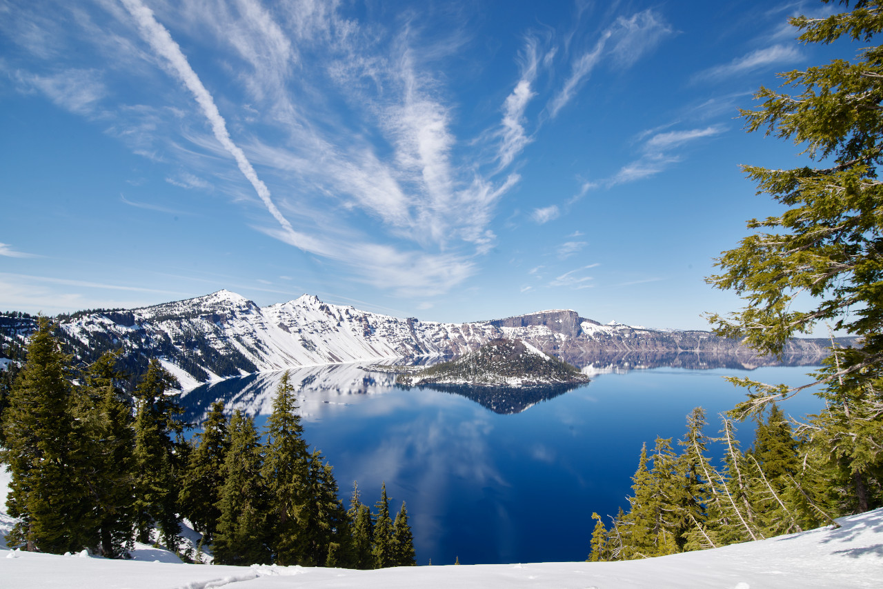
Oregon has spectacular scenery, from the misty forest near the Pacific to the snow-capped mountains to the high desert areas. The mountains include the Coast and Cascade ranges, where can be found Crater Lake, the deepest lake in the United States. The Pacific coast even has vast sand dunes. Everything is beautiful in Oregon.
Map
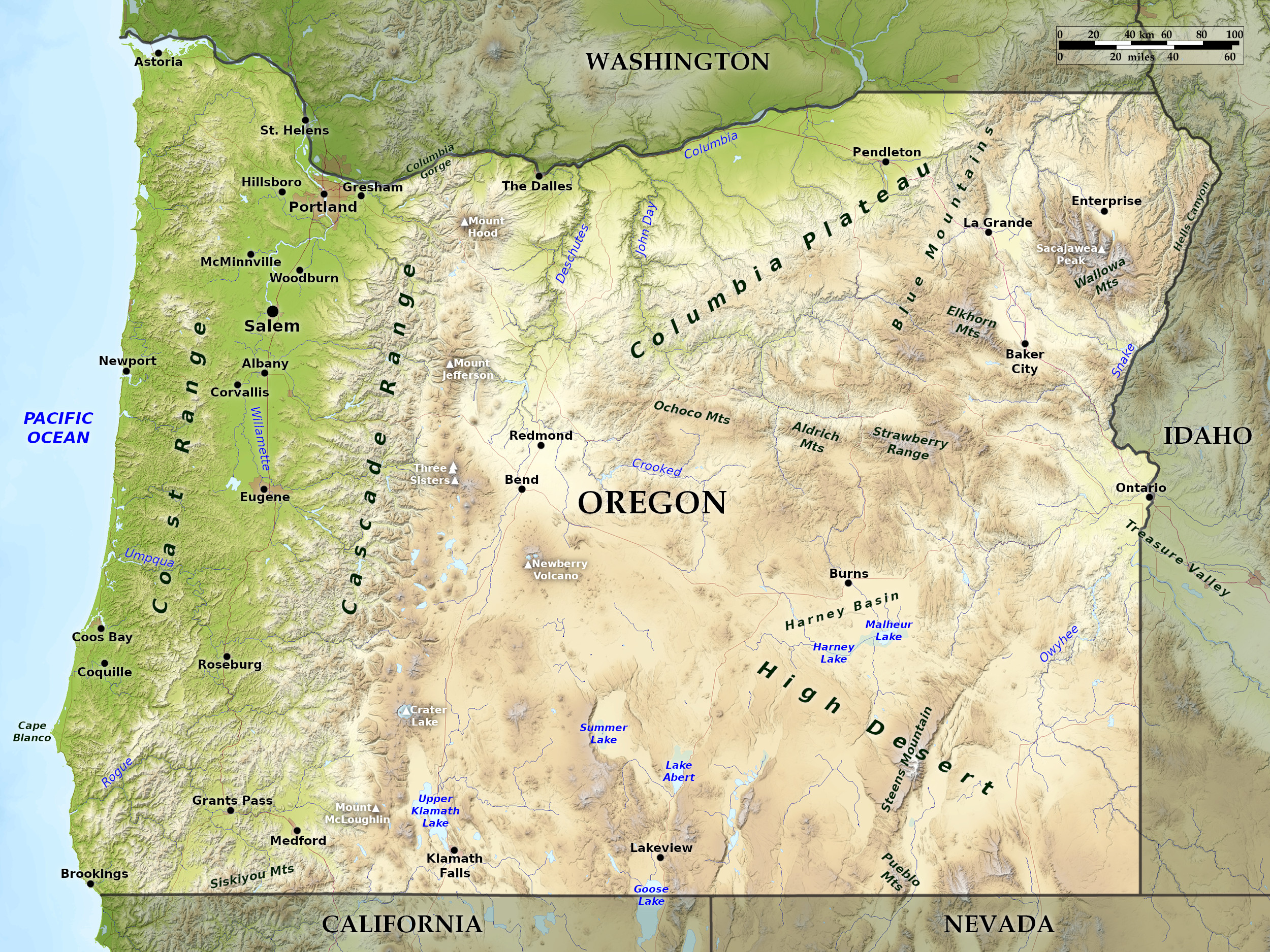 Relief map of Oregon
What is the landscape of Oregon like?
Coast
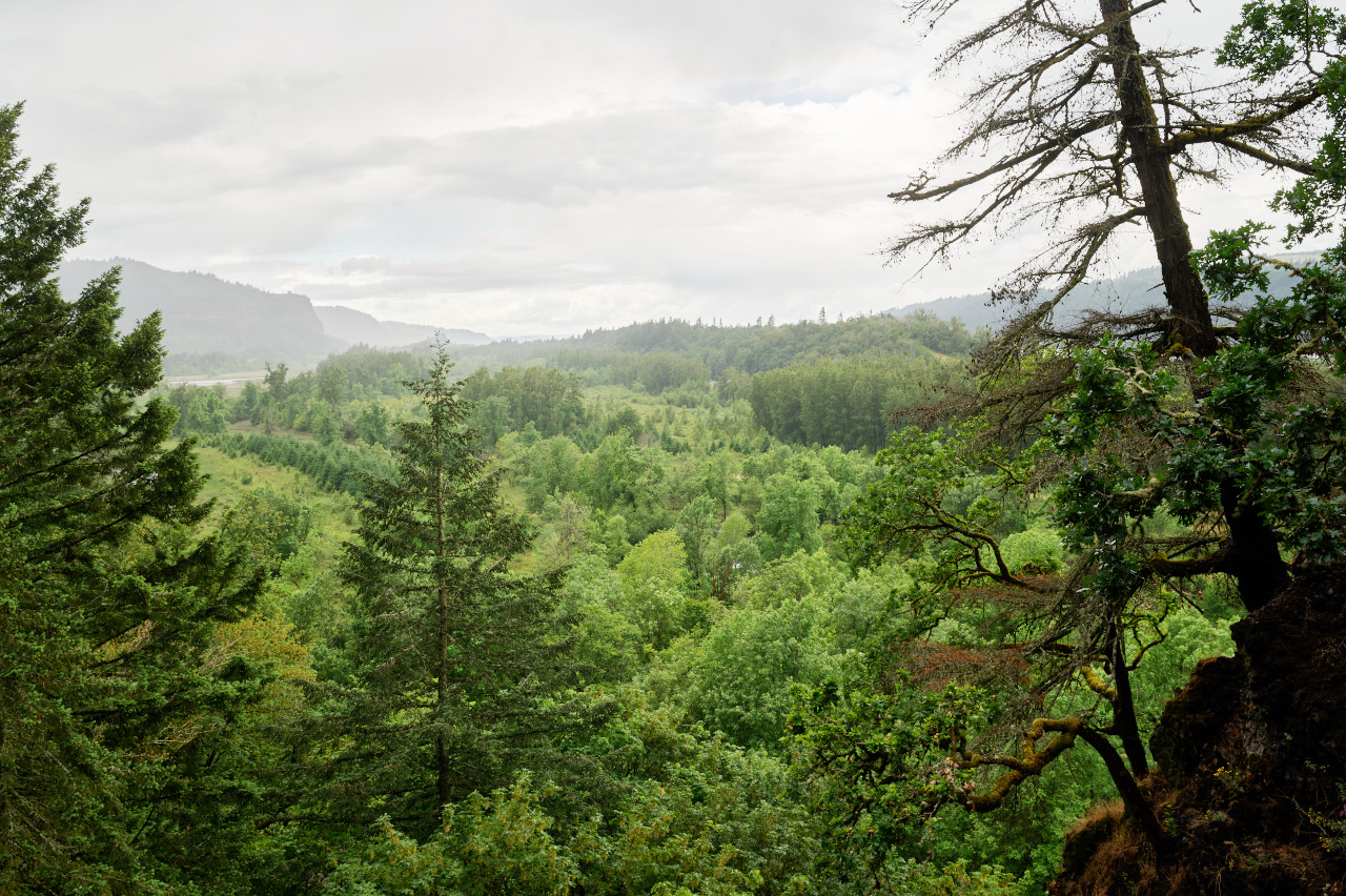
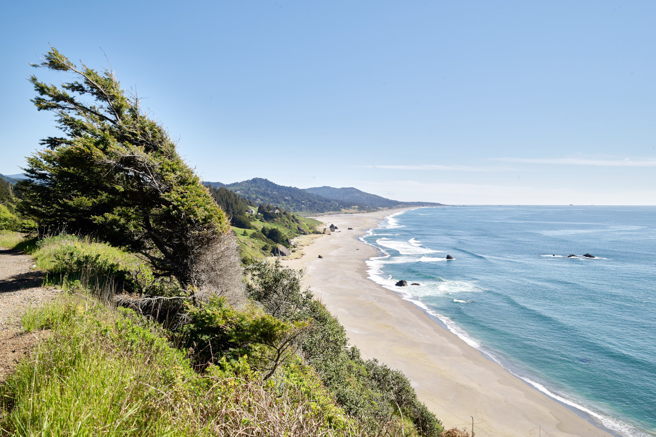
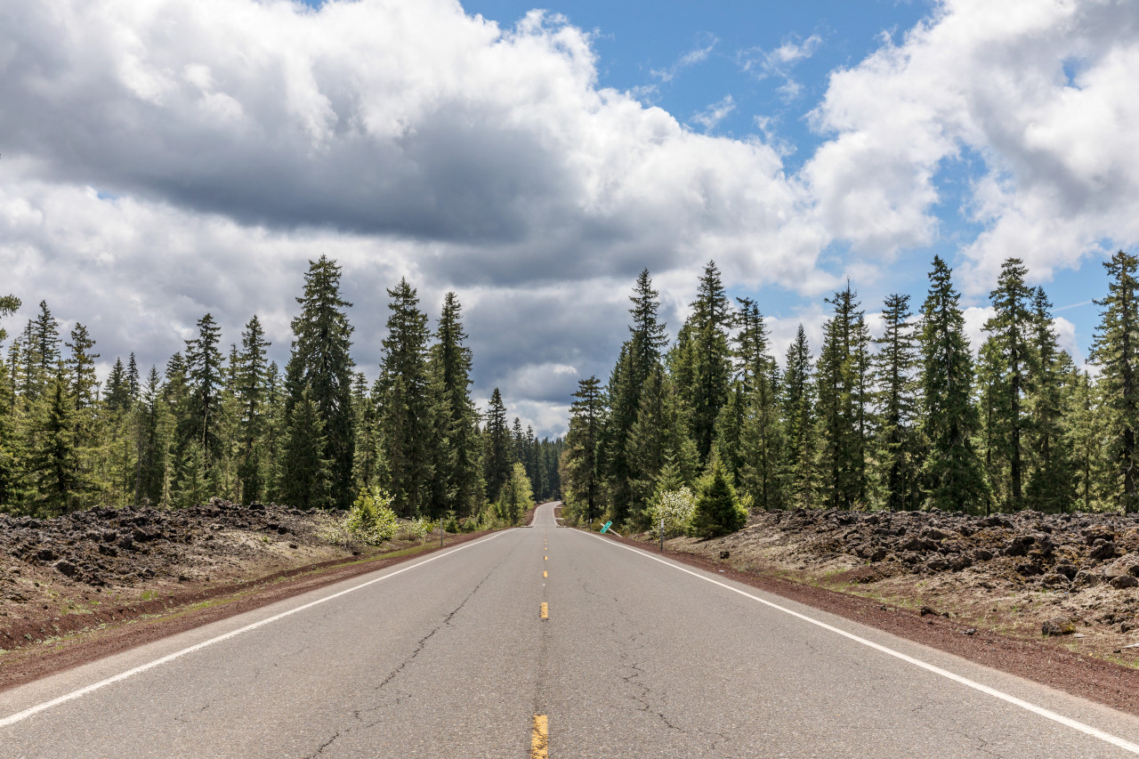
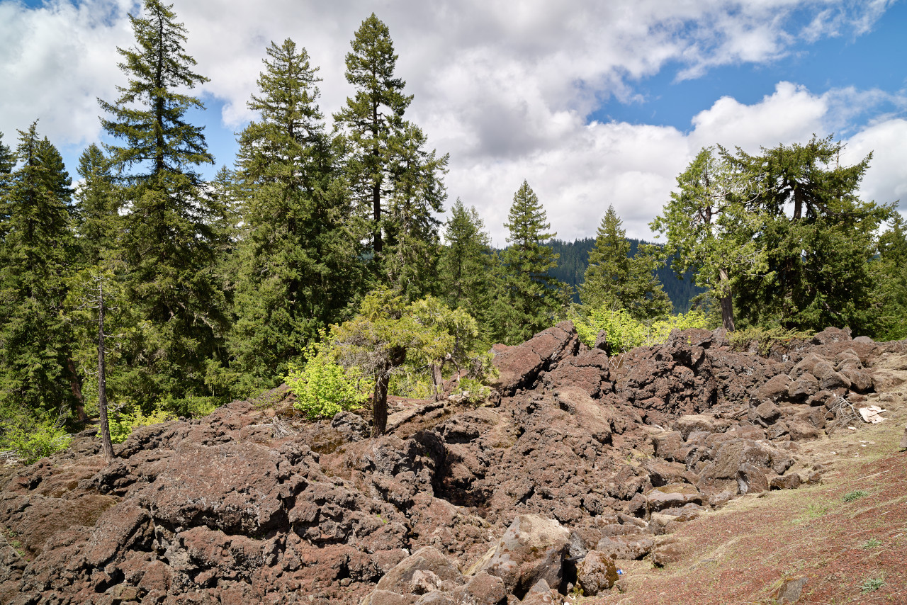
The coast of Oregon is about 300 miles long, and consists of long stretches of sandy beach broken occasionally by spurs of the Coast Range, which forms high rocky headlands. The Coast Range is an irregular chain of hills which runs parallel with the coast about 20 miles inland. In southern Oregon the general height of this range is greater than in the north, but the individual peaks are less prominent, and the range in some respects resembles a plateau. Its western slope is generally longer and more gentle than the eastern.
The Coast Range is bordered to the east by the Willamette Valley, a region about 200 miles long and about 30 miles wide, and the most densely populated portion of the State. In the south the Klamath Mountains separate southern Oregon from northern California. A number of spurs, such as the Siskiyou Mountains, belong to this group.
The most important river of Oregon is the Columbia river, which forms the northern border with Washington for 300 miles. About 160 miles from its mouth is the Columbia Gorge where the river crosses the Cascade Mountains through a canyon 6 miles long and nearly 1 miles deep.
Cascade Range
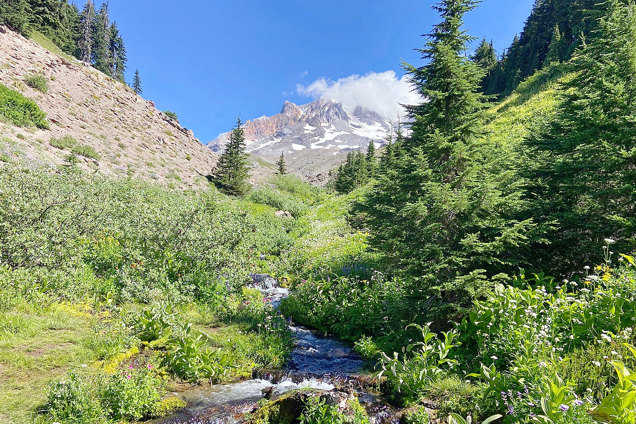
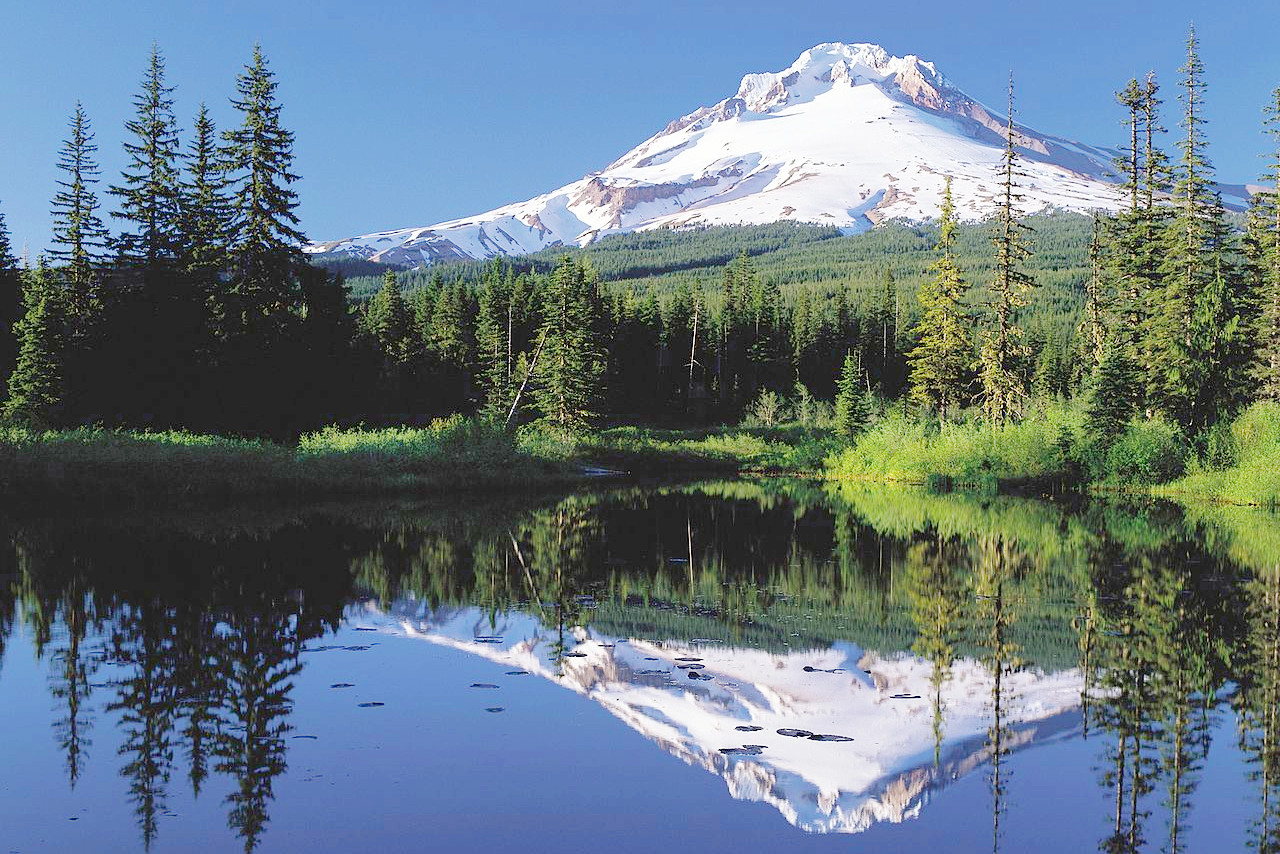
The Cascade Mountains are the most important range in Oregon. These run parallel with the coastabout 100 miles inland. The Cascade Mountains divide Oregon into two sharply contrasted parts. West of this range the country is humid and densely wooded; east of the range it consists of arid or semiarid tableland. The peaks of this system are much higher than those of the Coast Range, varying from 5,000 to 11,000 feet (1,500–3,350 m), and the highest of them are cones of extinct volcanoes. Mount Hood (11,225 feet), which is the highest point in the state, Mount Jefferson (10,200 feet), the Three Sister Peaks, Mount Adams, Bachelor Mountain, and Diamond Peak (8807 feet) all have one or more glaciers on their sides.
Eastern Oregon
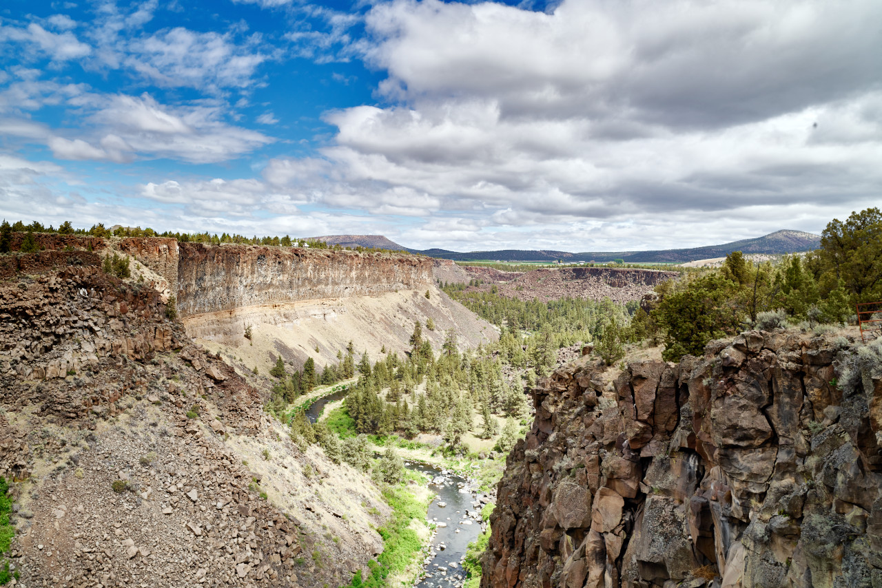
Eastern Oregon is rugged and mountainous. In the northeastern part of this plateau lie the Blue Mountains, which have an average height of about 6,000 feet (1,800 m) and decline gradually toward the north. The region south of these mountains is part of the Great Basin region—in Oregon this area extends north from the Nevada border. None of its rivers reaches the sea, but all lose their waters by seepage or evaporation. Many of the mountains consist of great faulted crust blocks. One face of these mountains is usually in the form of a steep cliff, while the other has a very gradual slope. Between these ridges lie almost level valleys. During the wet season the valleys often contain ephemeral lakes, whose waters on evaporating leave a playa, or mud flat, often covered with an alkaline crust of snowy whiteness.
The greatest level, or approximately level, area is the so-called High Desert, a region around 150 miles in diameter. Its surface consists of a thick sheet of sand and dust from which arise occasional buttes and mesas. The most prominent mountains in the High Desert are the Steens Mountains in the southeast which attain an altitude of about 9,000 feet (2,700 m) above sea-level and 5,000 feet (1,500 m) above Alvord Valley which lies along the eastern base. This range has deep canyons in its sides and it bears evidence of previous glaciers. To the east the hills are deeply sculpted and the valleys much carved by rivers which often flow through deep canyons.
Snake River marks the border between Oregon and Idaho for nearly 200 miles. It flows through Hells Canyon which is from 2,000 to 5,000 feet (600–1500 m) deep with steep walls. The powerful erosion has often caused the columnar black basalt to assume weird and fantastic shapes.
There are many lakes in Southern Oregon. Some like Malheur Lake and nearby Harney Lake are alkaline, frequently becoming a playa or mud flat in the summer months. In Lake county are several large bodies of water—Lake Abert, Warner Lake, Summer Lake, and Goose Lake (which lies partly in California). In Klamath county is the famous Crater Lake. This lake lies in a great pit or caldera rising 2,000 feet (600 m) above the surrounding country. It is around 5 miles wide and surrounded by walls of rock from 500 to 2,000 feet (150–600 m) high.
What is the nature of Oregon like?
.jpg)
.jpg&oldid=626815173)
Western Oregon, from the coast to the Cascade Mountains, is heavily wooded, and the most important tree is the Coast Douglas-fir, commonly called Oregon pine, which sometimes grows to a height of 300 feet (90 m), and which was formerly in great demand for masts and spars of sailing-vessels and for bridge timber. Cedar and hemlock are also present, and there are smaller amounts of sugar pine, yellow pine, red fir and silver fir and spruce. Among the hardwoods are the oak, ash, maple, mountain mahogany, aspen, cottonwood and balsam.
Trees are also found on the Blue Mountains in the northeast and on a number of mountains in the central and southeastern parts of the State. East of the Cascades the forests consist for the most part of yellow pine, but the valleys are usually treeless, save for a few willows and cottonwoods in the vicinity of streams. Over the greater part of this region the sagebrush is the most common plant, and it imparts to the landscape a greyish tint characteristic of the arid regions of the western United States.
What is the climate of Oregon like?
Perhaps no other American state has such great local variations in its climate as has Oregon. Along the coast the climate is humid, mild and uniform, wheras the in eastern two-thirds the climate is dry and marked by great daily and annual ranges of temperature. West of the Cascade mountains the climate is maritime. The temperatures along the coast are never scorching hot in summer, nor freezing in winter. Inland though, between the Coast Range and the Cascade Mountains heat waves and cold snaps do occur.
East of the Cascades Range the climate is continental, with much greater ranges of temperature than in the west. Rain, which can be heavy along the coast, diminishes further east, and the extreme southeastern part of the State is very arid. Rainfall for most of Oregon is concentrated in the winter months from October to March, and summers are very dry and are accompanied by cloudless skies.
| Climate data for Eugene, Oregon (1981–2010) | |||||||||||||
|---|---|---|---|---|---|---|---|---|---|---|---|---|---|
| Month | Jan | Feb | Mar | Apr | May | Jun | Jul | Aug | Sep | Oct | Nov | Dec | Year |
| Average high °F (°C) | 47.2 (8.4) | 51.1 (10.6) | 56.2 (13.4) | 60.8 (16.0) | 67.0 (19.4) | 73.2 (22.9) | 82.3 (27.9) | 82.8 (28.2) | 76.9 (24.9) | 64.2 (17.9) | 52.2 (11.2) | 45.6 (7.6) | 63.4 (17.4) |
| Daily mean °F (°C) | 40.7 (4.8) | 42.9 (6.1) | 46.7 (8.2) | 50.2 (10.1) | 55.3 (12.9) | 60.4 (15.8) | 66.8 (19.3) | 66.9 (19.4) | 61.9 (16.6) | 52.7 (11.5) | 44.9 (7.2) | 39.7 (4.3) | 52.4 (11.4) |
| Average low °F (°C) | 34.2 (1.2) | 34.8 (1.6) | 37.1 (2.8) | 39.5 (4.2) | 43.5 (6.4) | 47.6 (8.7) | 51.4 (10.8) | 51.1 (10.6) | 47.0 (8.3) | 41.2 (5.1) | 37.6 (3.1) | 33.8 (1.0) | 41.6 (5.3) |
| Average precipitation inches (mm) | 6.87 (174) | 5.43 (138) | 4.99 (127) | 3.33 (85) | 2.74 (70) | 1.50 (38) | 0.54 (14) | 0.61 (15) | 1.29 (33) | 3.25 (83) | 7.72 (196) | 7.83 (199) | 46.10 (1,171) |
| Average snowfall inches (cm) | 0.8 (2.0) | 2.4 (6.1) | trace | 0 (0) | 0 (0) | 0 (0) | 0 (0) | 0 (0) | 0 (0) | 0 (0) | 0.2 (0.51) | 1.5 (3.8) | 4.9 (12) |
| Source: NOAA | |||||||||||||
.jpg) Donner und Blitzen River, Steens Mountain Wilderness
Donner und Blitzen River, Steens Mountain Wilderness
.jpg&oldid=514597128)
The official websites
Oregon
The Beaver State
| Location: | Northwestern United States |
| Coordinates: | 44° 00′ N, 120° 45′ W |
| Size: | • 475 km N-S; 635 km E-W • 295 miles N-S; 395 miles E-W |
| Terrain: | Ranges of mountains in the west with fertile valleys. Arid plateau in the east with rolling hills rising to mountains in the northeast |
| Climate: | Temperate climate. The west has mild temperatures with rain; and the east is dry with more extreme temperatures |
| Highest point: | Mount Hood 3,429 m / 11,249 ft |
| Forest: | 49% (2016) (source) |
| Population: | 4,237,256 (2020) |
| Population density: | Low (15/km²) |
| Capital: | Salem |
| Languages: | English |
| Human Development Index: | Very High (0.936) |