The Geography of
Zimbabwe
Why visit Zimbabwe?
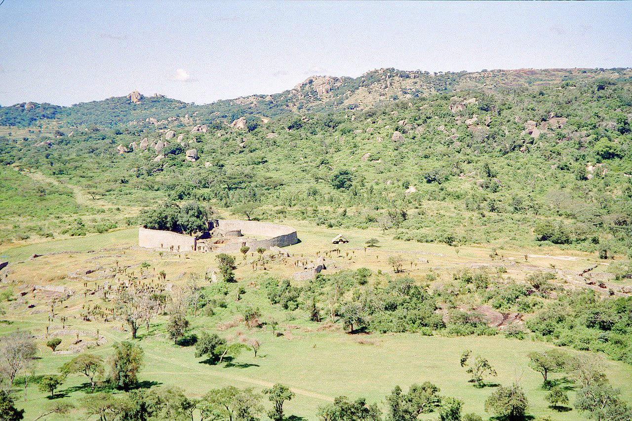
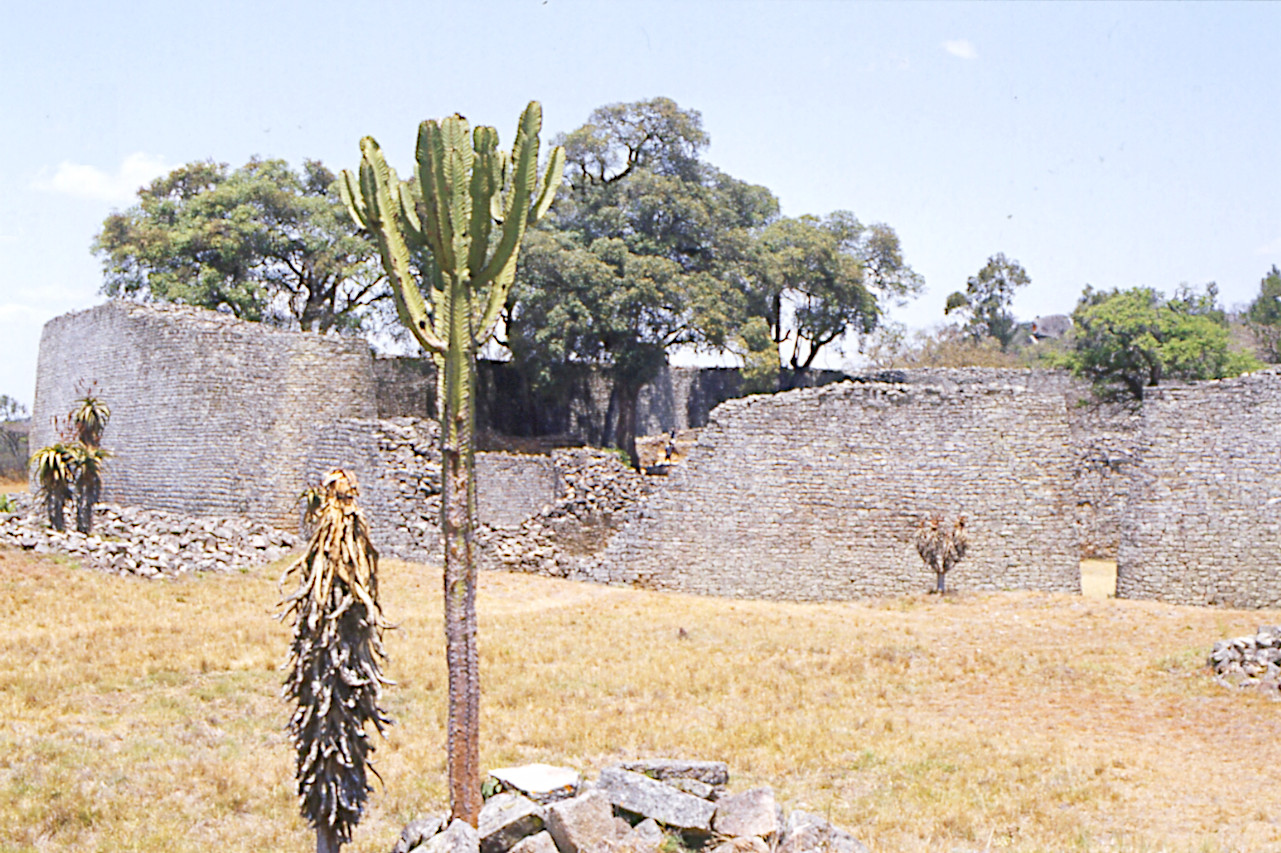
Zimbabwe is best known for its wildlife reserves and the Victoria Falls, but with its lush, granite mountains, balancing rocks, lakes, mighty rivers, savanna plains, and the magnificent ruins of Great Zimbabwe, it is truly a magnificent country.
Contents
Map
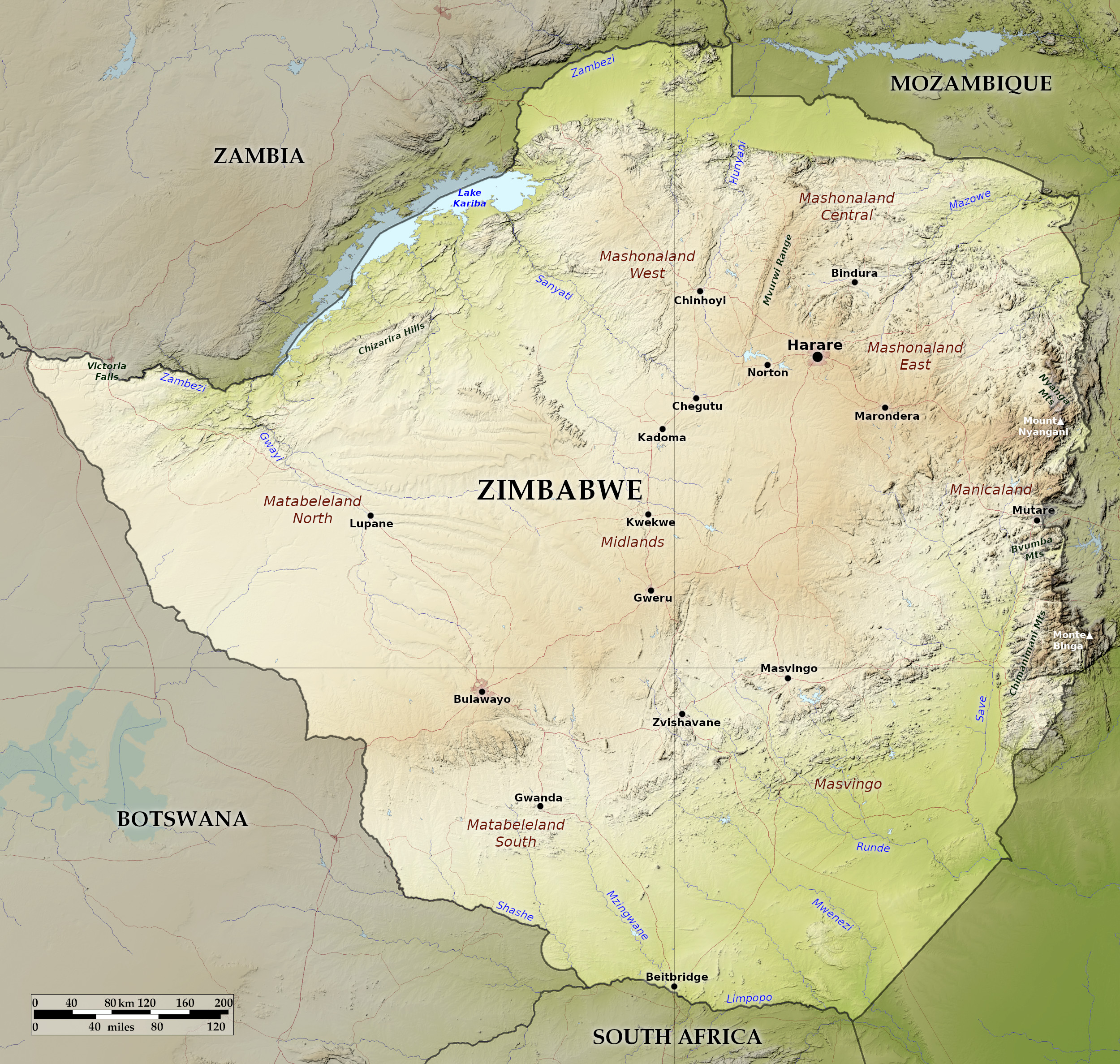 Relief map of Zimbabwe
What is the landscape of Zimbabwe like?
The main geographical feature of Zimbabwe is a broad plateau that forms an elevated savanna region, or highveld, through the center of the country. Lower plateau regions on either side of it slope to three river basins: the Zambezi on the northern border, the Limpopo in the south, and the Sabi in the southeast.
Highveld
The dominant feature of Zimbabwe’s landscape is the Highveld, whose area constitutes a quarter of the country’s land mass. The Highveld consists of land between 1,200 and 1,500 meters stretching south-west to north-east through the center of the country. This region, between 80 and 160 kilometers wide, stretches almost 650 kilometers through central Zimbabwe. It makes up between a fifth and a quarter of the total land area. Some of the native vegetation—tall grasses and open woodland—thas been removed to make room for cultivation, but significant areas retain their original vegetation. The Highveld forms the country's watershed, with streams flowing southeast to the Limpopo and Sabi rivers and northwest to the Zambezi. Only the largest of the many rivers carry water all year round.
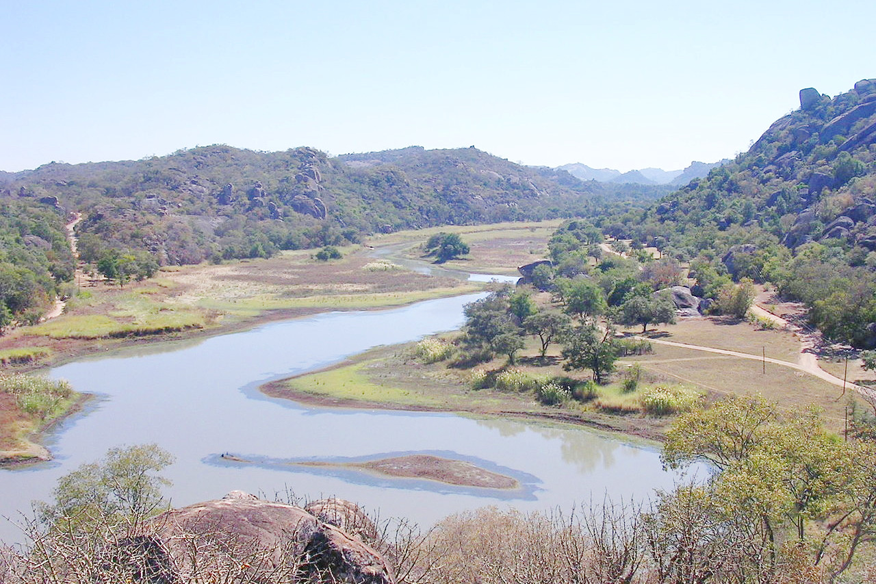
The undulating or flat surfaces of much of the Highveld are characterized by granite outcrops in the form of rock towers and mounds locally called kopjes. The Central Highlands is also characterized by the Great Dyke Hills, a massive extrusion of mineralized rocks generally extending north-south for more than 500 kilometers. Only a few kilometers wide in most sections, it rises in a series of eroded ridges up to 450 meters above the surrounding highlands.
Middleveld
The broader Middleveld, which makes up almost two-fifths of Zimbabwe's land, flanks and merges almost imperceptibly into the Highveld. This consists of land between 900 and 1,200 meters. On the south-eastern flank of the Highveld, the Middleveld is never more than 120 kilometers wide, and often less; on the opposite flank it can be twice as wide in many places. The natural vegetation on the Middleveld is a mosaic of wooded grasslands. In the drier part of the central field, the grassland remains; Elsewhere, however, shrubs and trees were cleared. The kopjes found in the Highveld also occur in the Middleveld.
Lowveld
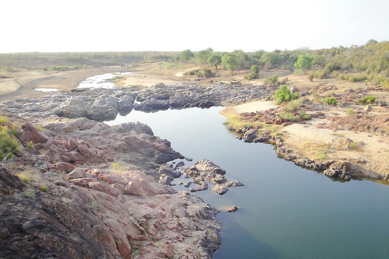
As the descending plateau approaches the northern and southern borders marked by the Zambezi and Limpopo rivers, it becomes Lowveld—land below 900 metres. This consists of the vast and grassy plains in the Zambezi, Limpopo, and Sabi (Save) basins. Just over a third of the country is made up of Lowveld, which is largest in the Limpopo and Sabi river basins in the south and south-east and less so in the north. The lowlands along the Zambezi River below Lake Kariba are sharply demarcated from the midfield by the Zambezi Escarpment. Lake Kariba, which Zimbabwe shares with neighboring Zambia, is one of the world's largest artificial lakes. The lake is as wide as 40 kilometers (25 miles) in some places.
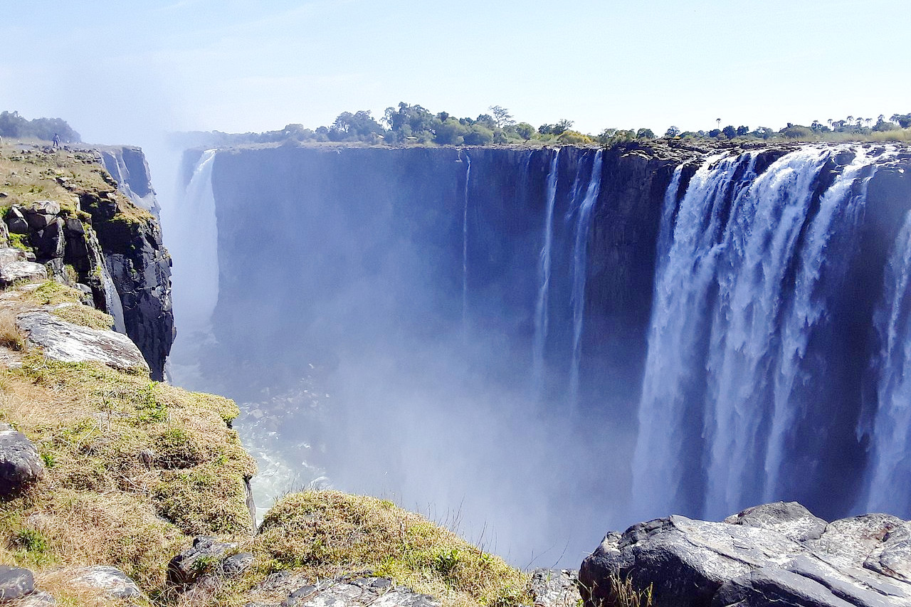
The Zambezi River, which marks much of the northern border with Zambia, is the longest of all African rivers that flow to the Indian Ocean. Near the northwestern tip of Zimbabwe, the river drops over Victoria Falls, a spectacular waterfall which is 108 meters (355 feet) high at its maximum and nearly 1.5 kilometers (1 mile) wide, making it one of the greatest natural wonders of the world.
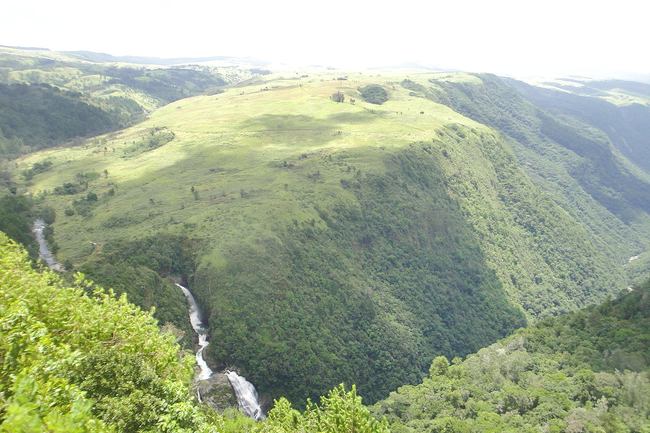
Eastern highlands
The eastern highlands are mountainous in contrast to the plateau that characterizes the rest of the country. The eastern mountain complex is the highest in the country; it consist of a set of mountain ranges marked by the presence of tropical and subtropical trees. Most peaks are between 1,800 and 2,400 meters (6,000 and 8,000 feet) in elevation. The highest peak, Mount Nyangani, reaches 2,592 meters (8,504 feet).
What is the nature of Zimbabwe like?
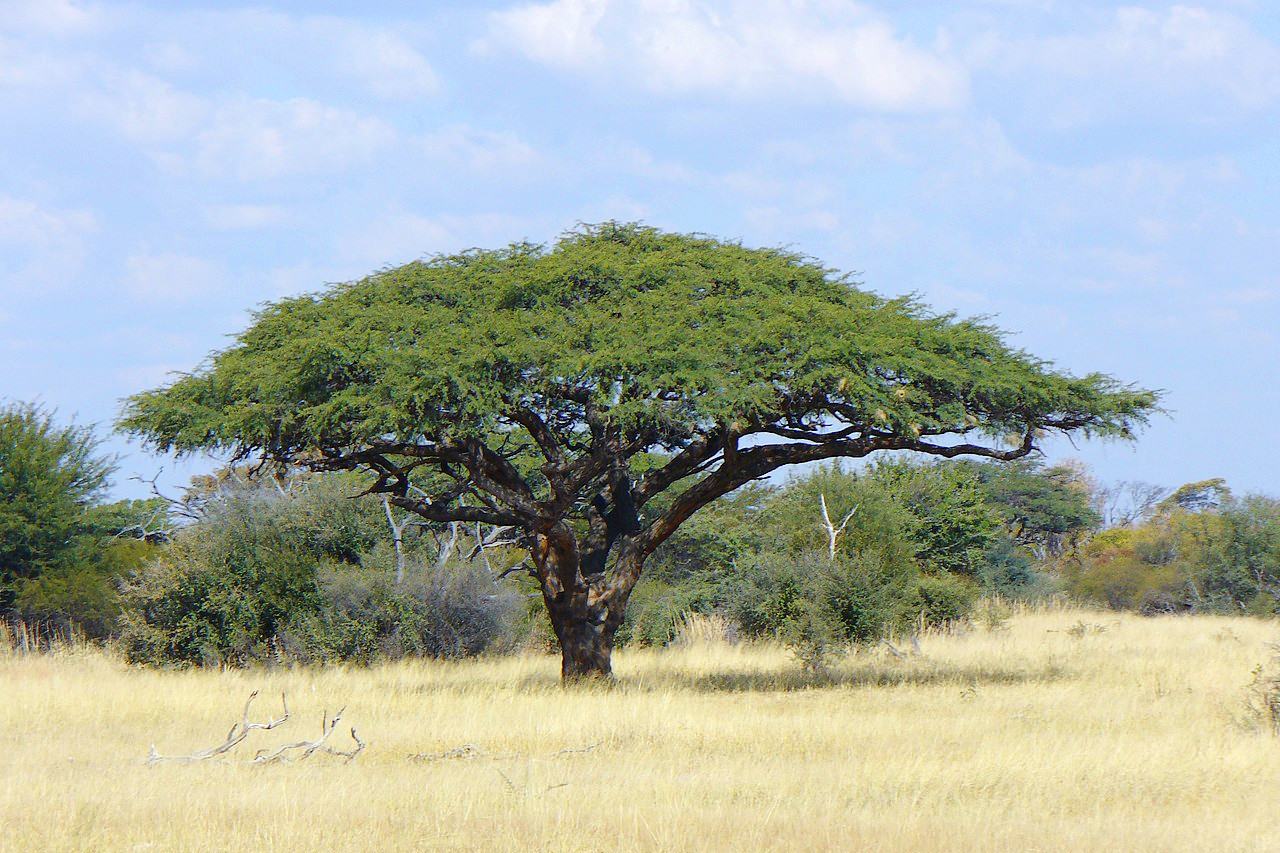
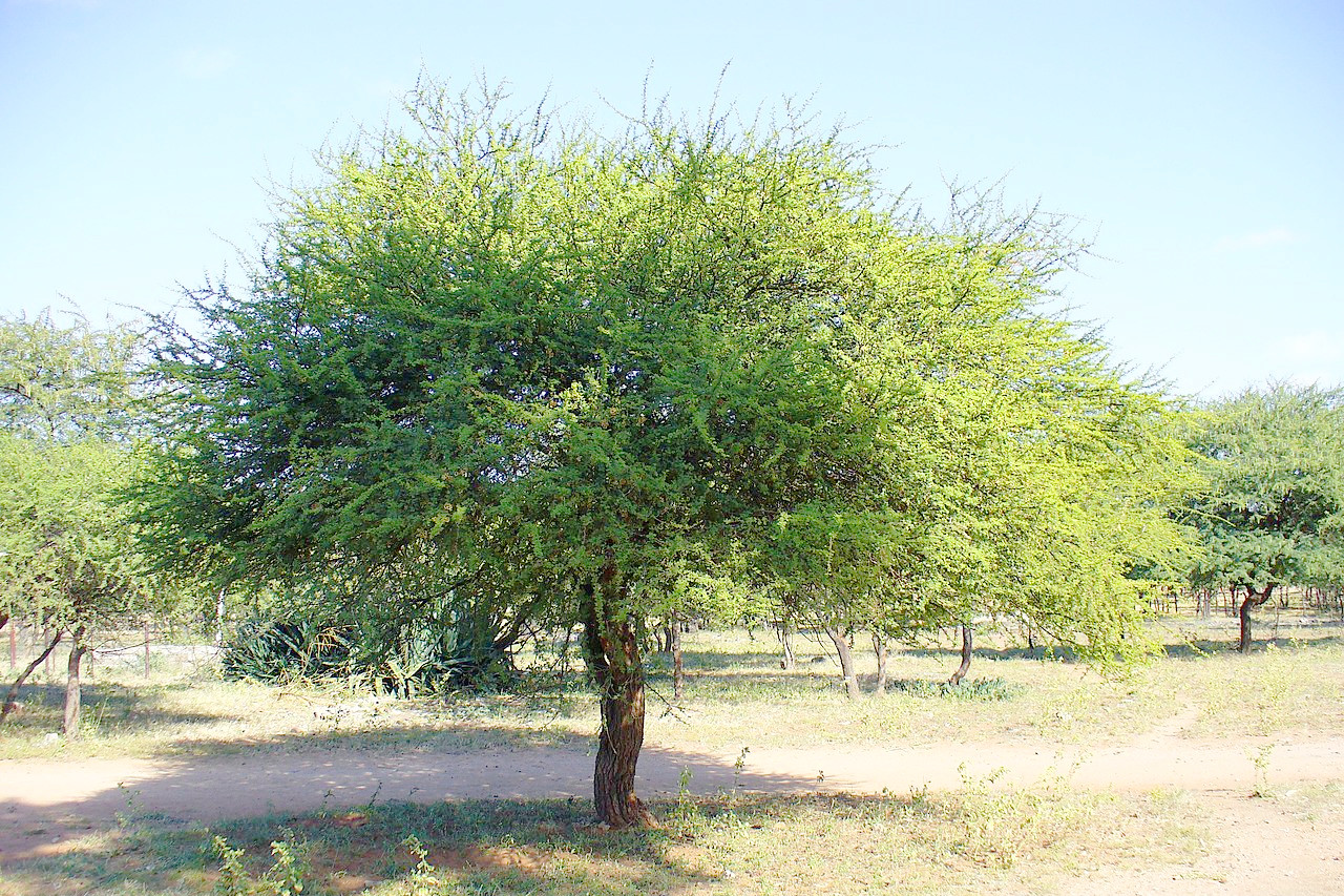
The central Highveld varies from relatively smooth to rough, almost mountainous, terrain. Much of the plateau surface is savannah, a rolling plain covered with a mixture of grasses and open woodlands. Thorny acacia savanna and dry open woodland cover most of the western and central plateau, while the drier lowlands of the south and southeast support lower thorny scrub and baobabs as well as euphorbias, aloes, poinsettia, jacarandas, hibiscus flame trees, bougainvilleas, jasmine, and a variety of citrus trees, palms, and bananas. The Middleveld consists of medium-altitude wooded grasslands, and the Lowveld is made up of wide grassy plains. The moist and mountainous east supports tropical evergreen and hardwood forests. Trees include knobthorn, msasa, and baobab. Zimbabwe is well-known for its great variety of flowering plants. Among the numerous flowers and shrubs are hibiscus, spider lily, leonotus, cassia, tree wisteria, and dombeya.
Zimbabwe is equally rich in animal life. The national parks scattered across the country are home to such creatures as elephants, buffalos, hippopotamus, rhinoceros, lions, a variety of large cats, baboons, zebras, and many more. The antelopes include the kudu, duiker, eland, sable, gemsbok, and waterbuck. Snakes and lizards abound. The large lizard, the Nile monitor, is found in many rivers, as are several species of crocodile.
What is the climate of Zimbabwe like?
See our main article: The Climate of Zimbabwe
The climate of Zimbabwe is greatly affected by altitude and time of year. Average temperatures in the high plateau are about 13°C (56°F) in the winter and about 24°C (75°F) in the summer. In the lower altitudes of the far north and south, temperatures are up to 6°C (11°F) higher than those measured in the highveld.
The summer rainy season lasts from November to March. The cool, dry season follows, lasting from mid-May to mid-August. The low-lying parts of the country have a rather dry climate with an unreliable rainfall of between 300 mm (12 in) and 600 mm (24 in). Over most of the country annual rainfall is between 600 mm (24 in) and 1,000 mm (40 in).
| Climate data for Harare (1961–1990) | |||||||||||||
|---|---|---|---|---|---|---|---|---|---|---|---|---|---|
| Month | Jan | Feb | Mar | Apr | May | Jun | Jul | Aug | Sep | Oct | Nov | Dec | Year |
| Average high °C (°F) | 26.2 (79.2) | 26.0 (78.8) | 26.2 (79.2) | 25.6 (78.1) | 23.8 (74.8) | 21.8 (71.2) | 21.6 (70.9) | 24.1 (75.4) | 28.4 (83.1) | 28.8 (83.8) | 27.6 (81.7) | 26.3 (79.3) | 25.5 (77.9) |
| Daily mean °C (°F) | 21.0 (69.8) | 20.7 (69.3) | 20.3 (68.5) | 18.8 (65.8) | 16.1 (61.0) | 13.7 (56.7) | 13.4 (56.1) | 15.5 (59.9) | 18.6 (65.5) | 20.8 (69.4) | 21.2 (70.2) | 20.9 (69.6) | 18.4 (65.1) |
| Average low °C (°F) | 15.8 (60.4) | 15.7 (60.3) | 14.5 (58.1) | 12.5 (54.5) | 9.3 (48.7) | 6.8 (44.2) | 6.5 (43.7) | 8.5 (47.3) | 11.7 (53.1) | 14.5 (58.1) | 15.5 (59.9) | 15.8 (60.4) | 12.3 (54.1) |
| Average precipitation mm (inches) | 190.8 (7.51) | 176.3 (6.94) | 99.1 (3.90) | 37.2 (1.46) | 7.4 (0.29) | 1.8 (0.07) | 2.3 (0.09) | 2.9 (0.11) | 6.5 (0.26) | 40.4 (1.59) | 93.2 (3.67) | 182.7 (7.19) | 840.6 (33.09) |
| Source: World Meteorological Organization | |||||||||||||
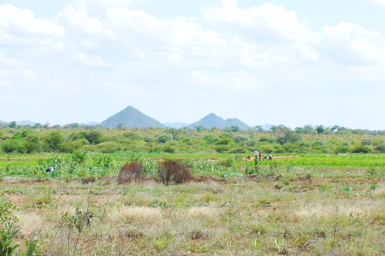 Farming area near Filabusi, Matabeleland South Province
The official websites
Zimbabwe
A World of Wonders
| Location: | Southern Africa, between South Africa and Zambia |
| Coordinates: | 20° 00′ S, 30° 00′ E |
| Size: | • 1010 km N-S; 1100 km E-W • 630 miles N-S; 680 miles E-W |
| Terrain: | Mostly high plateau with higher central plateau (high veld); mountains in east |
| Climate: | Tropical, moderated by altitude; rainy season (November to March) |
| Highest point: | Mount Nyangani 2,592 m / 8,504 ft |
| Forest: | 40% (2018 est.) |
| Population: | 15,121,004 (2022 est.) |
| Population density: | Low (39/km²) |
| Capital: | Harare |
| Languages: | Shona (official), Ndebele (official), English (official), 13 minority languages (official; includes Chewa, Chibarwe, Kalanga, Koisan, Nambya, Ndau, Shangani, Sotho, Tonga, Tswana, Venda, and Xhosa) |
| Human Development Index: | Medium (0.593) |