.jpeg)
.jpeg)
.jpeg)
.jpeg)
.jpeg)
.jpeg)
The Geography of
Alaska
Why visit Alaska?
What makes Alaska so special is the scenery. The state has rugged, majestic mountains that tower high into the sky, vast glaciers, and colorful lakes. It has an amazing variety of habitats, from the subarctic tundra to the lush forests. All of these make for an incredibly beautiful landscape. The landscape is quite rugged, with tall mountains in the foreground and endless forests in the background. The lakes are a great place to explore, as well as the glaciers, and the landscape is constantly changing as different glaciers move. The wildlife in Alaska is also amazing. The state has a rich variety of different animal populations, which provides for an amazing experience.
Contents
Map
 Relief map of Alaska
What is the landscape of Alaska like?
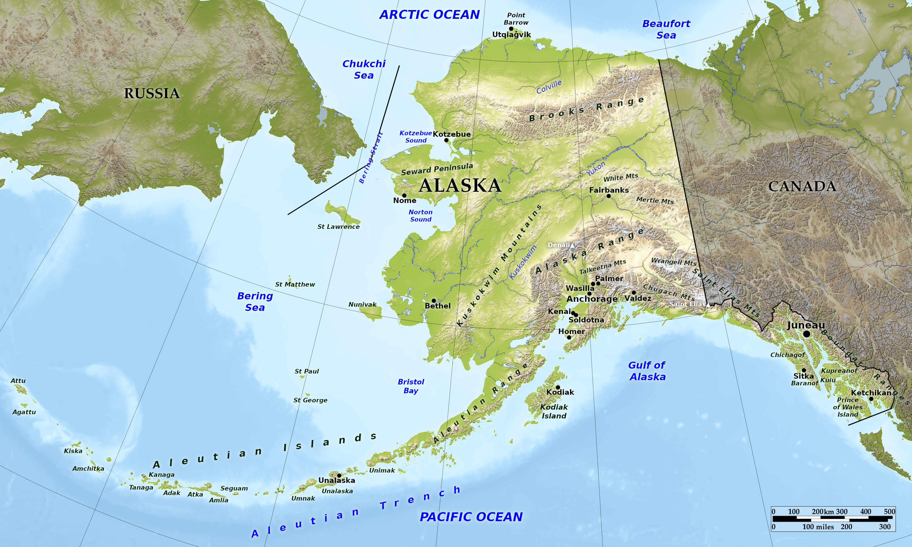
Alaska, the largest state of the USA, is a spectacular land of glaciers, volcanoes, forest-covered islands, massive fjords, tundra, pristine lakes and streams, and snow-covered mountain peaks. The landscape of Alaska varies sharply across six distinct regions.
Southeast: The Panhandle
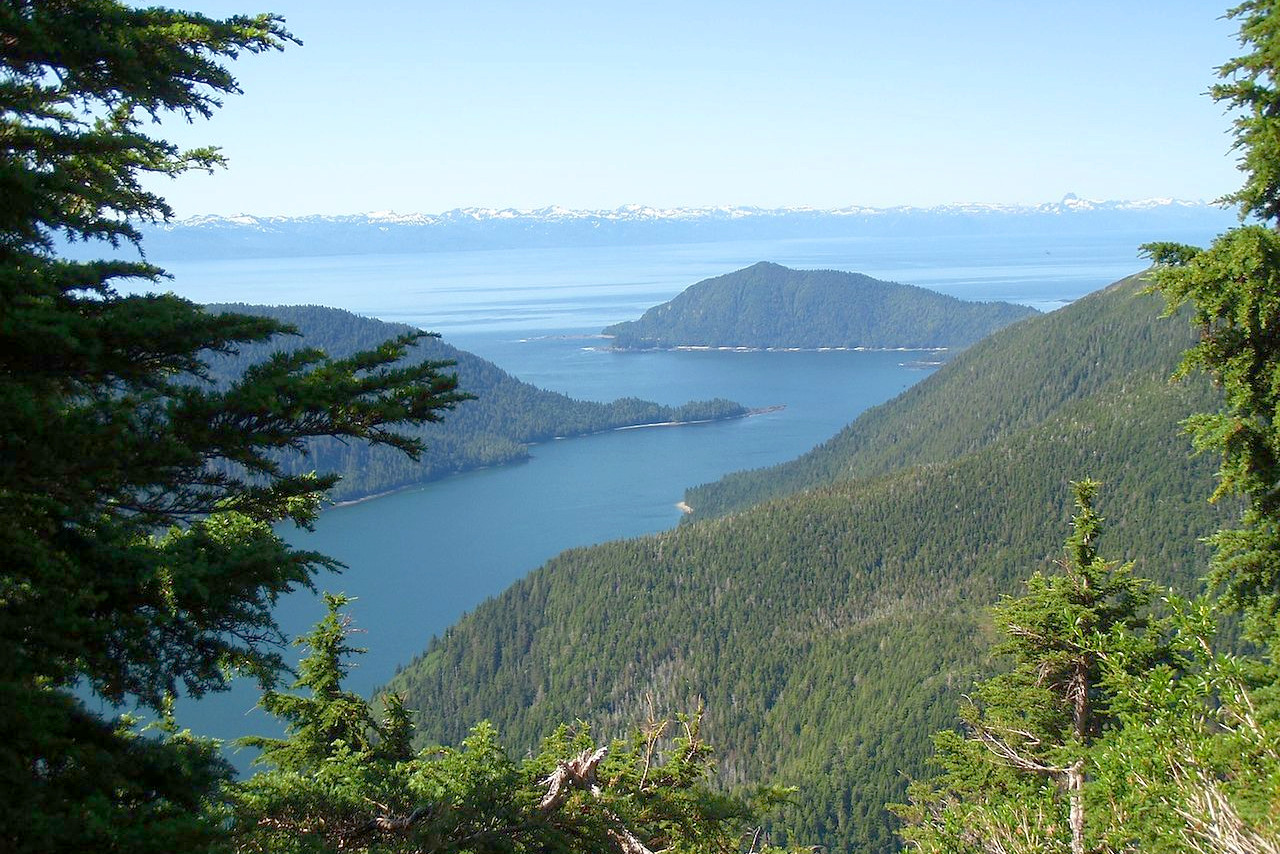
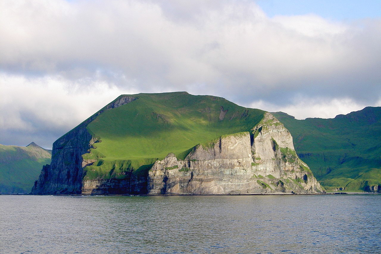
In the southeast is the narrow coastal Panhandle of Alaska cut off from the main landmass by the Saint Elias Range. The Panhandle is remarkably beautiful. The maze of islands, hundreds in number, of the Alexander Archipelago are remnants of a submerged mountain system; the islands rise 3,000 to 5,000 feet (900–1,500 m) above the sea, with luxuriantly wooded tops and bald, sheer sides scarred with marks of glacial action; the beachless coast is only a narrow ledge between the mountains and the sea, and is bold, steep and craggy.
The inter-island straits are carried up into the shore as fjords heading into rivers and glaciers. The Stikine, Taku and Alsek rivers all cross the mountains in deep-cut canyons. The Portland Canal (an inlet) is very deep, with steep shores and bordering mountains 5,000 to 6,000 feet (1,500–1,800 m) high; whereas Lynn Canal is a noble fjord 100 miles long and on an average 6 miles wide with magnificent Alpine scenery. This region, features numerous mountain peaks of 10,000 ft (3,000 m) in height.
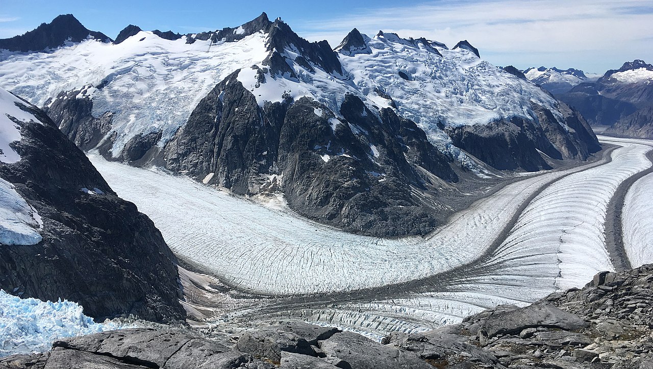
The glaciers of the Panhandle and the rest of the Gulf of Alaska are remarkable for their number and their size. They lie mainly in a belt 1,000 miles long, of which the central part, some 350 or 500 miles long and 80 miles to 100 miles wide, has been described as one great ice field. Thousands of Alpine glaciers from one to fifteen miles long fill the upper valleys and canyons of the mountains, and more than a hundred almost reach the sea.
 Carrol Inlet in the Tongass National Forest
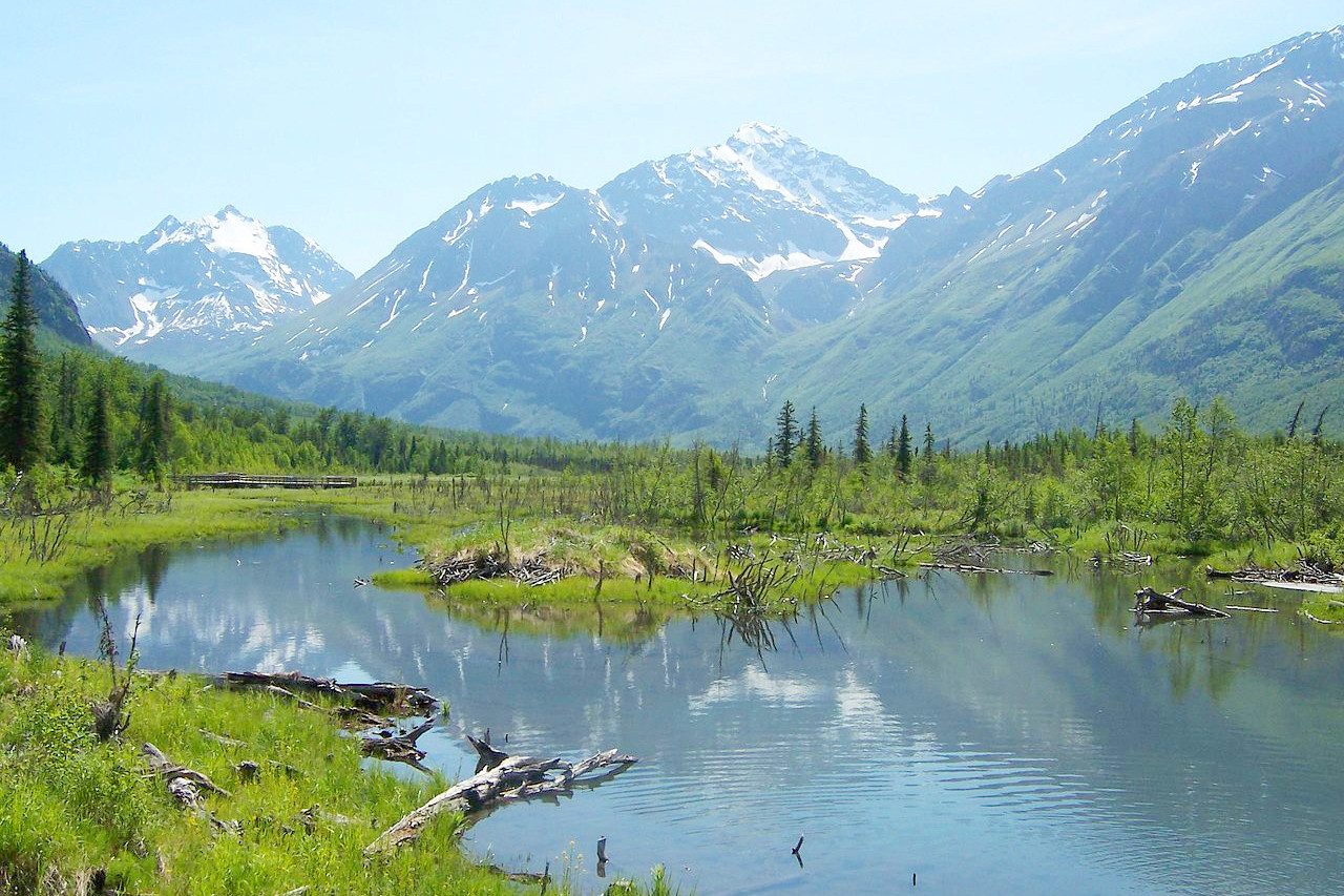
South-central
South-central Alaska, which covers a 700 mile (1,100 km) area along the Gulf of Alaska, includes the Kenai Peninsula and Cook Inlet, a great arm of the Pacific penetrating some 200 miles (320 km) to Anchorage. Anchorage's quarter of a million inhabitants make up more than 40 percent of the state's population. The entire southern coast is very irregular; it is steep, with only very slight stretches of beach or plain. Its height gradually decreases as one travels west toward the Aleutian islands.
.jpeg)
The mountains for part of the Pacific Mountain system which extends along the coast. In the east are the Saint Elias Range, as well the Chugach and Wrangell mountains. The highest peak in this region is Mount St Elias (18,008 ft or 5,489 m) situated on the Yukon and Alaska border.
The Alaskan Range lies a little farther inland; it is splendidly marked by many snowy peaks, including Denali (20,310 ft or 6190 m) the highest mountain peak in North America. On the west side Denali rises abruptly out of a marshy country and offers the obstacles of magnificent, inaccessible granite cliffs and large glaciers.
.jpeg) Denali, North America’s highest peak
Denali, North America’s highest peak
.jpeg)
To the south of Cook Inlet is Kodiak Island, a large Alaskan island which measures 40 miles by 100 miles and known for its comparatively mild and equable climate. It is mountainous and heavily forested in the north and east, but fairly treeless in the south. The island has many deep, ice-free bays that provide sheltered anchorages for boats.
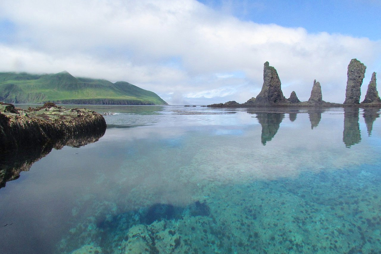
The Southwest
The southwestern region includes the Alaska Peninsula, filled with lightly wooded, rugged peaks. The Aleutian Range is a continuation of the Pacific Mountain system along the coast, of whose crest the Aleutian Islands are remnants. The great majority of the Aleutian Islands bear evident marks of volcanic origin, and there are numerous volcanic cones on the north side of the chain, some of them active. The coasts are rocky and surf-worn and the approaches are exceedingly dangerous, the land rising immediately from the coasts to steep, bold mountains.
The general height of the Aleutian Islands is greatest in the east and least in the west. The western-most point of the United States being at Cape Wrangell on Attu Island. The Aleutians have a mild climate despite the northern latitude. Warm, moist air masses moving past Japan and driven northeastward condense to produce mists that envelop the islands much of the year, making the Aleutians one of the foggiest places on earth.
The West
Western Alaska extends from Bristol Bay to the Seward Peninsula. It an immense tundra dotted with lakes and containing the deltas of the Yukon and Kuskokwim rivers. The Yukon is one of the great drainage systems of the world. The Yukon itself has a length of nearly 2,000 miles (3,000 km) and bisects the State from east to west. Its basin is a rolling country, sinking into a great flat levels. The Seward Peninsula, on the other hand is particularly rugged. Alaska's western islands include Saint Lawrence, Saint Matthew, Nunivak, and the Pribilof Islands (Saint Paul and Saint George) in the Bering Sea.
The Interior
.jpeg)
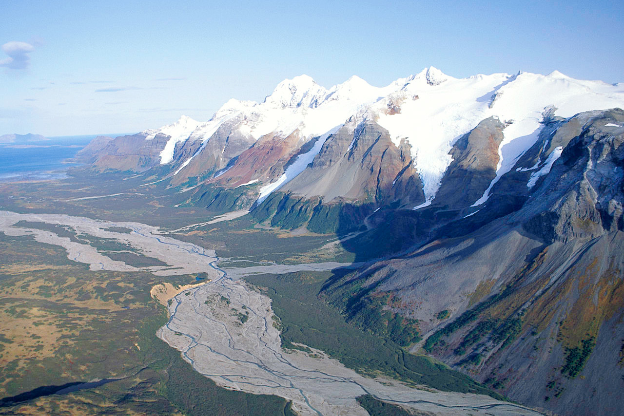
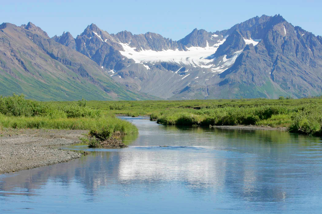
Interior Alaska extends north of the Alaska Range and south of the Brooks Range. It includes most of the drainage of the Yukon and its major tributaries, the Tanana and Porcupine rivers. This great plateau consists of rounded hills, level grasslands and persistent flat-topped ridges, throughout which flow the broad, gently flowing rivers.
The Arctic north
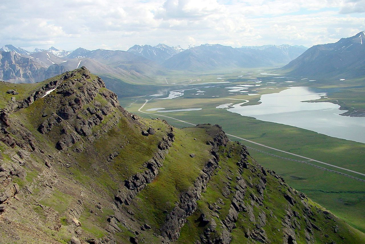
The Arctic region is the portion of the state that drains north to the Beaufort Sea. It is an icy, tundra, environment walled off by a chain of rugged mountains. The Brooks Range, which represents the northernmost extension of the Rocky Mountains, forms the northern edge of the Yukon Basin for more than five hundred miles across northern Alaska. Although the peaks in the Brooks Range are lower than those of the Alaska Range, the terrain is a maze of glaciated mountain valleys. The northern-most point in the United States lies at Point Barrow, at 71° 23′N.
What is the nature of Alaska like?
.jpeg)
The forests of Alaska are of fair variety and of great richness. The Sitka spruce (the state tree) dominates along the great tributaries of the Yukon, and along every river in central Alaska. On the Yukon flats it grows in a vast forest impenetrably dense. On the islands of the Alexander Archipelago and on Prince William Sound it grows to gigantic size. In may other areas it grows along side the western hemlock, tamarack, white birch, and western red cedar. There are thickets of alders and willows in wet places; aspens and large cottonwoods are common in the west.
Toward the Arctic circle, trees become sparse, low, gnarled and distorted. The willows in the Arctic drainage basin shrink to shrubs scarcely knee-high. Grasses grow luxuriantly in the river bottoms. Most distinctive is the carpeting of mosses, varying in colours from the pure white and cream of the reindeer moss to the deep green and brown of the peat moss, all conspicuously spangled in the brief summer with bright flowers. The thick peat moss or tundra of the undrained lowlands covers probably at least a quarter of Alaska; the reindeer moss grows both on the lowlands and the hills; sedges grow in the tundra. In August berries are fairly abundant over the interior.
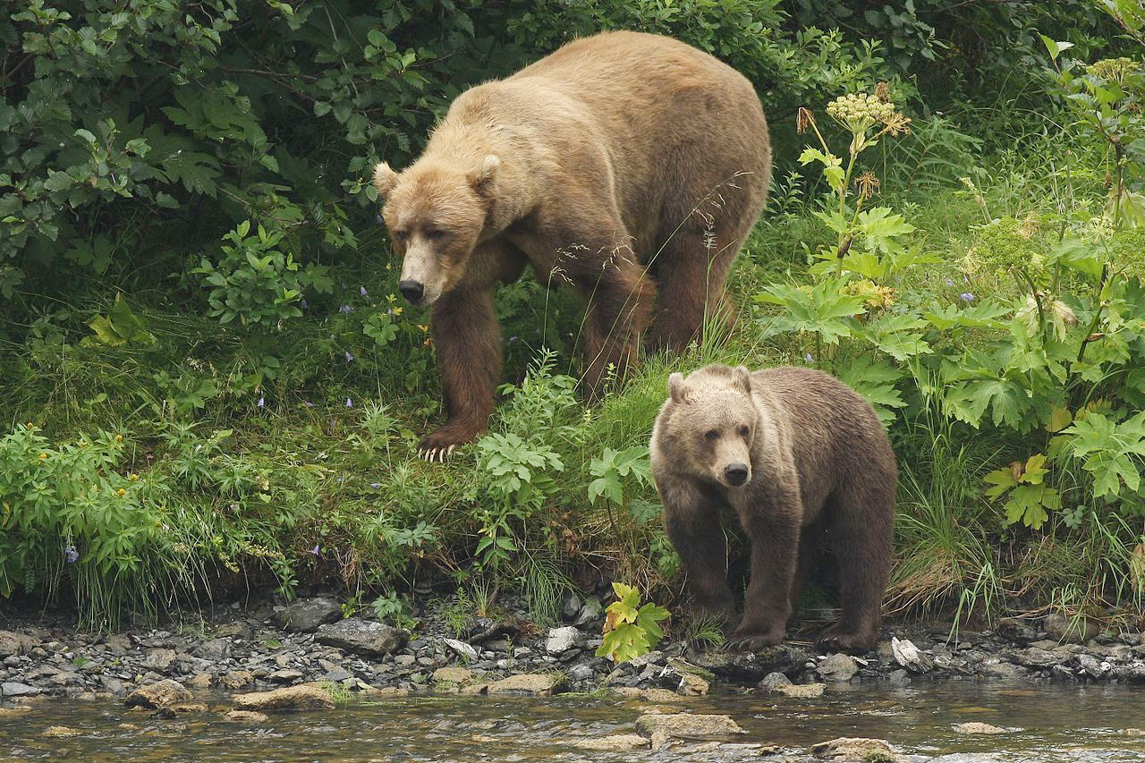
Alaska is home to an incredible array of wildlife. Mammals abound amid the wilderness. Great herds of caribou migrate across some northern areas of the state. Moose move within limited ranges but do not migrate seasonally or move in herds as do caribou. The musk ox has been successfully reintroduced. Reindeer were introduced to Alaska as herd animals. There are grizzly, polar, black, and brown bears, and two Alaskan sub-species of bear: the Kodiak and the glacier bear. There is an abundance of smaller mammals including wolves, wolverines, minks, otters, beavers, foxes, and the Dall sheep.
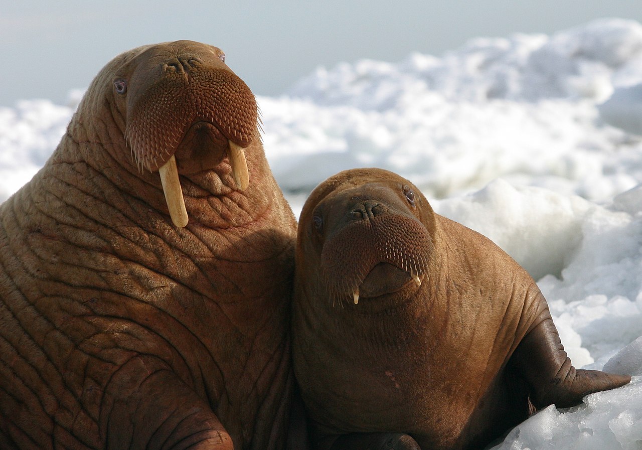
The coastal waters of Alaska teem with sea life. Whales migrate annually to the icy bays, and large walrus colonies are found along the north shore of Bristol Bay. The sea otter has been successfully reintroduced. There are many species of seals and sea-lions. Alaska is also home to a large population of bald eagles.
What is the climate of Alaska like?
.jpeg)
.jpg&oldid=480221483)
.jpg&oldid=490761962)
.jpg&oldid=303688814)
.jpg&oldid=516880807)
.jpg&oldid=452254119)
.jpg&oldid=489943881K)
.jpg&oldid=520262085)
.jpg&oldid=496727779)
.jpg&oldid=524740937)
.jpg&oldid=453543739)
.jpg&oldid=489659268)
.jpg&oldid=512847031)
Alaska is by no means a permanent icebox, summer temperatures in the Alaskan lowlands have been known to exceed 90°F (32°C ). The Panhandle, along with the coast westward to Anchorage might be called temperate Alaska, its climate being similar to that of the northwest coast of the United States. Western Alaska is rainy and cool; while in the north the winters become longer and more severe.
The Alaskan summer is relatively dry, the autumn and winter wetter. Snow flurries begin around the middle of September and snow is heavy all winter long, but the air is dry and quiet. In May the rivers open, the land thaws out, and in summer the sun shines from eighteen hours or more. All nature responds in rich and rapid growth to the warmth of the long, splendid days.
| Climate data for Anchorage (1991−2020) | |||||||||||||
|---|---|---|---|---|---|---|---|---|---|---|---|---|---|
| Month | Jan | Feb | Mar | Apr | May | Jun | Jul | Aug | Sep | Oct | Nov | Dec | Year |
| Average high °F (°C) | 22.7 (−5.2) | 27.3 (−2.6) | 33.0 (0.6) | 45.1 (7.3) | 56.3 (13.5) | 63.4 (17.4) | 66.2 (19.0) | 64.0 (17.8) | 55.7 (13.2) | 42.0 (5.6) | 28.9 (−1.7) | 25.0 (−3.9) | 44.1 (6.7) |
| Daily mean °F (°C) | 16.9 (−8.4) | 21.3 (−5.9) | 25.8 (−3.4) | 37.5 (3.1) | 48.1 (8.9) | 55.9 (13.3) | 59.6 (15.3) | 57.5 (14.2) | 49.3 (9.6) | 36.3 (2.4) | 23.6 (−4.7) | 19.4 (−7.0) | 37.6 (3.1) |
| Average low °F (°C) | 11.0 (−11.7) | 15.2 (−9.3) | 18.6 (−7.4) | 29.9 (−1.2) | 40.0 (4.4) | 48.4 (9.1) | 52.9 (11.6) | 50.9 (10.5) | 42.9 (6.1) | 30.7 (−0.7) | 18.3 (−7.6) | 13.8 (−10.1) | 31.0 (−0.6) |
| Average precipitation inches (mm) | 0.75 (19) | 0.86 (22) | 0.69 (18) | 0.43 (11) | 0.65 (17) | 1.02 (26) | 1.82 (46) | 2.93 (74) | 3.10 (79) | 1.82 (46) | 1.19 (30) | 1.16 (29) | 16.42 (417) |
| Average snowfall inches (cm) | 12.4 (31) | 13.4 (34) | 11.0 (28) | 4.0 (10) | 0.3 (0.76) | 0.0 (0.0) | 0.0 (0.0) | 0.0 (0.0) | 0.4 (1.0) | 5.6 (14) | 12.6 (32) | 18.2 (46) | 77.9 (198) |
| Source: NOAA | |||||||||||||
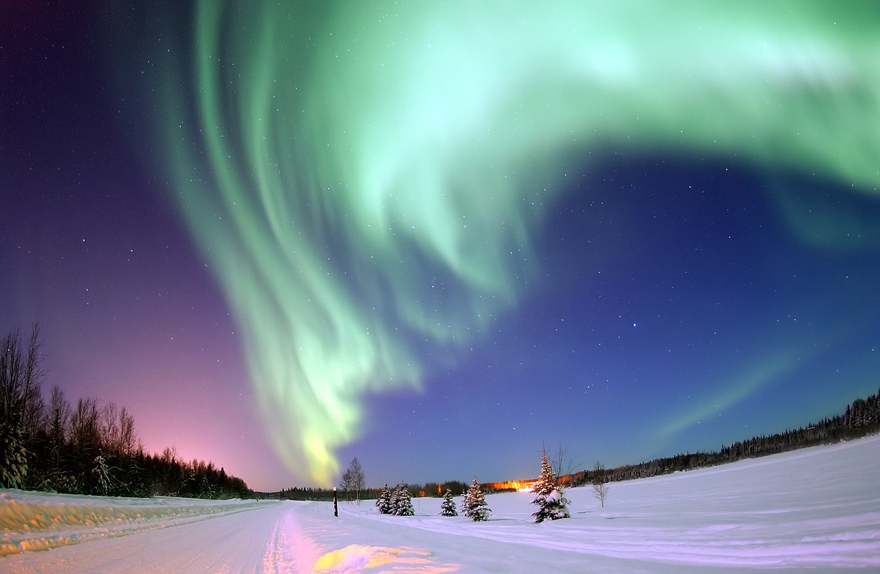 The Aurora Borealis shines above Bear Lake
The official websites
Alaska
The Last Frontier
| Location: | Northwest corner of the North American continent, between the Arctic and Pacific Oceans |
| Coordinates: | 64° 00′ N, 152° 15′ W |
| Size: | • 2,300 km N-S; 3,650 km E-W • 1,420 miles N-S; 2,260 miles E-W |
| Terrain: | High mountains in the southeast; rugged peaks and the Aleutian islands in the southwest; mountains, lakes, and river everywhere |
| Climate: | Sub-arctic climate; moderate in the southeast and southwest; warm summers in the lowlands, harsh winters |
| Highest point: | Denali 6190 m / 20,310 ft |
| Forest: | 35% (2016) (source) |
| Population: | 710,249 |
| Population density: | Very Low (0.5/km²) |
| Capital: | Juneau |
| Languages: | English 86.3%; Alaska Native languages 5.2%; Other (includes Tagalog, Spanish) |
| Human Development Index: | Very High (0.936) |