The Geography of
Alabama
Why visit Alabama?
The natural beauty of Alabama is undeniable, whether you're looking at its lakes, forests, mountains, rivers. From the foothills of the Appalachian Mountains and the Cumberland Plateau in the north, to the clear waters of the Gulf Coast in the south, Alabama is renonwed for its picturesque landscapes and warm weather.
Contents
Map
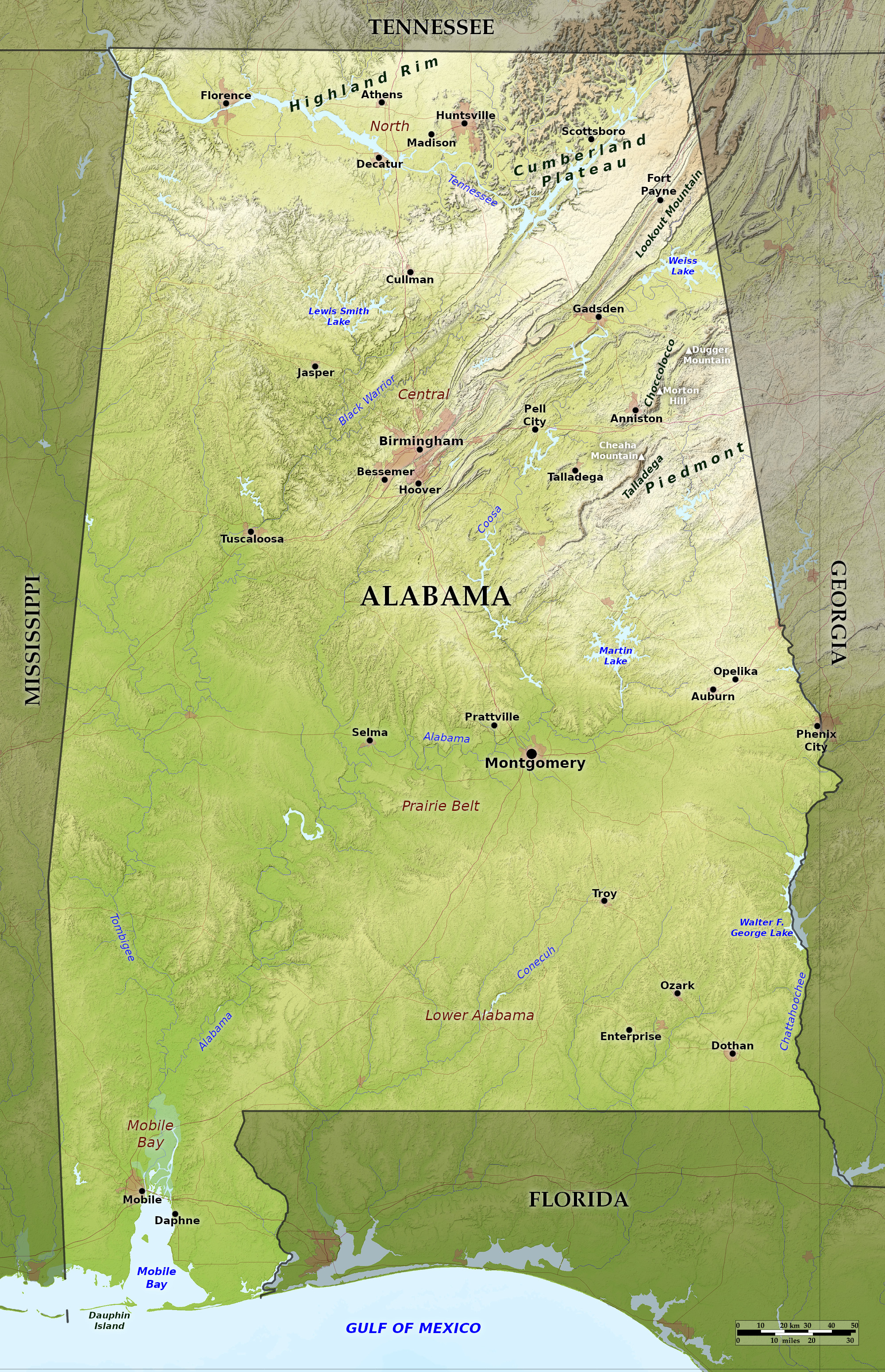
 Relief map of Alabama
What is the landscape of Alabama like?
Alabama, with its southern border on the Gulf of Mexico, is known for its fertile valleys, rolling hills covered with forest, and for its sweeps of extended beauty. The north and northeast portion of Alabama, nearly half of its area, is varied, hilly, and in places mountainous. The remainder of the State is comparatively smooth prairies and rolling hills, which becomes lower and less hilly toward the coast.
North
The northern end of Alabama is crossed by the great valley of the Tennessee River. This river sweeps through a broad, rolling valley, 12 to 15 miles wide, from the northeastern to the northwestern corner of the State. It is walled in by hills, both on the north and south, which protect it alike from the cold blasts of winter and the heat waves of summer. Along the slopes of the neighboring mountains and foothills there are to be found magnificent forests oak, walnut, poplar, and hickory. To the north is the Highland Rim Plateau, which is more extensive in Tennessee—it is a comparatively level region except for some deep and narrow valleys.
The Cumberland Plateau, one of the spurs of the Appalachian mountains, enters in the northeast corner and terminates in foothills toward the center of Alabama. It is several hundred feet higher than most of the neighboring valleys, the highest elevation being about 1,850 feet (560 m), on Lookout Mountain near Georgia. The slopes are composed of nearly pure hard limestone, with very little soil, and there are many limestone springs and caves. Mountain-rapids, cascades, and waterfalls contribute to the variety of the region. Some of the rivers have cut very picturesque gorges (Little River Canyon and the Noccalula Falls being the best known examples).
Central
The Central region extends the elevated plateau in the northwest part of the State to the peaks of the Piedmont mountains in the east. Flowing across the western plateau is the Black Warrior River, which flows through a region of low hills, interspersed with narrow valleys, where many of the rivers flow through deep gorges bordered with high cliffs. This region has superb forests, which cover many thousands of square miles, the trees being oaks, pines, hickories, chestnut, and gum. The other major valley is that of the Coosa River, which flows past the southwestern extremity of the great Appalachian Ridge and Valley system, which extends all the way to Vermont.
The Piedmont region to the east of this is the southwestern extremity of the Appalachian mountains. On most of the mountains the soil is thin and rocky, supporting a rather open, stunted growth of pine, red cedar, oak, chestnut, hickory, and other trees. Here can be found the ridge known as the Talladega Mountains which has the highest mountain in Alabama, namely Cheaha Mountain, 2,413 feet (735 m) above sea-level. The terrain is quite rugged; longleaf pine is the commonest tree on sunny slopes, up to nearly 2,000 feet (600 m), which is the highest altitude reached by it anywhere.
Prairie Belt
The Central Prairie Belt (also known as the Black Belt) is a rolling plain, with a rich and very dark soil. The landscape is undulating, and the belt is bordered on the north and south by pine-covered hills. Although it contains extensive tracts of prairie, it it is broken here and there by considerable woodlands, embracing the pine, different varieties of oak, hickory, gum, beech, maple, and magnolia.
Grasses and wildflowers spring spontaneously in all districts not under cultivation, they are wonderfully prolific. Along the numerous streams grows the swamp cane, which once overspread large sections of this Belt and gave it the significant name of the Canebrake. The remnants of natural prairie are scattered pretty well over the region; they may be recognized by the presence of such plants as Big Bluestem, Purple prairie clover, Largeflower milkweed, Compass plant, Purple coneflower, Aromatic aster, Grayhead Coneflower and Groovestem Indian plantain. Hay fields and pastures often contain some of these same species, together with others known to have been introduced but now very characteristic of this region, such as Johnson grass, "primrose" (Oenothera speciosa), Lemon beebalm, and Firewheel.
Lower Alabama
Lower Alabama is the Coast Pine Belt, which extends across the State. On the south side is the Coast Plain made up of rolling sandy uplands. Lower Alabama has a moderately hilly terrain, with rather more swamp than the highland regions. The glory of this region is its immense forests, which cover hundreds of thousands of acres uninterrupted. In these extensive forests the longleaf pine is most common of all the trees. These pine forests sweep down the Atlantic and along the Gulf coast from North Carolina to Texas.
There are some very interesting places in this region. The high sandstone ridges, in the western portion, some having an altitude of perhaps 600 feet (180 m). and known locally known as mountains, are pretty well wooded, and are said to still shelter some of the larger wild animals. In some of the limestone hills, the region is level to undulating, with many ponds and a few sinks and caves. These areas have open park-like longleaf pine forests, carpeted with numerous grasses and other narrow leaved plants. Most of the ponds contain water-loving trees as cypress (Taxodium imbricarium) black gum and mayhaw. There are swamps along most of the streams, and dense hardwood forests (hammocks) around the few limestone outcrops.
Mobile Bay
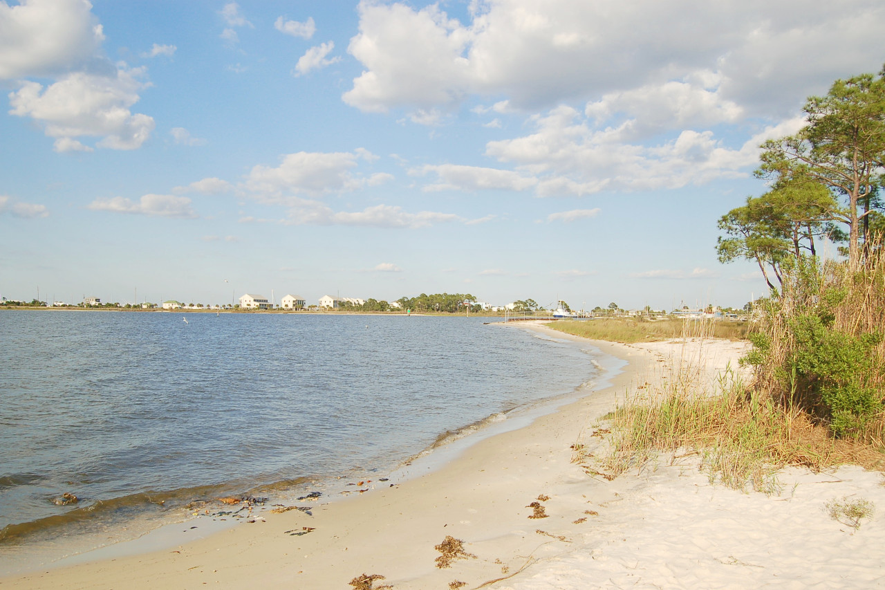
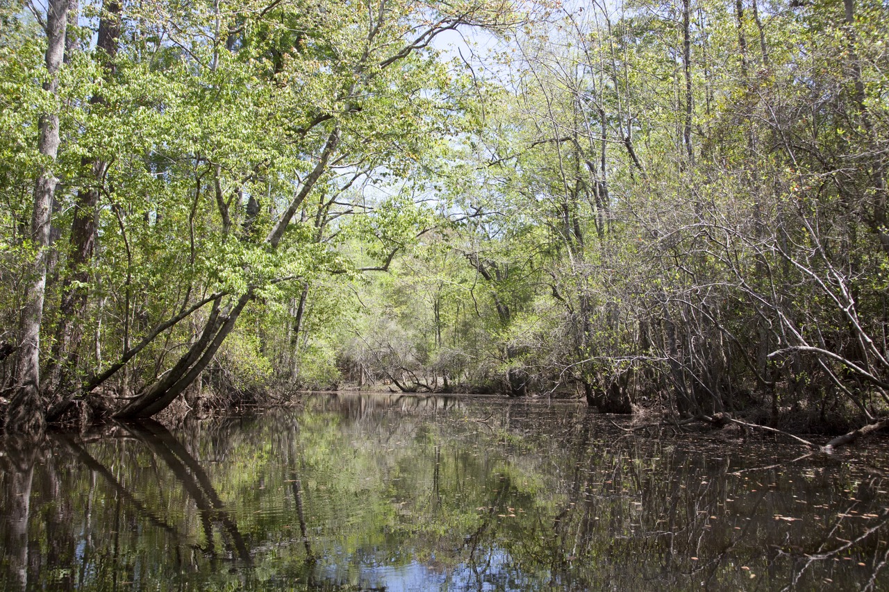
Mobile Bay comprises the sand-dune and salt-marsh areas of the coast, the coastal pine flats, and the extensive river swamps around the head of Mobile Bay. On the flats along the coast are open forests of pines, chiefly the swamp pine (Pinus elliottii). The Tombigbee and Alabama rivers merge to become the Mobile River, which after a short course of forty-five miles empties into Mobile Bay. Extensive river swamps cover the delta formed by this river. Here grow magnificent forests of cypress, tupelo gum, black gum, red maple, water hickory, water oak, overcup oak, water ash, green ash, swamp cottonwood, and other trees, all heavily festooned with the long Spanish "moss" and hung with tangles of grape vine and other climbing plants.
On the shores of the coastal bays are extensive salt marshes, largely occupied by the black rush (Juncus roemerianus) and inhabited by great numbers of the Louisiana clapper rail—these birds being saltmarsh specialists. On account of the copious warm summer rains the sand appears almost as white as snow in many places. On Dauphin Island is a considerable forest of pines and hardwoods, whereas the shores have dune and salt marsh vegetation.
What is the nature of Alabama like?
Alabama can be divided, very roughly, into a northern deciduous forest and a southern coniferous forest area. Included within the coniferous forest area is a prairie belt. Coniferous forests, principally of longleaf and shortleaf pine, occur throughout the state wherever the soil is poorest. Pine forests (especially those of longleaf pine) are subject to fires which, feeding on fallen needles, destroy other vegetation but apparently do not injure the pines. The deciduous forest of Alabama is primarily oak (white oak, post oak, red oak, black oak, black-jack oak, chestnut oak, and Spanish oak). Other trees characteristic of deciduous forest are tulip poplar, sweet gum, chestnut, beech, hickory, and dogwood. Even in the deciduous forest areas, though, shortleaf pine is often more abundant than any other one tree.
What is the climate of Alabama like?
Alabama rarely experiences extremes of heat or cold. The mountains in the northern end of the State temper the summer temperatures, while for many miles inland the cool breezes from the waters of the Gulf alleviate the heat of the summer. The temperature rarely ranges above 95°F (35°C) even in July—the hottest month of the year. Flowers blossom, and fruits ripen almost the year round. In winter snow seldom falls, and only thin coatings of ice are seen.
The rainfall throughout the state, except in the immediate vicinity of the coast where it is somewhat greater, is about 50 inches (1,250 mm) per year. In general the greatest rainfall occurs in summer in the south, and in winter in the north.
| Climate data for Montgomery, Alabama (1991–2020) | |||||||||||||
|---|---|---|---|---|---|---|---|---|---|---|---|---|---|
| Month | Jan | Feb | Mar | Apr | May | Jun | Jul | Aug | Sep | Oct | Nov | Dec | Year |
| Average high °F (°C) | 59.8 (15.4) | 64.7 (18.2) | 71.9 (22.2) | 78.8 (26.0) | 86.0 (30.0) | 91.5 (33.1) | 93.7 (34.3) | 93.6 (34.2) | 89.3 (31.8) | 80.2 (26.8) | 69.8 (21.0) | 61.9 (16.6) | 78.4 (25.8) |
| Daily mean °F (°C) | 48.1 (8.9) | 52.6 (11.4) | 59.2 (15.1) | 65.7 (18.7) | 73.6 (23.1) | 80.2 (26.8) | 82.9 (28.3) | 82.5 (28.1) | 77.8 (25.4) | 67.4 (19.7) | 56.6 (13.7) | 50.2 (10.1) | 66.4 (19.1) |
| Average low °F (°C) | 36.5 (2.5) | 40.4 (4.7) | 46.5 (8.1) | 52.6 (11.4) | 61.3 (16.3) | 69.0 (20.6) | 72.1 (22.3) | 71.4 (21.9) | 66.3 (19.1) | 54.5 (12.5) | 43.3 (6.3) | 38.6 (3.7) | 54.4 (12.4) |
| Average precipitation inches (mm) | 4.64 (118) | 4.88 (124) | 5.21 (132) | 3.99 (101) | 3.88 (99) | 4.08 (104) | 5.06 (129) | 4.02 (102) | 3.69 (94) | 2.87 (73) | 3.85 (98) | 4.99 (127) | 51.16 (1,299) |
| Source: NOAA | |||||||||||||
 Cotton Fields, Monroe County
The official websites
Alabama

The Heart of Dixie
| Location: | Southern United States, bordering the Gulf of Mexico, between Georgia and Mississippi |
| Coordinates: | 32° 45′ N, 86° 45′ W |
| Size: | • 330 miles N-S; 190 miles E-W; • 530 km N-S; 300 km E-W |
| Climate: | Sub-tropical; hot and humid; wet winters and summers |
| Highest point: | Cheaha Mountain 2,413 ft / 735 m |
| Forest: | 71% (2016) (source) |
| Population: | 4,903,185 (2019) |
| Population density: | Low (37/km²) |
| Languages: | English 95%; Spanish 3% (2010 est.) (source) |
| Human Development Index: | Very High (0.886) |


