.jpg)
.jpg)
_Bridge_in_Chattanooga,_Tennessee_12886v.jpg)
.jpg)
The Geography of
Tennessee
Why visit Tennessee?
The beauty of Tennessee is evident in all that it has to offer. From the Great Smoky Mountains to the Mississippi River, everything is picturesque. There are plenty of parks and forests where you can walk or hike and take in the natural beauty. The colors are so vivid and the landscapes so lovely that it is hard to resist taking a picture.
Contents
Map
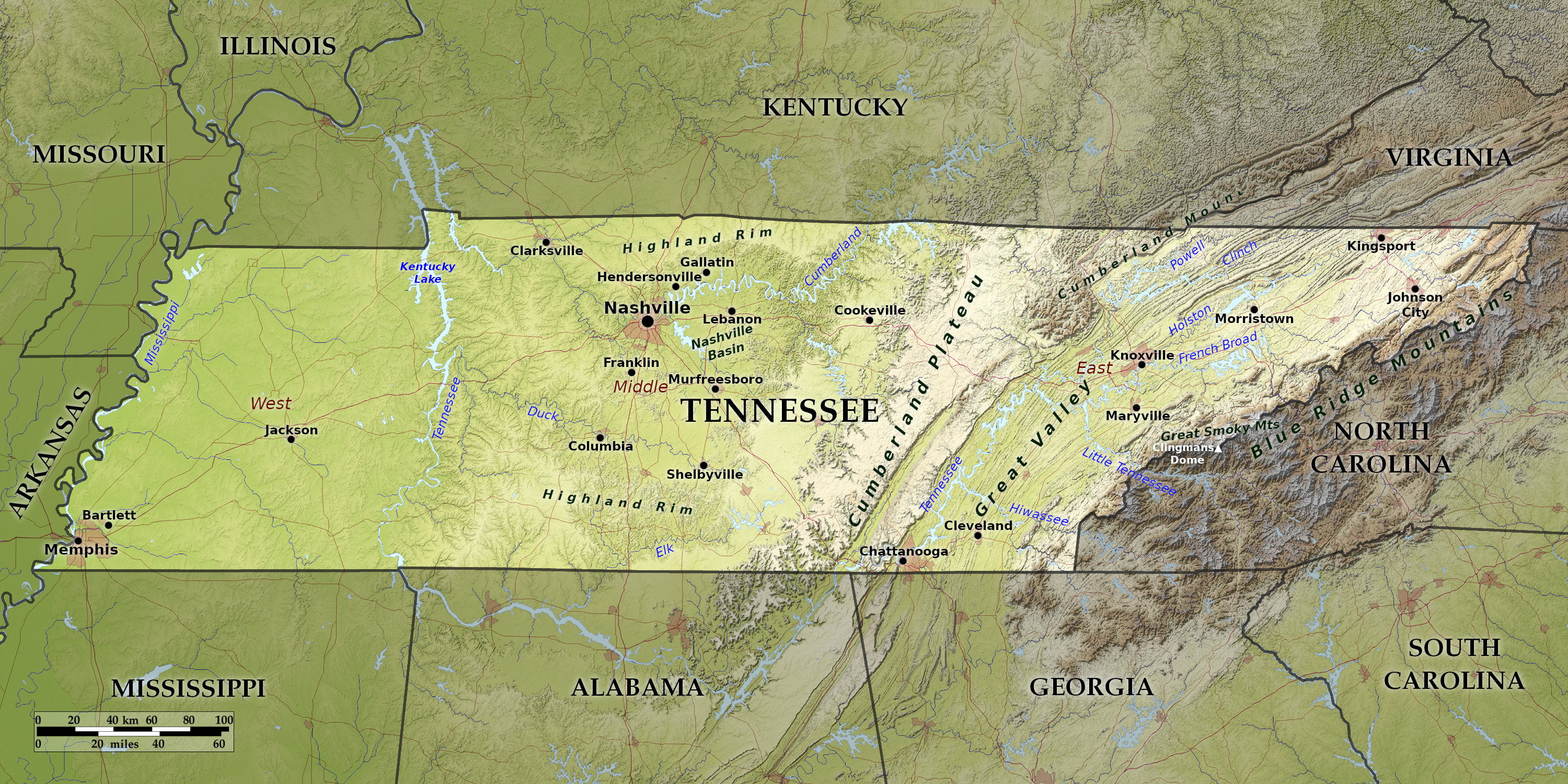 Relief map of Tennessee
What is the landscape of Tennessee like?
The State can be divided into East, Middle, and West Tennessee; the first extending from the North Carolina border to about the middle of the Cumberland Plateau, the second from this line to the Tennessee River, and the third from the Tennessee to the Mississippi River.
East Tennessee
.jpg)
.jpg&oldid=602481898)
.jpg&oldid=609854500)
.jpg&oldid=515554095)
.jpg&oldid=671997836)
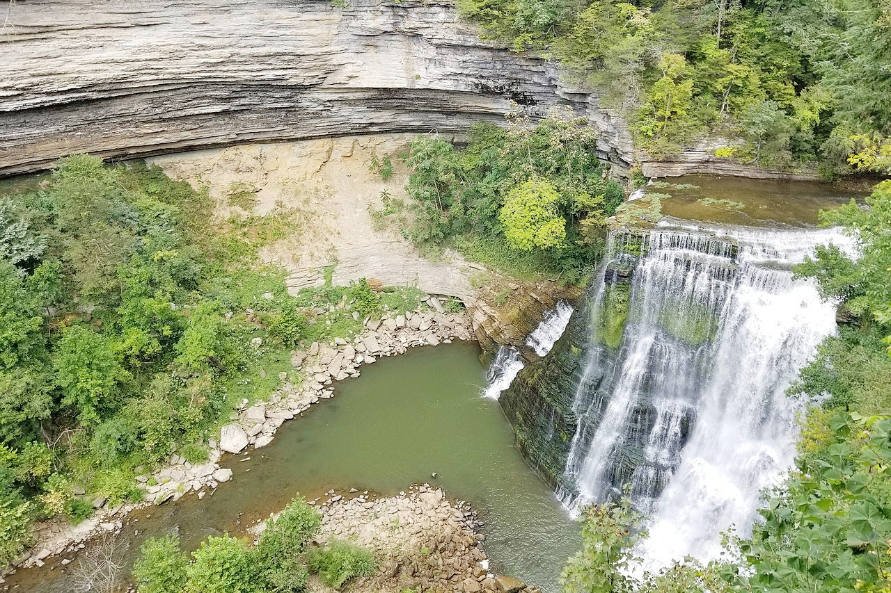
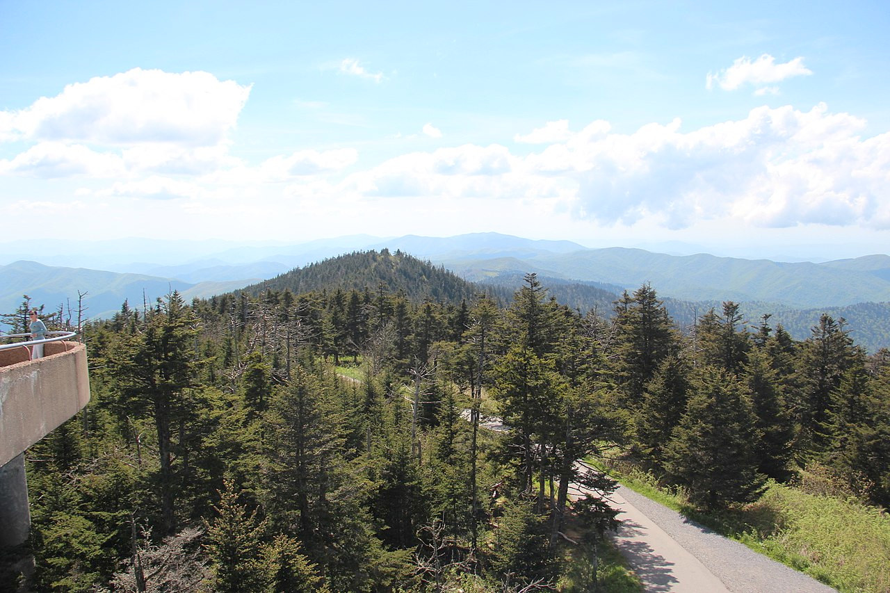
On the eastern border are Blue Ridge Mountains including the highest range in Tennessee: the Great Smoky Mountains. These mountains, which all belonging to the Appalachians, form a belt of somewhat irregular ridges. The average elevation of the main ridge is nearly 5,000 feet (1,500 m), but a number of peaks rise above 6,000 feet (1,800 m), the highest being Clingmans Dome at 6,643 ft (2,025 m).
Along the western base of the mountains stretches part of the the Great Appalachian Valley. This forms a succession of almost parallel ridges and valleys running in almost unbroken lines from northeast to southwest. In the northeast the ridges are more numerous and higher than in the south-west, where White Oak Ridge and Taylor's Mountain are among the highest.
The valley is bounded on the west by the abrupt and rugged escarpment of the Cumberland Plateau. This is a nearly level tableland, rising about 1,000 feet (300 m) above the East Tennessee Valley. This plateau is only slightly rolling, and slopes gently toward the north-west. The western edge of the plateau is much broken by deep indentations of river valleys.
Central Tennessee
From the western edge of the Cumberland Plateau the land falls to the somewhat less rugged slope to a lower plateau known as the Highland Rim. It is generally level except where it is cut by river valleys. As its name implies, the Highland Rim forms a rim encircling the Nashville Basin, a large oval depression lying several hundred feet below the surrounding highland. The Nashville Basin has a maximum width of about 60 miles and is a great farming region giving it the name "The Garden of Tennessee".
West Tennessee
Westward past the Tennessee river the land slopes gradually in a great plain toward the Mississippi River, near which it ends abruptly in a line of bluffs overlooking the Mississippi Flood Plain. This constitutes a low, fertile, alluvial plain, teeming with a luxurious vegetable life that is almost tropical.
What is the nature of Tennessee like?
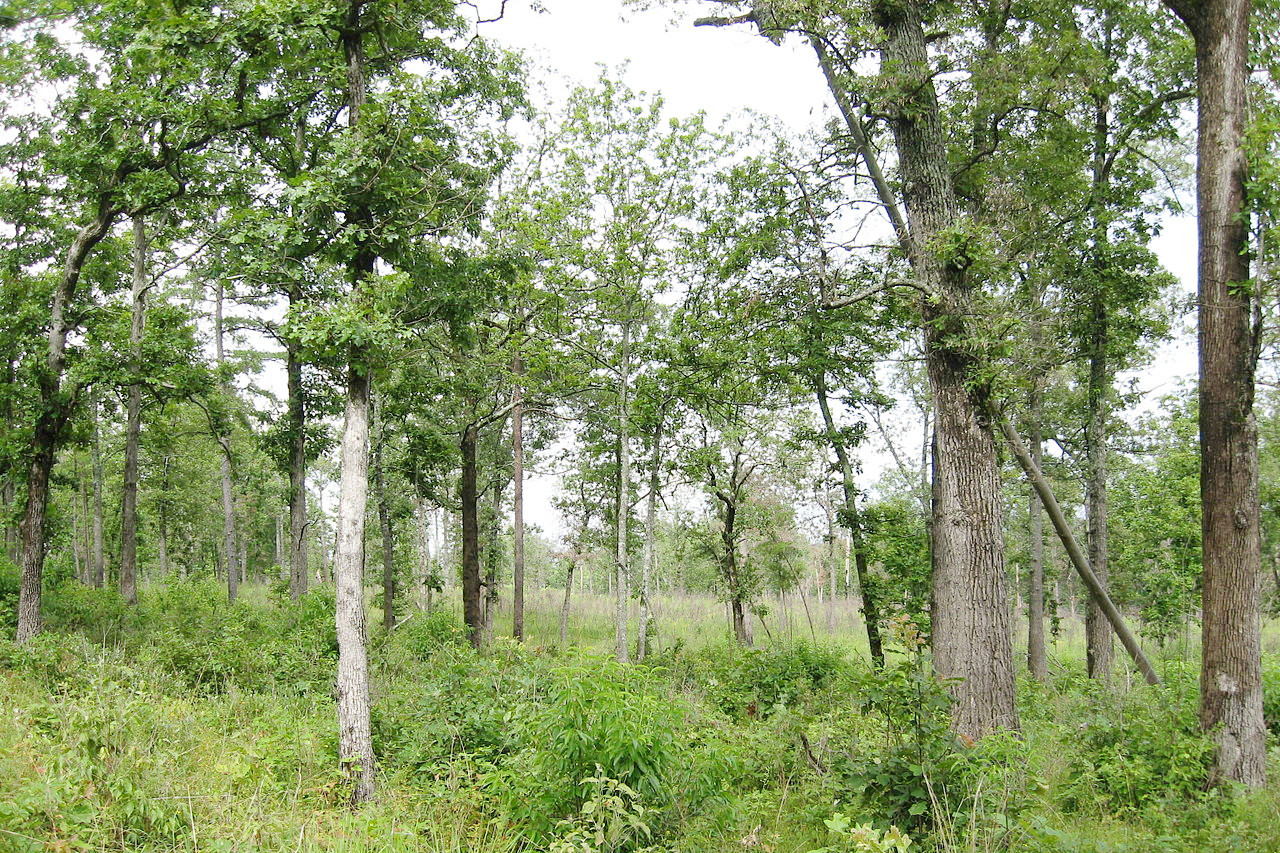
About one-half of Tennessee is still woodland containing a large variety of trees. On the mountains the trees are chiefly pines, firs, spruce and hemlock. Cypress is dominant on the Mississippi Flood Plain in the western part of the state. In the western lowlands small groves of what was once an extensive forest of red cedar remain. Poplar and larch are much more abundant in the western than in the eastern half of the state, and pine is much more abundant in the eastern than in the western half. But in most parts of the state there are mixed forests of white oak, red oak, ash, red gum, black gum, maple, hickory, chestnut, sycamore, magnolia, tulip tree, cherry, pecan, walnut, elm, beech, locust and persimmon. Birch, mulberry, linden, willow, bass-wood, dogwood, the sorrel tree, pawpaw and wild plum are common. Blue grass is indigenous in the lowlands.
What is the climate of Tennessee like?
The climate of Tennessee is in general very mild and pleasant. The climate is much the same across the State with the exception of the hotter lowlands of the Mississippi in the west and the cooler mountains in the east. Usually the highest temperatures of the year are in July and the lowest in January. In many places excessive heat or cold is rare or non-existant. The rainfall is also nearly equally distributed both as to seasons and localities, being somewhat heavier in the spring than in the autumn and a little heavier in the central regions than in the east and west.
| Climate data for Nashville (1991–2020) | |||||||||||||
|---|---|---|---|---|---|---|---|---|---|---|---|---|---|
| Month | Jan | Feb | Mar | Apr | May | Jun | Jul | Aug | Sep | Oct | Nov | Dec | Year |
| Average high °F (°C) | 49.1 (9.5) | 53.8 (12.1) | 62.7 (17.1) | 72.6 (22.6) | 80.4 (26.9) | 87.7 (30.9) | 90.9 (32.7) | 90.4 (32.4) | 84.4 (29.1) | 73.5 (23.1) | 61.4 (16.3) | 52.2 (11.2) | 71.6 (22.0) |
| Daily mean °F (°C) | 39.6 (4.2) | 43.4 (6.3) | 51.5 (10.8) | 60.8 (16.0) | 69.3 (20.7) | 77.1 (25.1) | 80.7 (27.1) | 79.7 (26.5) | 73.1 (22.8) | 61.7 (16.5) | 50.3 (10.2) | 42.7 (5.9) | 60.8 (16.0) |
| Average low °F (°C) | 30.1 (−1.1) | 33.0 (0.6) | 40.2 (4.6) | 48.9 (9.4) | 58.3 (14.6) | 66.4 (19.1) | 70.5 (21.4) | 69.0 (20.6) | 61.8 (16.6) | 49.9 (9.9) | 39.2 (4.0) | 33.3 (0.7) | 50.1 (10.1) |
| Average precipitation inches (mm) | 4.02 (102) | 4.47 (114) | 4.52 (115) | 4.72 (120) | 5.02 (128) | 4.36 (111) | 4.16 (106) | 3.79 (96) | 3.80 (97) | 3.36 (85) | 3.86 (98) | 4.43 (113) | 50.51 (1,283) |
| Average snowfall inches (cm) | 2.0 (5.1) | 1.5 (3.8) | 0.7 (1.8) | 0.0 (0.0) | 0.0 (0.0) | 0.0 (0.0) | 0.0 (0.0) | 0.0 (0.0) | 0.0 (0.0) | 0.0 (0.0) | 0.1 (0.25) | 0.4 (1.0) | 4.7 (12) |
| Source: NOAA | |||||||||||||
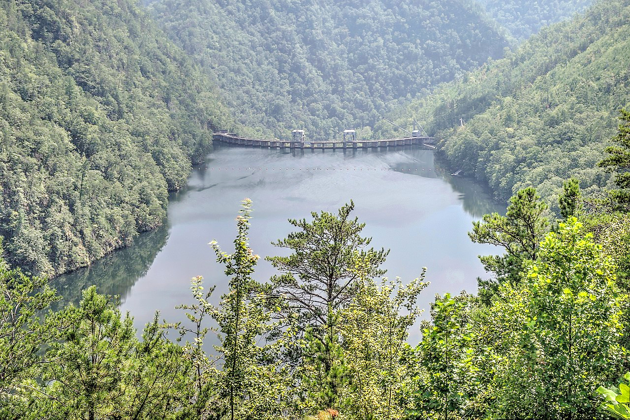
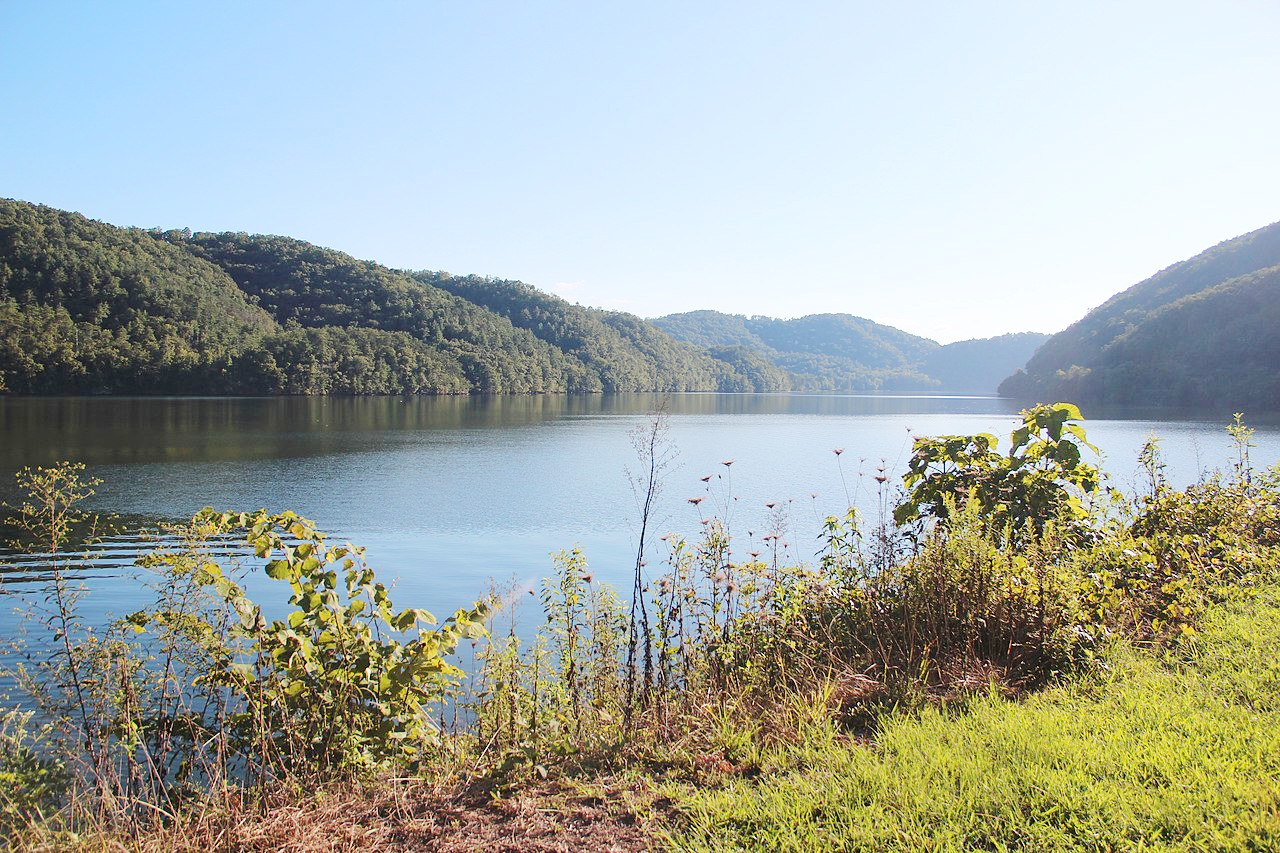 Chilhowee Lake upstream to Calderwood Dam
The official websites
Tennessee
The Volunteer State
| Location: | Eastern central United States |
| Coordinates: | 35° 45′ N, 86° 15′ W |
| Size: | • 180 km N-S; 690 km E-W • 110 miles N-S; 430 miles E-W |
| Terrain: | Low plains in the west which rise to rolling hills; then plateau; then ridges and valleys; then the Blue Ridge mountains on the eastern border |
| Climate: | Temperate climate, with warm summers and mild winters. Hotter in the west |
| Highest point: | Clingmans Dome 2,025 m / 6,643 ft |
| Forest: | 53% (2016) (source) |
| Population: | 6,916,897 (2020) |
| Population density: | Low (65/km²) |
| Capital: | Nashville |
| Languages: | English (95%); Spanish (4%) |
| Human Development Index: | Very High (0.901) |