The Geography of
Mexico
Why visit Mexico?
Mexico is a country of extreme contrasts in landforms, climate, vegetation, people and way of life. The landforms of Mexico vary from swampy coastal plains to high plateaus and snow-capped mountain peaks. The climate varies from coastal, tropical heat and heavy rainfall to the cold of elevated regions. The dense tropical lowland forests stand in sharp contrast to the arid, cactus-strewn desert region of the northwest. It is also a colourful, romantic country with a proud and ancient history.
Contents
Map
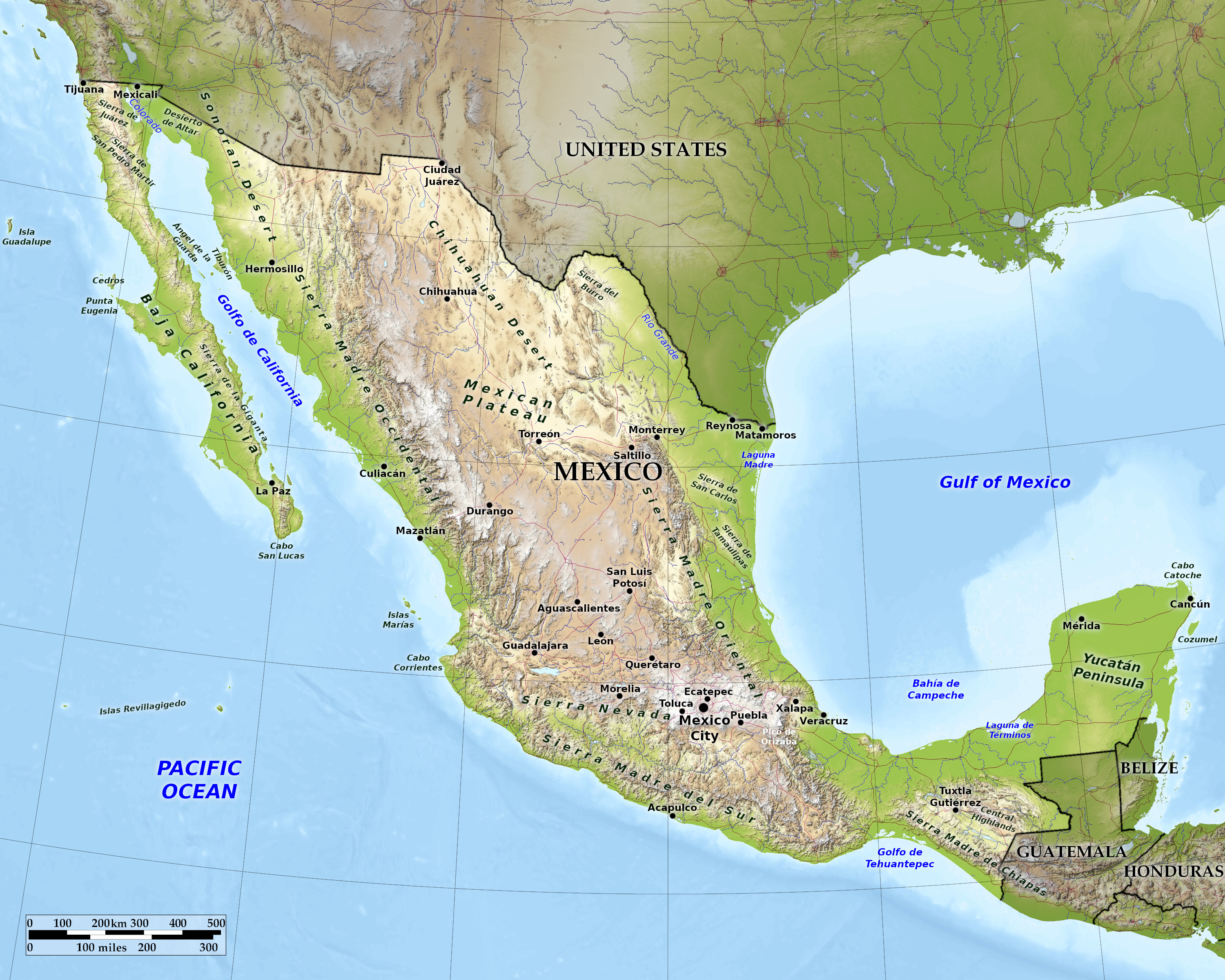 Relief map of Mexico
What is the landscape of Mexico like?
Mexico consists mainly of highlands. Most of it is a large mesa or plateau that occupies the central part of the country. To both the east and west, the plateau is bordered by high, rugged mountains called the Sierra Madres. Where the eastern and western Sierra Madres meet in southern Mexico are the highest mountains. Despite being in the tropics, some of the mountain peaks are high enough to be covered in snow. The mountains separate the great central plateau from the hot, narrow coastal plains that border the Gulf and Pacific coasts.
The Dry North
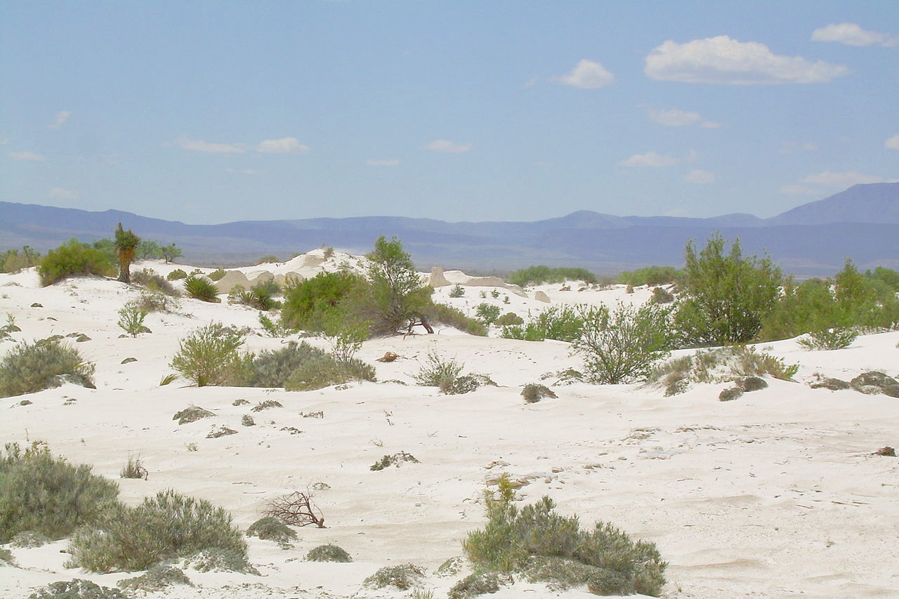
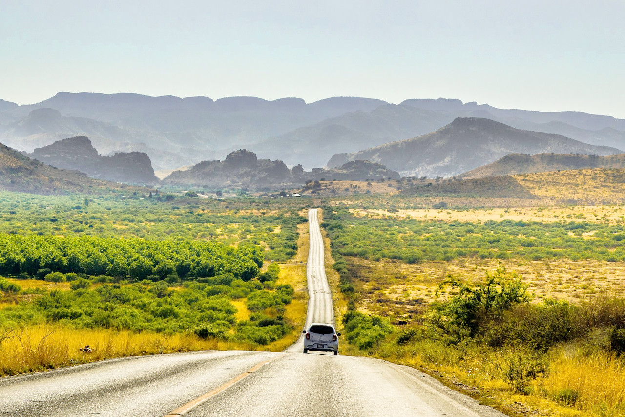
The northern half of Mexico is a land of mountains, deserts and semi-deserts. In many areas, and particularly the Northwest, only sagebrush, tall spiky cacti, and low bushes called mesquite can grow. Other larger areas of this region that receive slightly more rain may support sparse grass growth.
Two huge mountain ranges—the Sierra Madre Occidental and the Sierra Madre Oriental—run from north to south and meet Central Mexico. Both are extensions of the ranges found in the United States. The Sierra Madre Occidental to the west is a continuation of California's Sierra Nevada (with a break in southeastern California and far northern Mexico), and the Sierra Madre Oriental to the east is a southern extension of the Rocky Mountains of New Mexico and Texas. Between these two mountain ranges lies Mexico's Altiplano (High Plains), a southern continuation of the Great Basin and High Deserts that spread across much of the western United States.
The Sierra Madre Occidental extends 1,250 kilometers (775 miles) south to the Rio Santiago, where it joins the Cordillera Neovolcanica chain, which runs east-west through central Mexico. The Sierra Madre Occidental lies about 300 kilometers (185 miles) inland from the west coast of Mexico at its northern end, but approaches to within fifty kilometers (30 miles) of the coast near the Cordillera Neovolcanica. The Northwest Coastal Plain is the lowland area between the Sierra Madre Occidental and the Gulf of California. The Sierra Madre Occidental has an average elevation of 2,250 meters (7,400 feet) with peaks reaching 3,000 meters (9,800 feet). The Pacific slope has been carved into many vast canyons, or barrancas, by millions of years of water erosion. One of them, Barranca Cobre (Copper Canyon), is deeper and four times larger than the Grand Canyon in Arizona.
The Sierra Madre Oriental begins in the Big Bend region on the Texas-Mexico border and continues for 1,350 kilometers (840 miles) until it reaches the Cordillera Neovolcanica. As with the Sierra Madre Occidental, the Sierra Madre Oriental draws ever closer to shore as it approaches the south, reaching to within fifty miles of the Gulf of Mexico. The northeast coastal plain stretches from the eastern slope of the Sierra Madre Oriental to the Gulf of Mexico. The average altitude of the Sierra Madre Oriental is 2,200 meters (7,200 feet), with some peaks at 3,000 meters (9,800 feet).
Mexico's Altiplano, stretching from the border with the United States to the Cordillera Neovolcanica, occupies the vast expanse of land between the eastern and western Sierra Madres. The northern Altiplano has an average elevation of 1,100 meters (3,600 feet). Various narrow, isolated ridges criss-cross the high plains of the northern Altiplano. Numerous depressions characterize the region, the largest of which is the Bolsón de Mapimí.
Another important mountain range, the California system, cuts through the landscape of the northern half of Mexico. The Mexican portion of the California system is a southern extension of the California littoral, which runs parallel to the California coast and stretches from the United States border to the southern tip of the Baja Peninsula for a distance of 1,430 kilometers (900 miles). Peaks in the California system range from 2,200 meters (7,200 feet) in the north to just 250 meters (820 feet) near La Paz in the south. Narrow lowlands can be found on the coasts.
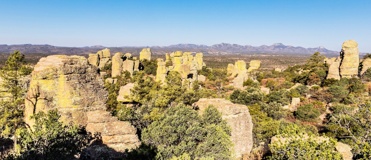 Parque nacional Cumbres de Majalca
The Central Plateau—Mexico's heartland
The Central Plateau, located more or less in the central part of Mexico, is the highest part of the great Mexican plateau. It stretches almost across the country from the western to the eastern lowlands and includes many of the largest cities, including Mexico City, the country's capital. Although the Central Plateau is a rather small part of the country, about half of Mexico's population is concentrated in it. This is indeed the heartland of Mexico.
Although the plateau is in the tropics, its high altitude ensures that the climate is pleasant all year round and therefore ideal for human habitation. The region consists of many basins surrounded by mountains, each with a flat area of good farmland. The soils in the basins are particularly fertile because they were deposited by volcanoes.
The southern Altiplano is higher than its northern counterpart, averaging 2,000 meters (6,500 feet). The southern Altiplano contains numerous valleys originally formed by ancient lakes.
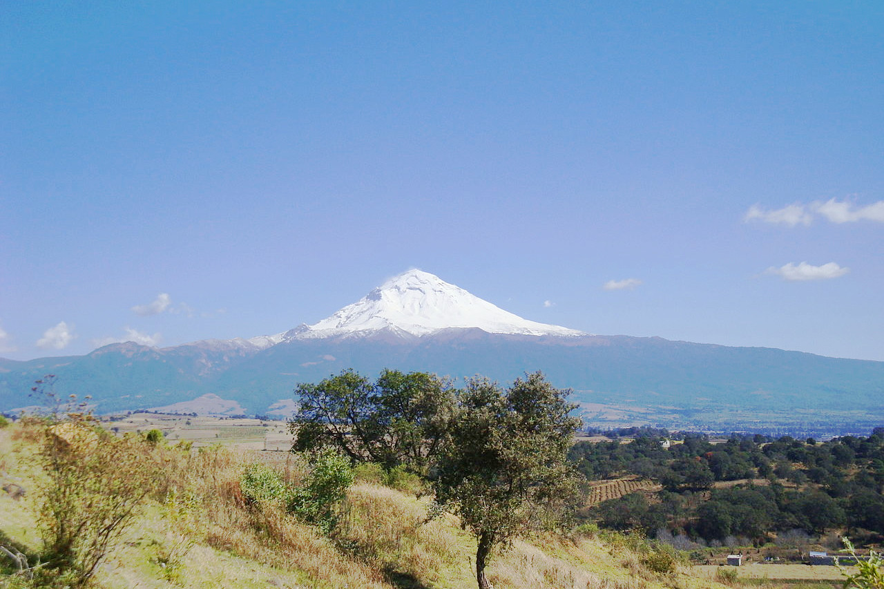
The Cordillera Neovolcanica is a belt 900 kilometers (560 miles) long and 130 kilometers (80 miles) wide that stretches from the Pacific Ocean to the Gulf of Mexico. The region is characterized by significant seismic activity and contains Mexico's highest volcanic peaks. This mountain range includes three peaks over 5,000 meters (16,400 feet): Pico de Orizaba (Citlaltepetl)—the third highest mountain in North America—and Popocatepetl and Iztaccihuatl near Mexico City. The Cordillera Neovolcanica is considered the geological dividing line between North America and Central America.
The Tropical Lowlands of the Southeast Coast
Unlike most of Mexico, this hot lowland region experiences an abundance of rainfall. Most of the coastal plain and the lower slopes of the mountains are covered with a dense growth of tropical forests. On the lower slopes of the mountains where the forests have been cleared, Mexicans grow coffee. Elsewhere, sugar cane, rubber, vanilla, bananas, rice and tropical fruits are grown.
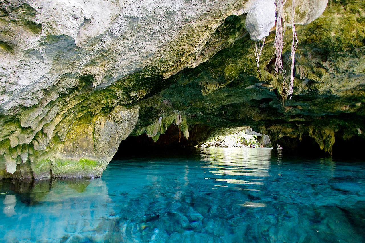
The largest plain is the Yucatán Peninsula. This flat to gently undulating area is a limestone platform rising above the surrounding Gulf of Mexico and Caribbean Sea. Water sinks into porous limestone and rock is dissolved in the process. As a result, the peninsula's surface has no lakes and few streams. Underground, however, erosion has formed caves. When the roof of a cave collapses, a sinkhole is created. These sheer cliffs, called cenotes, characterize the landscape of the Yucatán. Cenotes can reach a depth of almost 35 meters (115 feet).The Southern Mountain Region
Very high, rugged mountains, dera Madre de Oaxaca average 2,500 meters (8,200 feet) high, with some peaks exceeding 3,000 meters (9,800 feet). South of the Tehuantepec Isthmus, the Sierra Madre de Chiapas runs 280 kilometers (170 miles) along the Pacific coast from the Oaxaca-Chiapas border to Mexico's border with Guatemala. Although the average height is only 1,500 meters (4,900 feet), one peak—Volcan de Tacuma—exceeds 4,000 meters (13,100 feet) in height. Finally, the Meseta Central de Chiapas stretches 250 kilometers (155 miles) through the central part of Chiapas to Guatemala. The average height of the peaks of the Meseta Central de Chiapas is 2,000 meters (6,500 feet).
What is the nature of Mexico like?
Mexico's mountains offer spectacular scenery, including deep canyons and towering, snow-capped volcanic peaks. The plant and animal life differs greatly due to Mexico's varied climate and topography. The coastal plains are covered with tropical rainforest that tep gorges and a narrow coastal plain make up this region, which lies south of the Central Plateau. Several important mountain ranges dot the landscape of southern and southeastern Mexico. The Sierra Madre del Sur stretches 1,200 kilometers (750 miles) along the southern coast of Mexico from the southwestern part of the Cordillera Neovolcanica to the near-flat isthmus of Tehuantepec. Mountains in this area average 2,000 meters (6,500 feet) high. The average range is 100 kilometers wide (60 miles), but extends to 150 kilometers (90 miles) in the state of Oaxaca. The narrow southwestern coastal plain stretches from the Sierra Madre del Sur to the Pacific Ocean.
The Sierra Madre de Oaxaca stretches southeast for 300 kilometers (185 miles) until it reaches the Isthmus of Tehuantepec. The peaks in the Sierransitions into subtropical and temperate growth as you climb the plateau. Lush tropical forests and savanna grasslands thrive in the lowlands, as do tropical plants such as cacao, bananas, sugar cane, tobacco and coconut palms. Higher, more temperate regions were once home to vast areas of mixed forest. But most of the original plant cover has long since been removed for agriculture. Many crops thrive here, including corn, potatoes and cash crop coffee. In the northern states there is arid steppe vegetation with desert flora over much of the area. Oaks and conifers are found in mixed forest regions along the mountain slopes. The Yucatán Peninsula has scrubby vegetation.
What is the climate of Mexico like?
See our main article: The Climate of Mexico
Mexico's climate is inextricably linked to its physical geography. A distinct tropical climate (tierra caliente) prevails along the coast, in the flat expanses of the Yucatán Peninsula and along the Gulf of Mexico and most of the Pacific coast. These areas have an average temperature of 25–27°C (77–81°F), with a minimum of 16°C (61°F) and a maximum of almost 49°C (120°F). The temperate zone (tierra templada), at elevations of 900–1,800 meters (3,000–6,000 feet), has a temperate to warm climate and an average temperature of 21°C (70°F). Mexico City and most other major population centers are in the cool zone (tierra fría), starting at about 1,800 meters (6,000 feet), with a mean annual temperature of 17°C (63°F).
While the weather in the Yucatán lowlands varies from hot and humid to hot and humid with a hurricane risk (the season is August through December), the seasonal changes are more pronounced on the central plateau, with winter being cooler and drier. and summer warmer and wetter.
Rainfall varies greatly by region, ranging from less than 250 mm (10 inches) per year in Baja California to 5,000 mm (200 inches) in the Tabasco rainforests. Rainfall is adequate in central Mexico except at high altitudes, while the northern states are semi-desert or desert. The north generally receives less rainfall than the south, but the entire Gulf Coast plain is wetland.
| Climate data for Mexico City (1981–2010) | |||||||||||||
|---|---|---|---|---|---|---|---|---|---|---|---|---|---|
| Month | Jan | Feb | Mar | Apr | May | Jun | Jul | Aug | Sep | Oct | Nov | Dec | Year |
| Average high °C (°F) | 21.8 (71.2) | 23.5 (74.3) | 25.7 (78.3) | 26.9 (80.4) | 26.8 (80.2) | 25.4 (77.7) | 24.1 (75.4) | 24.1 (75.4) | 23.4 (74.1) | 23.1 (73.6) | 22.7 (72.9) | 21.9 (71.4) | 24.1 (75.4) |
| Daily mean °C (°F) | 14.8 (58.6) | 16.2 (61.2) | 18.2 (64.8) | 19.7 (67.5) | 20.1 (68.2) | 19.5 (67.1) | 18.4 (65.1) | 18.5 (65.3) | 18.1 (64.6) | 17.2 (63.0) | 16.1 (61.0) | 14.9 (58.8) | 17.6 (63.7) |
| Average low °C (°F) | 7.8 (46.0) | 8.9 (48.0) | 10.6 (51.1) | 12.5 (54.5) | 13.3 (55.9) | 13.5 (56.3) | 12.7 (54.9) | 12.8 (55.0) | 12.7 (54.9) | 11.4 (52.5) | 9.4 (48.9) | 8.0 (46.4) | 11.1 (52.0) |
| Average precipitation mm (inches) | 8.3 (0.33) | 7.2 (0.28) | 9.2 (0.36) | 24.3 (0.96) | 62.3 (2.45) | 141.0 (5.55) | 189.0 (7.44) | 174.8 (6.88) | 146.4 (5.76) | 69.5 (2.74) | 12.8 (0.50) | 6.0 (0.24) | 850.6 (33.49) |
| Source: Servicio Meteorologico Nacional | |||||||||||||
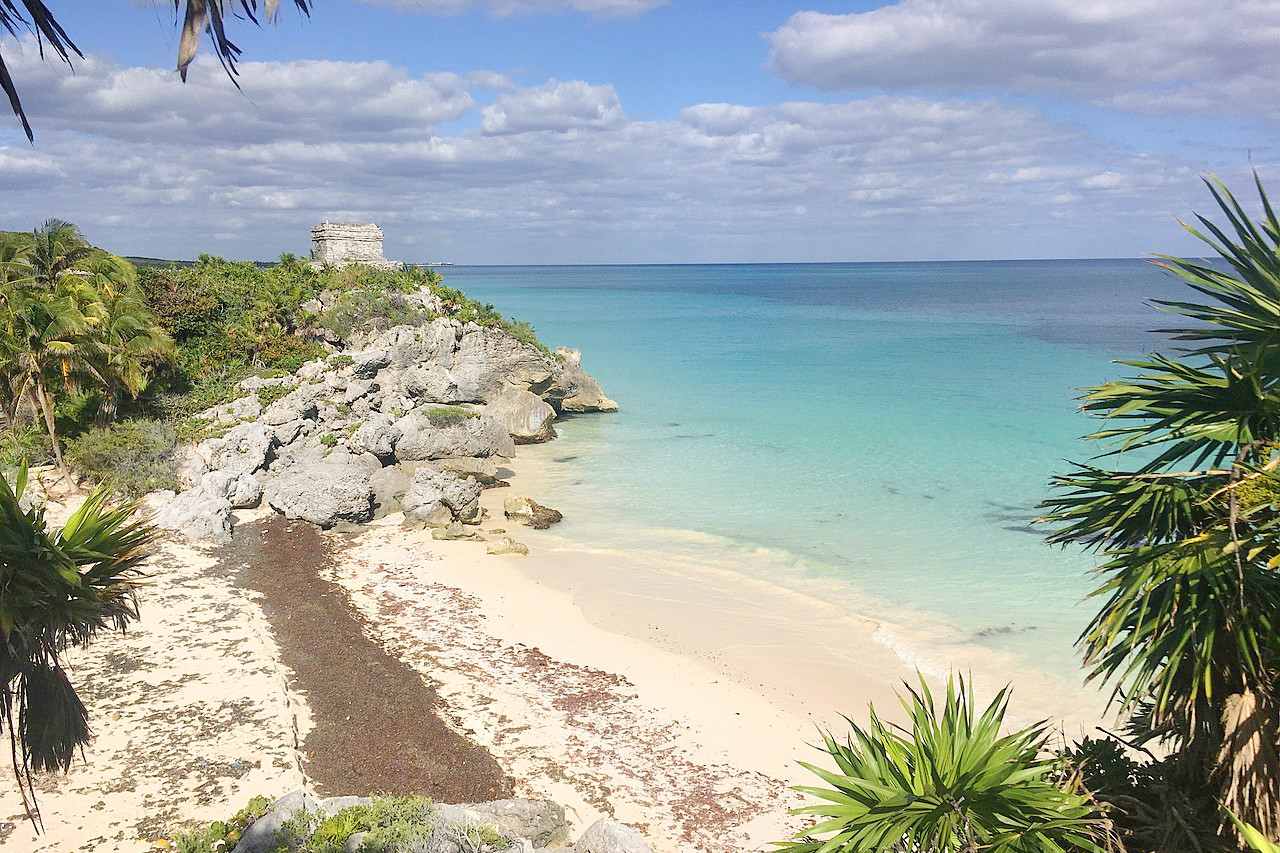
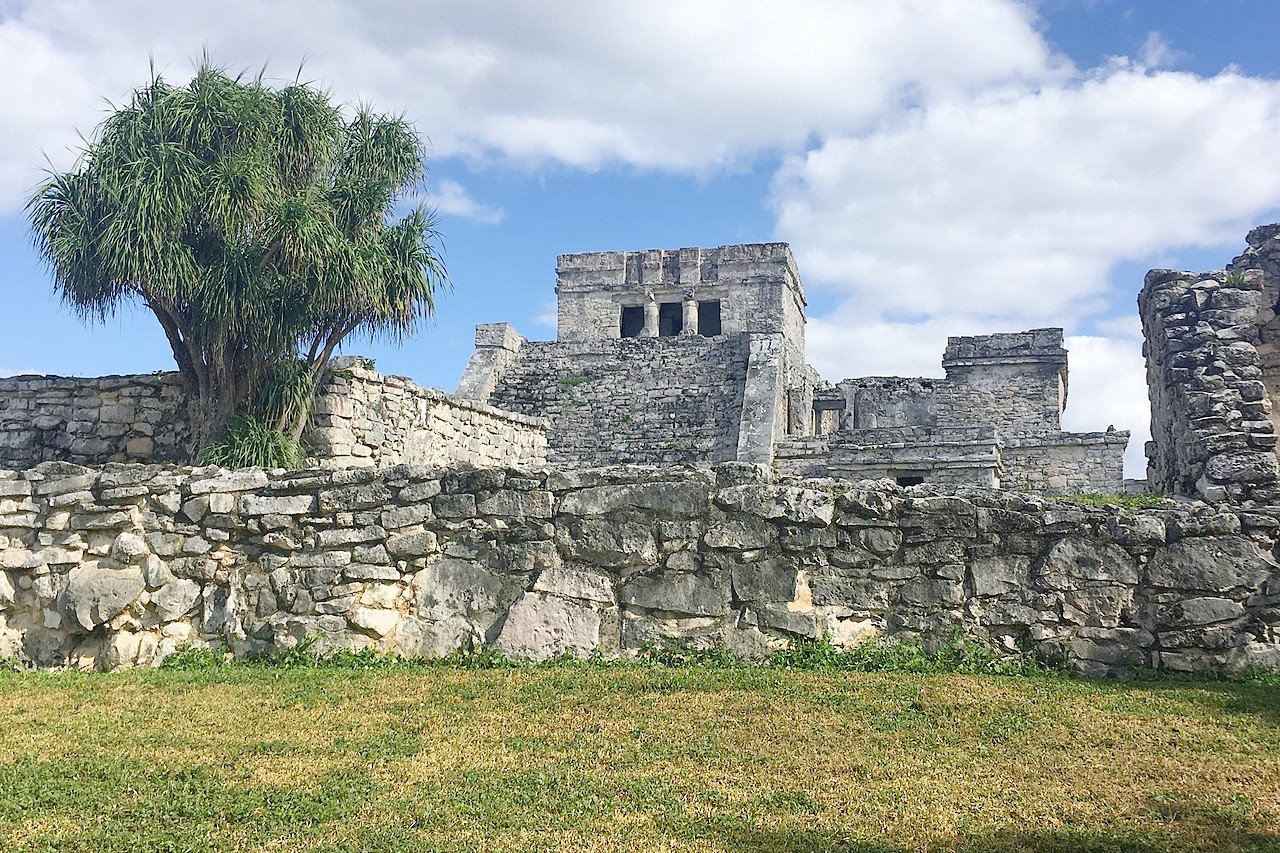 Tulum, a Maya archaeological site in Quintana Roo
The official websites
Mexico
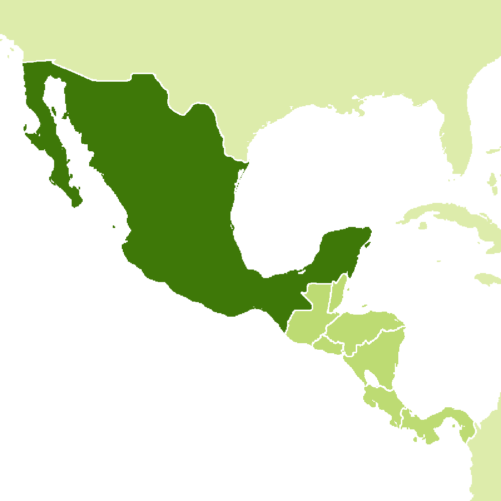
A World of Its Own
| Location: | North America, between the Gulf of Mexico and the North Pacific Ocean. North of Belize and Guatemala. South of the United States. |
| Coordinates: | 23° 00′ N, 102° 00′ W |
| Size: | • 2130 km N-S; 2890 km E-W • 1320 miles N-S; 1800 miles E-W |
| Terrain: | High, rugged mountains; low coastal plains; high plateaus; desert |
| Climate: | Varies from tropical along the coasts, to temperate on the southern plateau, to desert in the north |
| Highest point: | Pico de Orizaba 5,636 m / 18,491 ft |
| Forest: | 33% (2018 est.) |
| Population: | 129,150,971 (2022 est.) |
| Population density: | Low (61/km²) |
| Capital: | Mexico City |
| Languages: | Spanish only 94%, Spanish and indigenous languages 5.4%, indigenous only 0.6% |
| Human Development Index: | High (0.758) |
.jpg)
